Overview
|
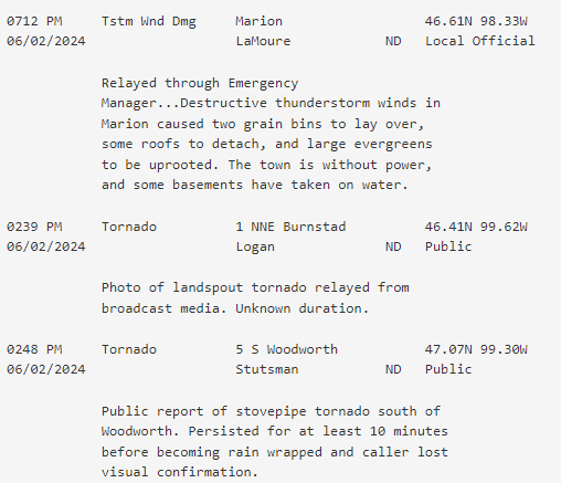
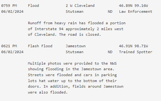
Scattered severe thunderstorms occurred across parts of southwest and much of south central North Dakota on Sunday, June 2, 2024. Showers and thunderstorms were ongoing much of the day Sunday as a warm front lifted north through the state, while a surface low pressure moved in from Montana. The surface low also brought a cold front moving west to east, which was a main driver of thunderstorms developing. A stovepipe tornado touched down just south of Woodworth, ND, in Stutsman County. Reports from the public indicate it was on the ground for approximately 10 minutes. Luckily, there was no damage from this tornado. Multiple rounds of thunderstorms and torrential rain led to a Flash Flood Warning being issued for the city of Jamestown, as trained spotters reported significant amounts of water over the roads in town. The highest rainfall report came from Medina, where almost 5 inches of rain fell. Interstate 94 just west of Cleveland was temporarily closed by the North Dakota Department of Transportation, due to water over the highway. The strongest wind gusts occurred from a bowing line segment of thunderstorms that started around the Jamestown area, moving southeast, with an 88 mph wind gust reported a few miles east-southeast of the city. The LaMoure County Sheriff's Department provided photos of damage to grain bins and the top of a grain elevator in Marion, where there were nearby observed wind gusts of 82 mph and 79 mph. |
 Tornado south of Woodworth around 250 PM CDT on Sunday, June 2. Photo courtesy of Cody Mack. |
Photos & Video
 |
 |
 |
 |
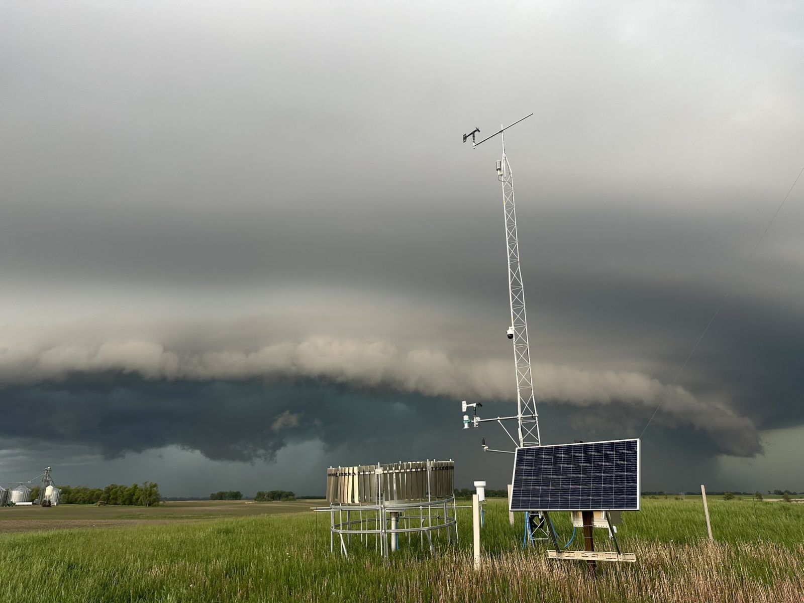
| Shelf cloud moving into Jamestown (Laurel Sornes on Facebook) |
Large hail in Goodrich (Lindsey Wahl on Facebook) |
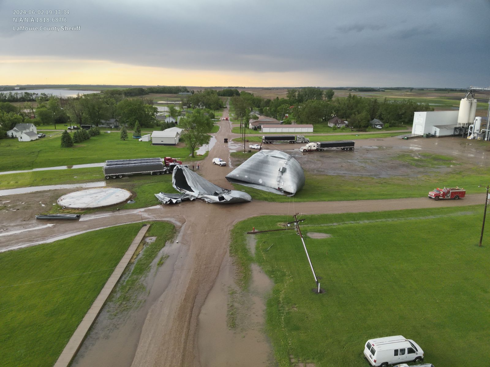
Damage to the top of a grain elevator in Marion (LaMoure County Sheriff's Department, Deputy Fleck) |
Damage to grain bins in Marion (LaMoure County Sheriff's Department, Deputy Fleck) |
 |
 |
 |
 |
| Street flooding in Jamestown (Matthew Kriedeman on Facebook) |
Street flooding in the city of Jamestown (Matthew Kriedeman on Facebook) |
Large hail in Goodrich (Heather Weippert on Facebook) |
Shelf cloud moving into Ypsilanti (NDAWN) |
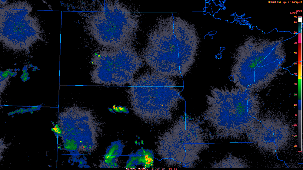
Radar
Regional radar loop starting around 1 AM CDT on Sunday, June 2nd, and ending around 1 AM on Monday, June 3rd.
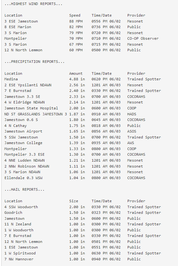
Storm Reports
Environment
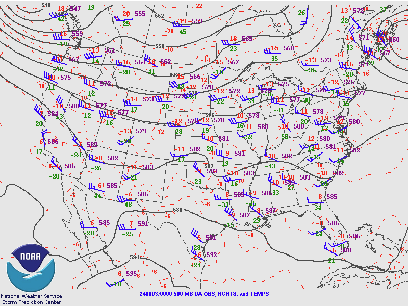
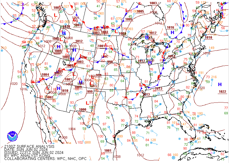
An active upper-level flow was in place over North Dakota, with an upper impulse moving through the area Sunday afternoon that aided in convective development. A broad inverted surface trough was analyzed extending north from low pressure in western/ north central South Dakota along and west of the Highway 83 corridor in North Dakota. Instability increased through Sunday afternoon, overlaid with strong bulk shear, while convective inhibition (capping) decreased. Large hail was the initial threat, as well as a tornado or two, before storms were expected to become more linear in nature and damaging wind gusts would become the primary threat. Due to how persistent storms had been throughout the day, outflow boundaries were common across the area, which aided in additional thunderstorm development.
 |
 |
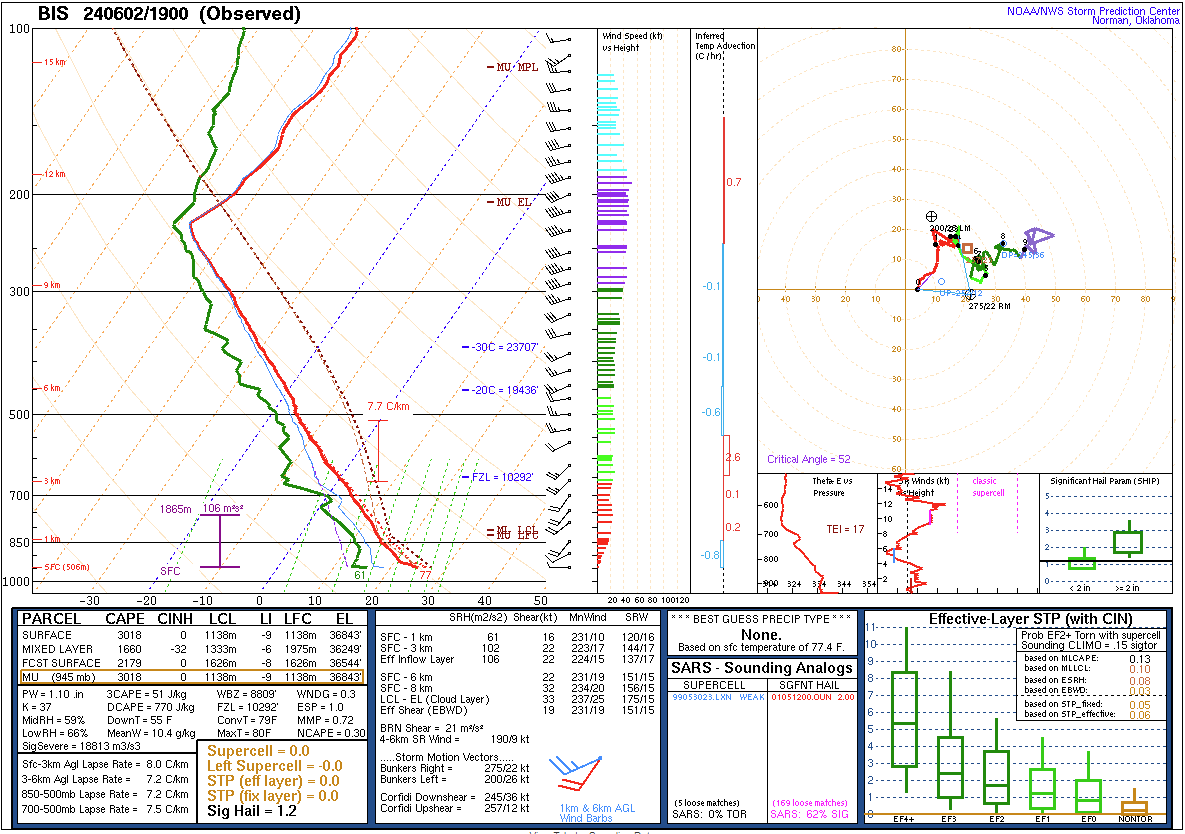 |
| Figure 1: SPC 500mb 00Z upper air map | Figure 2: WPC 21 UTC surface analysis shows a surface low centered over south central North Dakota | Figure 3: Observed upper air sounding from Bismarck at 19 UTC |
 |
Media use of NWS Web News Stories is encouraged! Please acknowledge the NWS as the source of any news information accessed from this site. |
|

