Severe thunderstorms are forecast through this weekend along a slow moving cold front and secondary storm system that will impact areas from the southern Plains to the Great Lakes. Large hail and isolated damaging wind gusts are the main threats with these storms along with a risk for heavy to excessive rainfall which could bring flooding. Read More >
Overview
|
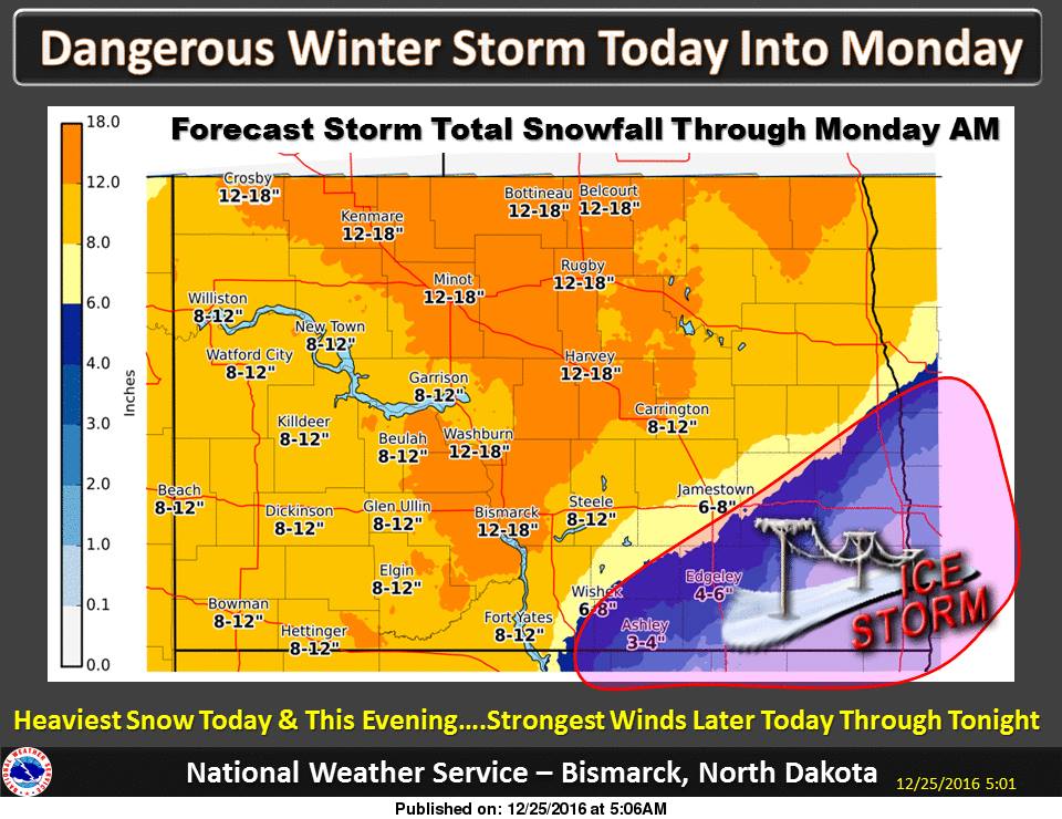
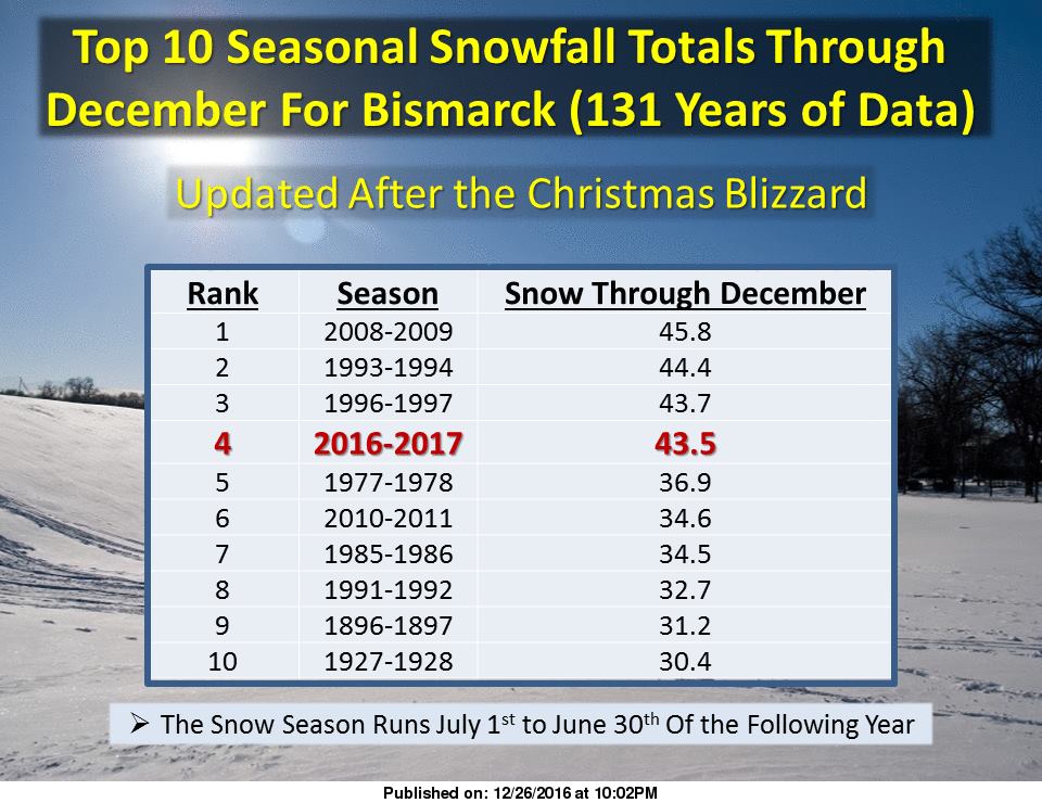
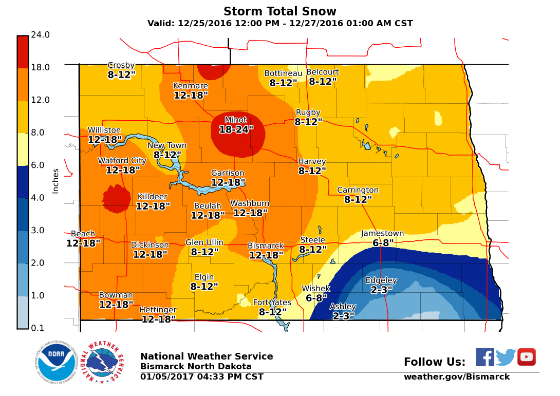
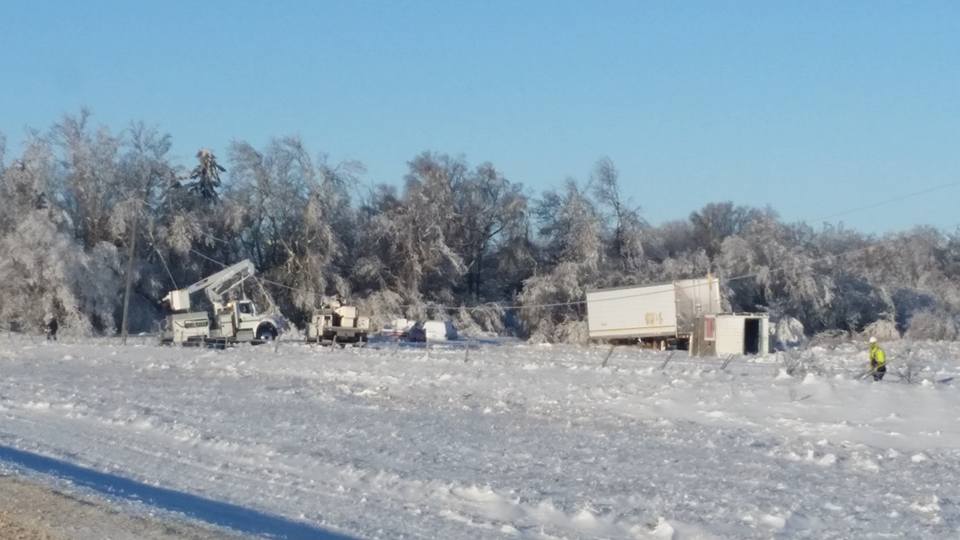
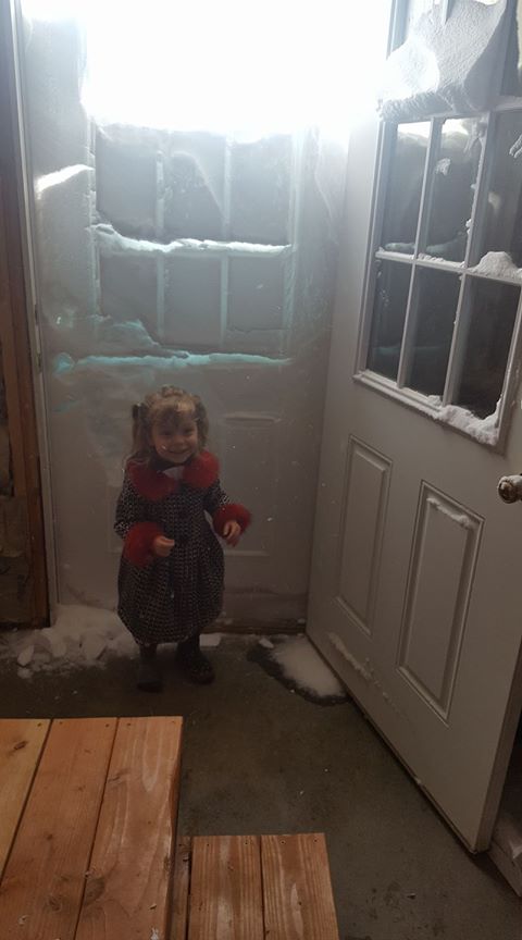
The week before Christmas, global weather models were in remarkable agreement with regards to a major winter storm developing around Christmas somewhere in the Northern Plains. Run to run model consistency led to higher confidence than usual for heavy snowfall accumulations and strong winds across most of western and central North Dakota. Because of the higher confidence and an approaching holiday weekend, the Bismarck NWS office, along with other neighboring offices, issued blizzard watches and warnings well before the typical time frame. The GFS model in particular was suggesting record precipitable water values in the forecast sounding over Bismarck. High precipitable water values over the region during the snowfall season means a higher abundance of available moisture than usual. In general, most locations across western and central North Dakota received anywhere from 12 to 18 inches of snow with isolated higher amounts. However, in the southeast part of the Bismarck forecast area (Stutsman, Dickey, LaMoure, McIntosh, Emmons, and Logan Counties), heavy freezing rain caused major ice accumulations which created widespread power outages and numerous downed trees. Gusty winds up to 60 mph, heavy snow/ice accumulations, and extreme snow drifts created very difficult, if not impossible, travel until well into the day of 12/27/2016. Finally, this storm was so intense that it generated quite a bit of "thundersnow" over parts of central North Dakota. (Click on Images to Make Them Larger)
|
|
Photos & Video:
Weather Balloon Launch in Blizzard Conditions:
https://www.youtube.com/watch?v=nMZYhRZxLXU&feature=youtu.be
Blizzard Conditions at the Capitol Grounds in Bismarck, ND:
https://www.youtube.com/watch?v=6xoT8wvMRRY
Thundersnow and Blizzard Timelapse:
https://www.youtube.com/watch?v=H2N2Om-D4f0&t=1s
(Click on Images to Make Them Larger)
 |
 |
 |
 |
|
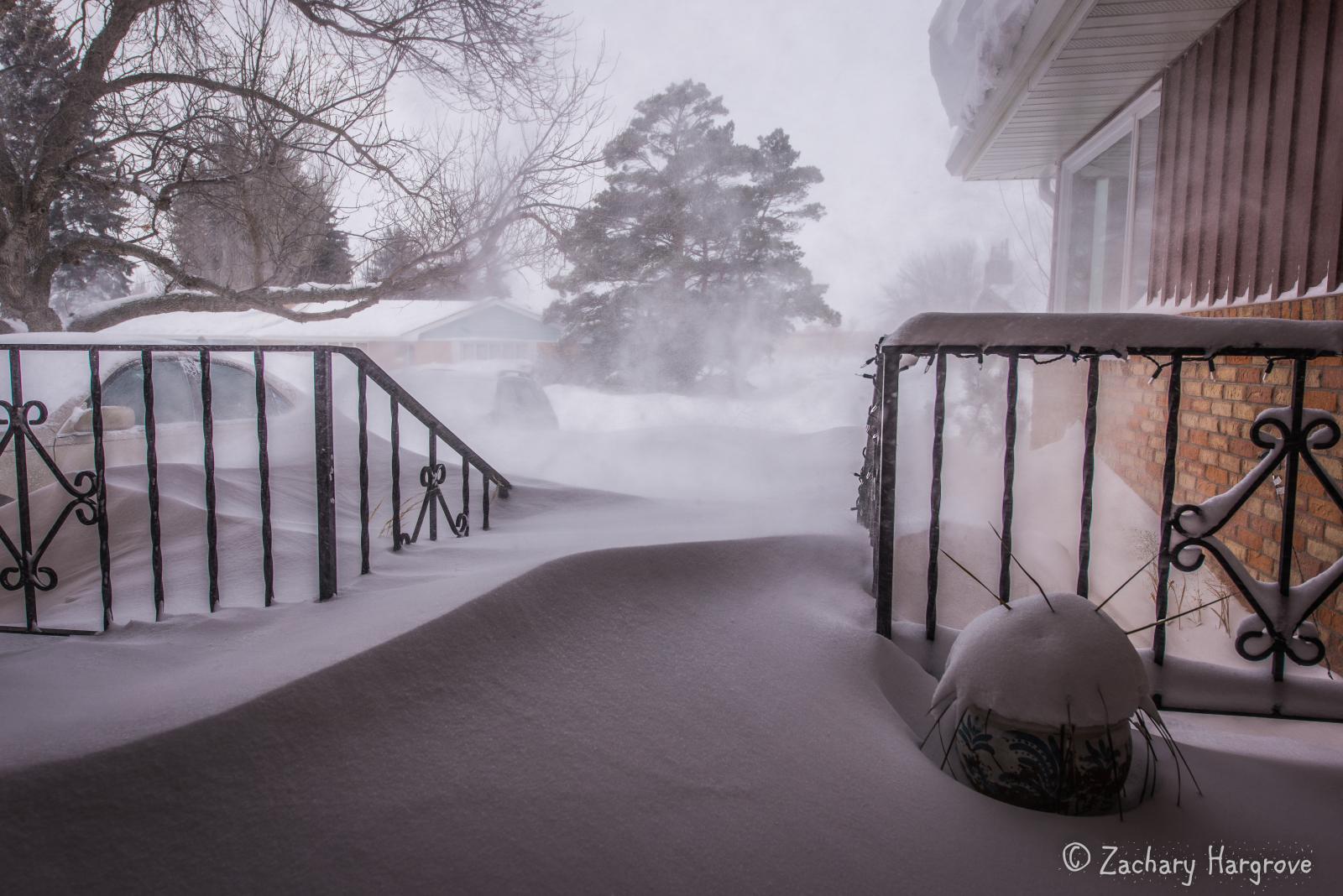
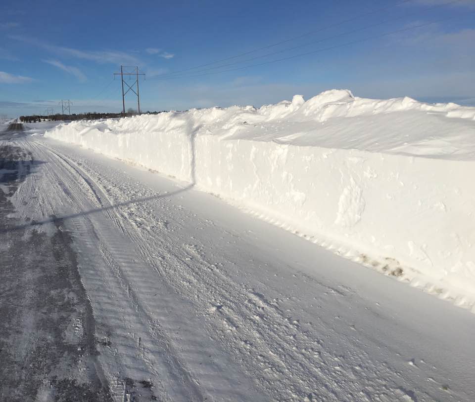
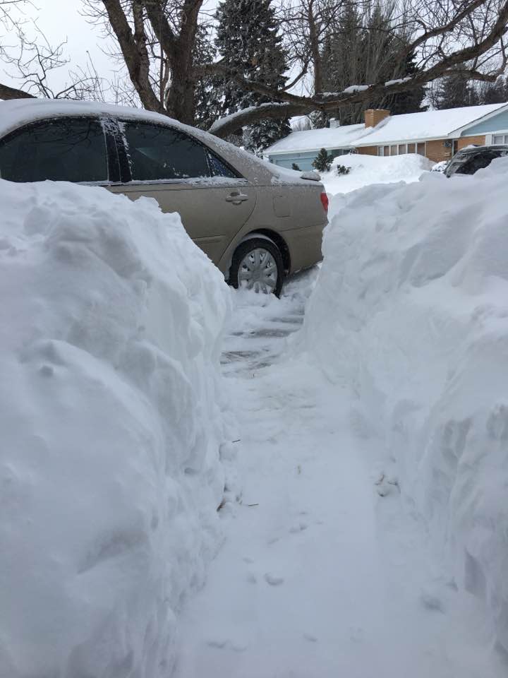
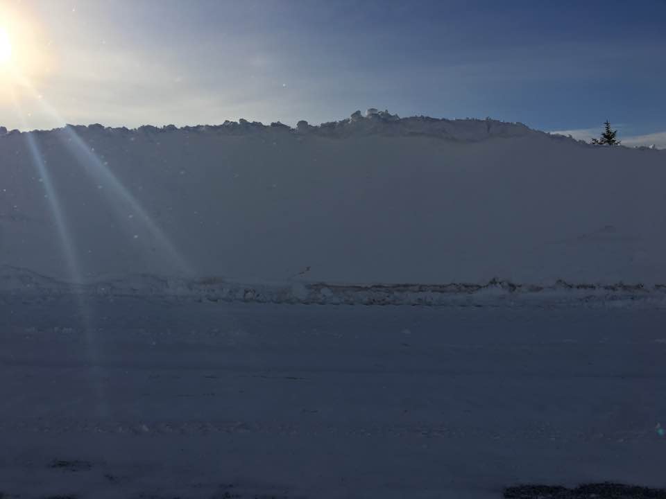
Large Snowplow Walls
(Photo Courtesy of Zachary Hargrove) |
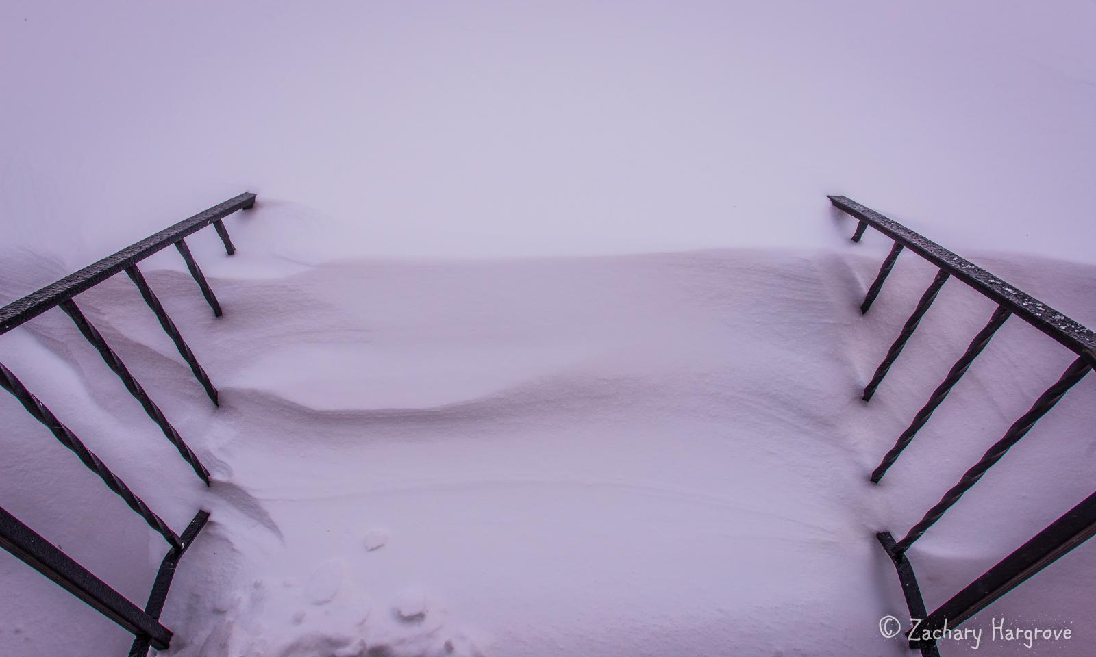
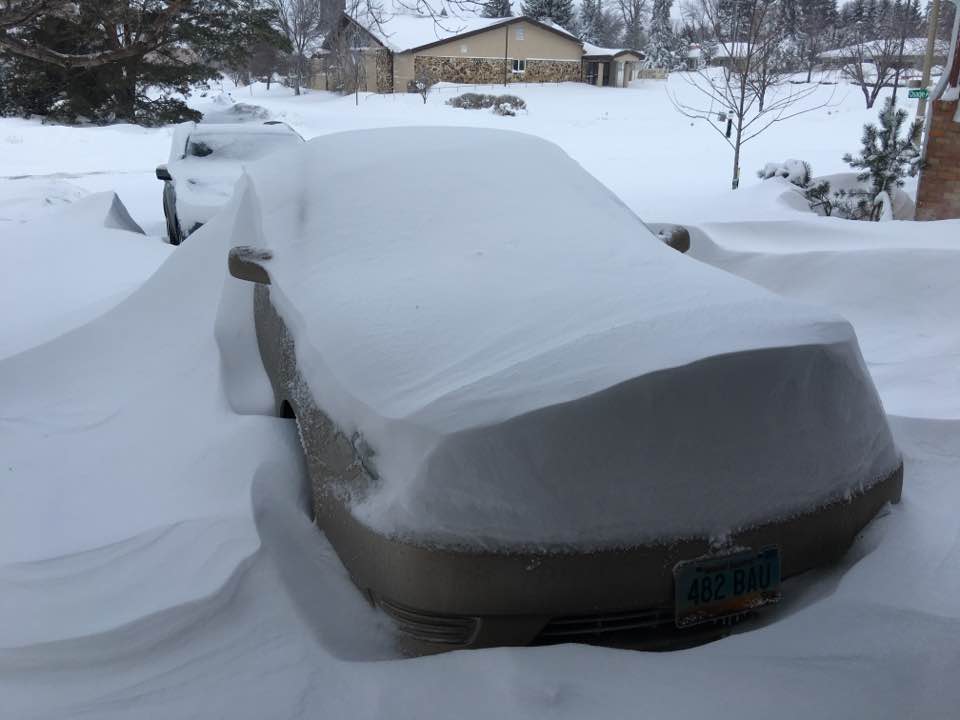
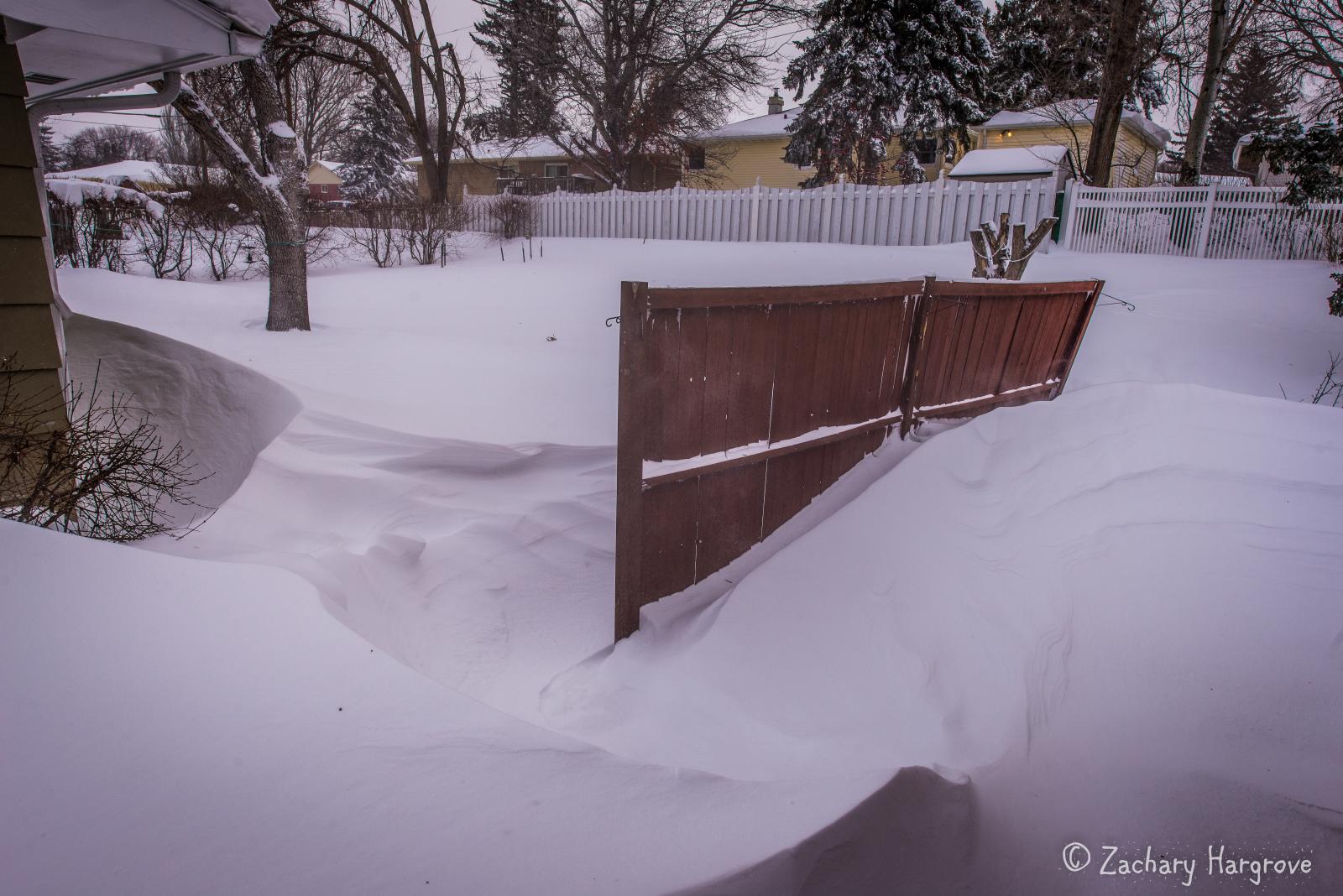
Large Snow Drifts
(Photo Courtesy of Zachary Hargrove) |
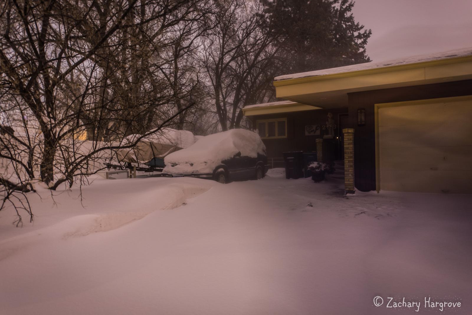
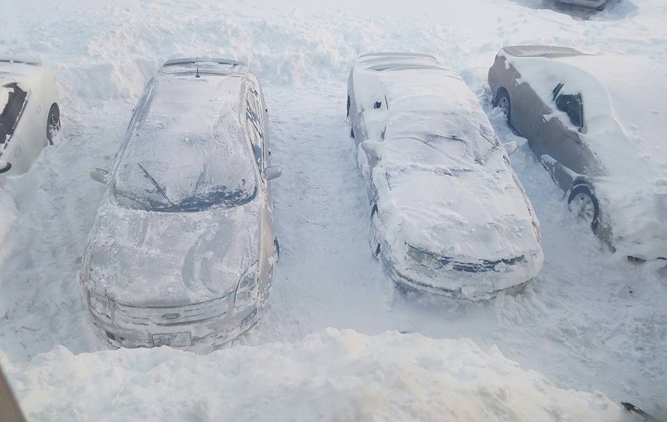
Snowed In
(Photo Courtesy of Zachary Hargrove) |
Large Snow Drifts (Photo Courtesy of Zachary Hargrove)
|
 |
 |
 |
 |
|
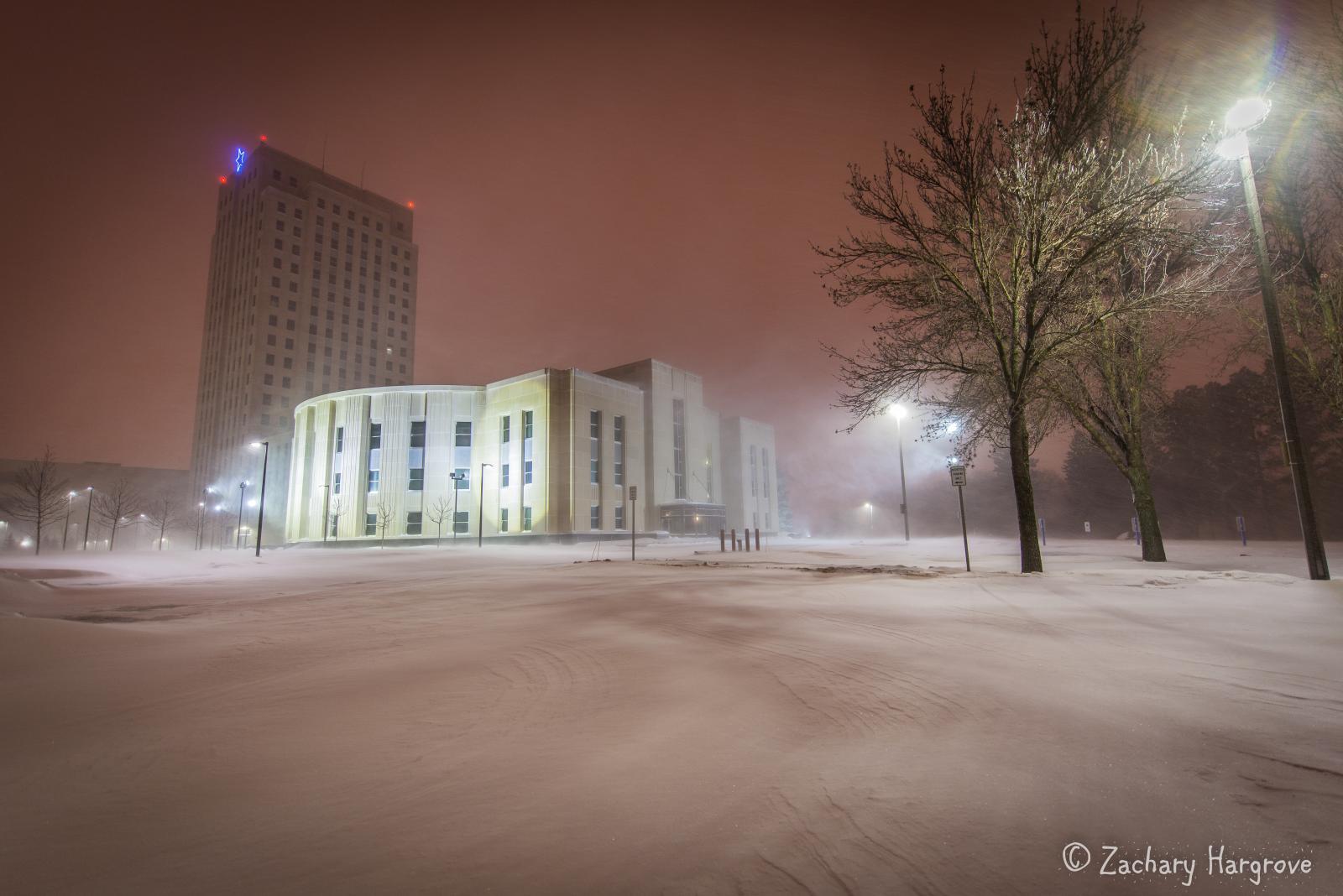
Blizzard Conditions Capitol Grounds
(Photo Courtesy of Zachary Hargrove) |
Large Snow Drifts
(Photo Courtesy of Zachary Hargrove) |
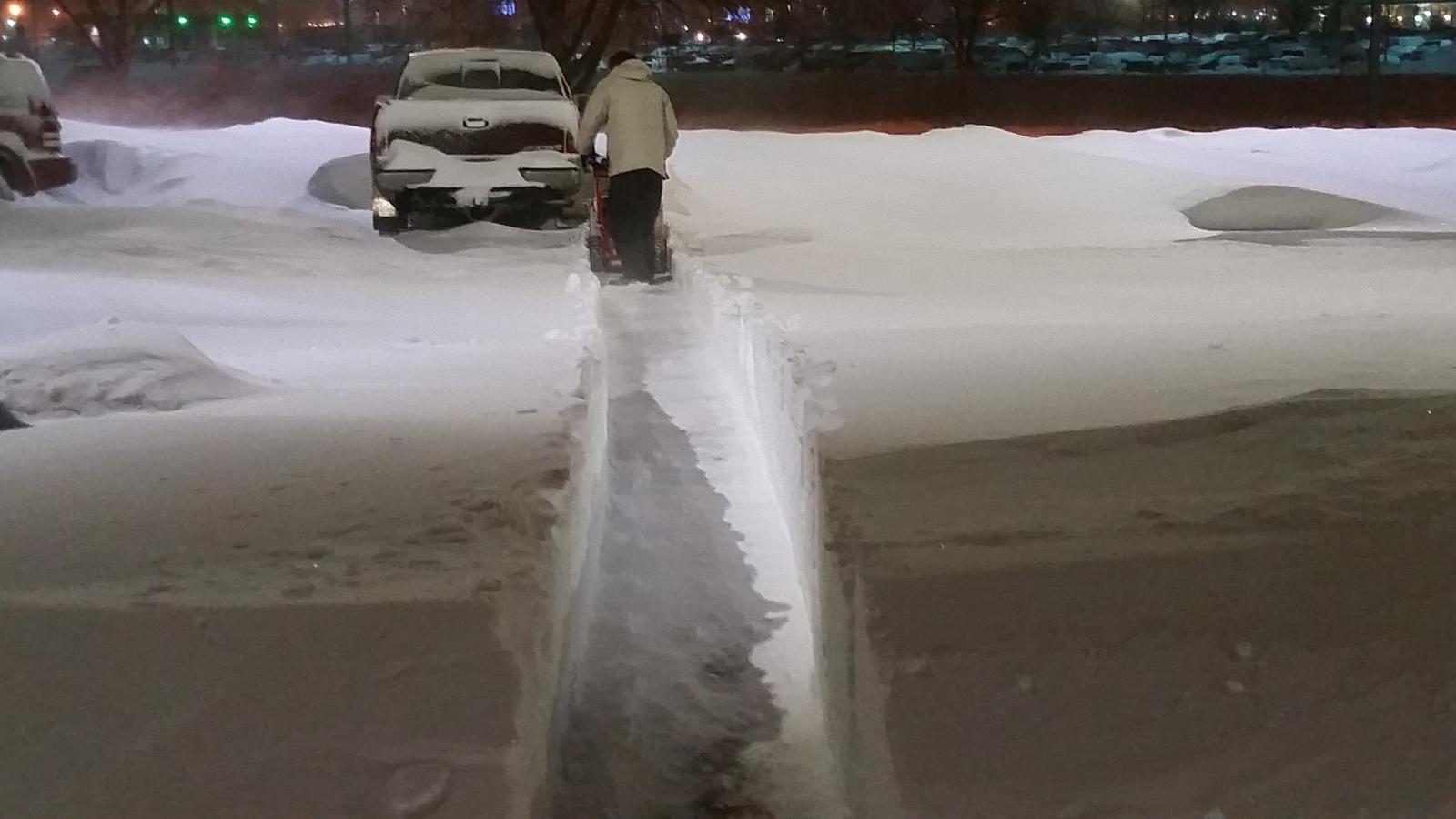
Digging Out
(Photo Courtesy of Zachary Hargrove) |
Large Snowplow Walls (Photo Courtesy of Zachary Hargrove) |
 |
 |
 |
 |
|
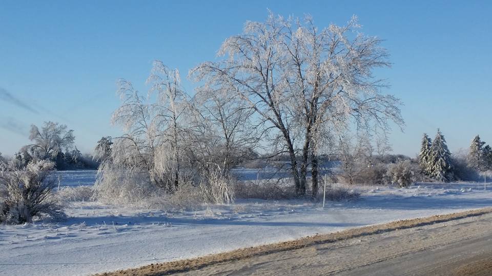
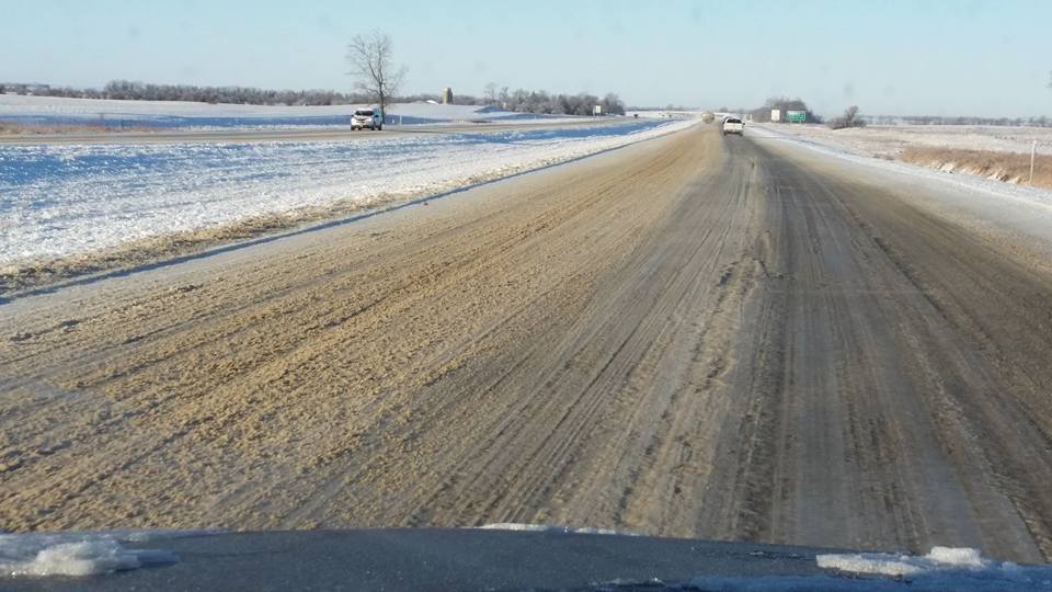
Ice Covered Trees on I-94 (Photo Courtesy of Janine Vining
|
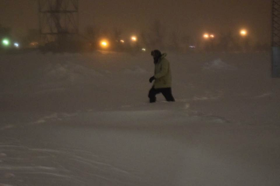
Ice Covered Trees on I-94 (Photo Courtesy of Janine Vining) | Ice Covered Interstate 94 (Photo Courtesy of Janine Vining) | One of our Meteorologists Making the Knee Deep Walk Back from Launching the Weather Balloon (Photo Courtesy of William Abeling) |
 |
 |
 |
 |
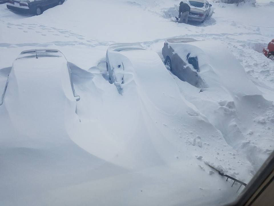
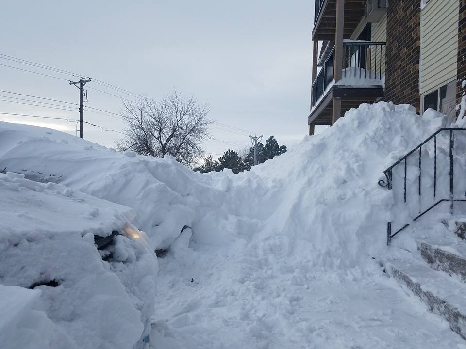
| Snow Covered Parking Lot in Bismarck (Photo Courtesy of Christina Marie) | Progression of the Clean-up of a Snow Covered Parking Lot in Bismarck (Photo Courtesy of Christina Marie) | Further Progression of the Clean-up of a Snow Covered Parking Lot in Bismarck (Photo Courtesy of Christina Marie) | Large Snow Piles in Bismarck, ND (Photo Courtesy of Christina Marie) |
 |
 |
 |
 |
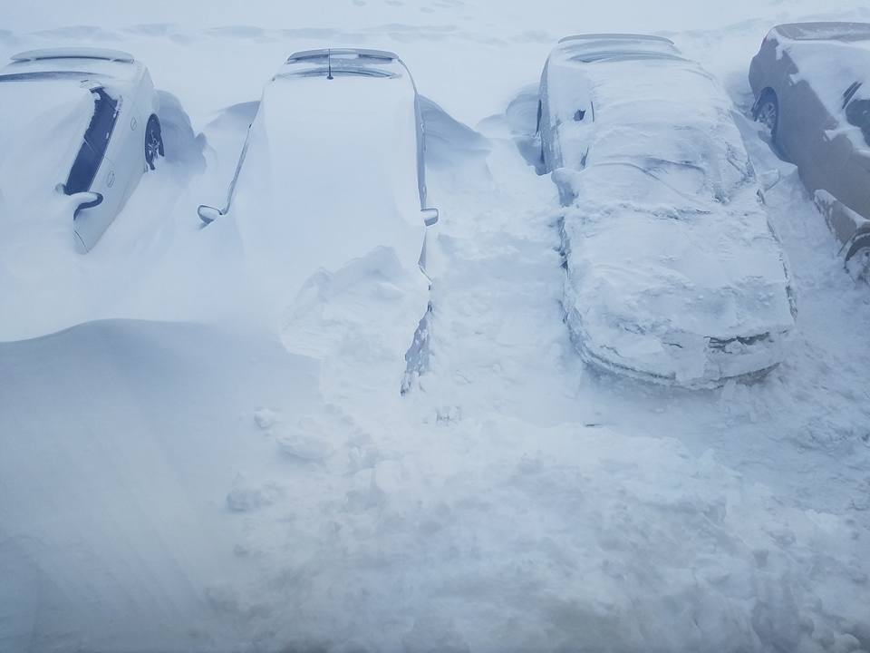
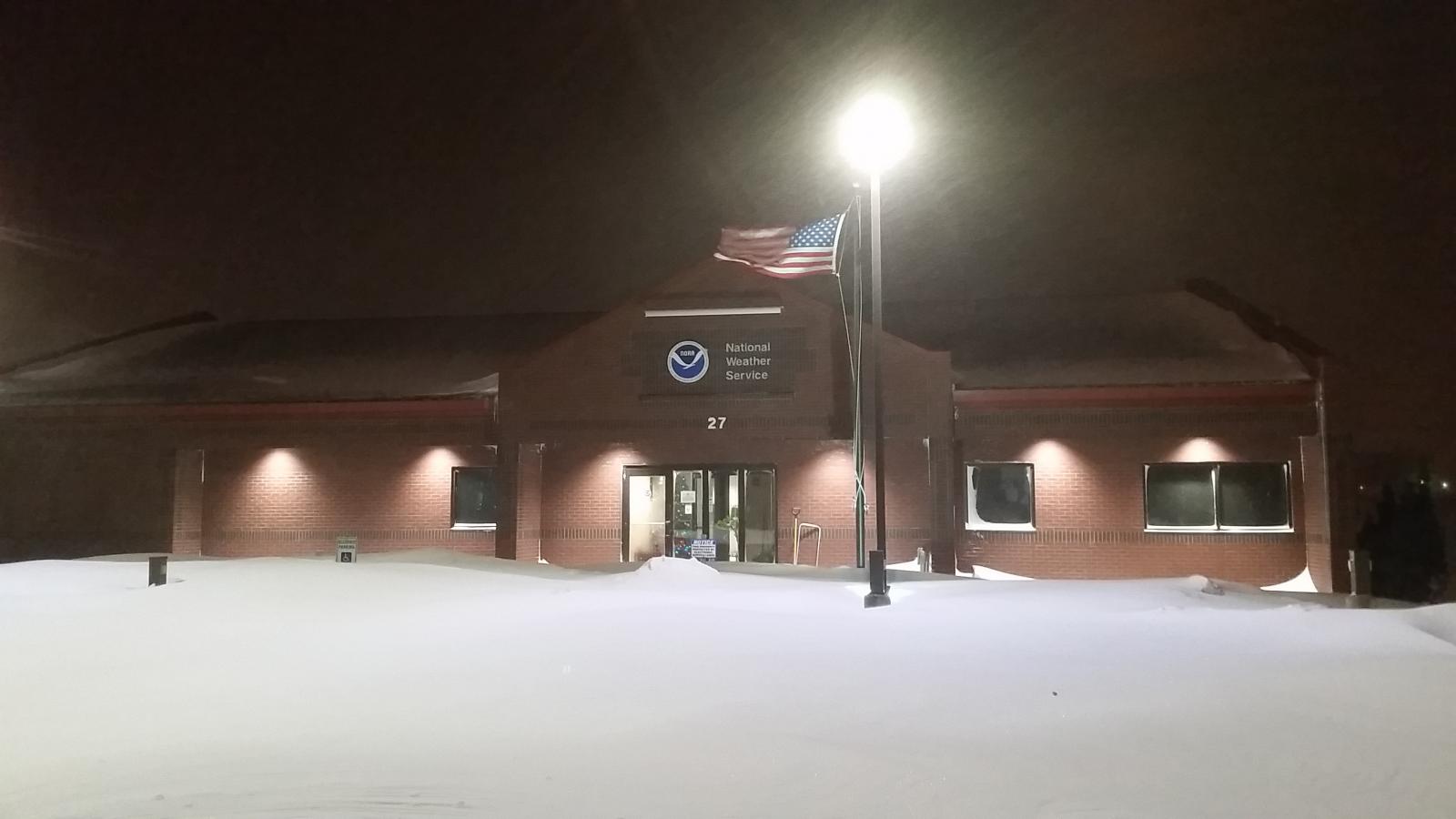
| Snow Blowing the Sidewalk at the NWS Bismarck Office (Photo Courtesy of Jeff Savadel) | NWS Bismarck During the Blizzard (Photo Courtesy of Jeff Savadel) | Large Snow Piles in Bismarck, ND (Photo Courtesy of Christina Marie) | Large Snow Drift in Golden Valley, ND (Photo Courtesy of Alesha Marie) |
Radar:
(Click on Images to Make Them Larger)
.gif) |
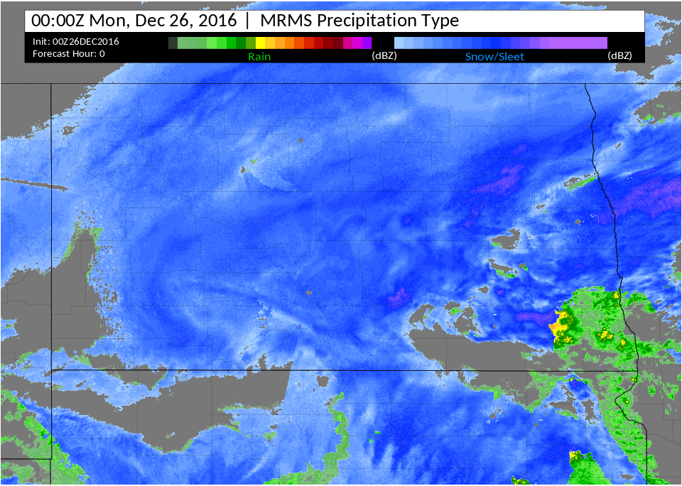 |
| Radar Loop from 6am to 6pm on 12/25/2017 | Radar Loop from 6pm on 12/25/2017 to 6am on 12/26/2017 |
Storm Reports:
| Snow Report Locations | Amounts | Wind Report Locations | Highest Gusts (mph) |
| Southwest Minot Sherwood 2 ENE Grassy Butte Underwood 6 E New Hradec Dickinson Watford City Northwest Minot Hazen Wilton Lansford 2 NE Towner Pick City Mandan 2 E Rhame NWS Bismarck 1 NNW Hettinger 7 NE Dickinson New Salem Harvey 2 N Williston Lignite Beulah Glen Ullin Columbus 1 WSW Hannover 2 NNW Ray New Town Westhope Flasher Garrison Bottineau Glenburn Wildrose |
22.0 in 20.0 in 18.5 in 18.0 in 17.0 in 16.5 in 16.0 in 16.0 in 16.0 in 15.0 in 15.0 in 14.0 in 13.5 in 13.2 in 13.0 in 12.5 in 12.5 in 12.0 in 12.0 in 12.0 in 12.0 in 12.0 in 12.0 in 11.0 in 11.0 in 11.0 in 10.0 in 10.0 in 10.0 in 9.0 in 9.0 in 8.6 in 8.0 in 7.0 in |
Belcourt 4 SW |
62 |
Environment:
(Click on Images to Make Them Larger)
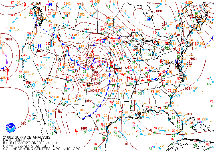
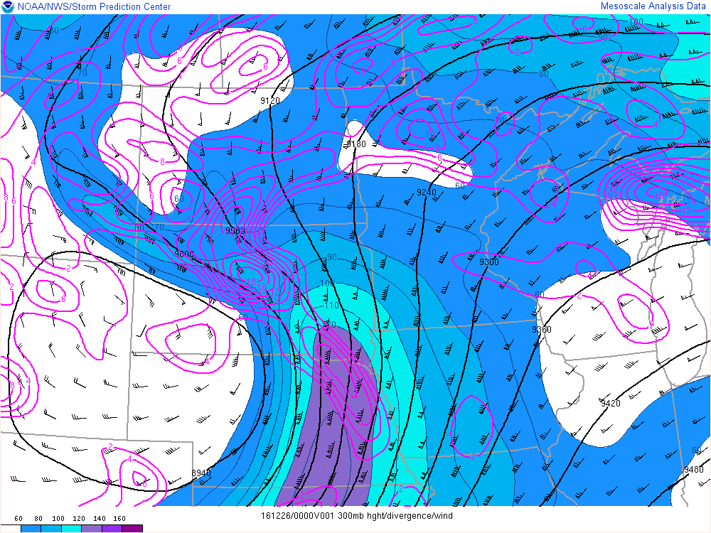
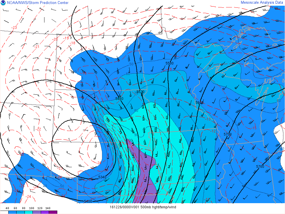
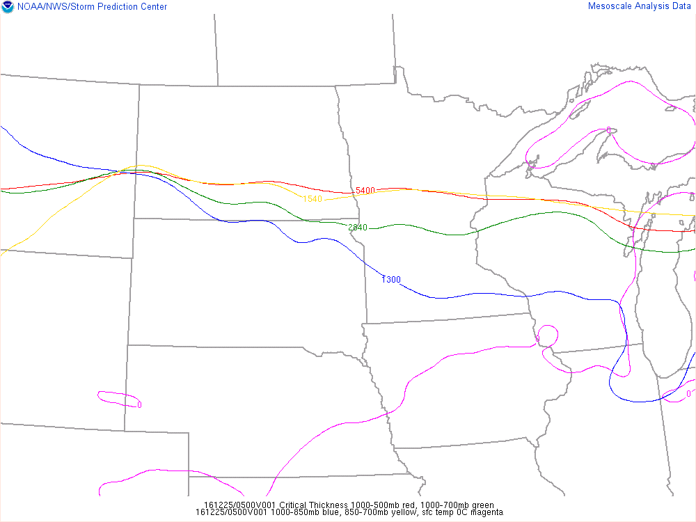
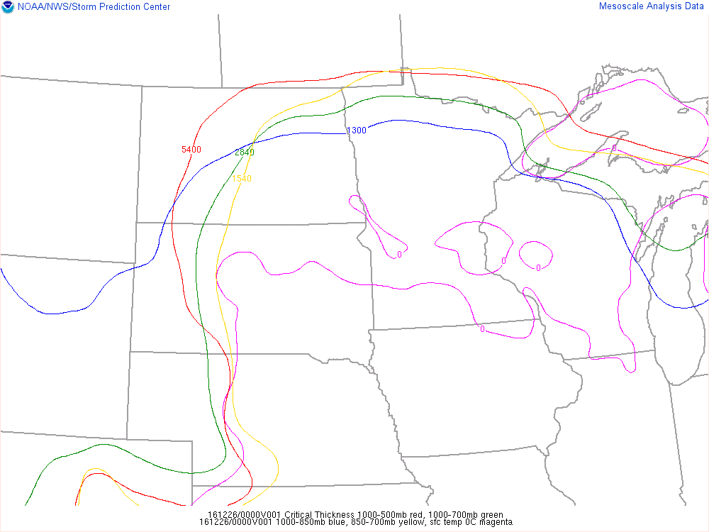
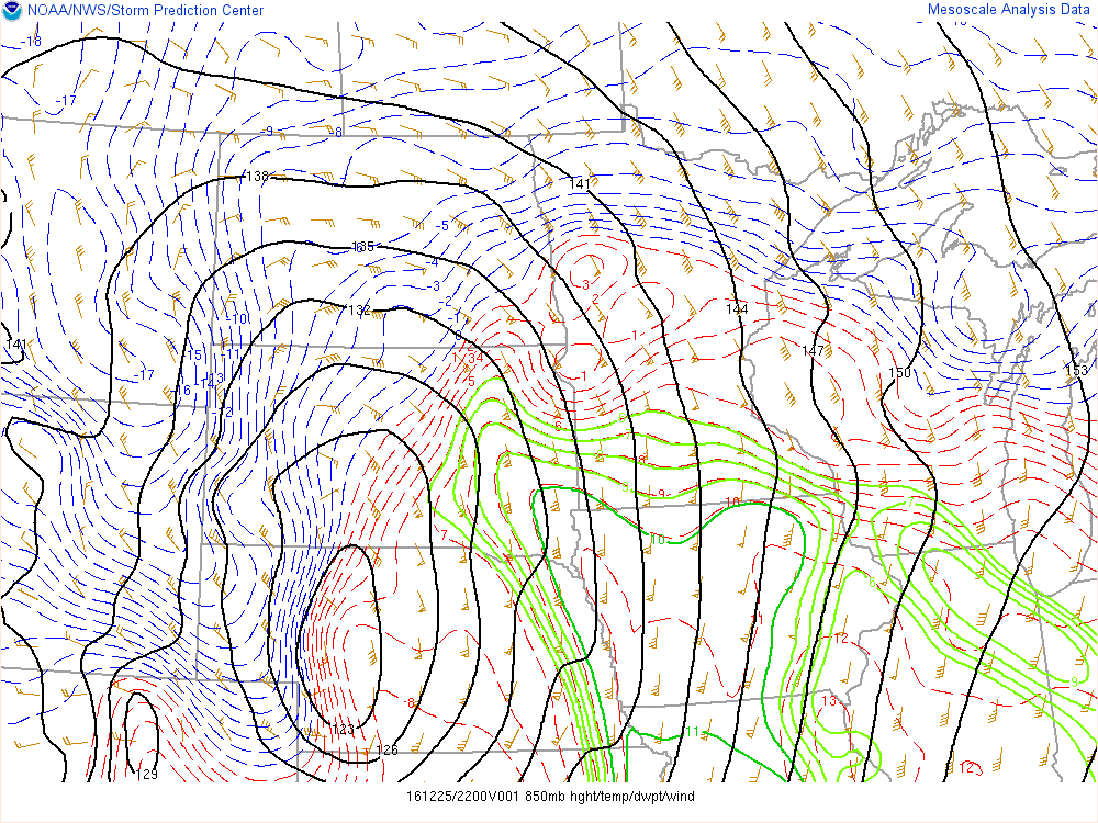
Synoptically, everything fell into place for this to become an historic winter storm. As a trough of low pressure made landfall on the west coast of the United States it began to deepen and amplify near the Four Corners region. It was at this time that the mid-level cyclone began to close off and intensify, while also taking on a negative tilt. At the surface, a low formed on the lee side of the Colorado Rockies (making this a classic "Colorado Low" scenario), and began to deepen as it moved into southern South Dakota and eventually into northern Minnesota. Strong winds at the low levels provided efficient transport for copious amounts of Gulf of America moisture to stream into the Northern Plains. By Christmas night, a strong jet streak at the 300 mb level of over 120 knots was entering South Dakota. This jet stream structure put most of North Dakota in the left exit region, promoting very strong upper level divergence and upward motion.
|
|
|
|
|
Figure 1: Surface Analysis at 21z on 12/25/2017
|
Figure 2: 300 mb Analysis at 00z on 12/26/2017. Heights, Divergence, and Windspeed
|
Figure 3: 500 mb Analysis at 00z on 12/26/2017. Heights, Temperatures, and Windspeed
|
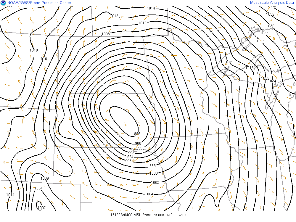
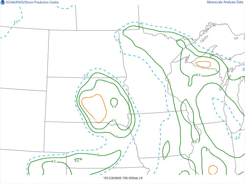
As the storm began to wrap up and the surface low began to deepen (to sub-990 mb levels), a strong low level jet intensified, advecting warm moist Gulf of America air north and west. Increasing temperatures aloft and the very moist air mass worked together to allow steeper mid-level lapse rates and instability to creep into parts of south central North Dakota. The Storm Prediction Center caught these trends early in the day on the morning of the 25th, and highlighted most of North Dakota in the general thunderstorm area. On the night of the 25th, numerous lightning strikes occurred during intense snowfall across parts of central North Dakota. Additionally, the increasing temperatures aloft and increasing critical thickness values promoted heavy freezing rain and sleet production over parts of northern South Dakota and southern North Dakota. Significant icing was reported in these areas.
|
|
|
 |
| Figure 4: Analyzed Surface Pressure and Surface Winds at 04z on 12/26/2017 | Figure 5: Mid-level Lapse Rates at 04z on 12/26/2017 | Figure 6: SPC Convective Outlook from 06z on 12/25/2016 |
 |
 |
 |
| Figure 7: Critical Thickness Values at 06z on 12/25/2017 | Figure 8: Critical Thickness Values at 01z on 12/26/2017 | Figure 9: 850mb Heights and Temperatures at 23z on 12/25/2017 |
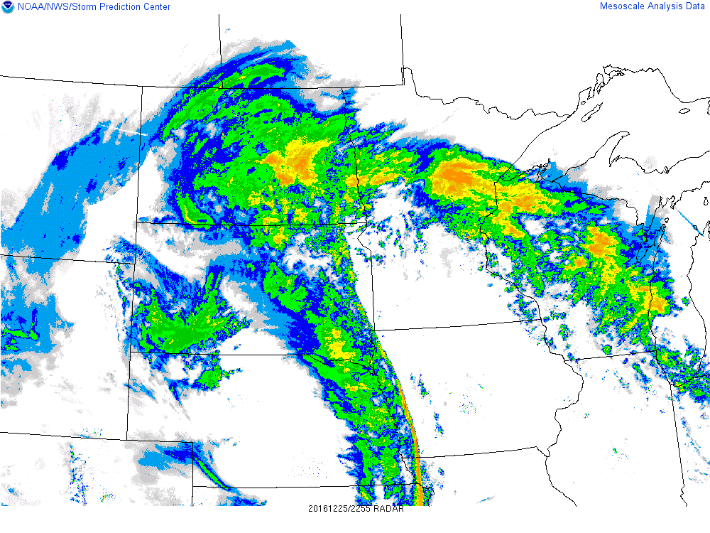
Here is some additional radar and satellite data:
 |
.gif) |
.gif) |
| Figure 10: Regional Radar at Peak Storm Strength | Figure 11: Water Vapor Satellite Loop | Figure 12: Infrared Satellite Loop |
 |
Media use of NWS Web News Stories is encouraged! Please acknowledge the NWS as the source of any news information accessed from this site. |
|