Binghamton, NY
Weather Forecast Office
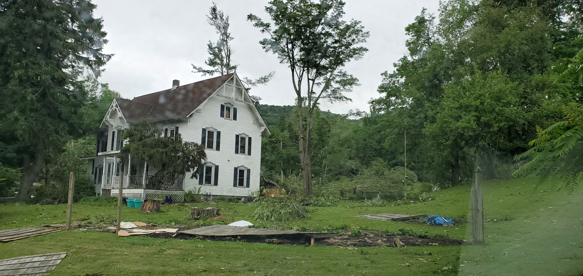
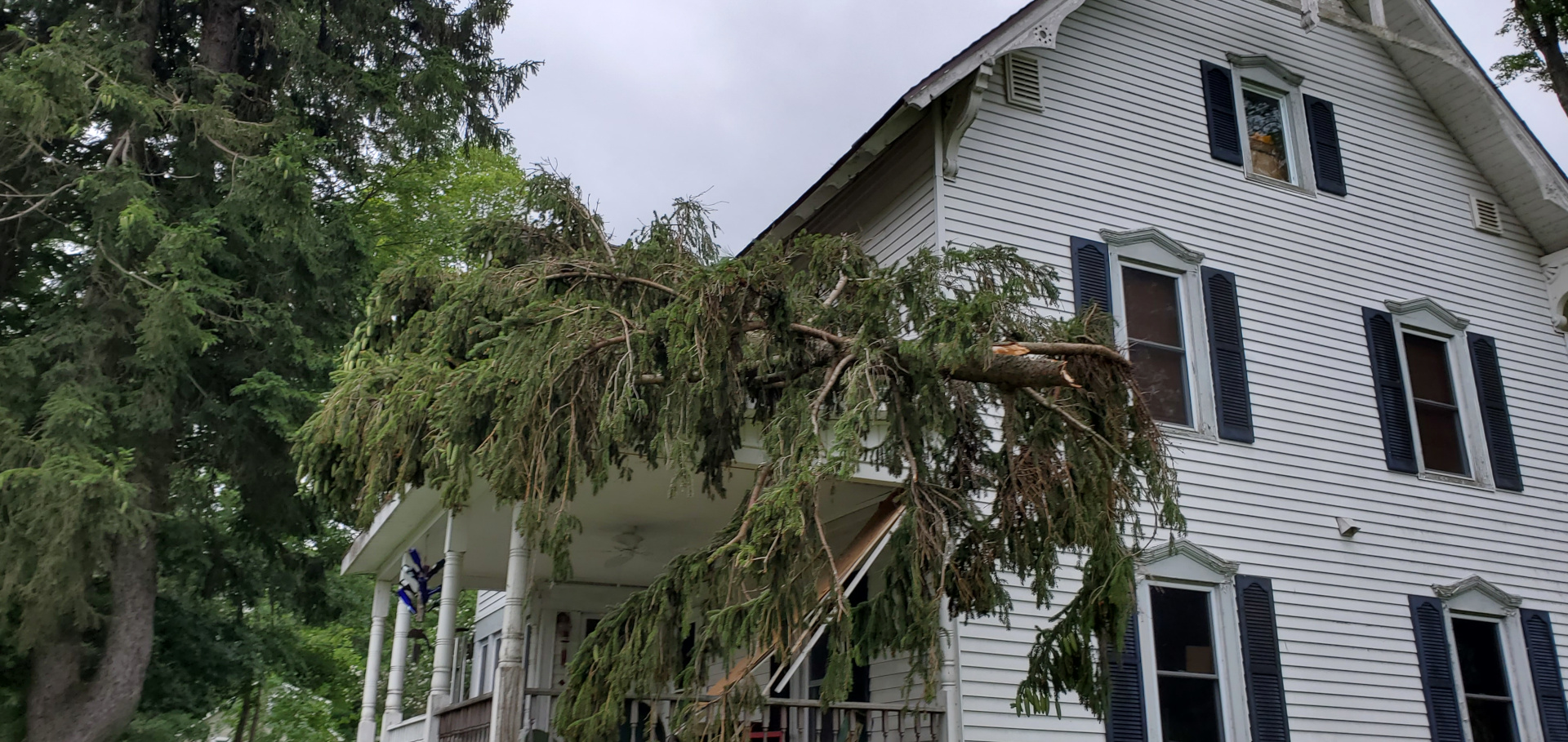
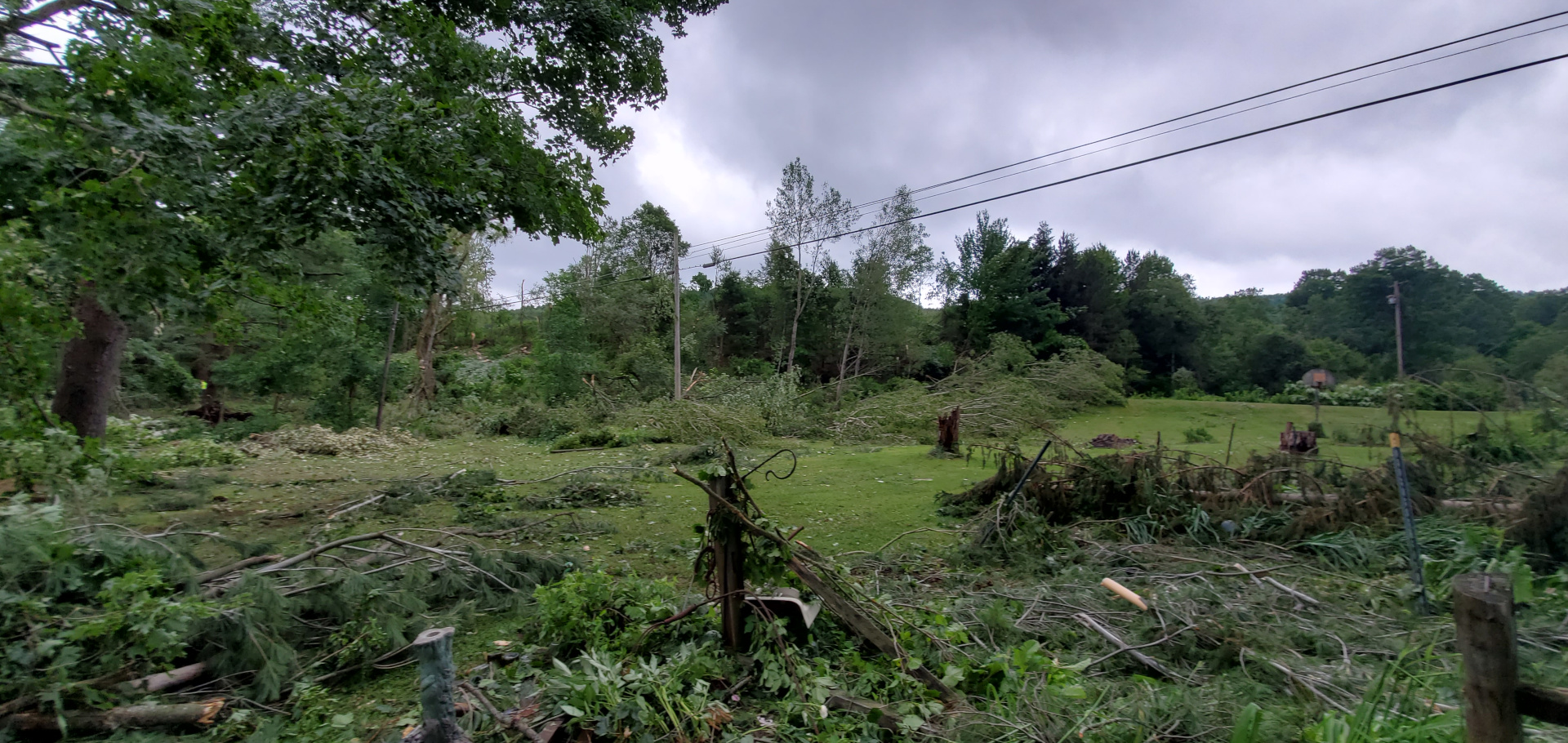
![]() Overview, a tornado touched down in Yellow Barn State Forest, east of Yellow Barn Road. It continued to travel eastward and passed over Card Road. It then struck a farm on Irish Settlement Road, snapping and uprooting multiple trees. Then it continued eastward and crossed through a wooded section of Beam Hill Road. The tornado then struck the yard of a house on the west side of Route 38, causing significant tree damage to the yard, a shed to blow off its foundation, and a blow-down of a fence. The tornado then crossed Route 38 just south of Dryden, before lifting just east of the road.
Overview, a tornado touched down in Yellow Barn State Forest, east of Yellow Barn Road. It continued to travel eastward and passed over Card Road. It then struck a farm on Irish Settlement Road, snapping and uprooting multiple trees. Then it continued eastward and crossed through a wooded section of Beam Hill Road. The tornado then struck the yard of a house on the west side of Route 38, causing significant tree damage to the yard, a shed to blow off its foundation, and a blow-down of a fence. The tornado then crossed Route 38 just south of Dryden, before lifting just east of the road.
Damage Pictures (click for a larger view)
 |
 |
 |
For reference:
EF Scale: The Enhanced Fujita Scale classifies tornadoes into the following categories:
| EF0 | Weak | 65 to 85 mph |
| EF1 | Weak | 86 to 110 mph |
| EF2 | Strong | 111 to 135 mph |
| EF3 | Strong | 136 to 165 mph |
| EF4 | Violent | 166 to 200 mph |
| EF5 | Violent | >200 mph |
Additional Information:
Radar Links:
Current Hazards
Briefing
Drought
Fire Weather
Graphical Hazardous Weather Outlook
Hurricanes
Local Outlook
River Flooding
Space Weather
Thunderstorms
Winter
Current Conditions
Air Quality
Local Storm Reports
Observation (list)
Observations (Map)
More Surface Observations
Rainfall
Satellite
More Satellite
Upper Air
Radar
Local Enhanced Radar
Local Standard Radar (low bandwidth)
Regional/National Standard Radar (low bandwidth)
More Radar
Forecasts
Activity Planner
Aviation
Fire Weather
Forecaster's Discussion
HeatRisk
Hourly View
Map View
Model Data
NWS GIS Viewer
Space Weather
Text Products
Rivers and Lakes
River Observation/Forecasts (Map)
River Forecast Centers
County Flash Flood Guidance
Current Streamflow
Ensemble River Guidance
Flood Inundation Maps
US Dept of Commerce
National Oceanic and Atmospheric Administration
National Weather Service
Binghamton, NY
32 Dawes Drive
Johnson City, NY 13790
(607) 729-1597
Comments? Questions? Please Contact Us.

