NWS Damage Survey for 07/08/21 Tornado Event
A Tornado has been confirmed in Westernville, NY
A tornado touched down in the Woods Valley Ski Area and then moved northeast into downtown Westernville. The tornado caused considerable damage along Main street. Several roofs were blown off houses and numerous trees were uprooted and snapped. The tornado continued to move northeast crossing the the Mohawk River and paralled east of River Road, leading to crop damage and a roof torn off of a barn before lifting.
We want to thank the Volunteer Fire Company of Western and the Oneida County Sheriff`s department for their assistance with the survey today.
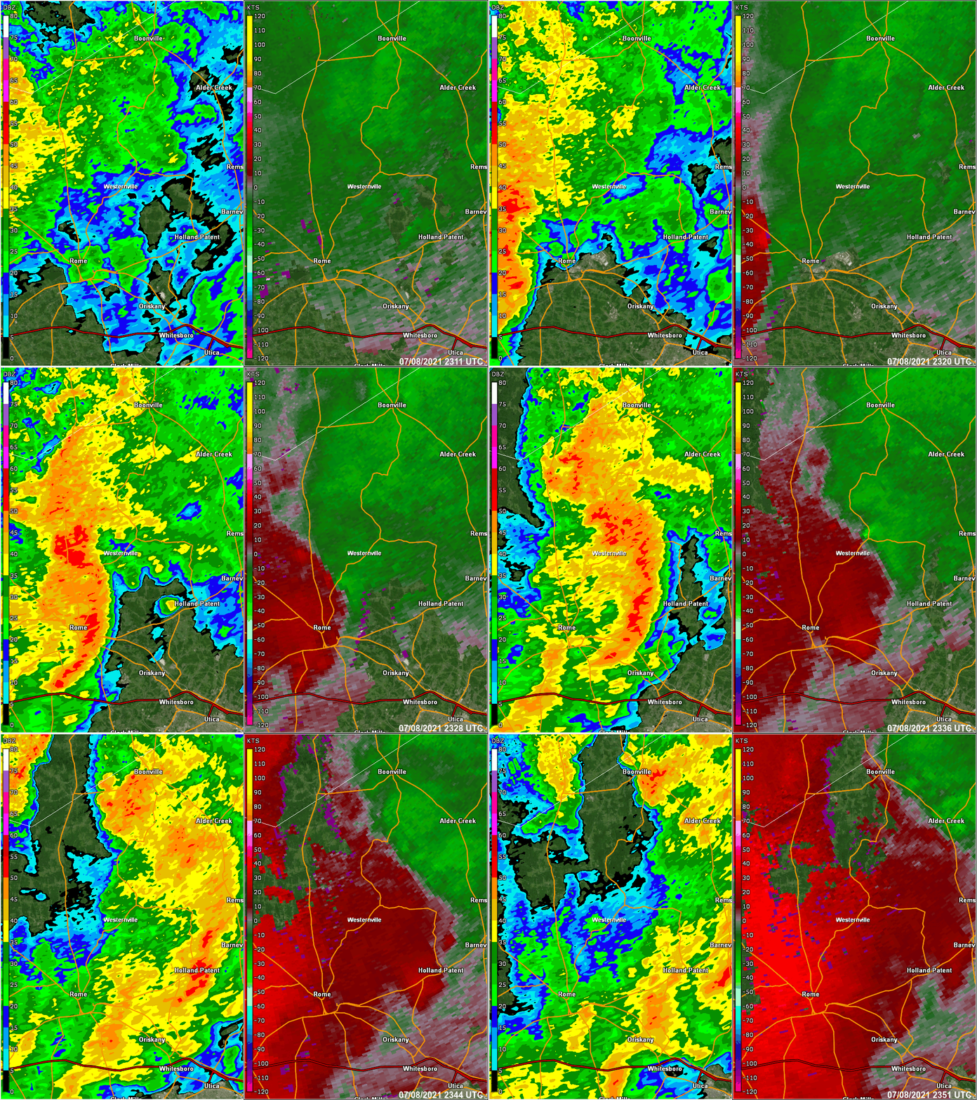
The right half of the image below is base reflectivity at 0.5 degrees and the left is Storm Relative Motion at 0.5 degrees elevation. The arrows show the circulation with the storm. Click for a larger view.
The KTYX radar loop below is from 7:11 PM to 7:51 PM EDT. 0.5 degree base reflectivity on the right half and 0.5 storm relative motion on the left side. Note the circulation that move across the Westernville NY area around 7:30 PM EDT.

|
For reference: Enhanced Fujita Scale classifies tornadoes into the following categories:
A microburst is a convective downdraft with an affected outflow area of less than 2 1/2 miles wide and peak winds lasting less than 5 minutes. Microbursts may induce dangerous horizontal and vertical wind shears, which can adversely affect aircraft performance and cause property damage. Straight-line winds are generally any wind that is not associated with rotation, used mainly to differentiate them from tornadic winds. |