Binghamton, NY
Weather Forecast Office
NWS Damage Survey for Wednesday 7/07/2021 Thunderstorm Wind Damage in the Apalachin NY Area
Microburst / Straight line Wind damage found in the Apalachin NY area in southeast Tioga County from Wednesday Evening's severe thunderstorms.
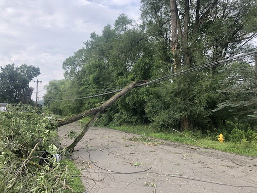
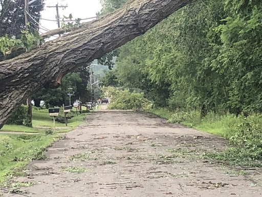
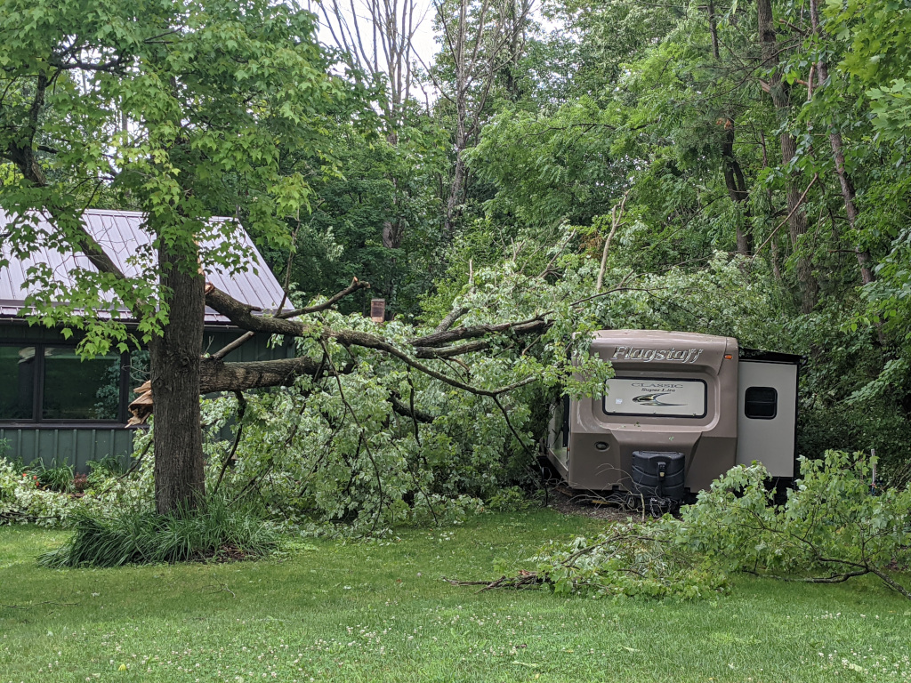
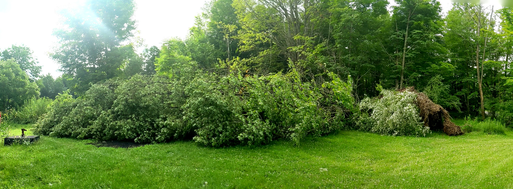
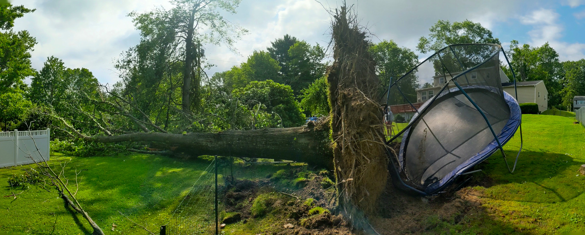
A microburst hit Apalachin NY at 948 pm EDT Wednesday 7/7/21 as winds up to 80 mph blasted to the northeast and ended around Campville at 950 pm EDT. The winds were strongest from McFadden Road to Shady Hill Road and Route 434 near the eastern end of ain Street. The winds in these areas were between 70 and 80 mph. The rest of the Apalachin and Campville areas had winds of 60 to 70 mph estimated. The strongest winds lasted about 2 minutes. Numerous trees were blown down with many structures having minor damage and a few sustaining major damage from trees falling on them.
This area of damage was within a much broader area of thunderstorm wind damage of 50 to 60 mph that hit many areas in Broome and Tioga Counties in NY Wednesday evening July 7th, 2021.
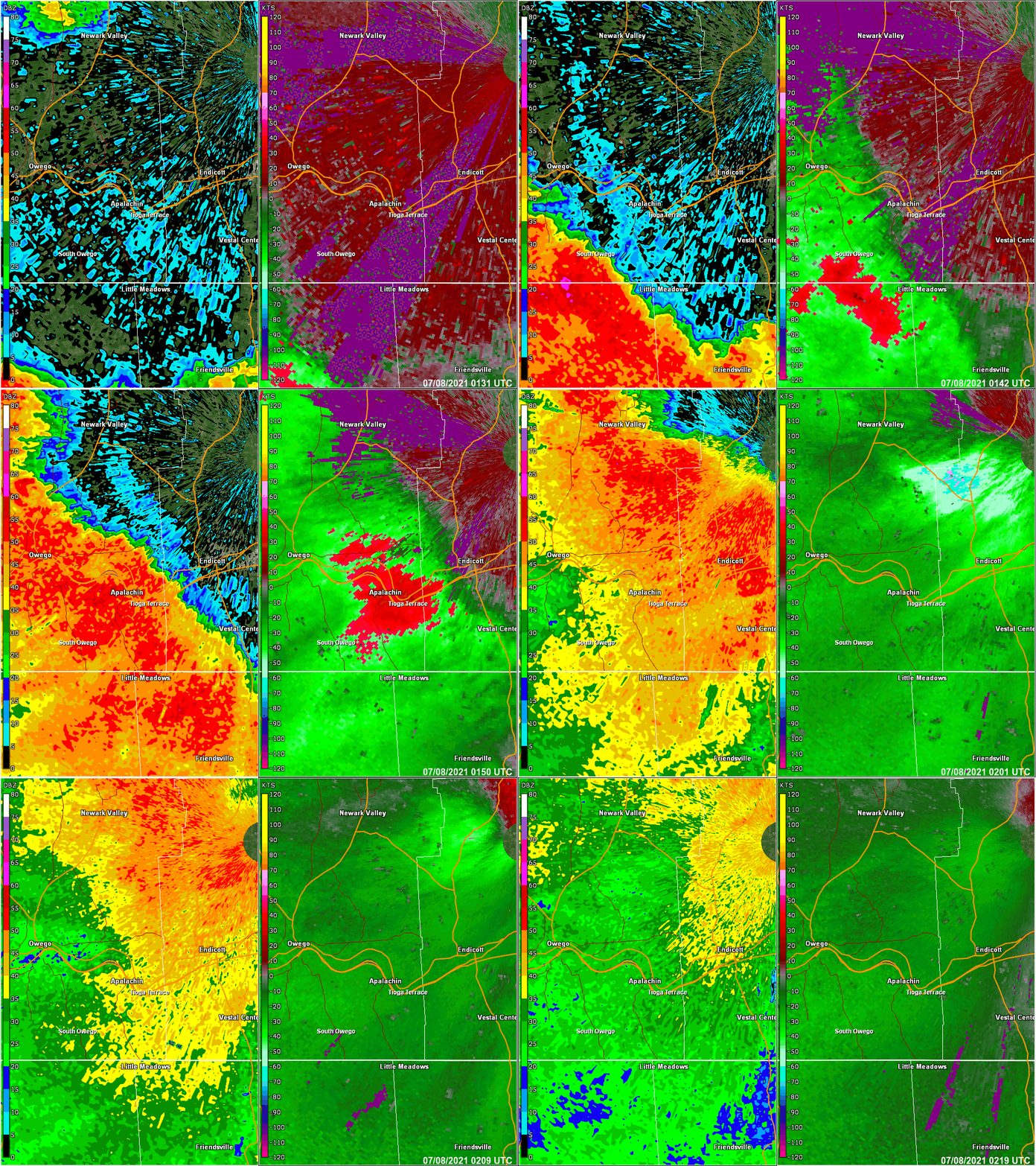
The radar loop below is from the Binghamton, NY WSR 88D. The loop starts at 9:31 PM EDT and ends at 10:19 PM EDT. The right half is base reflectivity at 0.5 degrees and the left is base velocity at 0.5 degrees elevation. On the base velocity note the large patch of red that moves from South Owego to Apalachin and across Endicott NY. This swath of strong winds, 60 to 90 mph, at about 500 to 800 feet off the ground. This is indicator for the possibility of damaging wind gusts at the surface.
Storm Damage Pictures
|
Tree on wires south Glann Rd Apalachin NY |
Tree on wires south Glann Rd Apalachin NY Zoomed in. |
Tree on trailer Apalachin, NY |
Current Hazards
Briefing
Drought
Fire Weather
Graphical Hazardous Weather Outlook
Hurricanes
Local Outlook
River Flooding
Space Weather
Thunderstorms
Winter
Current Conditions
Air Quality
Local Storm Reports
Observation (list)
Observations (Map)
More Surface Observations
Rainfall
Satellite
More Satellite
Upper Air
Radar
Local Enhanced Radar
Local Standard Radar (low bandwidth)
Regional/National Standard Radar (low bandwidth)
More Radar
Forecasts
Activity Planner
Aviation
Fire Weather
Forecaster's Discussion
HeatRisk
Hourly View
Map View
Model Data
NWS GIS Viewer
Space Weather
Text Products
Rivers and Lakes
River Observation/Forecasts (Map)
River Forecast Centers
County Flash Flood Guidance
Current Streamflow
Ensemble River Guidance
Flood Inundation Maps
US Dept of Commerce
National Oceanic and Atmospheric Administration
National Weather Service
Binghamton, NY
32 Dawes Drive
Johnson City, NY 13790
(607) 729-1597
Comments? Questions? Please Contact Us.


