Binghamton, NY
Weather Forecast Office
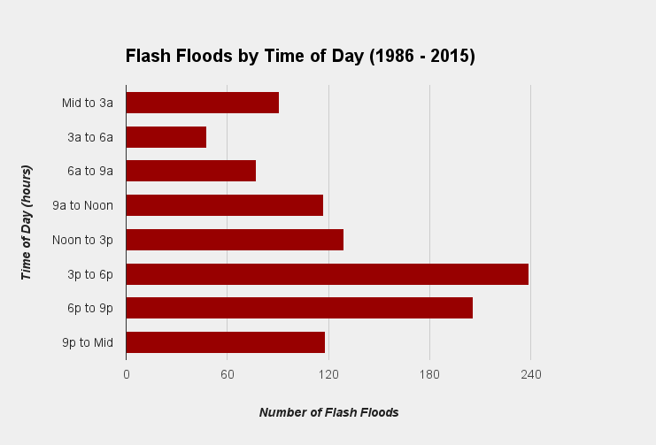
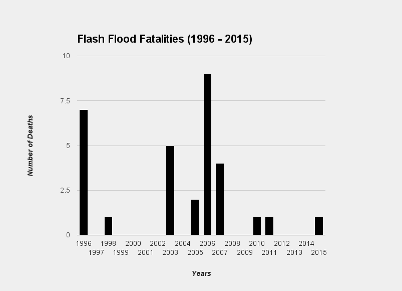
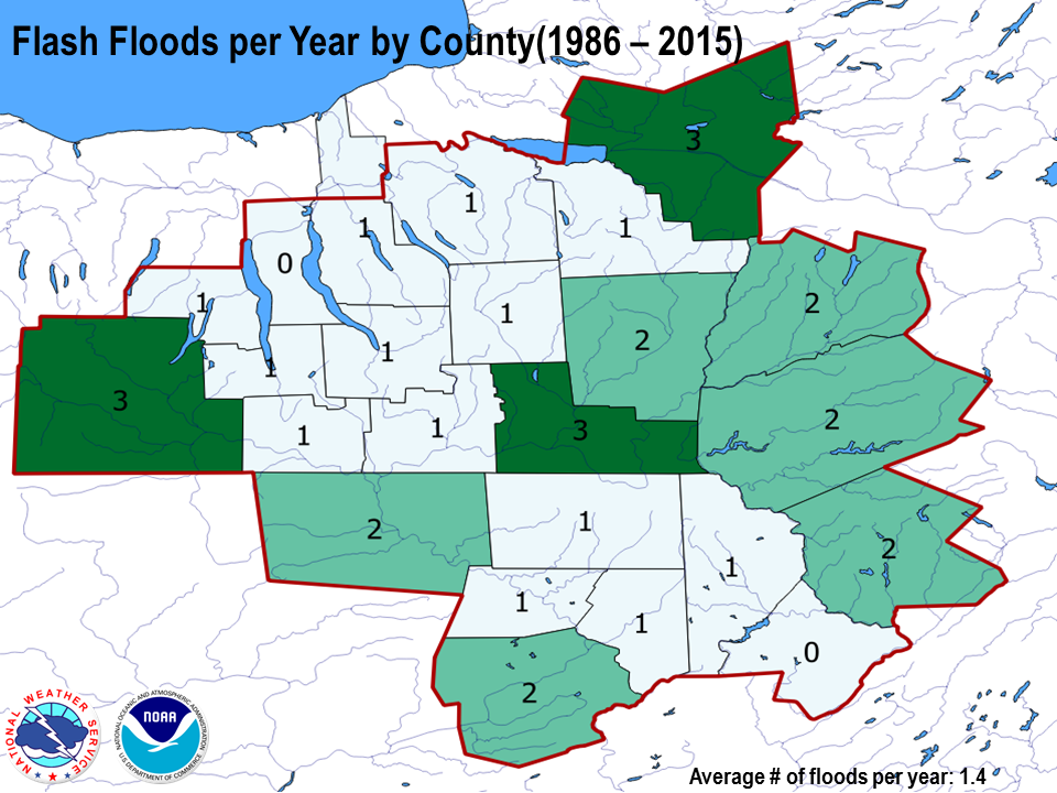
The following data is a brief analysis of the flash flood climatology for the NWS Binghamton, NY service area between the years 1986 to 2015. Central New York and Northeast Pennsylvania are prone to heavy rain and flash flooding with an average of about 34 flash floods per year throughout the region. The following are some basic facts about flash flooding in the area.
Other statistics show a fairly common pattern to flash flooding across the Nation. Most flash floods occur during the summer months, and between the hours of 3 PM and 9 PM. This is due to the fact that the majority of flash floods are associated with afternoon and evening thunderstorms. Click the images below to expand.
 |
 |
|---|---|
 |
 |
 |
 |
 |
 |
 |
 |
| Flash Flood Data collected from the National Center for Environmental Information (NCEI) | |
Current Hazards
Briefing
Drought
Fire Weather
Graphical Hazardous Weather Outlook
Hurricanes
Local Outlook
River Flooding
Space Weather
Thunderstorms
Winter
Current Conditions
Air Quality
Local Storm Reports
Observation (list)
Observations (Map)
More Surface Observations
Rainfall
Satellite
More Satellite
Upper Air
Radar
Local Enhanced Radar
Local Standard Radar (low bandwidth)
Regional/National Standard Radar (low bandwidth)
More Radar
Forecasts
Activity Planner
Aviation
Fire Weather
Forecaster's Discussion
HeatRisk
Hourly View
Map View
Model Data
NWS GIS Viewer
Space Weather
Text Products
Rivers and Lakes
River Observation/Forecasts (Map)
River Forecast Centers
County Flash Flood Guidance
Current Streamflow
Ensemble River Guidance
Flood Inundation Maps
US Dept of Commerce
National Oceanic and Atmospheric Administration
National Weather Service
Binghamton, NY
32 Dawes Drive
Johnson City, NY 13790
(607) 729-1597
Comments? Questions? Please Contact Us.

