National Weather Service United States Department of Commerce
Click a location below for detailed forecast.

Last Map Update: Thu, Apr 17, 2025 at 12:40:18 pm CDT

Fire weather conditions for today, especially for the northwest combined Panhandles. Please use caution with any outdoor activities which could promote sparks or flames.
Strong winds are expected to unfold in the Panhandles this afternoon with highest gusts looking to be in the Northwestern Panhandles. Continue to practice fire safety, as hot temperatures and low relative humidity values will also aid in creating high-end critical fire weather conditions for the area.
Hot, dry, and windy conditions are expected to create critical fire weather conditions Thursday afternoon. Make sure to be aware of your surroundings and avoid any activity that can cause a spark!
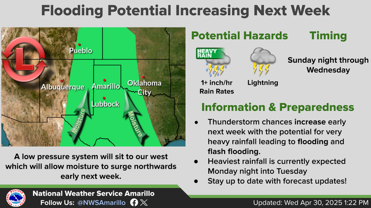
Active weather continues to trend for this coming weekend with chances of showers starting as early as Friday night. Currently best chances continue to trend Saturday into Sunday with showers and thunderstorms the more likely precipitation type present. However, potential is present for some snowfall to sneak in for Saturday night into early Sunday morning. Make sure to check back with us, so you can stay up to date for any holiday travel plans you might have!
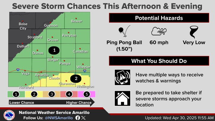
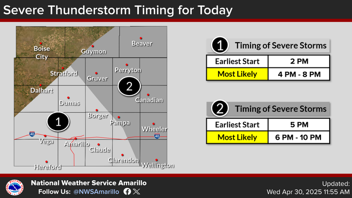
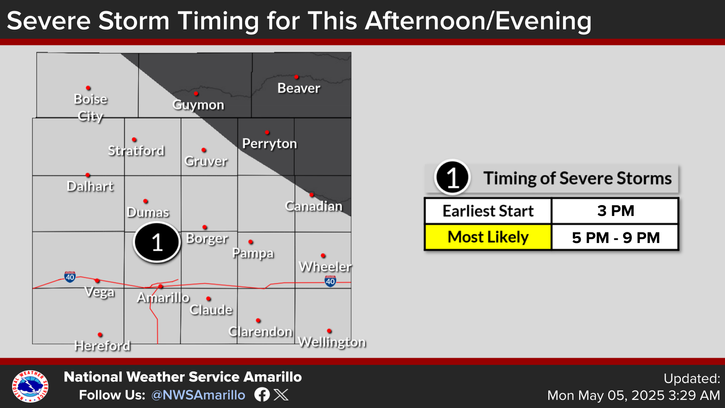
With the arrival of moisture on Friday there will be a low chance for severe weather in the SE panhandles. While the chance may be low the severe thunderstorms may be very impactful as the environment can support the formation of large hail
It will be hot across the panhandles today. This will cool down for the weekend as moisture streams across the panhandles. Once the moisture draws down on Monday the temperature will rise again.

Text Product Selector (Selected product opens in current window)


Current Observations ( )
Location Sky/Weather Temp (°F) Dewpt (°F) RH (%) Wind (mph) Pressure (inHg) Remarks
 Amarillo
N/A
N/A
N/A
N/A
N/A
N/A
N/A
 Borger
N/A
N/A
N/A
N/A
N/A
N/A
N/A
 Canadian
N/A
N/A
N/A
N/A
N/A
N/A
N/A
 Dalhart
N/A
N/A
N/A
N/A
N/A
N/A
N/A
 Dumas
N/A
N/A
N/A
N/A
N/A
N/A
N/A
 Guymon
N/A
N/A
N/A
N/A
N/A
N/A
N/A
 Hereford
N/A
N/A
N/A
N/A
N/A
N/A
N/A
 Pampa
N/A
N/A
N/A
N/A
N/A
N/A
N/A
 Perryton
N/A
N/A
N/A
N/A
N/A
N/A
N/A
 Amarillo 9NNE
N/A
N/A
N/A
N/A
N/A
N/A
N/A
 Amarillo 7SSE
N/A
N/A
N/A
N/A
N/A
N/A
N/A
 Bootleg 11WNW
N/A
N/A
N/A
N/A
N/A
N/A
N/A
 Canadian 6E
N/A
N/A
N/A
N/A
N/A
N/A
N/A
 Clarendon 2WSW
N/A
N/A
N/A
N/A
N/A
N/A
N/A
 Claude 12SW
N/A
N/A
N/A
N/A
N/A
N/A
N/A
 Hereford 2NW
N/A
N/A
N/A
N/A
N/A
N/A
N/A
 McLean 1E
N/A
N/A
N/A
N/A
N/A
N/A
N/A
 Palo Duro SP
N/A
N/A
N/A
N/A
N/A
N/A
N/A
 Pampa 2E
N/A
N/A
N/A
N/A
N/A
N/A
N/A
 Umbarger 3NNE
N/A
N/A
N/A
N/A
N/A
N/A
N/A
Note: "N/A" or "MISG" will be displayed if values are not available. In the LOCATION column, click on links for a list of recent observations at sites of interest. In the WIND column, VRB is "variable" and G is "gust". In the REMARKS column, HX is "heat index", WCI is "wind chill index", and VSB is "visibility" (if shown).


Aviation Drought Fire Weather Hydrology Severe Weather Winter Weather
 
Climate Graphs Hourly Forecast Long Range Local Model Data Precip Maps Office Webcam
 
Education Local Research News Skywarn Weather Calculator Weather Radio