
Scattered severe thunderstorms capable of large hail in excess of two inches, strong tornadoes, and damaging wind gusts are likely across parts of the Upper Mississippi Valley and Midwest this evening. Heavy to excessive rainfall may bring a flooding threat to portions of the Central Plains to the Midwest through Thursday. The heatwave in the Central U.S. will begin to push South and East Thursday Read More >
|
December 2006 Panhandles Winter Storm |
 PC200011.JPG |
 PC200012.JPG |
 PC200013.JPG |
 PC200014.JPG |
 PC200015.JPG |
 PC200019.JPG |
 PC200020.JPG |
 PC200021.JPG |
 PC200022.JPG |
 PC200023.JPG |
 PC200024.JPG |
 PC200025.JPG |
 PC200026.JPG |
 PC200027.JPG |
||
|
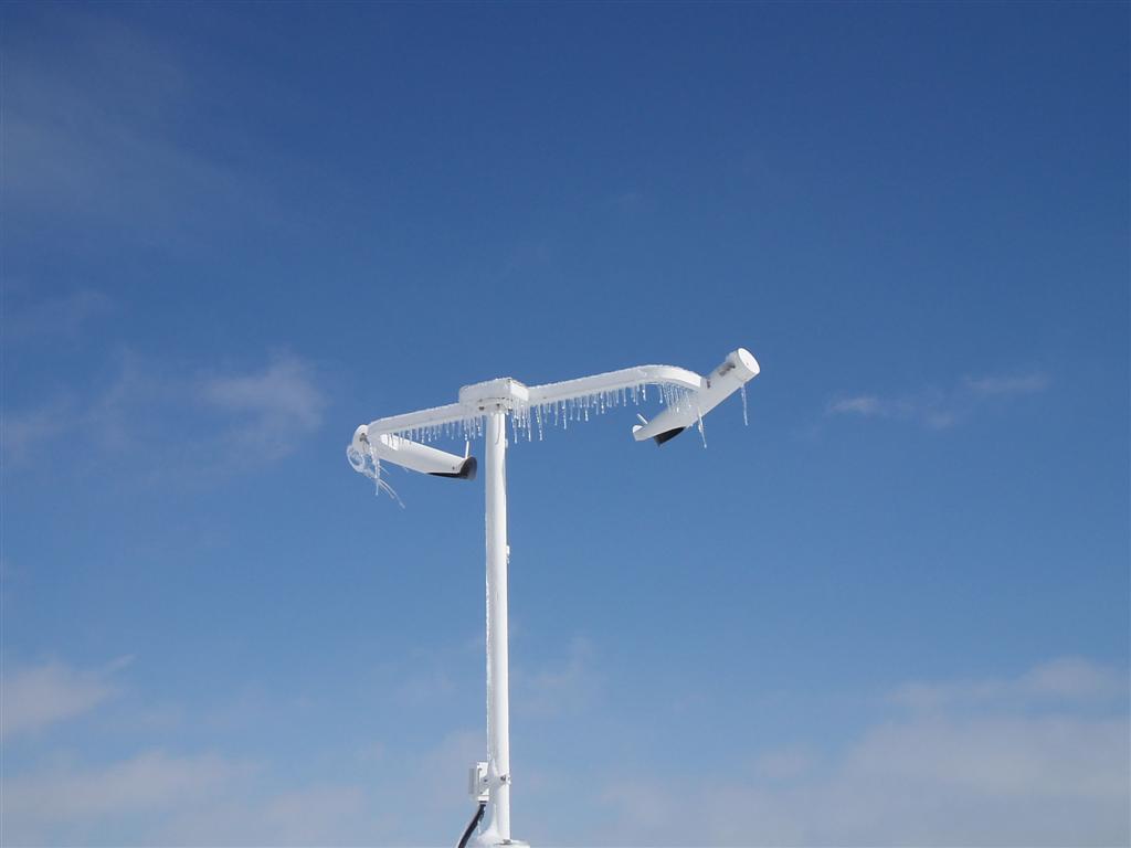
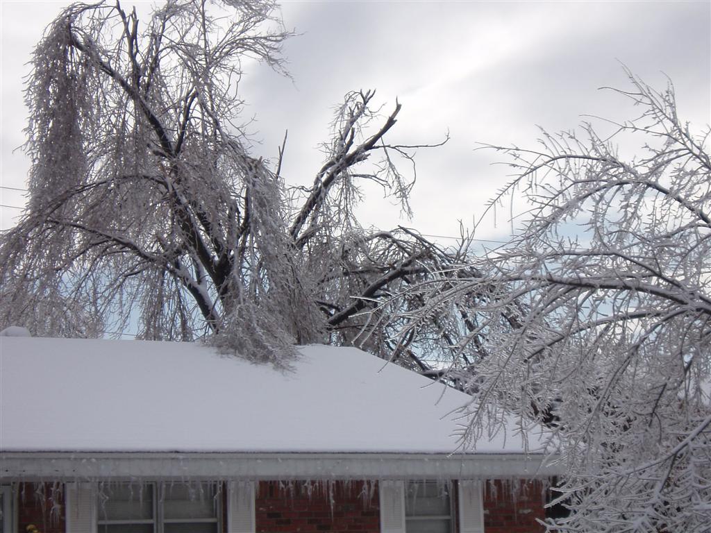
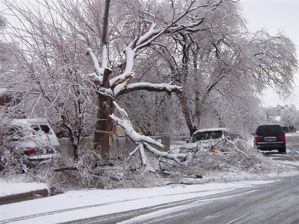
From December 18th through the 20th, a major winter storm blew across the Panhandles bringing a mixture of freezing rain, sleet and snow. The storm affected most of the Panhandles but hit the hardest across the western Texas to Oklahoma Panhandles. Across the Panhandles, numerous downed tree limbs and power poles caused traffic problems and left many Panhandle residents without electricity. The hardest hit area was in Texas county in the Oklahoma Panhandle where around 900 residents and businesses lost power. The storm first affected the Panhandles on Monday the 18th in the afternoon. Initially, the storm produced light freezing rain on Monday night. As the airmass cooled and moisture increased, the light freezing rain showers became more intense. In fact, some locations even received thunderstorms that produced freezing rain. The widespread freezing rain showers continued all day Tuesday (the 19th) providing up to 1 inch of ice in the worst hit locations. Generally though, most areas in the Panhandles received about 1/2 inch of ice. Late Tuesday night into Wednesday (the 20th) morning, the freezing rain showers changed over to snow. Areas in the northwest Texas and Oklahoma Panhandles received 4 to 5 inches of snow, with slightly lower snow totals across the central to eastern Panhandles. Above are a few photos taken after the event by NWS Hydrometeorlogical Technician Steve Bilodeau in the Amarillo area. |
|||

