
Severe thunderstorms are forecast through this weekend along a slow moving cold front and secondary storm system that will impact areas from the southern Plains to the Great Lakes. Large hail and isolated damaging wind gusts are the main threats with these storms along with a risk for heavy to excessive rainfall which could bring flooding. Read More >
Overview
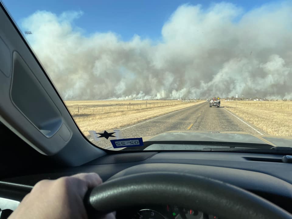
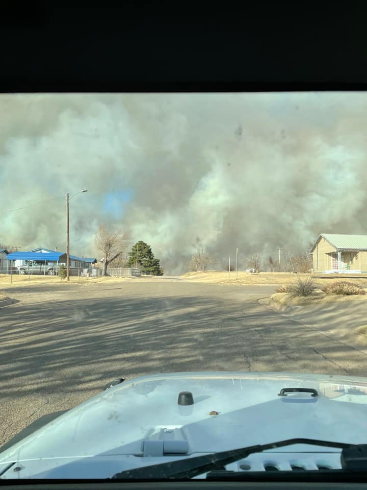
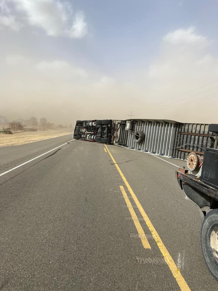
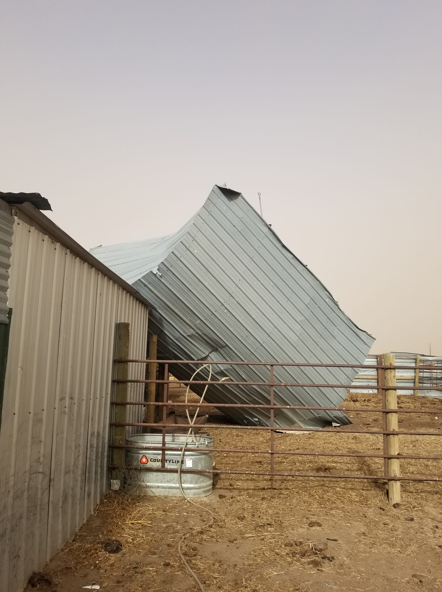
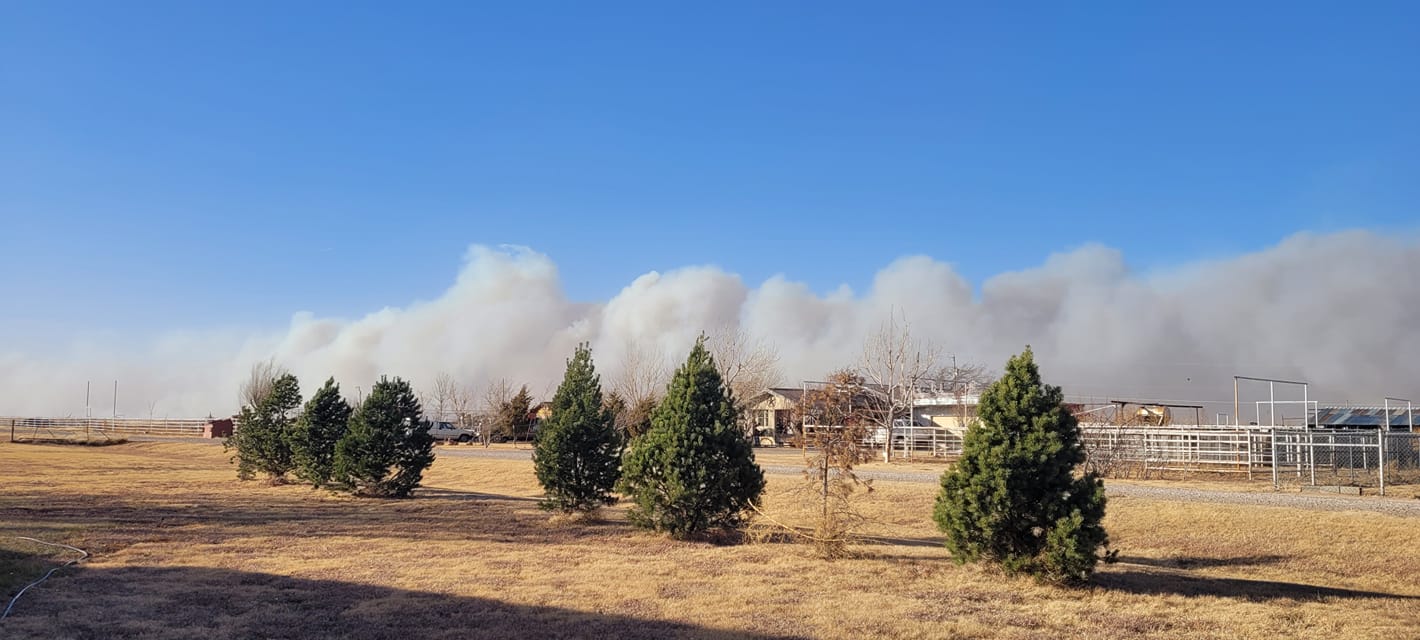
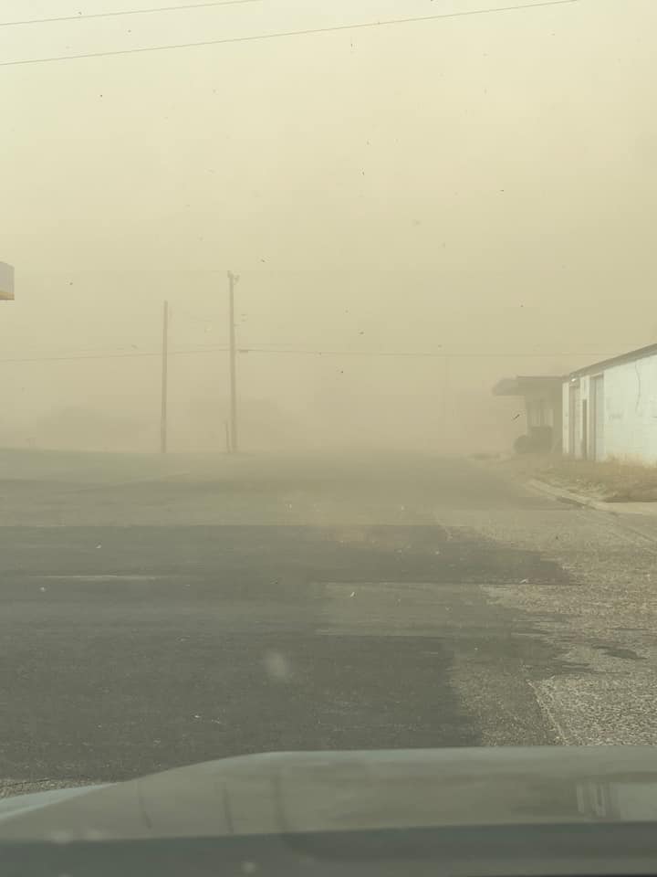
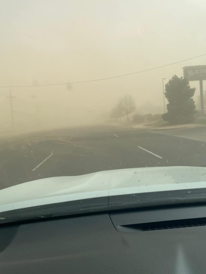
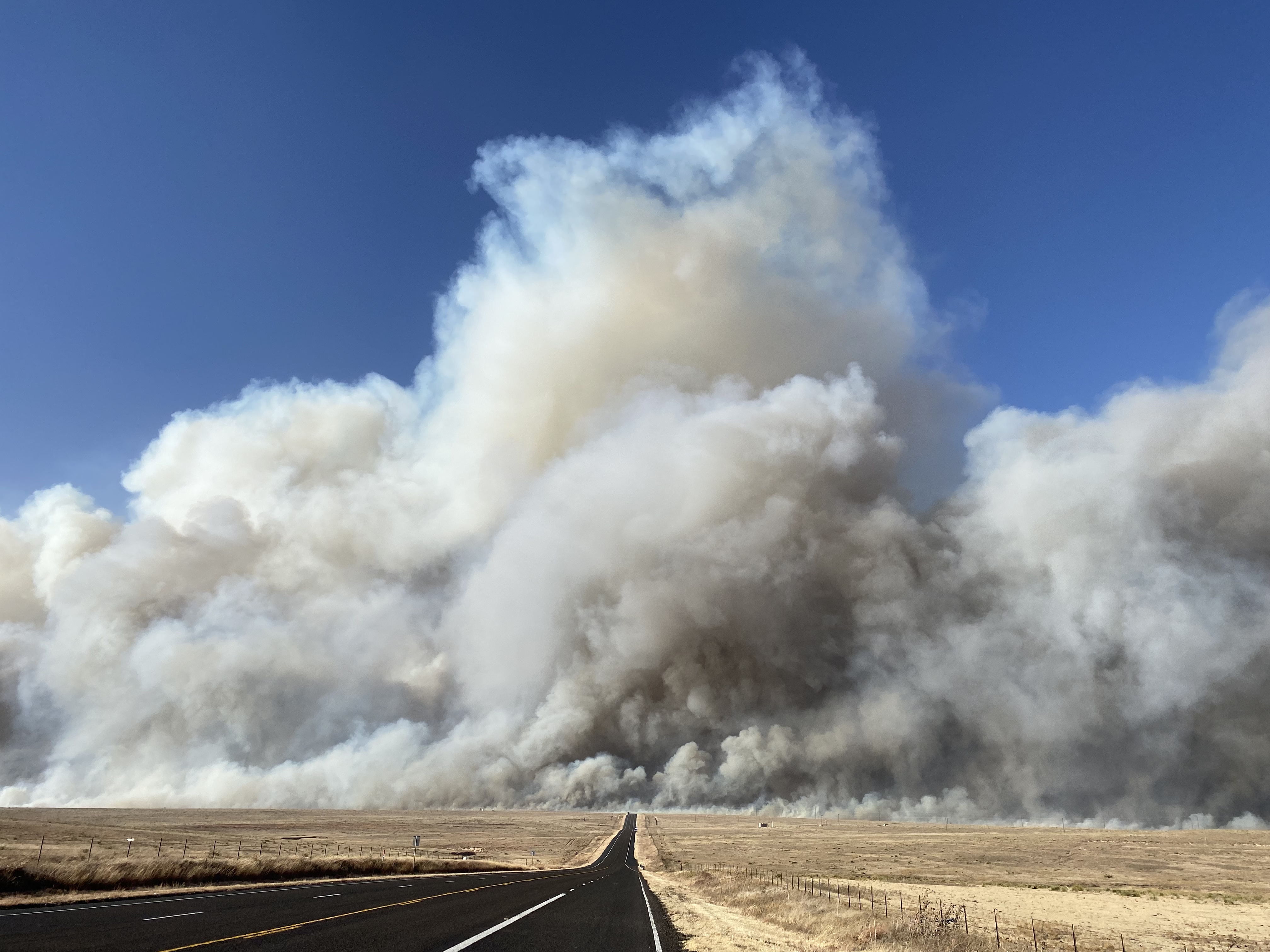
A potent storm system raced across Colorado and Kansas through the day, causing strong to extreme southwest to west winds across the area, but especially across the northern Texas and Oklahoma Panhandles. By mid-morning, winds were already gusting to well over 60 mph across the northwest half of the Panhandles. Wind gusts were measured at 70 to 90 mph by observation sites during the peak of the wind event which occurred between 11 am and 3 pm. Sustained winds ranged from 40 to 50 mph during this period and some site briefly measured sustained winds close to 60 mph. These winds led to damage to trees, powerlines, and roofs in areas where the strongest winds occurred. In addition, there were several reports of semi trucks being overturned across the area. Blowing dust caused widespread visibility reductions down to 1 to 3 miles and there were reports of localized areas where visibility dropped to less than a 1/4 mile leading to several major accidents and road closures. The combination of high winds, ongoing drought, and very dry conditions also led to 32 wildfires burned over 436,000 acres across multiple states. Three of the fires in the Panhandles were classified as significant wildfires as they raced uncontrolled across the landscape. The Parker Creek Fire (11,067 acres) started in northwest Oldham county, briefly threatened the city of Channing in southeast Hartley County and crossed into southwest Moore County before being contained with the help of agricultural barriers. The Cobb fire (7,987 acres as of Dec 16) started in Texas County and raced east threatening Guymon, prompting evacuations for the west side of the city before being controlled. The North 207 Fire (23,810 acres) started along Highway 207 in northern Carson County between Borger and Panhandle. This fire moved east across a canyon area and threatened Skellytown, prompting evacuations. This fire finally slowed its progress near the Pampa Airport and Wayside as winds subsided in the evening.
Photos
 |
 |
 |
 |
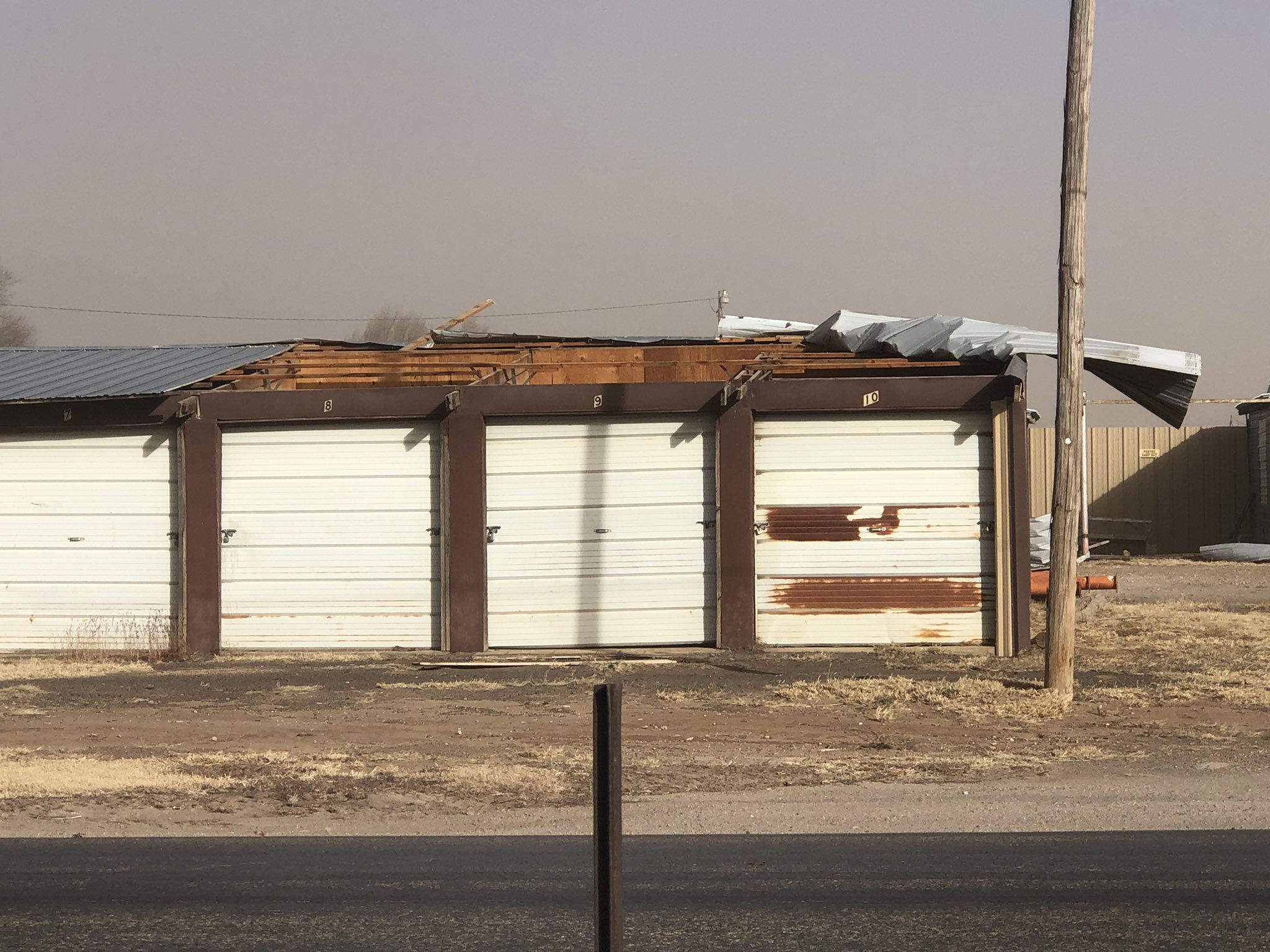
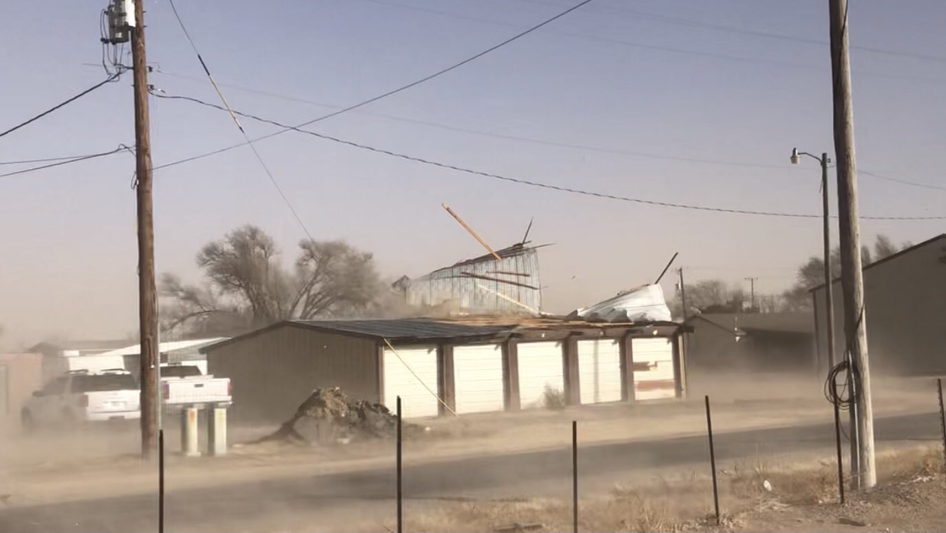
| Damage to storage building roof on 13th Street in Dalhart. (Aaron Graves) |
Damage to storage building roof on 13th Street in Dalhart. (Aaron Graves) |
Tree damage on 13th Street in Dalhart. (Aaron Graves) |
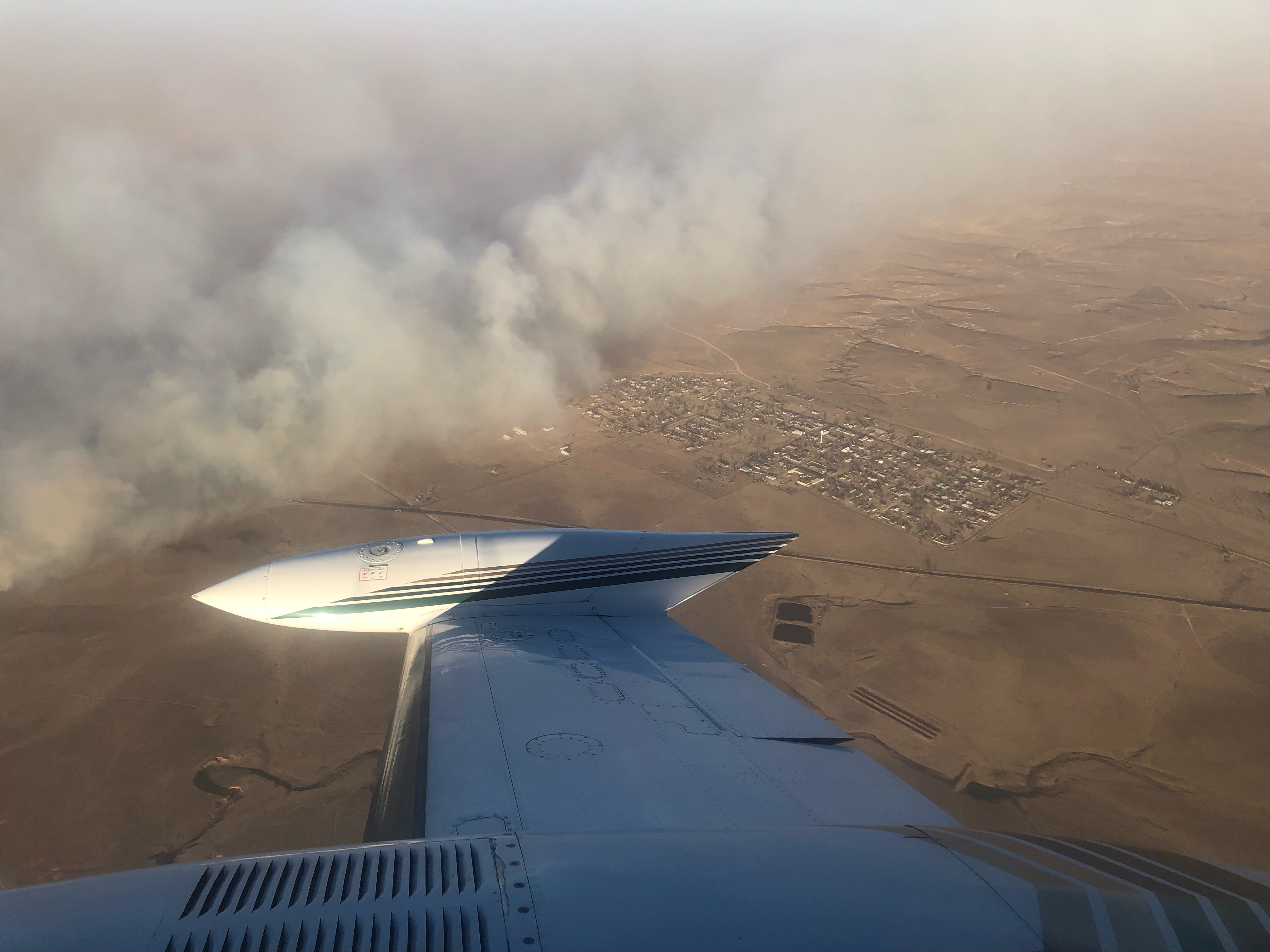
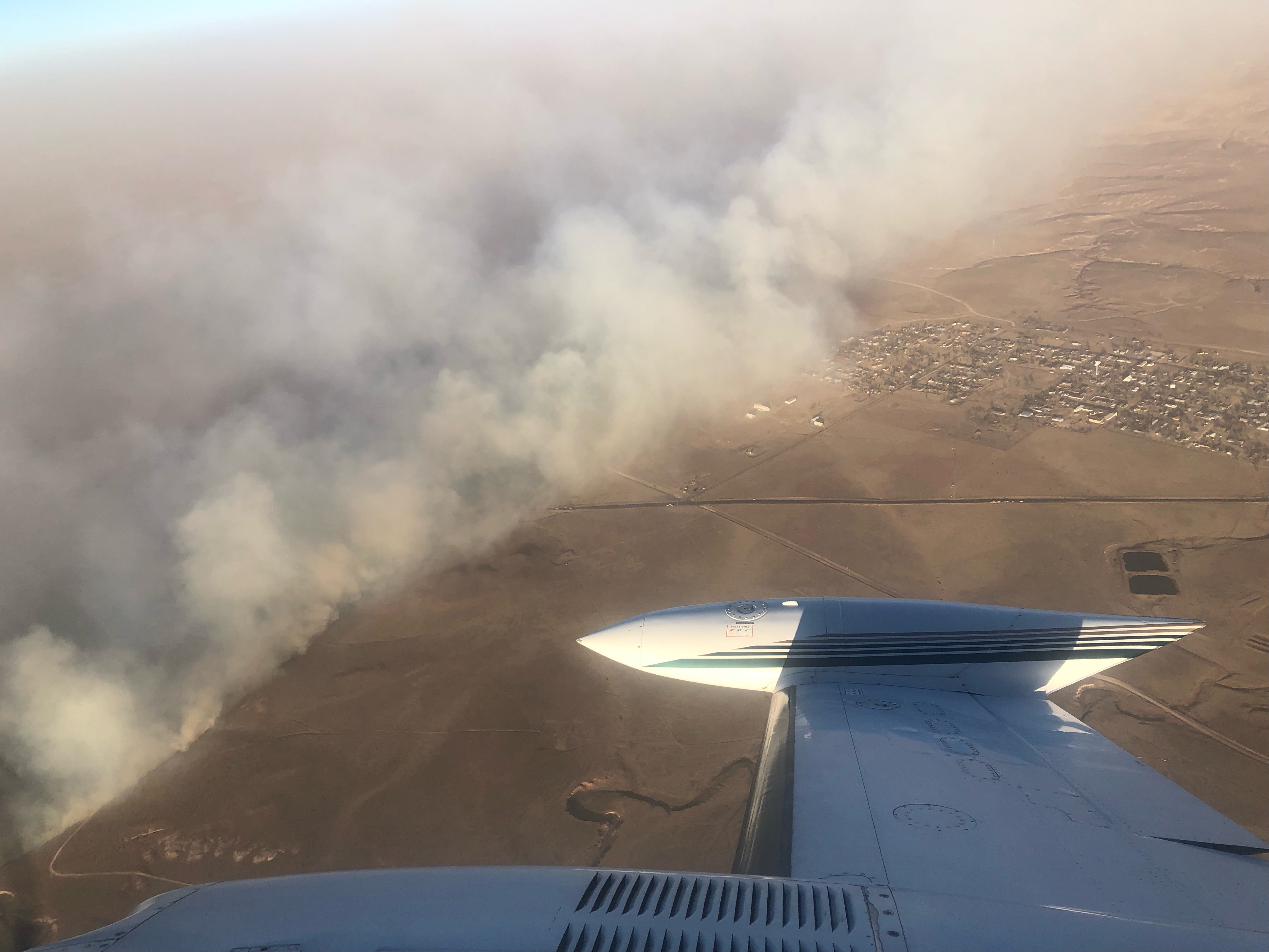
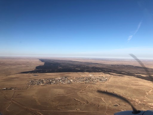
Aerial view of smoke from the North 207 Fire near Skellytown. (Texas Forest Service) |
 |
 |
 |
 |
| A different aerial view of smoke from the North 207 Fire near Skellytown. (Texas Forest Service) |
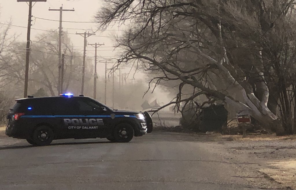
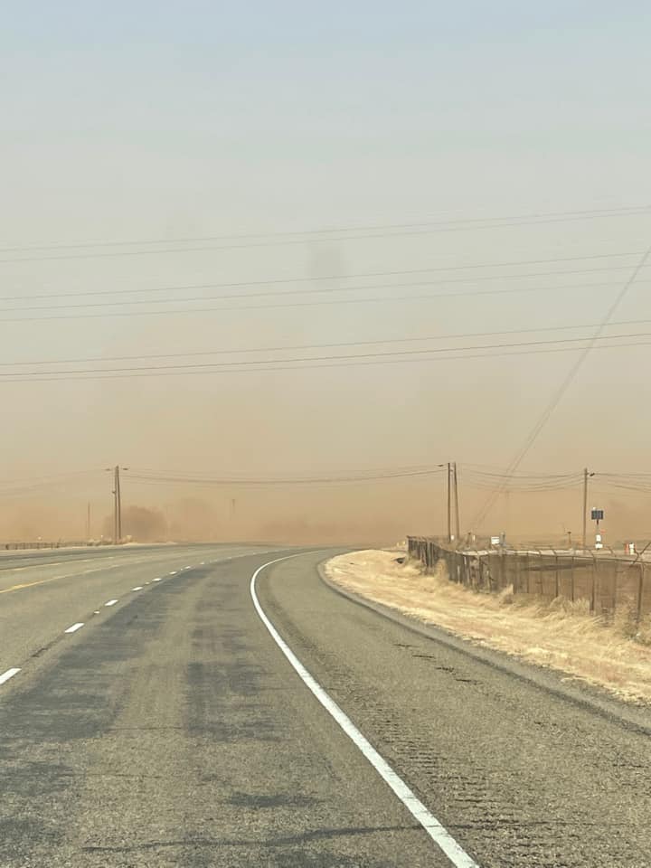
Low visibility due to blowing dust near 34th and Soncy in Amarillo. (Angel Tovar) |
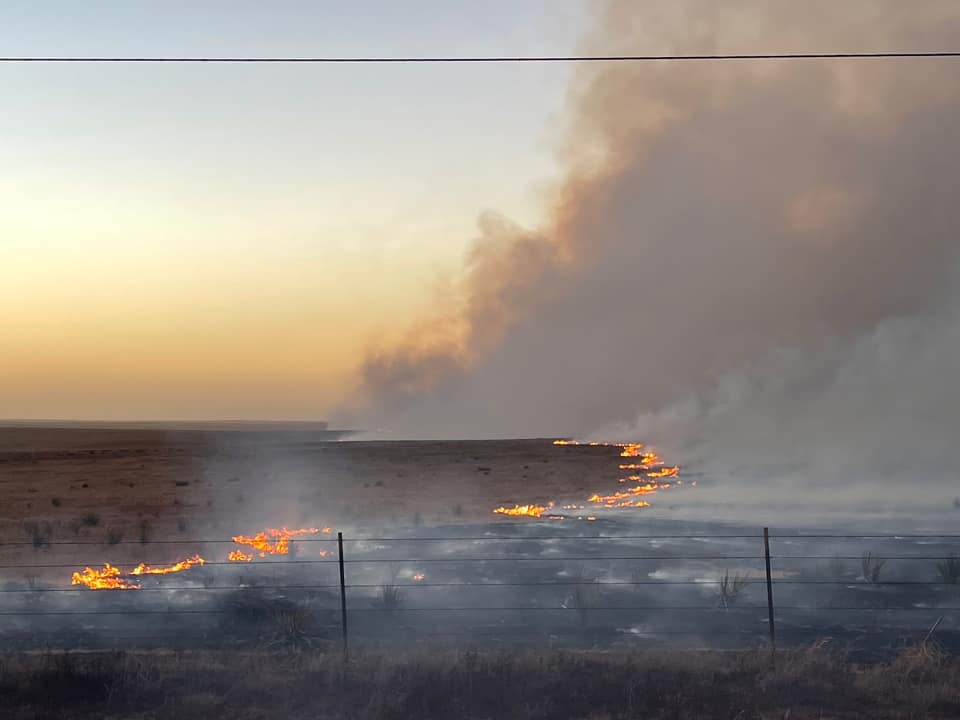
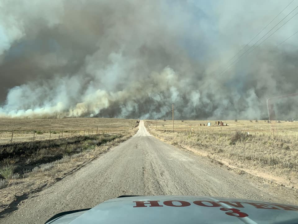
Edge of the North 207 Fire near Skellytown. (Cody McGehee) |
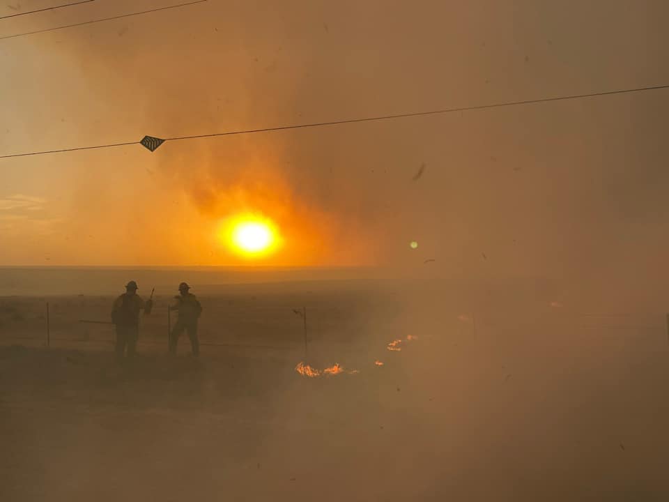
Edge of the North 207 Fire, smoke, and firefighters near Skellytown. (Cody McGehee) |
 |
 |
 |
 |
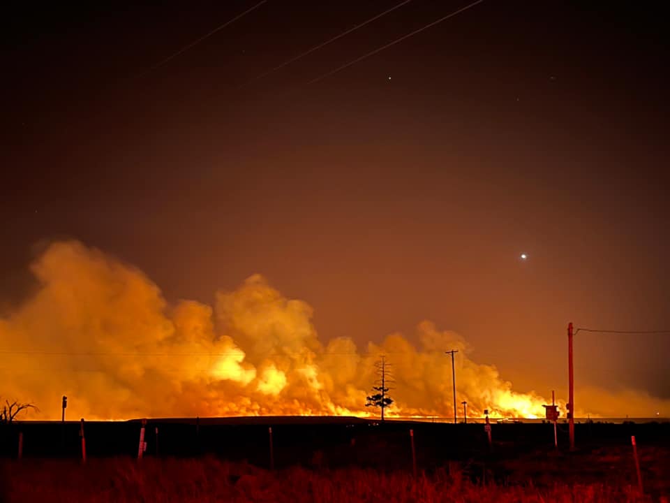
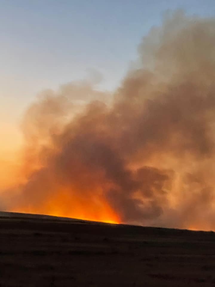
| Post sunset view of the North 207 Fire near Skellytown (Cody McGehee) |
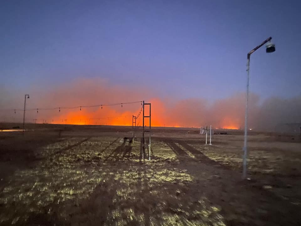
Smoke from the North 207 Fire looking north on Main Street near Skellytown (Donny Farmer) |
Smoke from the North 207 Fire looking north from Poplar Street in Skellytown (Donny Farmer) |
Semi-truck flipped near Booker (Isabel Aguilar) |
 |
 |
 |
 |
| Damage to a barn around 13 miles south of Guymon (Jessica Calsing) |
Smoke from the North 207 Fire seen from Pampa at dusk (Kalynn Curtis) |
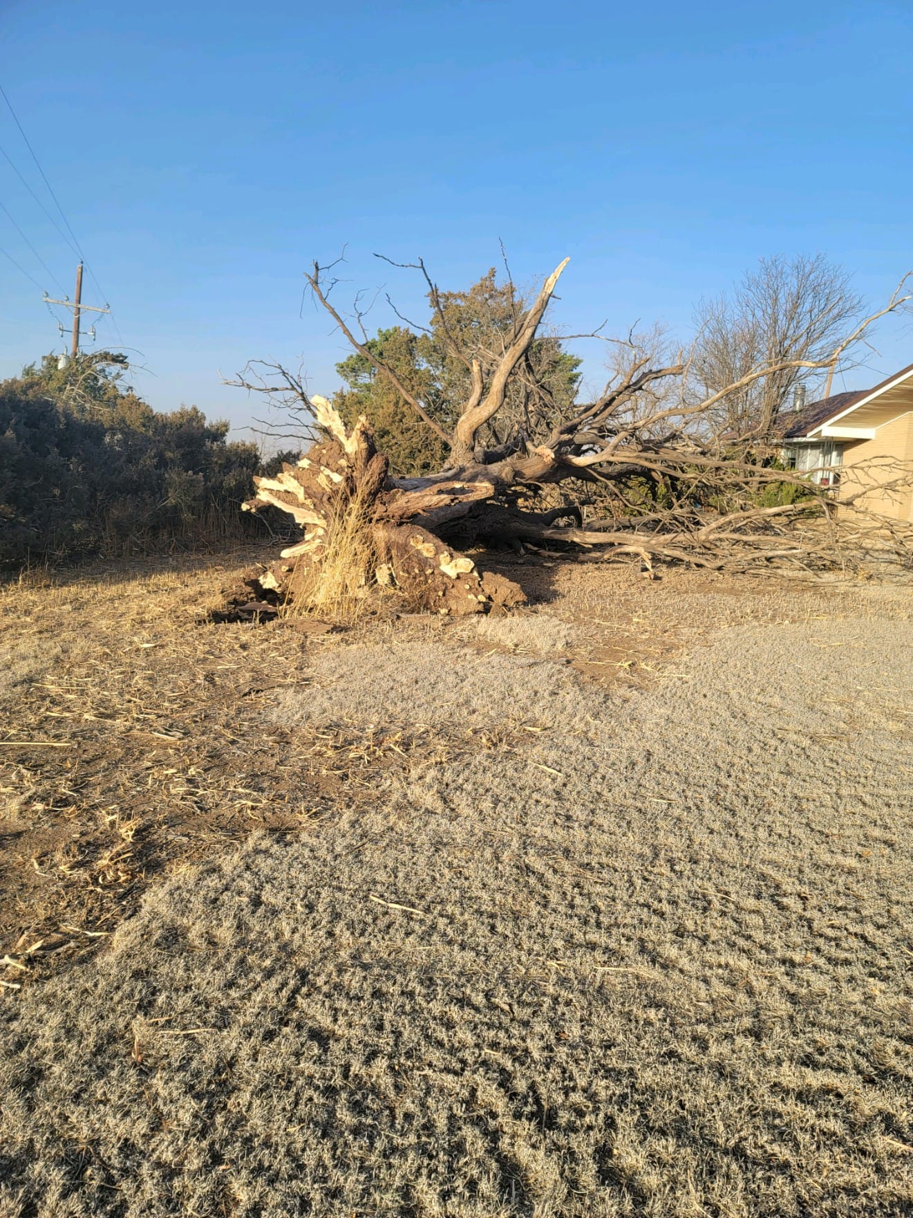
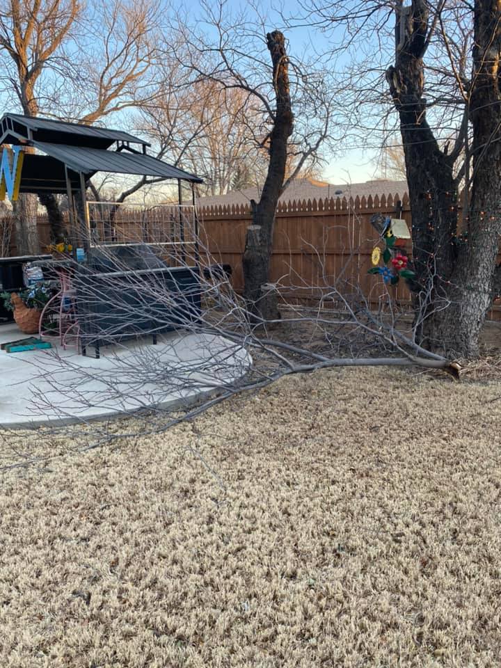
Tree downed in Sunray (Kimmy Craig) |
Blowing dust between Borger and Stinnett (Lindsey McFall Armstrong) |
 |
 |
 |
 |
| Large branch downed in Dalhart (Mary White) |
Smoke from the North 207 Fire as seen from Kentucky Acres near Dalhart (Michelle Osborn) |
Blowing dust in Sunray (Misti Loman) |
Blowing dust near 34th and Soncy in Amarillo (Monya Mullins-Ohm) |
 |
 |
 |
 |
| Smoke from the North 207 Fire near Skellytown (Jason Whisler) |
Aerial view of the burn scar from the North 207 Fire. Skellytown in the foreground. (Texas Forest Service) |
Smoke from the North 207 Fire near Skellytown (Theodore Meisel) |
Smoke from the North 207 Fire as seen from Telephone Pole Road near Skellytown (Bill Campbell) |
Radar & Satellite
Satellite view of wildfires from the Wednesday, December 15th, 2021 high wind and wildfire event in the Oklahoma and Texas Panhandles. Loop runs from 7 AM CST to 11 PM CST. Left image is GOES-16 shortwave infrared (3.9 micrometer) band, right image is the GOES-16 fire temperature RGB.
Radar detection of wildfire smoke from the Parker Creek, Corsino, and North 207 fires on Wednesday, December 15th, 2021 from the WSR-88D at Amarillo, TX. Radar loop runs from 10:41 AM CST to 2:22 PM CST. Left image is radar reflectivity, right image is correlation coefficient.
Wind Reports
...HIGHEST WIND GUSTS FROM THE PANHANDLES ON DECEMBER 15TH...

Location                     Speed     Time/Date       Provider
9 NNE Sunray                 90 MPH    1255 PM 12/15   WT Mesonet
4 WNW Stratford              84 MPH    1210 PM 12/15   WT Mesonet
2 ENE Goodwell               79 MPH    1225 PM 12/15   OK Mesonet
1 SSW Beaver                 78 MPH    0110 PM 12/15   OK Mesonet
9 NW Waka                    78 MPH    0126 PM 12/15   WT Mesonet
1 S Black Mesa Park          77 MPH    0955 AM 12/15   OK Mesonet
2 WNW Fritch                 77 MPH    0226 PM 12/15   WT Mesonet
3 SW Dalhart                 74 MPH    1017 AM 12/15   ASOS
2 N Spearman                 74 MPH    0155 PM 12/15   AWOS
1 WSW Hooker                 73 MPH    1135 AM 12/15   OK Mesonet
8 W Slapout                  73 MPH    0140 PM 12/15   OK Mesonet
6 ENE Amarillo               71 MPH    1120 AM 12/15   ASOS
11 S Romero                  71 MPH    0101 PM 12/15   WT Mesonet
4 E Vega                     70 MPH    1100 AM 12/15   WT Mesonet
3 SSE Boise City             70 MPH    0110 PM 12/15   OK Mesonet
4 E Perryton                 69 MPH    0215 PM 12/15   AWOS
3 SE Pantex                  68 MPH    1112 AM 12/15   WT Mesonet
2 N Stinnett                 68 MPH    0223 PM 12/15   WT Mesonet
6 WSW Adrian                 67 MPH    1027 AM 12/15   WT Mesonet
1 SSW Panhandle              67 MPH    1122 AM 12/15   WT Mesonet
2 ESE Pampa                  67 MPH    1214 PM 12/15   WT Mesonet
7 E Borger                   67 MPH    1234 PM 12/15   WT Mesonet
3 W Dumas                    67 MPH    0115 PM 12/15   AWOS
3 N Borger                   66 MPH    1103 AM 12/15   ASOS
11 NE Eva                    66 MPH    1250 PM 12/15   OK Mesonet
6 ESE Lora                   66 MPH    1253 PM 12/15   WT Mesonet
1 NW Boys Ranch              65 MPH    1050 AM 12/15   WT Mesonet
11 WNW Bootleg               64 MPH    1111 AM 12/15   WT Mesonet
2 WNW Hereford               64 MPH    1114 AM 12/15   WT Mesonet
10 ESE Valley de Oro         63 MPH    1059 AM 12/15   WT Mesonet
9 N Amarillo                 63 MPH    1106 AM 12/15   WT Mesonet
6 E Canadian                 63 MPH    1259 PM 12/15   WT Mesonet
2 WNW Lake Mcclellan         60 MPH    1231 PM 12/15   WT Mesonet
5 NNW Pampa                  59 MPH    0110 PM 12/15   AWOS
4 NNW Lake Tanglewood        58 MPH    1208 PM 12/15   WT Mesonet
3 NNE Umbarger               58 MPH    1232 PM 12/15   WT Mesonet
1 SW Canadian                58 MPH    1255 PM 12/15   AWOS
23 NW Codman                 58 MPH    1255 PM 12/15   AWOS

Observations are collected from a variety of sources with varying
equipment and exposures. We thank all volunteer weather observers
for their dedication. Not all data listed are considered official.
NWS Web Stories from Elsewhere
This storm system generated a swath of hazardous weather - including dust storms, wildfires, damaging winds from thunderstorms, damaging winds outside of thunderstorms, tornadoes, a few hail reports, and snow from the Rockies all the way to the Great Lakes. Here are other NWS offices' web stories covering what occurred in each of their areas of responsibility.
 |
Media use of NWS Web News Stories is encouraged! Please acknowledge the NWS as the source of any news information accessed from this site. |
|

