
Severe thunderstorms are forecast through this weekend along a slow moving cold front and secondary storm system that will impact areas from the southern Plains to the Great Lakes. Large hail and isolated damaging wind gusts are the main threats with these storms along with a risk for heavy to excessive rainfall which could bring flooding. Read More >
Overview
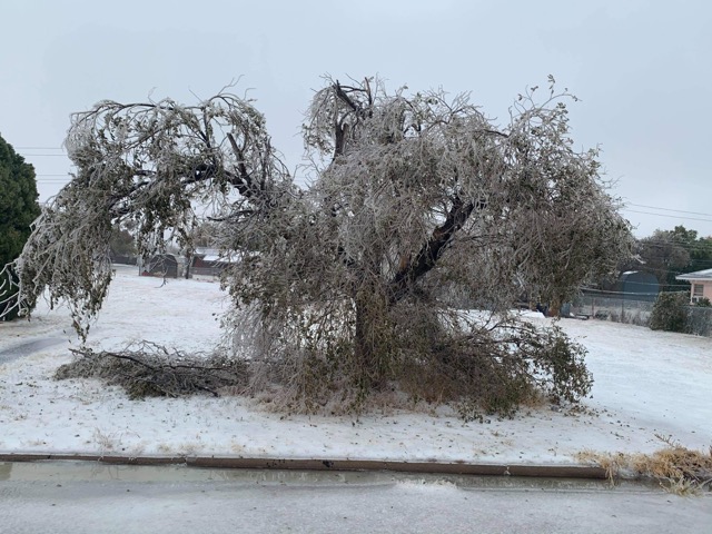
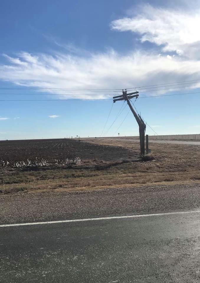
A record cold arctic air mass for late October moved across the high plains on Sunday, October 25th as a major winter storm slowly developed over the Desert Southwest. This combination led to three significant wintry precipitation episodes from Monday night through early Thursday morning. The initial precipitation event on Monday night included a wintry mix of sleet and freezing rain in the central and eastern Panhandles with heavy snow across portions of the northern Panhandles. Impacts from this first event were mainly poor travel conditions due to icy roads which led to numerous school and business delays and closures. Most of the freezing rain came from the second precipitation episode Tuesday night into early Wednesday across the southeast Texas Panhandle when ¼ to ¾” ice accumulations occurred. Additional sleet and snow accumulations occurred further west where deeper cold air existed. This again led to significant travel issues, but also caused numerous power outages and tree damage in areas hardest hit by ice, with the majority of several counties left without power for multiple days. One final precipitation episode occurred as the main storm system crossed Texas just south of the Texas Panhandle Wednesday night into early Thursday morning. This precipitation fell in the form of rain across the northern Panhandles and the southeast Texas Panhandle where temperatures had managed to increase into the mid 30s, but heavy snow occurred in the central and southwest Texas Panhandle where temperatures remained in the low 30s. The combination of windy conditions and heavy snow, with rates of over 2 inches per hour at times, led to treacherous travel due to poor visibility and rapid snow accumulations on roadways. With trees and powerlines still heavy due to ice from previous freezing rain events, strong winds and heavy wet snow led to additional power outages. Snow and ice melted rapidly off roadways on Thursday and travel greatly improved by midday.
 |
 |
 |
 |
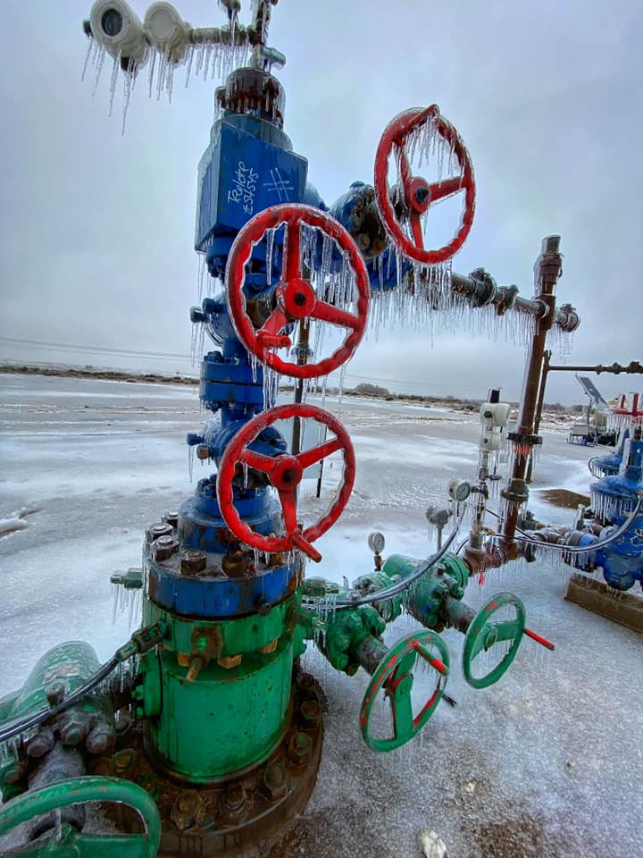
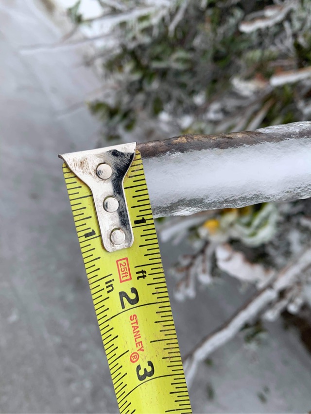
| 3S Canadian, TX - Ice (Casey Long) |
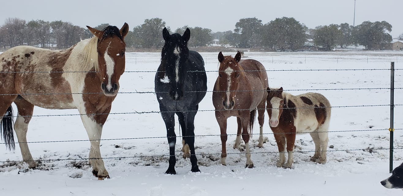
Hereford - Horses (Becca Noggler) |
Amarillo - Collapsed Parking Cover (Rachel Goehring) |
Amarillo - Snowman (Ashley Parks) |
 |
 |
 |
 |
| Dumas - Ice (Danny Montanez) |
Amarillo - Downed Trees (Miuriel Flores) |
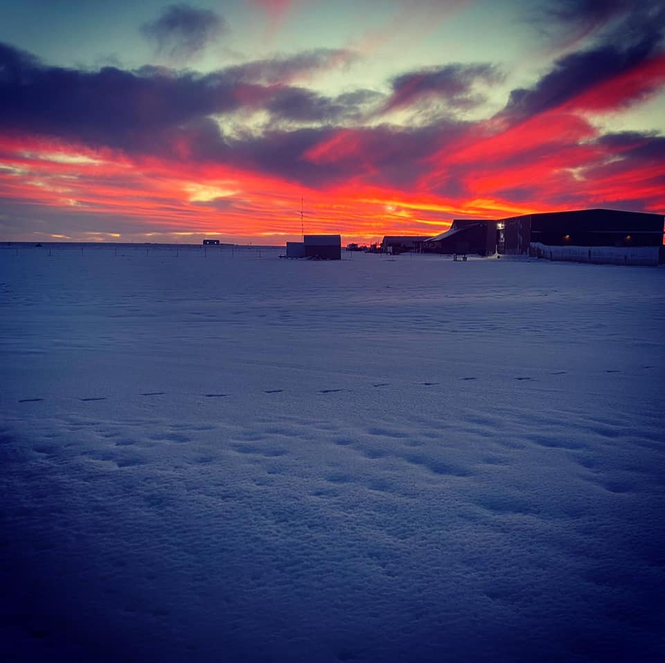
4S Bushland - Snow Sunset (Bryan Yeast) |
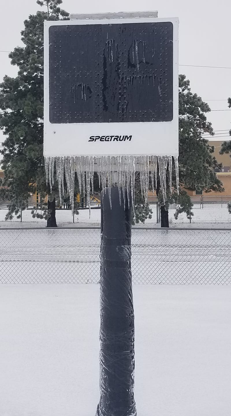
Borger - Ice (Sarah Richter) |
 |
 |
 |
 |
| Pampa - Downed Trees and Branches (Blake Brown) |
Pampa - Ice (Blake Brown) |
Ice caused multiple power outages (Greenbelt Electric Cooperative) |
One of many snapped poles they repaired (Greenbelt Electric Cooperative) |
 |
.jpg) |
 |
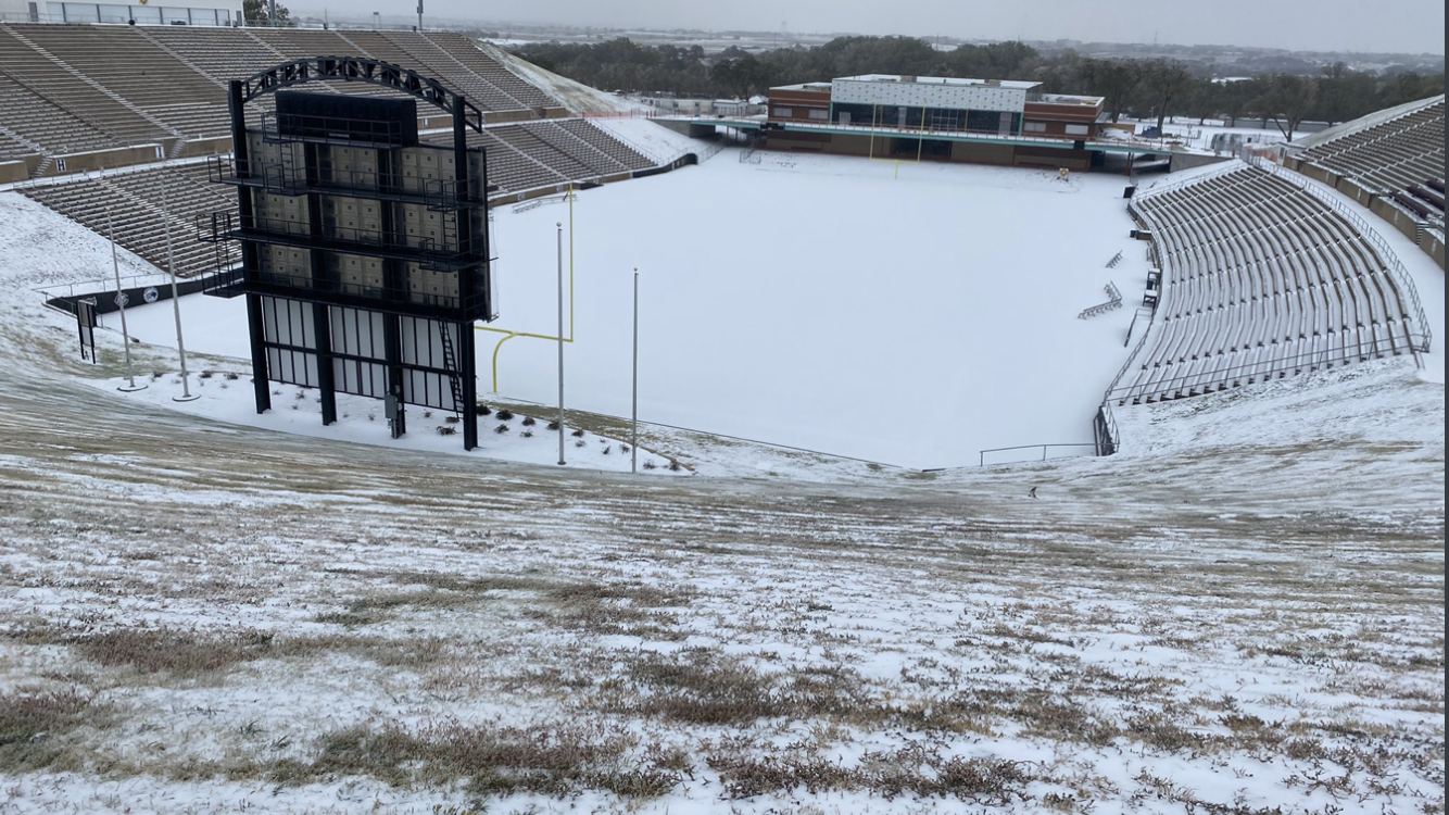
| Canyon Happy State Bank Stadium (Toby Tucker) |
Fritch- Snow (Rachel Fisher) |
Follett- Ice (Roxanna Matthews) |
 |
 |
 |
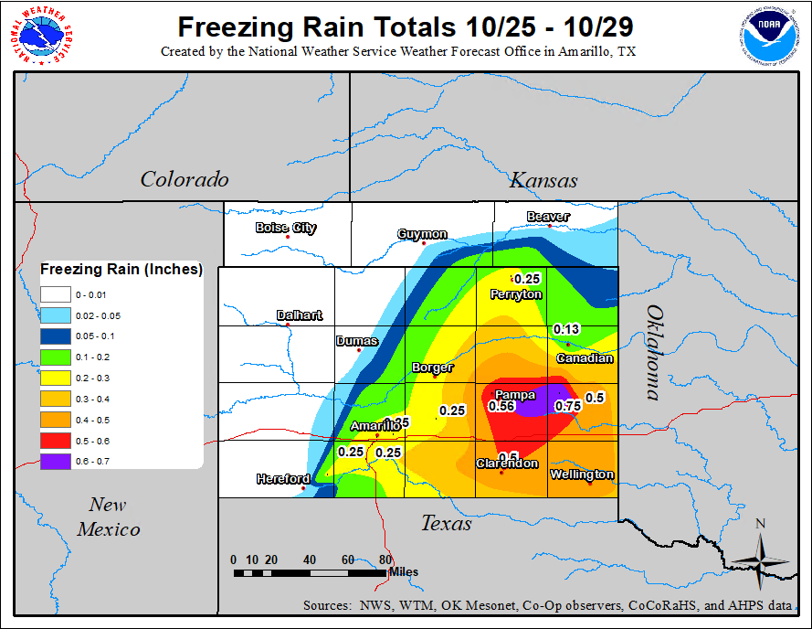
| Estimated Ice Accumulation Totals (NOAA/NWS) |
Estimated Snowfall Totals (NOAA/NWS) |
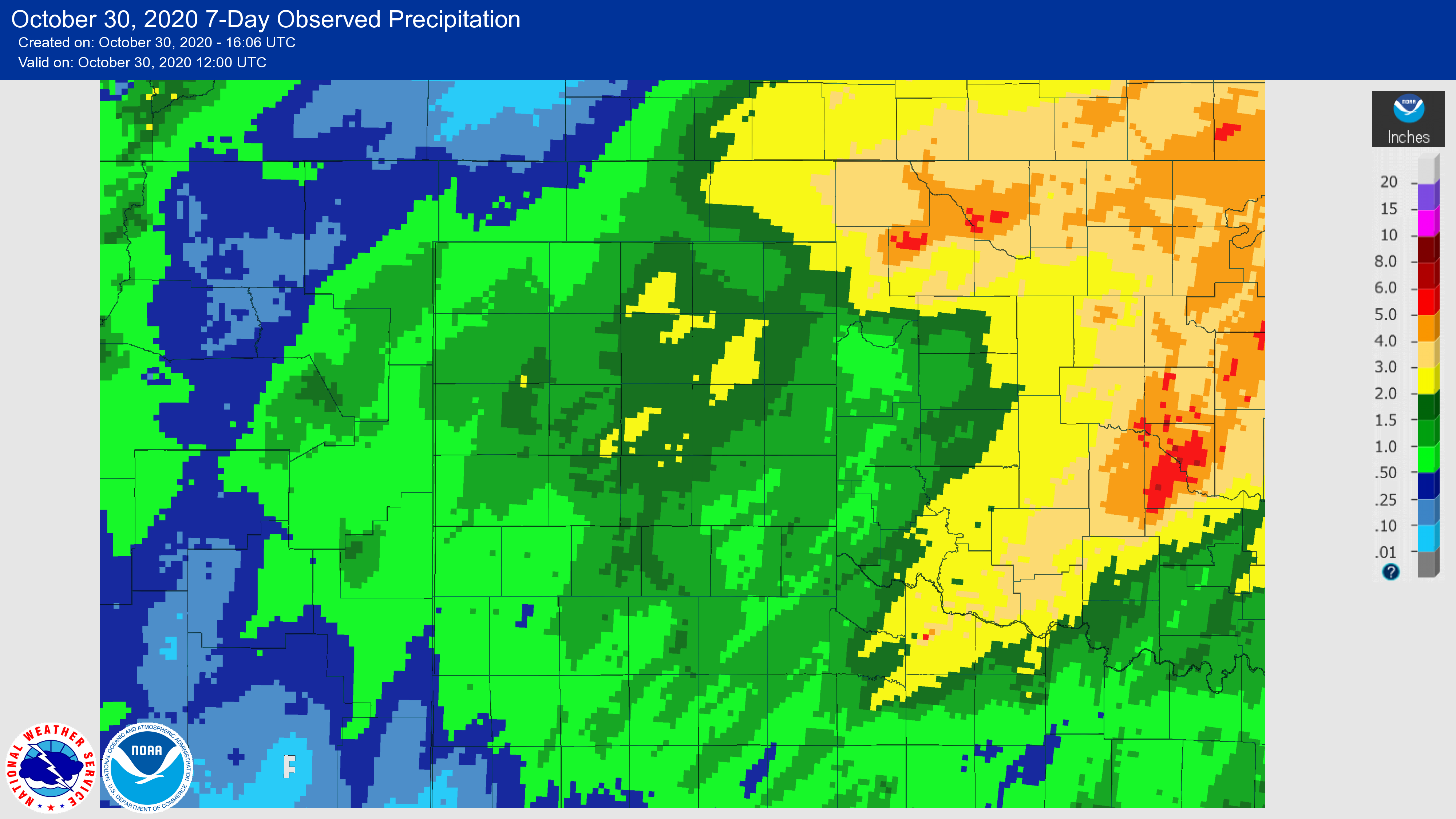
Observed Precipitation Totals (NOAA/NWS) |
 |
.gif) |
 |
|
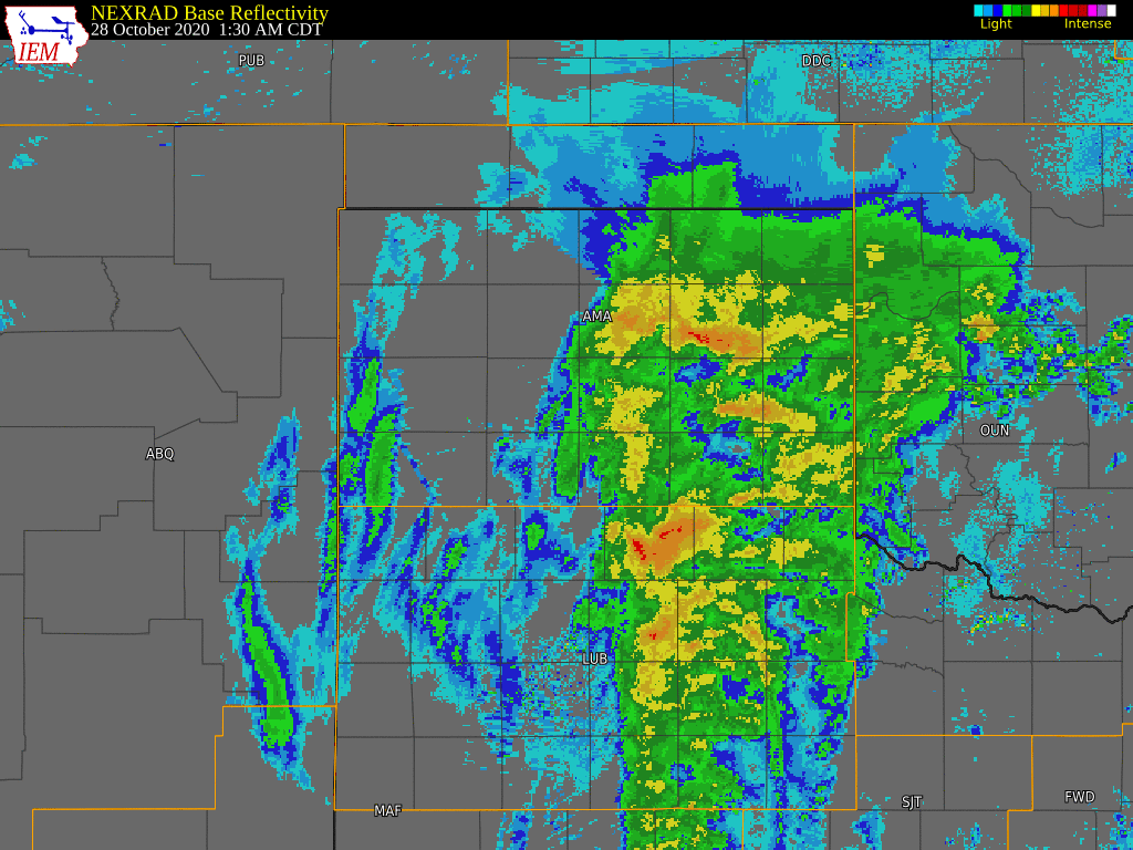
| Radar Imagery with Reports (Iowa Environmental Mesonet/NWS) |
Snow Melt Oct 29th (NOAA/NWS) |
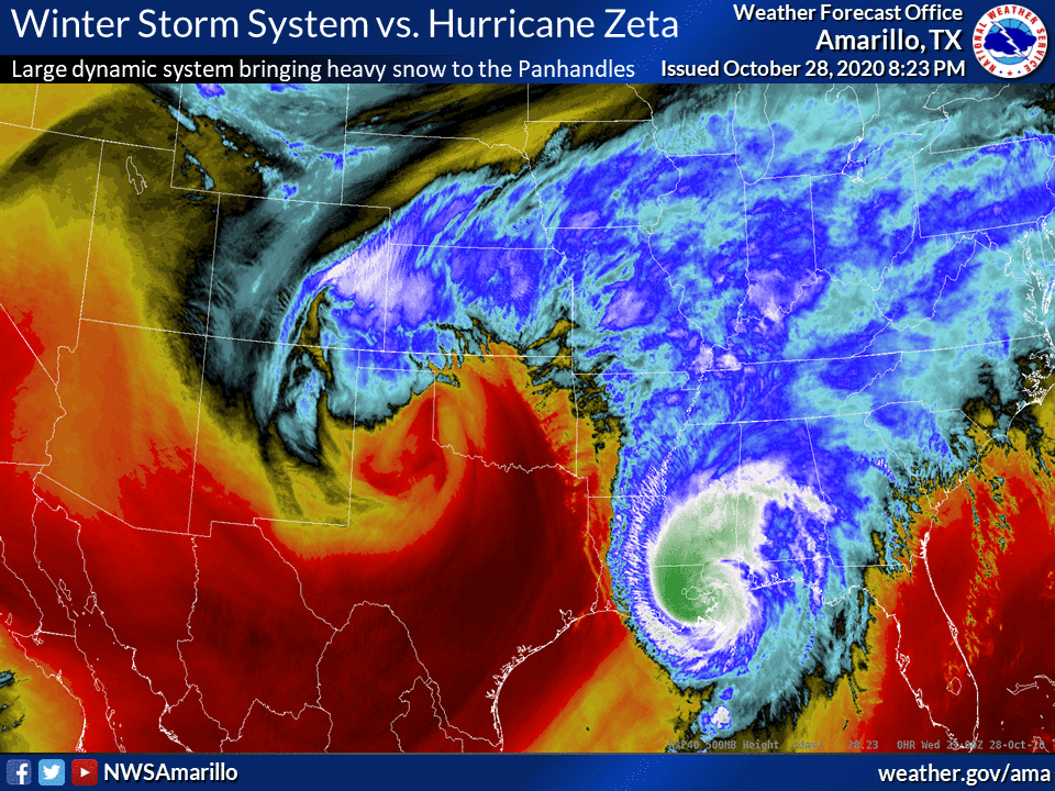
Satellite Imagery of Winter Storm Vs. Hurricane Zeta (NOAA/NWS) |
|
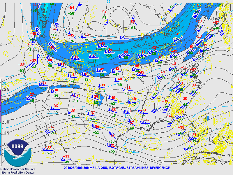
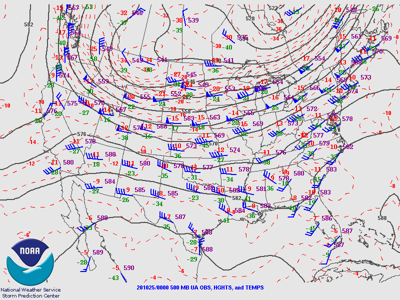
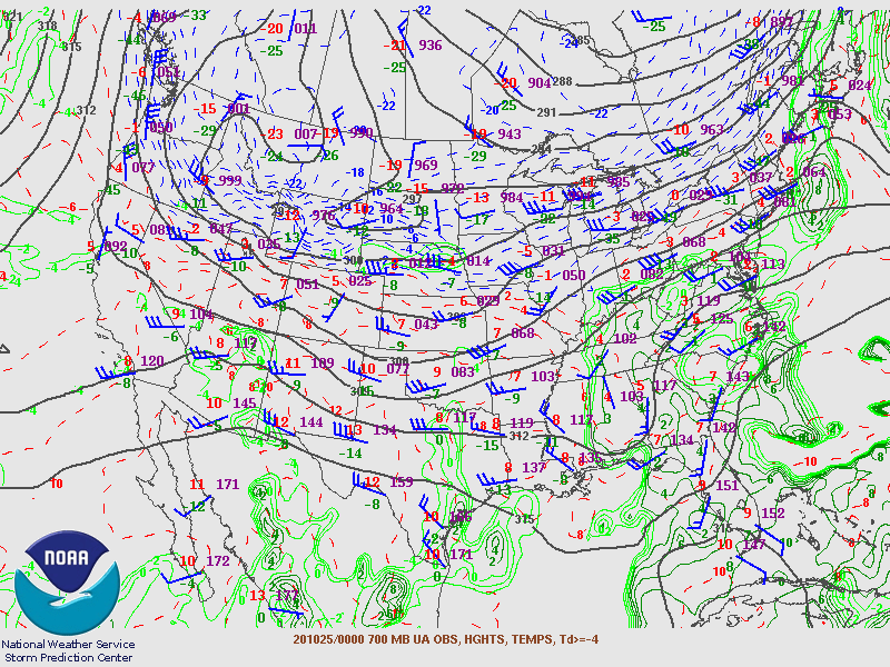
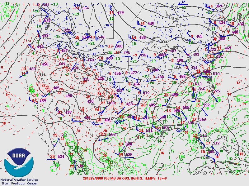
On Sunday, October 25th, a deepening upper level trough was evident over the Great Basin. As the low pushed southward, it eventually became cut-off and a strong dynamic system slowly meandered through the Desert Southwest before crossing over West Texas. Several ingredients came together with this system: very cold arctic air at the surface, moisture moving in on moderate return flow, and lift spreading over the area due to shortwaves moving across the Intermountain West.
 |
 |
 |
| 300mb Upper Air Observations (NOAA/NWS SPC) |
500mb Upper Air Observations (NOAA/NWS SPC) |
700mb Upper Air Observations (NOAA/NWS SPC) |
 |
 |
| 850mb Upper Air Observations (NOAA/NWS SPC) |
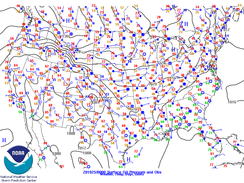
Surface Upper Air Observations (NOAA/NWS SPC) |
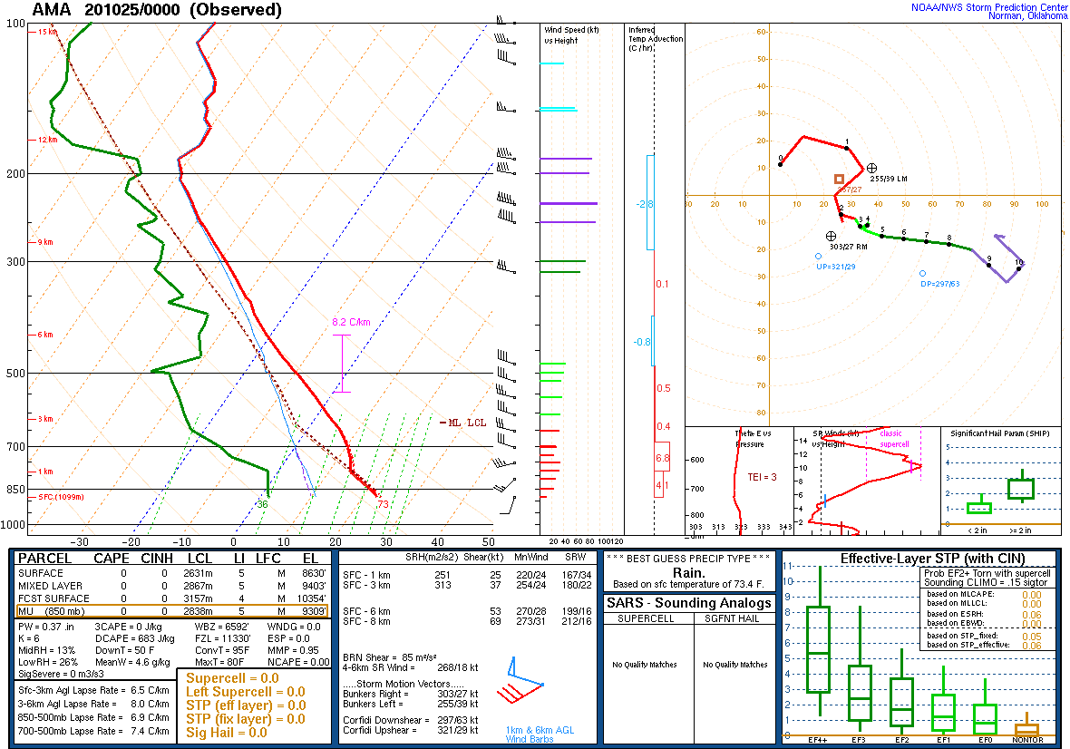
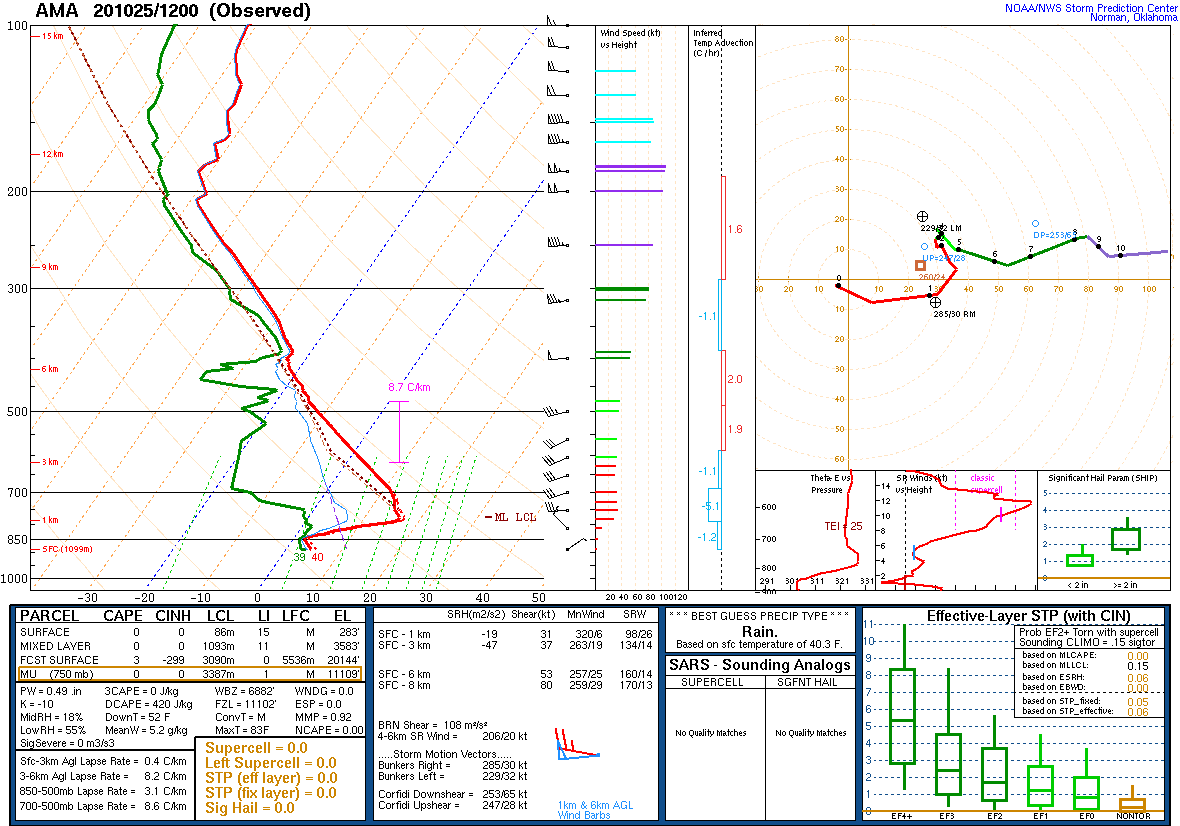
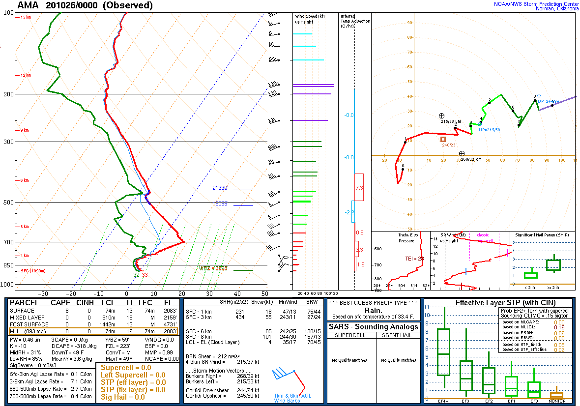
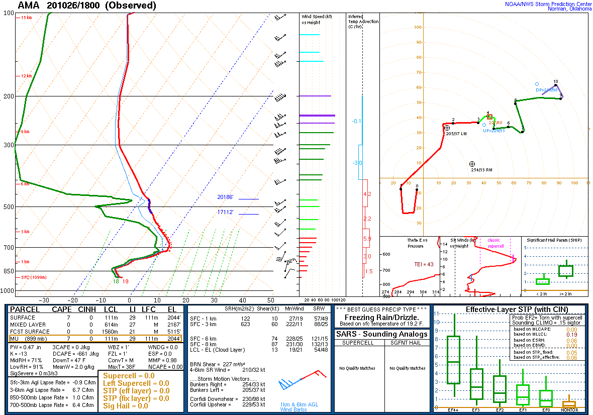
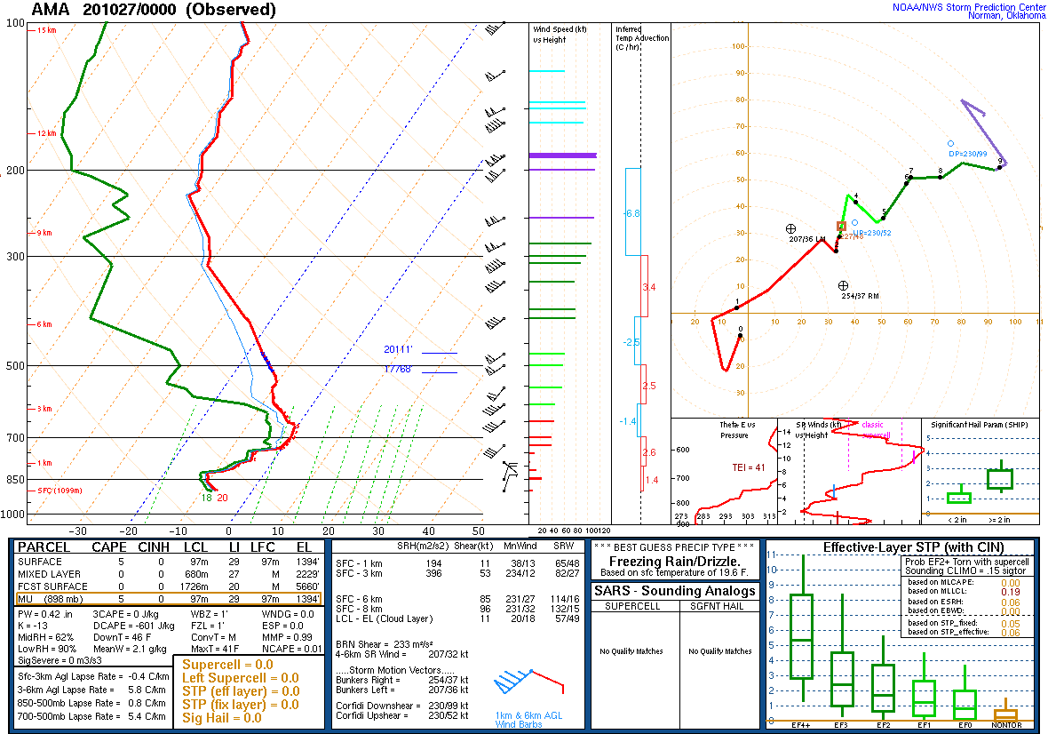
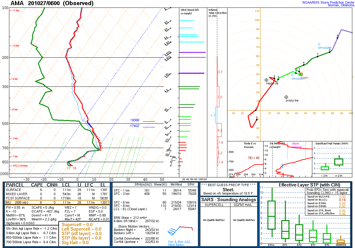
By Monday, October 26th, the position of the upper low allowed for broad large scale accent over the Panhandles where a cold airmass was in place. The northwestern combined Panhandles received the most snow, as this area was colder aloft and saw more periods of snow banding. Some areas in the far northwest saw over 15 inches of storm total snow (adding at least 3 separate rounds of snow from Sunday night through Wednesday night). The central Panhandles (including Amarillo - see sounding images below) saw more of a winter mix, starting with mostly sleet through Monday, then freezing rain on Tuesday, then snow on Wednesday as the main system moved across. The sleet and freezing rain occurred due to a persistent layer of warm air aloft, which finally cooled below freezing as the main dynamic low moved over on Wednesday evening. The eastern zones also saw a mixture of precipitation types, but freezing rain was dominant (along with some periods of rain).
 |
 |
 |
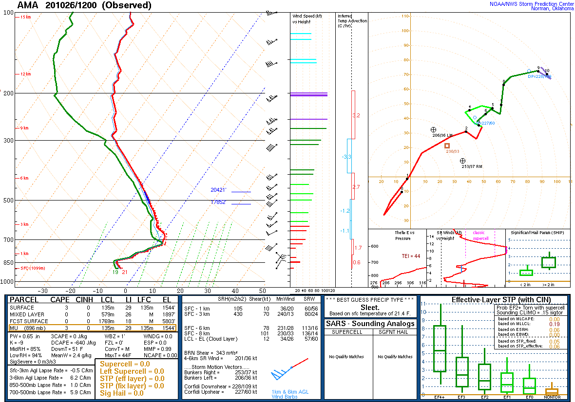 |
| Amarillo Sounding - 7PM Oct 24 (NOAA/NWS SPC) |
Amarillo Sounding - 7AM Oct 25 (NOAA/NWS SPC) |
Amarillo Sounding - 7PM Oct 25 (NOAA/NWS SPC) |
Amarillo Sounding - 7AM Oct 26 (NOAA/NWS SPC) |
 |
 |
 |
 |
| Amarillo Sounding - 1PM Oct 26 (NOAA/NWS SPC) |
Amarillo Sounding - 7PM Oct 26 (NOAA/NWS SPC) |
Amarillo Sounding - 1AM Oct 27 (NOAA/NWS SPC) |
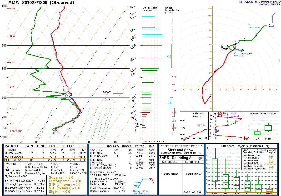
Amarillo Sounding - 7AM Oct 27 (NOAA/NWS SPC) |
 |
 |
 |
 |
| Amarillo Sounding - 1PM Oct 27 (NOAA/NWS SPC) |
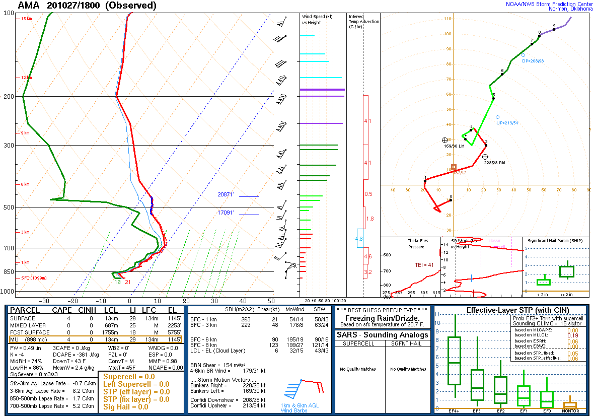
Amarillo Sounding - 7PM Oct 27 (NOAA/NWS SPC) |
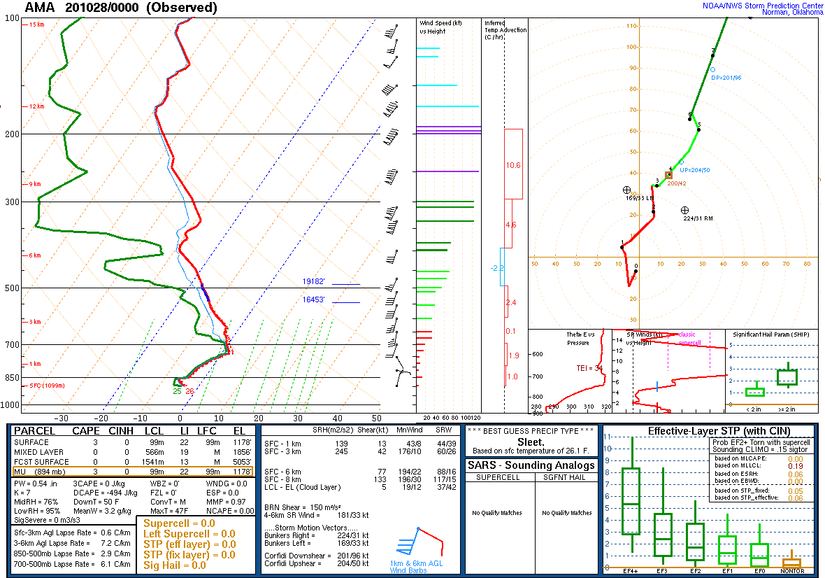
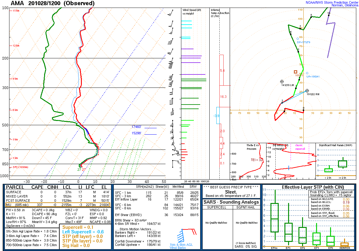
Amarillo Sounding - 1AM Oct 28 (NOAA/NWS SPC) |
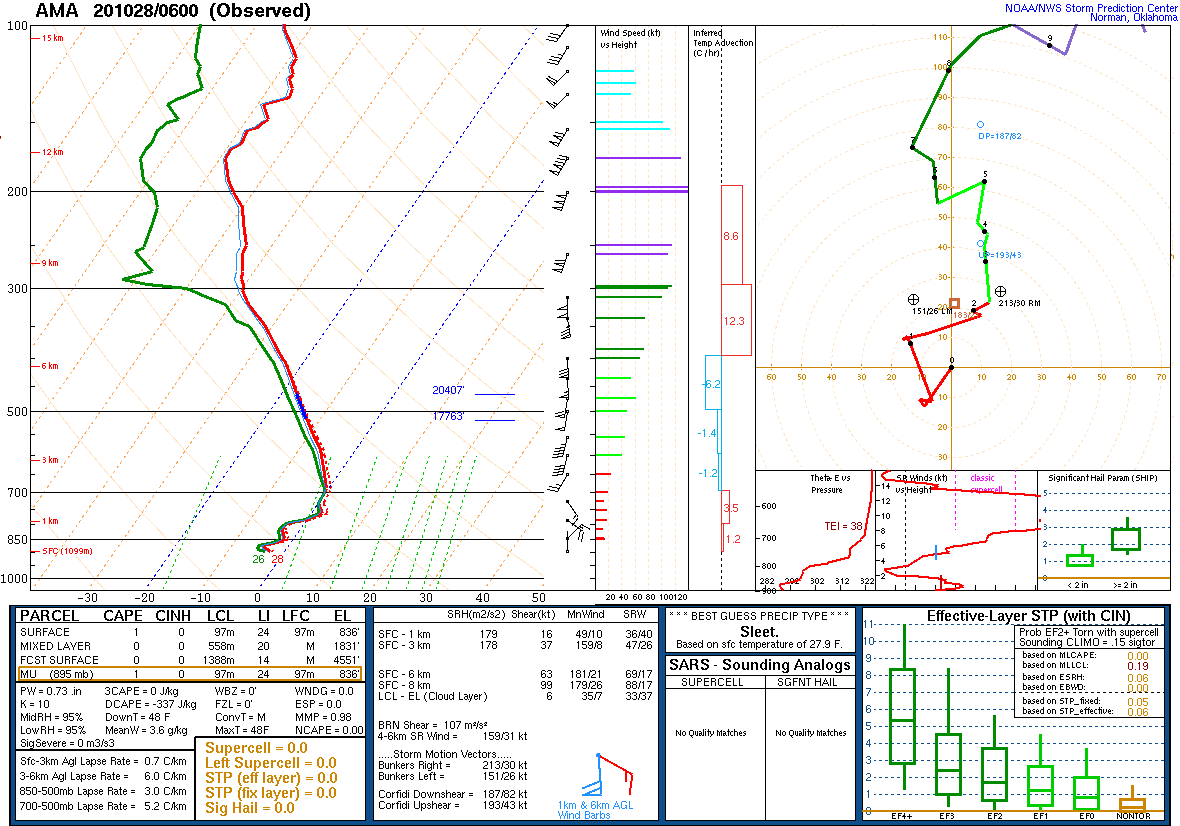
Amarillo Sounding - 7AM Oct 28 (NOAA/NWS SPC) |
 |
 |
|
 |
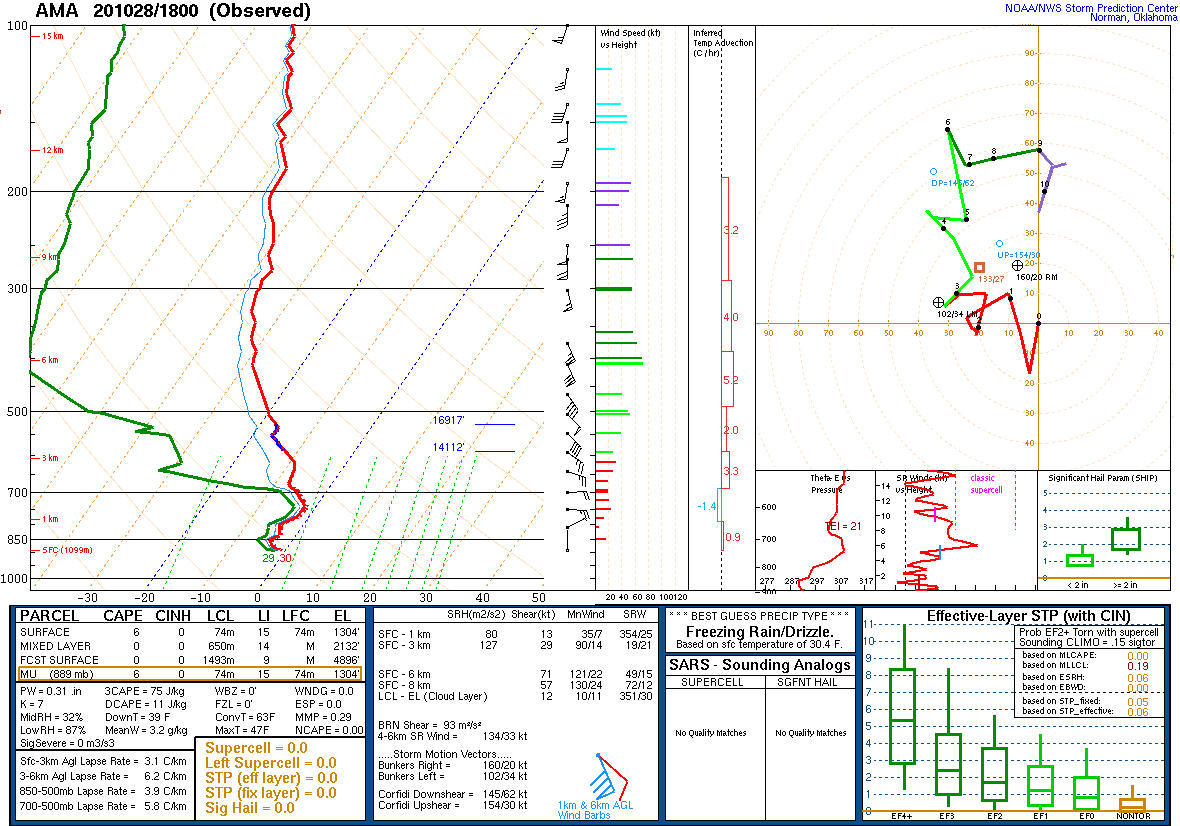
| Amarillo Sounding - 1PM Oct 28 (NOAA/NWS SPC) |
Amarillo Sounding - 7PM Oct 28 (NOAA/NWS SPC) |
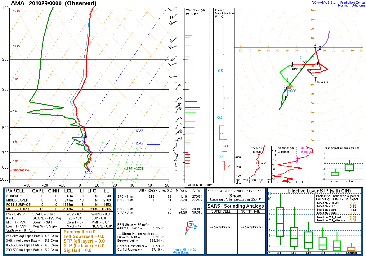
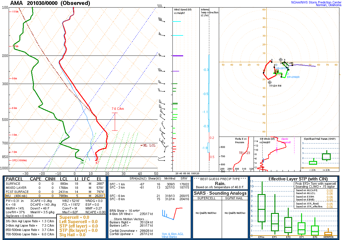
Amarillo Sounding - 7AM Oct 29 (NOAA/NWS SPC) |
Amarillo Sounding - 7PM Oct 29 (NOAA/NWS SPC) |
New Records for Amarillo (Previous Record/Date)
| October 26 | October 27 | October 28 | October 29 |
|---|---|---|---|
| Record Low: 18 (19 1997) | Record Low: 18 (22 1997) | Record Snow: 4.5 (3.0 1976) | Record Snow: 0.6 (0.5 1976) |
New Records for Dalhart (Previous Record/Date)
| October 25 | October 26 | October 27 | October 28 |
|---|---|---|---|
| Record Low: 24 (24 1997) | Record Low: 17 (24 2019) | Record Low: 17 (22 2012) | Record Snow: 4.8 (T 2019) |
| Record Snow: 2.4 (1.0 1970) | Record Snow: 1.6 (1.0 1970) |
New Records for Borger (Previous Record/Date)
| October 26 | October 27 | October 28 |
|---|---|---|
| Record Low: 22 (25 1997) | Record Low: 21 (25 1997) | Record Precipitation: 1.08 (0.41 1991) |
 |
Media use of NWS Web News Stories is encouraged! Please acknowledge the NWS as the source of any news information accessed from this site. |
|

