
Life-threatening, potentially catastrophic flash flooding expected along the central Gulf Coast as the remnants of Arthur track across the area. Isolated brief tornadoes and damaging gusts remain possible overnight in the Southeast. Isolated to scattered dry thunderstorms may cause lightning-ignited fires and erratic behavior due to gusty winds across parts of the West Friday. Read More >
Overview
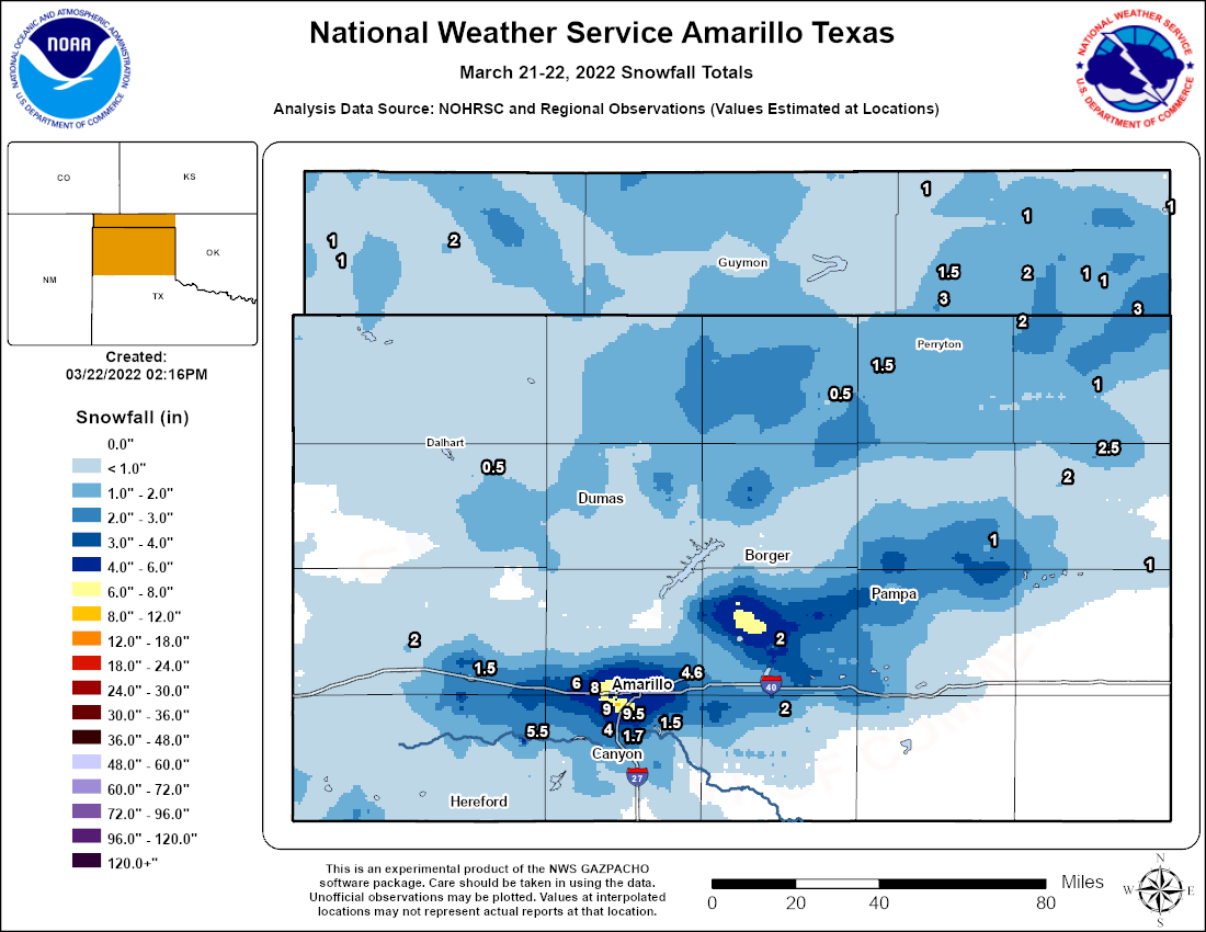
An upper level low over southern New Mexico with an associated surface low in eastern New Mexico on the morning of the 21st was moving east towards west Texas. The main upper level 500 mb low was near Midland, Texas by the afternoon of the 21st while the surface low was near Silverton around the same time frame. Out ahead of the main cyclonic flow, showers and low topped thunderstorms developed along a surface trough that was situated across the south central Texas Panhandle. These low topped thunderstorms that developed in the aforementioned area of the surface trough did grow enough in the vertical to produce hail size from pea up to 0.5" in parts of western Amarillo. As this broad southerly flow was producing showers and low topped storms in the southern TX Panhandle, further to the northwest, a cold front was entering the northwestern Panhandles where snow was reported as early as 1-2 PM CDT in areas behind the passing cold front. Going forward to around 4 PM CDT, due to enough instability, a rogue wind gusts near 60 MPH for areas just east of Amarillo is where a severe thunderstorm warning was issued. Back to the SW TX Panhandle behind the front, steep height falls caused some non-thunderstorm high wind gusts to be reached. The main cold front continued to move east before mixing out as it reached Gray and Armstrong counties. Cyclonic flow continued to advect moisture back over what is now a stalled front just south of US Highway 60 and with cold air advection in the wake of the cold front. This resulted in precipitation further developing along an area from Amarillo northeast towards Pampa where dynamic cooling and higher precipitation rates changed the precipitation from rain to snow. Snow was reported across many areas of the Panhandles for several hours into the morning of the 22nd before the system exited the region past sunrise. Snowfall totals ranged from a trace up to 9.5" in portions of southwest Amarillo where the best deformation band set up. Peak non-thunderstorm wind gusts were as high as 64 MPH for portions of the western Texas Panhandle.Snow/Ice
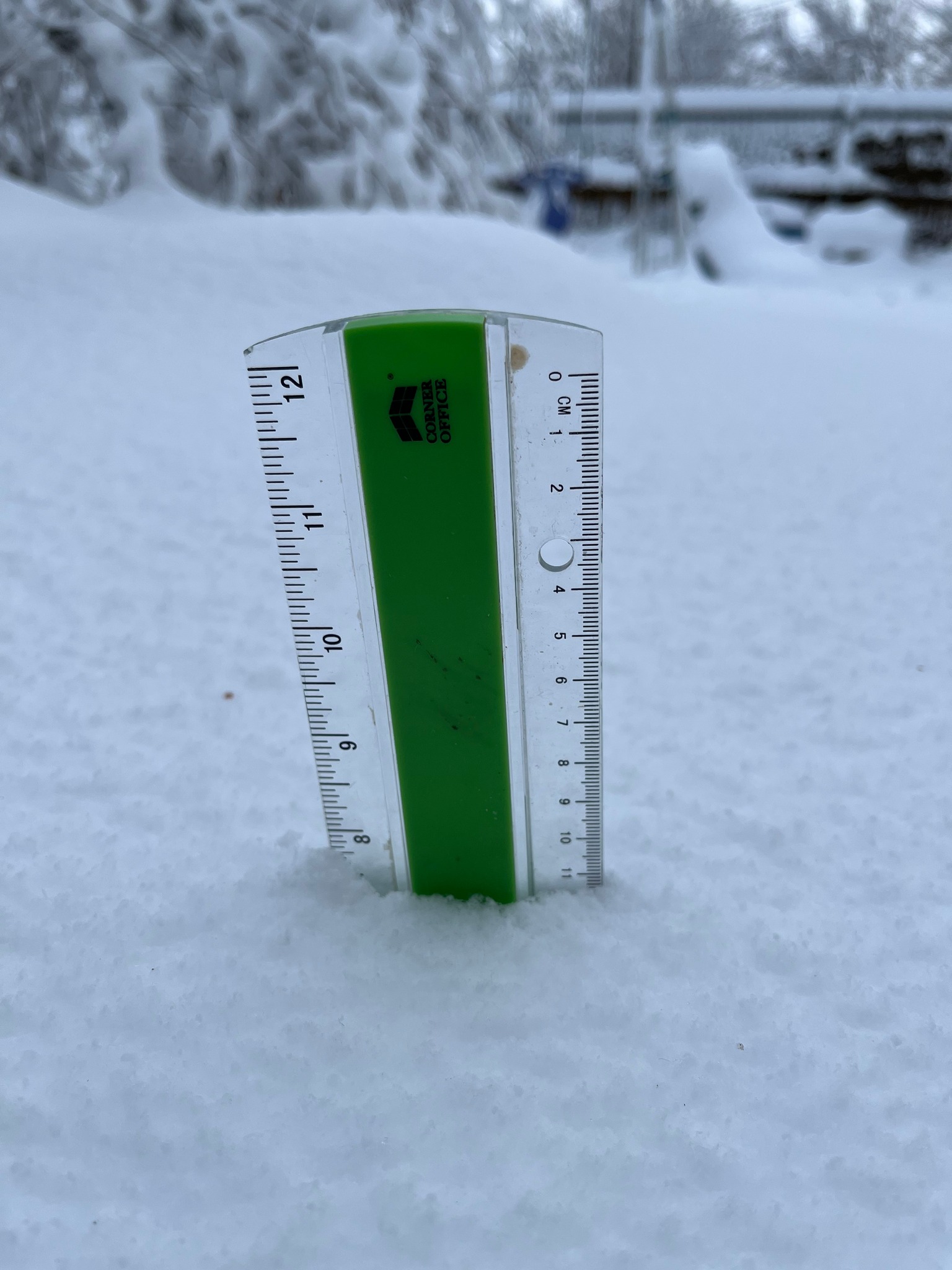
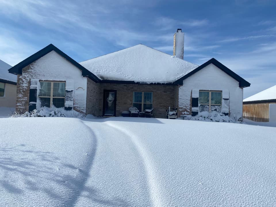
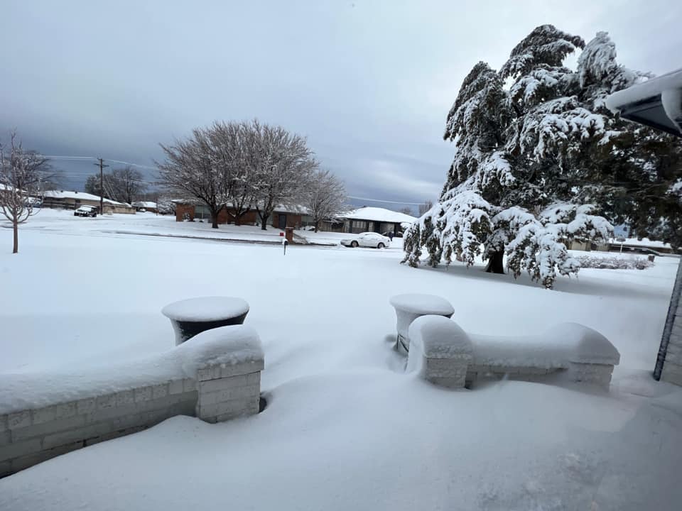
Photos & Video
Header
 |
 |
 |
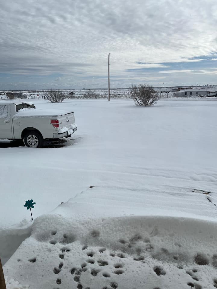 |
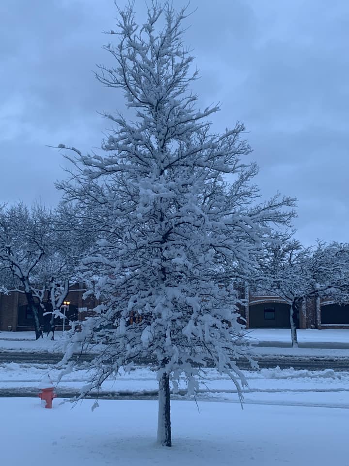
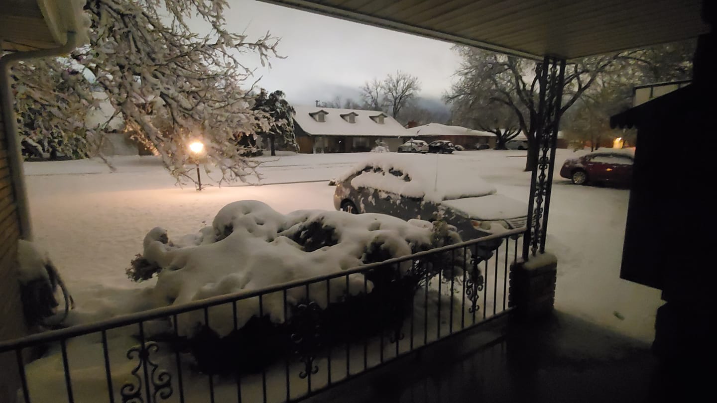
| 8" of snow in Amarillo - Ridgecrest (Photo by: Angie Croshay) |
Amarillo - Hillside (Photo by: Brittainy Lynn) |
Amarillo (Photo by: Brittney Studer) |
Amarillo - Bishop Estates (Photo by: Cathy Hooper) |
 |
 |
 |
 |
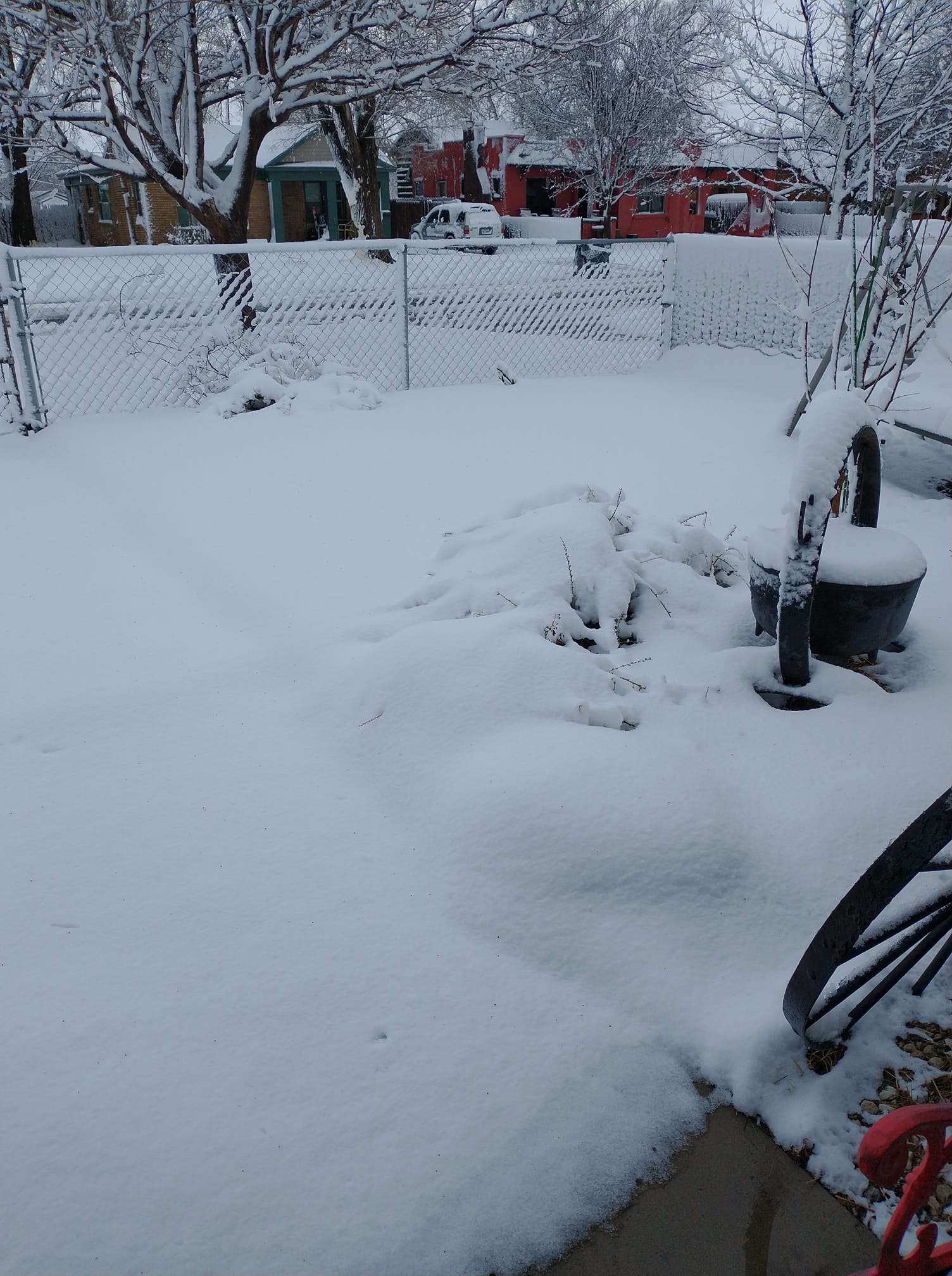
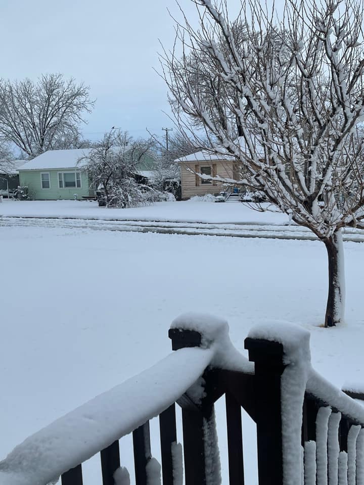
| Amarillo - Van Buren (Photo by: Joy Gonzales) |
Amarillo - Sunset Acres (Photo by: Kirby-Denise Lambert) |
Amarillo - Belmar (Photo by: Lesley Lemons) |
Amarillo - Georgia |
 |
 |
 |
 |
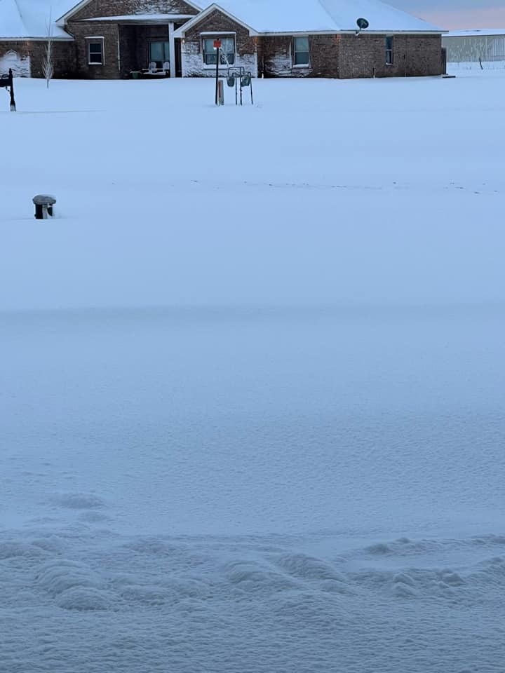
| Amarillo - Amarillo Blvd. (Photo by: Melanie Henry) |
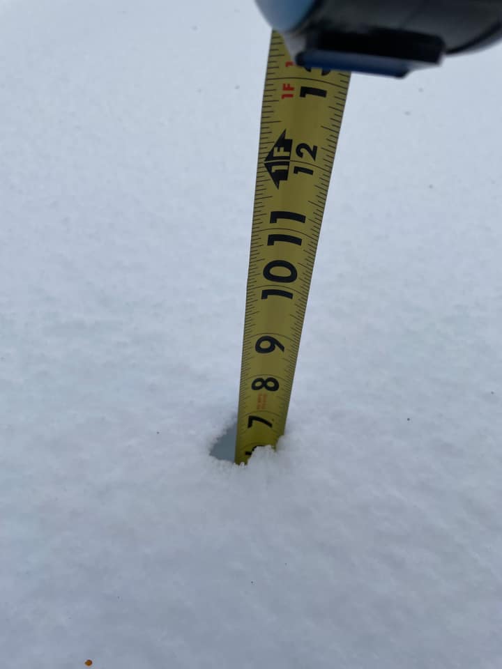
7" of snow measured in Amarillo - Belmar (Photo by: Melissa Lee Valle) |
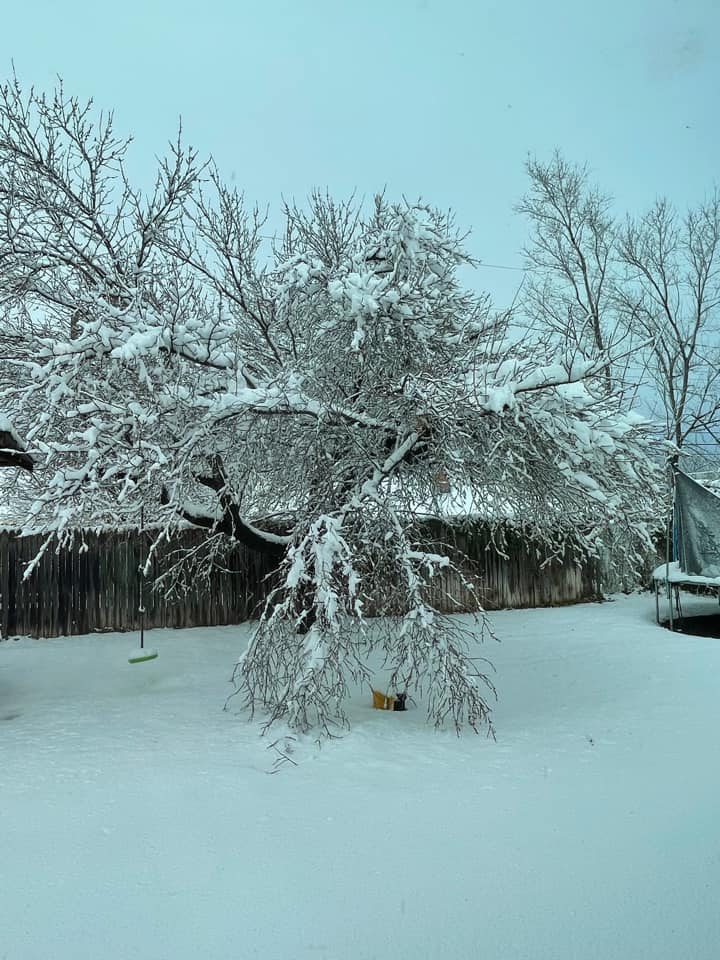
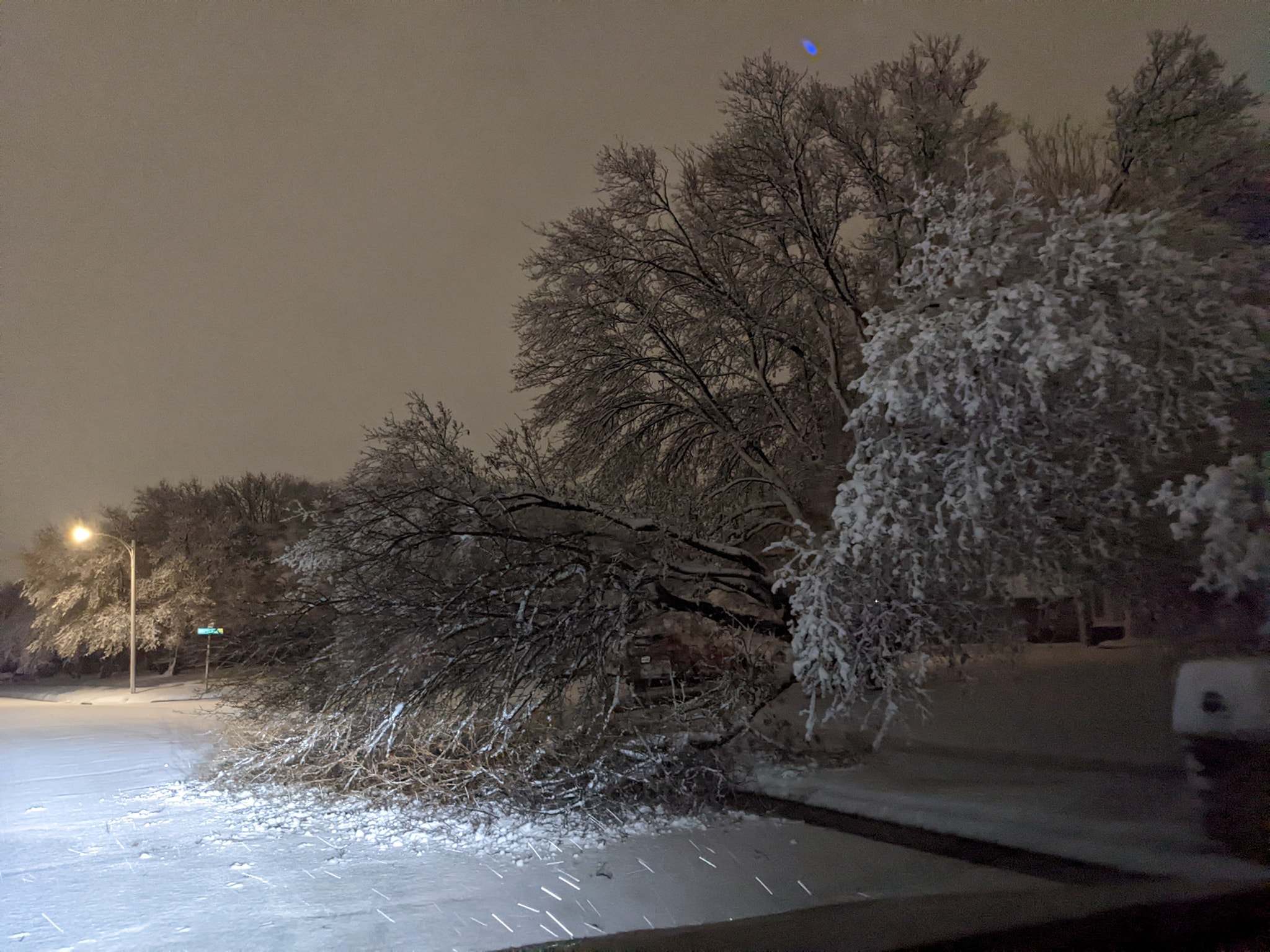
Bent tree caused by heavy wet snow in Amarillo - Belmar (Photo by: Melissa Lee Valle) |
Amarillo - Ridgecrest (Photo by: Meredith Highsmith) |
 |
 |
 |
 |
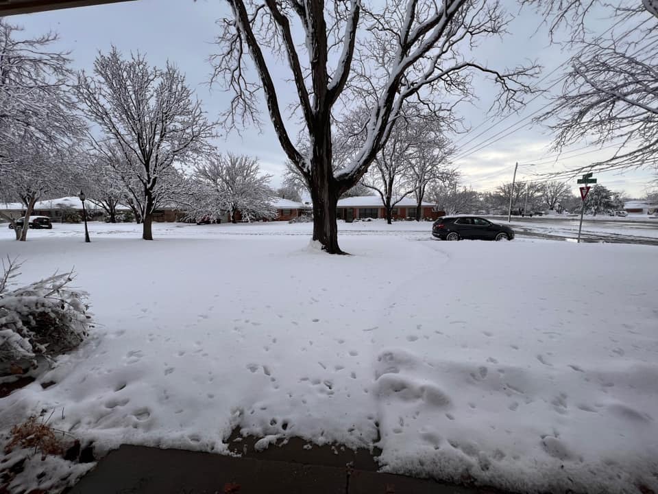
| Amarillo - McCormick (Photo by: Rachel Hardy) |
Bushland (Photo by: Staci Elsen) |
Southeast Amarillo |
Bent tree caused by heavy wet snow in Amarillo (Photo by: Wesley Luginbyhl) |
Storm Reports
PRELIMINARY LOCAL STORM REPORT...SUMMARY
NATIONAL WEATHER SERVICE AMARILLO TX
109 AM CDT WED MAR 23 2022
..TIME... ...EVENT... ...CITY LOCATION... ...LAT.LON...
..DATE... ....MAG.... ..COUNTY LOCATION..ST.. ...SOURCE....
..REMARKS..
1125 PM SNOW 5 W AMARILLO 35.20N 101.91W
03/21/2022 E2.0 INCH POTTER TX TRAINED SPOTTER
1150 PM SNOW 3 WSW AMARILLO 35.18N 101.87W
03/21/2022 M3.3 INCH RANDALL TX TRAINED SPOTTER
0100 AM SNOW 7 ENE AMARILLO 35.23N 101.71W
03/22/2022 M3.1 INCH POTTER TX OFFICIAL NWS OBS
0120 AM SNOW 8 WSW AMARILLO 35.15N 101.93W
03/22/2022 E4.0 INCH RANDALL TX NWS EMPLOYEE
0400 AM SNOW PERRYTON 36.39N 100.80W
03/22/2022 E3.5 INCH OCHILTREE TX BROADCAST MEDIA
0600 AM SNOW 7 WSW AMARILLO 35.15N 101.92W
03/22/2022 M9.0 INCH RANDALL TX NWS EMPLOYEE
0600 AM SNOW GLAZIER 36.01N 100.26W
03/22/2022 M2.5 INCH HEMPHILL TX CO-OP OBSERVER
CO-OP OBSERVER STATION GLZT2 GLAZIER.
0630 AM SNOW 1 NW PAMPA 35.55N 100.97W
03/22/2022 M1.0 INCH GRAY TX CO-OP OBSERVER
CO-OP OBSERVER STATION PAPT2 PAMPA 2 NNW.
0700 AM SNOW 8 ESE BUSHLAND 35.13N 101.94W
03/22/2022 M5.8 INCH RANDALL TX COCORAHS
COCORAHS STATION TX-RD-41 AMARILLO 8.9 SW.
0700 AM SNOW 4 N CANYON 35.04N 101.92W
03/22/2022 M1.7 INCH RANDALL TX COCORAHS
COCORAHS STATION TX-RD-50 CANYON 4.2 N.
0700 AM SNOW 7 ENE AMARILLO 35.23N 101.71W
03/22/2022 M4.6 INCH POTTER TX OFFICIAL NWS OBS
THIS IS THE FINAL STORM TOTAL SNOWFALL
ACCUMULATION.
0700 AM SNOW 6 WSW AMARILLO 35.18N 101.92W
03/22/2022 M6.1 INCH POTTER TX COCORAHS
COCORAHS STATION TX-PT-17 AMARILLO 5.9 WSW
(COCORAHS).
0700 AM SNOW 5 NNE ADRIAN 35.35N 102.65W
03/22/2022 M2.0 INCH OLDHAM TX CO-OP OBSERVER
CO-OP OBSERVER STATION ADNT2 ADRIAN.
0800 AM SNOW 2 WNW WHEELESS 36.73N 102.93W
03/22/2022 M1.0 INCH CIMARRON OK COCORAHS
COCORAHS STATION OK-CM-12 KENTON 12.1 S.
0843 AM SNOW 5 WSW AMARILLO 35.18N 101.90W
03/22/2022 M4.4 INCH POTTER TX NWS EMPLOYEE
COMPACTION AND MELTING ALREADY OCCURRED
OVERNIGHT WITH A LOSS OF ABOUT ONE INCH OF
SNOW LIKELY.
0900 AM SNOW 2 SW AMARILLO 35.19N 101.85W
03/22/2022 M5.5 INCH POTTER TX PUBLIC
0902 AM SNOW 5 W AMARILLO 35.22N 101.91W
03/22/2022 M8.0 INCH POTTER TX PUBLIC
0905 AM SNOW LAKE TANGLEWOOD 35.06N 101.78W
03/22/2022 M1.5 INCH RANDALL TX PUBLIC
0913 AM SNOW 6 W AMARILLO 35.19N 101.92W
03/22/2022 M6.5 INCH POTTER TX NWS EMPLOYEE
TREE FELL IN APARTMENT COMPLEX DUE TO THE
WEIGHT OF THE HEAVY SNOW.
0917 AM SNOW 4 SW AMARILLO 35.16N 101.86W
03/22/2022 M5.5 INCH RANDALL TX PUBLIC
0917 AM SNOW 8 W SLAPOUT 36.62N 100.26W
03/22/2022 M1.0 INCH BEAVER OK PUBLIC
0920 AM SNOW 6 WSW AMARILLO 35.17N 101.92W
03/22/2022 M5.0 INCH RANDALL TX PUBLIC
0921 AM SNOW 6 WSW AMARILLO 35.18N 101.92W
03/22/2022 M6.1 INCH RANDALL TX PUBLIC
0922 AM SNOW 1 WSW LIPSCOMB 36.23N 100.28W
03/22/2022 M1.0 INCH LIPSCOMB TX PUBLIC
0923 AM SNOW 3 NW TIMBERCREEK CANYON 35.09N 101.85W
03/22/2022 M6.0 INCH RANDALL TX PUBLIC
0930 AM SNOW 5 WSW AMARILLO 35.17N 101.90W
03/22/2022 M8.0 INCH RANDALL TX PUBLIC
0930 AM SNOW 4 N FOLLETT 36.49N 100.14W
03/22/2022 M3.0 INCH LIPSCOMB TX TRAINED SPOTTER
SOME MELTING MAY HAVE ALREADY OCCURRED.
0933 AM SNOW 5 E BUSHLAND 35.18N 101.97W
03/22/2022 M8.0 INCH RANDALL TX PUBLIC
0933 AM SNOW 2 ESE GATE 36.85N 100.03W
03/22/2022 M1.0 INCH BEAVER OK PUBLIC
0933 AM SNOW 8 W SLAPOUT 36.62N 100.26W
03/22/2022 M1.0 INCH BEAVER OK TRAINED SPOTTER
0934 AM SNOW ALLISON 35.61N 100.10W
03/22/2022 M1.0 INCH WHEELER TX PUBLIC
0934 AM SNOW 6 SW AMARILLO 35.14N 101.89W
03/22/2022 M6.2 INCH RANDALL TX PUBLIC
0936 AM SNOW BEAVER 36.81N 100.52W
03/22/2022 M1.0 INCH BEAVER OK TRAINED SPOTTER
0945 AM SNOW 2 SW AMARILLO 35.18N 101.85W
03/22/2022 M6.0 INCH RANDALL TX PUBLIC
0945 AM SNOW 4 SW AMARILLO 35.17N 101.87W
03/22/2022 M6.0 INCH RANDALL TX PUBLIC
0950 AM NON-TSTM WND GST 6 SE WELLINGTON 34.79N 100.15W
03/22/2022 M68 MPH COLLINGSWORTH TX MESONET
MESONET STATION AT WELLINGTON 6 SE.
1000 AM SNOW 6 W AMARILLO 35.19N 101.92W
03/22/2022 M5.0 INCH POTTER TX PUBLIC
1000 AM SNOW 9 NNW DAWN 35.03N 102.24W
03/22/2022 M5.5 INCH DEAF SMITH TX PUBLIC
1005 AM SNOW 4 W AMARILLO 35.20N 101.89W
03/22/2022 M7.0 INCH POTTER TX PUBLIC
1008 AM SNOW 4 N CANYON 35.04N 101.92W
03/22/2022 M4.0 INCH RANDALL TX PUBLIC
1010 AM SNOW PANHANDLE 35.35N 101.38W
03/22/2022 M2.0 INCH CARSON TX PUBLIC
1014 AM SNOW 7 WSW AMARILLO 35.17N 101.93W
03/22/2022 M8.0 INCH RANDALL TX PUBLIC
1016 AM SNOW 6 WSW AMARILLO 35.17N 101.91W
03/22/2022 M6.0 INCH RANDALL TX PUBLIC
1017 AM SNOW 5 SW AMARILLO 35.15N 101.87W
03/22/2022 M7.0 INCH RANDALL TX NWS EMPLOYEE
1019 AM SNOW BOOKER 36.45N 100.54W
03/22/2022 M2.0 INCH LIPSCOMB TX PUBLIC
1020 AM SNOW 6 SW AMARILLO 35.15N 101.91W
03/22/2022 M9.5 INCH RANDALL TX PUBLIC
1021 AM SNOW 4 WSW AMARILLO 35.19N 101.88W
03/22/2022 M5.0 INCH POTTER TX PUBLIC
1025 AM SNOW BUSHLAND 35.19N 102.06W
03/22/2022 M6.0 INCH POTTER TX PUBLIC
1028 AM SNOW 7 NW TIMBERCREEK CANYON 35.12N 101.92W
03/22/2022 M6.0 INCH RANDALL TX PUBLIC
1037 AM SNOW 4 WSW AMARILLO 35.18N 101.89W
03/22/2022 M5.8 INCH RANDALL TX PUBLIC
1057 AM SNOW BOISE CITY 36.73N 102.51W
03/22/2022 M2.0 INCH CIMARRON OK TRAINED SPOTTER
1100 AM SNOW 1 N WAKA 36.30N 101.05W
03/22/2022 M1.5 INCH OCHILTREE TX PUBLIC
1100 AM SNOW WHEELESS 36.72N 102.90W
03/22/2022 M1.0 INCH CIMARRON OK PUBLIC
1105 AM SNOW PERRYTON 36.39N 100.80W
03/22/2022 M2.0 INCH OCHILTREE TX PUBLIC
1107 AM SNOW BRYANS CORNER 36.62N 100.82W
03/22/2022 M1.5 INCH BEAVER OK PUBLIC
1111 AM SNOW CANADIAN 35.91N 100.38W
03/22/2022 M2.0 INCH HEMPHILL TX PUBLIC
1120 AM SNOW VEGA 35.25N 102.43W
03/22/2022 M1.5 INCH OLDHAM TX PUBLIC
1131 AM SNOW MIAMI 35.69N 100.64W
03/22/2022 M1.0 INCH ROBERTS TX PUBLIC
1133 AM SNOW CLAUDE 35.11N 101.36W
03/22/2022 M2.0 INCH ARMSTRONG TX TRAINED SPOTTER
1140 AM SNOW ELMWOOD 36.62N 100.52W
03/22/2022 M2.0 INCH BEAVER OK EMERGENCY MNGR
1140 AM SNOW 2 SSE GRAY 36.53N 100.81W
03/22/2022 M3.0 INCH BEAVER OK EMERGENCY MNGR
1140 AM SNOW 3 N TURPIN 36.91N 100.87W
03/22/2022 M1.0 INCH BEAVER OK EMERGENCY MNGR
&&
$$
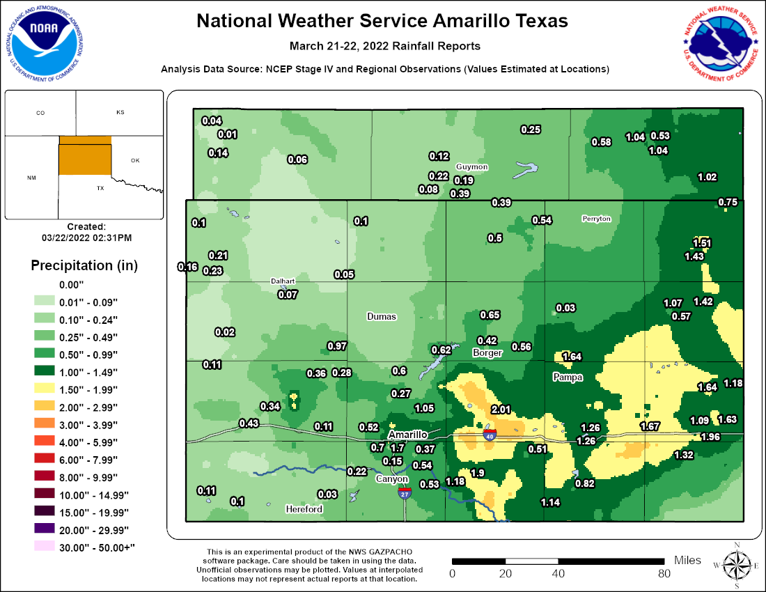
Rain Reports
 |
Media use of NWS Web News Stories is encouraged! Please acknowledge the NWS as the source of any news information accessed from this site. |
|

