Severe weather and flooding threats will continue for portions of the central U.S. through Thursday, focused from the central High Plains to the Mid-Mississippi Valley. Hot and dry conditions will fuel fire weather concerns for the Intermountain West, and dry thunderstorms may spark additional wildfires. Dangerous heat will build across the southern U.S. Friday into the weekend. Read More >
Overview
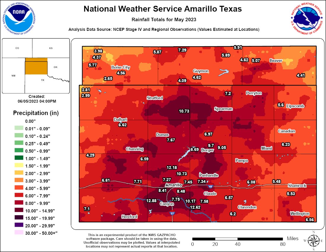
A unique and rare weather pattern characterized by persistent low pressure over the Desert Southwest lead to multiple days of widespread heavy rain for the combined Texas and Oklahoma Panhandles. The heavy rain was mainly due to the fact that the atmosphere was relatively warm and very moist, with total atmospheric moisture above the 90th percentile to near daily max values with subtropical moisture being pumped into the area. There was also some severe weather, but hail sizes rarely were above the size of quarters and damaging wind reports were not common. The flooding reports were numerous, however. Many of the area rivers and creeks were approaching record levels, and many locations were impacts by flash flooding as well.
Flooding
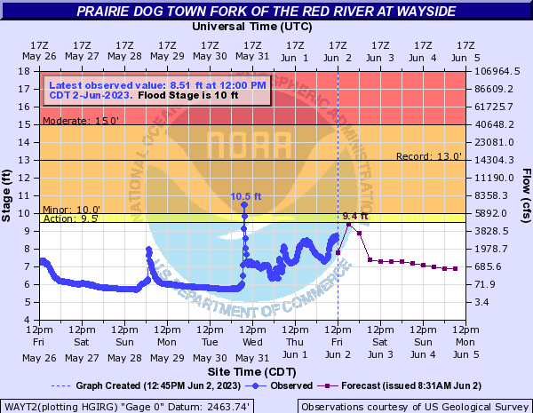
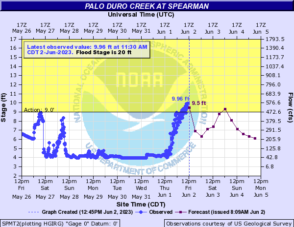
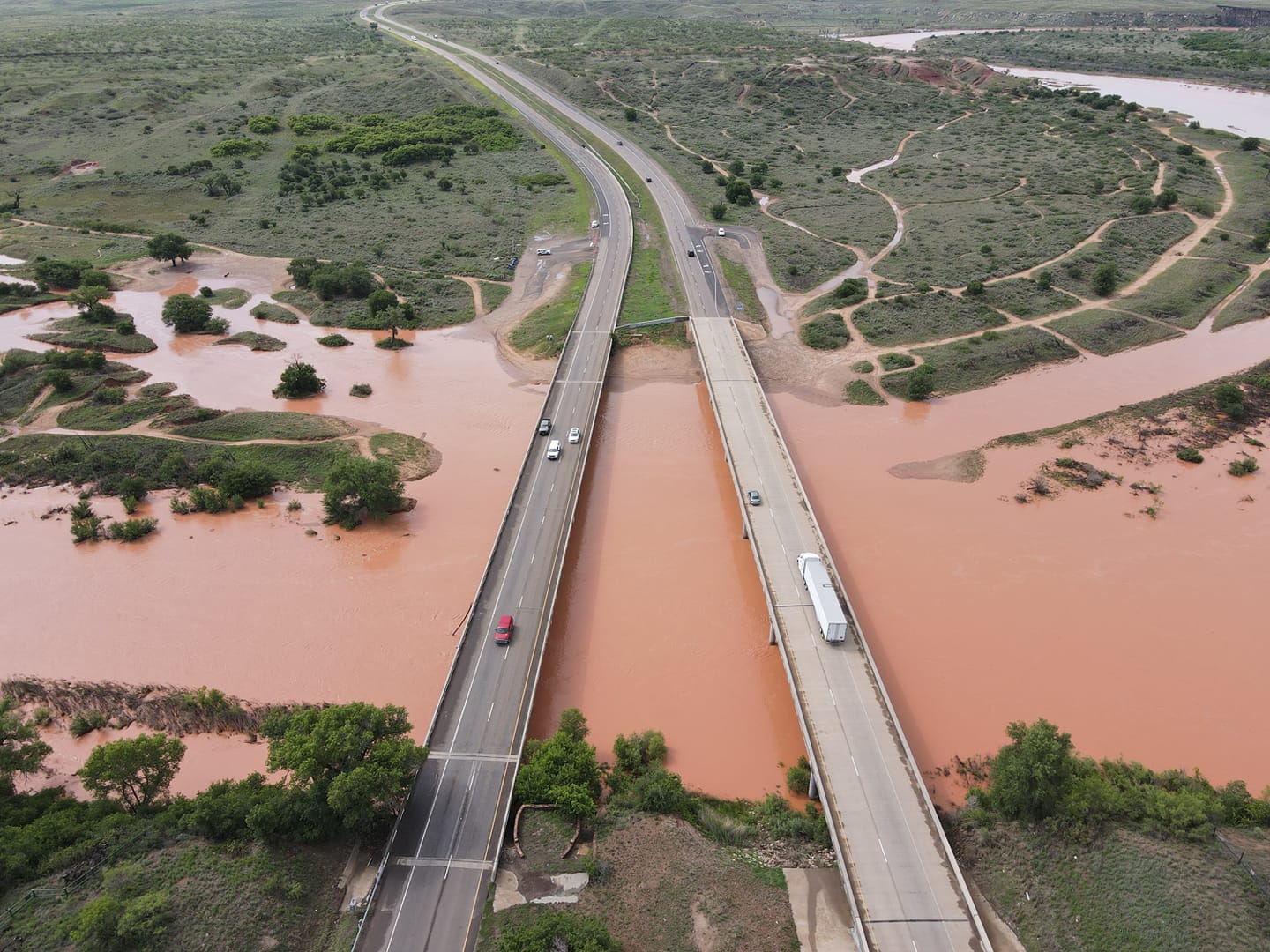
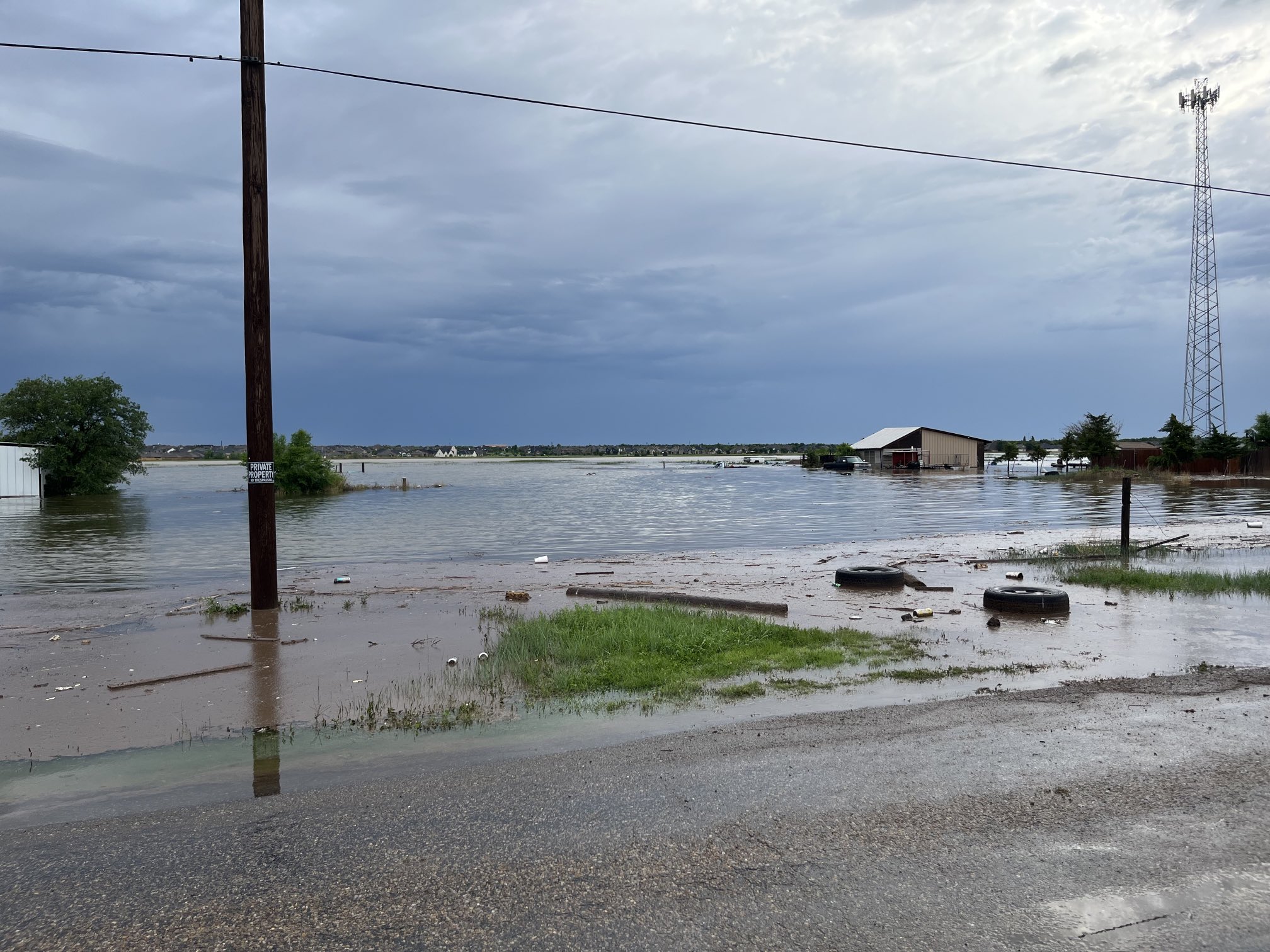
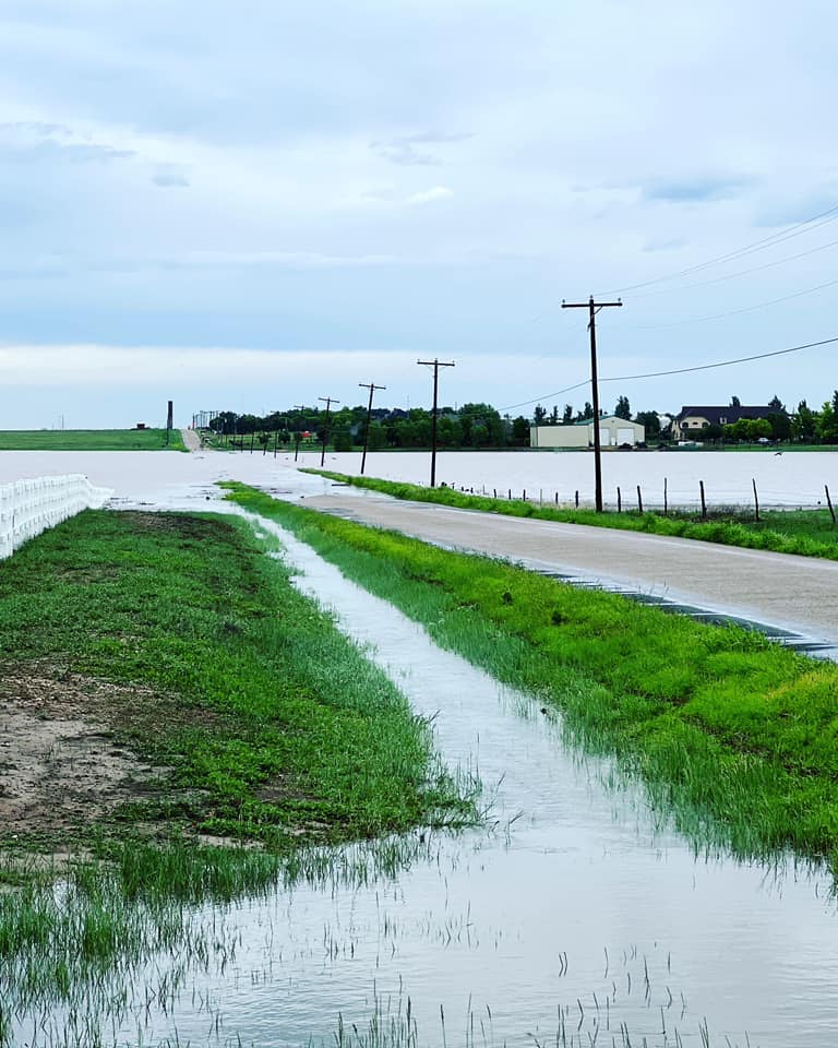
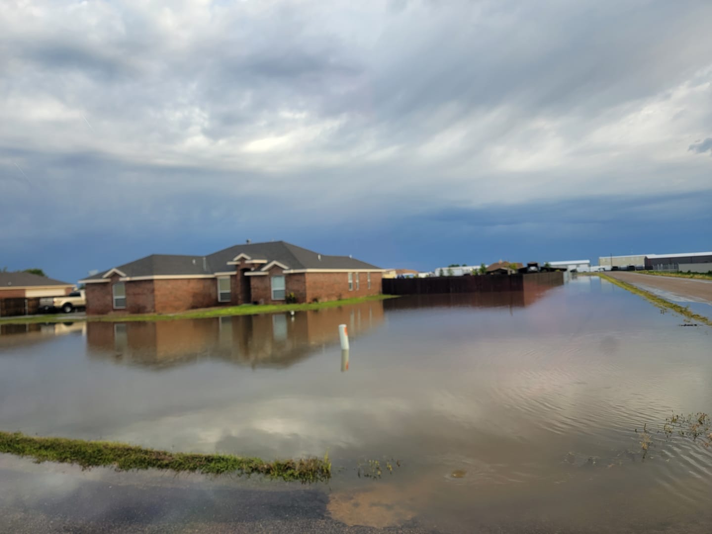
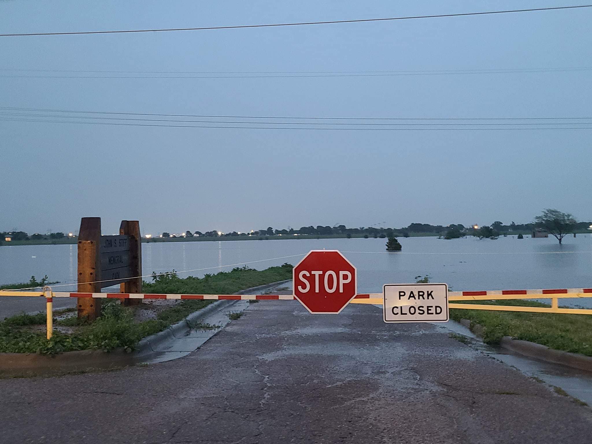
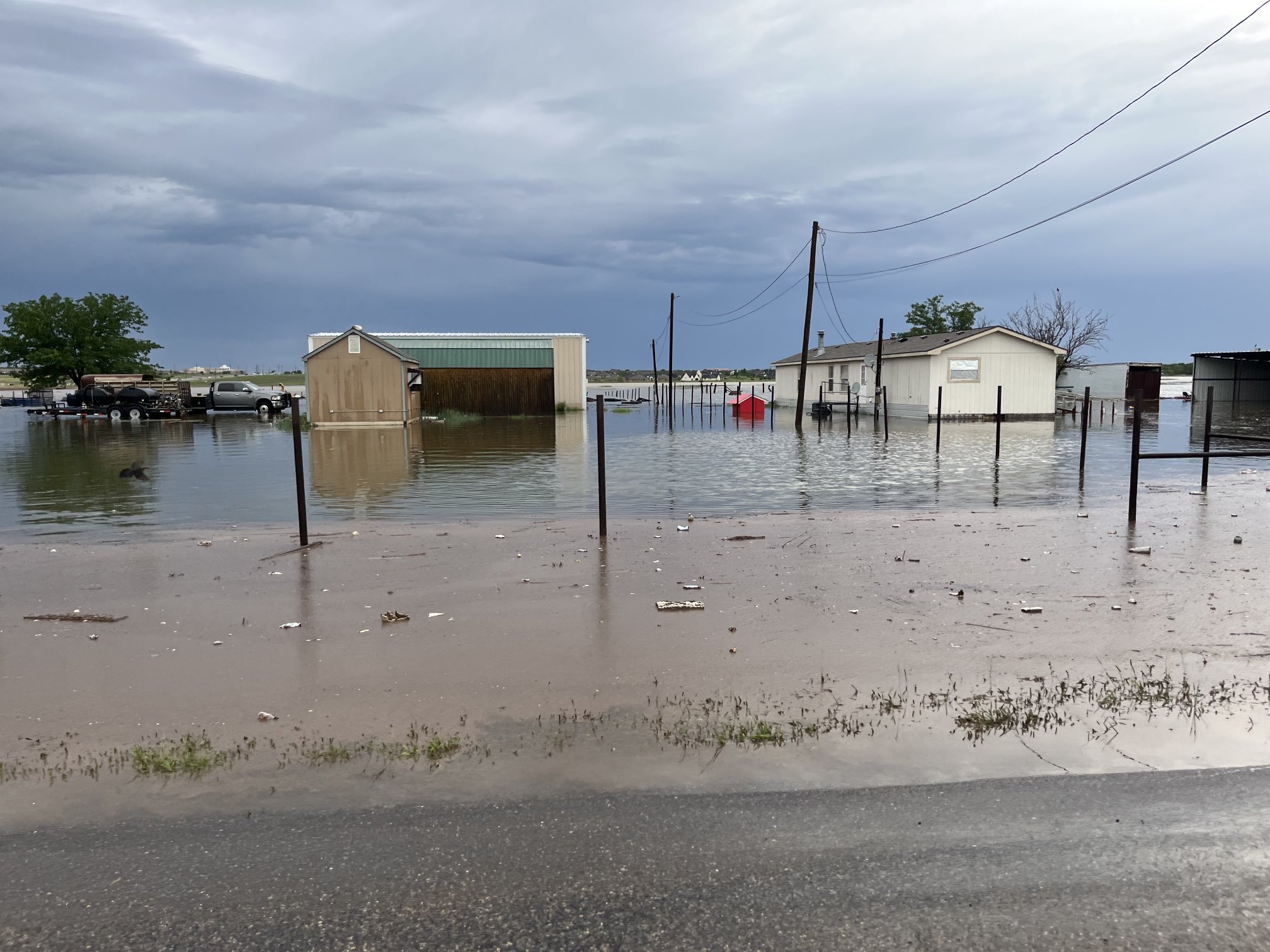
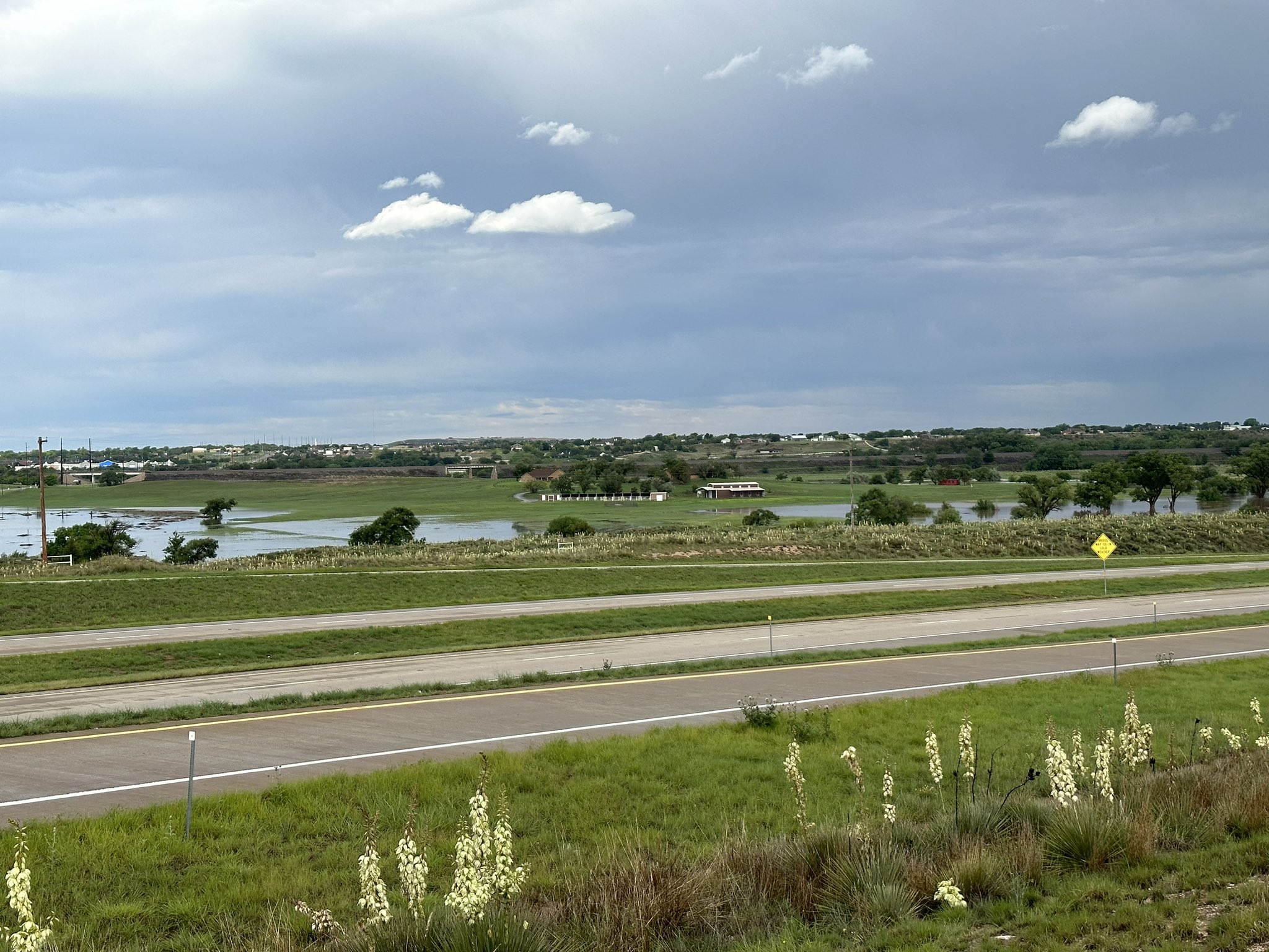
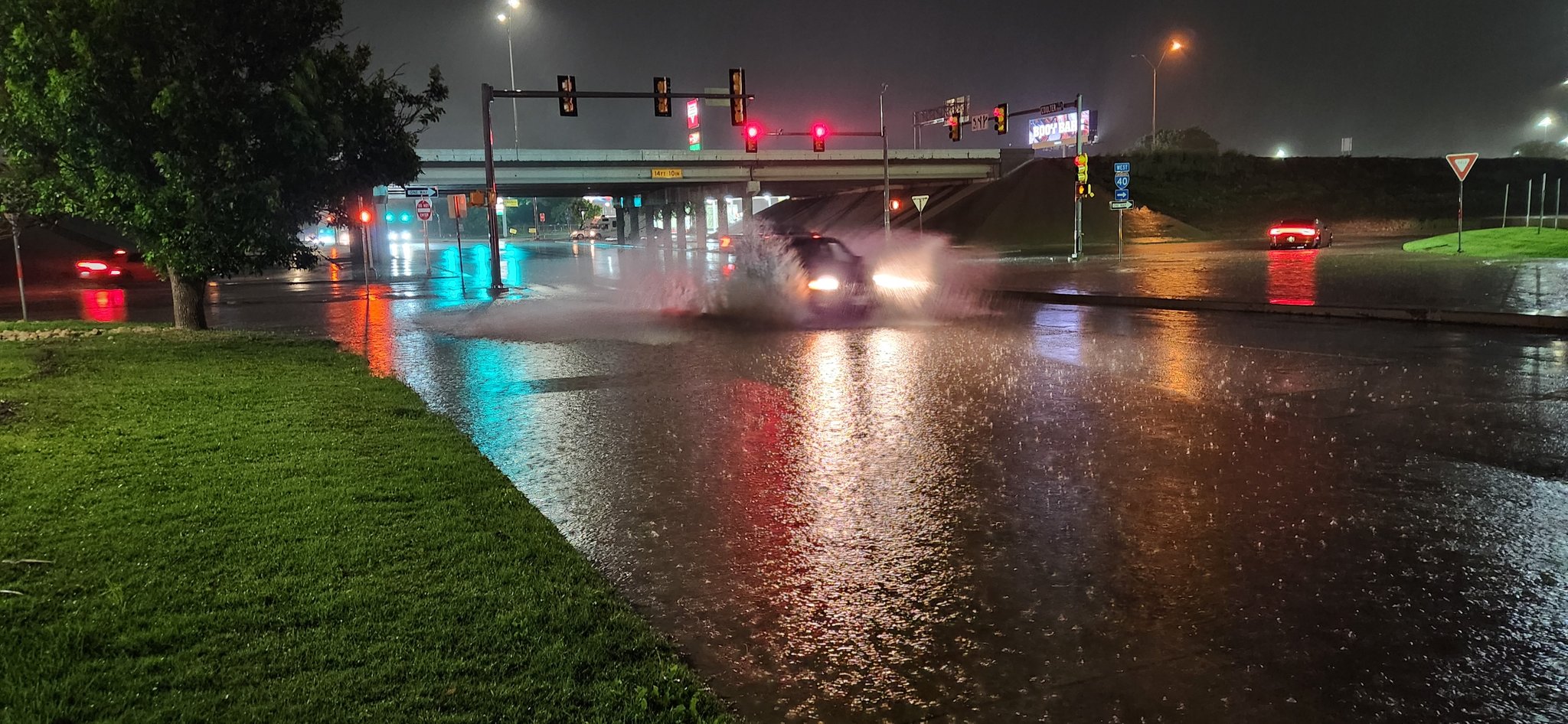
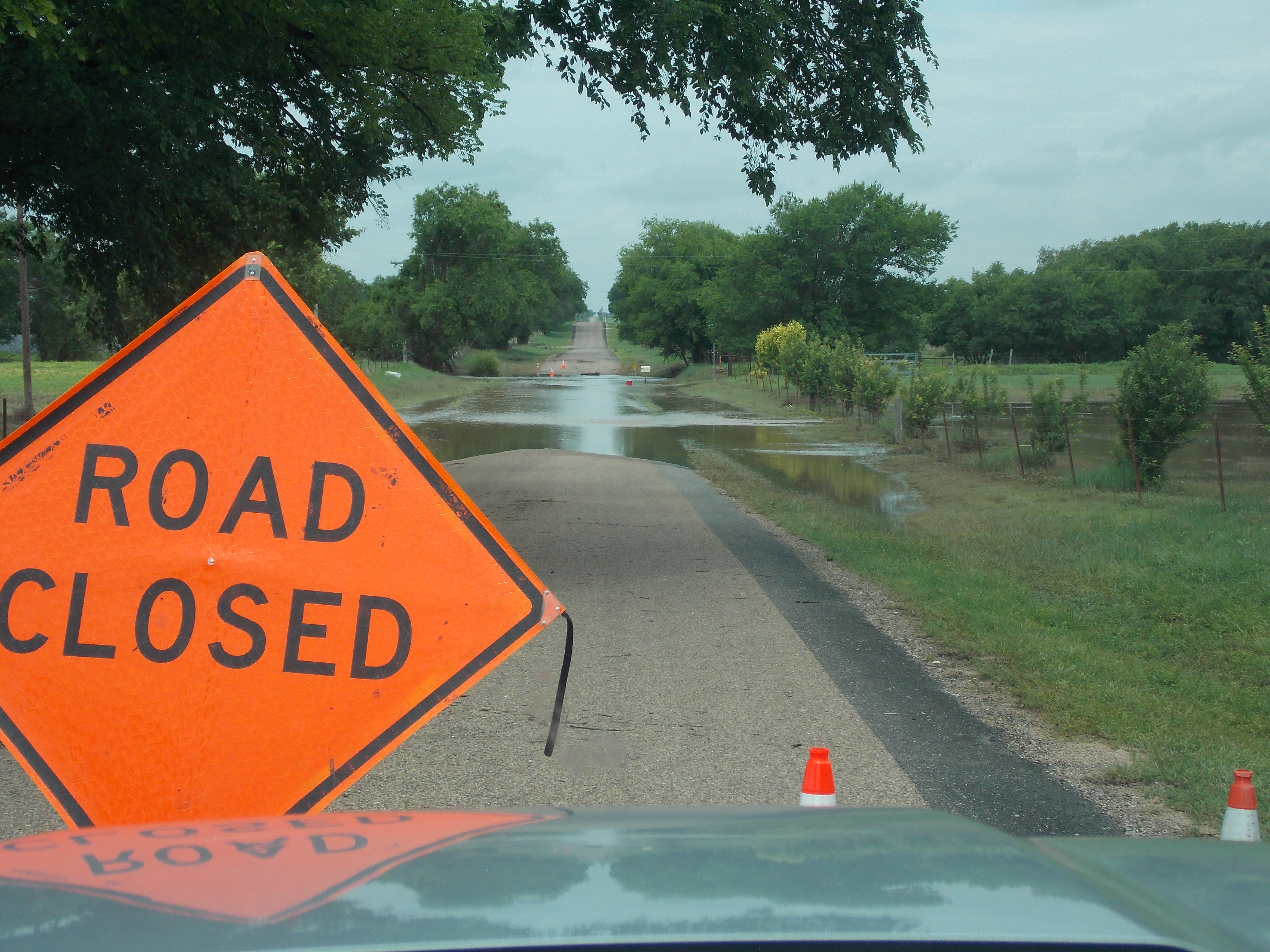
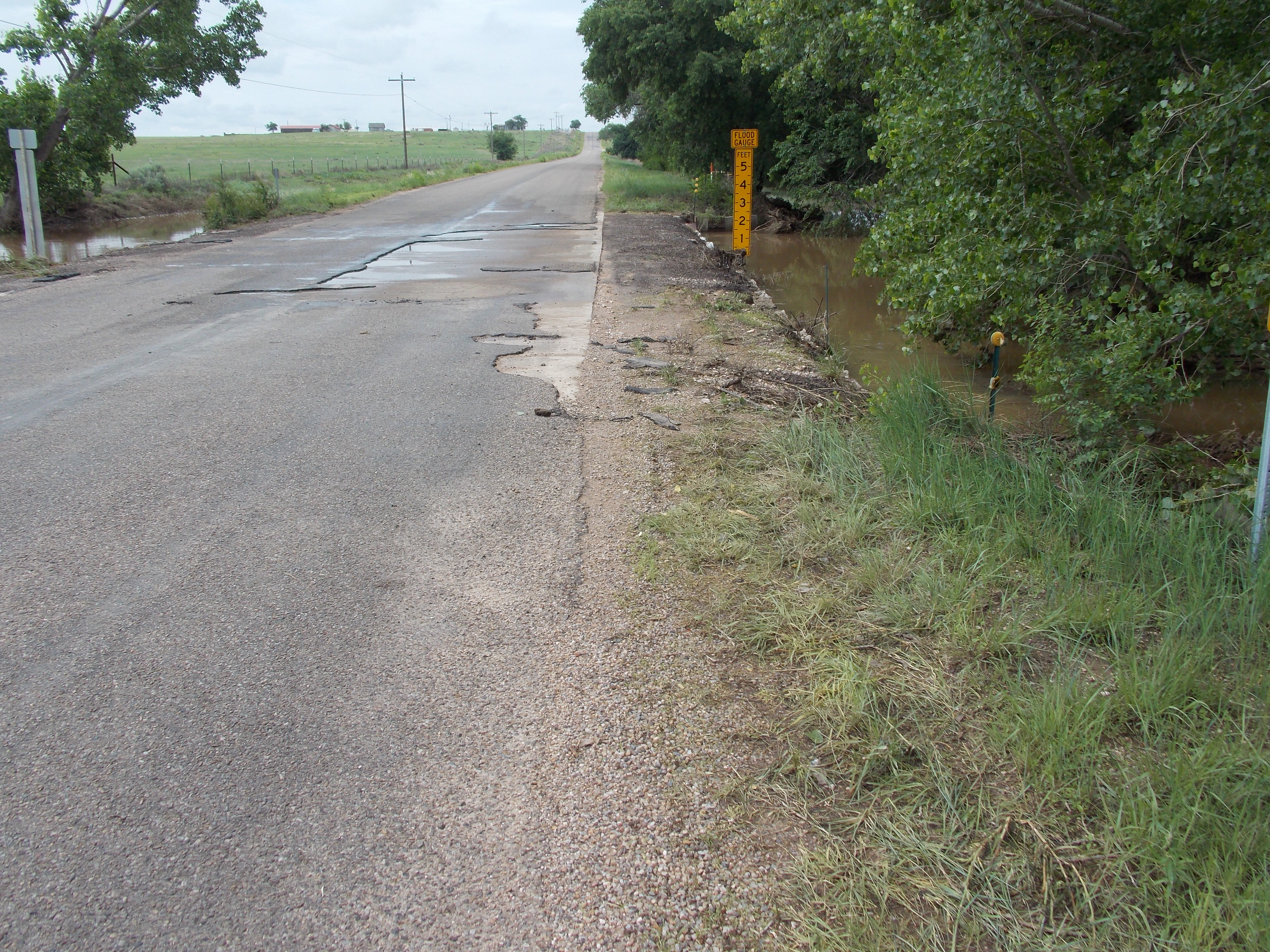
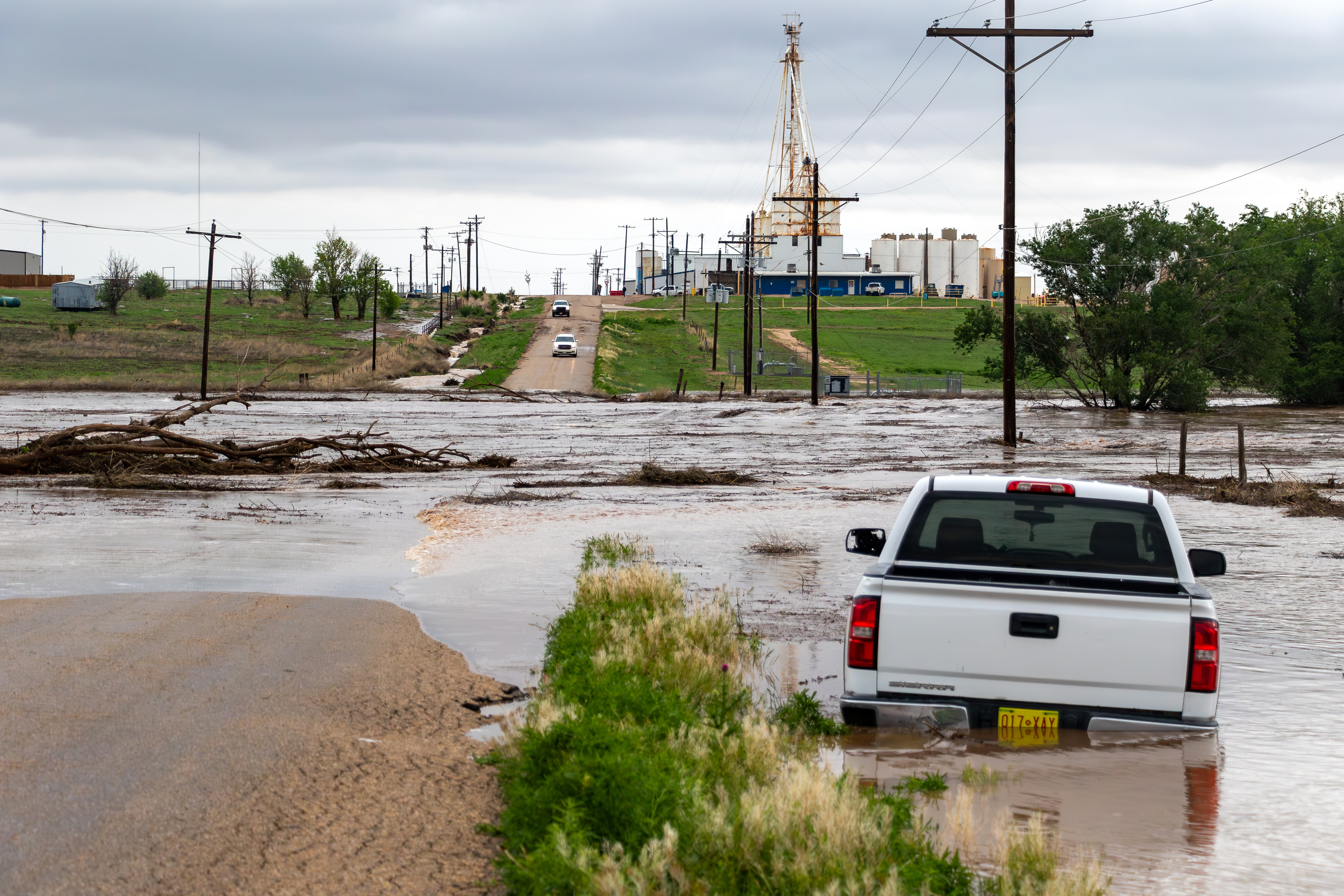
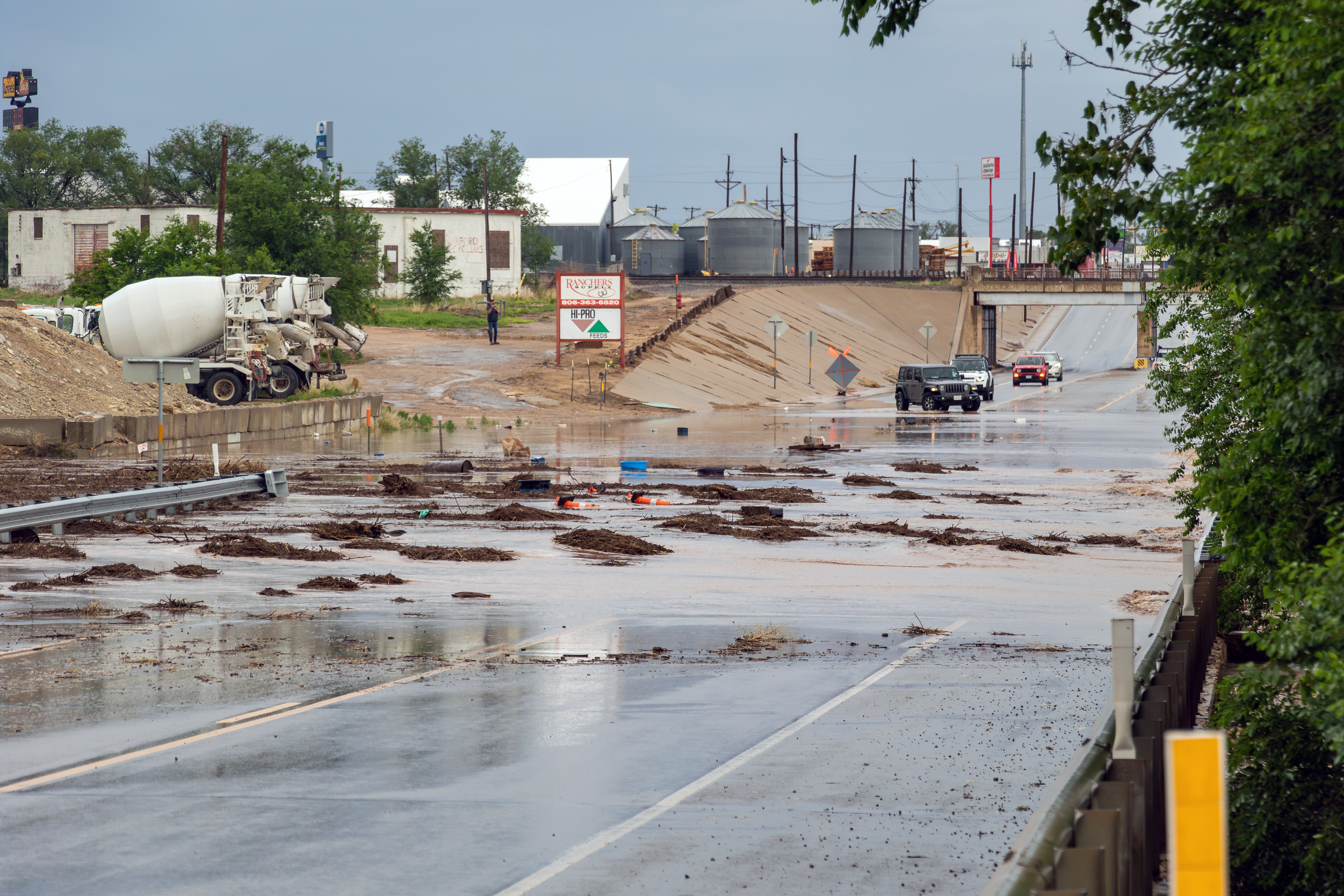
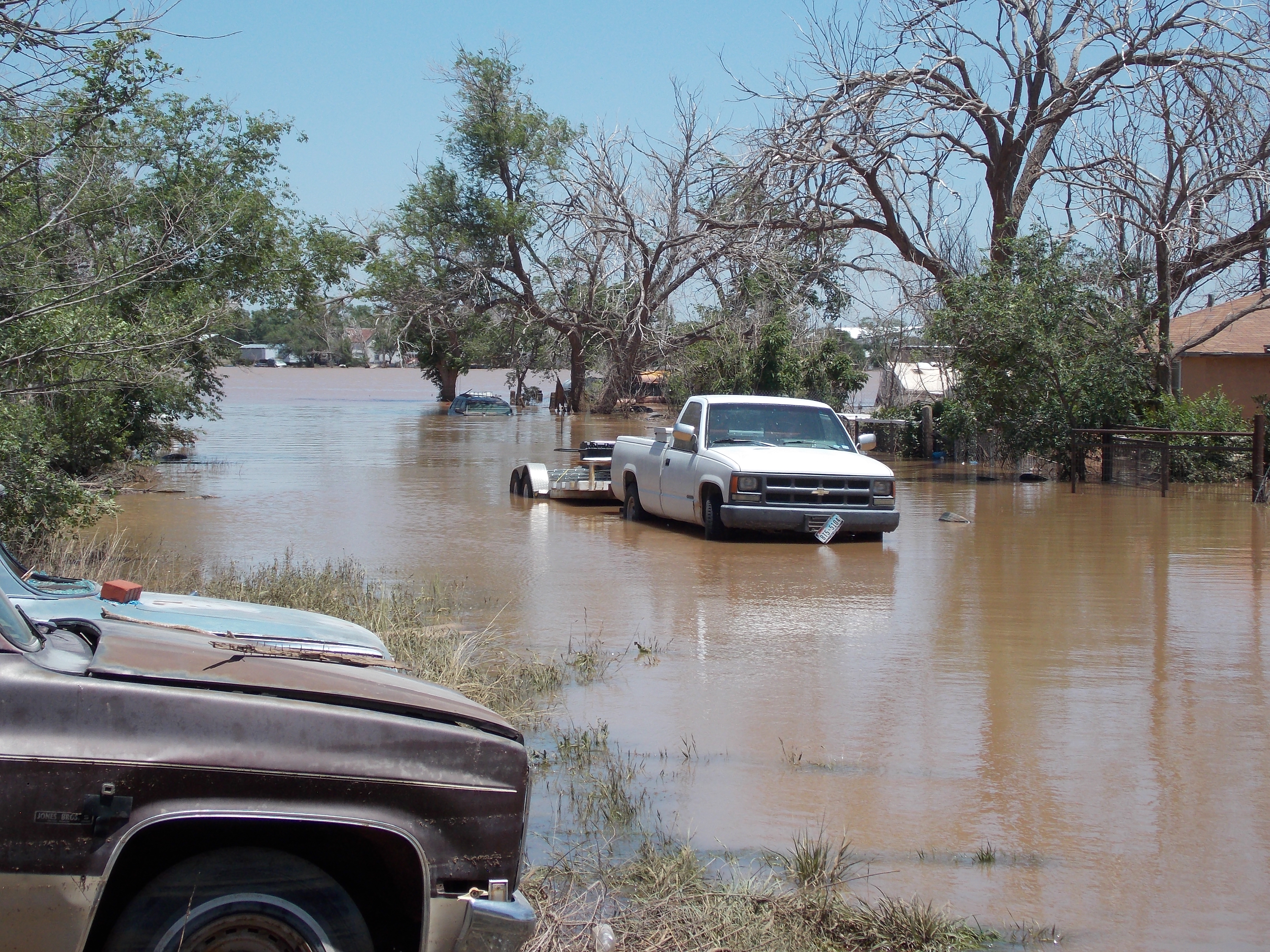
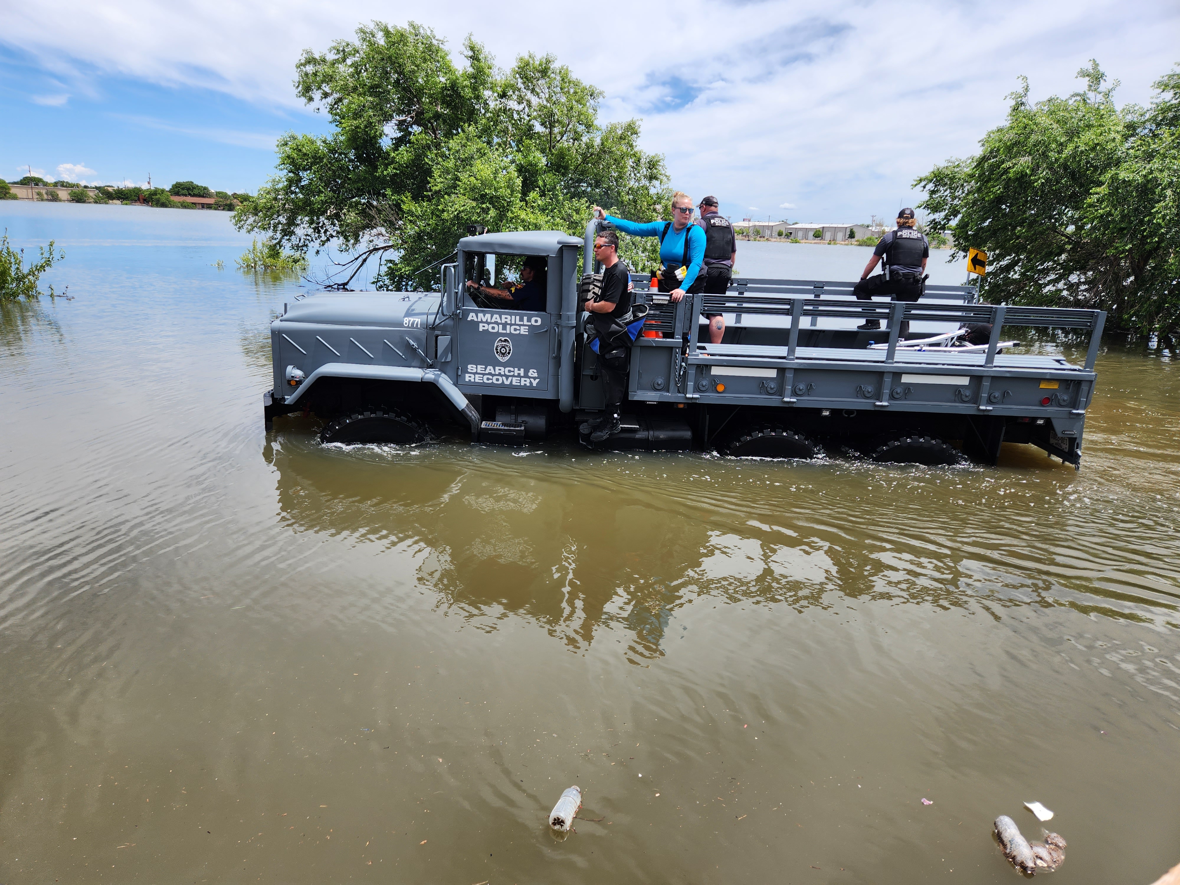
Multiple days of heavy rain resulted in area rivers and creeks flooding, including the Canadian River and the Prairie Dog Town Forks of the Red River. The Tierra Blanca Creek. The Wolf Creek and Palo Duro Creek were also flooding over their banks. There were several impacts along these rivers and creeks, including the evacuation of Valley De Oro along the Canadian River, the closing of Palo Duro State Park, and the closing of Southeast Park in Canyon as waters flooded most of the area baseball fields and dog park. By the end of May many locations had seen a monthly rain total anywhere from 6 to 14 inches of rainfall (with a few even higher). Most of the area was already at or above half of the annual rainfall by June 1st. A couple of notable events include May 27th when the Hereford area saw major flash flooding with over 2 inches of rain falling in just 40 minutes (some isolated locations saw over 8 inches of rain outside of Hereford). The Canyon/Umbarger area saw 3 to 5 inches on the evening and overnight of May 31st, while most of the remaining area saw 1-3 inches. Amarillo and Canyon both saw flash flooding which caused cars to be swept off roadways resulting in numerous water rescues. 2 to 4 inches of rain over western Lipscomb County during the afternoon of June 2nd caused flooding downstream on the Wolf Creek at Lipscomb. The final major event was during the overnight period on June 7th when a broken line of storms moved in from the northwest that filled in and strengthened just as they moved into the Amarillo area. Heavy rainfall produced anywhere from 0.5" to 1.5" across Amarillo and this lead to major flash flooding as water escaped from the already full Lawrence Lake and flooded area streets, businesses, and residents in that area. Over 200 people and 50 pets had to be rescued.
Hydrographs
 |
 |
 |
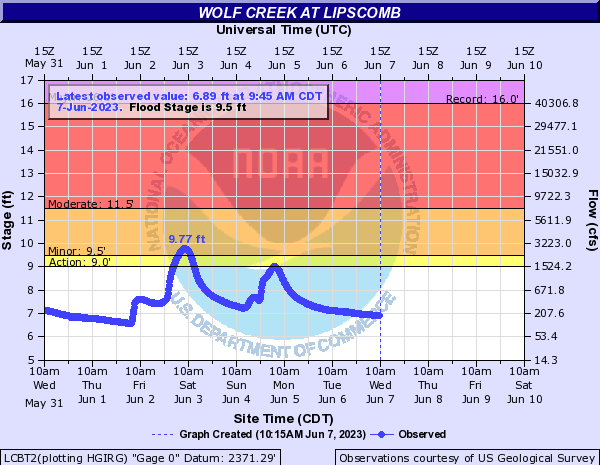 |
| Flooding at the Canadian River 19 miles north of Amarillo | Flooding at the Prairie Dog Town Fork of the Red River 13 miles northeast of Wayside | High water levels at Palo Duro Creek 6 miles west of Spearman | Flooding at the Wolf Creek at Lipscomb |
Radar/Photos
 |
 |
 |
 |
|
Canadian River Flooding North of Amarillo Courtesy of Rodney Bastow |
Greenway Playa Lake Flooding Courtesy of Mike Gittinger
|
Helium Road Flood Courtesy of John McKee
|
Flooding in Strawberry Fields Courtesy of Lawrence Laney
|
 |
 |
 |
 |
|
John Stiff Park Flooding Courtesy of Jay McCoy |
Greenways Flooding Courtesy of Mike Gittinger |
Flooding where Tierra Blanca and Palo Duro Creek merge Courtesy of Dr. JB Boren |
Street flooding in Amarillo on Couter and I-40 Courtesy of Obie Rangel |
 |
 |
 |
 |
|
Mudslide in Canyon Courtesy of NWS Amarillo, TX |
Gordon Cummings Rd. west of Brown Rd. Courtesy of NWS Amarillo, TX |
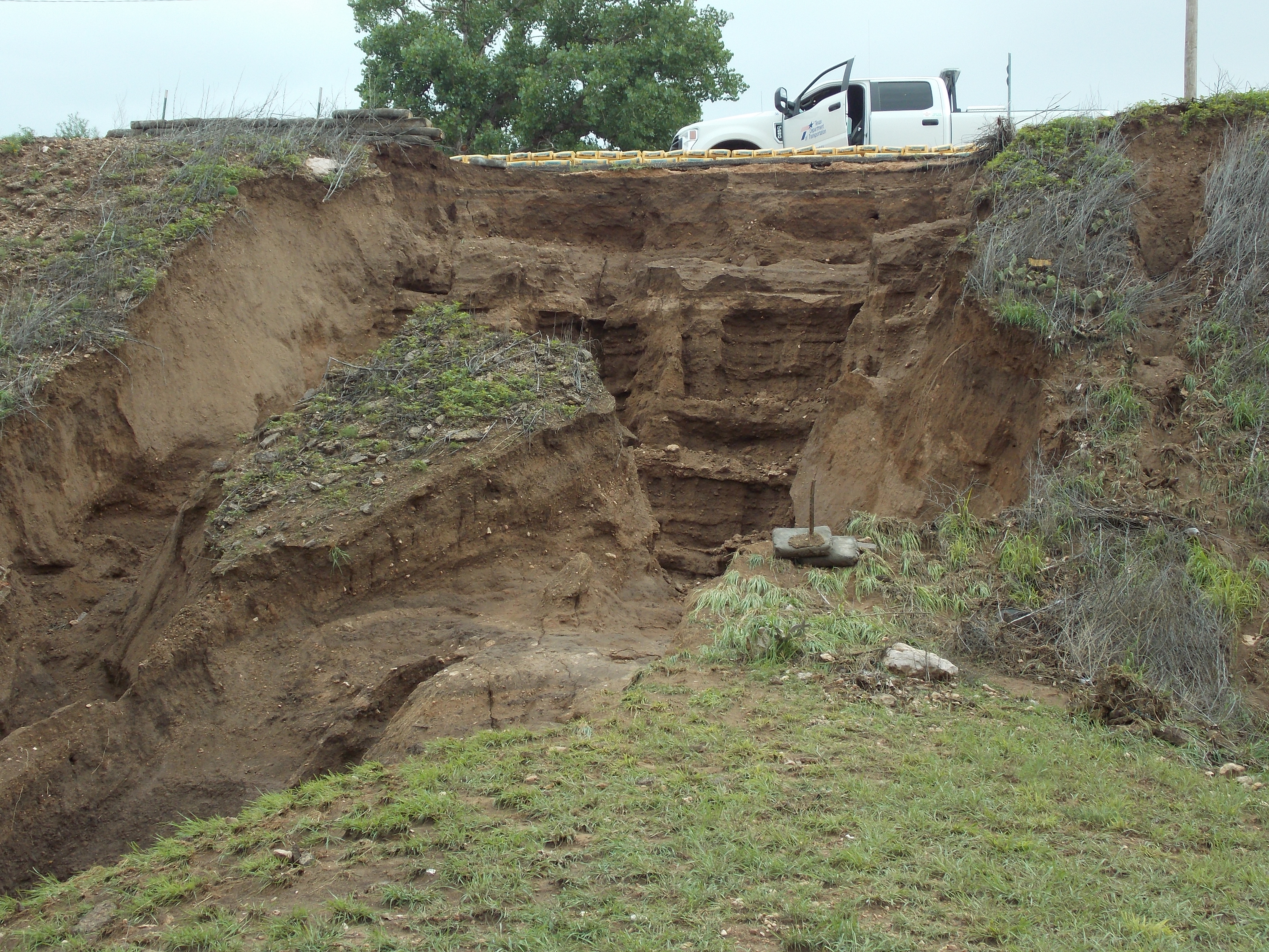
Tierra Blanca Creek on Brown Rd. with scoured asphalt Courtesy of NWS Amarillo, TX |
Road H west of Hereford, TX Courtesy of Brady Kendrick |
 |
 |
 |
 |
|
Tierra Blanca Creek over U.S. Highway 385 in Hereford, TX Courtesy of Brady Kendrick |
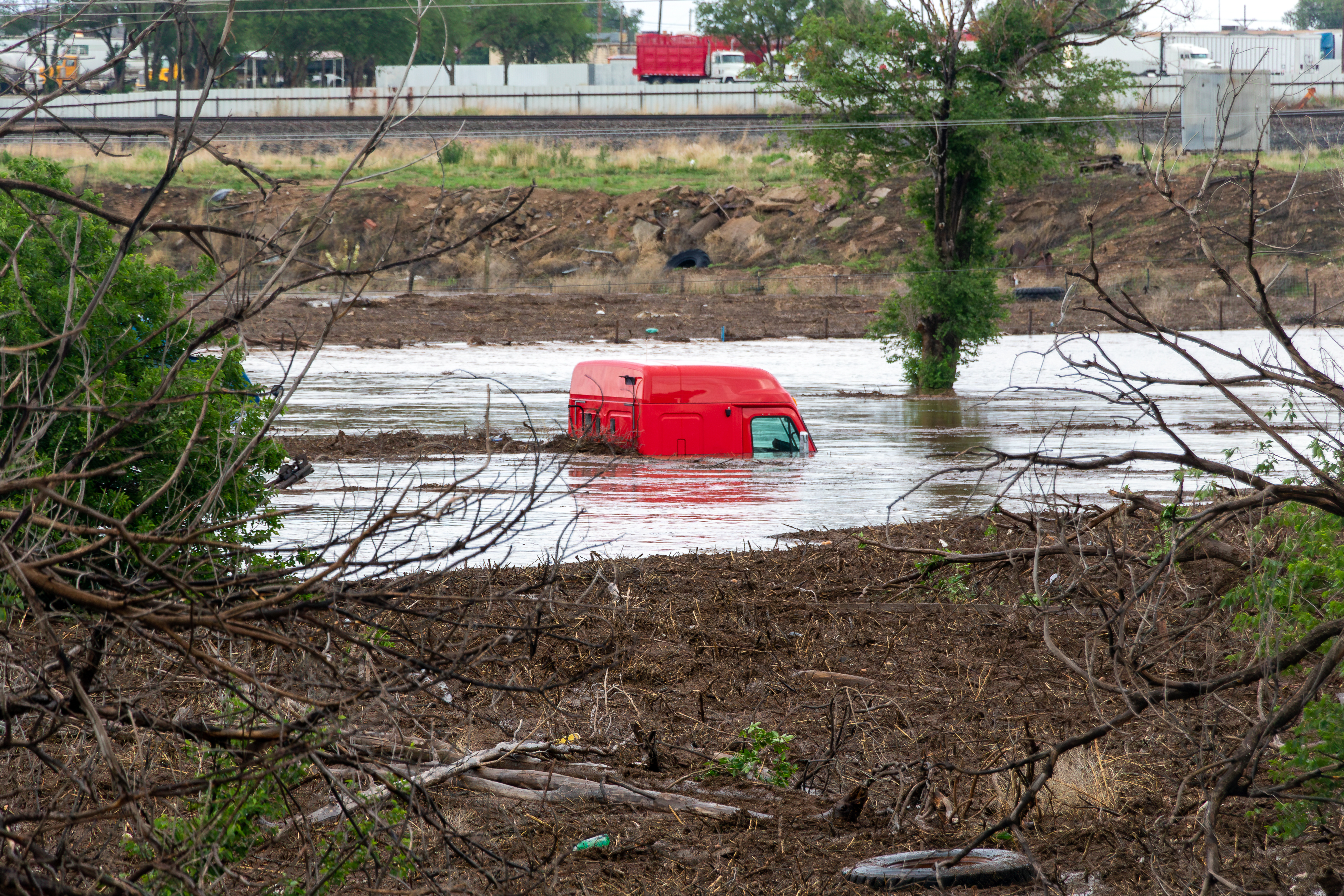
Semi truck in water in Hereford, TX. Courtesy of Brady Kendrick |
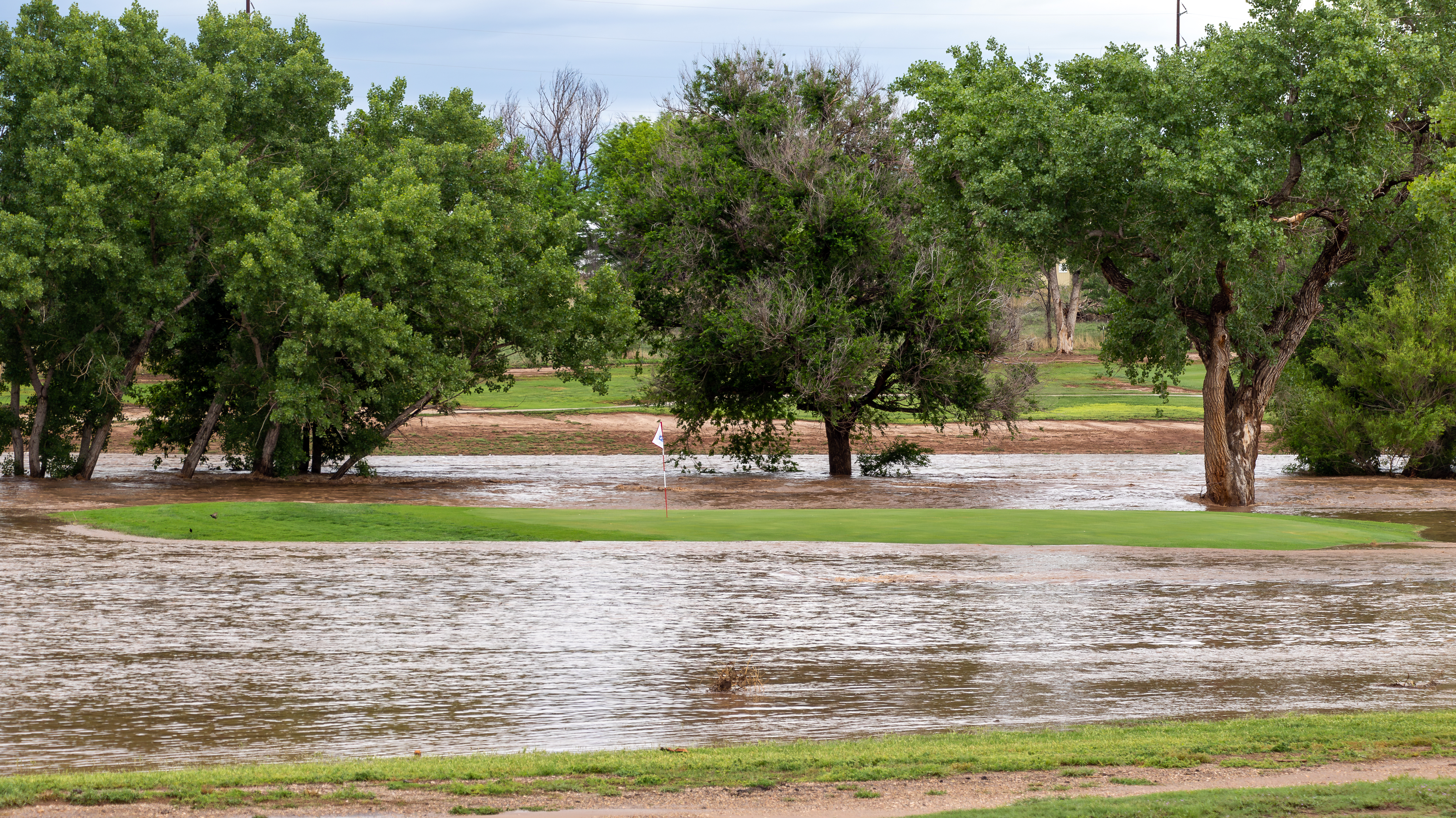
John Pitman Municipal Golf Course in Hereford TX Courtesy of Brady Kendrick |
San Jose community in Hereford TX Courtesy of NWS Amarillo TX |
 |
 |
 |
 |
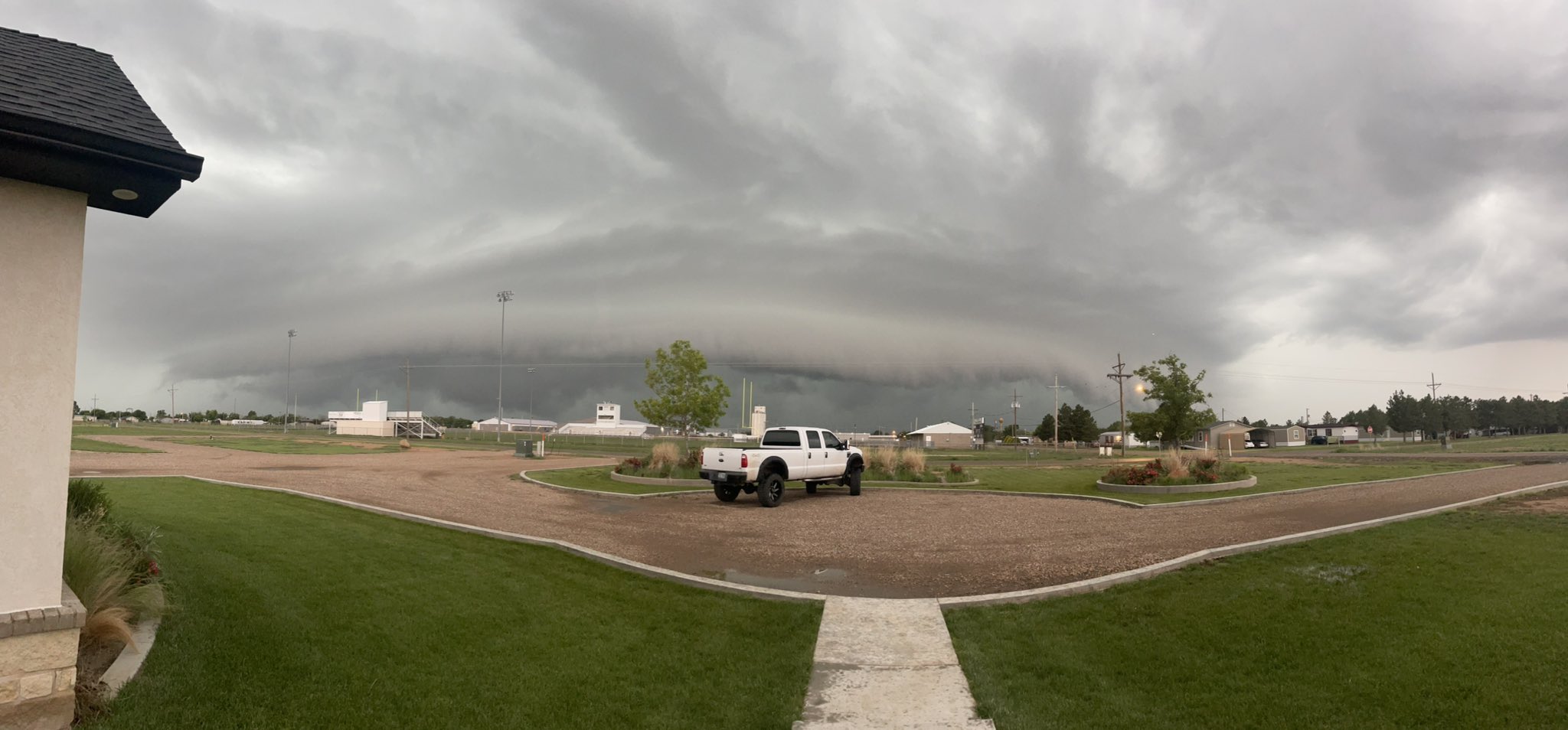
| Shelf Cloud near Amarillo, TC (source: Ara Cousins) |
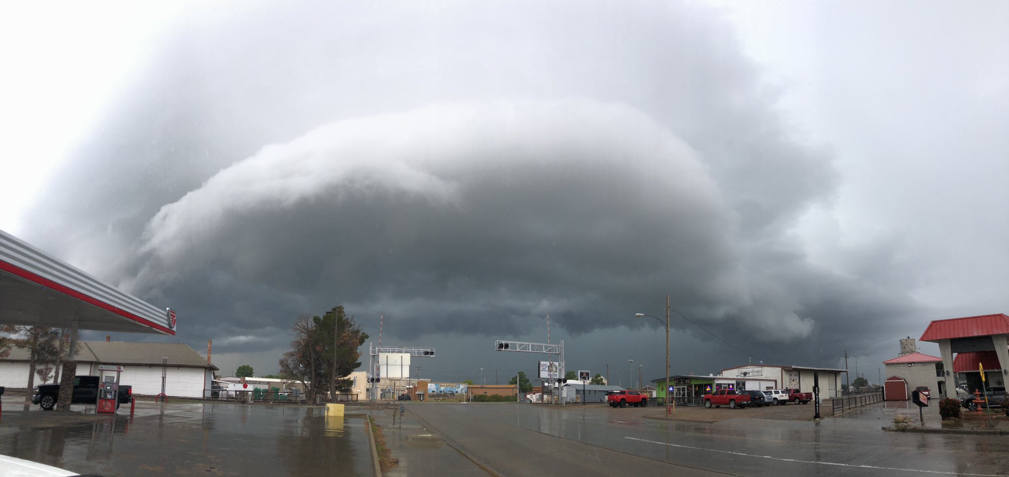
Shelf Cloud coming into Dalhart (source: Aaron Graves) |
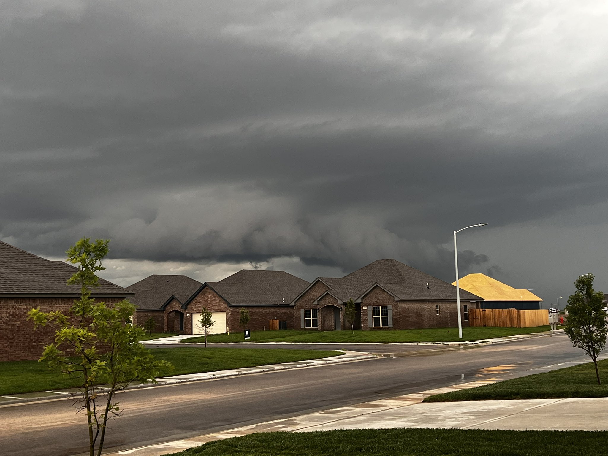
Possible Wall Cloud near Amarillo (source: Cody Buck) |
The National Guard helped with high water rescues on June 7th and 8th. (source: Doug Weber) |
Rain Reports

Environment
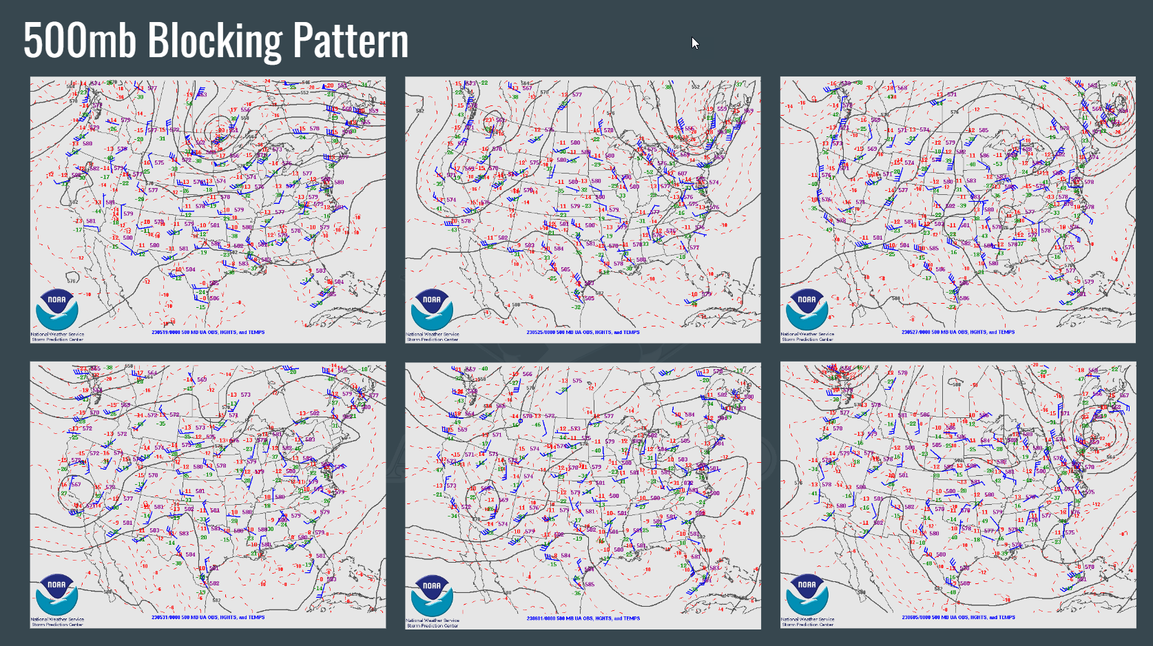
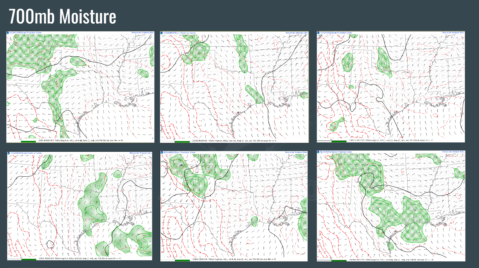
The environment was characterized by a persistent "blocking" pattern that provided well above normal moisture to the area. This moisture provided fuel for any little disturbance to produce thunderstorms.
 |
 |
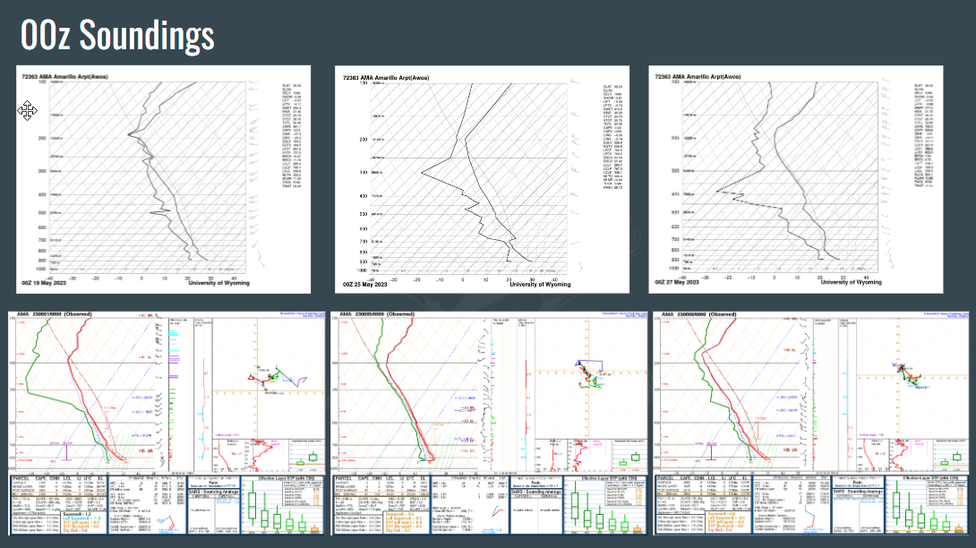 |
| Figure 1: 500mb Heights show multiple days of the same general "blocking" pattern that resulted in well above normal moisture advection into the Panhandles along with weak steering winds. | Figure 2: 700mb shows moisture anomalies each day due to the increased subtropical flow] | Figure 3: 00z soundings from KAMA showed ample instability and well above normal moisture for storms to feed on and grow upscale |
 |
Media use of NWS Web News Stories is encouraged! Please acknowledge the NWS as the source of any news information accessed from this site. |
|