Record setting heat is expected over the next several days from the Intermountain West through the northern Plains. Furthermore, fire weather concerns increase with dry and breezy conditions. Meanwhile, heavy rainfall and severe thunderstorm threats for the Ohio/Tennessee Valleys, central Appalachians and Southeast today. The threat shifts to central Gulf Coast and across central Texas this week. Read More >
Overview
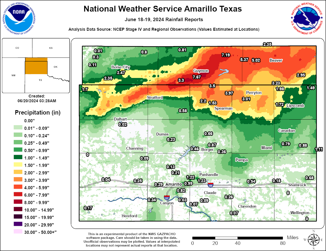
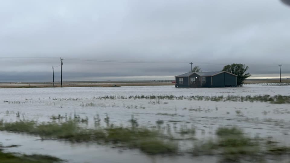
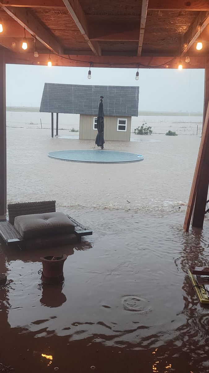
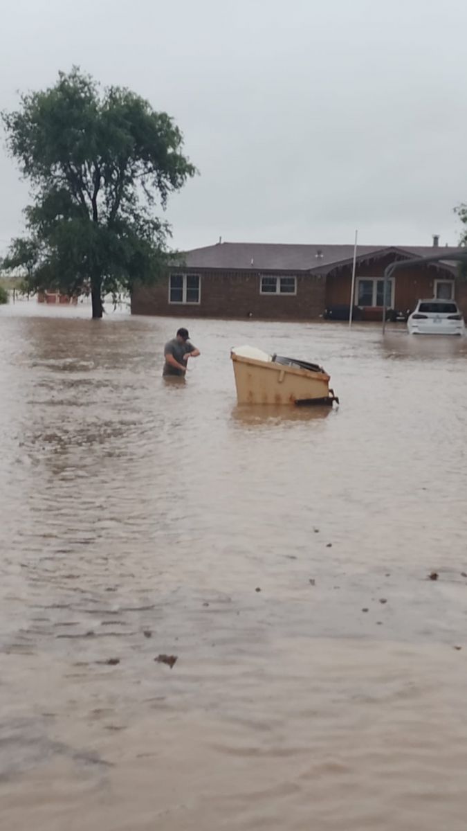
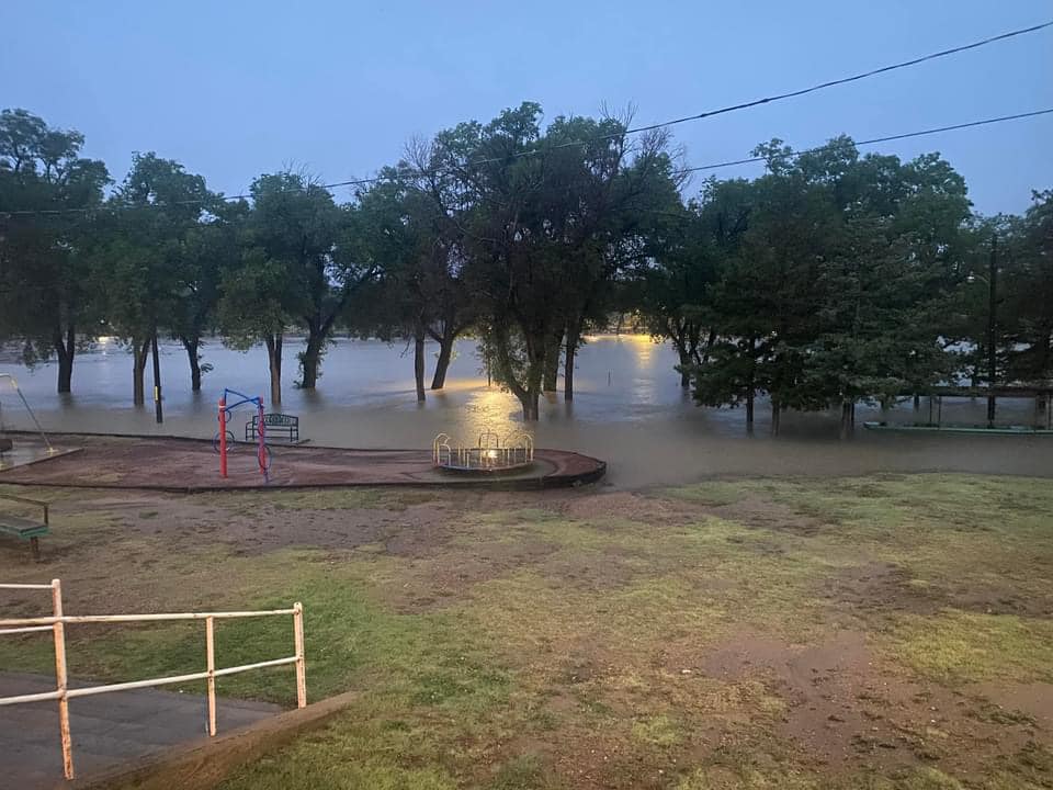
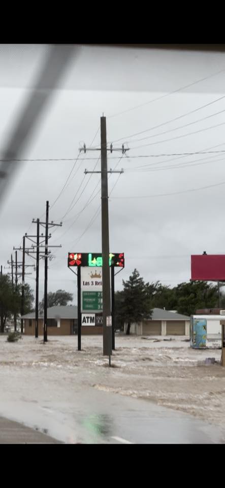
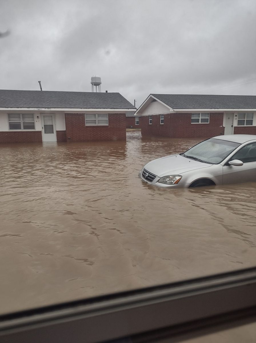
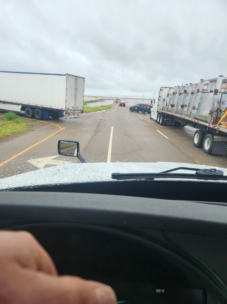
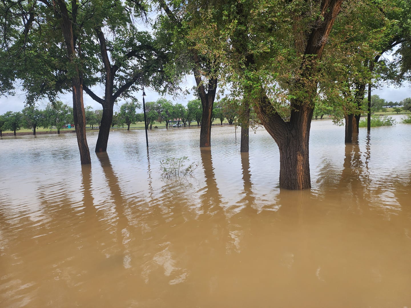
A slow moving cold front moved south out of Kansas into the northern Panhandles during the evening of June 18 into the morning of June 19, 2024. The cold front along with upper level dynamics and abundant moisture throughout the atmosphere, combined to form a line of showers and thunderstorms across the northern half of the Panhandles, in particular for the Oklahoma Panhandle. Due to weak flow aloft, the storms moved very slowly and when attached to the cold front, were able to keep moving over the same locations for hours at a time. With moisture near or above the climatological maximum in place over the Panhandles, the stronger thunderstorms were able to produce rainfall rates upwards of 3 to 4 inches per hour at times. With these rain rates and several hours of rainfall occurring at some locations, rainfall totals upwards of 5 to 9 inches were recorded across the north central Texas Panhandle into Texas and Beaver counties of the Oklahoma Panhandle. A majority of this rainfall fell in 1 to 2 hours, which maximized the flash flood potential. This resulted in many roads were closed or completely washed out, high water rescues were performed due to stranded motorists, and many citizens woke up to feet of water outside, and in some cases inside, their homes. Additionally, some of these storms were able to take advantage of the unstable airmass across the Panhandles and produced large hail and damaging winds. Although many hail reports ranged from penny to quarter size, some locations did have hail upwards of 2 to potentially 2.5 inches (tennis ball) across the same areas that received historic levels of flash flooding.Photos & Video
 |
 |
 |
 |
| 4.5 mi north of Stratford (Bryson Warren) |
Flooded Yard Goodwell (Tasha Michelle Herrera) |
Flooded Streets Goodwell, OK (Tasha Michelle Herrera) |
Sunset Lake, Guymon, OK (Samantha Rosenda) |
 |
 |
 |
 |
| Passing through Goodwell, OK (Jocelyne Gomez) |
Panhandle State University, Goodwell, OK (Jennifer Brdar) |
HWY 54 Outside Goodwell (Jason Strick) | Sunset Lake, Guymon, OK (Dakota Gomez) |
Radar
|
Radar Loop |
Storm Reports
961
NWUS54 KAMA 211047
LSRAMA

Preliminary Local Storm Report...Summary
National Weather Service Amarillo TX
547 AM CDT Fri Jun 21 2024

..TIME...   ...EVENT...      ...CITY LOCATION...     ...LAT.LON...
..DATE...   ....MAG....      ..COUNTY LOCATION..ST.. ...SOURCE....
            ..REMARKS..

0930 PM     Tstm Wnd Gst     1 WSW Hooker            36.86N 101.23W
06/18/2024  M58 MPH          Texas              OK   Mesonet


0940 PM     Tstm Wnd Gst     1 SSW Beaver            36.80N 100.53W
06/18/2024  M62 MPH          Beaver             OK   Mesonet


1003 PM     Tstm Wnd Dmg     3 E Baker               36.86N 100.96W
06/18/2024                   Texas              OK   Public

            Pictures of power poles snapped along US HWY
            - 64 13 miles east of Hooker received via
            social media. Time estimated via radar.

1020 PM     Hail             5 E Optima              36.76N 101.26W
06/18/2024  E1.00 Inch       Texas              OK   Emergency Mngr

            Mostly nickel size hail with a few quarters
            mixed in.

1021 PM     Flash Flood      Hooker                  36.86N 101.21W
06/18/2024                   Texas              OK   Emergency Mngr

            Home washed away due to flood waters.

1021 PM     Flash Flood      Hooker                  36.86N 101.21W
06/18/2024                   Texas              OK   NWS Employee

            1 foot of water over the roadway at the
            intersection of Illinois St and Ireland St.
            Water is higher than the bottom of a SUV.

1105 PM     Flash Flood      Beaver                  36.81N 100.52W
06/18/2024                   Beaver             OK   Public

            Fast flowing water covering roads in Beaver,
            OK. Video received via social media.

1109 PM     Hail             Hardesty                36.61N 101.19W
06/18/2024  M1.00 Inch       Texas              OK   Public

            Estimated 1 inch hail report in Hardesty
            received via social media. Time estimated
            based on radar.

1128 PM     Hail             4 SW Guymon             36.65N 101.53W
06/18/2024  E0.75 Inch       Texas              OK   Public

            Report from mPING: Dime (0.75 in.).

1135 PM     Tstm Wnd Gst     2 ENE Goodwell          36.60N 101.60W
06/18/2024  M61 MPH          Texas              OK   Mesonet

            Corrects previous thunderstorm wind gust
            report from 2 ENE Goodwell. 61 mph maximum
            wind gust measured from Goodwell mesonet.
            Storms still ongoing.

1151 PM     Hail             1 SW Texhoma            36.50N 101.79W
06/18/2024  E1.00 Inch       Sherman            TX   NWS Employee

            Report of at least estimated quarter sized
            hail from NWS Employee received via Slack.

1157 PM     Hail             4 SW Texhoma            36.46N 101.86W
06/18/2024  M1.00 Inch       Sherman            TX   NWS Employee

            Corrects previous hail report from 4 SW
            Texhoma. Estimated 1 inch hail report along
            US HWY 54. From NWS Employee received via
            Slack.

1200 AM     Hail             Texhoma                 36.51N 101.79W
06/19/2024  M2.00 Inch       Texas              OK   Public

            Picture of 2 inch diameter hail next to a
            ruler received via social media.

1242 AM     Hail             4 NW Stratford          36.39N 102.13W
06/19/2024  M1.25 Inch       Sherman            TX   Public

            Public Mping report of half dollar size hail
            along 287 NW of Stratford near Mallett.

0100 AM     Hail             5 SW Goodwell           36.55N 101.70W
06/19/2024  E2.50 Inch       Texas              OK   Emergency Mngr

            Emergency manager relayed report via Slack.
            Dispatchers report large near baseball size
            hail on Highway 54 between Goodwell and
            Texhoma. Said it stopped before Goodwell.
            Said enough to cover roadway and she had
            major cracks in windshield.

0207 AM     Flash Flood      Beaver                  36.81N 100.52W
06/19/2024                   Beaver             OK   Emergency Mngr

            Local EM reports areas of flooding in and
            around Beaver, OK. Multiple lane and road
            closures ongoing in the area due to
            flooding, especially HWY 23. Bar ditches
            overflowing onto roadways.

0751 AM     Flash Flood      5 NE Goodwell           36.65N 101.56W
06/19/2024                   Texas              OK   Emergency Mngr

            Picture shared on Facebook of a road washed
            out.

0751 AM     Flash Flood      2 NW Guymon             36.70N 101.50W
06/19/2024                   Texas              OK   Emergency Mngr

            Picture shared on Facebook. Road completely
            covered with water and power poles laying
            across it.

0751 AM     Flash Flood      2 NNW Guymon            36.72N 101.49W
06/19/2024                   Texas              OK   Emergency Mngr

            Corrects previous flash flood report from 2
            NNW Guymon. Picture sent through Facebook.
            Road completely covered by water. This water
            extend fully into the N side of town with
            widespread flooding still present at 4:30pm.

0800 AM     Flash Flood      Guymon                  36.69N 101.48W
06/19/2024                   Texas              OK   Emergency Mngr

            30 total high water rescues across Texas
            County.

0919 AM     Flash Flood      Goodwell                36.59N 101.63W
06/19/2024                   Texas              OK   Public

            Picture shared on Facebook of a flooded back
            yard. Water appears to be 2 to 3 feet deep.

0919 AM     Flash Flood      Goodwell                36.60N 101.63W
06/19/2024                   Texas              OK   Emergency Mngr

            All homes in Goodwell are flooded.

0945 AM     Rain             1 SW Guymon             36.67N 101.49W
06/19/2024  M8.79 Inch       Texas              OK   Public

            8.79 inches of rainfall measured by public
            at golf course club house.

1200 PM     Flood            4 N Stratford           36.40N 102.06W
06/19/2024                   Sherman            TX   Public

            Flooded property with water up to porch
            still present at noon.

0330 PM     Flood            1 NNE Baker             36.88N 101.02W
06/19/2024                   Texas              OK   Public

            Flood water covering the roads at
            intersection and flooding surrounding
            fields.

0345 PM     Flood            Goodwell                36.59N 101.64W
06/19/2024                   Texas              OK   Public

            Flood waters still present at 3:45pm, water
            inside apartment that is 1 inch deep, water
            in the road up to the top of front car
            tires.

1100 PM     Flood            1 NW Hooker             36.87N 101.22W
06/19/2024                   Texas              OK   CO-OP Observer

            7.90 inches of rain fell between 9 am and 11
            pm. Many homes flooded.


&&

$$
Rain Totals
|
|
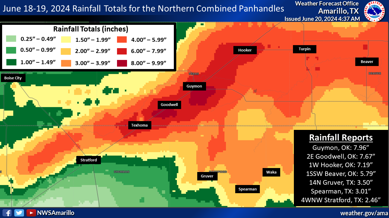 |
| North Central Combined Panhandles |
 |
Media use of NWS Web News Stories is encouraged! Please acknowledge the NWS as the source of any news information accessed from this site. |
|