
Dangerous and extreme heat will remain across portions of the southern U.S. through the weekend. A heat wave over the Southwest U.S. will intensify this week, peaking and expanding into the Intermountain West and northern High Plains this weekend. Multiple rounds of thunderstorms will produce heavy to excessive rainfall with significant flash flooding across portions of southern New England. Read More >
Overview
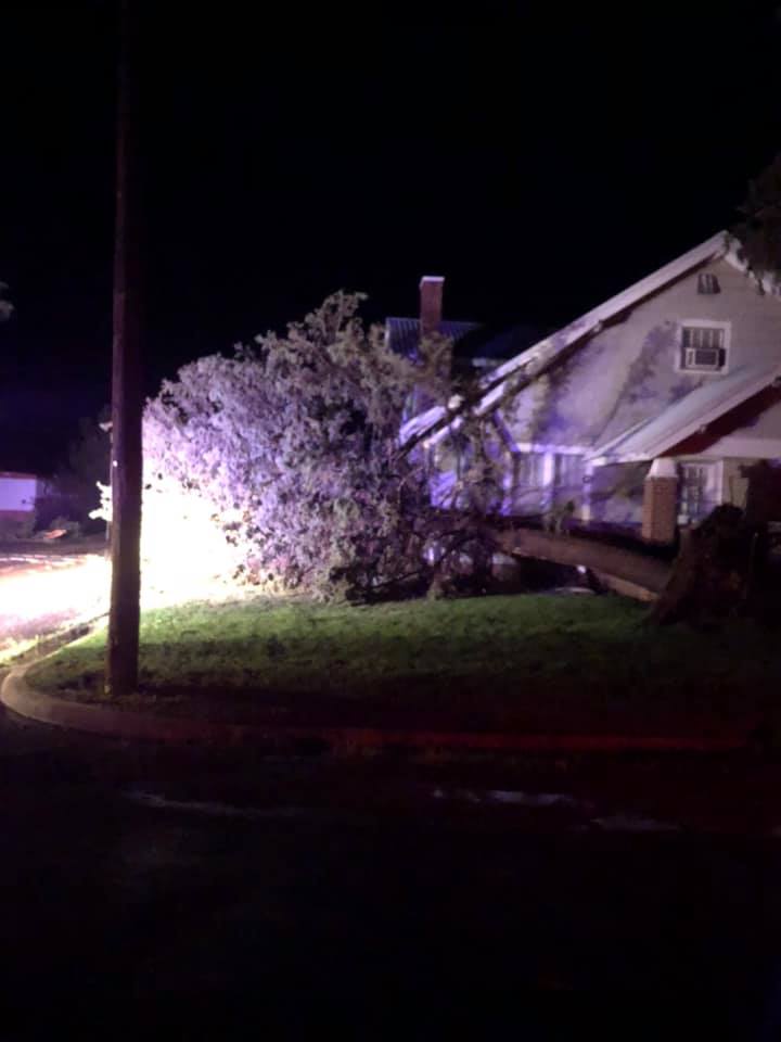
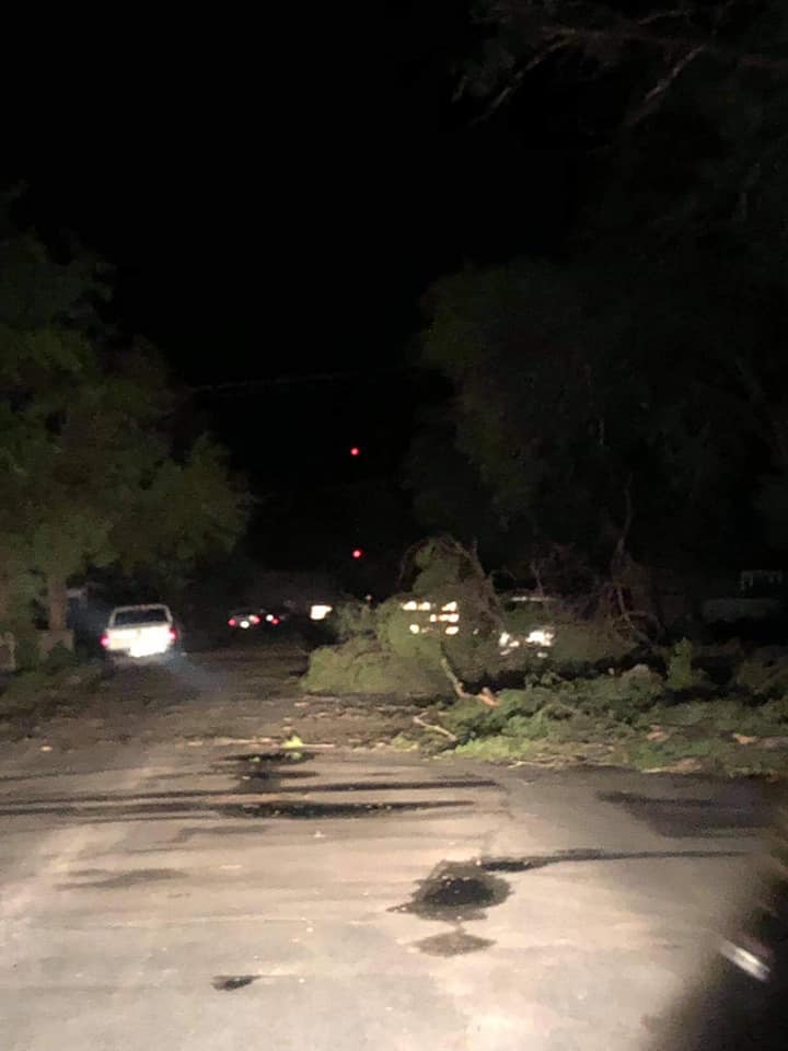
A weak upper level disturbance moved along the northern side of an upper level ridge centered across the Desert Southwest generating thunderstorms over the mountains of Colorado and New Mexico. These storms slowly moved east into the Panhandles and encountered an environment with weak to moderate wind shear but extreme instability and high moisture which allowed these storms to thrive and increase in severity and organization as they tracked east. The main impact from the storms was damaging winds as they crossed out of New Mexico and Colorado into the Panhandles, but some hail was also reported. The most significant damage occurred with a storm that strongly bowed as it moved southeast across Cimarron County Oklahoma. This storm produced wind speeds likely around 90 mph in some locations based on damage and were measured at just shy of 80 mph near Boise City, OK at a mesonet site. The storm produced widespread wind damage from Kenton to Boise city and southeast to Griggs, OK. Widespread damage to trees and powerlines occurred and isolated significant roof damage occurred as well, including the Boise City High School auditorium, which lost part of it's roof completely. Fifty-five power poles were reported damaged across Cimarron County with around 1600 customers without power during the peak outage after the storms. Power was out until well into the afternoon hours on Sunday for some locations. This storm continued to grow upscale and eventually merged across the northwestern Texas Panhandle with another broken line of storms that had crossed the New Mexico border near I-40, also producing severe wind gusts as they entered the Texas Panhandle. This storm complex tracked east-southeast and continued to produce severe wind gusts and heavy rainfall, especially across the northern and central Texas Panhandle. The storm complex finally weakened early Sunday morning as instability decreased.
Photos & Video
Header
 |
 |
 |
 |
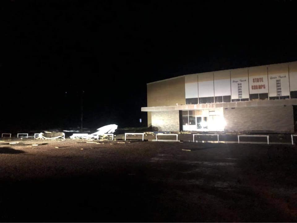
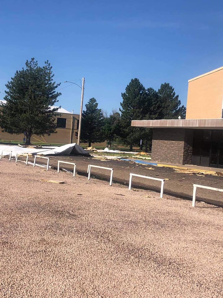
| Roof damage to Boise City High School auditorium (Boise City News) |
Roof damage to Boise City High School auditorium (Boise City News) |
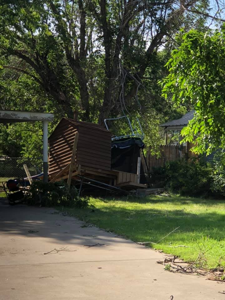
Shed damage in Boise City (Boise City News) |
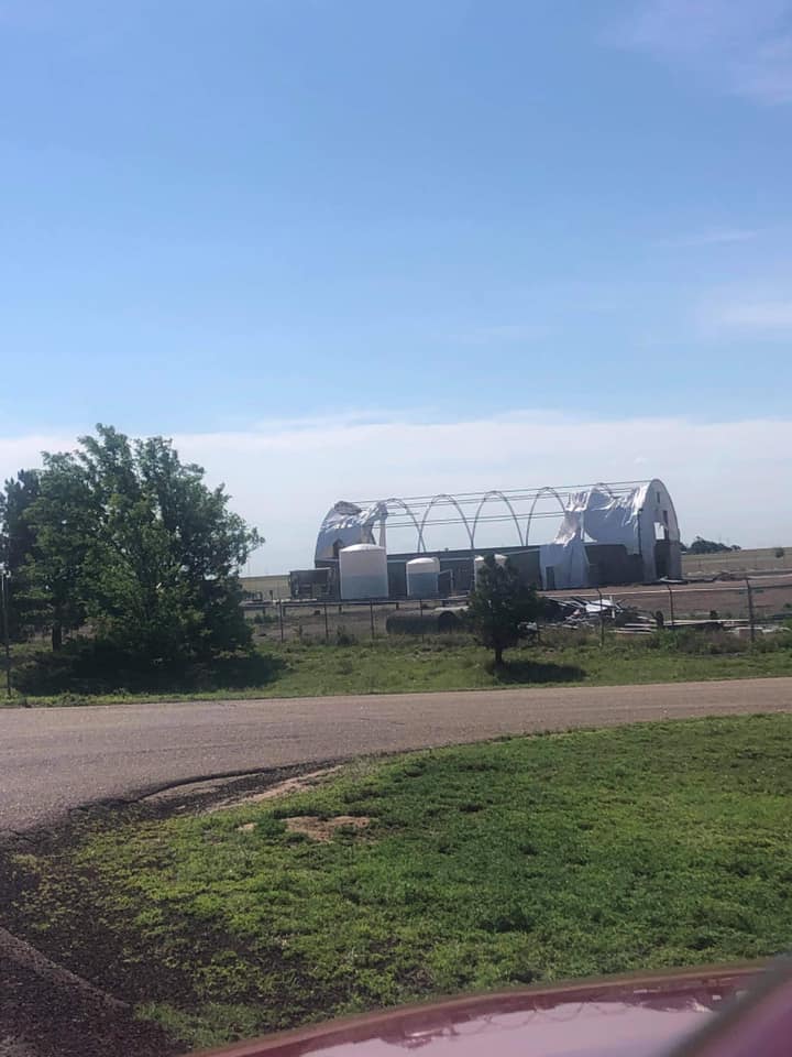
Damage to the State Highway Department near Boise City (Boise City) |
 |
 |
 |
 |
| Damage to a trailer in Boise City (Boise City News) |
Damage to a trailer in Boise City (Boise City News) |
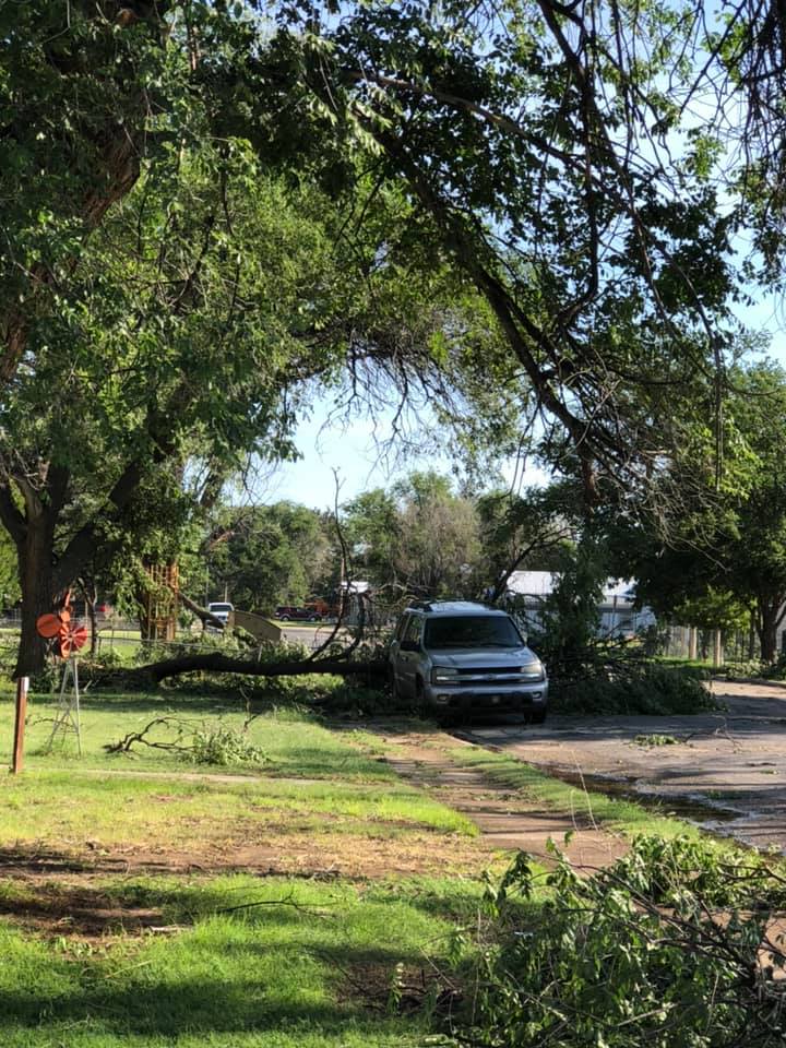
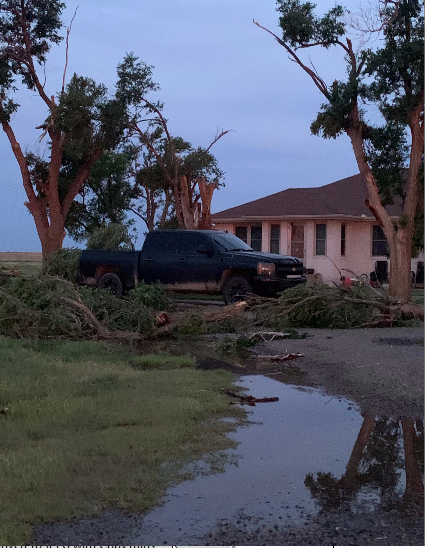
Large branch down in Boise City (Boise City News) |
Tree down in Boise City (Boise City News) |
 |
 |
 |
 |
| Tree down in Boise City (Boise City News) |
Tree branches down in Boise City (Boise City News) |
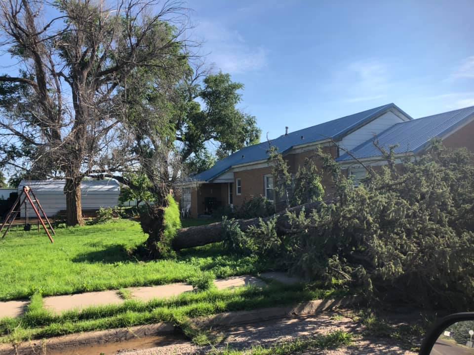
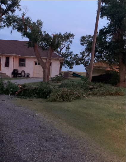
Tree damage in Griggs (Lea Lavielle) |
Damage to trees and a garage in Griggs (Lea Lavielle) |
 |
 |
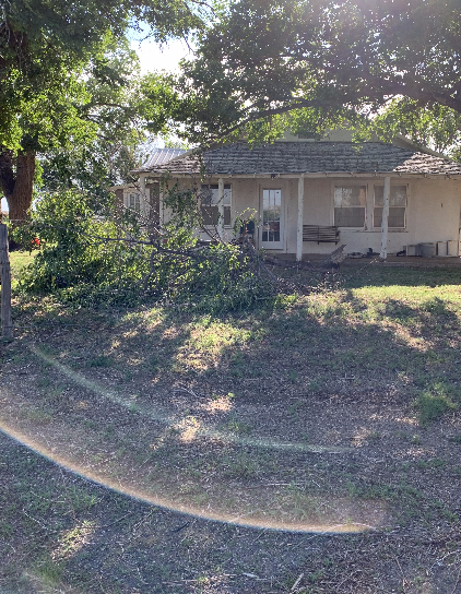
| Tree damage in Felt (Lea Lavielle) |
Tree damage in Felt (Lea Lavielle) |
Radar
Header
| Radar loop with warnings from the event. Radar data and warnings from NWS; animation from Iowa Environmental Mesonet |
Storm Reports
 |
| Map of hail, severe wind, and wind damage reports received on the night of June 12th, 2021 |
| Report Time (CDT) | County | Location | State | Event Type | Magnitude | Source | Lat | Long | Remark |
| 2021/06/12 21:30 | CIMARRON | KENTON | OK | TSTM WND DMG | EMERGENCY MNGR | 36.9 | -102.97 | SOME TREE LIMBS SNAPPED AND METAL ROOF PEELED BACK SLIGHTLY ON LOCAL BUSINESS. | |
| 2021/06/12 22:30 | CIMARRON | 3 SSE BOISE CITY | OK | TSTM WND GST | 78 | MESONET | 36.69 | -102.5 | MESONET STATION BOISE CITY (BOIS) MEASURED SEVERE WIND GUSTS IN EXCESS OF 65 MPH FOR 25 MINUTES (1030 CDT TO 1055 CDT). THE PEAK WIND GUST MEASURED WAS 78 MPH. LARGE TREE LIMBS WERE REPORTED DOWN THROUGHOUT TOWN AND SOME TREES WERE UPROOTED COMPLETELY. SEVERAL HOMES REPORTED SIGNIFICANT ROOF DAMAGE AND A PORTION OF THE ROOF WAS BLOWN OFF THE HIGH SCHOOL AUDITORIUM. DOWNED POWERLINES AND WIDESPREAD POWER OUTAGES WERE REPORTED THROUGHOUT TOWN. |
| 2021/06/12 22:34 | CIMARRON | BOISE CITY | OK | HAIL | 1 | TRAINED SPOTTER | 36.73 | -102.51 | |
| 2021/06/12 22:35 | CIMARRON | 3 SSE BOISE CITY | OK | TSTM WND GST | 75 | MESONET | 36.69 | -102.5 | MESONET STATION BOIS BOISE CITY REPORT OF COTTONWOOD TREES BEING RIPPED APART IN BOISE CITY. |
| 2021/06/12 22:40 | CIMARRON | 3 SSE BOISE CITY | OK | TSTM WND GST | 78 | MESONET | 36.69 | -102.5 | MESONET STATION BOIS BOISE CITY POWER IS OUT IN BOISE CITY. |
| 2021/06/12 23:22 | SHERMAN | 4 WNW STRATFORD | TX | TSTM WND GST | 67 | MESONET | 36.36 | -102.14 | |
| 2021/06/12 23:30 | CIMARRON | GRIGGS | OK | TSTM WND DMG | EMERGENCY MNGR | 36.6 | -102.12 | THREE LIMBS SNAPPED AND SHED WAS SHIFTED OFF ITS FOUNDATION AND RELOCATED. | |
| 2021/06/12 23:35 | HARTLEY | 4 SSW DALHART | TX | TSTM WND GST | 63 | ASOS | 36.02 | -102.55 | ASOS STATION KDHT DALHART (ASOS). |
| 2021/06/12 23:43 | HARTLEY | 4 SSW DALHART | TX | TSTM WND GST | 62 | ASOS | 36.02 | -102.55 | ASOS STATION KDHT DALHART (ASOS). |
| 2021/06/12 23:48 | HARTLEY | 4 SSW DALHART | TX | TSTM WND GST | 62 | ASOS | 36.02 | -102.55 | ASOS STATION KDHT DALHART (ASOS). |
| 2021/06/12 23:57 | HARTLEY | 4 SSW DALHART | TX | TSTM WND GST | 61 | ASOS | 36.02 | -102.55 | ASOS STATION KDHT DALHART (ASOS). |
| 2021/06/13 00:23 | MOORE | 1 WSW CACTUS | TX | TSTM WND GST | 75 | TRAINED SPOTTER | 36.04 | -102.02 | MEASURED THUNDERSTORM WIND GUST WITH A HANDHELD WIND METER. |
| 2021/06/13 00:28 | MOORE | CACTUS | TX | TSTM WND DMG | PUBLIC | 36.05 | -102.01 | 3 INCH TREE LIMBS BLOWN DOWN AND POWER POLES BLOWN OVER IN CACTUS. | |
| 2021/06/13 00:30 | DALLAM | DALHART | TX | FLASH FLOOD | CO-OP OBSERVER | 36.06 | -102.51 | WATER OVER CURB AND A FEW INCHES COVERING ALL LANES OF HWY 87. | |
| 2021/06/13 00:35 | MOORE | 3 WSW DUMAS | TX | TSTM WND GST | 61 | AWOS | 35.85 | -102.02 | AWOS STATION KDUX DUMAS (AWOS). |
| 2021/06/13 00:50 | DEAF SMITH | 11 WNW BOOTLEG | TX | TSTM WND GST | 61 | MESONET | 34.89 | -102.99 | MESONET STATION 69 BOOTLEG 11WNW. |
| 2021/06/13 01:08 | HUTCHINSON | 3 N BORGER | TX | TSTM WND GST | 67 | ASOS | 35.7 | -101.4 | ASOS STATION KBGD BORGER (ASOS). |
| 2021/06/13 01:13 | POTTER | 9 SE MASTERSON | TX | TSTM WND DMG | PUBLIC | 35.53 | -101.87 | POWER POLES BLOWN DOWN. | |
| 2021/06/13 01:16 | POTTER | 11 SSW FRITCH | TX | TSTM WND GST | 74 | STORM CHASER | 35.49 | -101.64 | |
| 2021/06/13 01:17 | POTTER | 11 SSW FRITCH | TX | TSTM WND GST | 61 | TRAINED SPOTTER | 35.5 | -101.67 | MEASURED USING HANDHELD WIND METER. |
| 2021/06/13 01:29 | POTTER | 4 N AMARILLO | TX | TSTM WND DMG | PUBLIC | 35.26 | -101.83 | SHINGLES BLOWN OFF HOUSES. | |
| 2021/06/13 02:13 | RANDALL | 5 S AMARILLO | TX | TSTM WND DMG | TRAINED SPOTTER | 35.13 | -101.82 | APPROXIMATELY 6 INCH DIAMETER TREE DOWN NEAR ZITA ALONG LOOP 335. | |
| 2021/06/13 02:13 | RANDALL | 5 S AMARILLO | TX | TSTM WND DMG | TRAINED SPOTTER | 35.13 | -101.82 | CORRECTS PREVIOUS TSTM WND DMG REPORT FROM 5 S AMARILLO. APPROXIMATELY 6 INCH DIAMETER TREE DOWN NEAR ZITA ALONG LOOP 335. |
Environment
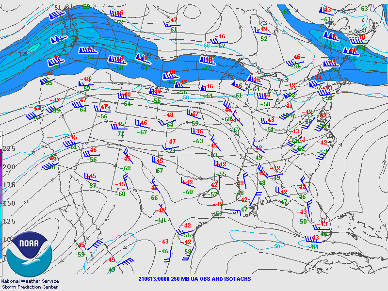
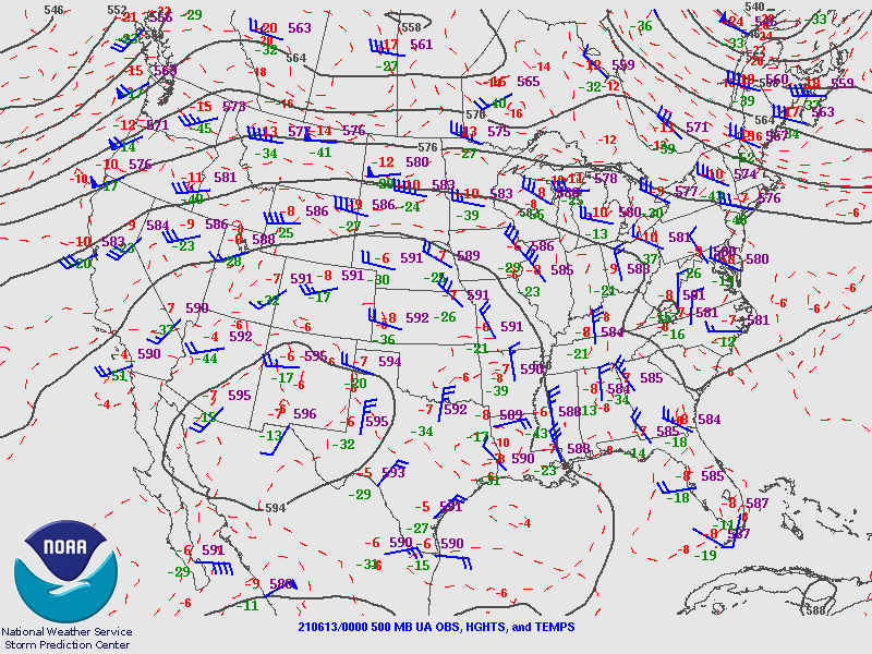
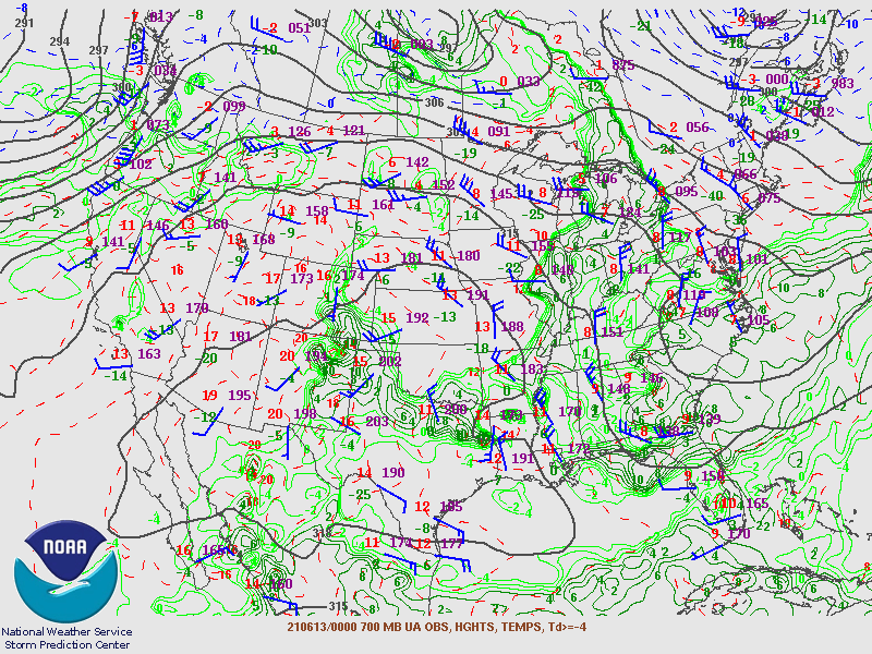
Overall, this was a weakly forced event, with a large ridge of high pressure in place to our west (250mb and 500mb charts, top left and top right respectively). However, there was a large amount of moisture present lower in the atmosphere (700mb and 850mb charts, bottom left and bottom right, respectively).
 |
 |
 |
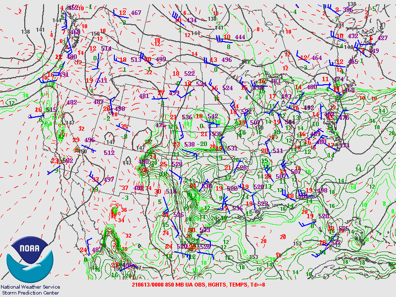 |
| 250mb (top left), 500mb (top right), 700mb (bottom left), and 850mb (bottom right) charts at 7pm June 12th, 2021 | |
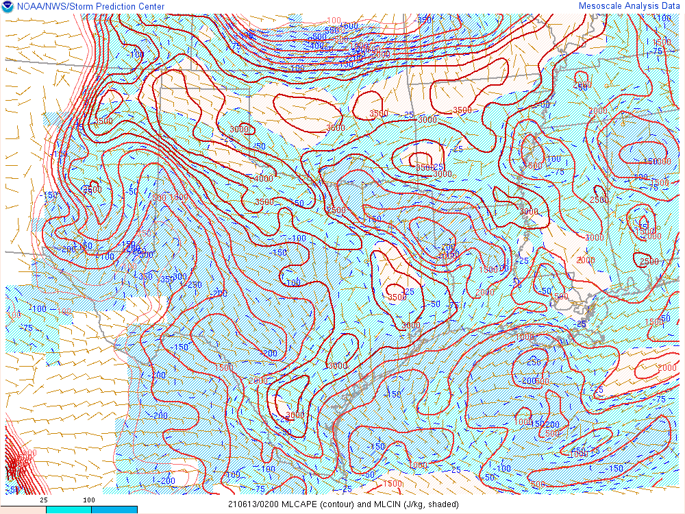
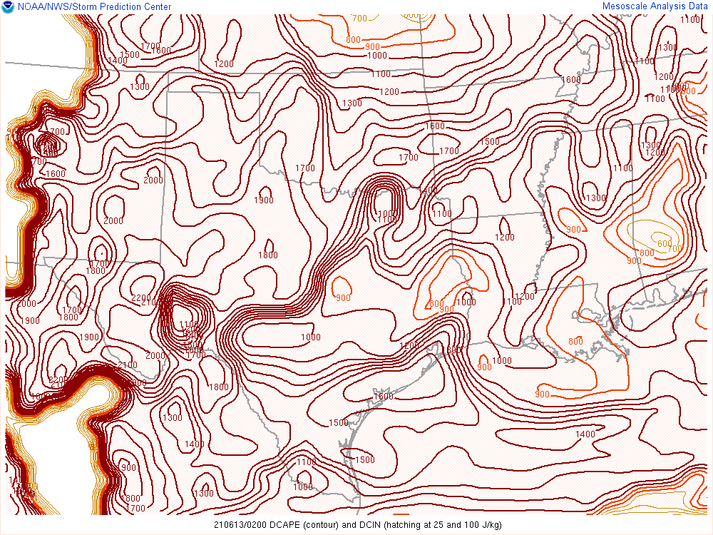
The high amount of low level moisture led to a very large amount of instability, as demonstrated by MLCAPE values (left) near 4000 J/kg in the northwestern Panhandles. Additionally, the environment was supportive of strong downdrafts, as evidenced by DCAPE greater than 1500 J/kg (center). Thus, despite weak overall wind shear (right), thunderstorms were able to develop and generate severe wind gusts.
 |
 |
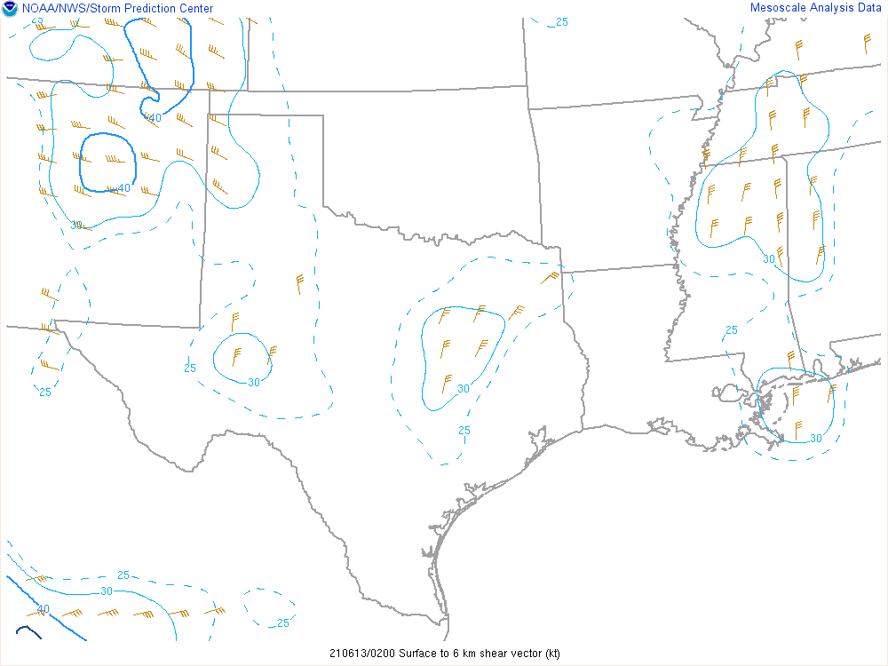 |
| Mixed layer convective available potential energy at 9pm June 12th, 2021 | Downdraft CAPE at 9pm June 12th, 2021 | 0-6km bulk shear at 9pm June 12th, 2021 |
 |
Media use of NWS Web News Stories is encouraged! Please acknowledge the NWS as the source of any news information accessed from this site. |
|

