Overview
An upper level shortwave moving south through western Kansas helped to spark showers and thunderstorms in the northwest combined Panhandles during the afternoon hours on July 4th, 2021 . Storm development was also aided by a surface trough draped from northeast New Mexico into the western Oklahoma Panhandle. These storms formed in an environment with ample low level moisture and instability, with at least modest shear for multicell and supercell storm structures. These thunderstorms moved south southwest across the western combined Panhandles, a few of which did become severe. Hail up to 2 inches in diameter and flooding were reported near Dalhart while winds up to 78 mph were reported at the Boise City mesonet station. Strong winds were reported at several different mesonet stations in the Oklahoma Panhandle and western Texas Panhandle through the evening, with wind damage reported in the Washburn area with a storm that occurred after midnight.
Photos & Video
Header
 |
 |
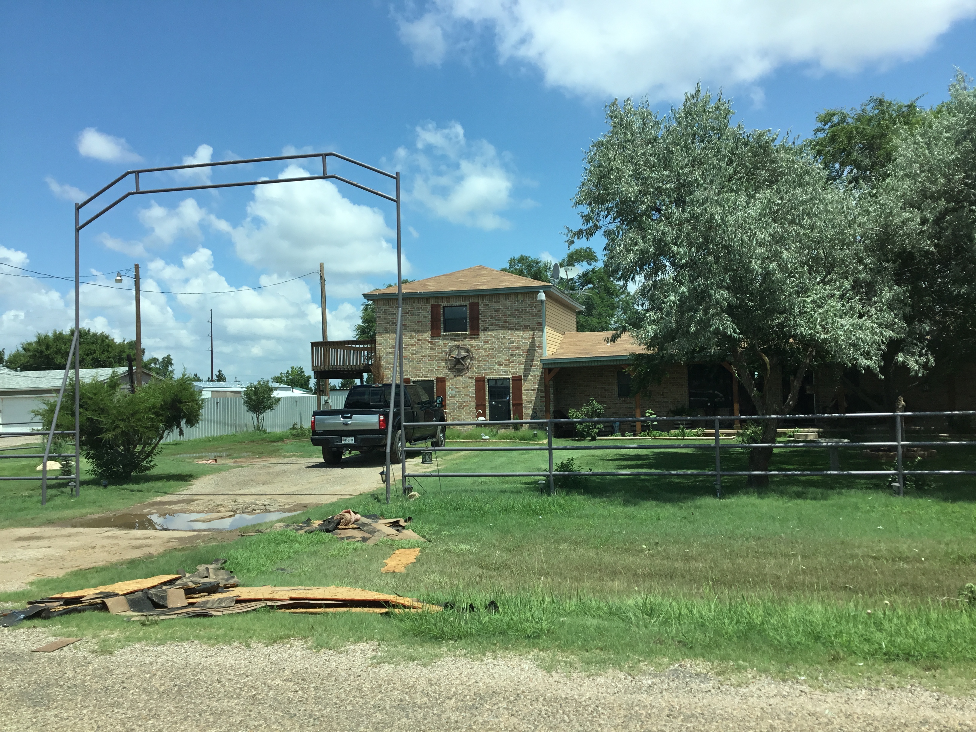
| Damaged wood at a home in far southeastern Amarillo (Mike Gittinger) |
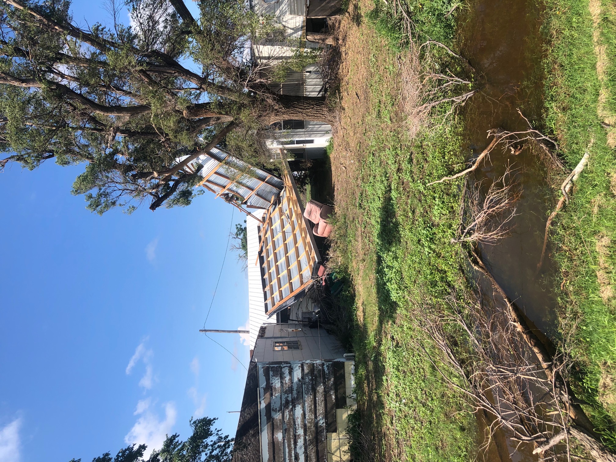
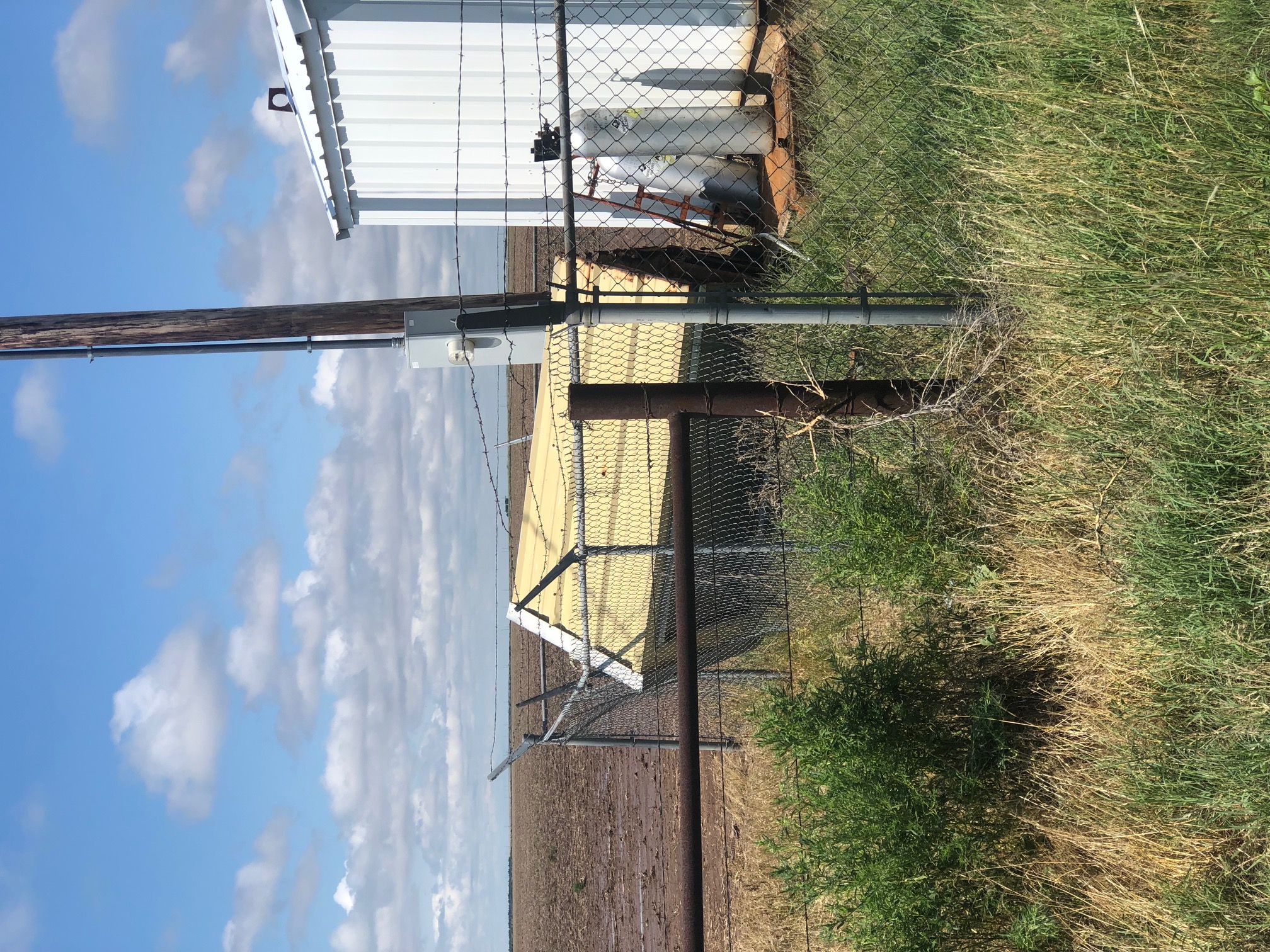
Damage to a shed in Washburn (Nathan McKee) |
 |
 |
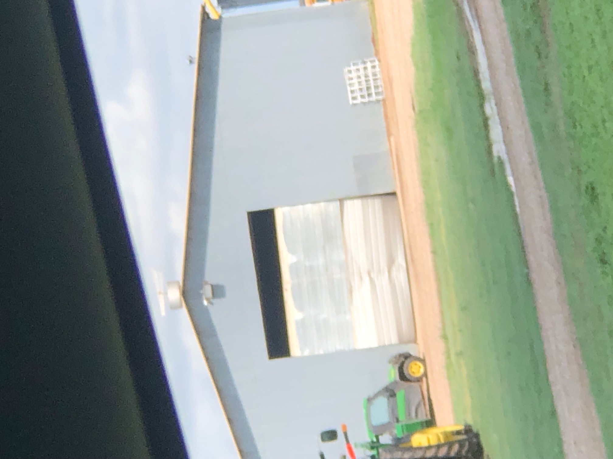
| Damage to a building in Washburn (Nathan McKee) |
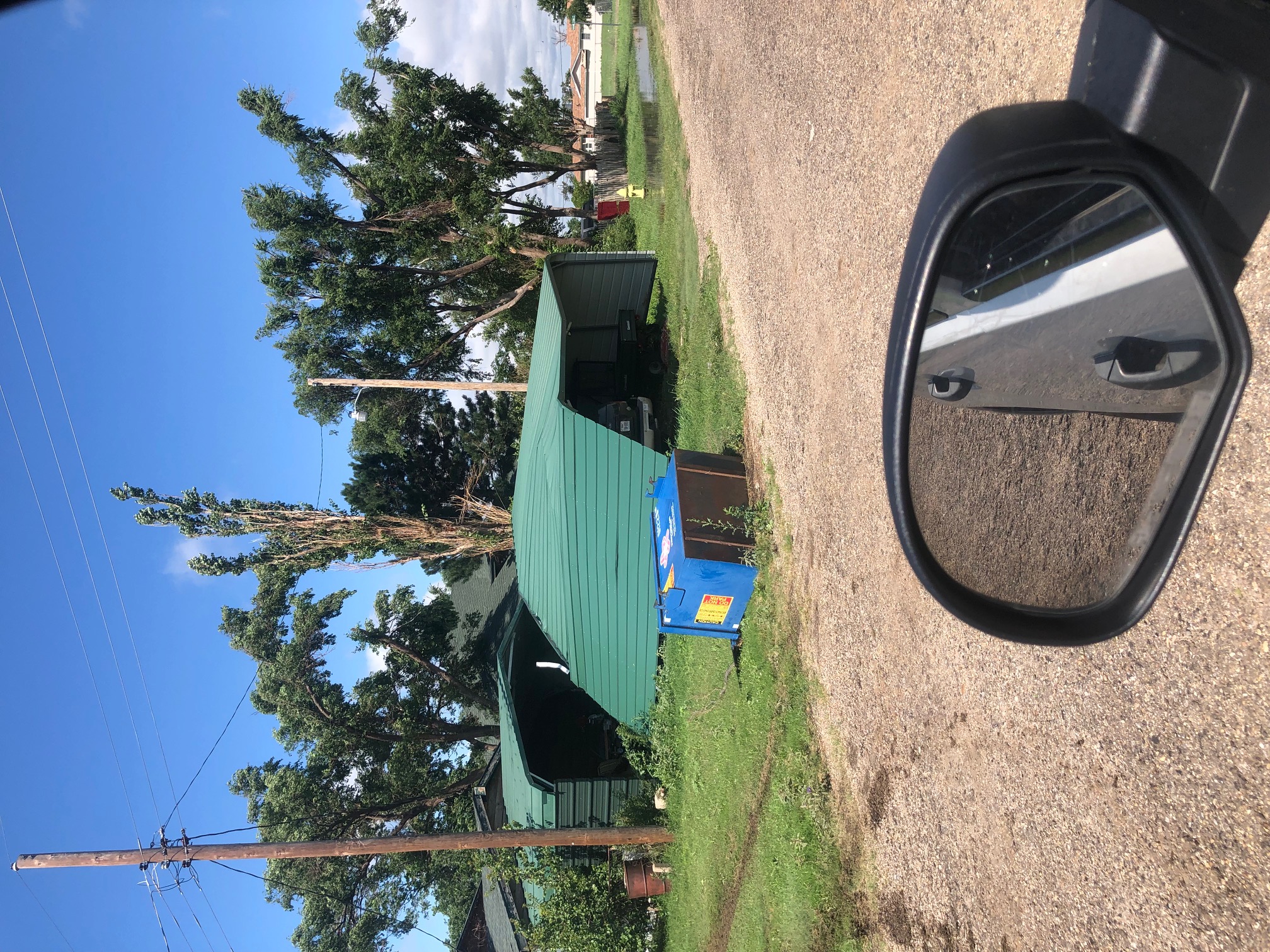
Damage to a carport in Washburn (Nathan McKee) |
 |
 |
| Damage to barn door in Wasbhurn (Nathan McKee) |
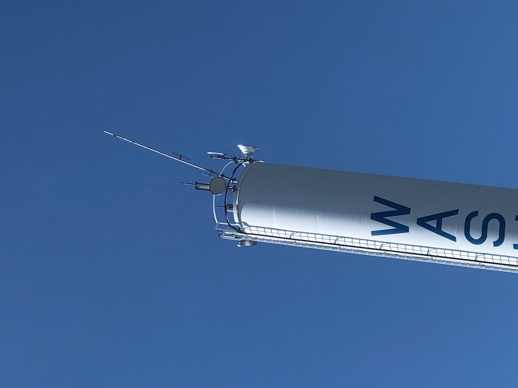
Damage to equipment on the top of the Washburn water tower (Nathan McKee) |
 |
 |
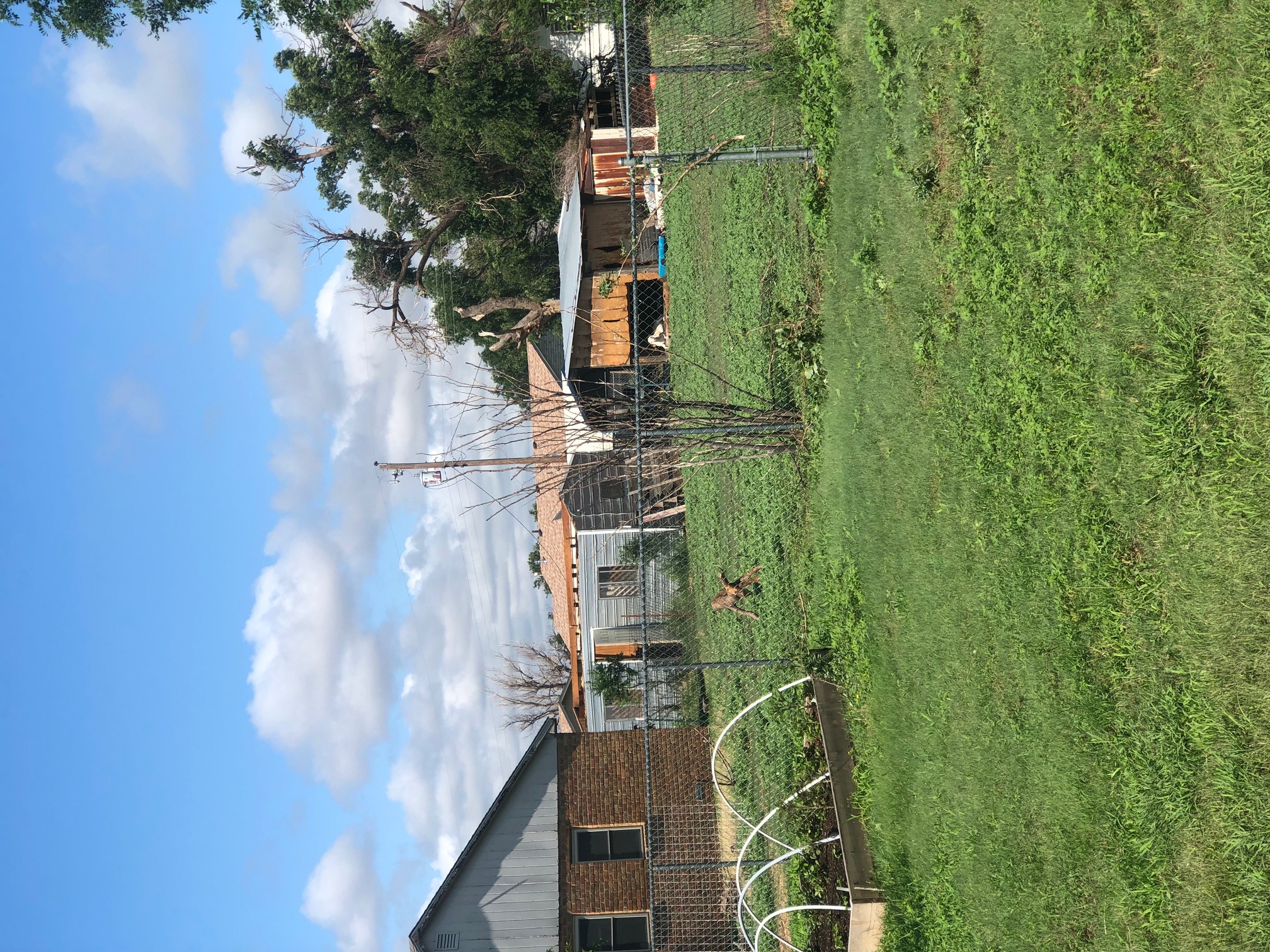
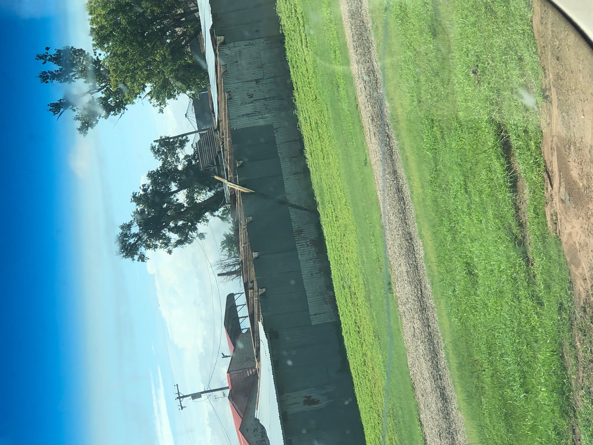
| Damage to sheds in Washburn (Nathan McKee) |
Outbuilding knocked over in Washburn (Nathan McKee) |
 |
 |
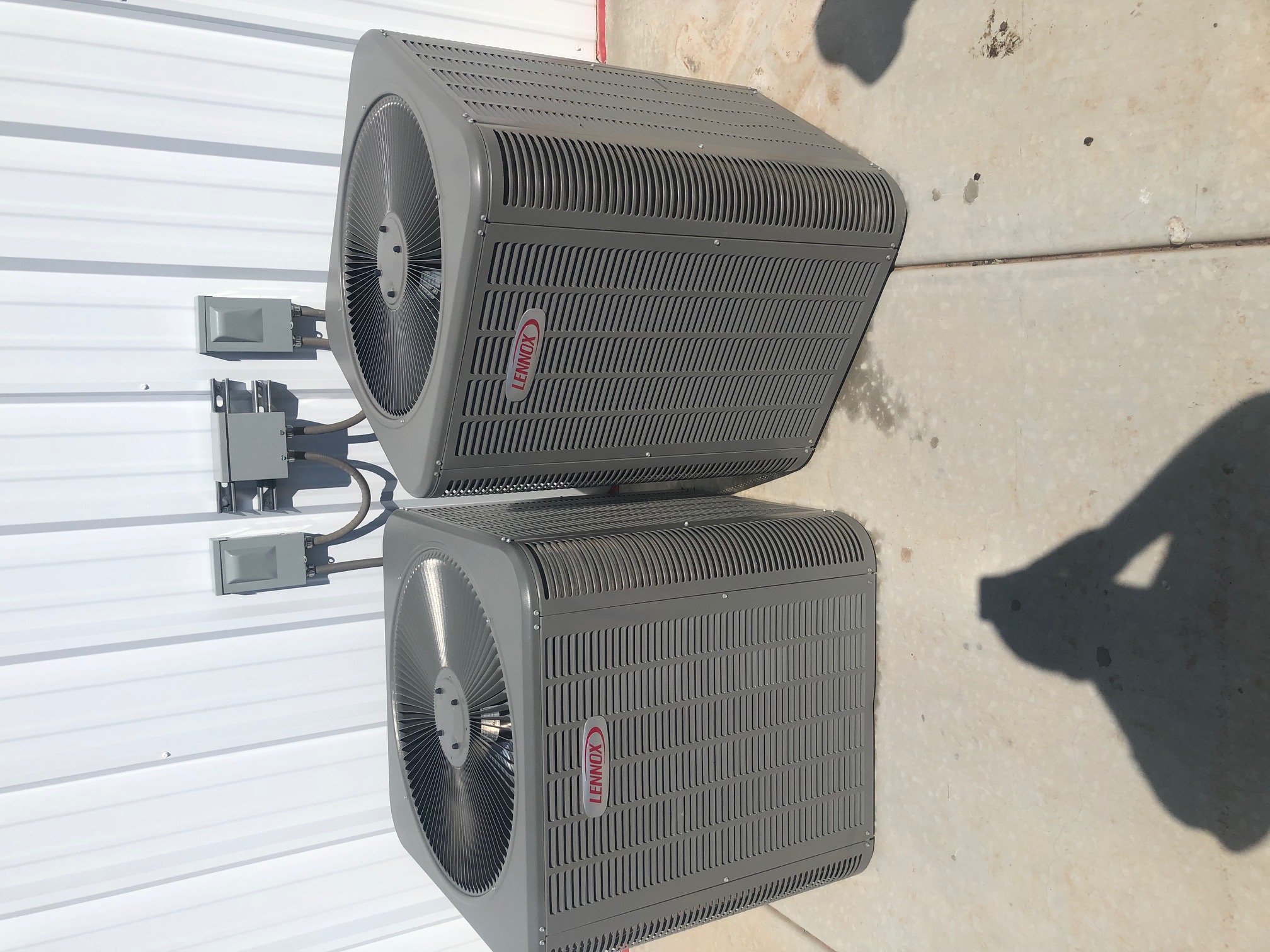
| Air conditioning unit shifted in Washburn (Nathan McKee) |
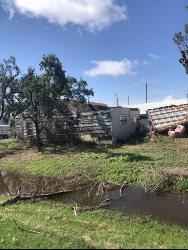
Damaged home in Washburn (Nathan McKee) |
Radar
Header
| Loop of composite radar reflectivity and warnings issued during the July 4th, 2021 severe weather event. Radar and warnings from NWS; animation from Iowa Environmental Mesonet |
Storm Reports
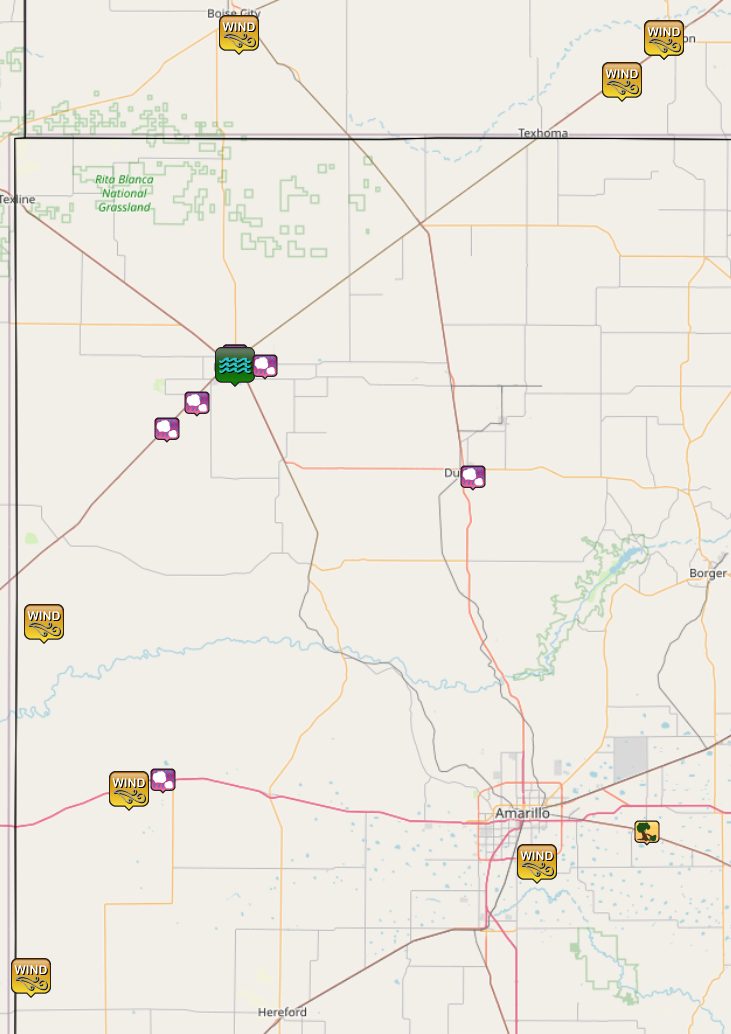 |
| Map of storm reports received from the July 4th, 2021 severe weather event. All reports came from the western Panhandles. |
| Report Time (CDT) | County | Location | Event Type | Magnitude | Source | Lat | Lon | Remark |
| 2021/07/04 16:46 | MOORE | 1 SE DUMAS | HAIL | 1.25 | PUBLIC | 35.85 | -101.95 | SOCIAL MEDIA REPORT OF HALF DOLLAR SIZE HAIL. |
| 2021/07/04 16:55 | DALLAM | 1 N DALHART | HAIL | 2 | STORM CHASER | 36.08 | -102.51 | SOCIAL MEDIA REPORT OF TWO INCH HAIL. |
| 2021/07/04 16:55 | DALLAM | 1 N DALHART | HAIL | 2 | STORM CHASER | 36.08 | -102.51 | UPDATE TO PREVIOUS HAIL REPORT FROM 1 N DALHART. 1-2 INCH HAIL IN AND AROUND DALHART AND EXTENDING TO AROUND 5 MILES NORTH OF TOWN. SOME MINOR ACCUMULATING HAIL WAS REPORTED ON HIGHWAY 385 4 MILES NORTH OF THE CITY AS WELL. |
| 2021/07/04 17:38 | DALLAM | DALHART | FLOOD | STORM CHASER | 36.06 | -102.51 | STREET FLOODING IN AND AROUND THE CITY OF DALHART. ROADS REMAINED PASSIBLE. | |
| 2021/07/04 17:43 | DALLAM | 4 E DALHART | HAIL | 1.5 | PUBLIC | 36.06 | -102.44 | 1 TO 1.5 INCH HAIL FELL FOR 2 MINUTES. |
| 2021/07/04 17:50 | HARTLEY | 7 SW DALHART | HAIL | 1.75 | TRAINED SPOTTER | 35.99 | -102.6 | GOLFBALL SIZE HAIL. |
| 2021/07/04 18:23 | HARTLEY | 12 SW DALHART | HAIL | 2 | STORM CHASER | 35.94 | -102.67 | AROUND 2 INCH HAIL BROKE WINDSHIELD OF VEHICLE. |
| 2021/07/04 19:09 | OLDHAM | 11 S ROMERO | TSTM WND GST | 69 | MESONET | 35.57 | -102.96 | MULTIPLE GUSTS IN EXCESS OF 58 MPH. MAXIMUM GUST OF 69 MPH OCCURRED AT 728 CDT. |
| 2021/07/04 19:40 | TEXAS | 1 WSW GUYMON | TSTM WND GST | 62 | ASOS | 36.68 | -101.5 | ASOS STATION KGUY GUYMON (ASOS). |
| 2021/07/04 19:54 | TEXAS | 1 WSW GUYMON | TSTM WND GST | 59 | ASOS | 36.68 | -101.5 | ASOS STATION KGUY GUYMON (ASOS). |
| 2021/07/04 19:56 | OLDHAM | 6 WSW ADRIAN | TSTM WND GST | 62 | MESONET | 35.25 | -102.76 | MESONET STATION 109 ADRIAN 6WSW. |
| 2021/07/04 20:10 | OLDHAM | 1 WSW ADRIAN | HAIL | 1.25 | STORM CHASER | 35.27 | -102.68 | QUARTER TO HALF DOLLAR SIZE HAIL. |
| 2021/07/04 20:10 | TEXAS | 2 ENE GOODWELL | TSTM WND GST | 73 | MESONET | 36.6 | -101.6 | MESONET STATION GOOD GOODWELL. INITIAL SEVERE WIND GUST OCCURRED AT 810 PM CDT WITH PEAK GUST AROUND 815 PM CDT. |
| 2021/07/04 20:25 | CIMARRON | 3 SSE BOISE CITY | TSTM WND GST | 78 | MESONET | 36.69 | -102.5 | MESONET STATION BOIS BOISE CITY. FIRST SEVERE GUST OCCURRED AT 830 PM CDT WITH PEAK GUST AT 835 PM CDT. |
| 2021/07/05 00:19 | DEAF SMITH | 11 WNW BOOTLEG | TSTM WND GST | 68 | MESONET | 34.89 | -102.99 | MESONET STATION 69 BOOTLEG 11WNW. |
| 2021/07/05 01:32 | ARMSTRONG | 2 ESE WASHBURN | TSTM WND DMG | PUBLIC | 35.17 | -101.54 | ROOF TAKEN OFF A FRONT PORCH. HEAVY DUTY SWING SET BLOWN OVER. SEVERAL TREE LIMBS DOWN. | |
| 2021/07/05 02:22 | RANDALL | 4 NNW LAKE TANGLEWOOD | TSTM WND GST | 64 | MESONET | 35.11 | -101.8 | MESONET STATION 75 AMARILLO 7SSE. |
Rain Reports
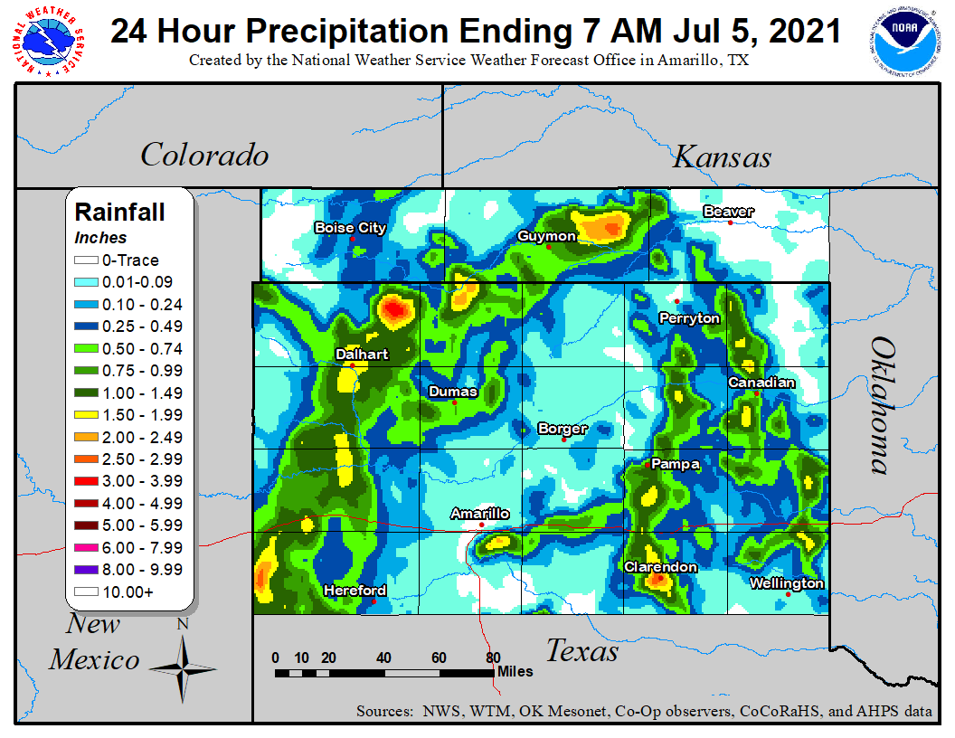 |
| Map of estimated rainfall using a combination of surface observations (ASOS, West Texas Mesonet, Oklahoma Mesonet, COOP, and CoCoRaHS) and data from multiple radars. |
Environment
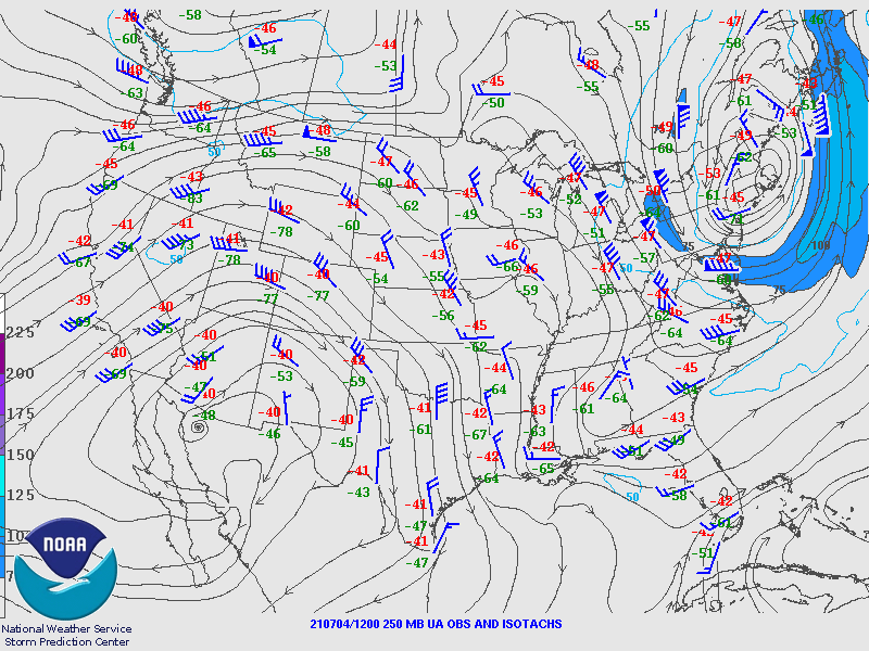
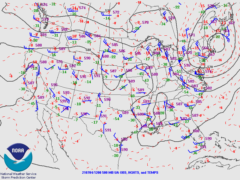
While jet stream (left) winds were modest and mid-atmospheric (center) winds were weak, plentiful moisture in the lower levels (right) allowed thunderstorms to form ahead of weak disturbances aloft. The jet stream winds out of the north-northwest led to north to south moving storms, with the strongest storms having the tendency to move toward the southwest.
 |
 |
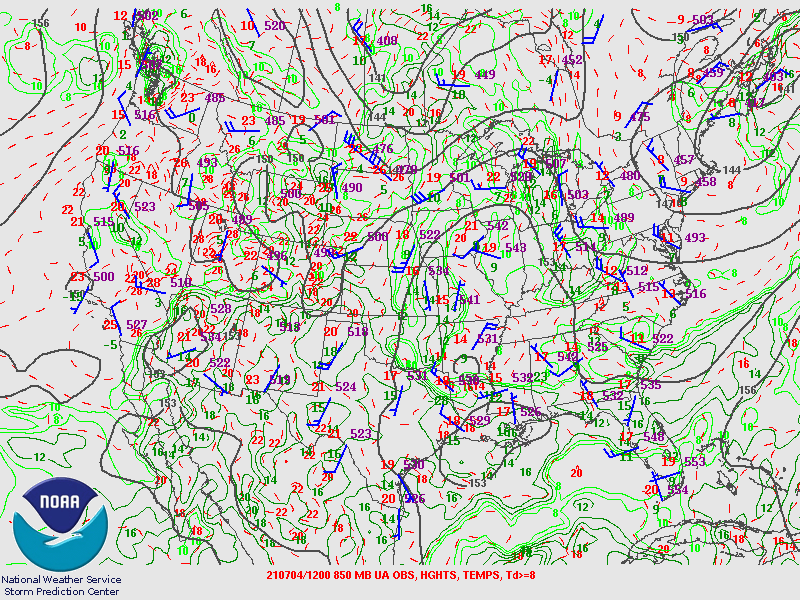 |
| Jet stream (250mb) level winds during the July 4th, 2021 severe weather event | Mid-atmospheric (500mb) winds during the July 4th, 2021 severe weather event | Lower atmosphere analysis during the July 4th, 2021 severe weather event |
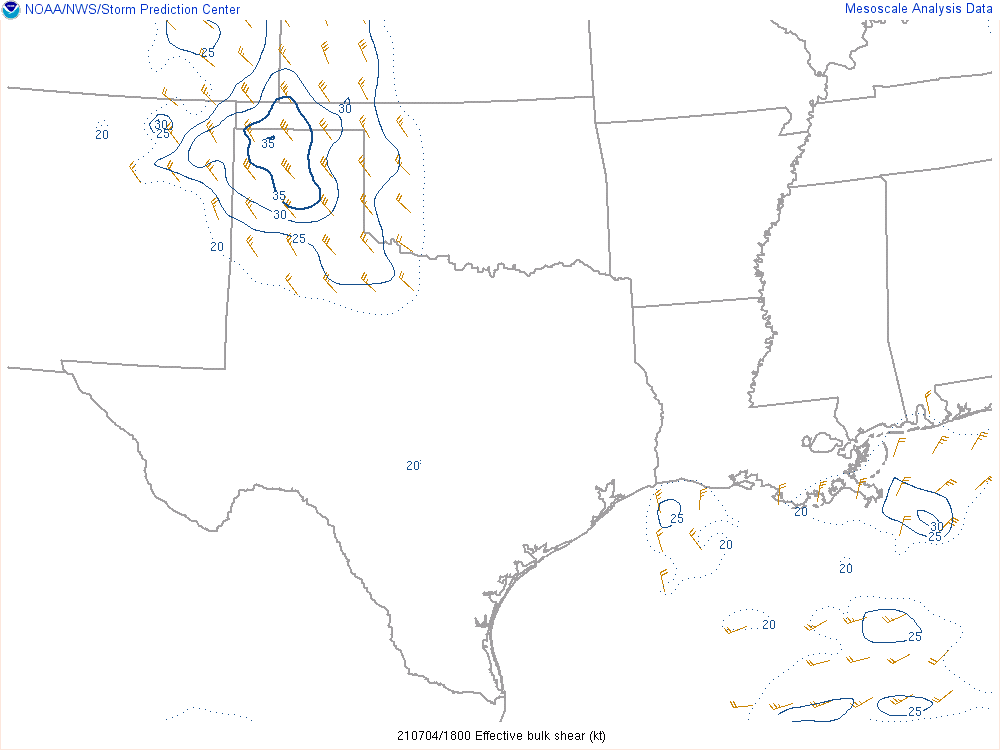
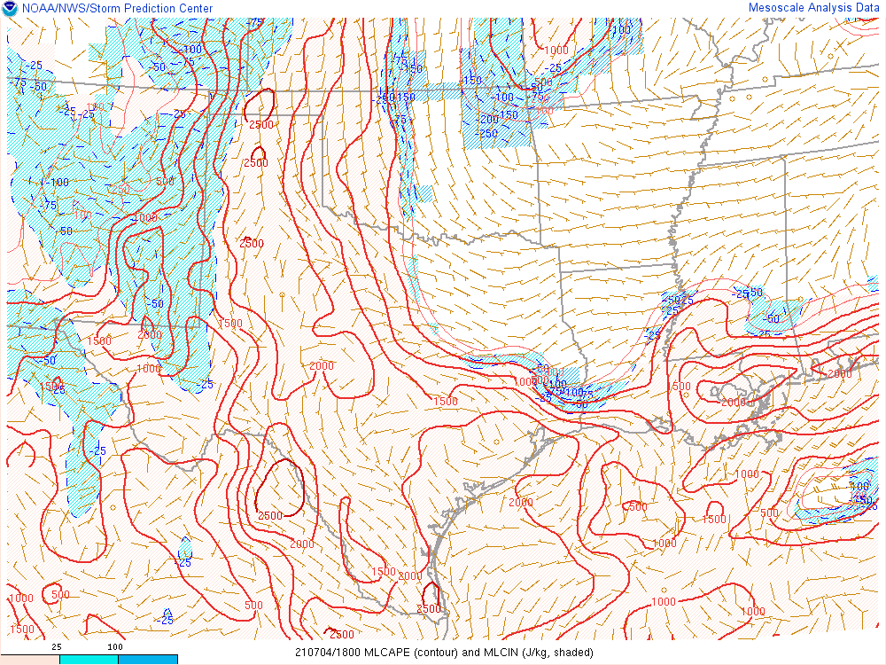
The modest jet stream winds out of the north-northwest and ground level winds out of the south-southeast set up a good amount of wind shear through the atmosphere (left). Due to the low level moisture, plenty of energy (center) was available for thunderstorms as well. Thus, the storms that formed were able to persist as they moved south and had strong updrafts capable of generating large hail. Potential downdraft strength (right) was large as well, so damaging winds occurred in addition to the hail.
 |
 |
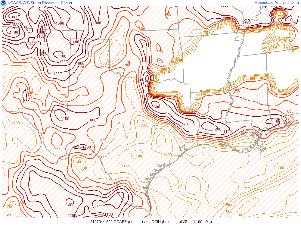 |
| Wind shear during the July 4th, 2021 severe weather event | Energy available for thunderstorms (MLCAPE) during the July 4th, 2021 severe weather event | Potential downdraft strength (DCAPE) during the July 4th, 2021 severe weather event |
 |
Media use of NWS Web News Stories is encouraged! Please acknowledge the NWS as the source of any news information accessed from this site. |
|

