
Tropical system in the Gulf expected to gradually strengthen the next couple of days off the Florida Panhandle and Alabama coasts. Instances of flash flooding will be possible through Thursday along the eastern and central Gulf Coast. Severe thunderstorms will develop and move along a cold front crossing the Upper Midwest, and through the Ohio Valley/Mid-Atlantic on Tuesday. Read More >
Overview
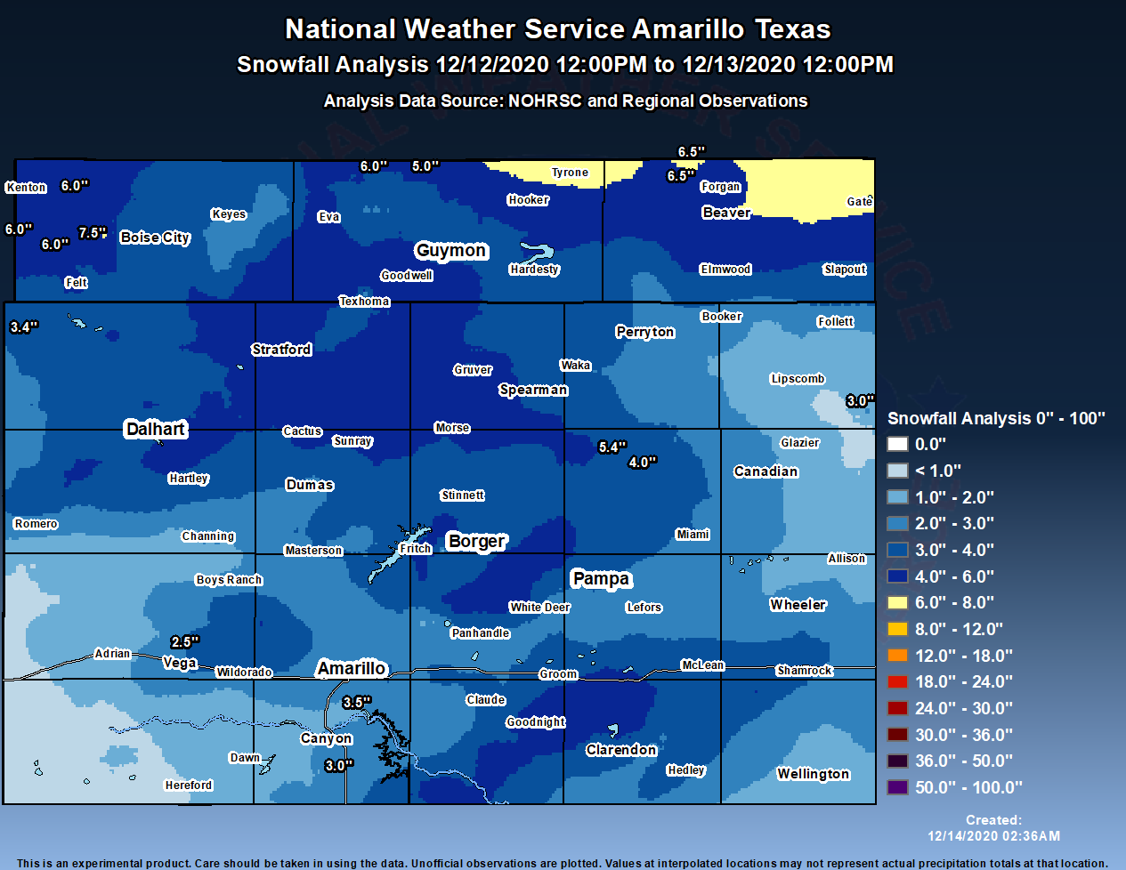
An upper level trough moved ashore across Washington in the Pacific Northwest on Friday, December 11th. This system moved rapidly southeast across the Central Rockies on Saturday before crossing the Panhandles Region on Sunday, December 13th. Moderate snowfall developed across the northwest Panhandles on Saturday evening and spread east as the system moved across the area. A majority of the snowfall with the system occurred between midnight and noon on Sunday. Moderate snow and winds gusting to 30 to 40 mph created low visibility of around ½ mile at times across the area. This, together with snow accumulating on roadways, led to poor travel conditions and several major accidents occurred on I-40 causing the interstate to be shut down in multiple locations for a period of time. Event snowfall totals of 4 to 8 inches occurred with one band across the Oklahoma Panhandle and even higher amounts around 12” were reported just north in southwest Kansas. Otherwise snowfall totals ranged from around 1 to 5 inches across the area.
Snow/Ice
Photos & Video
Header
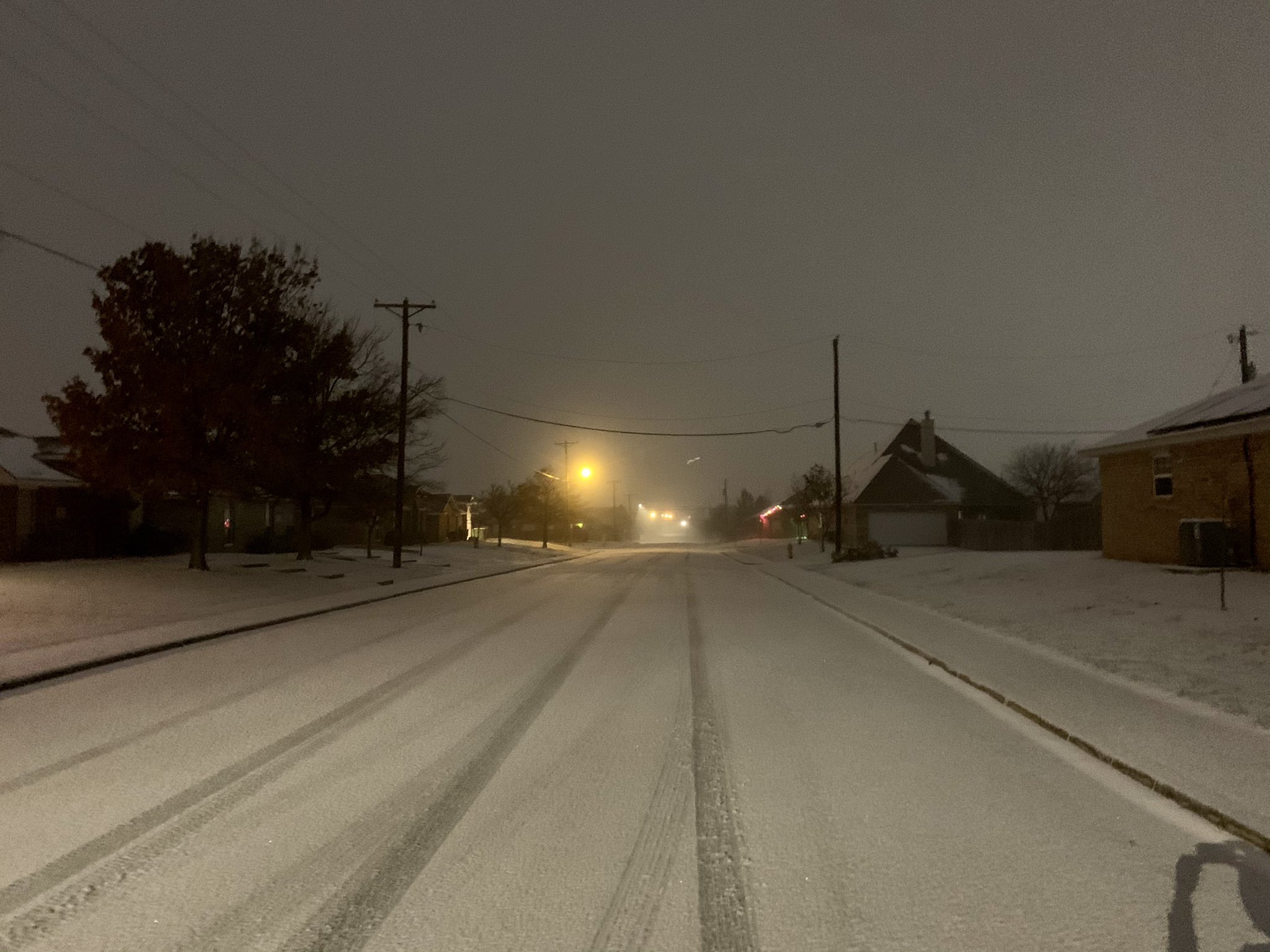 |
| Snow coated roadway in south Amarillo (Stephen Bieda) |
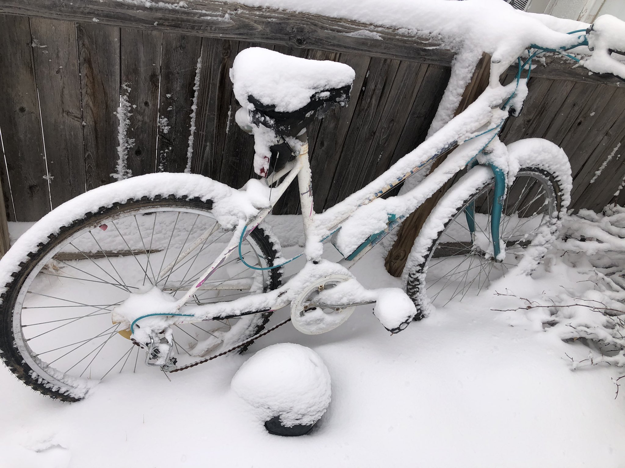 |
| Snow covered bicycle in Dalhart (Aaron Graves) |
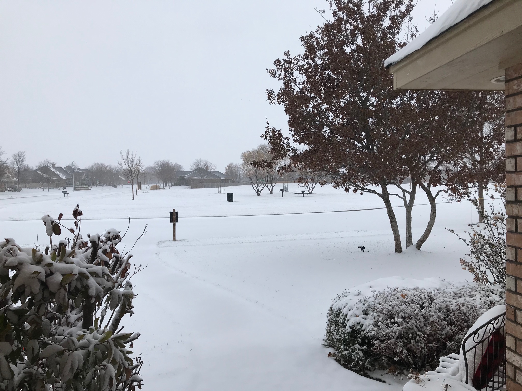 |
| Snowy neighborhood in southwestern Amarillo (Mark Fox) |
Radar
Header
.gif) |
| Radar composite loop of the December 13th snow event. Radar data from NWS; image from Iowa Environmental Mesonet. |
Storm Reports
...SNOWFALL REPORTS FOR THE DECEMBER 13TH SNOW EVENT...

LOCATION                     AMOUNT    TIME/DATE       PROVIDER
10 W BOISE CITY              7.5 IN    0855 AM 12/13   EMERGENCY MNGR
8 N FLORIS                   6.5 IN    0700 AM 12/13   COCORAHS
11 NNE EVA                   6.0 IN    0830 AM 12/13   PUBLIC
2 W WHEELESS                 6.0 IN    0855 AM 12/13   TRAINED SPOTTER
4 W WHEELESS                 6.0 IN    0800 AM 12/13   COCORAHS
4 NNE BLACK MESA PARK        6.0 IN    0800 AM 12/13   COCORAHS
BEAVER                       6.0 IN    0825 AM 12/13   PUBLIC
20 SW WOLF CREEK PARK        5.4 IN    1033 AM 12/13   PUBLIC
1 SSE STRATFORD              5.0 IN    0831 AM 12/13   COCORAHS
6 NNW HOUGH                  5.0 IN    1022 AM 12/13   PUBLIC
GUYMON                       5.0 IN    0851 AM 12/13   EMERGENCY MNGR
BOISE CITY                   5.0 IN    0900 AM 12/13   PUBLIC
SHAMROCK                     4.0 IN    1138 AM 12/13   PUBLIC
FRITCH                       4.0 IN    0955 AM 12/13   PUBLIC
GROOM                        4.0 IN    1055 AM 12/13   PUBLIC
5 SSW AMARILLO               3.5 IN    1158 AM 12/13   NWS EMPLOYEE
3 E CANYON                   3.3 IN    1017 AM 12/13   NWS EMPLOYEE
4 S CANYON                   3.0 IN    1000 AM 12/13   PUBLIC
1 W BUSHLAND                 3.0 IN    0800 AM 12/13   CO-OP OBSERVER
HIGGINS                      3.0 IN    0959 AM 12/13   TRAINED SPOTTER
BOOKER                       3.0 IN    0818 AM 12/13   PUBLIC
PANHANDLE                    3.0 IN    1053 AM 12/13   EMERGENCY MNGR
HOOKER                       3.0 IN    0945 AM 12/13   TRAINED SPOTTER
1 WNW CLARENDON              2.8 IN    1146 AM 12/13   TRAINED SPOTTER
STRATFORD                    2.5 IN    0458 AM 12/13   LAW ENFORCEMENT
6 W AMARILLO                 2.5 IN    1100 AM 12/13   NWS EMPLOYEE
3 NW VEGA                    2.5 IN    0700 AM 12/13   CO-OP OBSERVER
GRUVER                       2.0 IN    0735 AM 12/13   CO-OP OBSERVER
DAWN                         2.0 IN    1045 AM 12/13   PUBLIC
2 NNE TEXHOMA                2.0 IN    0700 AM 12/13   COCORAHS
1 SSW PERRYTON               1.8 IN    0700 AM 12/13   COCORAHS
WHEELER                      1.5 IN    0130 PM 12/13   TRAINED SPOTTER
DUMAS                        1.5 IN    0930 AM 12/13   TRAINED SPOTTER
1 SE DALHART                 1.5 IN    0615 AM 12/13   TRAINED SPOTTER
2 ENE HEREFORD               1.5 IN    0700 AM 12/13   COCORAHS
WELLINGTON                   1.5 IN    0132 PM 12/13   LAW ENFORCEMENT
5 NW CANYON                  1.1 IN    0800 AM 12/13   COCORAHS
LIPSCOMB                     1.0 IN    0504 AM 12/13   LAW ENFORCEMENT
CHANNING                     1.0 IN    0137 PM 12/13   FIRE DEPT/RESCUE
WHITE DEER                   1.0 IN    0649 AM 12/13   BROADCAST MEDIA
HEREFORD 1.1 N (COCORAHS)    0.8 IN    0630 AM 12/13   COCORAHS
Environment
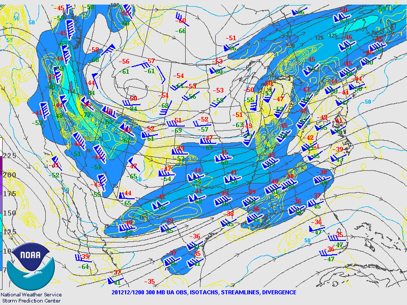
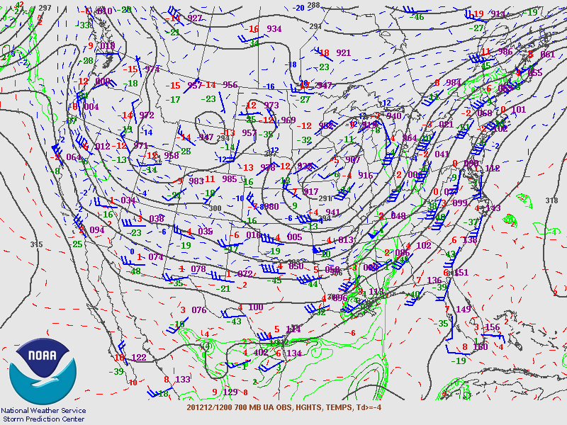
A fast moving upper trough moved across the Panhandles, leading to the development of an area of low pressure lower in the atmosphere. East of this area of low pressure, flow out of the south set up, helping pull moisture northward. North of the low, flow out of the north brought cooler out southward. This helped the mid and lower levels saturate while broad ascent occurred ahead of the upper trough, allowing snow to develop across most of the Panhandles.
 |
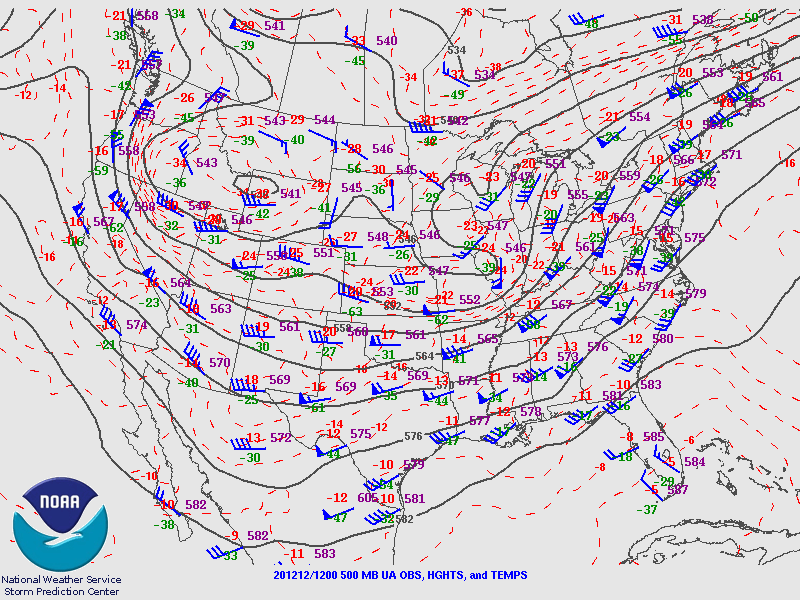 |
| Figure 1: Animation of 300mb objective analyses from 12 UTC December 12th through 12 UTC February 14th. | Figure 2: Animation of 500mb objective analyses from 12 UTC December 12th through 12 UTC February 14th. |
 |
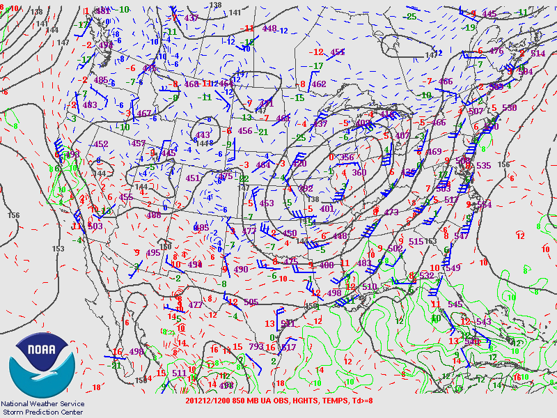 |
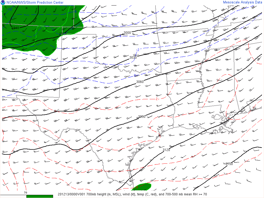
| Figure 3: Animation of 700mb objective analyses from 12 UTC December 12th through 12 UTC February 14th. | Figure 4: Animation of 850mb objective analyses from 12 UTC December 12th through 12 UTC February 14th. |
Northerly winds on the north side of the 700mb (generally between 5000 and 7000 feet above the ground in the Panhandles depending on the altitude at your location) low pressure center, combined with the southerly winds on the east side of this feature, led to an area of frontogenesis developing over southeast Colorado and southwest Kansas, which then shifted south over the Oklahoma Panhandle and Texas Panhandle. This enhanced ascent at and above 700mb. Since these levels were saturated, precipitation occurred. These temperatures were cold enough for ice crystal generation and temperatures closer to the ground (not shown) were below freezing, so precipitation fell as snow. The highest snow totals from the event focused on the enhanced ascent associated with the area of frontogenesis.
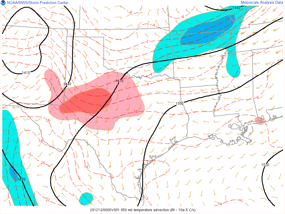
A second area of enhanced snow was associated with warm air advection at 850mb across the southeastern Texas Panhandle.
Finally, a third area of enhanced snowfall occurred due to surface wind directions and terrain. Winds out of the north can subtly enhance ascent on the south side of the Canadian River as flow ascends the valley, frequently leading to a bit more snow there. Winds out of the north set up during the last few hours of the snow event, so a few spots in that area got a bit more snow.
 |
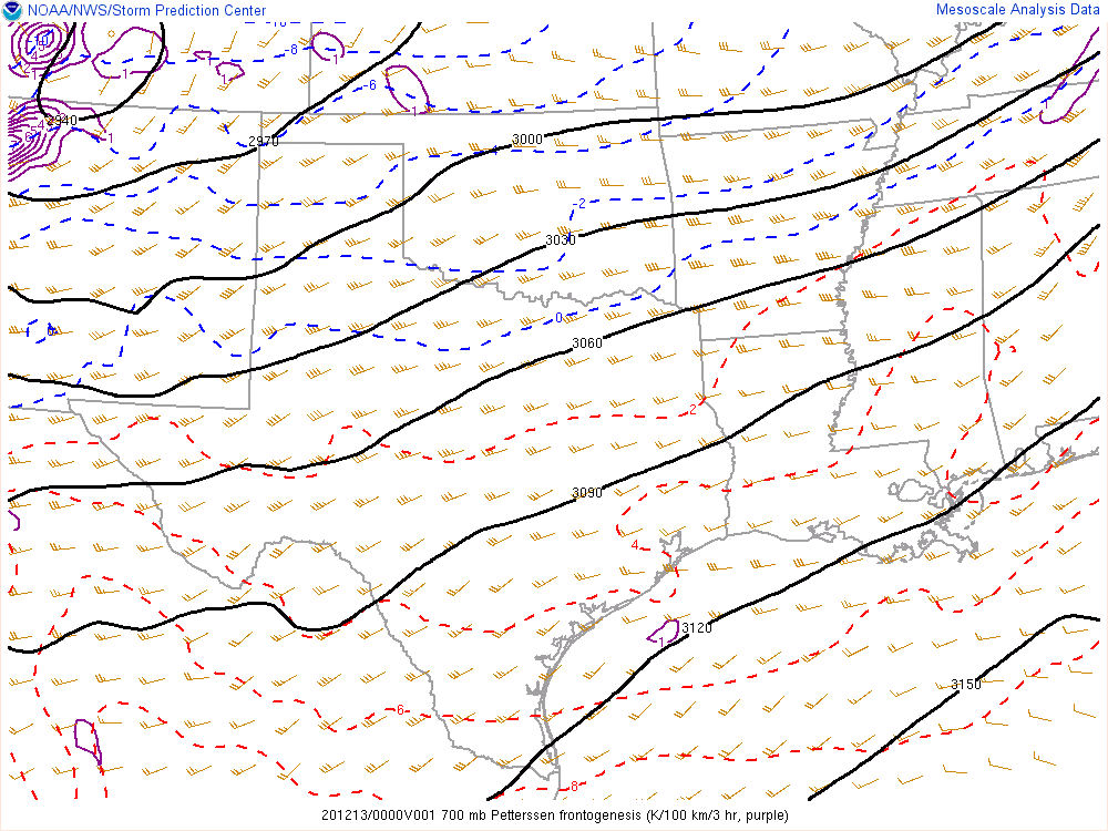 |
| Figure 5: Higher spatial and temporal resolution 700mb objective analyses from 00 UTC to 21 UTC on December 13th (6pm on the 12th through 3pm on the 13th). Some hours are missing. | Figure 6: 700mb objective analyses including frontogenesis from 00 UTC to 21 UTC on December 13th (6pm on the 12th through 3pm on the 13th). Some hours are missing. The highest snow amounts of the event focused on the area of frontogenesis that moved over the OK Panhandle. |
 |
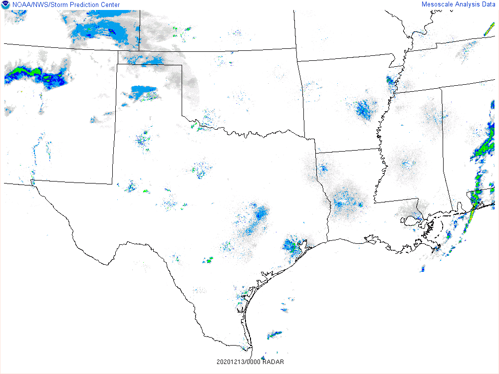 |
| Figure 7: 850mb objective analyses including temperature advection from 00 UTC to 21 UTC on December 13th (6pm on the 12th through 3pm on the 13th). Some hours are missing. An area of slightly enhanced snowfall was associated with the area of warm advection over the southeastern TX Panhandle. | Figure 8: Radar composite loop from 00 UTC to 21 UTC on December 13th (6pm on the 12th through 3pm on the 13th). Some hours are missing. |
 |
 |
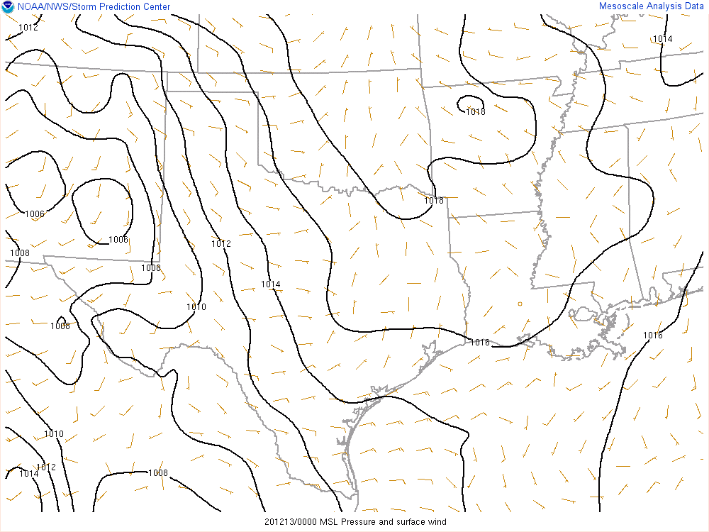
| Figure 9: Objective analyses of surface winds and mean sea level pressure from 00 UTC to 21 UTC on December 13th (6pm on the 12th through 3pm on the 13th). Some hours are missing. Note winds become out of the north during the latter parts of the event. | Figure 10: Exaggerated topographic relief image of the Panhandles. Lower elevations are in white, with higher elevation in maroon and green. |
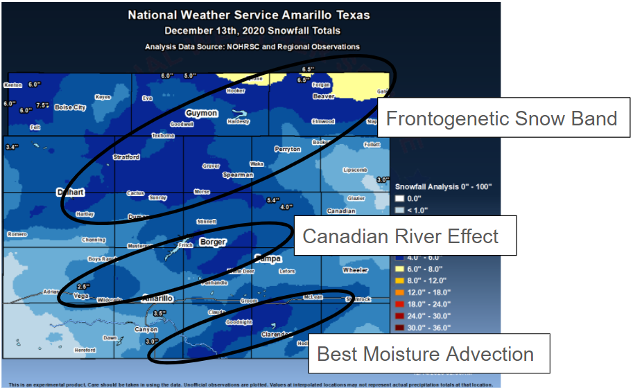 |
| Figure 11: Snow total map showing the 3 areas of enhanced snowfall discussed above. |
 |
Media use of NWS Web News Stories is encouraged! Please acknowledge the NWS as the source of any news information accessed from this site. |
|

