Overview
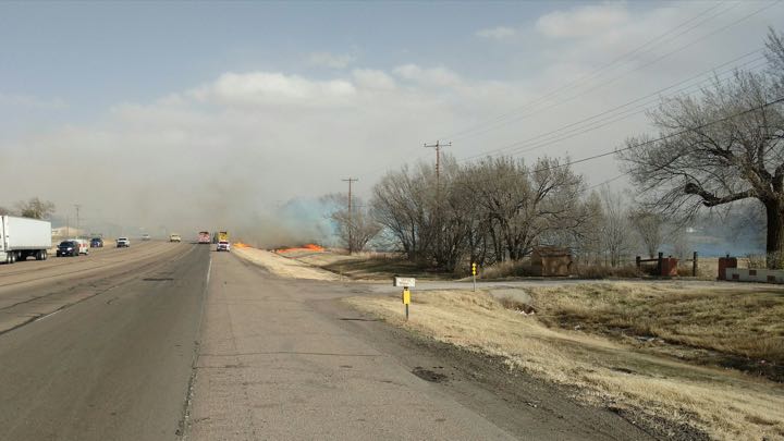
On February 23, 2017, strong sustained winds of 35 to 45 mph with gusts to near 60 mph across the western portions of the Texas and Oklahoma Panhandles and sustained winds of 25 to 35 mph with gusts near 50 mph across the eastern portions of the Panhandles prevailed along with minimum afternoon relative humidities of 8 to 12 percent during the day. Reports of 9 wildfires ranging from 1 acre to 7,000 acres occurred during the day. The first wildfire was reported shortly after 2 PM CST east of the city of Dalhart in a wheat field. Evacuations were issued for residences along FM 297 and US Highway 54, but did not request Fire Warning issuance when asked. This fire was contained by roughly 4:30PM CST. Several more reports of wildfires were reported to the Amarillo office between 3 and 4 PM CST. Fires in the Amarillo metro, including the Windrock Fire located east of I-27 between Lair and Rockwell Roads, resulted in 5 residences being destroyed. A wildfire 2 miles west of Borger caused by downed power lines was quickly under control by a collaborative effort of the National Park Service and Hutchinson EM. This wildfire did cause FM 1319 from Highway 136 to Sanford to be closed briefly. A wildfire was initially spotted via satellite in southeastern Oldham County would be called the LIT Ranch Fire. The wildfire would spread into both Deaf Smith and Potter counties. Air support was also provided for the LIT Ranch Fire. The fire threatened the community of Boys Ranch but evacuations were not called as the fire remained northeast of the community due to a northwest wind shift. By early in the evening, all minor fires had been contained while the LIT Ranch Fire continued to grow. The LIT Ranch Fire burned approximately 13,500 acres.
On February 28, 2017, preliminary reports of 7 wildfires were reported to NWS Amarillo with no known estimates provided as of this writing of 6 out of the 7 fires. The 1st wildfire reported to our office occurred in a grass field next to Ridgecrest Elementary School at 11:58 AM, which was quickly contained due to pre-staged resources. The 2nd wildfire of the day became known as the St Francis fire, which burned 6 acres in the north side of Amarillo within residential and business neighborhoods. The 3rd wildfire was known as the Arroyo Verde in Hutchinson County at 1:30 PM, with arcing power lines being the cause, which was quickly contained by 2:02 PM. The 4th wildfire reported at 2:28 PM was unofficially called the Keller Estate fire on the north side of Pampa, with multiple pre-staged fire resources responding to the area to multiple structures being threatened. This fire was declared under control by 4:55 PM. This fire resulted in the Pampa Independent School District requesting weather information in the event the city ordered evacuations, which thankfully did not occur. The 5th wildfire was detected as a hot spot on satellite at 3:18 PM south of Hartley, which was later confirmed by the Hartley County EM with resources quickly gaining control of that fire. The 6th fire reported to WFO Amarillo was the Dawn Fire, located just outside Dawn Town Limits, with fire resources gaining control of this wildfire by 3:49 PM. WFO Amarillo reported a hot spot being detected at 3:44 PM to the city of Amarillo for a wildfire 3 SW of Lake Tanglewood, with confirmation by Amarillo/Potter/Randall County Emergency management which investigated by 3:51 PM. This would be the 7th wildfire of the day, with the fire brought under control by 5:30 PM.
On March 6, 2017, preliminary reports of about 13 or so wildfires that were reported to WFO Amarillo and included any preliminary estimates of acreage burned and damage/evacuations/injuries. The 1st wildfire reported was in Beaver County Oklahoma about 2 miles west of Gate Oklahoma and was known as the Starbuck wildfire at 11:51 AM CST. The Starbuck wildfire spread northeast into Kansas and became part of the Northwest Oklahoma Wildfire Complex. The Starbuck wildfire consumed approximately 662,687 acres of which approximately 198,379 acres were burned in Oklahoma. There have been no reports of damages, however an evacuation was declared for the town of Gate Oklahoma. No known injuries or fatalities and no known structures damaged or destroyed. The 2nd wildfire at 1:37 PM was the Reclamation wildfire which merged into other multiple grass fires (Willow Vista, Bluebonnet, and Folsom wildfires or wildfires 3rd, 4th and 5th) to become the Dumas Complex wildfire. The Dumas Complex wildfire was reported to have consumed 28,800 acres and 150 homes were threatened and evacuation was declared. The was a local television station report that at least 3 firefighters were injured by the wildfire. The 6th wildfire at 2:57 PM was the Perryton wildfire 20 miles south of Perryton in Ochiltree County near U.S. Highway 281. The Perryton wildfire burned an estimated 318,056 acres and there was a report that this wildfire spread east across southern Lipscomb and northern Hemphill counties. The Perryton wildfire was determined to be the third largest wildfire in the history of the Texas A&M Forest Service. The wildfire was threatening homes north of Canadian and residents were urged to evacuate at a moments notice. The cause of the Perryton wildfire was determined to be from downed power lines or sparks from a transformer. The town of Higgins was threatened briefly. There was one report of a fatality along with several heads of cattle lost, however there have been no reports of any injuries. Two homes were reported destroyed by the wildfire. The 7th wildfire was the East fire which began at 3:01 PM northwest of the Pantex Plant and north of the Amarillo Rick Husband International Airport just east of the Fritch Highway (State Road 136 and Farm to Market Road 293). The East fire also merged into the Dumas Complex. The Dumas Complex was comprised of the Folsom Fire, the East Fire, the Willow Vista Fire, the Bluebonnet Fire, and the Reclamation Fire. The 8th wildfire was one in Gray County about 4 miles east northeast of Lefors TX and was called the Lefors East wildfire. This wildfire spread east into Wheeler County where a evacuation was declared for the towns of Mobeetie and Wheeler. An evacuation was also declared for the town of Lefors, however 3 people were killed as they tried to save livestock in the area. Livestock were also lost, although it is not certain how many head of cattle were lost. The wildfire consumed approximately 135,000 acres. No known homes or other structures damaged or destroyed and no known injuries or fatalities. The 9th wildfire was about 10 miles north northwest of the town of Hooker Oklahoma in Texas County at 4:08 PM. No known structures or homes damaged or destroyed and no known injuries or fatalities. The 10th and 11th wildfires were once again in Gray County County near County Road 21 and State Highway 152 and also about 9 miles north of McLean on Farm to Market Roads 1321 and 273. No known homes or other structures damaged or destroyed and no known injuries or fatalities. The 12th wildfire was at 5:09 PM and was about 6 miles west northwest of Lake McClellan north of I-40 in Gray County. No known homes or other structures damaged or destroyed by the wildfire and no known injuries or fatalities. The 13th wildfire was at 5:18 PM about 4 miles southwest of Beaver OK in Beaver County between Beaver and Elmwood Oklahoma and was called the Beaver wildfire. The Beaver wildfire burned approximately 2,962 acres. No known homes or other structures damaged or destroyed by the wildfire and no known injuries or fatalities. There were approximately 4,000 livestock killed in the Texas Panhandle by the wildfires and total damages were estimated to be $25.1 million.
Photos & Video:
 |
 |
 |
 |
| Caption (source) |
Caption (source) |
Caption (source) |
Caption (source) |
 |
 |
 |
 |
| Caption (source) |
Caption (source) |
Caption (source) |
Caption (source) |
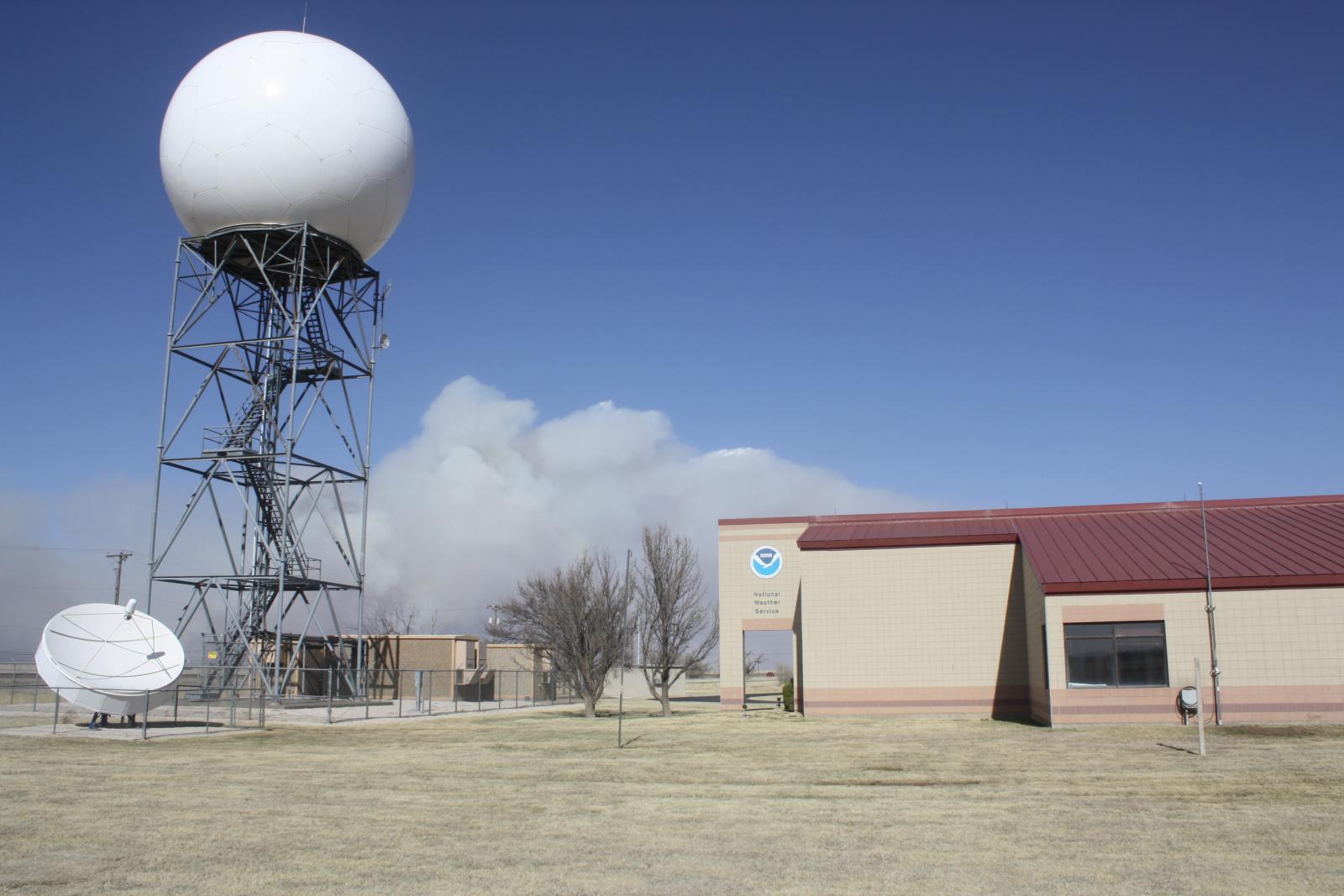
Hot Spot Detection from new GOES-R Satellite
 |
| Fire Detection via Satellite |
 |
Media use of NWS Web News Stories is encouraged! Please acknowledge the NWS as the source of any news information accessed from this site. |
|

