
Severe thunderstorms are forecast through this weekend along a slow moving cold front and secondary storm system that will impact areas from the southern Plains to the Great Lakes. Large hail and isolated damaging wind gusts are the main threats with these storms along with a risk for heavy to excessive rainfall which could bring flooding. Read More >
Overview
A vigorous upper level low pressure system developing across the western United States was positioned over southern Nevada by Thursday morning, May 23rd, 2019 while a frontal boundary settled across the Panhandles. Significant wind shear and instability developed as moisture was drawn north into the Panhandles setting the stage for a very long duration, high end severe thunderstorm episode which lasted much of the day and into the evening hours.
In the morning, elevated supercell storms developed in the northwest Texas Panhandles on the cold side of a nearly stationary frontal boundary and moved northeast into the central Oklahoma Panhandle as the first upper level disturbances moved across the area. Hail up to golf ball size and wind damage was reported with these storms despite temperatures in the 50s.
During the afternoon hours, upper level disturbances, daytime heating and the very pronounced frontal boundary stretching from near Amarillo northeast into Beaver County, Oklahoma became the main catalyst for surface based supercells which produced very large hail up to baseball size and tornadoes. Two very large and long tracked tornadoes produced damage across the northeast Panhandles. Both tornadoes were over ½ mile wide at some point. The tornadoes were rated EF-2s based on the damage, but they remained in very rural areas throughout their life-cycle. One tornado destroyed a home as it crossed the county line from Beaver to Ellis County Oklahoma. A total of eight tornadoes occurred during this event, however three of these were landspouts that developed along an outflow produced by storms early in the event. With the loss of daytime heating, supercells congealed into a line which produced gusty winds and hail across the eastern Texas Panhandle before finally moving east and exiting the region in the early morning hours on May 24th.
Below are the tornadoes working from the north towards the south of the forecast area.
Tornadoes:
|
Tornado - Southeast Beaver County
Track Map (click to enlarge) 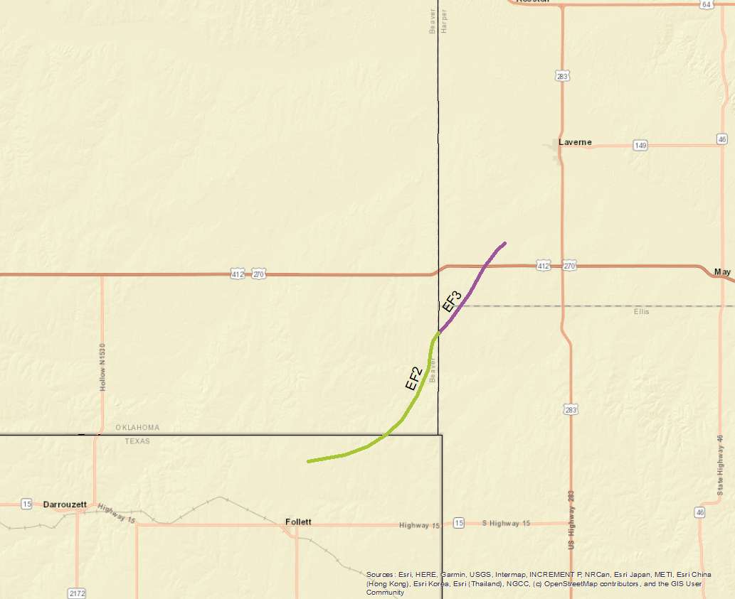 
|
||||||||||||||||
|
Tornado - 15 North Northwest of Canadian
Track Map (click to enlarge) 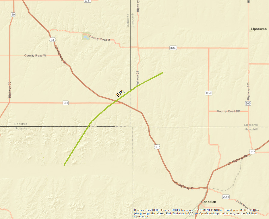
|
||||||||||||||||
|
Tornado - 10 WSW Lipscomb
Track Map (click to enlarge) 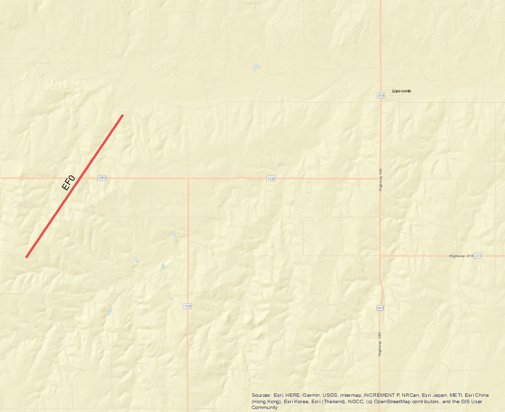
|
||||||||||||||||
|
Tornado - 15 N Pampa
Track Map (click to enlarge) 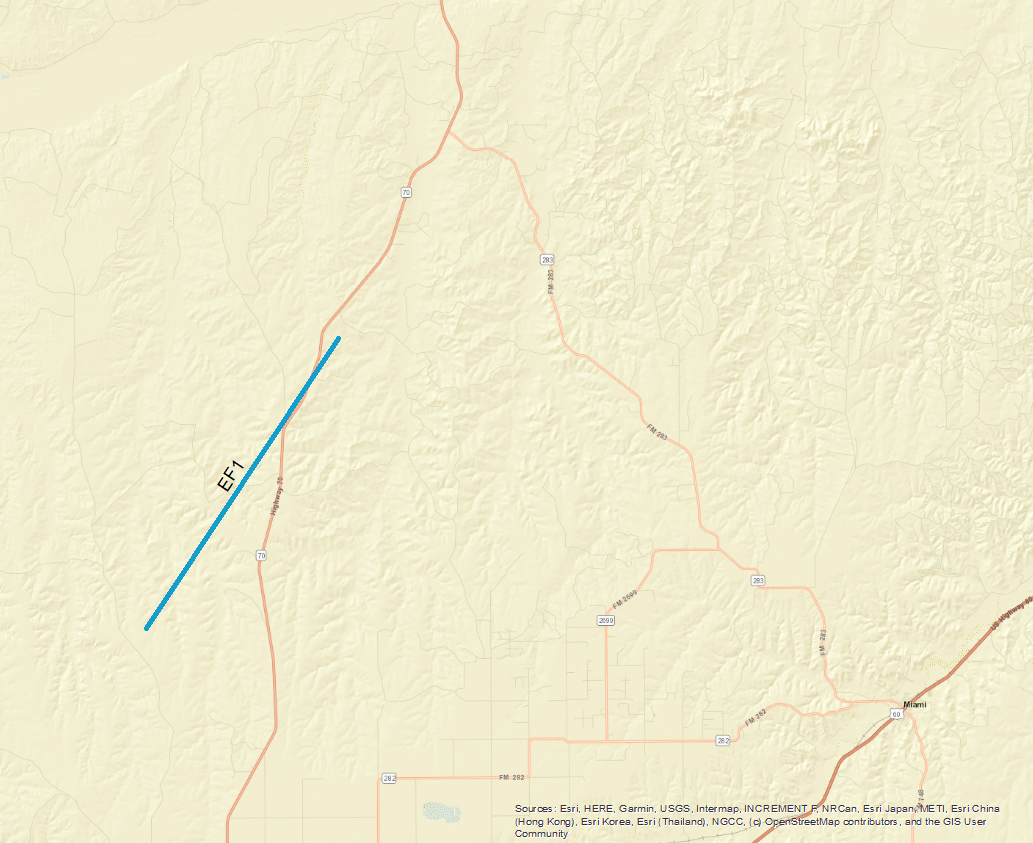
|
||||||||||||||||
|
Tornado - 6 NNE Pampa
Track Map (click to enlarge) 
|
||||||||||||||||
|
Landspouts (Three) - Amarillo and Canyon area
Track Map (click to enlarge) 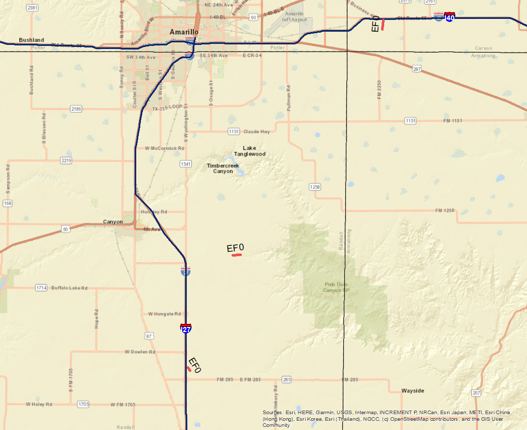
|
||||||||||||||||
The Enhanced Fujita (EF) Scale classifies tornadoes into the following categories:
| EF0 Weak 65-85 mph |
EF1 Moderate 86-110 mph |
EF2 Significant 111-135 mph |
EF3 Severe 136-165 mph |
EF4 Extreme 166-200 mph |
EF5 Catastrophic 200+ mph |
 |
|||||
Photos & Video
Some of the more intense Damage
 |
 |
 |
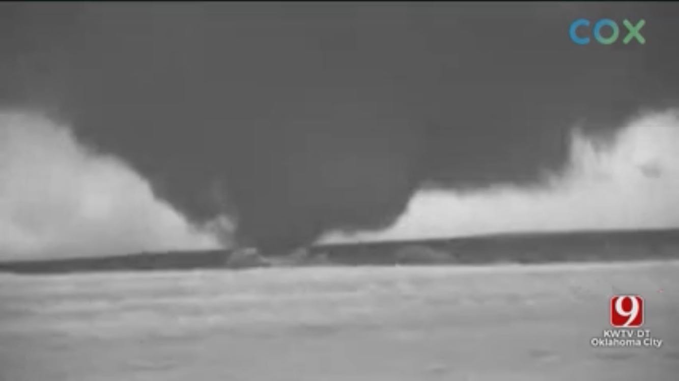
| Night Vision Tornado - Beaver County (Source: Val Castor) |
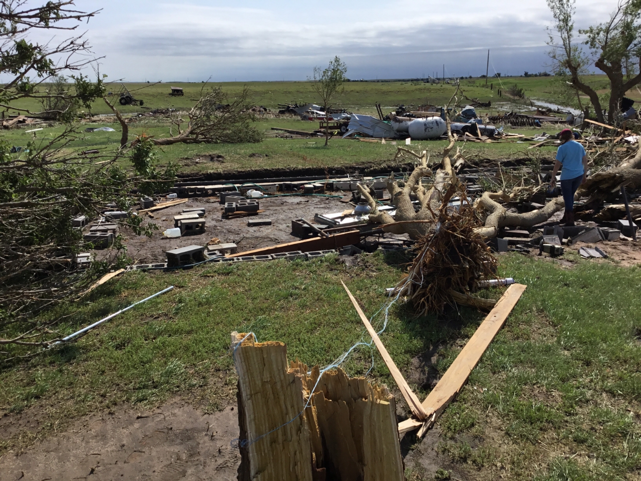
Home Destroyed as it went into Ellis County (Source: NWS) |
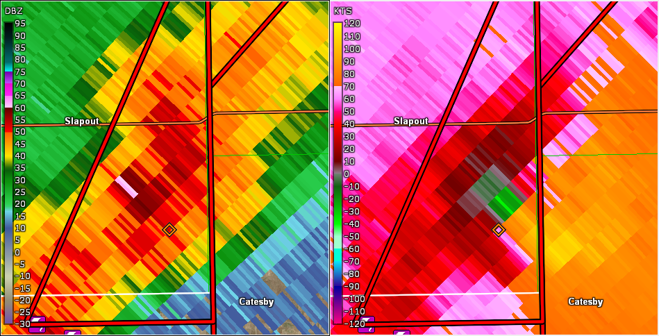
Radar reflectivity and storm relative velocity of tornado on the ground before entering Ellis County (Source: NWS/GR2Analyst) |
 |
 |
 |
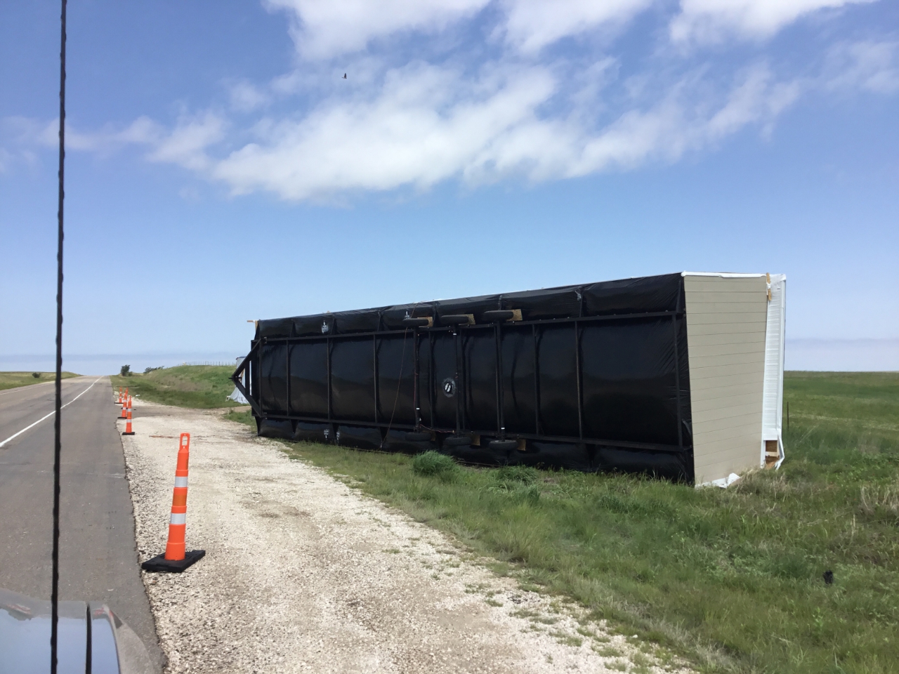
| Manufactured home being transported were blown over onto highway 83 by the tornado (Source: NWS) |
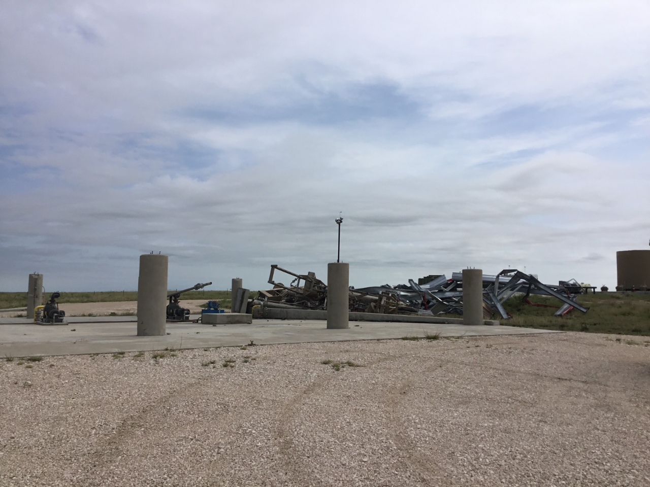
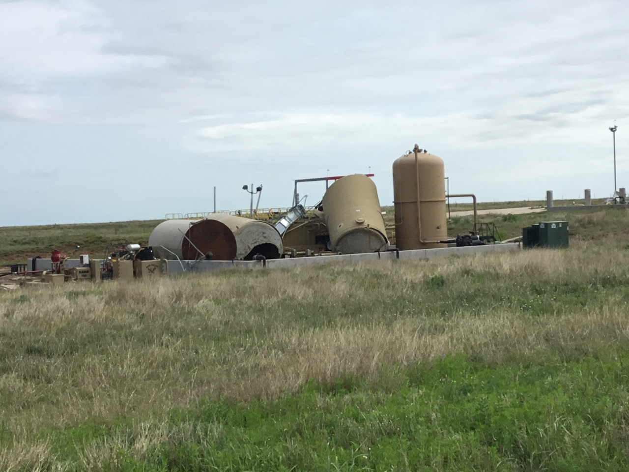
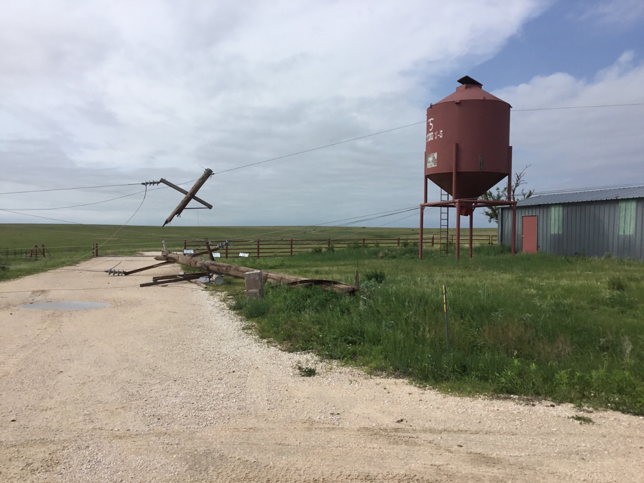
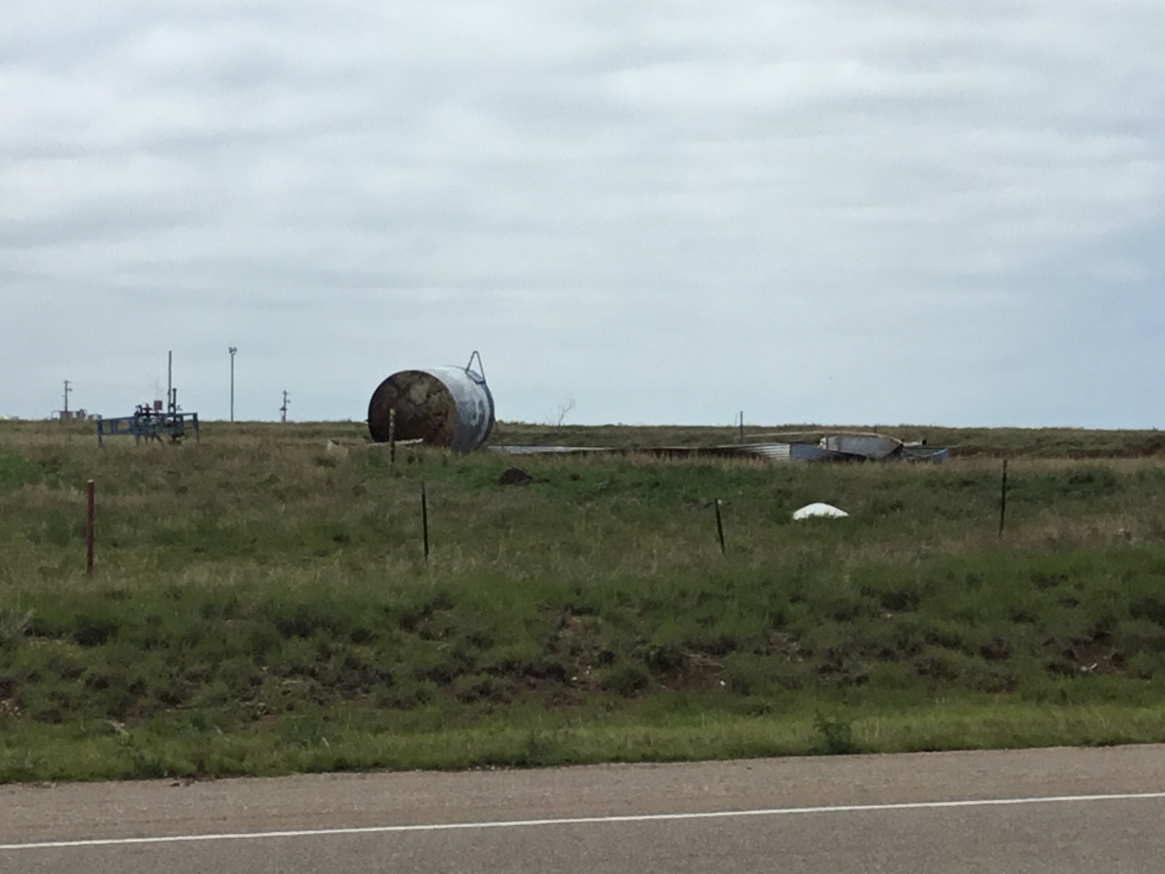
Oil/Natural Gas facility damage (Source: NWS) |
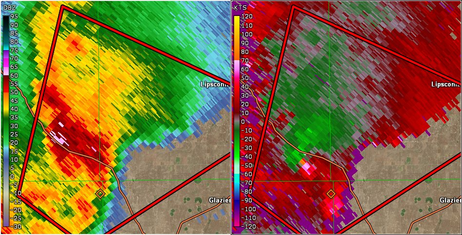
Radar reflectivity and storm relative velocity of tornado on the ground crosing highway 83 (Source: NWS/GR2Analyst) |
 |
 |
 |
| Caption (source) |
Caption (source) |
Caption (source) |
Radar
| Radar Reflectivity Loop of May 23rd, 2019 Severe Weather Event. |
Storm Reports
Insert storm reports here. Copy in PNS or paste map.
 |
Media use of NWS Web News Stories is encouraged! Please acknowledge the NWS as the source of any news information accessed from this site. |
|

