National Weather Service United States Department of Commerce

Temperatures turn hot again today and Monday. When combined with increasing humidity, the heat index or "feel-like" temperatures will rise back into the mid to upper 90s.
With hot and humid weather in place on Monday, an incoming cold front will result in increased chances for showers and thunderstorms. Thunderstorms mainly north and west of the Capital District may turn strong to severe, mainly during the afternoon hours, with damaging winds the primary hazard. There is a marginal risk (level 1 of 5) for severe weather.
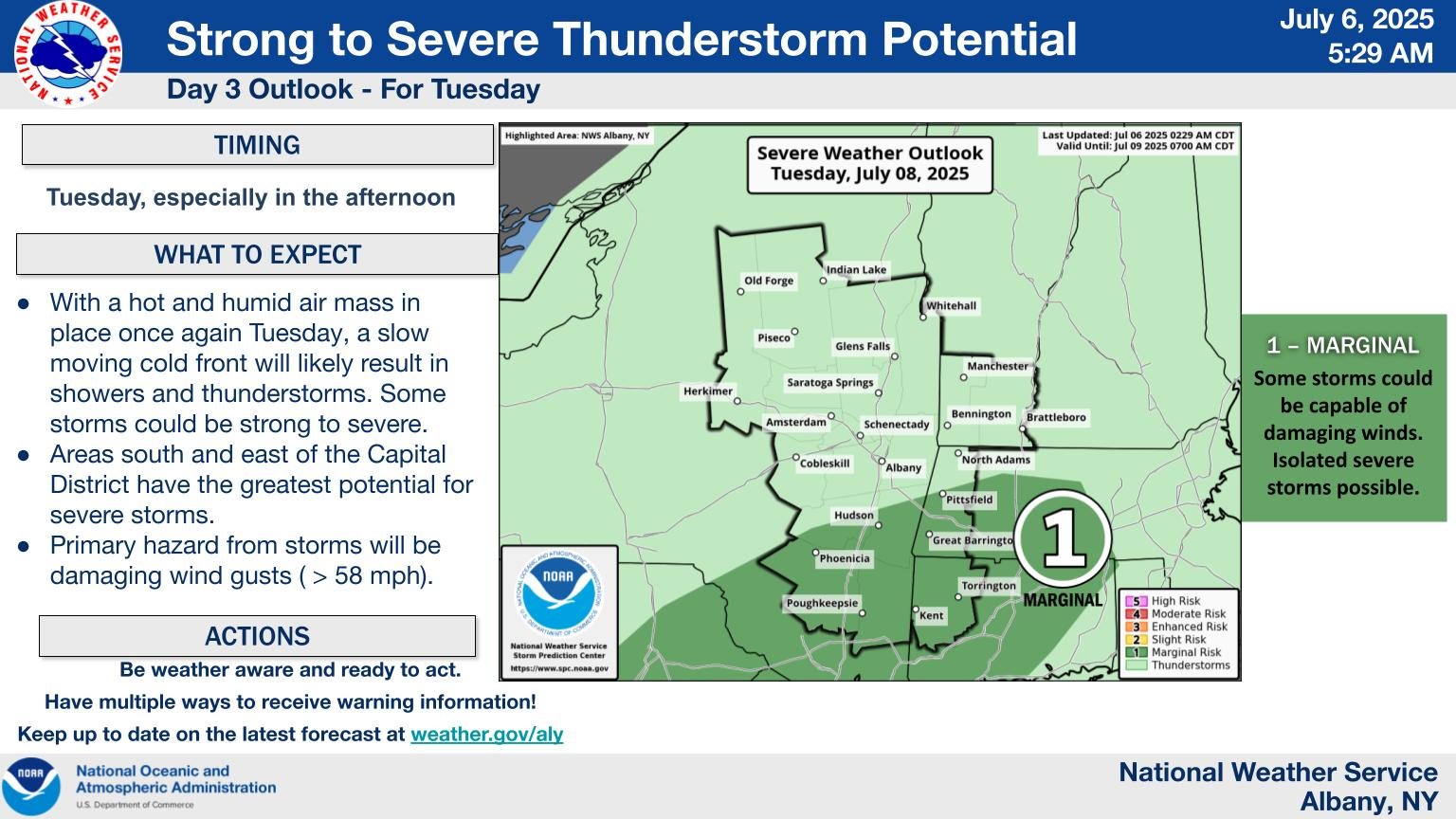
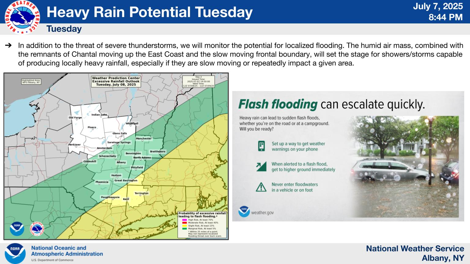
With hot and humid weather in place once again Tuesday, slow moving cold front will result in increased chances for showers and thunderstorms. Thunderstorms mainly south and west of the Capital District may turn strong to severe, mainly during the afternoon hours, with damaging winds the primary hazard. There is a marginal risk (level 1 of 5) for severe weather.