Overview
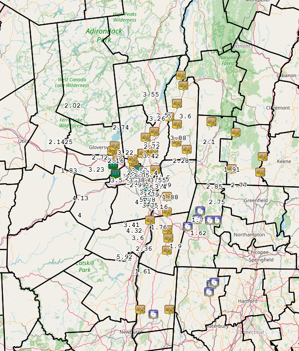
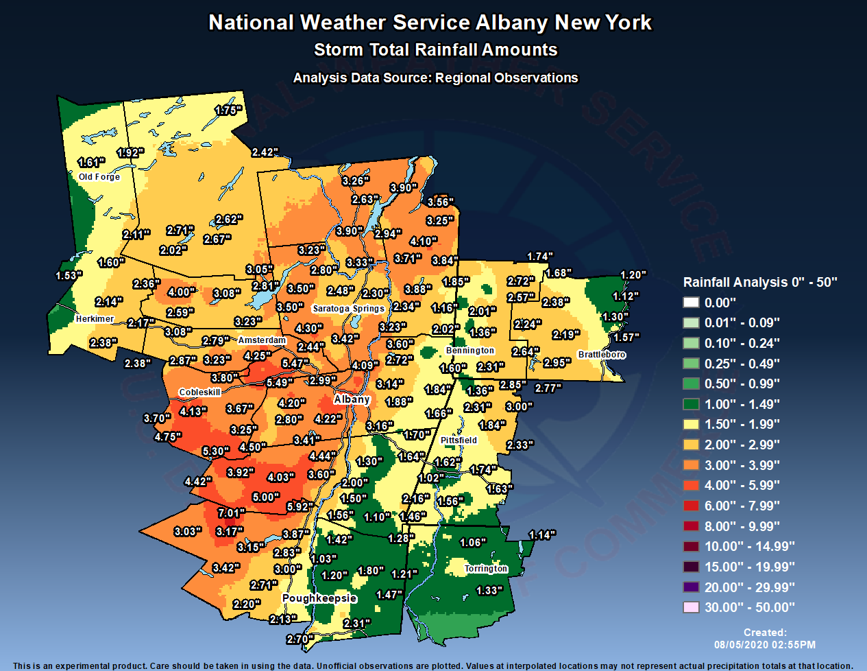
Hurricane Isaias made landfall at around 11:10 pm EDT on August 3 near Ocean Isle Beach, NC, as a category 1 storm with maximum sustained winds of 85 mph. From then, it weakened to a tropical storm while proceeding north-northeastward inland along the Eastern Seaboard, reaching near Albany by 5:00 pm EDT on August 4. Moderate to heavy rainfall overspread eastern New York and western New England by the early morning of the 4th and continued much of the day before ending from south to north in the afternoon and evening. Rainfall totals of 1-6 inches were recorded, with the heaviest occurring in a swath from the eastern Catskills to the Schoharie Valley, Capital District, and Lake George Saratoga region. There were several reports of flash flooding in the Capital District in the afternoon when the rainfall was heaviest. In addition, strong winds developed to the east of the storm's track, especially impacting the Mid-Hudson Valley and western New England. Winds gusting 40-50 mph brought down numerous trees and limbs, and resulted in thousands of power outages. The state of Connecticut was especially hard-hit, with over 700,000 customers losing power, including over two-thirds of customers in Litchfield County. In addition, over 50,000 customers lost power in Dutchess and Ulster Counties.Radar
Storm Reports
Listing of local storm reports via Iowa Environmental Mesonet
Listing OF PEAK GUSTS via Iowa Environmental Mesonet
Storm History
Weather Prediction Center Analysis/Satellite Images
 |
 |
 |
| 0000 UTC 2 August (8 pm EDT 1 August) | 0000 UTC 3 August (8 pm EDT 2 August) | 0000 UTC 4 August (8 pm EDT 3 August) |
 |
 |
| 1200 UTC 4 August (8 am EDT 4 August) | 0000 UTC 5 August (8 pm EDT 4 August) |
Useful Links
Local Post Tropical Cyclone Report. - Coming soon
National Hurricane Center's Tropical Cyclone Report. - Coming soon
Environment
Coming soon.
| Figure 1: Caption | Figure 2: Caption | Figure 3: Caption |
Near-storm environment summary.
| Figure 4: Caption | Figure 5: Caption | Figure 6: Caption |
Additional environmental data.
| Figure 7: Caption | Figure 8: Caption | Figure 9: Caption |
 |
Media use of NWS Web News Stories is encouraged! Please acknowledge the NWS as the source of any news information accessed from this site. |
|

