Overview
Severe thunderstorms impacted portions of the Catskills, Mid-Hudson Valley, Taconics, and Litchfield Hills on the afternoon of May 15. The storms became intense around 2:30 pm with hail up to baseball size reported. In addition, an EF1 tornado occurred near Saugerties, NY. From about 3:30 to 5:00 pm, the main threat turned to wind as an intense squall line raced across Ulster, Dutchess, and Litchfield Counties producing widespread wind damage and gusts estimated at up to 105 mph. Another EF1 tornado occurred in Winsted, CT, and a tornado of unknown intensity occurred over Barkhamsted Reservoir in Connecticut.Tornadoes:
|
Tornado - Saugerties, NY
Track Map  
|
||||||||||||||||
|
Tornado - Winsted, CT
Track Map  
|
||||||||||||||||
|
Tornado - Barkhamsted Reservoir, CT
|
||||||||||||||||
The Enhanced Fujita (EF) Scale classifies tornadoes into the following categories:
| EF0 Weak 65-85 mph |
EF1 Moderate 86-110 mph |
EF2 Significant 111-135 mph |
EF3 Severe 136-165 mph |
EF4 Extreme 166-200 mph |
EF5 Catastrophic 200+ mph |
 |
|||||
Macroburst
|
Macroburst - Dutchess County, NY
Map of Surveyed Damage Swath  |
||||||||||||||
Photos & Video:
 |
 |
 |
| Damage near Saugerties, NY (NWS Albany damage survey) |
Damage near Saugerties, NY (NWS Albany damage survey) |
Damage near Saugerties, NY (NWS Albany damage survey) |
 |
 |
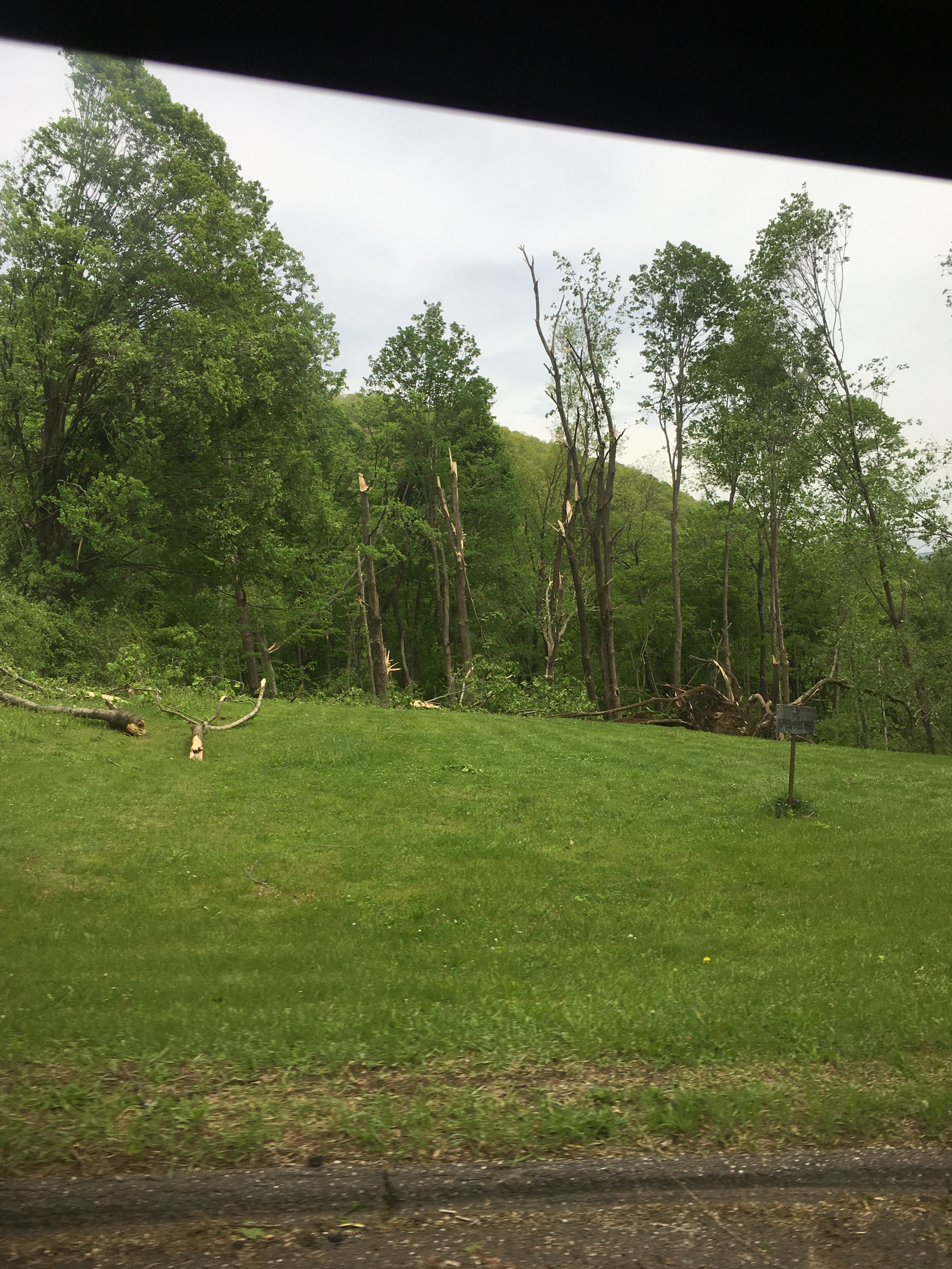 |
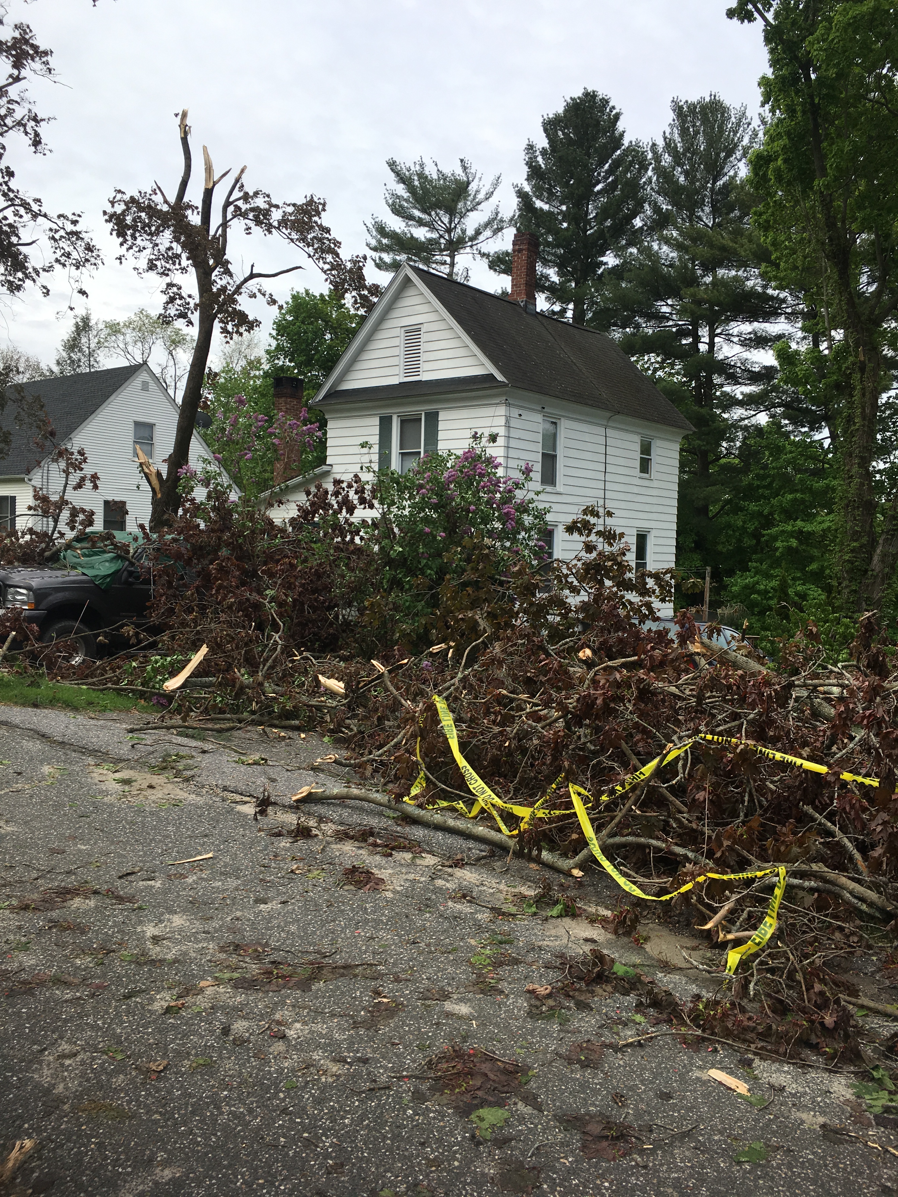
| Damage near Winsted, CT (NWS Albany damage survey) |
Damage near Winsted, CT (NWS Albany damage survey) |
Damage near Winsted, CT (NWS Albany damage survey) |
Radar:
(Loops may take some time to load)
 |
 |
 |
 |
| KENX radar loop from approximately 1:40-5:30 pm | KENX radar loop from approximately 1:40-5:30 pm with NWS warnings | 2:47 pm image from KENX radar. Reflectivity cross section of a storm that produced baseball sized hail in Columbia County, NY | 3:44 pm image from KENX radar of the storm that produced the tornado near Winsted, CT. Reflectivity (left) and storm-relative velocity (right). |
Storm Reports
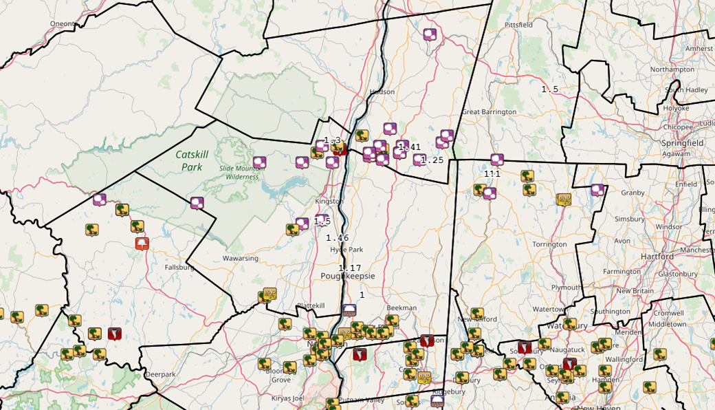

Saugerties, NY Tornado - Public Information Statement
Winsted/Barkhamsted Reservoir, CT Tornadoes - Public Information Statement
Dutchess County, NY Macroburst - Public Information Statement
Links courtesy Iowa Environmental Mesonet
Environment
Fast 500 mb flow existed over the Northeast US on May 15th between a strong upper low over northern Quebec and a high over the Deep South (Fig. 1). While 500 mb height falls were weak, there was a right entrance region of a strong upper jet which enhanced ascent (Fig. 2). At the surface, a NE/SW oriented cold front tracked westward through the day (Fig. 3). There was a bit of an outflow boundary present associated with showers and thunderstorms that tracked through the Mohawk Valley/Capital District earlier in the day, allowing the effective position of the front to sag farther south than originally forecast and spared the I-90 corridor/Schoharie Valley and points north from severe weather potential. To the south, there was plenty of sunshine through the morning and early afternoon which allowed temperatures to soar into the upper 70s (Catskills) to upper 80s (Mid-Hudson Valley) with dewpoints in the low 60s (Catskills) to upper 60s (Mid-Hudson Valley). This allowed a tongue of 1000-2000 J/kg MLCAPE values to surge into the eastern Catskills, Mid-Hudson Valley, and northwestern CT by 18Z (Fig. 4) coincident with a pocket of 6.5-8.0 K/km midlevel lapse rates (Figs. 5, 6). Effective bulk shear values were very impressive at 60-70 kt collocated with the axis of instability (Fig. 7). These factors coming together, along with the continued CAM depiction of several bowing lines of storms, prompted an SPC categorical upgrade to moderate risk with the 1630Z update (Fig. 8). This included probabilities of 10% tornado, 30% hail, and 60% wind.
As a broken line of bowing cells were forming over western/central PA during the early afternoon hours along the cold front, a few supercells formed ahead of the front in the Catskills around 17-1730Z. The lead cell became severe, resulting in an EF1 tornado near Saugerties at around 1830Z, and a swath of large hail in the 2.00-2.75" range in southern Columbia County. This cell eventually would produce two more tornadoes in northwestern CT. A couple of more discrete rotating storms formed with a few hail and wind reports, and then the frontal convection that had formed over western/central PA earlier approached. A portion of this line accelerated across far southern portions of Ulster/Dutchess/Litchfield Counties, producing swaths of widespread wind damage in spots, especially along the I-84 corridor from Beacon to Fishkill, NY. A few tornadoes were confirmed just south of our CWA border in Orange/Putnam/Fairfield Counties in addition to widespread straight-line wind damage. The event was over shortly thereafter for the ALY CWA, with the bulk of the severe reports occurring between 1830-2100Z.
 |
 |
 |
| Figure 1: 500 mb analysis, 12Z 15 May 2018 | Figure 2: 300 mb analysis, 12Z 15 May 2018 | Figure 3: Weather Prediction Center surface analysis valid 18Z 15 May 2018 |
 |
 |
 |
| Figure 4: Storm Prediction Center mesoanalysis of mixed-layer CAPE (J/kg) valid 18Z 15 May 2018 | Figure 5: As in Fig. 4 but for 700-500-hPa lapse rates (K/km) | Figure 6: KALB RAOB at 18Z 15 May 2018 |
 |
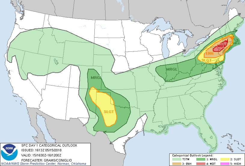 |
| Figure 7: As in Fig. 4 but for effective bulk shear (kt). | Figure 8: Storm Prediction Center Day 1 Convective Outlook issued 1630Z 15 May 2018 |
 |
Media use of NWS Web News Stories is encouraged! Please acknowledge the NWS as the source of any news information accessed from this site. |
 |