
High winds and very dry conditions will bring extremely critical fire weather over a large part of New Mexico today. Red Flag and High Wind Warnings have been issued. Isolated to scattered severe thunderstorms may produce large to very large hail and localized damaging winds late this afternoon into evening from the eastern Central Plains to the Upper Midwest. Read More >
|
|
|
Typically updated by 5 am/pm during or in advance of expected widespread hazardous weather conditions |
|
Listing of snow, ice, rain, wind, or temperature |
|
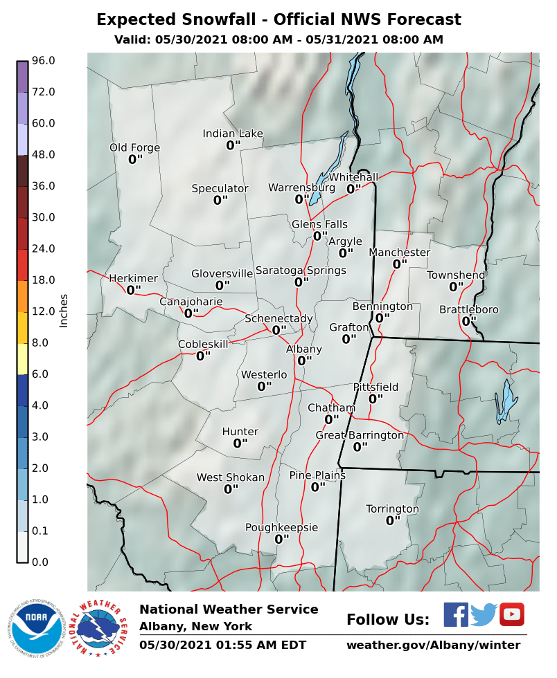
Snow/Ice Forecast |
Winter Watch/Warning/
|
|
|
Latest Watch/Warning/Advisory (Text) Latest Snow Squall Warning (Text)
|
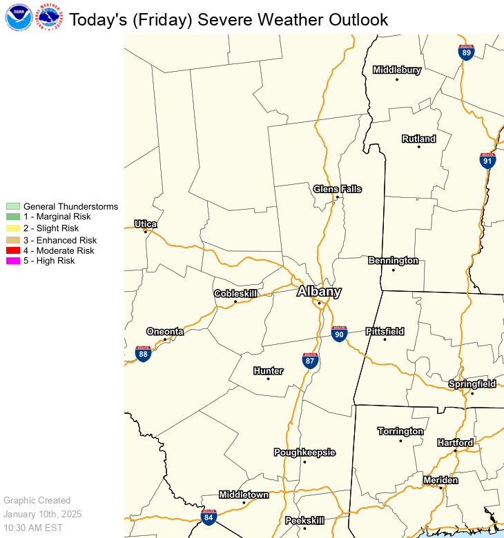
SPC Day 1 Convective Outlook |
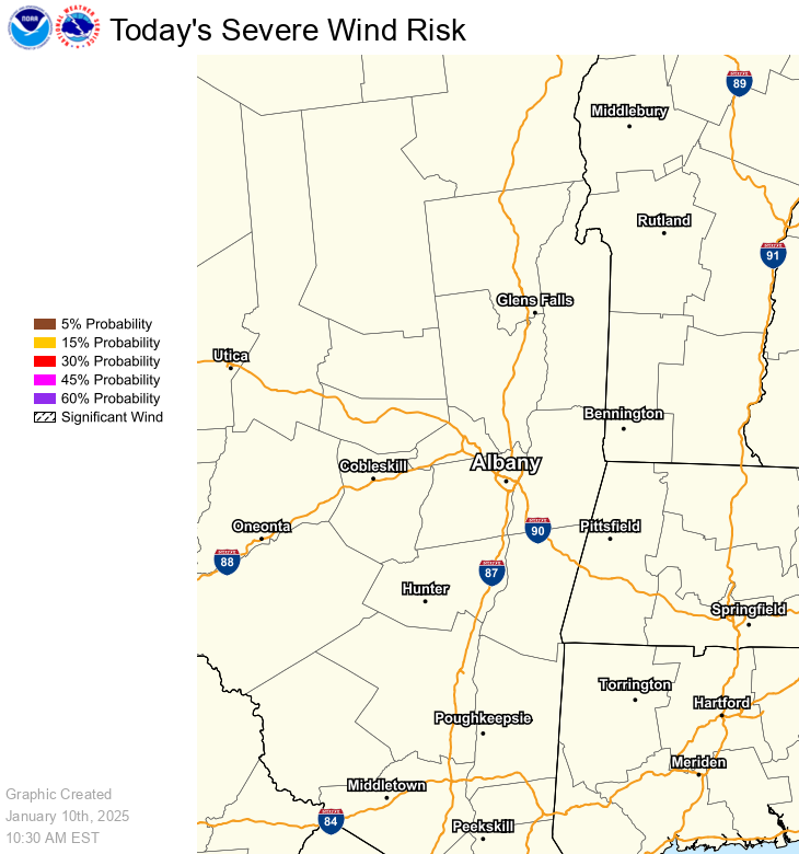
SPC Day 1 Wind Outlook |
|
|
|
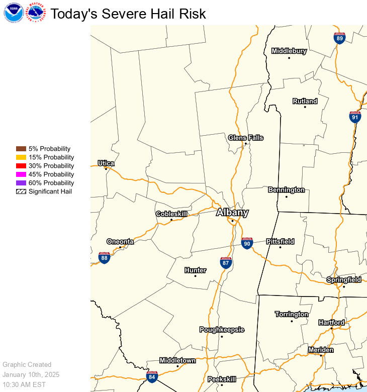
SPC Day 1 Hail Outlook |
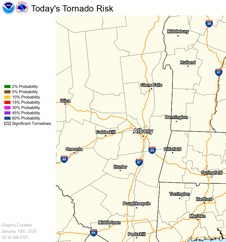
SPC Day 1 Tornado Outlook |
|
|
|
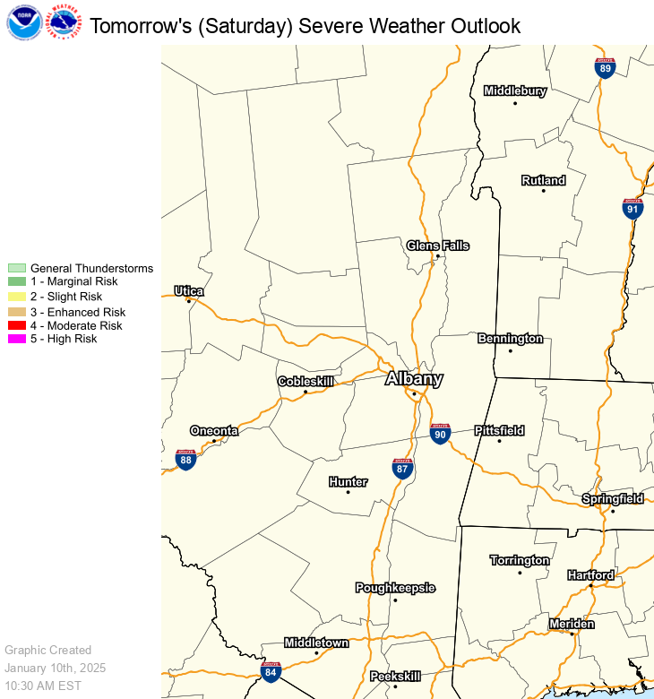
SPC Day 2 Convective Outlook |
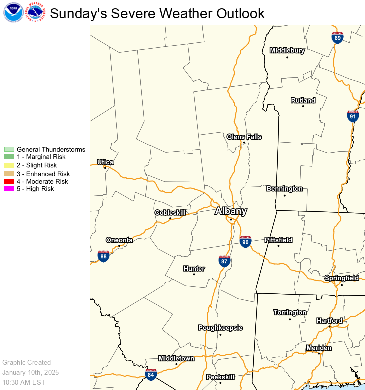
SPC Day 3 Convective Outlook |
|
|
|
Flood Watch/Warning/
|
Day 1 Excessive Rainfall
|
|
Latest Flash Flood Warning (Text) Latest Areal/River Flood Warning Latest Flood Advisory/
|
|
Day 2 Excessive Rainfall
|
Day 3 Excessive Rainfall
|
|
|
|
Heat Watch/Warning/
|
Wind Watch/Warning/
|
|
|
|
 |
Please acknowledge the NWS as the source of any news information accessed from this site | |


.png)


