
Gusty winds and very dry conditions will lead to a critical to extremely critical fire weather threat over portions of the Central and Southern Plains Thursday. Critical fire weather continues through Friday. Moderate to heavy mountain snow and strong winds will expand into the Northern Rockies Thursday, then into Colorado by Friday. Up to a foot of snow accumulation is possible. Read More >
Overview
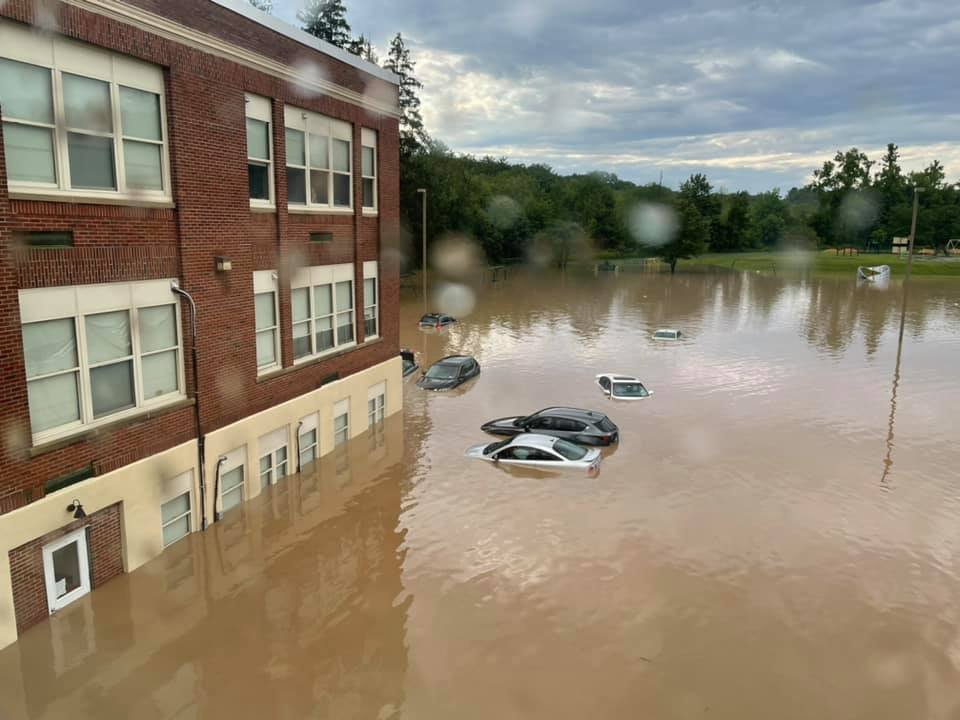
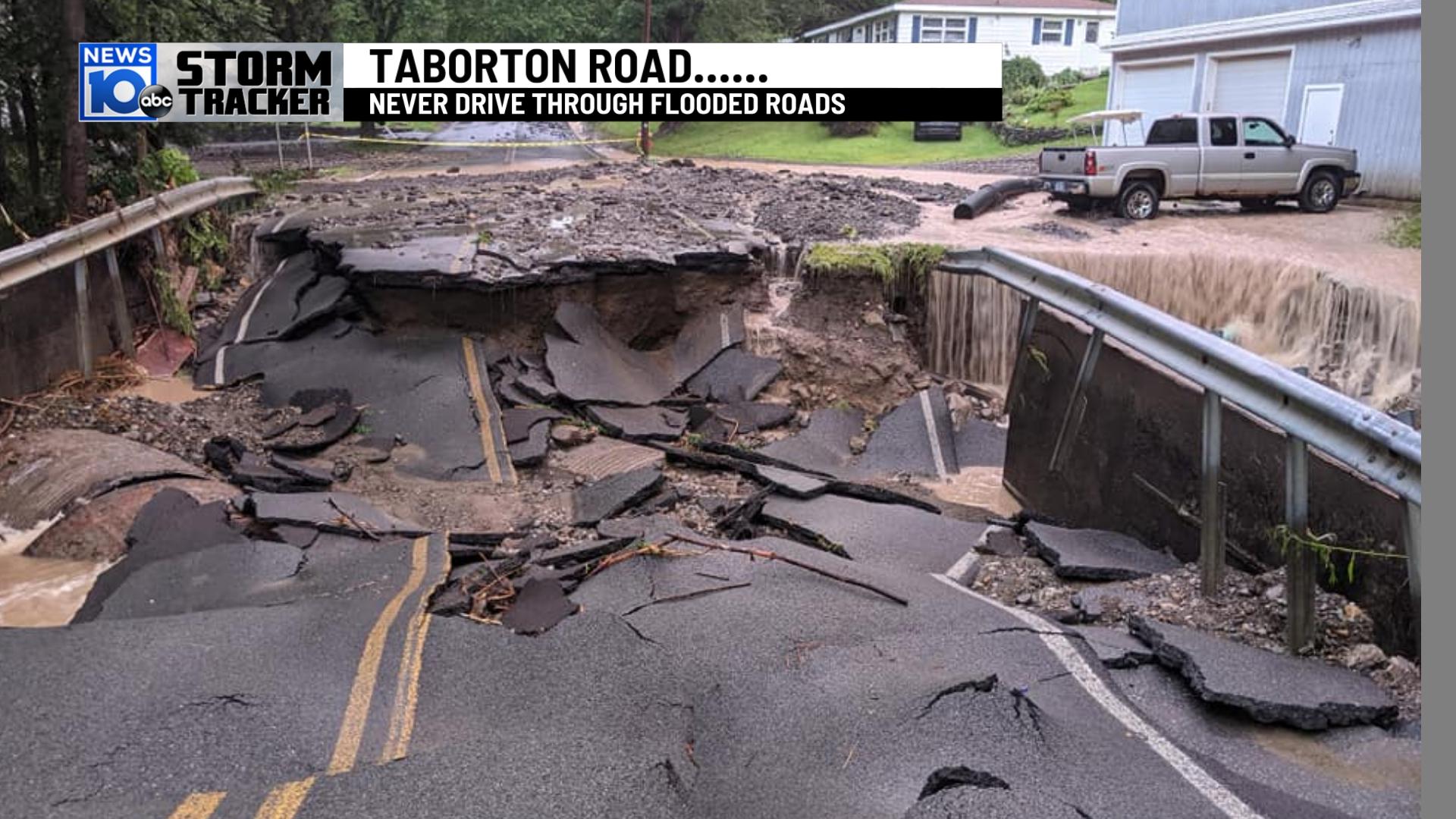
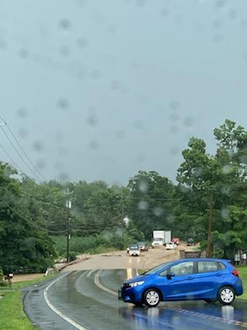
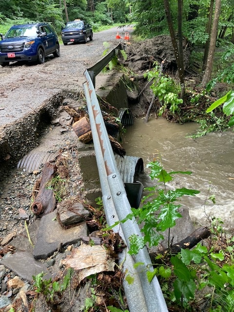
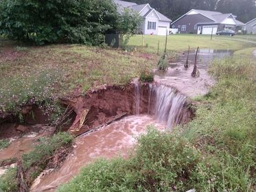
July 2021 was exceptionally wet across all of eastern New York and western New England with monthly rainfall totals ranging from six to as much as 18 inches with the highest values across southern Vermont and western Massachusetts. Several rounds of showers and thunderstorms occurred during the month leading to numerous occurrences of areal and flash flooding.
Summary of Flood Events across New York:
Summary of Flood Events across southern Vermont:
Summary of Flood Events across western Massachusetts:
Summary of Flood Events across northwestern Connecticut:
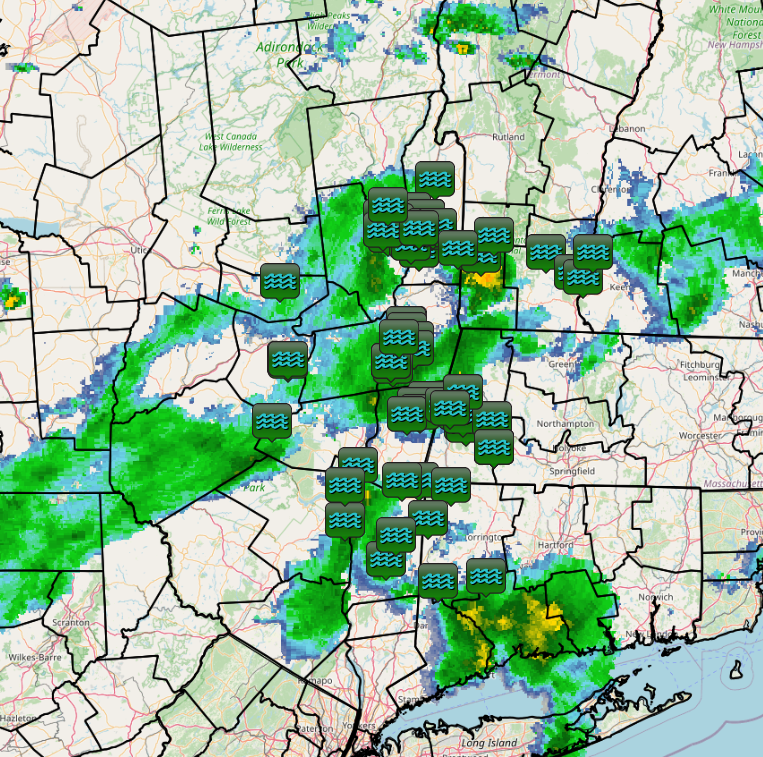
Radar
 |
 |
 |
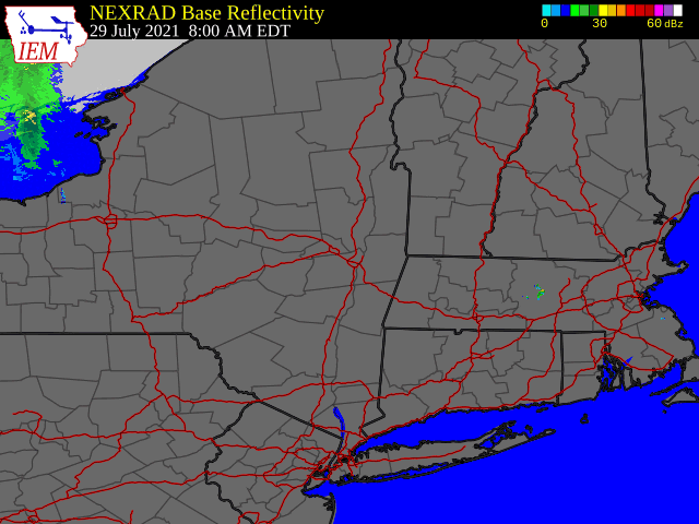 |
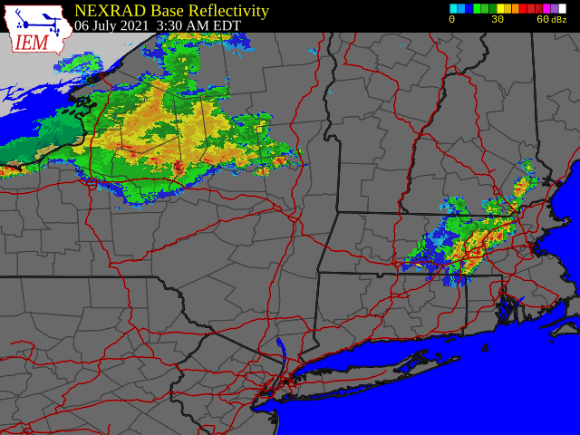
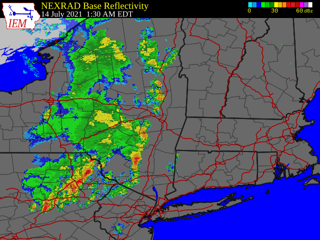
| Radar loop valid 3:30 am July 6 to 6:00 am July 9, 2022 | Radar loop valid 1:30 am July 14 to 2:00 am July 15, 2022 | Radar loop valid 8:00 am July 17 to 8:00 am July 19, 2022 | Radar loop valid 8:00 am July 29 to 12:00 pm July 30, 2022 |
Photos & Video
 |
 |
 |
 |
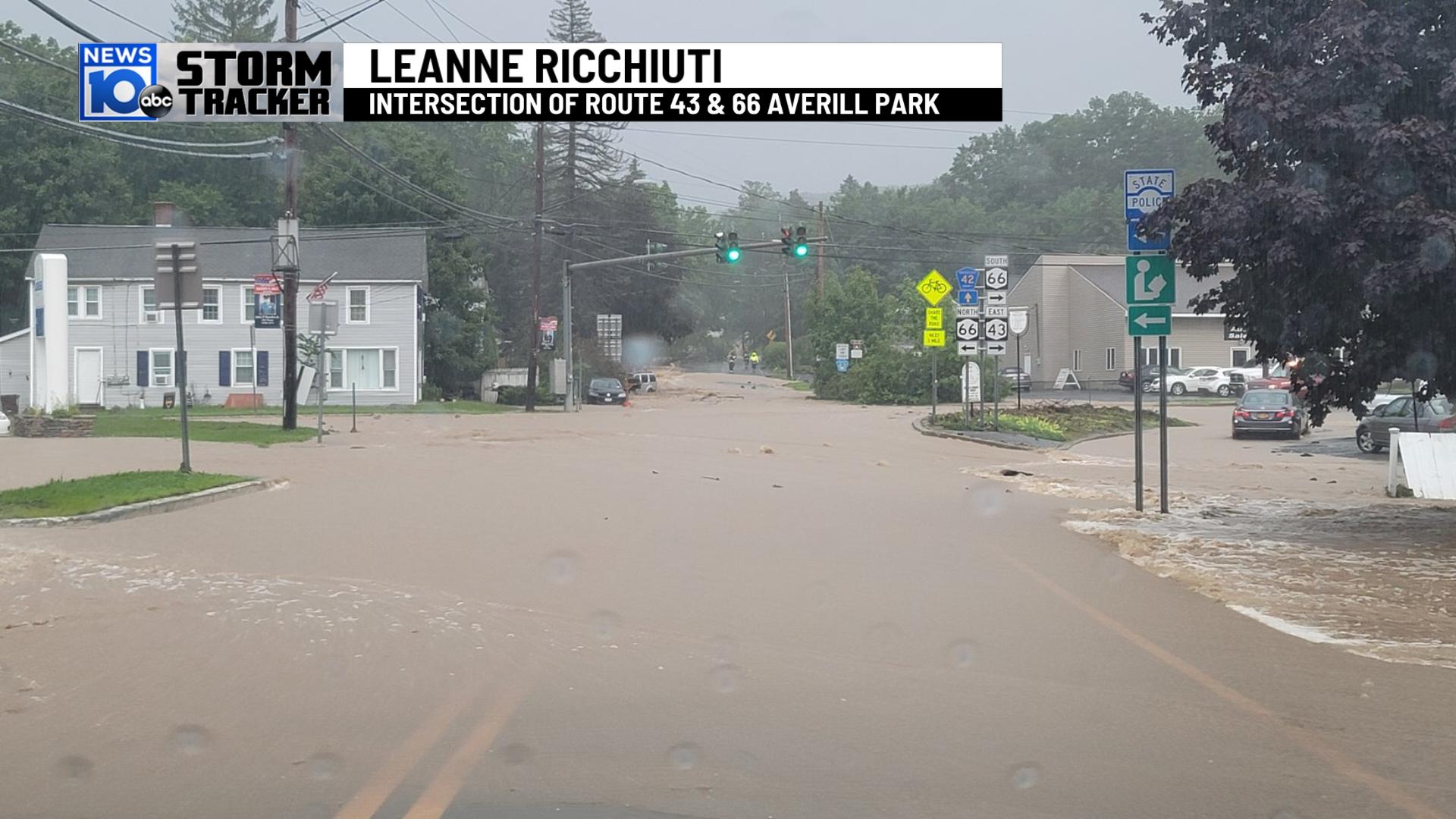
| Flooding in Averill Park, NY following heavy rain on July 14, 2021 (WTEN) |
Flooding in Averill Park, NY following heavy rain on July 14, 2021 (Leanne Ricchiuti) |
Flooding in Nassau, NY following heavy rain on July 14, 2021 (WTEN) |
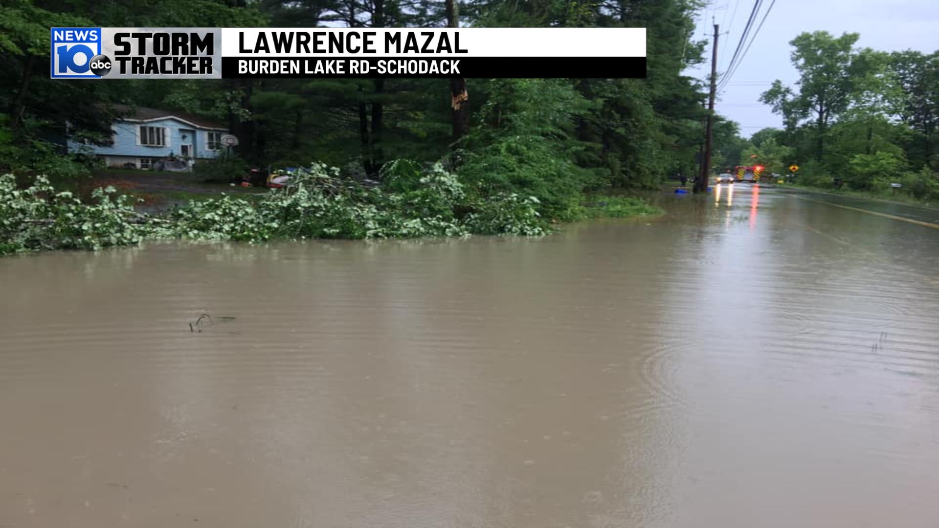
Flooding in Schodack, NY following heavy rain on July 14, 2021 (Lawrence Mazal) |
 |
 |
 |
 |
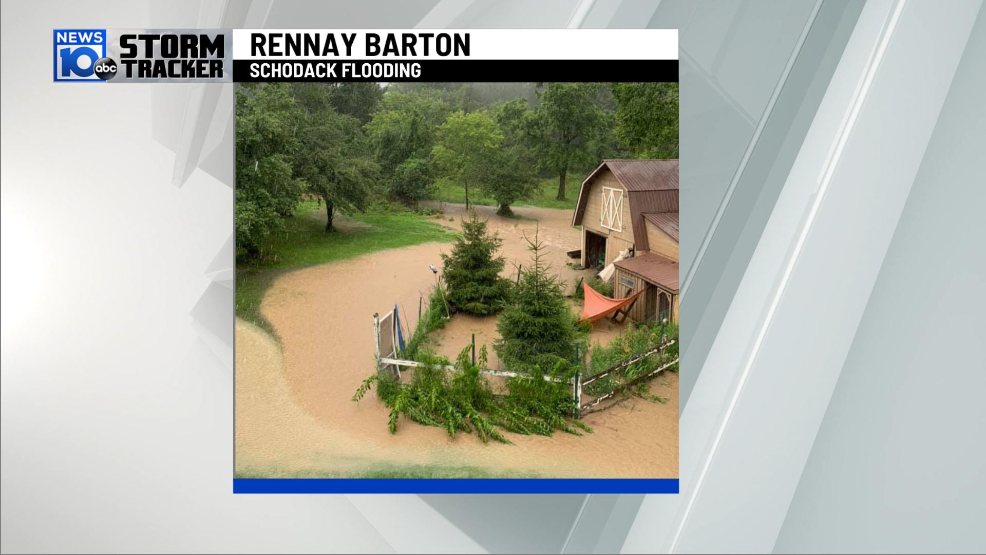
| Flooding in Schodack, NY following heavy rain on July 14, 2021 (Rennay Barton) |
Flooding near Averill Park, NY following heavy rain on July 14, 2021 (WTEN) |
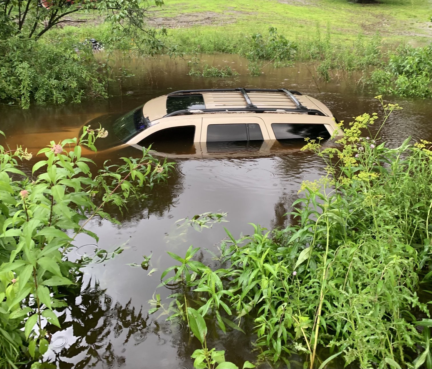
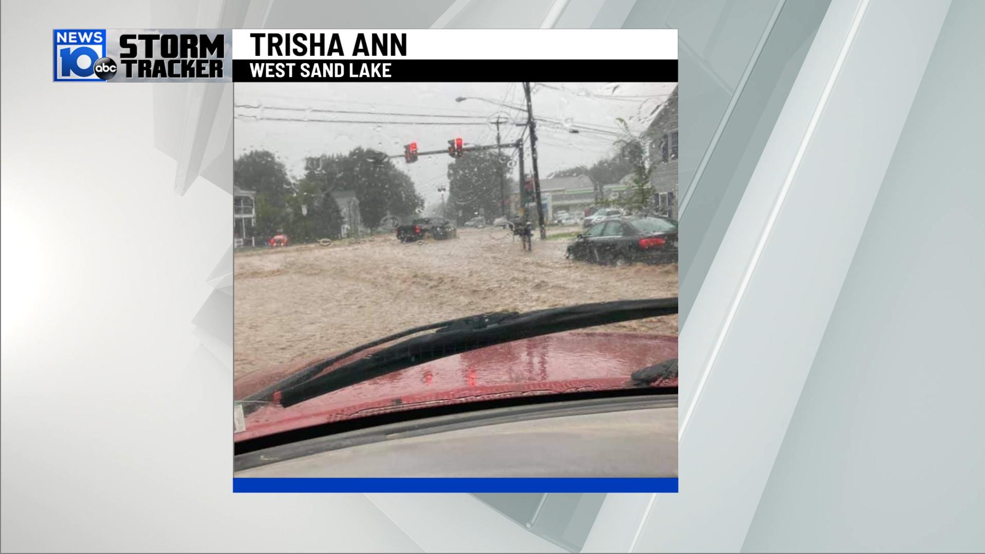
Flooding in West Sand Lake, NY following heavy rain on July 14, 2021 (Trisha Ann) |
Flooding in Brunswick, NY following heavy rain on July 14, 2021 (Alicia and Catherine Wasula) |
 |
 |
 |
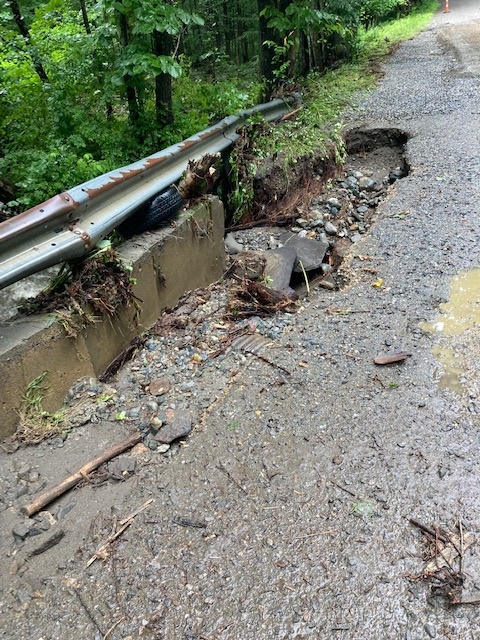 |
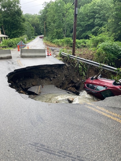
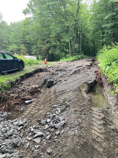
| Roads were damaged in the Town of Brattleboro due to heavy rain on July 17-18, 2021 (Brattleboro, VT DPW) |
Roads were damaged in the Town of Brattleboro due to heavy rain on July 17-18, 2021 (Brattleboro, VT DPW) |
Roads were damaged in the Town of Brattleboro due to heavy rain on July 17-18, 2021 (Brattleboro, VT DPW) |
Roads were damaged in the Town of Brattleboro due to heavy rain on July 17-18, 2021 (Brattleboro, VT DPW) |
 |
|||
| Flooding in Wilton, NY following heavy rain on July 29, 2021 (Jeremy Davis) |
Storm Reports

Rain Reports
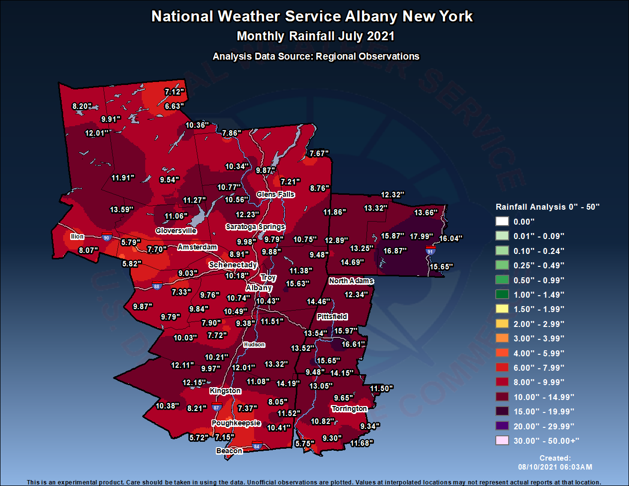 |
| July 2021 Total Rainfall |
Monthly Precipitation Totals For July 2021
National Weather Service Albany NY
Location Precipitation
Eastern New York...Albany County
Albany 0.3 ESE M
Albany 0.7 SW 9.49
Albany 0.8 ENE M
Albany 2.4 WNW 8.50
Albany 2.4 W M
Albany 2.5 WSW M
Albany ASOS 8.96
Albany NWS CESTM 8.28
Albany RAWS 8.06
Alcove Dam M
Altamont 2.7 SSW 9.96
Altamont 2.9 SW M
Delmar 1.0 S 9.37
East Berne 2.7 NE 9.76
Glenmont 1.8 WSW 10.74
Glenmont 2.5 SW 10.43
Ravena 1.4 WNW 10.49
Rensselaerville 2.1 NNW 9.84
Eastern New York...Columbia County
Ancramdale 0.2 N 14.19
Copake 0.3 WNW 13.32
Hillsdale 5.8 S M
Hudson 8.2 S M
Livingston 0.7 SSW 12.01
Valatie 2.9 N 11.51
Valatie 3.2 NE 11.92
Eastern New York...Dutchess County
Beacon Hills RAWS M
Beacon 0.7 SE 6.61
Clinton Corners M
Hopewell Jct 2.8 NE 8.31
Hopewell Jct 2.9 ENE M
Hyde Park 1.5 E 7.37
Lagrangeville 3.4 NE 10.41
Millbrook 2.5 NE 8.05
Millbrook 3.2 SE 11.52
Pleasant Valley 1.7 S 7.83
Poughkeepsie 2.4 S 7.26
Poughkeepsie 3.9 SSE 7.02
Poughkeepsie 4.5 SE M
Poughkeepsie 5.3 S 7.15
Poughkeepsie ASOS 6.06
Poughquag 2.0 S M
Red Hook 1.2 NNE 11.08
Rhinebeck 3.4 N 11.29
Rhinebeck 5.2 SE M
Wappingers Falls 1.6ESE 7.18
Eastern New York...Fulton County
Broadalbin 4.7 ESE 8.36
Northville 6.87
Northville 0.6 N 11.27
Peck Lake 11.06
Eastern New York...Greene County
Athens 2.2 NNW 11.39
Freehold 3.4 E 7.72
Greenville 0.7 E 7.90
Lexington 1.5 N 10.03
New Baltimore 0.2 SE 9.38
Tannersville 4.5 SSE M
Tannersville RAWS M
Eastern New York...Hamilton County
Hoffmeister 2.0 E 11.91
Indian Lake 10.36
Inlet 0.8 SE 11.47
Lake Pleasant RAWS M
Lake Pleasant 2.3 WSW 9.54
Long Lake 0.1 SSE 6.63
Long Lake 1.2 N 7.12
Speculator 10.0 SSW 9.56
Eastern New York...Herkimer County
Big Moose 3 SE 9.91
Chepatchet M
Dolgeville 1.9 NW M
Ilion 0.7 WSW 7.44
Little Falls 0.3 E M
Jordanville 4.2 E 8.07
Old Forge M
Old Forge COOP M
Old Forge 0.3 NE 12.01
Salisbury Center 1.8 NW 13.59
Stillwater Resvr 8.20
Eastern New York...Montgomery County
Amsterdam 1.0 NNW 7.74
Fonda 5.2 W 7.70
Fort Plain 0.2 SE 5.79
Hessville 1.8 WSW 5.82
Eastern New York...Rensselaer County
Averill Park 0.9 WNW 15.63
Averill Park 7.5 SE 12.34
Buskirk 10.75
Melrose 1 NE M
Nassau 4.2 ESE 14.76
Rensselaer 3.0 SSE M
Stephentown 3.4 SW 14.46
Troy Lock & Dam 10.94
Troy 0.7 E 11.07
Troy 2.1 NNE M
Troy 2.8 NNE M
Troy 3.3 NE M
Troy 6.9 NE 11.38
Wyantskill 2.6 SW 10.71
Eastern New York...Saratoga County
Ballston Spa 2.9 ESE M
Clifton Park 0.8 SSW M
Clifton Park 2.0 S M
Clifton Park 2.7 S 10.10
Conklingville Dam 10.77
Galway 0.3 NNW M
Gansevoort 1.3 WNW M
Greenfield Ctr 1.6 W 12.23
Malta 2.6 NNW 8.10
Mechanicville 3.4 WSW 9.88
Milton 5.2 NNW M
Round Lake 2.2 NNE 9.98
Round Lake 2.7 N M
Round Lake 4.1 NE 9.79
Saratoga RAWS 8.86
Saratoga Sprgs 0.5 S 9.53
Saratoga Springs 4SW 8.92
Schuylerville 1.6 SSW 9.87
Waterford 1.7 NW M
Eastern New York...Schenectady County
Amsterdam 6.4 E 8.00
Delanson 2 NE 9.03
Niskayuna 0.4 S 8.33
Niskayuna 0.7 NE M
Niskayuna 2.0 N 8.91
Niskayuna 2.9 SSE 10.18
Pattersonville 4.2 SSW 7.88
Rotterdam 0.9 NW 7.43
Schenectady 1.5 ENE 7.91
Schenectady 1.6 NE 7.20
Schenectady 2.7 SSW M
Schenectady 3.3 E M
Scotia 1.1 NW 7.58
Eastern New York...Schoharie County
Cobleskill M
Cobleskill 4.2 NNE M
Jefferson 0.2 S 9.87
Lansing Manor 9.79
Middleburgh 6.3 ESE 10.72
Schoharie Village 7.33
Eastern New York...Ulster County
Belleayre MTN RAWS M
Esopus 0.8 NNE 6.82
Gardiner 1.3 WNW M
Highland 0.2 SW 5.29
Hurley 2.2 S 10.23
Kerhonkson 3.7 N 10.38
Kingston 2.1 N M
Mohonk Lake M
New Paltz 3.5 SSW 9.36
Phoenicia 12.11
Rosendale 1.8 WNW 9.01
Saugerties 4.7 NW 10.21
Stone Ridge 0.5 WNW 8.21
Stone Ridge 0.7 N 8.90
Ulster Park 0.9 NNW 8.42
Wallkill 3.7 E 5.72
West Hurley 0.1 S 12.15
Woodstock 0.8 ENE 9.97
Eastern New York...Warren County
Glens Falls ASOS 8.05
Glens Falls 1.6 W M
Lake George 1.0 N 9.87
Lake George 5.0 ESE 7.21
Lake Luzerne 10.56
North Creek 7.86
Warrensburg 0.6 WSW M
Warrensburg 2.1 WNW 10.34
Eastern New York...Washington County
Granville 9.5 SW 8.76
Salem 2.3 SSE 11.86
Whitehall 7.67
Vermont...Bennington County
Bennington ASOS 9.48
Bennington 3.4 W M
Landgrove 1.1 NNE 8.66
Manchester 2.8 ENE 13.32
North Bennington 0.5N M
Peru 12.32
Shaftsbury 0.4 WNW 12.89
Stamford 5.0 NNE 14.69
Woodford RAWS 13.25
Vermont...Windham County
Brattleboro 0.7 S 15.65
East Dover 1.8 N 15.87
Marlboro 2.0 NNE M
Putney 0.7 NE 16.04
Putney 2.0 WNW 17.99
Rockingham 1.1 NNE 13.66
West Halifax 0.2 SE M
Westminster 5.5 NW 15.11
Wilmington 0.6 WNW 16.87
Massachusetts...Berkshire County
Cheshire 0.5 NNW 12.34
Dalton 2.9 SW 12.76
Great Barrington 0.4 N M
Great Barrington 3.0 N 13.52
Hancock 3.6 NNE 15.46
Lee 3.7 SE 16.61
Lenoxdale 15.97
North Adams ASOS 12.15
North Adams 3.0 WNW M
Pittsfield 2.0 NNW M
Pittsfield ASOS M
Sheffield 1.6 NW 15.65
Stockbridge 0.2 NNE 13.54
Stockbridge DCR 11.73
Tyringham 1.5 WNW M
Connecticut...Litchfield County
Bakersville 9.39
Canaan 4.2 ESE 14.15
Colebrook 1.0 NE M
Goshen 0.5 NW 9.65
Litchfield 2.3 NNE 9.05
New Hartford CTR 1.5 N 11.50
New Hartford CTR 3.2SW 9.40
New Milford 2.3 W M
New Milford 3.1 WNW 6.23
New Milford 5.3 SSW 5.75
Norfolk 2SW 13.05
Salisbury 3.8 NE 9.48
Thomaston Dam 9.34
Torrington 1.1 SSE 9.83
Warren 2.4 WNW 10.82
Watertown 0.5 S 11.68
Winsted 1.0 WSW 12.20
Winsted 2.6 NNW M
Winsted 3.8 ESE 11.44
Woodbury Center 1.5 SSW 9.30
---------------------------------------------------------------------------------------------
These data are preliminary and have not undergone final quality
control by the National Centers for Environmental Information
(NCEI). Therefore, these data are subject to revision. Final
and certified climate data can be accessed at www.ncei.noaa.gov.
---------------------------------------------------------------------------------------------
 |
Media use of NWS Web News Stories is encouraged! Please acknowledge the NWS as the source of any news information accessed from this site. |
|

