
Gusty winds and very dry conditions will lead to a critical to extremely critical fire weather threat over portions of the Central and Southern Plains Thursday. Critical fire weather continues through Friday. Moderate to heavy mountain snow and strong winds will expand into the Northern Rockies Thursday, then into Colorado by Friday. Up to a foot of snow accumulation is possible. Read More >
Overview
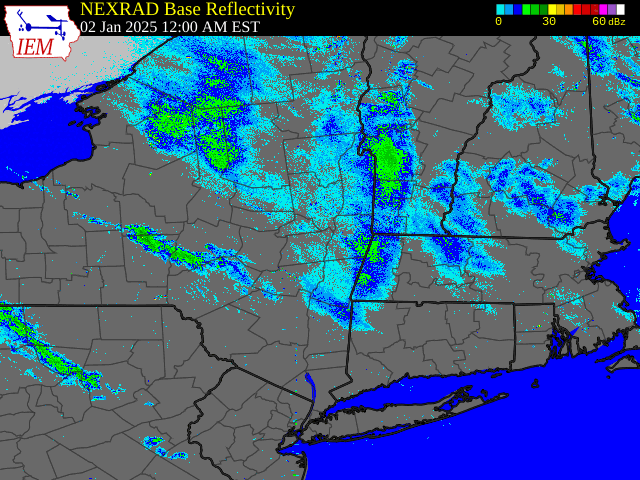
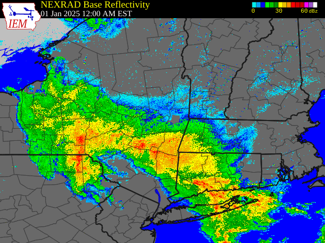
A multi-day lake-effect and upslope snow event began across eastern New York and western New England during the afternoon and evening hours on January 1, 2025 and continued into the evening hours on January 5, 2025 before ending. Low pressure tracked northward across the region on January 1 bringing a widespread rainfall, which gradually mixed with and changed over to snow during the afternoon and evening hours as colder air filtered back into the region. This low then tracked into Quebec and remained nearly stationary into January 3, 2025. Persistent west to west-northwesterly flow and a multi-lake connection during this time resulted in an oscillating band of heavy lake effect snow mostly impacting the Adirondacks and Mohawk Valley. On occasion, the band extended farther eastward bringing some light to moderate snowfall to portions of the Hudson Valley, especially from Albany and points north, and into western New England. There were instances the band even extended as far east as eastern New England!
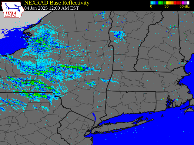
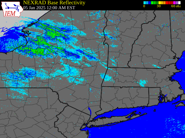
An upper level disturbance tracked through the region during the evening hours on January 3, 2025 weakening and disrupting the lake effect response into the early morning hours on January 4 as flow became more northwesterly. West to west-northwesterly flow and a multi-lake connection resumed by the afternoon hours on January 4 as another period of heavy lake-effect snow took shape across the Adirondacks and Mohawk Valley which continued into January 5. A north to northwesterly wind shift and the arrival of surface high pressure and drier air ended the lake-effect event by the evening hours on January 5.
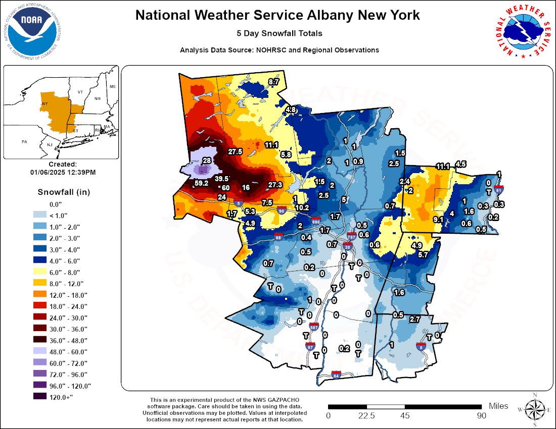
Snowfall totals from 1 to locally 5 feet fell across the Adirondacks and Mohawk Valley during this 5-day event with the highest totals occurring across central portions of Herkimer County, just north of the New York State Thruway.
Outside of the lake-effect snow, persistent upslope flow brought a general 5 to 10 inches of snow across the Rensselaer Plateau, northern Berkshires and into southern Vermont with some locally higher amounts within the peaks of the southern Greens.
Snow
 |
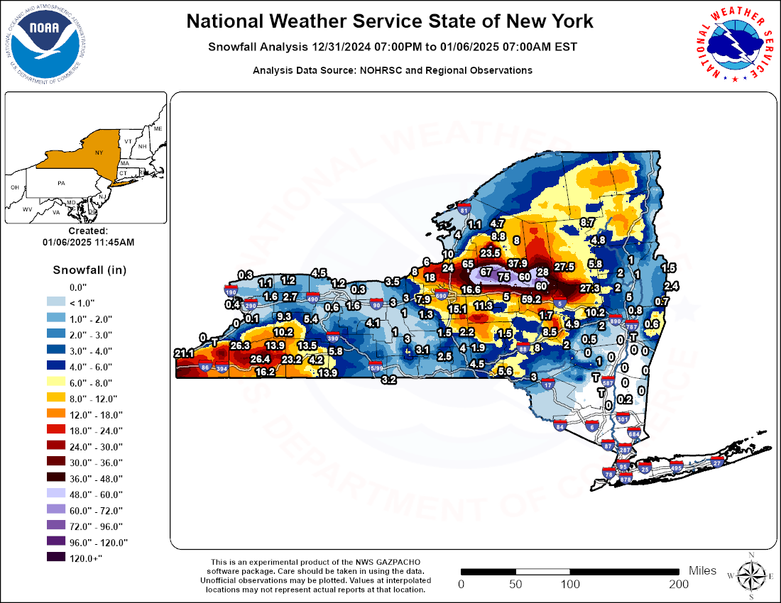 |
| Storm Total Snowfall: January 1-5, 2025 | New York State Storm Total Snowfall: January 1-5, 2025 |
Public Information Statement
National Weather Service Albany NY
1132 AM EST Mon Jan 6 2025

...5 Day Snowfall Total Reports as of 11 AM January 6th...

Location                     Amount    Time/Date       Provider

...Connecticut...

...Litchfield County...
Norfolk                      2.7 in    0800 AM 01/06   COOP
Warren 2.4 WNW               1.0 in    0700 AM 01/06   COCORAHS
Canaan 4.2 ESE               0.5 in    0700 AM 01/06   COCORAHS
New Hartford Center 3.2 SW    T in     0700 AM 01/06   COCORAHS
Bakersville                   T in     0700 AM 01/06   COOP

...Massachusetts...

...Berkshire County...
Cheshire 0.5 NNW             5.7 in    0700 AM 01/06   COCORAHS
Cheshire 2.6 N               4.9 in    0700 AM 01/06   COCORAHS
Great Barrington 0.4 N       1.6 in    1159 PM 01/05   COCORAHS

...New York...

...Albany County...
Latham 1.8 NW                2.3 in    0700 AM 01/06   COCORAHS
Albany 0.7 SW                0.7 in    0700 AM 01/06   COCORAHS
NWS Albany                   0.6 in    0700 AM 01/06   COCORAHS
Rensselaerville 2.1 NNW      0.5 in    0700 AM 01/06   COCORAHS
Altamont 0.4 SE              0.4 in    0700 AM 01/06   COCORAHS
Glenmont 2.5 SW               T in     0700 AM 01/06   COCORAHS

...Columbia County...
Germantown 0.6 E              T in     0700 AM 01/06   COCORAHS
Chatham 0.7 SW                T in     0700 AM 01/06   COCORAHS
Valatie 2.9 N                 T in     0700 AM 01/06   COCORAHS
Ancramdale 0.2 N              T in     0700 AM 01/06   COCORAHS

...Dutchess County...
Pleasant Valley 1.7 S        0.2 in    1200 AM 01/06   COCORAHS
Millbrook 3.2 SE              T in     0700 AM 01/06   COCORAHS
Red Hook 1.2 NNE              T in     0700 AM 01/06   COCORAHS

...Fulton County...
Gloversville 7nw             27.3 in   0700 AM 01/06   COOP
Dolgeville 6.4 E             16.0 in   0845 AM 01/06   COCORAHS
2 NW Hagaman                 1.0 in    0358 PM 01/05

...Greene County...
Elka Park 3.8 ESE            1.0 in    0700 AM 01/06   COCORAHS
Greenville 0.7 E             0.2 in    0500 AM 01/06   COCORAHS
Freehold 3.4 E                T in     0530 AM 01/06   COCORAHS
Athens 0.3 WNW                T in     0700 AM 01/06   COCORAHS
Lexington 1.5 N               T in     0700 AM 01/06   COCORAHS

...Hamilton County...
Hoffmeister 2.4 WNW          27.5 in   0800 AM 01/06   COCORAHS
Lake Pleasant 2.3 WSW        11.1 in   0655 AM 01/06   COCORAHS
Long Lake 1.2 N              8.7 in    0700 AM 01/06   COCORAHS
4 NNW Wells                  5.8 in    0459 PM 01/05
Indian Lake                  4.8 in    0740 AM 01/06   COOP

...Herkimer County...
3 NW Dolgeville              60.0 in   0740 AM 01/06   Broadcast Media
4 W Middleville              59.2 in   0700 AM 01/06
Schuyler 3.3 NE              59.0 in   0700 AM 01/06   COCORAHS
Salisbury Center 1.8 NW      39.5 in   0500 AM 01/06   COCORAHS
Ohio                         28.0 in   0740 AM 01/06   Broadcast Media
Little Falls                 24.0 in   0740 AM 01/06   Broadcast Media

...Montgomery County...
Amsterdam 1.0 NNW            10.2 in   0714 AM 01/06   COCORAHS
Fonda 5.2 W                  7.5 in    0900 AM 01/06   COCORAHS
Fort Plain 0.2 SE            5.3 in    0700 AM 01/06   COCORAHS
Hessville 1.8 WSW            1.7 in    0800 AM 01/06   COCORAHS

...Rensselaer County...
Buskirk                      0.7 in    0830 AM 01/06   COOP
Averill Park 0.9 WNW         0.6 in    0800 AM 01/06   COCORAHS
Troy 2.1 NNE                 0.6 in    0800 AM 01/06   COCORAHS
Troy 2.6 N                   0.5 in    0700 AM 01/06   COCORAHS

...Saratoga County...
Ballston Spa 2.9 ESE         5.0 in    0730 AM 01/06   COCORAHS
4 WNW Rock City Falls        2.5 in    0845 AM 01/06   COCORAHS
Milton 5.9 NNW               2.0 in    0700 AM 01/06   COCORAHS
Sacandaga Lake               2.0 in    0800 AM 01/06   COOP
5 W Porter Corners           1.5 in    1007 PM 01/05
Clifton Park 2.7 S           0.8 in    0630 AM 01/06   COCORAHS

...Schenectady County...
Scotia 1.1 NW                2.5 in    0600 AM 01/06   COCORAHS
Delanson 2ne                 2.0 in    0700 AM 01/06   COOP
Niskayuna 2.9 SSE            1.7 in    0700 AM 01/06   COCORAHS
Niskayuna 2.0 N              1.7 in    0700 AM 01/06   COCORAHS

...Schoharie County...
Sharon Springs 0.5 S         4.9 in    0700 AM 01/06   COCORAHS
Lansing Manor                0.7 in    0830 AM 01/06   COOP

...Ulster County...
Esopus 0.8 NNE                T in     0700 AM 01/06   COCORAHS
Hurley 2.2 S                  T in     0700 AM 01/06   COCORAHS
Highland 0.2 SW               T in     0700 AM 01/06   COCORAHS
West Hurley 0.1 S             T in     0700 AM 01/06   COCORAHS
Woodstock 0.8 ENE             T in     0700 AM 01/06   COCORAHS
Saugerties 4.7 NW             T in     0830 AM 01/06   COCORAHS

...Warren County...
1 SW Warrensburg             1.0 in    0359 PM 01/05
1 WNW West Glens Falls       1.0 in    0458 PM 01/05
Lake George 1.0 N            1.0 in    0600 AM 01/06   COCORAHS
West Glens Falls 1.1 NW      0.9 in    0800 AM 01/06   COCORAHS

...Washington County...
6 NE Argyle                  2.5 in    0517 AM 01/06
Salem 2.3 SSE                2.4 in    0600 AM 01/06   COCORAHS
5 WSW Granville              1.5 in    0453 PM 01/05

...Vermont...

...Bennington County...
Peru                         11.1 in   0700 AM 01/06   COOP
Stamford 5.0 NNE             9.1 in    0400 PM 01/05   COCORAHS
Landgrove 1.1 NNE            4.5 in    0750 AM 01/06   COCORAHS
5 S Woodford State Park      4.3 in    0400 PM 01/05
5 WNW Arlington              2.0 in    0436 AM 01/06

...Windham County...
Wilmington 0.6 WNW           4.0 in    0535 AM 01/06   COCORAHS
Marlboro 2.0 NNE             1.6 in    0800 AM 01/06   COCORAHS
East Dover 1.8 N             1.0 in    0650 AM 01/06   COCORAHS
Rockingham 1.1 NNE           1.0 in    0700 AM 01/06   COCORAHS
5.6 W West Brattleboro       0.6 in    0800 AM 01/06   COOP
Guilford 7.0 SW              0.5 in    0730 AM 01/06   COCORAHS
East Dummerston 0.5 NE       0.3 in    0730 AM 01/06   COCORAHS
Putney 0.7 NE                0.3 in    0800 AM 01/06   COCORAHS
Brattleboro 0.7 S            0.2 in    0700 AM 01/06   COCORAHS
Westminster 5.5 NW            T in     0700 AM 01/06   COCORAHS
Radar
 |
 |
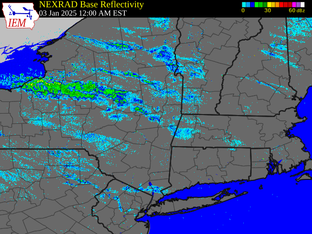 |
| Regional Radar Loop valid 12:00 am January 1 to 12:00 am January 2, 2025 | Regional Radar Loop valid 12:00 am January 2 to 12:00 am January 3, 2025 | Regional Radar Loop valid 12:00 am January 3 to 12:00 am January 4, 2025 |
 |
 |
 |
| Regional Radar Loop valid 12:00 am January 4 to 12:00 am January 5, 2025 | Regional Radar Loop valid 12:00 am January 5 to 12:00 am January 6, 2025 | Regional Radar Loop valid 12:00 am January 1 to 12:00 am January 6, 2025 (1-hour increments) |
Environment
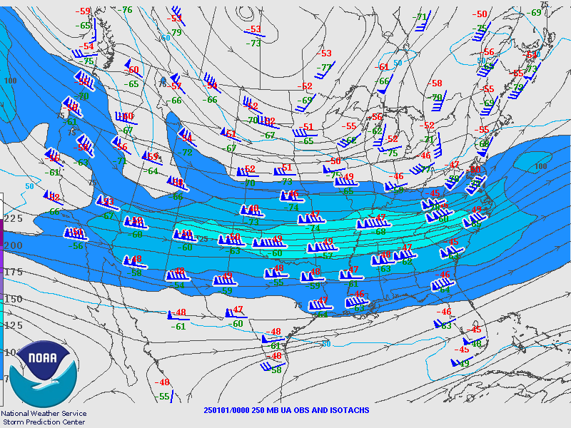
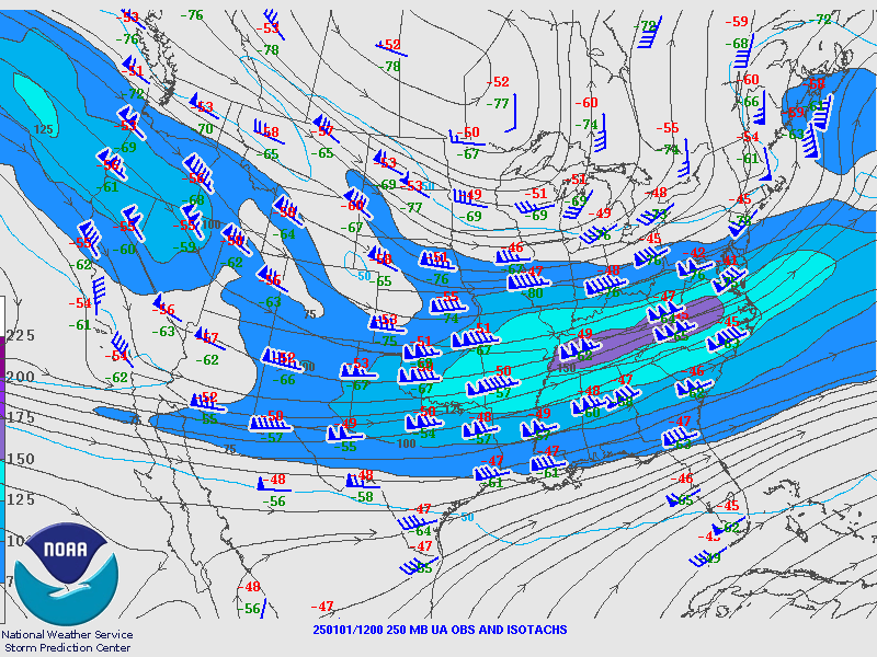
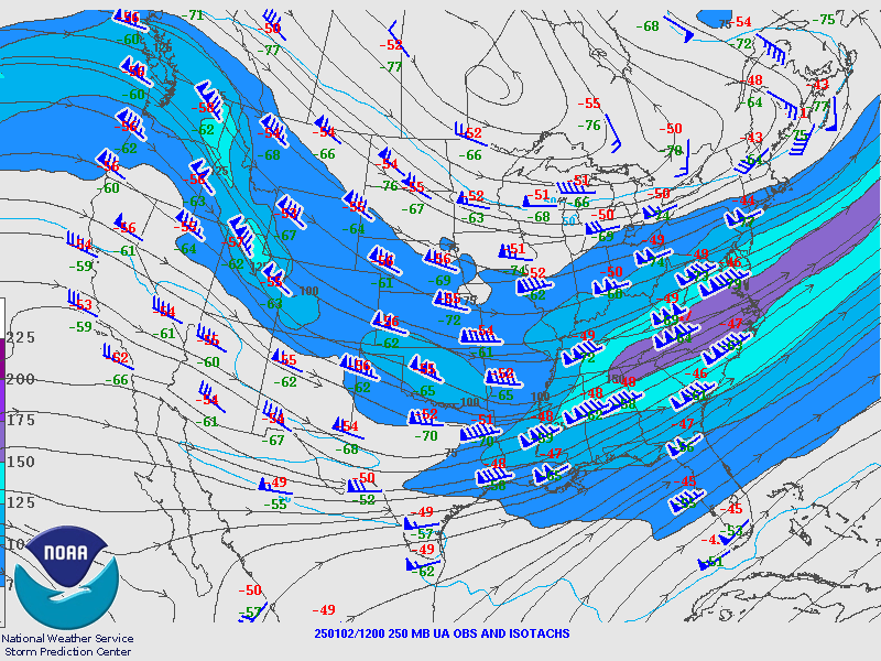
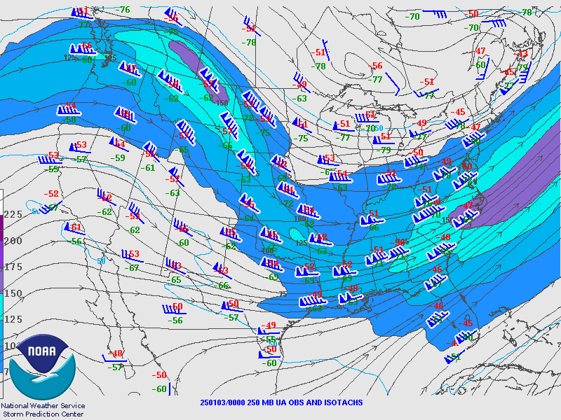
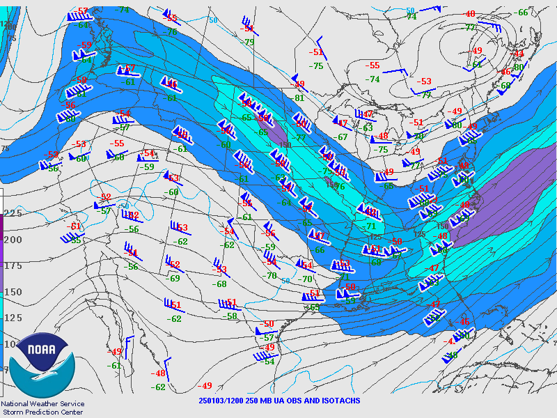
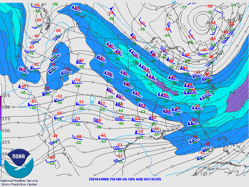
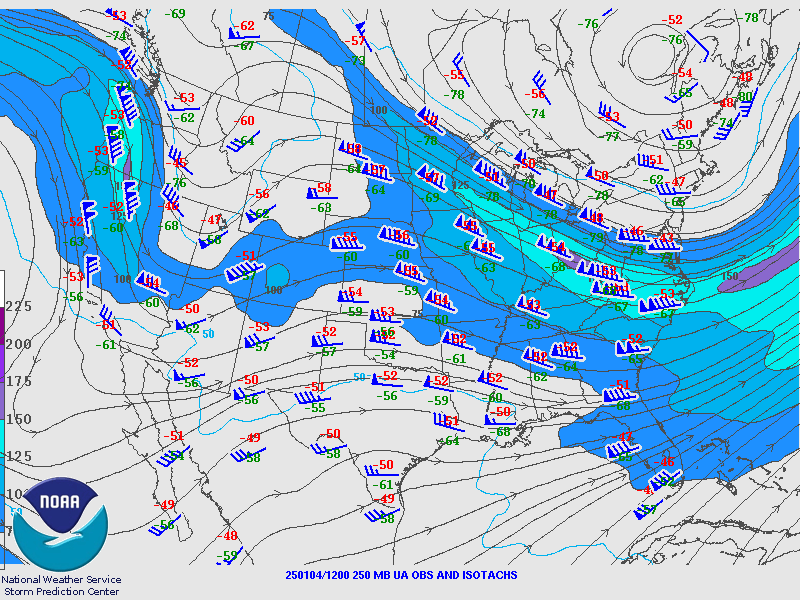
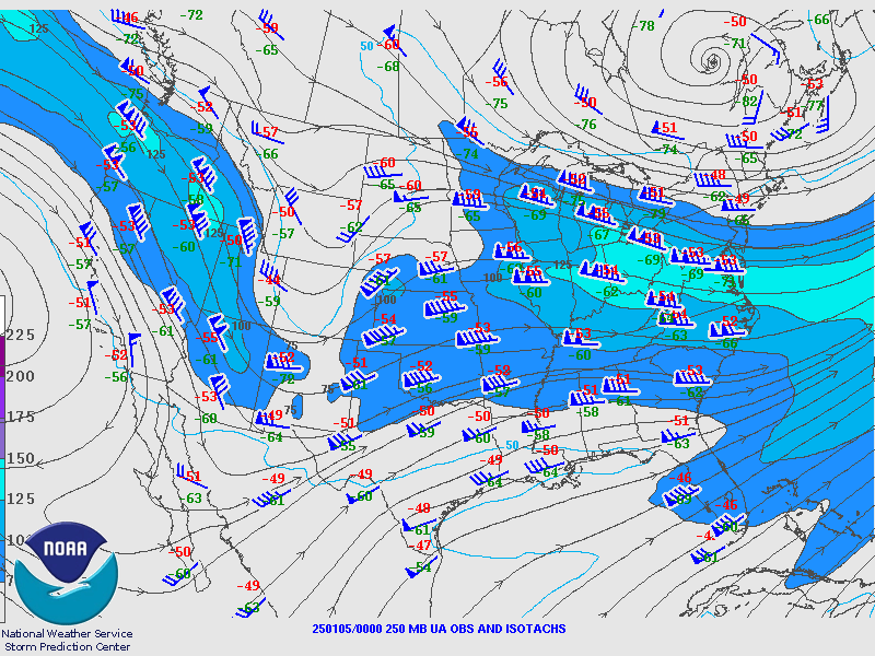
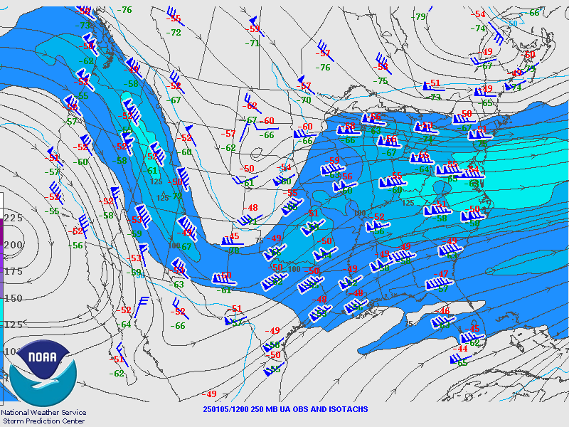
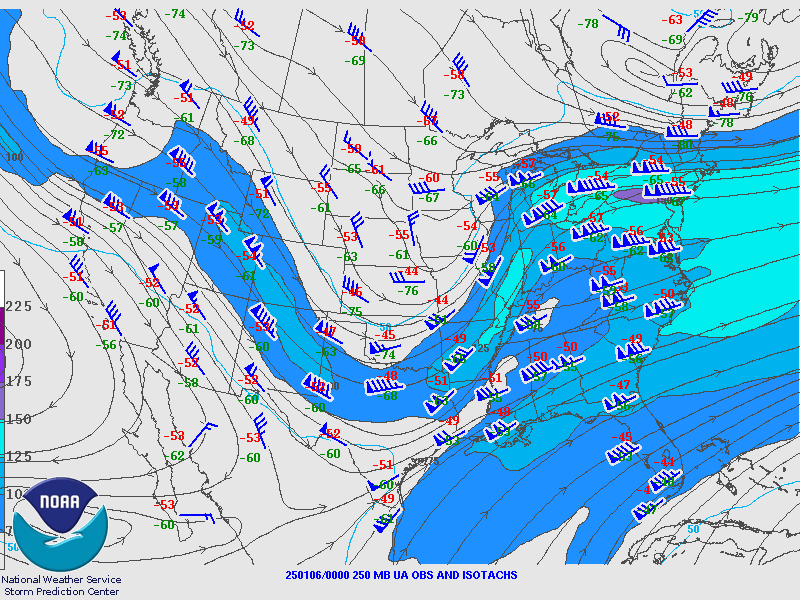
250 hPa Analysis
 |
 |
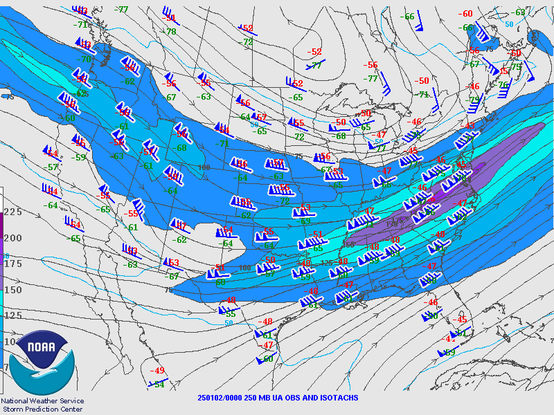 |
| Valid 00z January 1, 2025 | Valid 12z January 1, 2025 | Valid 00z January 2, 2025 |
 |
 |
 |
| Valid 12z January 2, 2025 | Valid 00z January 3, 2025 | Valid 12z January 3, 2025 |
 |
 |
 |
| Valid 00z January 4, 2025 | Valid 12z January 4, 2025 | Valid 00z January 5, 2025 |
 |
 |
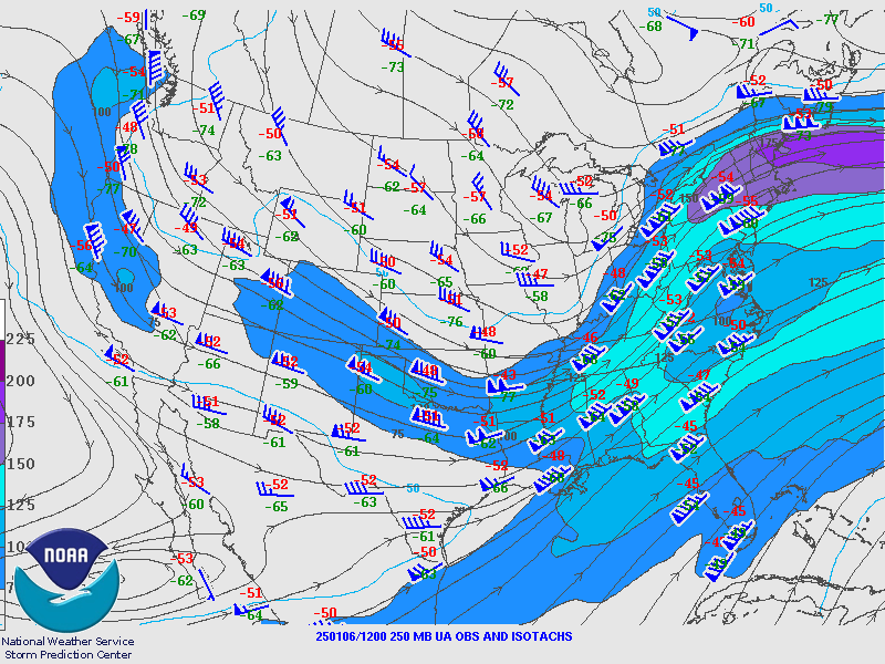 |
| Valid 12z January 5, 2025 | Valid 00z January 6, 2025 | Valid 12z January 6, 2025 |
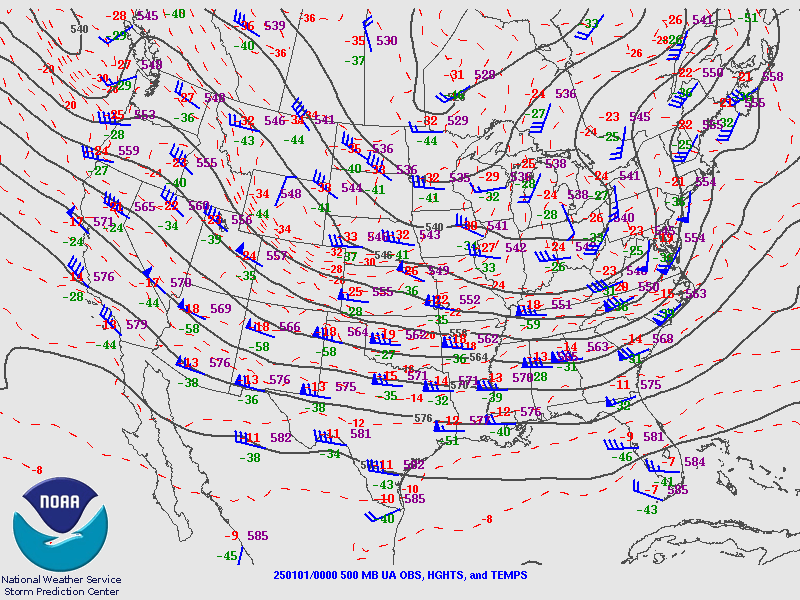
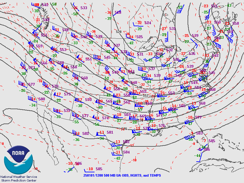
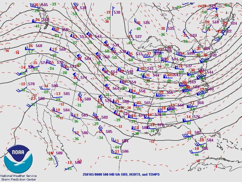
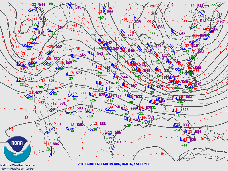
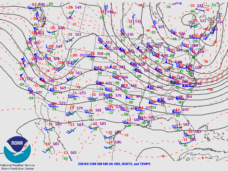
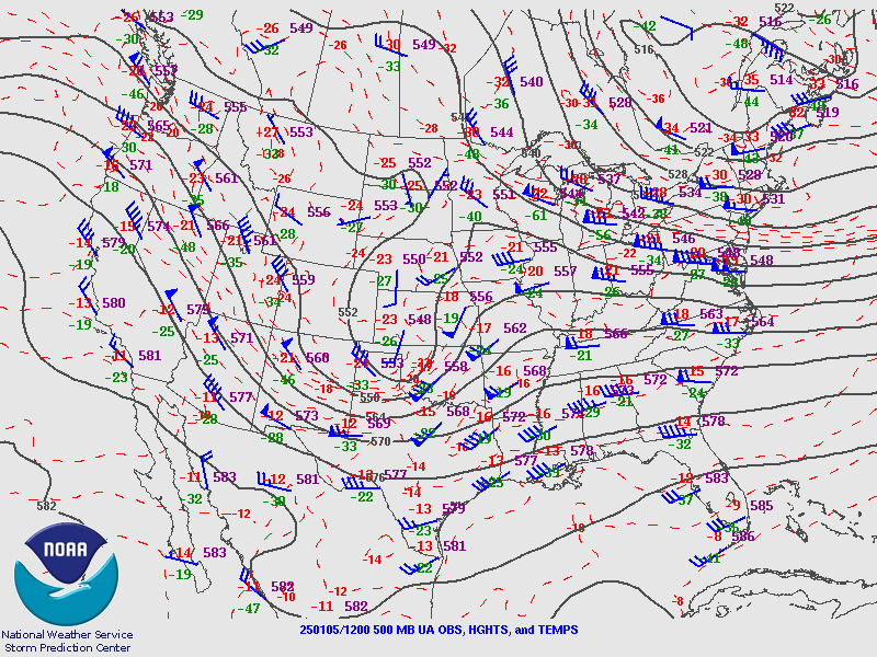
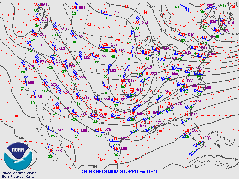
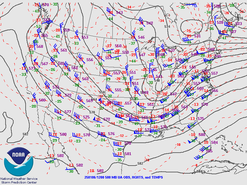
500 hPa Analysis
 |
 |
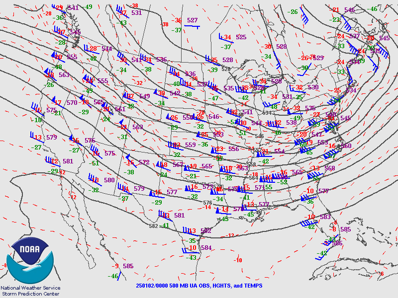 |
| Valid 00z January 1, 2025 | Valid 12z January 1, 2025 | Valid 00z January 2, 2025 |
 |
 |
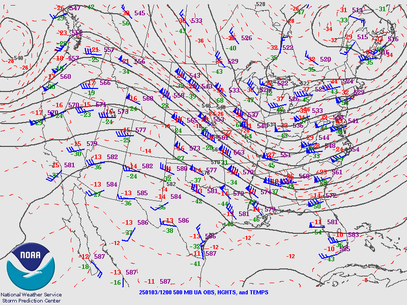 |
| Valid 12z January 2, 2025 | Valid 00z January 3, 2025 | Valid 12z January 3, 2025 |
 |
 |
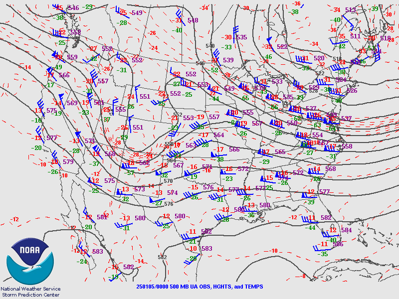 |
| Valid 00z January 4, 2025 | Valid 12z January 4, 2025 | Valid 00z January 5, 2025 |
 |
 |
 |
| Valid 12z January 5, 2025 | Valid 00z January 6, 2025 | Valid 12z January 6, 2025 |
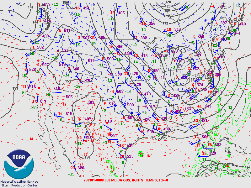
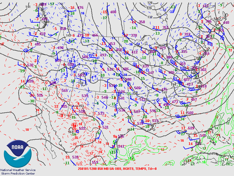
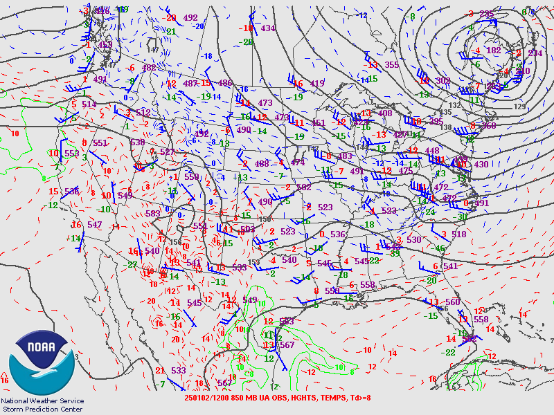
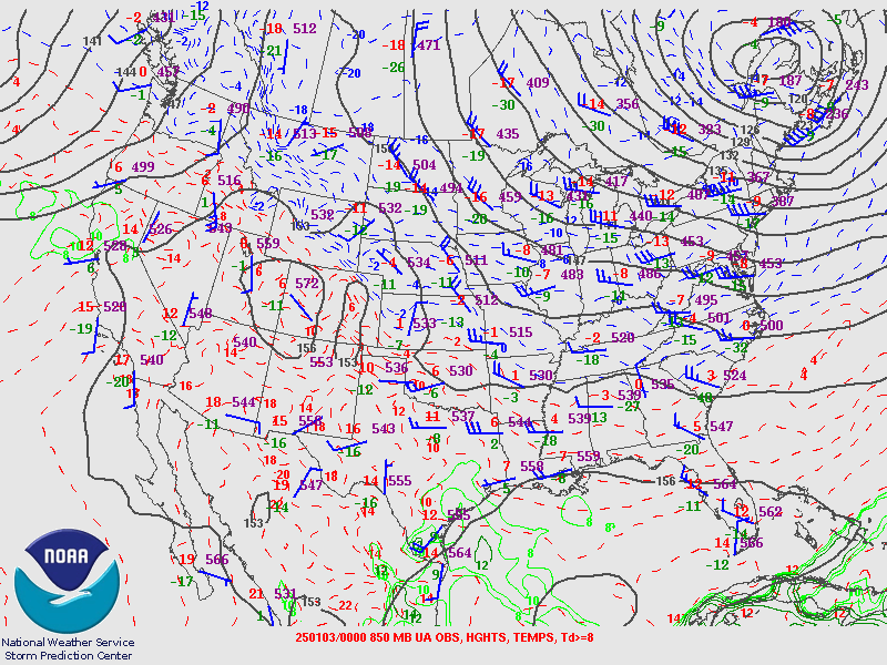
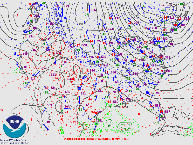
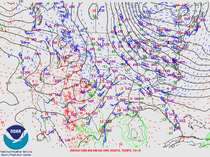
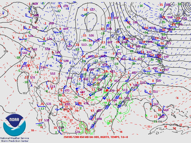
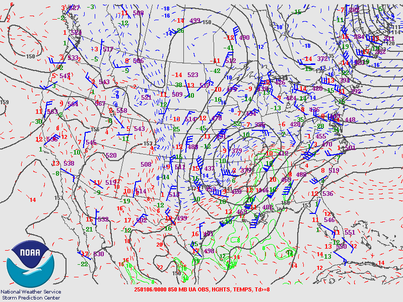
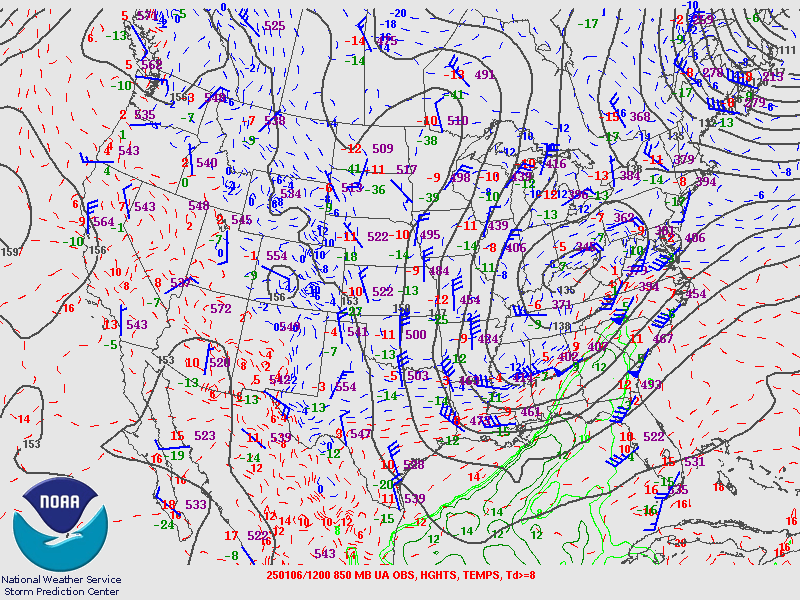
850 hPa Analysis
 |
 |
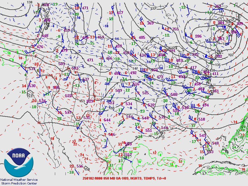 |
| Valid 00z January 1, 2025 | Valid 12z January 1, 2025 | Valid 00z January 2, 2025 |
 |
 |
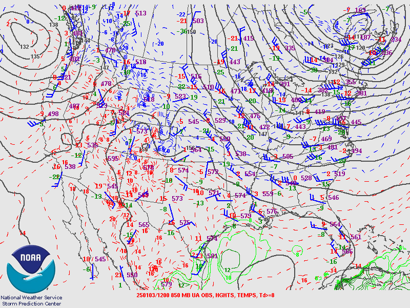 |
| Valid 12z January 2, 2025 | Valid 00z January 3, 2025 | Valid 12z January 3, 2025 |
 |
 |
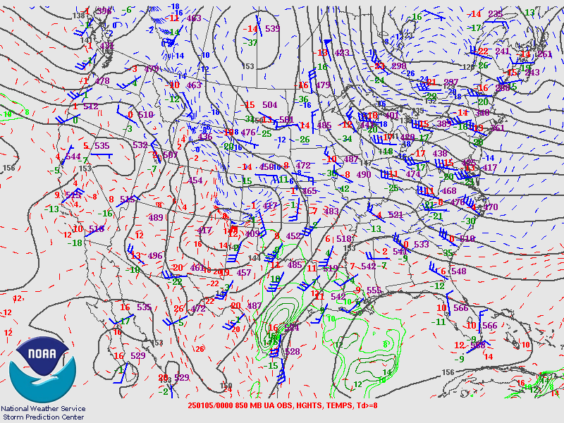 |
| Valid 00z January 4, 2025 | Valid 12z January 4, 2025 | Valid 00z January 5, 2025 |
 |
 |
 |
| Valid 12z January 5, 2025 | Valid 00z January 6, 2025 | Valid 12z January 6, 2025 |
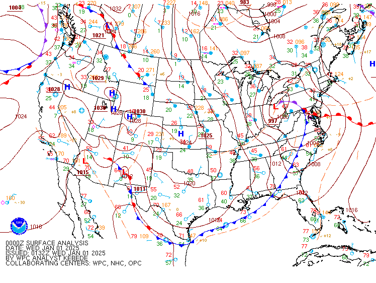
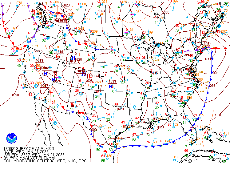
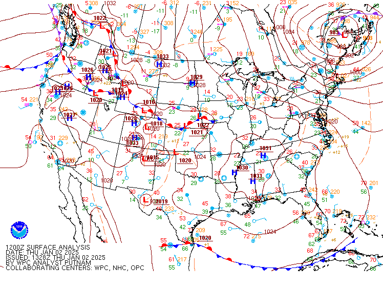
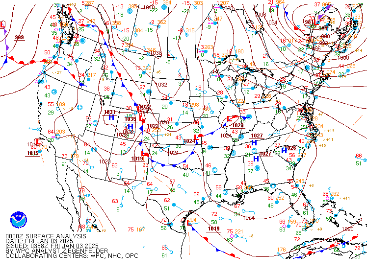
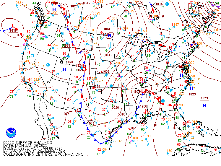
Surface Analysis
 |
 |
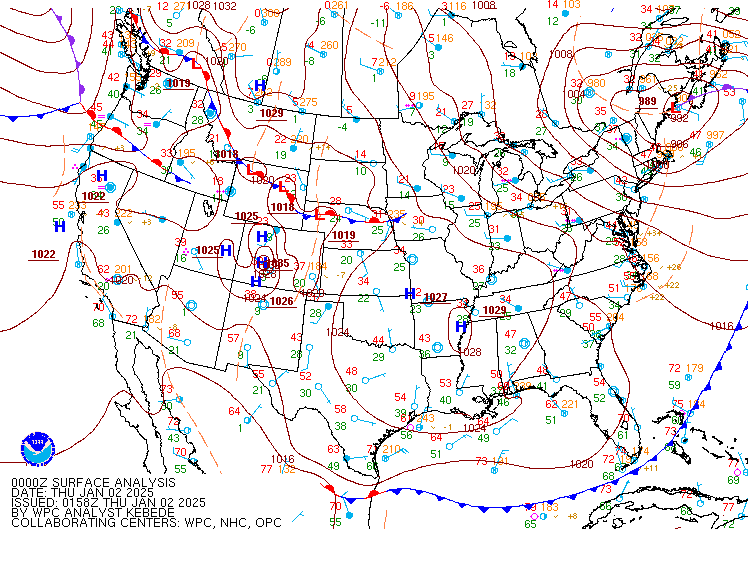 |
| Valid 00z January 1, 2025 | Valid 12z January 1, 2025 | Valid 00z January 2, 2025 |
 |
 |
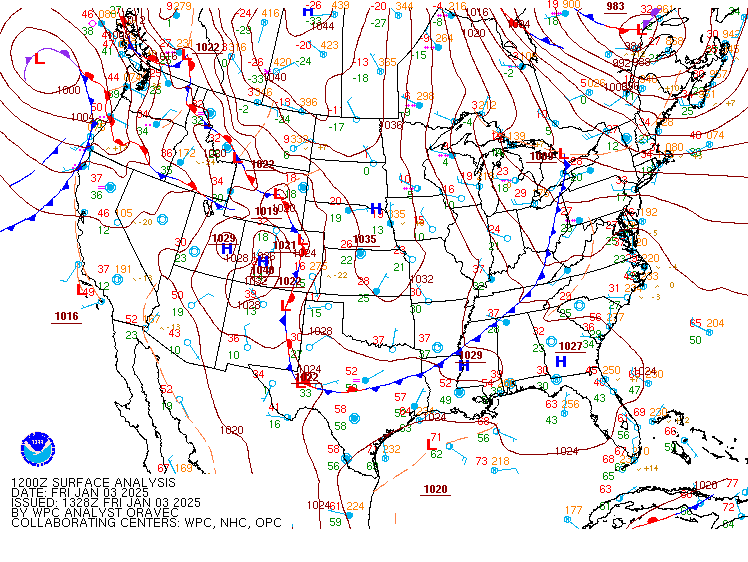 |
| Valid 12z January 2, 2025 | Valid 00z January 3, 2025 | Valid 12z January 3, 2025 |
 |
 |
 |
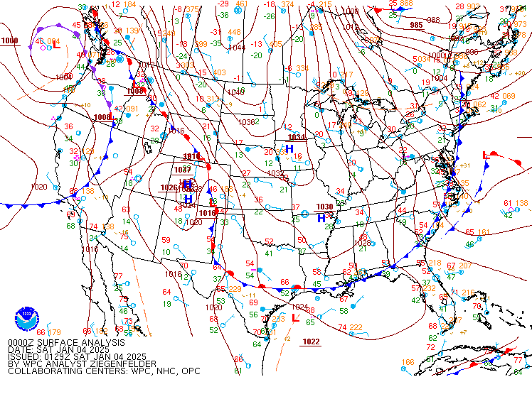
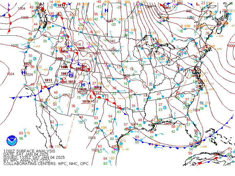
| Valid 00z January 4, 2025 | Valid 12z January 4, 2025 | Valid 00z January 5, 2025 |
 |
 |
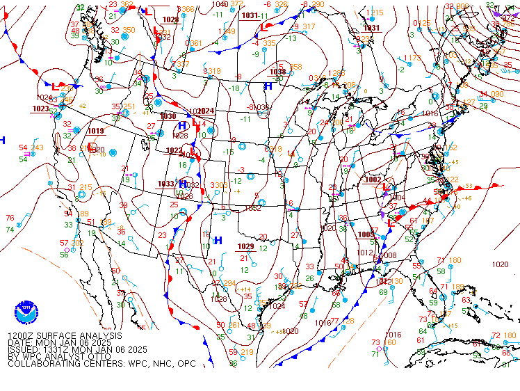 |
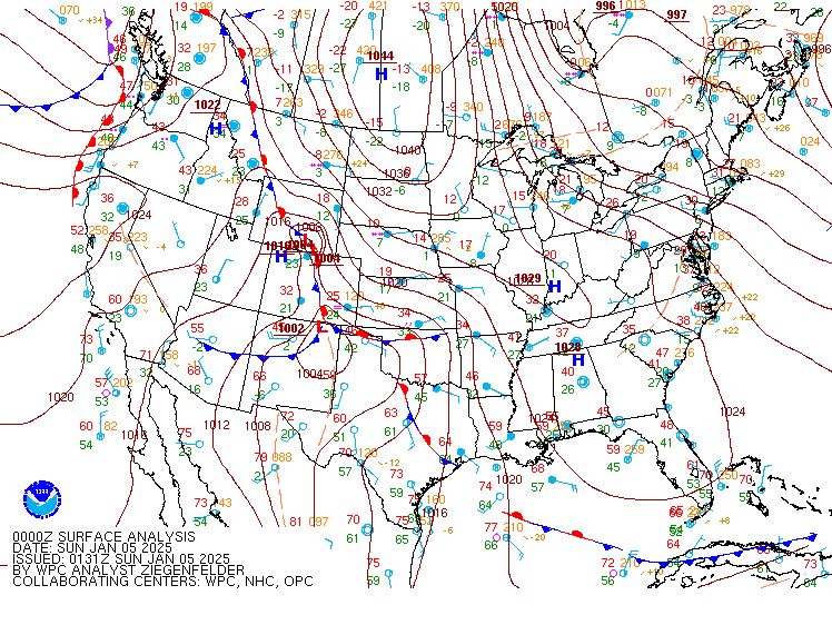
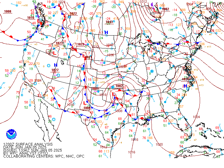
| Valid 12z January 5, 2025 | Valid 00z January 6, 2025 | Valid 12z January 6, 2025 |
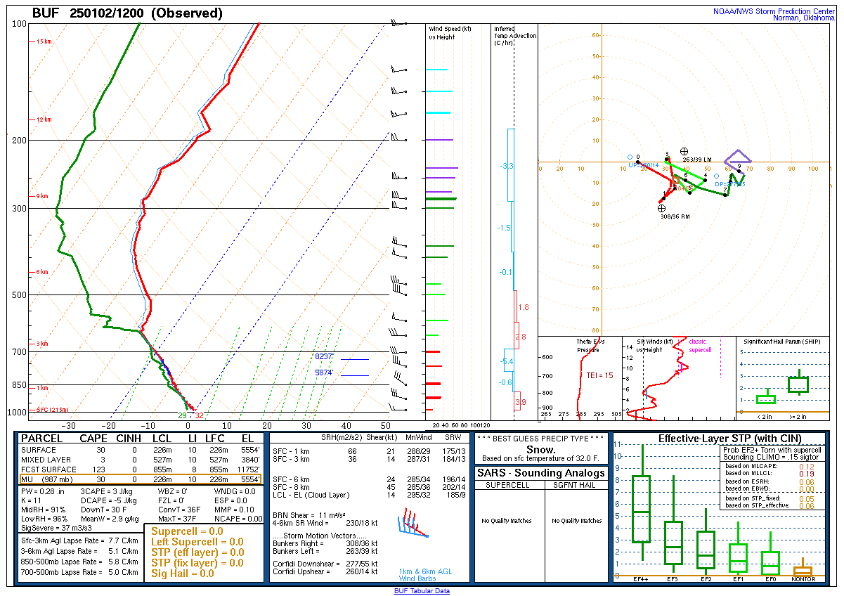
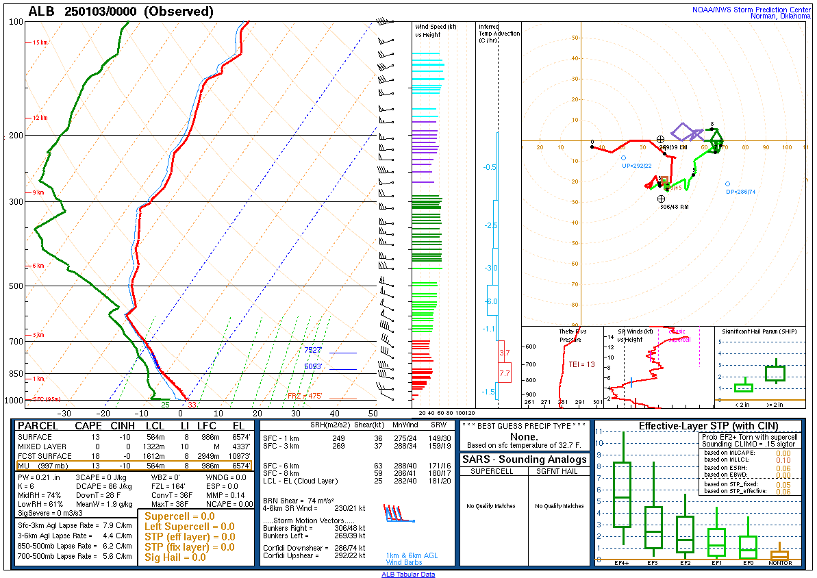
Upper Air Soundings
 |
 |
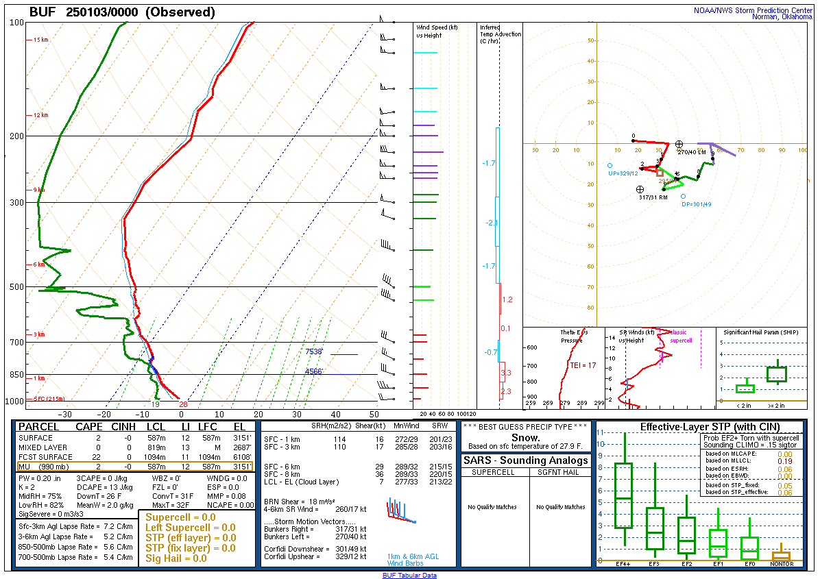 |
| KBUF Sounding Valid 12z January 2, 2025 | KALY Sounding Valid 00z January 3, 2025 | KBUF Sounding Valid 00z January 3, 2025 |
 |
 |
 |
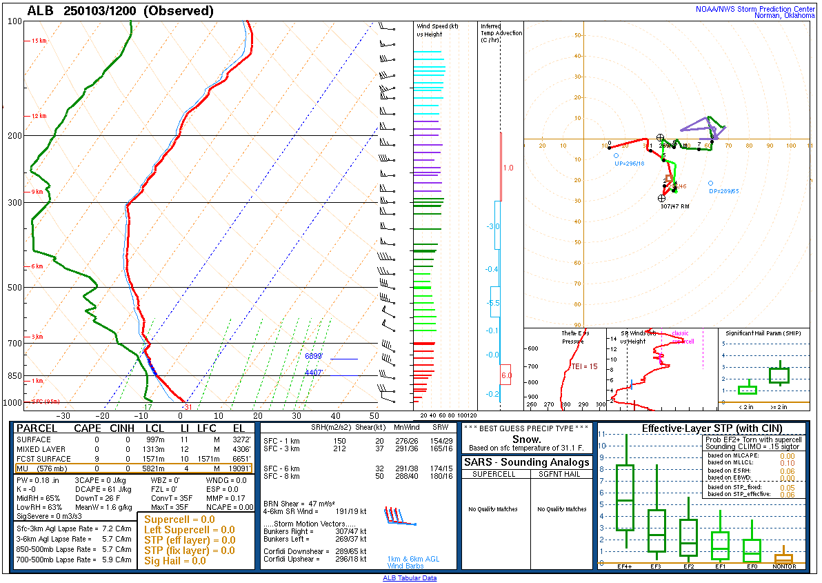
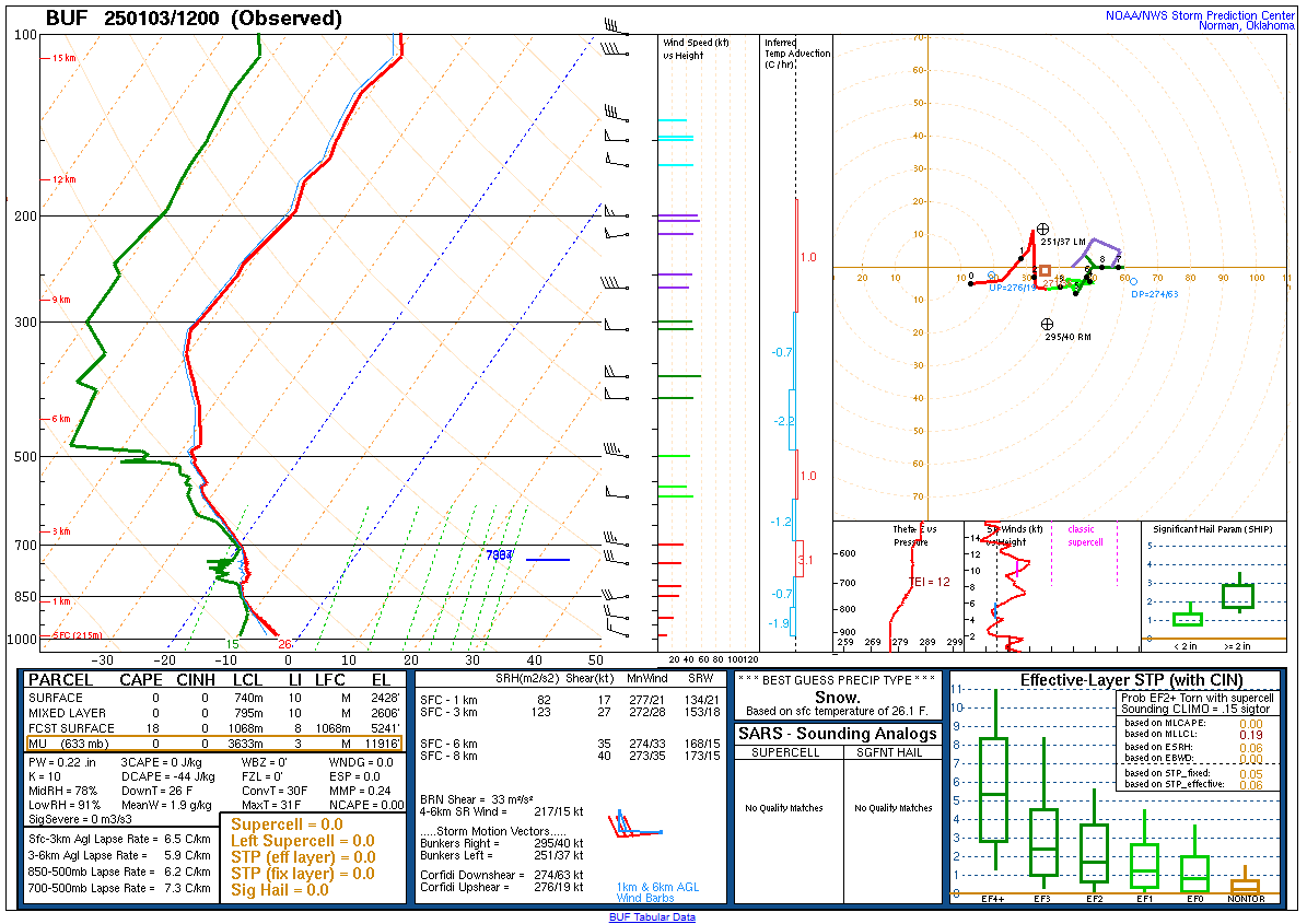
| KALY Sounding Valid 12z January 3, 2025 | KBUF Sounding Valid 12z January 3, 2025 | KALY Sounding Valid 00z January 4, 2025 |
 |
 |
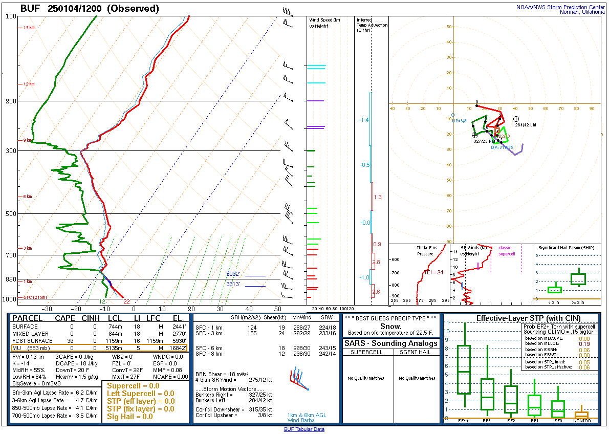 |
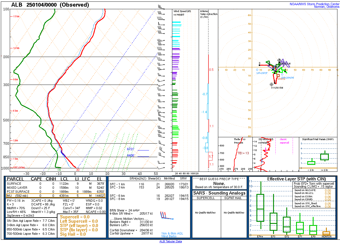
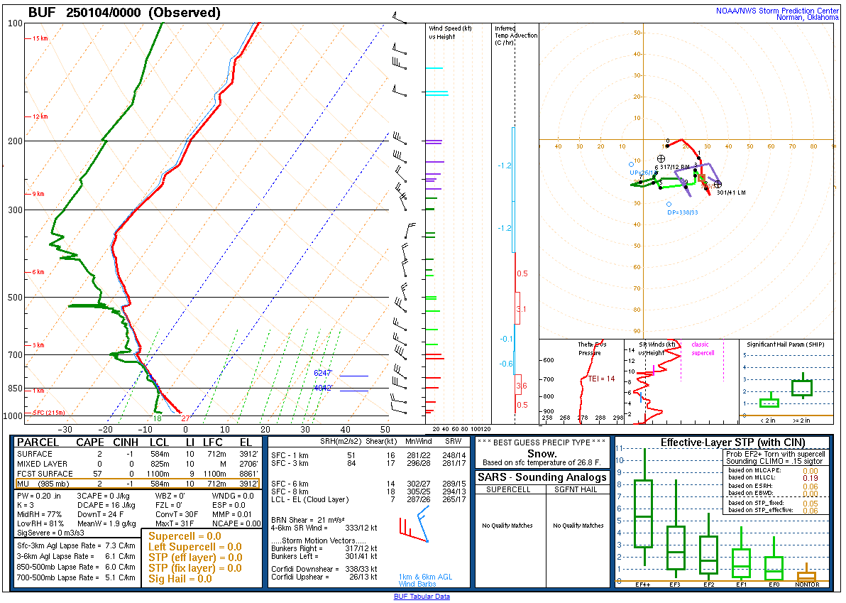
| KBUF Sounding Valid 00z January 4, 2025 | KALY Sounding Valid 12z January 4, 2025 | KBUF Sounding Valid 12z January 4, 2025 |
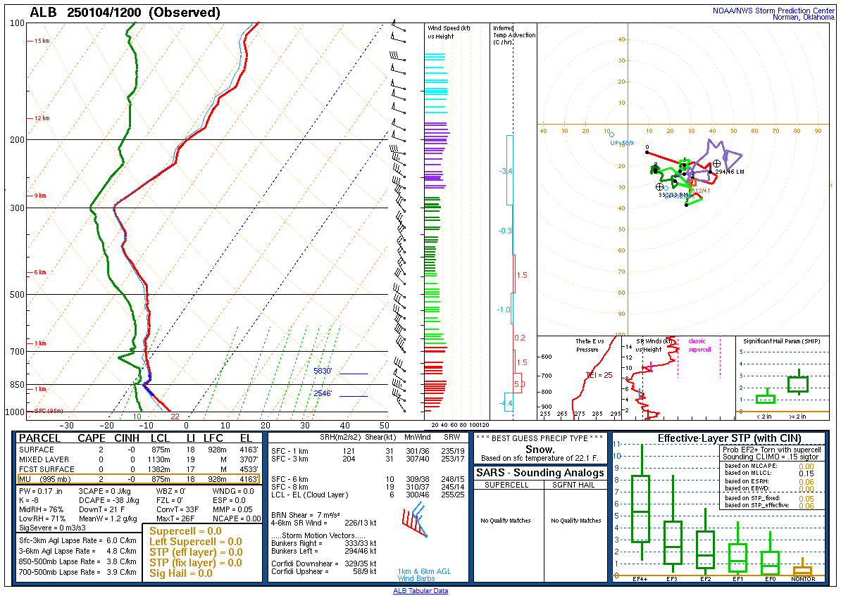
 |
 |
 |
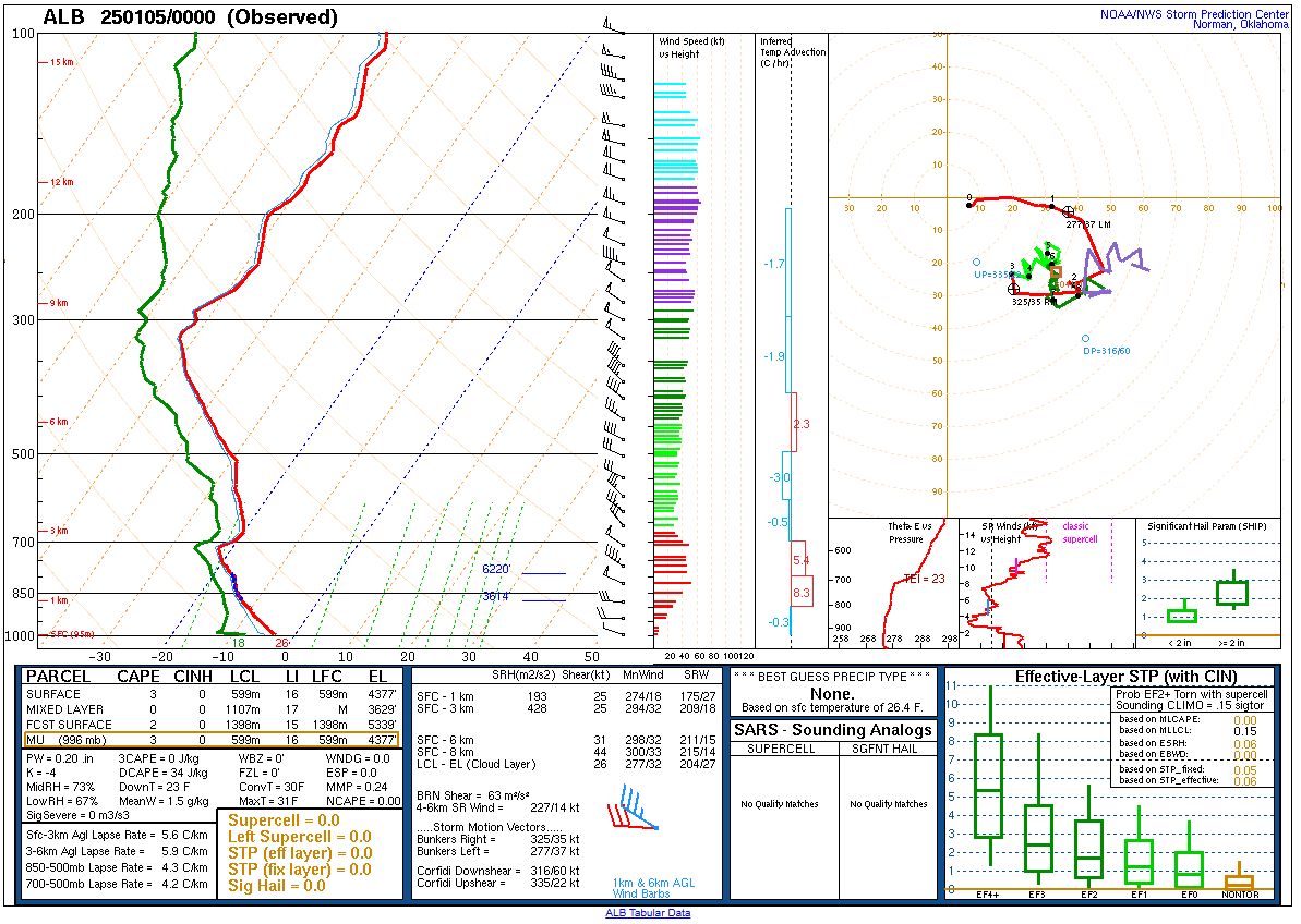
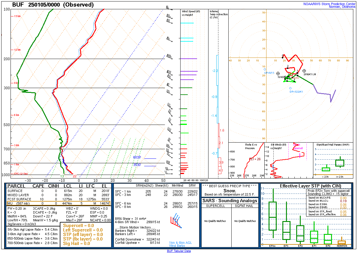
| KALY Sounding Valid 00z January 5, 2025 | KBUF Sounding Valid 00z January 5, 2025 | KALY Sounding Valid 12z January 5, 2025 |
 |
 |
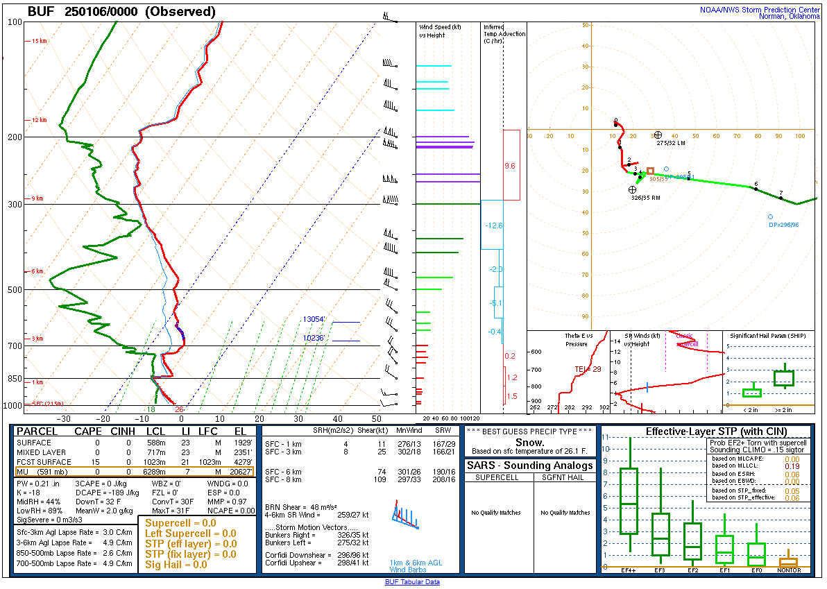 |
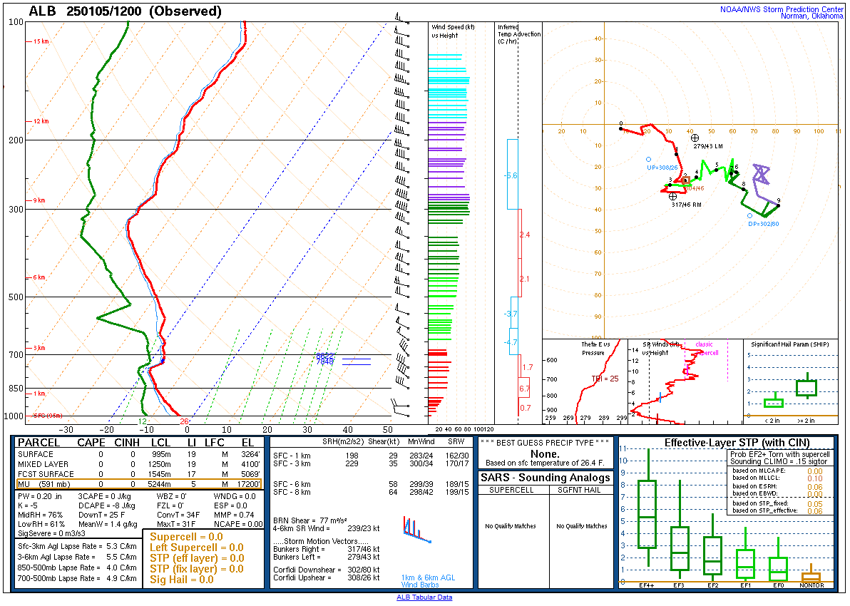
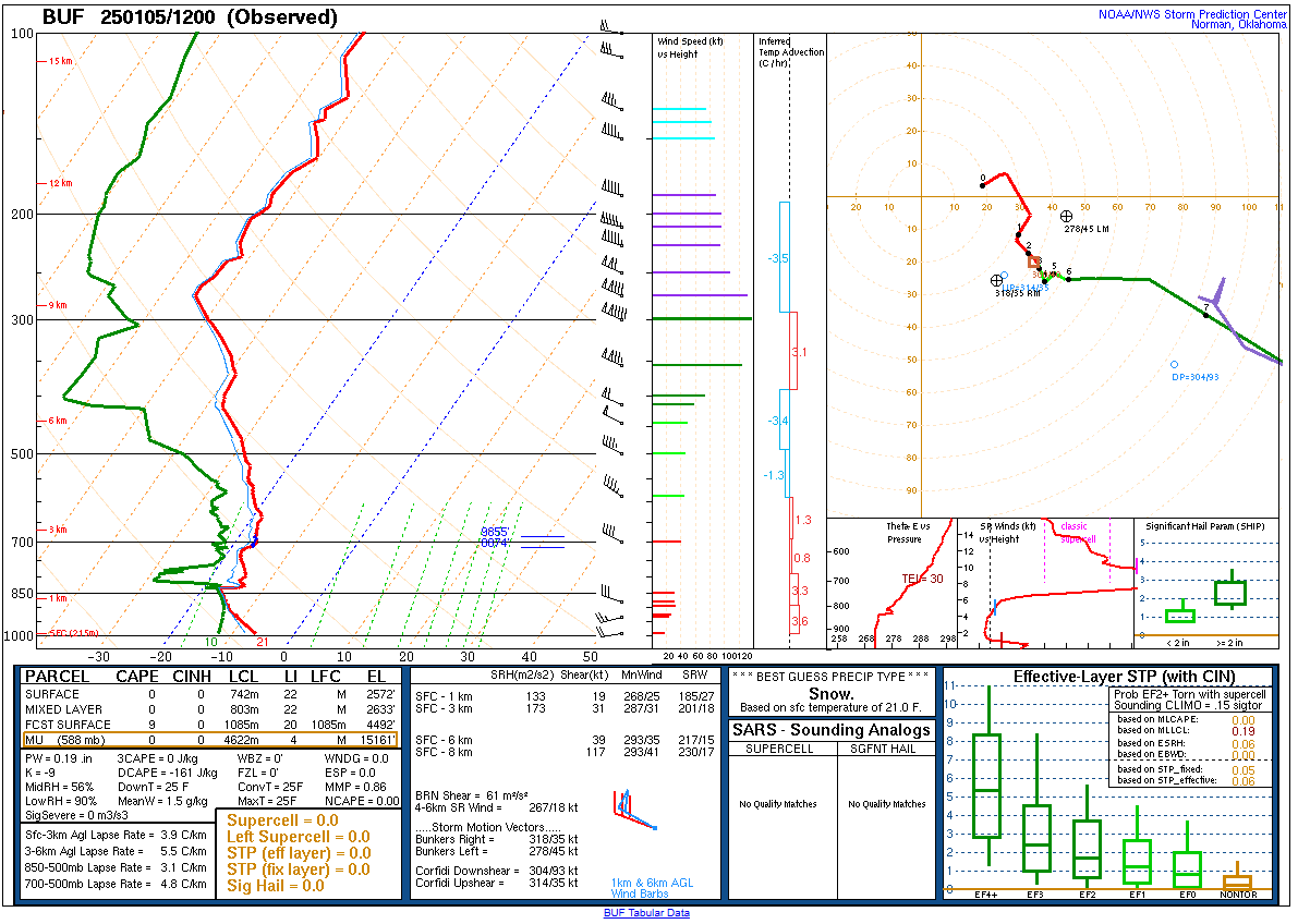
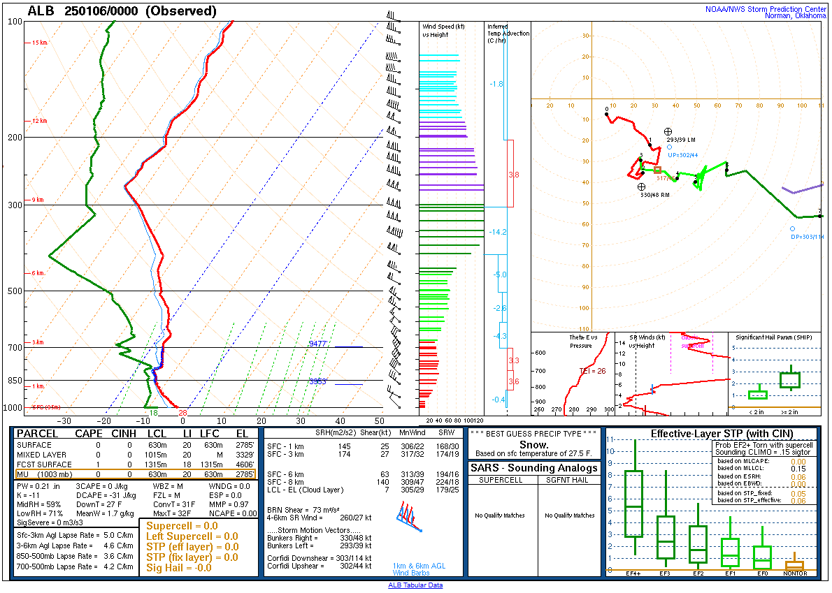
| KBUF Sounding Valid 12z January 5, 2025 | KALY Sounding Valid 00z January 6, 2025 | KBUF Sounding Valid 00z January 6, 2025 |
 |
Media use of NWS Web News Stories is encouraged! Please acknowledge the NWS as the source of any news information accessed from this site. |
|

