Overview
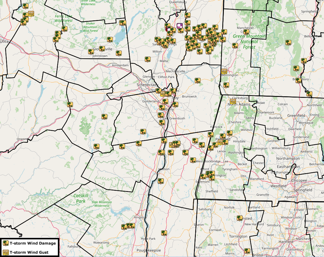
On Friday May 15, 2020, an intense line of thunderstorms quickly developed near Lake Ontario and raced eastward in the NWS Albany, NY County Warning Area. A segment of particularly strong and long lasting thunderstorms impacted the region from just north of the Mohawk Valley in Herkimer County and raced into Saratoga and Washington counties and southern Vermont, producing damaging winds throughout its path. Notable areas of damage include a confirmed macroburst near Russia and Cold Brook, NY where wind estimates ranged from 80 to 100mph and an EF-1 tornado in Wilton, NY with numerous trees snapped or uprooted in Saratoga and Washington counties. A supercell that developed in the eastern Catskills produced a microburst in Cottekill, NY.Tornado:
|
Tornado - Wilton, NY
Track Map 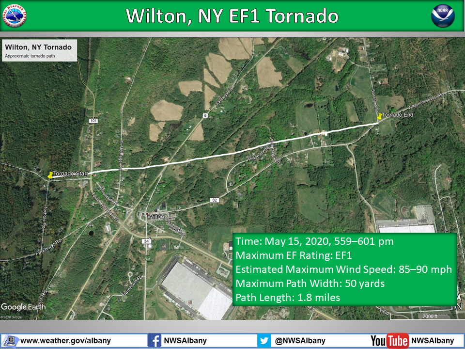
|
||||||||||||||||
The Enhanced Fujita (EF) Scale classifies tornadoes into the following categories:
| EF0 Weak 65-85 mph |
EF1 Moderate 86-110 mph |
EF2 Significant 111-135 mph |
EF3 Severe 136-165 mph |
EF4 Extreme 166-200 mph |
EF5 Catastrophic 200+ mph |
 |
|||||
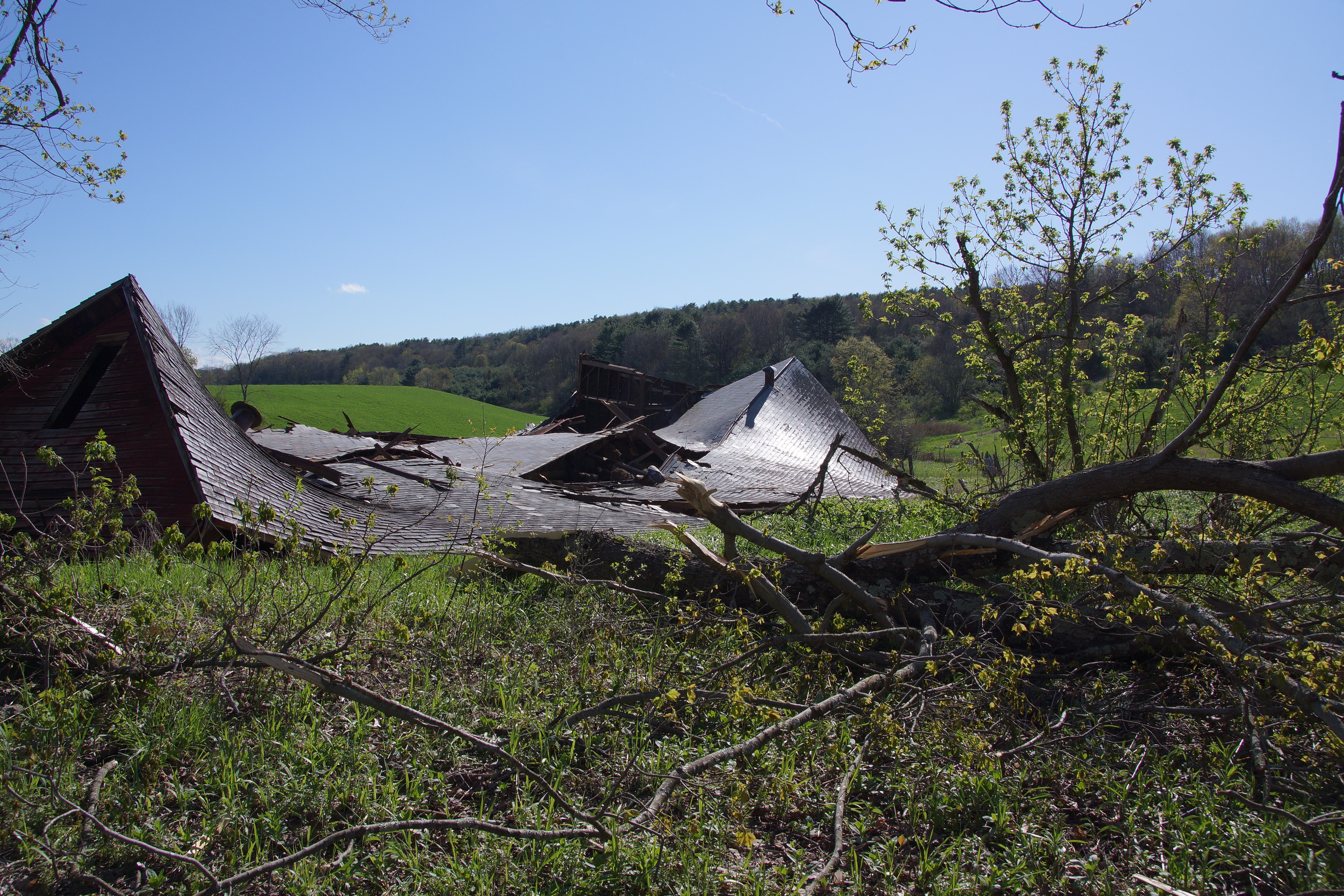
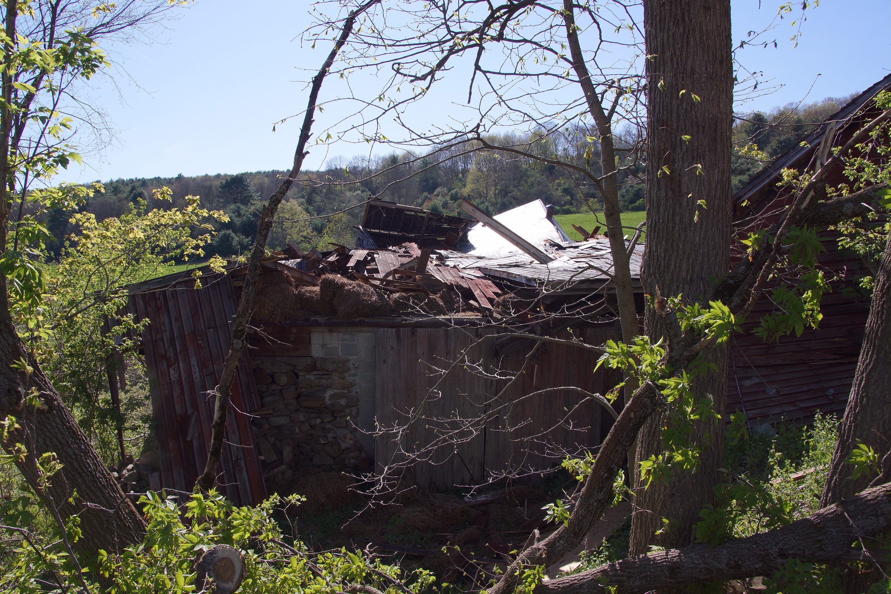
Macroburst:
|
Macroburst - Russia/Norway, NY
Track Map 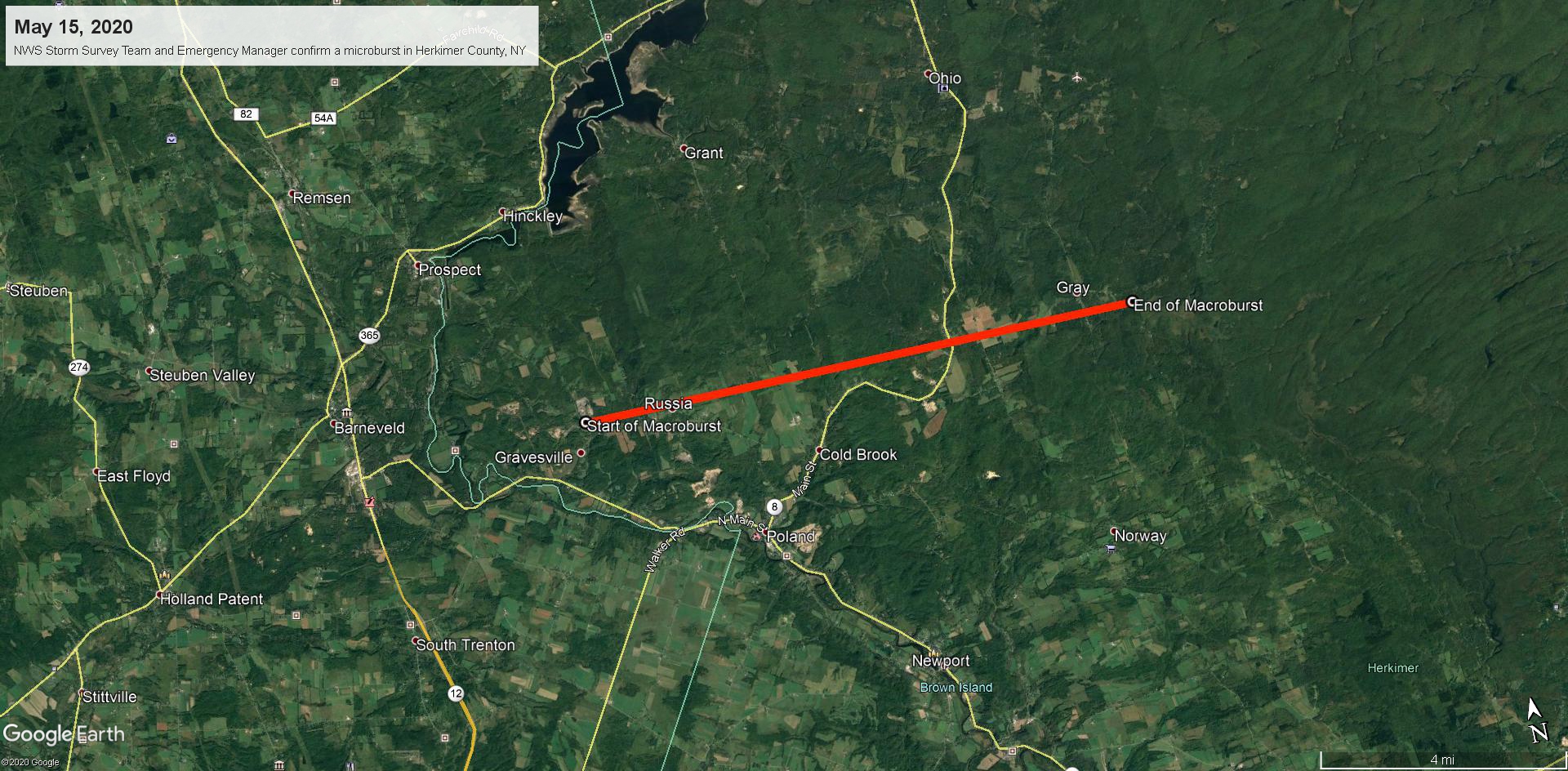
|
||||||||||||||
Photos & Video
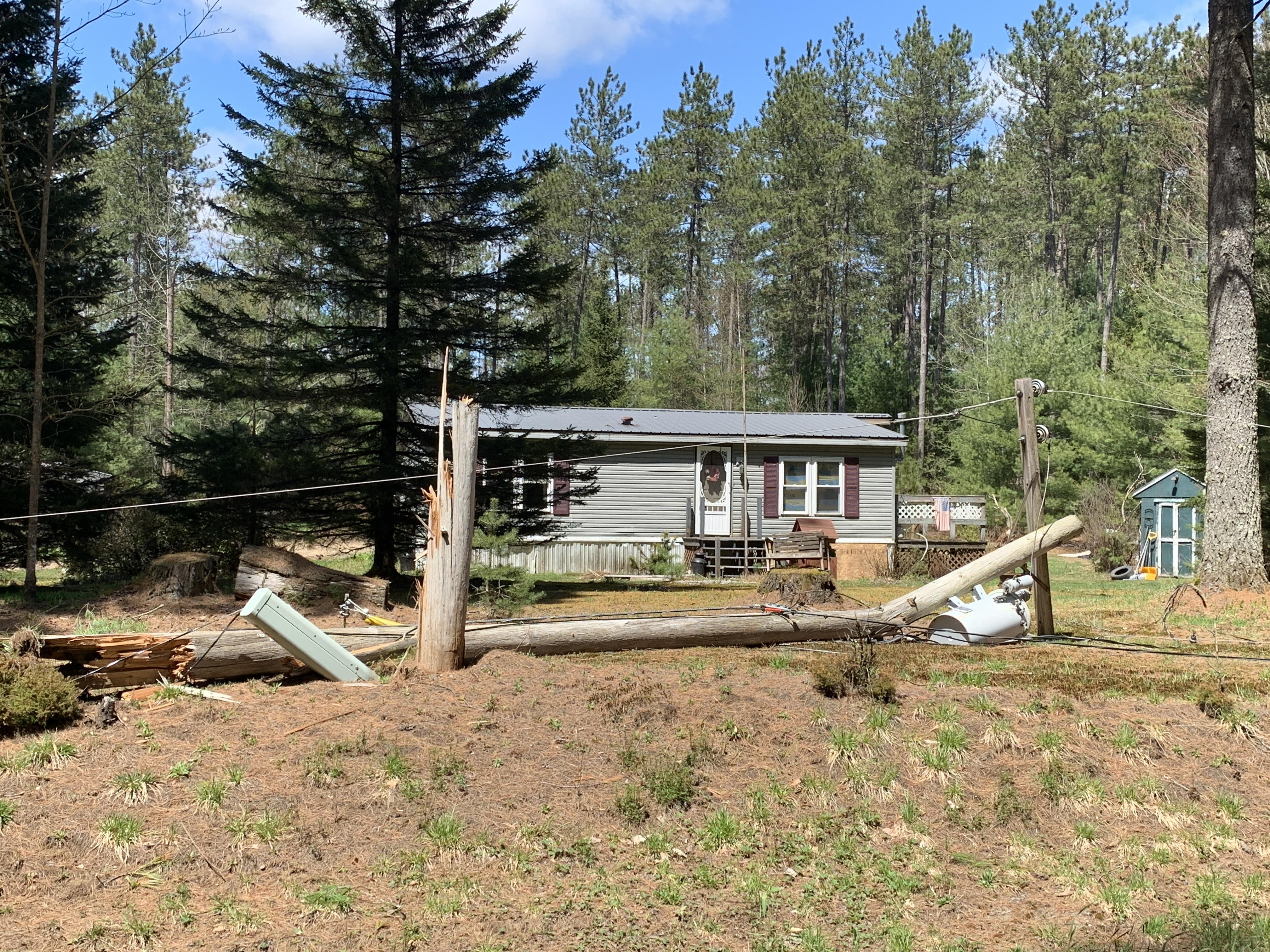
Storm Survey Pictures in Herkimer County, NY
 |
 |
 |
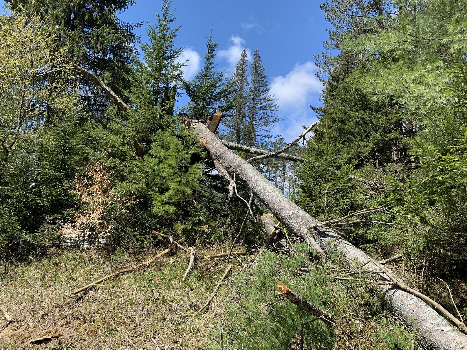 |
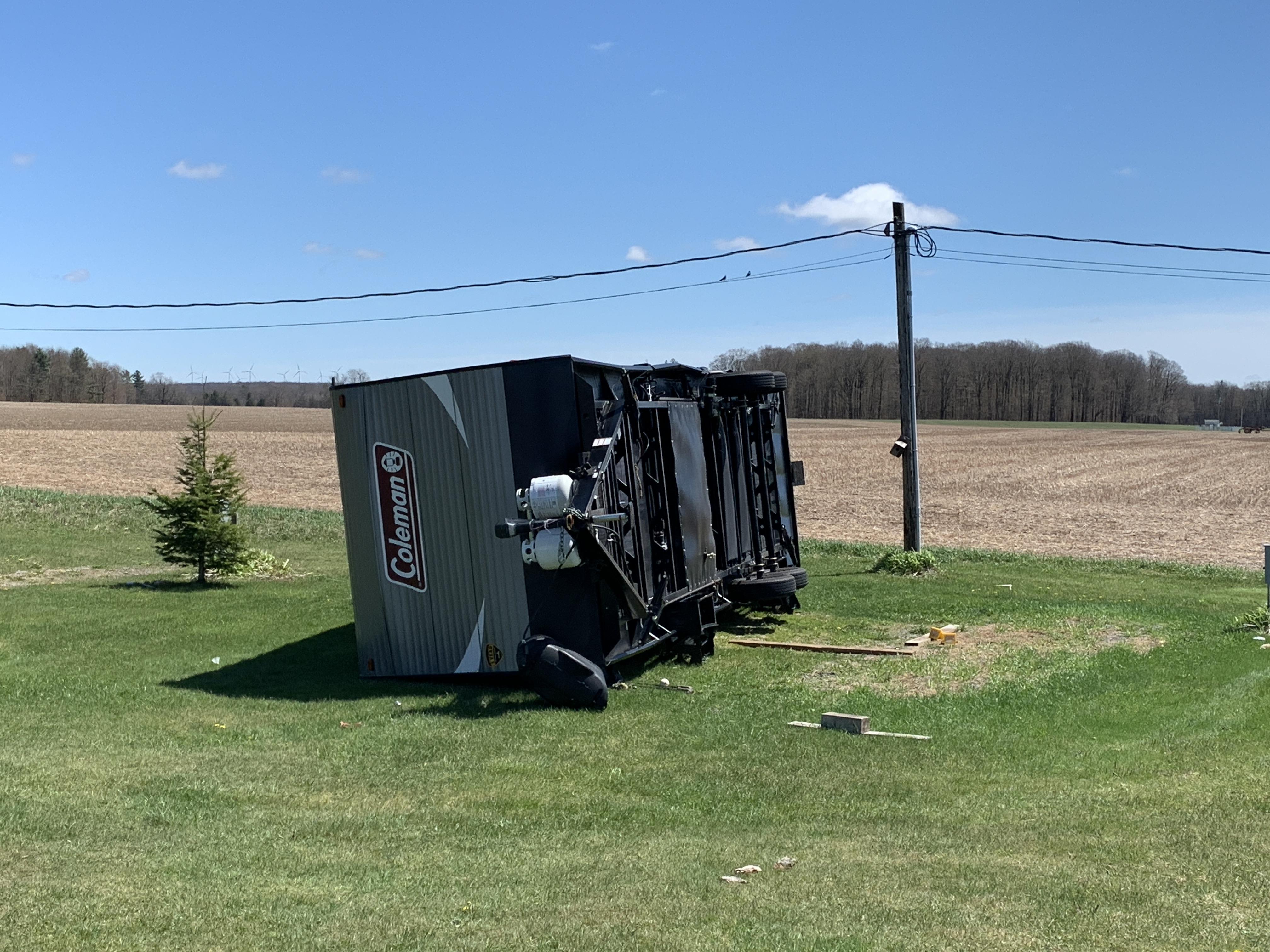
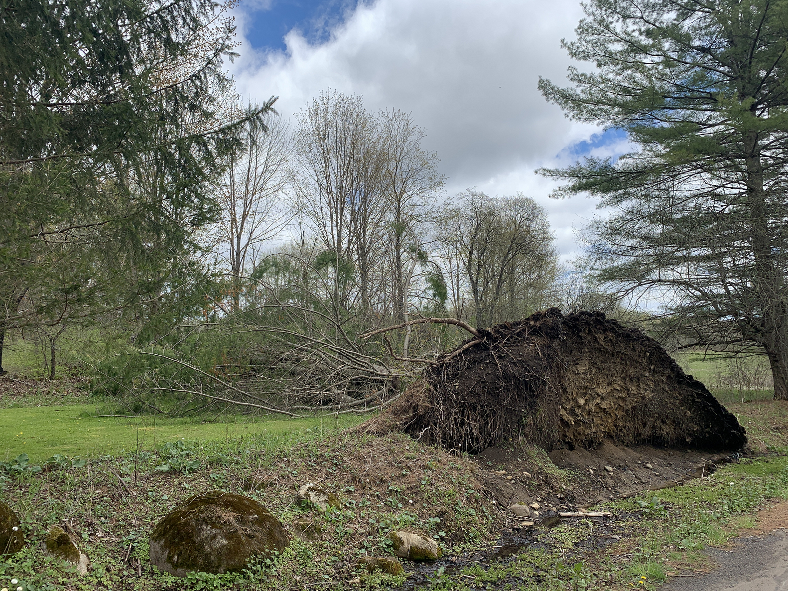
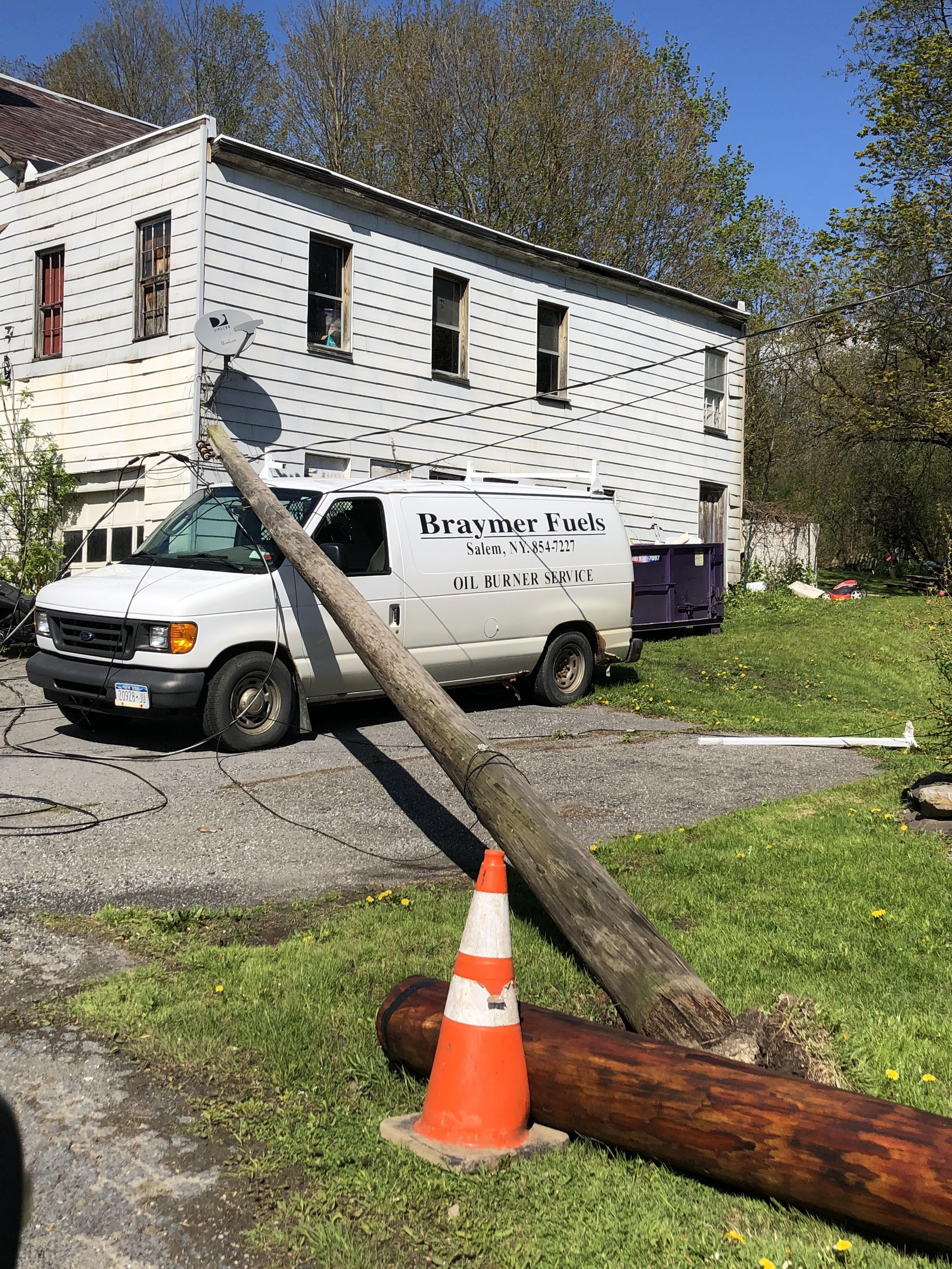
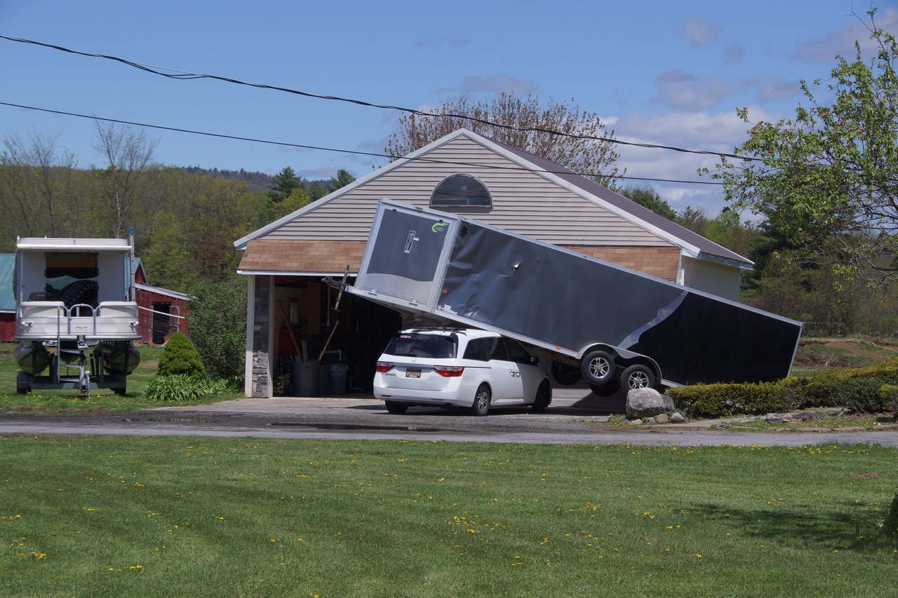
Storm Survey Pictures in Saratoga and Washington Counties
 |
 |
 |
 |
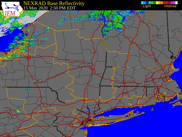
Radar
 |
 |
 |
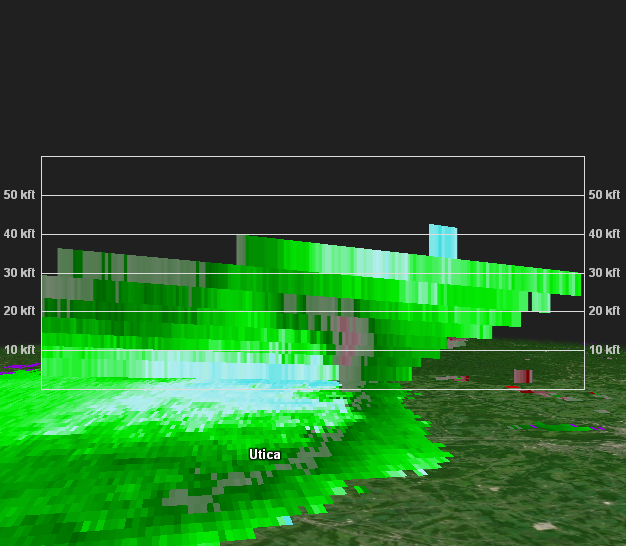 |
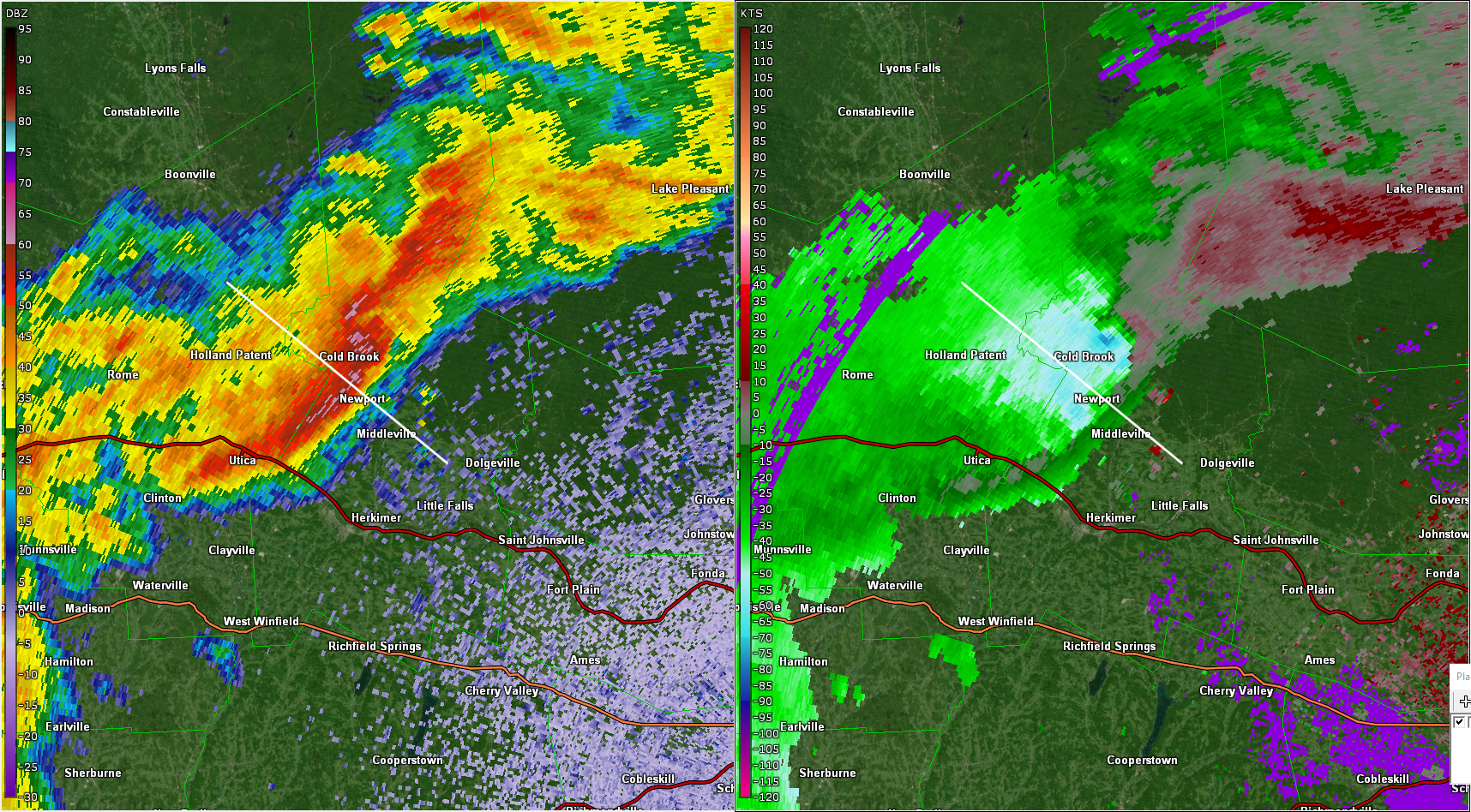
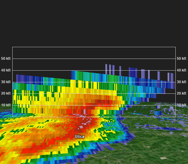
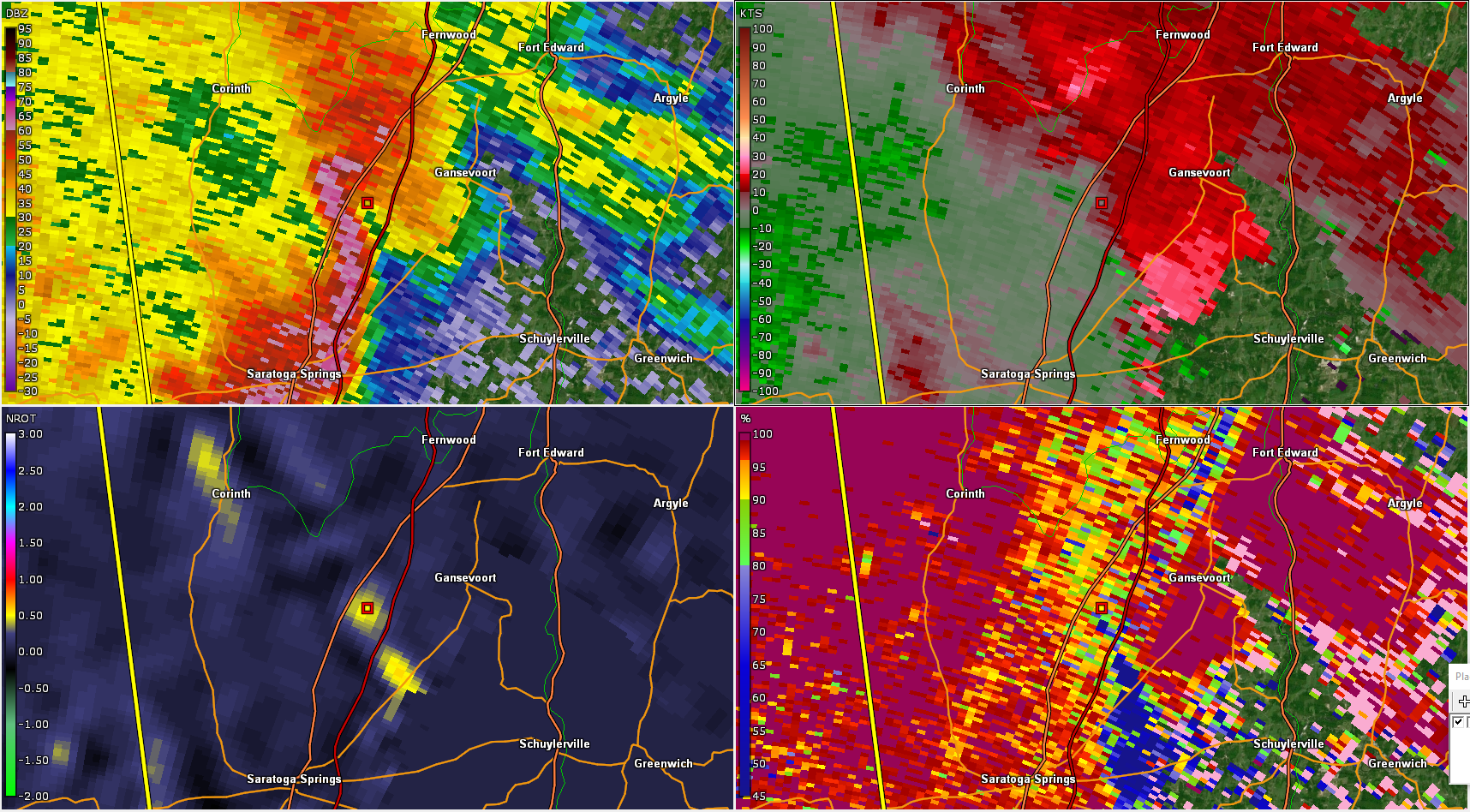
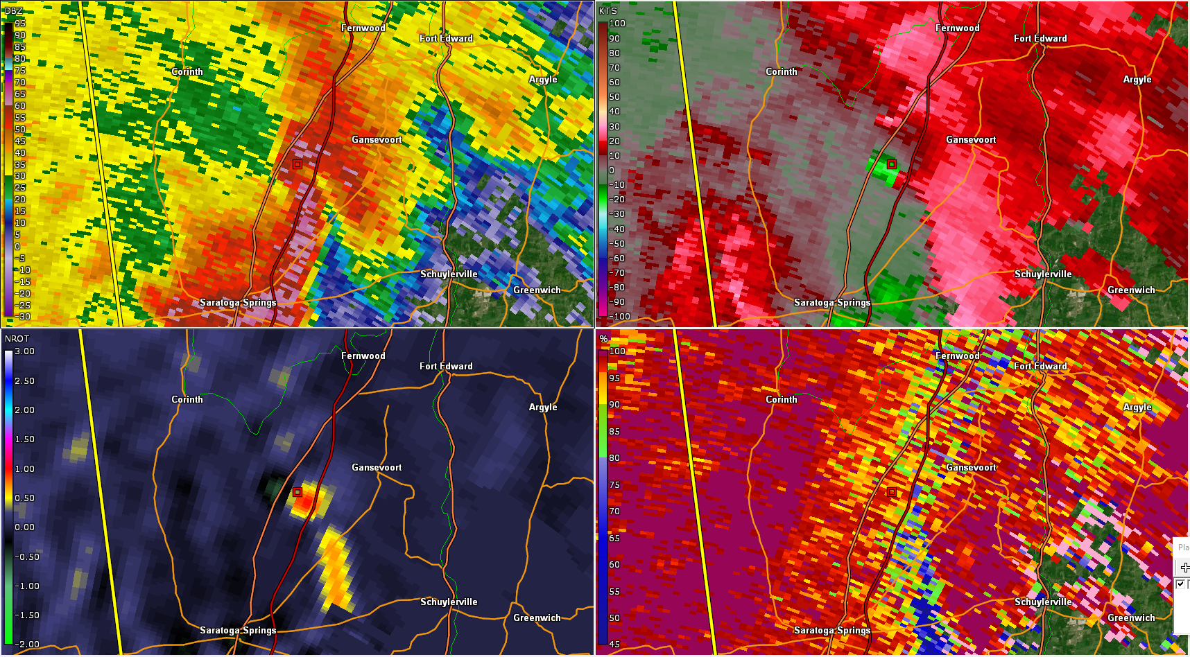
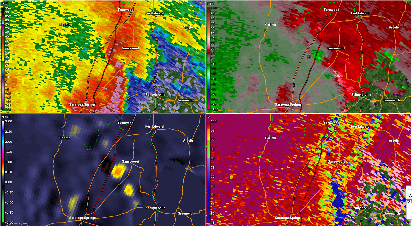
| Figure 1. Friday May 15, 2020 Radar Loop | Figure 2. KENX radar image valid at 2047Z (4:47 pm EDT) near the time of the Herkimer County macroburst showing 0.5 degree reflectivity (left) and base veocity (right). Line denotes cross section for Figs 3-4. | Figure 3. KENX radar image showing a cross section of reflectivity valid at 2047Z (4:47 pm). | Figure 4. KENX radar image showing a cross section of velocity valid at 2047Z (4:47 pm). |
 |
 |
 |
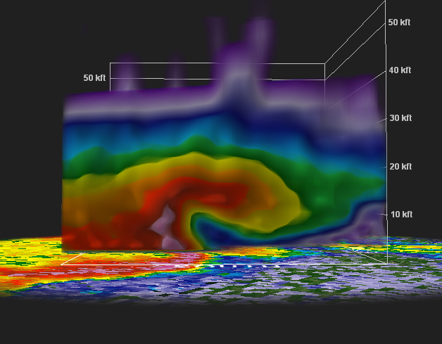 |
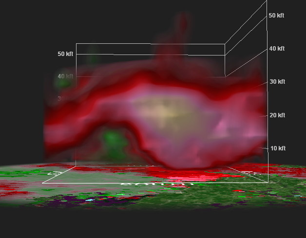
| Figure 5. KENX radar image valid at 2159Z (5:59 pm EDT) near the time of the Wilton tornado showing 0.5 degree reflectivity (upper left), storm-relative velocity (upper right), normalized rotation (bottom left), and correlation coefficient (lower right). | Figure 6. As in Figure 5, but at 1.3 degrees. | Figure 7. As in Figure 5, but at 2202Z (6:02 pm EDT). | Figure 8. KENX radar image showing a cross section of reflectivity in the Wilton, NY storm valid at 2159Z (5:59 pm). |
 |
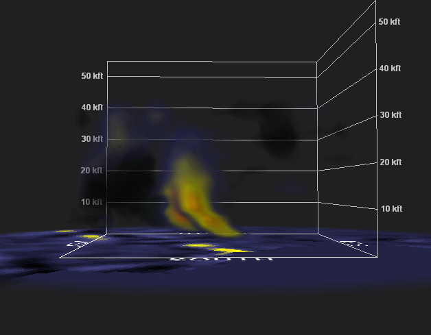 |
| Figure 9. As in Figure 8, but for storm-relative velocity. | Figure 10. As in Figure 8, but for normalized rotation. |
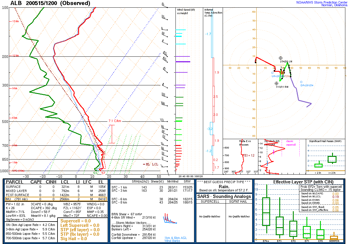
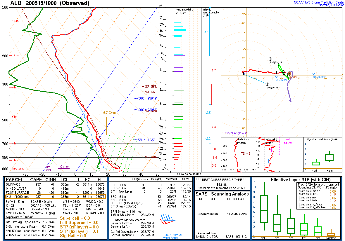
Environment
 |
 |
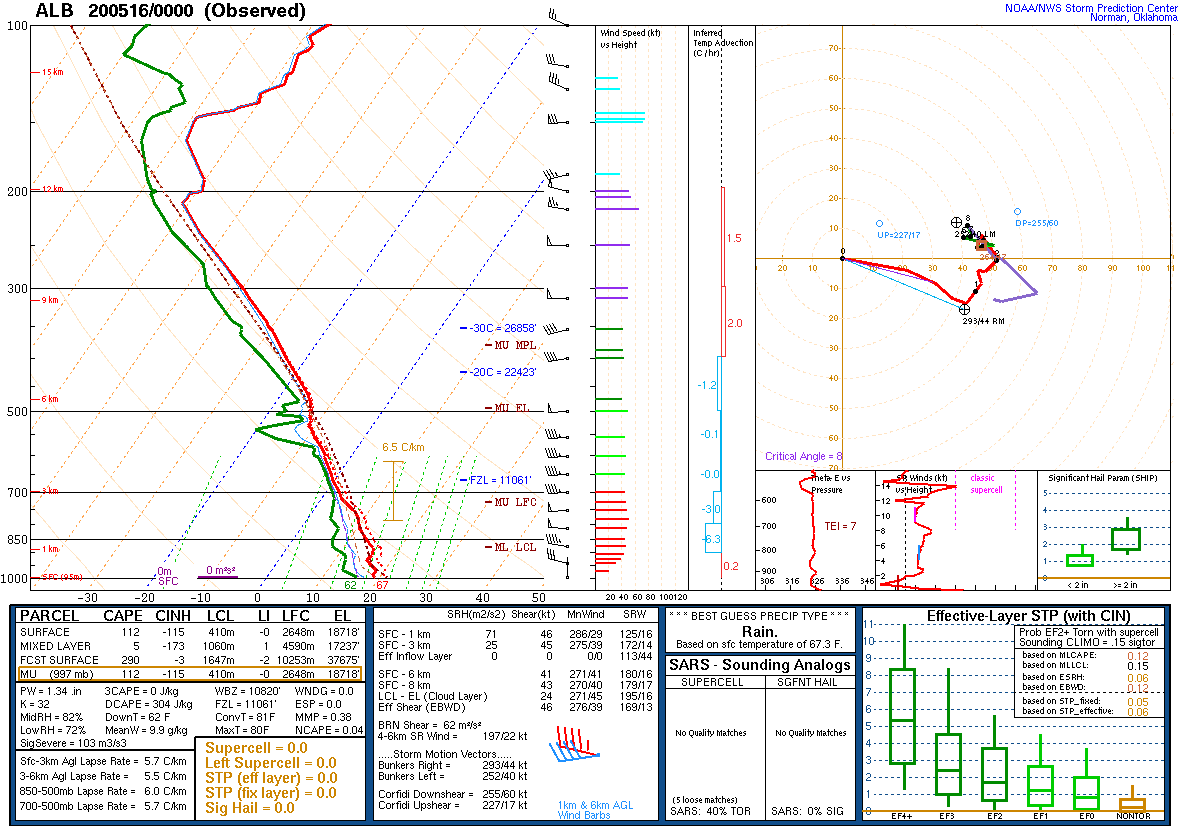 |
| Figure 1: 12Z 15 May sounding from Albany, NY | Figure 2: 18Z 15 May sounding from Albany, NY | Figure 3: 00Z 16 May sounding from Albany, NY |
 |
Media use of NWS Web News Stories is encouraged! Please acknowledge the NWS as the source of any news information accessed from this site. |
|

