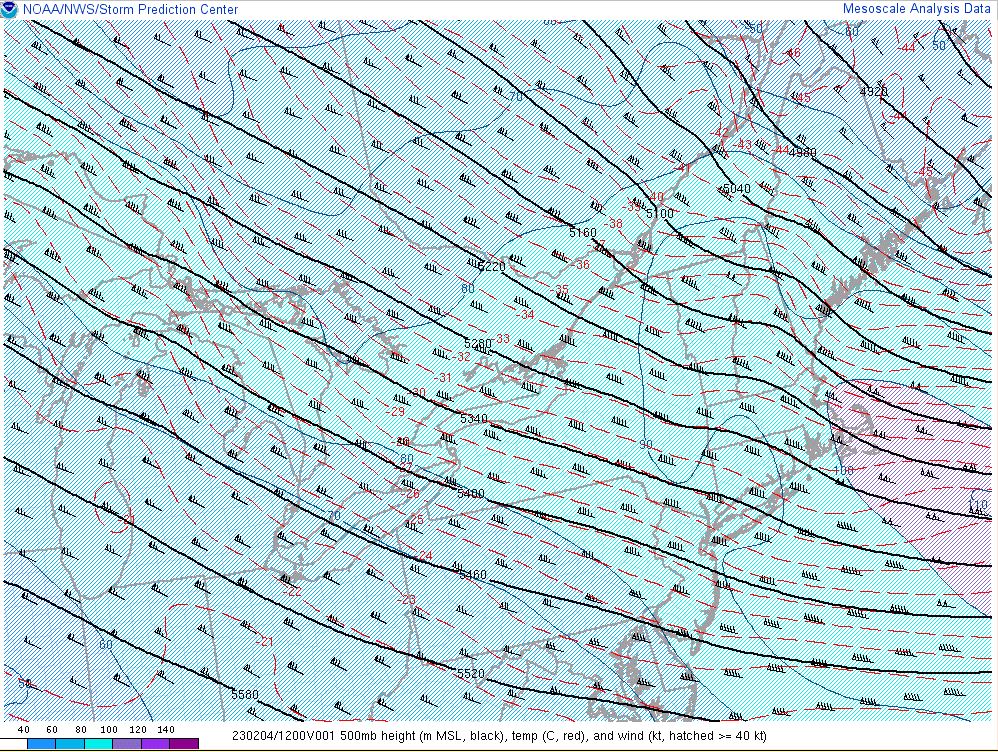
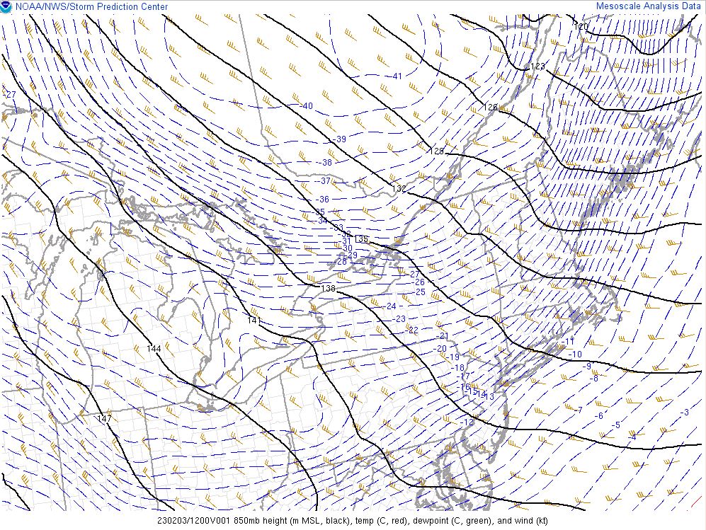
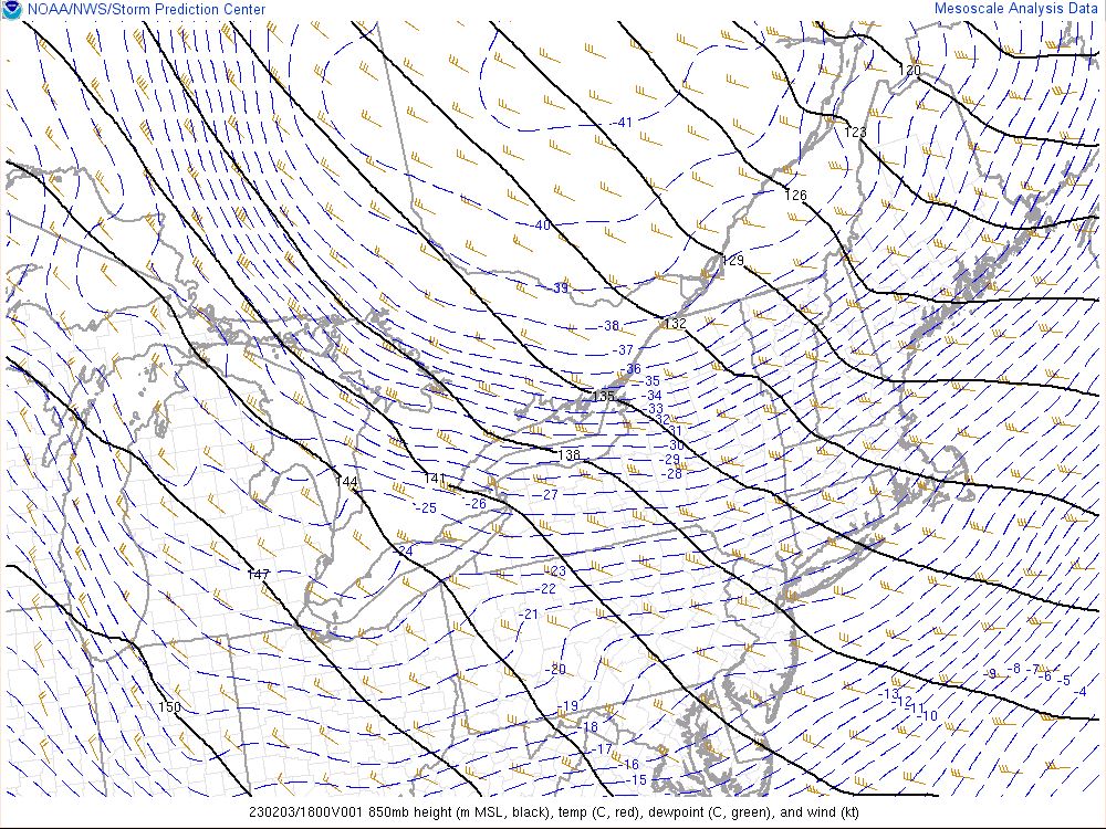
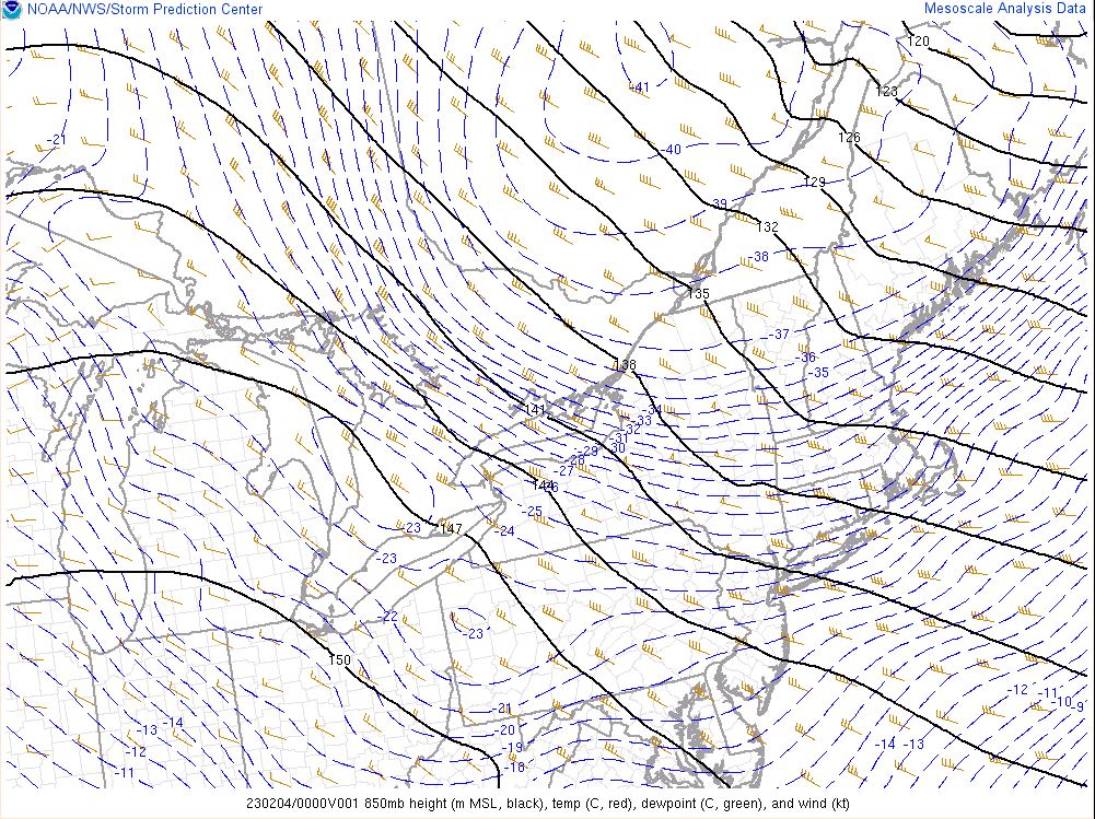
Overview
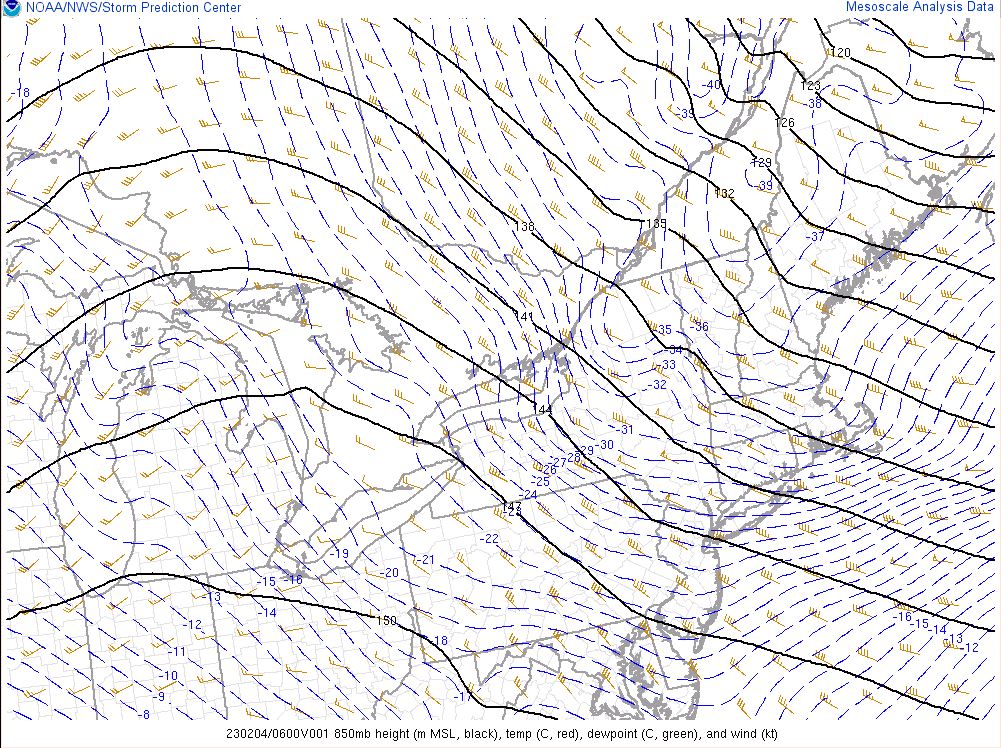
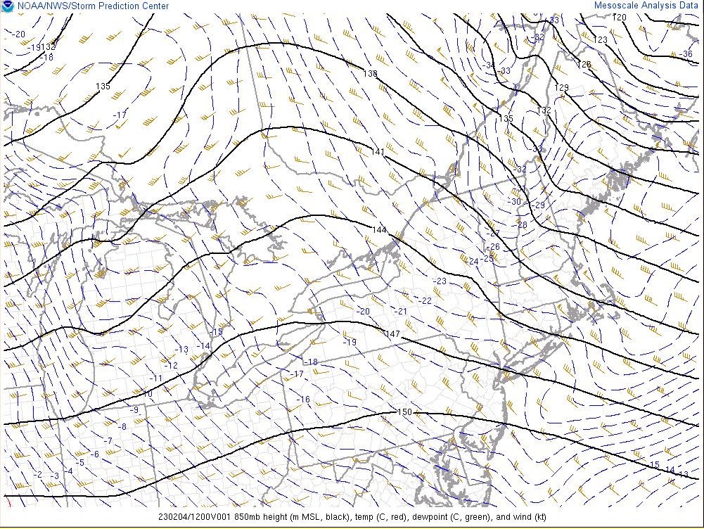
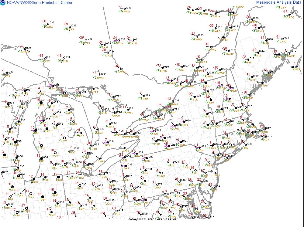
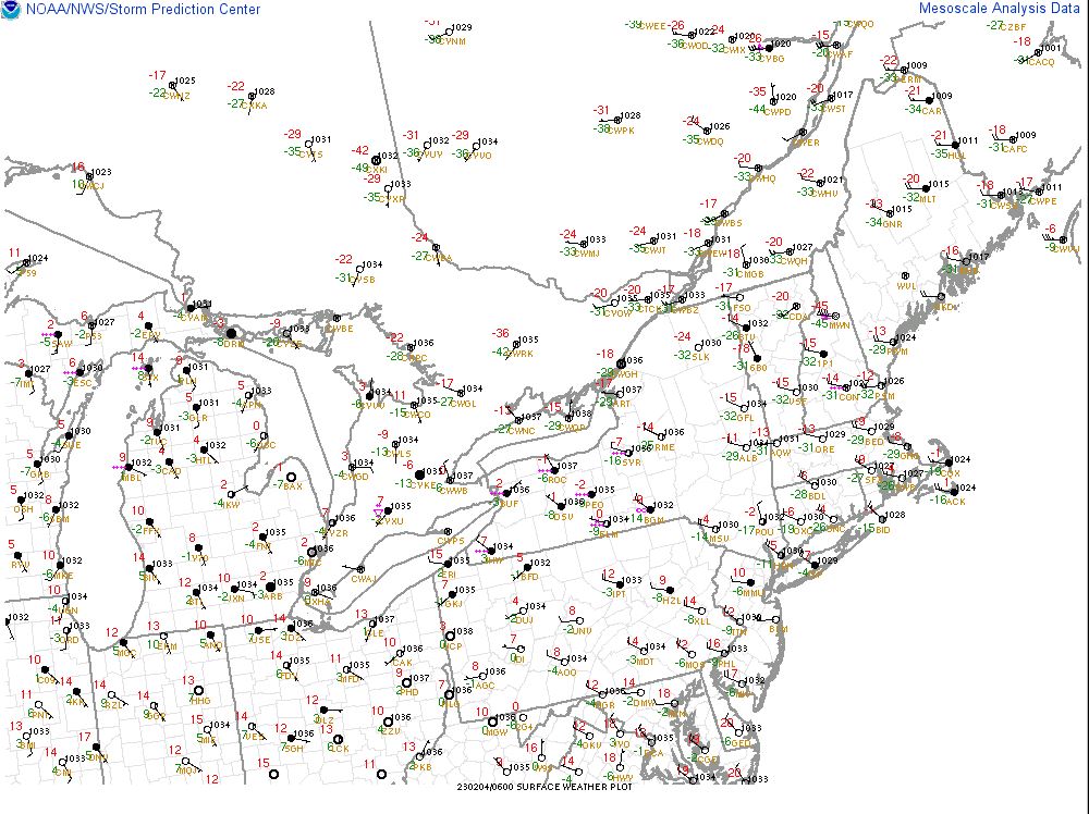
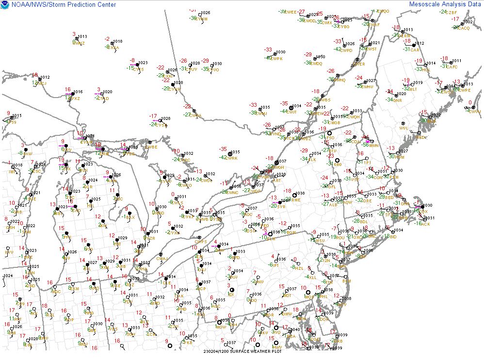
A brief but powerful arctic airmass moved across the region on February 3-4, 2023 which brought dangerously low wind chill values to much of the region along with strong wind gusts. An arctic cold front passed across the region during the evening hours on February 2 accompanied by snow showers and snow squalls, mainly for the Capital District and points north and west. Lightning was observed with these snow squalls over portions of the Finger Lakes, Tug Hill Plateau and just west of Lake Champlain. Thereafter, very cold air gradually advected into the region on February 3 into the morning hours on February 4.
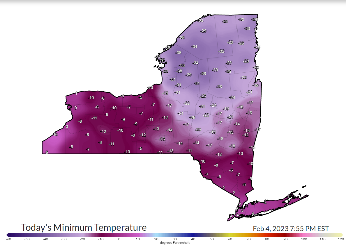
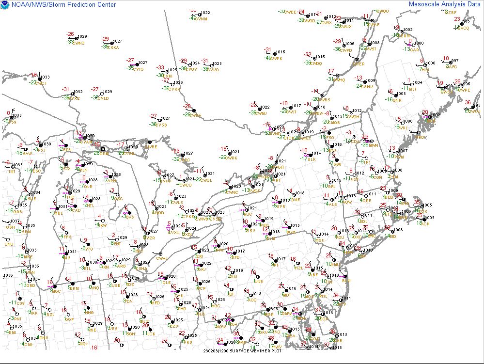
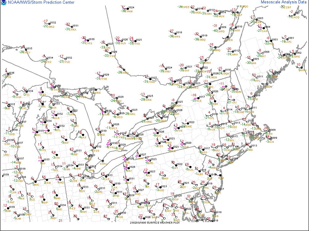
Air temperatures gradually fell throughout the day on February 3 with readings down to the single digits above zero to 10 to 20 below zero by the late-afternoon hours. Many locations dropped to between 10 and 25 degrees below zero with a few pockets in the Adirondacks nearing 40 below zero by the early morning hours on February 4. Portions of the mid-Hudson Valley into southern Litchfield County, CT only fell to between 5 and 10 degrees below zero. On February 4, a record low temperature of -13F was tied at Albany while a record low temperature of -24F was set at Glens Falls. Poughkeepsie was short of their daily record low of -10F by only falling to -7F.
In addition to the cold, this arctic air mass brought strong winds across the region during the daytime hours on February 3 into the overnight hours before easing on February 4. Peak gusts between 35 and 50 mph were common across most areas. A few localized areas had a peak wind gust greater than 50 mph, the highest being 64 mph at the Schenectady County Airport in East Glenville, NY. A few downed trees and power lines occurred which resulted in a few power outages. The area with the highest amount of power outages was Ulster County.
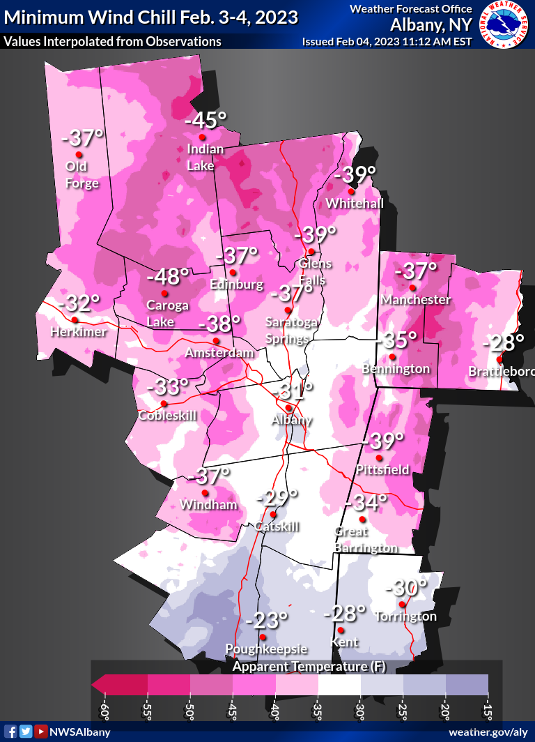
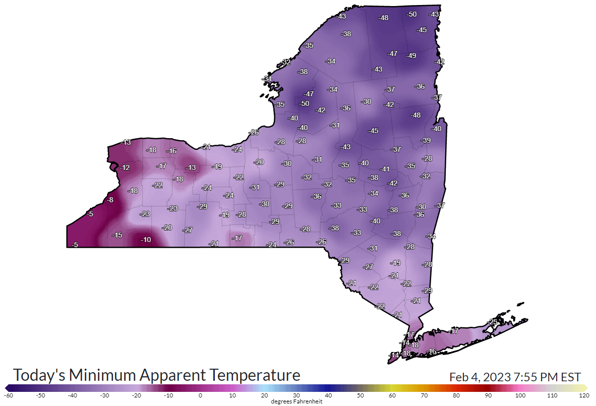
The combination of very cold air and strong winds resulted in wind chill values much lower than the actual air temperature. The lowest wind chills ranged from 20 below zero across portions of the mid-Hudson Valley into southern Litchfield County, CT to near 50 below zero across portions of the Adirondacks. For many, the last time it was this cold was nearly 7 years ago (February 14, 2016).
Low Temperatures and Wind Chills
 |
 |
 |
| Observed minimum wind chills across eastern New York and western New England. Note that the map above was produced from observations and interpolated where there weren't any, so it's considered an approximation. Observed wind chills can be found in the Public Information Statement below. | Observed minimum apparent temperatures (wind chills) across New York State on February 4, 2023. (NYS Mesonet) |
Observed low temperatures across New York State on February 4, 2023. (NYS Mesonet) |
PUBLIC INFORMATION STATEMENT NATIONAL WEATHER SERVICE ALBANY NY 953 AM EST SAT FEB 4 2023 ...MINIMUM WIND CHILL REPORTS... LOCATION WC TEMP. TIME/DATE PROVIDER ...CONNECTICUT... ...LITCHFIELD COUNTY... WINSTED (WEATHERSTEM) -38 F 0430 AM 02/04 MESOWEST 4 NNE KENT -38 F 0555 AM 02/04 AWS NORFOLK - RT44WB - GREENWOOD -37 F 0529 AM 02/04 MESOWEST LITCHFIELD -37 F 0320 AM 02/04 AWS TORRINGTON -36 F 0415 AM 02/04 CWOP 3 WSW BETHLEHEM VILLAGE -33 F 0220 AM 02/04 AWS NEW HARTFORD -33 F 0358 AM 02/04 CWOP PLYMOUTH -33 F 0310 AM 02/04 DAVIS 3 NNW WINSTED -31 F 0235 AM 02/04 AWS TORRINGTON -31 F 1215 AM 02/04 CWOP WINSTED -29 F 0605 AM 02/04 CWOP BANTAM -29 F 0530 AM 02/04 CWOP BARKHAMSTED -29 F 0615 AM 02/04 CWOP PLYMOUTH -28 F 0430 AM 02/04 CWOP NORTH CANAAN - RT44 WB EAST -26 F 1249 AM 02/04 MESOWEST SHARON - SHARON VALLEY RD - -26 F 0149 AM 02/04 MESOWEST TORRINGTON -26 F 0355 AM 02/04 CWOP WATERTOWN -25 F 0346 AM 02/04 CWOP NEW MILFORD -25 F 0235 AM 02/04 DAVIS OAKVILLE -21 F 0548 AM 02/04 CWOP COLEBROOK -17 F 0220 AM 02/04 CWOP NEW MILFORD - US HWY 7 NB - -17 F 0520 AM 02/04 MESOWEST NEW MILFORD -16 F 0345 AM 02/04 CWOP THOMASTON -15 F 1019 PM 02/03 CWOP OXFORD -13 F 0113 AM 02/04 CWOP ...MASSACHUSETTS... ...BERKSHIRE COUNTY... ADAMS -41 F 0325 AM 02/04 DAVIS PITTSFIELD MUNICIPAL AIRPORT -41 F 0154 AM 02/04 ASOS 3 WSW LEE -39 F 0210 AM 02/04 AWS HANCOCK -38 F 0805 AM 02/04 DAVIS WILLIAMSTOWN -38 F 1230 AM 02/04 CWOP GREAT BARRINGTON -38 F 0545 AM 02/04 AWS HARRIMAN AIRPORT -37 F 1252 AM 02/04 ASOS MONTEREY -36 F 0455 AM 02/04 AWS ALFORD -35 F 0315 AM 02/04 CWOP PITTSFIELD -35 F 0414 AM 02/04 CWOP 1 N WILLIAMSTOWN -35 F 0424 AM 02/04 AWS 2 NNW SOUTH EGREMONT -35 F 0334 AM 02/04 AWS NEW ASHFORD -34 F 0225 AM 02/04 CWOP EAST OTIS -31 F 0516 AM 02/04 CWOP PITTSFIELD -31 F 0217 AM 02/04 CWOP 4 E SHEFFIELD -31 F 0130 AM 02/04 AWS 1 NW PITTSFIELD -30 F 1029 PM 02/03 AWS WILLIAMSTOWN -29 F 0245 AM 02/04 DAVIS BECKET -29 F 0357 AM 02/04 CWOP GREAT BARRINGTON -29 F 0147 AM 02/04 CWOP WILLIAMSTOWN -28 F 0200 AM 02/04 CWOP CLARKSBURG -26 F 0730 AM 02/04 CWOP PERU -22 F 1235 PM 02/03 CWOP GREAT BARRINGTON -19 F 0615 AM 02/04 CWOP PITTSFIELD -14 F 0909 PM 02/03 CWOP ...NEW YORK... ...ALBANY COUNTY... MEDUSA -39 F 0330 AM 02/04 NYSM BERNE -37 F 1240 AM 02/04 AWS 4 SSW VOORHEESVILLE -37 F 0150 AM 02/04 AWS LOUDONVILLE -37 F 1140 PM 02/03 AWS VOORHEESVILLE -36 F 0205 AM 02/04 NYSM ALBANY INTL AP -34 F 0451 AM 02/04 ASOS GUILDERLAND -33 F 0400 AM 02/04 DAVIS 2 W GUILDERLAND -32 F 0115 AM 02/04 RAWS EAST BERNE -31 F 0406 AM 02/04 CWOP VOORHEESVILLE -29 F 0357 AM 02/04 CWOP GLENMONT -27 F 1232 AM 02/04 CWOP COLONIE -26 F 1116 PM 02/03 CWOP ALBANY -26 F 0247 AM 02/04 CWOP COLONIE -25 F 0415 AM 02/04 CWOP ALBANY -21 F 1146 PM 02/03 CWOP ALBANY -20 F 1056 PM 02/03 CWOP ...COLUMBIA COUNTY... KINDERHOOK -35 F 0220 AM 02/04 NYSM COPAKE -34 F 0335 AM 02/04 NYSM HARMLEMVILLE -32 F 0445 AM 02/04 DAVIS HUDSON COLUMBIA -30 F 0429 AM 02/04 AWOS 1 ESE ANCRAM -29 F 0155 AM 02/04 AWS GHENT -28 F 1154 PM 02/03 CWOP CLAVERACK -28 F 1145 PM 02/03 CWOP CHATHAM -27 F 1229 AM 02/04 CWOP CHATHAM -25 F 0559 AM 02/04 CWOP HUDSON -24 F 0115 AM 02/04 CWOP GERMANTOWN -21 F 0505 AM 02/04 CWOP HILLSDALE -19 F 0815 PM 02/03 CWOP ...DUTCHESS COUNTY... PAWLING -31 F 0245 AM 02/04 DAVIS LAGRANGEVILLE -30 F 0431 AM 02/04 CWOP DOVER PLAINS -28 F 0435 AM 02/04 NYSM RED HOOK -28 F 0355 AM 02/04 NYSM RHINEBECK -26 F 0655 AM 02/04 AWS 3 WNW PAWLING -25 F 0710 AM 02/04 AWS HUDSON VALLEY REGIONAL AIRPO -25 F 0353 AM 02/04 ASOS LAGRANGEVILLE -23 F 0430 AM 02/04 DAVIS BEACON -22 F 0405 AM 02/04 NYSM WAPPINGERS FALLS -21 F 0551 AM 02/04 CWOP WAPPINGERS FALLS -20 F 0605 AM 02/04 CWOP BANNERMAN ISLAND -20 F 0500 AM 02/04 WXFLOW 2 NE PLEASANT VALLEY -17 F 0645 AM 02/04 AWS POUGHQUAG -17 F 0830 AM 02/04 DAVIS PLEASANT VALLEY -17 F 1146 PM 02/03 CWOP FAIRVIEW -15 F 0400 AM 02/04 CWOP SALT POINT -15 F 0635 AM 02/04 CWOP 3 NNE BEACON -12 F 0348 AM 02/04 RAWS STANFORDVILLE -10 F 0955 PM 02/03 CWOP ...FULTON COUNTY... 2 ESE JOHNSTOWN -42 F 1057 PM 02/03 AWOS BROADALBIN -41 F 0335 AM 02/04 CWOP OPPENHEIM -40 F 0215 AM 02/04 NYSM PERTH -38 F 0845 AM 02/04 CWOP 2 S BROADALBIN -37 F 0155 AM 02/04 AWS ...GREENE COUNTY... TANNERSVILLE -40 F 0450 AM 02/04 DAVIS FLEISCHMANNS -39 F 0515 AM 02/04 DAVIS TANNERSVILLE -38 F 0345 AM 02/04 NYSM HALCOTT CENTER -37 F 0440 AM 02/04 CWOP ATHENS -32 F 1220 AM 02/04 AWS HUNTER -25 F 0500 AM 02/04 CWOP EAST DURHAM -25 F 0416 AM 02/04 CWOP FREEHOLD -11 F 0915 PM 02/03 CWOP ...HAMILTON COUNTY... PISECO -45 F 1025 PM 02/03 NYSM INDIAN LAKE -43 F 0925 PM 02/03 NYSM 6 ENE PISECO -43 F 0100 AM 02/04 RAWS INLET -40 F 0225 AM 02/04 CWOP RAQUETTE LAKE -33 F 1030 PM 02/03 NYSM ...HERKIMER COUNTY... 3 NNE EAST SPRINGFIELD -51 F 1150 PM 02/03 AWS COLD BROOK -43 F 0655 AM 02/04 NYSM BIG MOOSE -42 F 0245 AM 02/04 CWOP POLAND -37 F 0740 PM 02/03 AWS OLD FORGE -37 F 1250 AM 02/04 NYSM HERKIMER -35 F 0235 AM 02/04 NYSM WEST WINFIELD -35 F 1200 AM 02/04 AWS LITTLE FALLS -32 F 0215 AM 02/04 CWOP NEWPORT -31 F 1045 PM 02/03 DAVIS LITTLE FALLS -26 F 0620 PM 02/03 CWOP DOLGEVILLE -26 F 1100 PM 02/03 CWOP DOLGEVILLE -17 F 0230 PM 02/03 CWOP ...MONTGOMERY COUNTY... JOHNSTOWN -41 F 0720 AM 02/04 NYSM FORT PLAIN -40 F 1120 PM 02/03 AWS 2 N TRIBES HILL -40 F 0441 AM 02/04 AWS SPRAKERS -38 F 0245 AM 02/04 DAVIS SPRAKERS -38 F 0340 AM 02/04 NYSM HAGAMAN -33 F 1021 PM 02/03 CWOP AMSTERDAM -32 F 0745 AM 02/04 CWOP FULTONVILLE -31 F 0600 AM 02/04 DAVIS HESSVILLE -27 F 1215 AM 02/04 CWOP ...RENSSELAER COUNTY... GRAFTON -39 F 0220 AM 02/04 DAVIS STEPHENTOWN -37 F 1205 AM 02/04 NYSM 1 NW WYANTSKILL -35 F 0450 AM 02/04 AWS AVERILL PARK -33 F 0150 AM 02/04 DAVIS BRUNSWICK -33 F 1257 AM 02/04 CWOP BRUNSWICK -31 F 0205 AM 02/04 CWOP SCHAGHTICOKE -31 F 0810 AM 02/04 NYSM EAGLE MILLS -30 F 0137 AM 02/04 CWOP SCHODACK -30 F 0130 AM 02/04 NYSM PITTSTOWN -28 F 1130 PM 02/03 DAVIS EAST GREENBUSH -26 F 1246 AM 02/04 CWOP EAST GREENBUSH -26 F 0427 AM 02/04 CWOP TROY -24 F 1155 PM 02/03 CWOP CASTLETON -18 F 0145 AM 02/04 CWOP ...SARATOGA COUNTY... EDINBURG -40 F 1130 PM 02/03 NYSM BALLSTON SPA -37 F 1110 PM 02/03 NYSM SARATOGA SPRINGS -37 F 1129 PM 02/03 AWOS SCHUYLERVILLE -37 F 1140 PM 02/03 AWS BALLSTON SPA -36 F 1200 AM 02/04 AWS GANSEVOORT -32 F 1250 AM 02/04 CWOP MECHANICVILE -31 F 0130 AM 02/04 CWOP BALLSTON SPA -30 F 0815 AM 02/04 CWOP SCHUYLERVILLE -30 F 1155 PM 02/03 NYSM KINGSBURY -29 F 1030 PM 02/03 CWOP BALLSTON SPA -27 F 0920 AM 02/04 CWOP BALLSTON LAKE -26 F 1025 PM 02/03 CWOP SARATOGA SPRINGS -25 F 0217 AM 02/04 CWOP SCHUYLERVILLE -23 F 0610 PM 02/03 DAVIS GANSEVOORT -23 F 0115 AM 02/04 CWOP MALTA -22 F 1215 AM 02/04 CWOP STILLWATER -22 F 1100 PM 02/03 AWS SARATOGA SPRINGS -19 F 1036 PM 02/03 CWOP ...SCHENECTADY COUNTY... DUANESBURG -44 F 1125 PM 02/03 NYSM DUANESBURG -32 F 0234 AM 02/04 CWOP DELANSON -32 F 0446 AM 02/04 CWOP EAST GLENVILLE -31 F 0849 AM 02/04 AWOS 4 NNW ROTTERDAM JUNCTION -30 F 0455 AM 02/04 AWS NISKAYUNA -29 F 0554 AM 02/04 CWOP SCHENECTADY -27 F 0535 AM 02/04 CWOP ...SCHOHARIE COUNTY... 3 WSW CENTRAL BRIDGE -41 F 1240 AM 02/04 AWS COBLESKILL -38 F 0205 AM 02/04 CWOP COBLESKILL -34 F 0745 AM 02/04 NYSM SCHOHARIE -34 F 1100 PM 02/03 AWS ...ULSTER COUNTY... KERHONKSON -36 F 1245 AM 02/04 CWOP CLARYVILLE -32 F 0155 AM 02/04 NYSM BIG INDIAN -31 F 0125 AM 02/04 DAVIS WOODSTOCK -25 F 0335 AM 02/04 AWS BEARSVILLE -24 F 0155 AM 02/04 DAVIS HURLEY -23 F 1235 AM 02/04 DAVIS 6.1 W ROSENDALE VILLAGE (WEA -22 F 1240 AM 02/04 MESOWEST CATSKILL CENTER -21 F 0248 AM 02/04 RAWS HIGH FALLS -20 F 0410 AM 02/04 NYSM WALLKILL -20 F 0310 AM 02/04 NYSM KINGSTON -19 F 1136 PM 02/03 CWOP NEW PALTZ -18 F 0146 AM 02/04 CWOP 1 E LAKE KATRINE -17 F 1235 AM 02/04 AWOS KINGSTON -16 F 0309 AM 02/04 CWOP NEW PALTZ -16 F 0450 AM 02/04 AWS GARDINER -15 F 0845 AM 02/04 CWOP ...WARREN COUNTY... GLENS FALLS -39 F 1210 AM 02/04 NYSM FLOYD BENNETT MEMORIAL AIRPO -39 F 0653 AM 02/04 ASOS 1 N LAKE LUZERNE-HADLE -39 F 0935 PM 02/03 AWS GLENS FALLS -38 F 1145 PM 02/03 AWS 1 SE LAKE GEORGE VILLAG -38 F 1144 PM 02/03 AWS NORTH CREEK -33 F 1026 PM 02/03 CWOP SILVER BAY -28 F 0115 AM 02/04 CWOP GLEN FALLS -26 F 1146 PM 02/03 CWOP CLEVERDALE -26 F 1230 AM 02/04 CWOP LAKE LUZERNE -25 F 0815 AM 02/04 CWOP HARTFORD -24 F 0518 AM 02/04 CWOP QUEENSBURY -23 F 1115 PM 02/03 CWOP ...WASHINGTON COUNTY... 5 S WHITEHALL -40 F 0140 AM 02/04 NYSM GRANVILLE -34 F 0102 AM 02/04 CWOP CAMBRIDGE -31 F 1115 PM 02/03 CWOP SALEM -30 F 0738 AM 02/04 CWOP BROOKLYN -26 F 0910 PM 02/03 CWOP ARGYLE -26 F 1216 AM 02/04 CWOP GREENWICH -17 F 1135 PM 02/03 CWOP ...VERMONT... ...BENNINGTON COUNTY... RT-9 SEARSBURG -51 F 0320 AM 02/04 MESOWEST 3.5 W PERU (VTRANS) -48 F 1049 PM 02/03 MESOWEST 3.1 W WOODFORD STATE PARK (V -46 F 0219 AM 02/04 MESOWEST WOODFORD STATE PARK -41 F 0502 AM 02/04 RAWS STRATTON MOUNTAIN -40 F 1100 PM 02/03 CWOP STAMFORD -38 F 0530 AM 02/04 CWOP 1.6 NE OLD BENNINGTON (VTRAN -38 F 1224 AM 02/04 MESOWEST BENNINGTON STATE AIRPORT -34 F 0354 AM 02/04 ASOS ARLINGTON -32 F 0125 AM 02/04 CWOP ARLINGTON -20 F 0300 PM 02/03 DAVIS ...WINDHAM COUNTY... 5 SSE WEST WARDSBORO -50 F 1205 AM 02/04 AWS RT 9 - MARLBORO -50 F 1220 AM 02/04 MESOWEST WEST DOVER -49 F 0235 AM 02/04 CWOP 4 NE JACKSONVILLE -43 F 0205 AM 02/04 AWS WHITINGHAM -38 F 1235 AM 02/04 DAVIS I-91 ROCKINGHAM -37 F 1125 PM 02/03 MESOWEST E.DUMMERSTON -36 F 0939 PM 02/03 CWOP WESTMINSTER -36 F 1227 AM 02/04 CWOP EAST DOVER -36 F 0240 AM 02/04 CWOP BELLOWS FALLS -35 F 1244 AM 02/04 AWS 0.9 N BRATTLEBORO (VTRANS) -34 F 0145 AM 02/04 MESOWEST ROCKINGHAM -31 F 0140 AM 02/04 CWOP 1 NNE WEST BRATTLEBORO -30 F 1100 PM 02/03 AWS 3.7 S WESTMINSTER (VTRANS) -25 F 0450 AM 02/04 MESOWEST 3.4 S BRATTLEBORO (VTRANS) -12 F 0424 PM 02/03 MESOWEST
PUBLIC INFORMATION STATEMENT NATIONAL WEATHER SERVICE ALBANY NY 739 AM EST SAT FEB 4 2023 ...LOW TEMPERATURE REPORTS... LOCATION TEMP TIME/DATE PROVIDER ...CONNECTICUT... ...LITCHFIELD COUNTY... NORFOLK - RT44WB - GREENWOOD -16 F 0719 AM 02/04 MESOWEST 4 NNE KENT -16 F 0714 AM 02/04 AWS 3 NNW WINSTED -15 F 0710 AM 02/04 AWS 3 WSW BETHLEHEM VILLAGE -14 F 0445 AM 02/04 AWS WINSTED -14 F 0725 AM 02/04 CWOP TORRINGTON -13 F 0715 AM 02/04 CWOP BARKHAMSTED -13 F 0615 AM 02/04 CWOP LITCHFIELD -13 F 0455 AM 02/04 AWS WINSTED (WEATHERSTEM) -12 F 0710 AM 02/04 MESOWEST NORTH CANAAN - RT44 WB EAST -12 F 0659 AM 02/04 MESOWEST NEW HARTFORD -12 F 0638 AM 02/04 CWOP TORRINGTON -12 F 0720 AM 02/04 CWOP BANTAM -12 F 0715 AM 02/04 CWOP SHARON - SHARON VALLEY RD - -11 F 0719 AM 02/04 MESOWEST TORRINGTON -11 F 0545 AM 02/04 CWOP COLEBROOK -10 F 0730 AM 02/04 CWOP PLYMOUTH -10 F 0700 AM 02/04 DAVIS PLYMOUTH -9 F 0715 AM 02/04 CWOP OAKVILLE -9 F 0438 AM 02/04 CWOP NEW MILFORD - US HWY 7 NB - -8 F 0719 AM 02/04 MESOWEST WATERTOWN -8 F 0530 AM 02/04 CWOP NEW MILFORD -8 F 0400 AM 02/04 DAVIS FALLS VILLAGE -8 F 0615 AM 02/04 HADS OXFORD -8 F 0723 AM 02/04 CWOP NEW MILFORD -8 F 0715 AM 02/04 CWOP 2.0 SW THOMASTON -8 F 0245 AM 02/04 HADS THOMASTON -3 F 1122 PM 02/03 CWOP ...MASSACHUSETTS... ...BERKSHIRE COUNTY... HANCOCK -19 F 0650 AM 02/04 DAVIS ADAMS -19 F 0401 AM 02/04 CWOP 1 NW PITTSFIELD -19 F 0433 AM 02/04 AWS MONTEREY -19 F 0535 AM 02/04 AWS CLARKSBURG -18 F 0715 AM 02/04 CWOP 3 WSW LEE -18 F 0445 AM 02/04 AWS PITTSFIELD -17 F 0729 AM 02/04 CWOP NEW ASHFORD -17 F 0725 AM 02/04 CWOP PITTSFIELD MUNICIPAL AIRPORT -17 F 0654 AM 02/04 ASOS 1 N WILLIAMSTOWN -17 F 0735 AM 02/04 AWS GREAT BARRINGTON -17 F 0545 AM 02/04 AWS 2 NNW SOUTH EGREMONT -17 F 0735 AM 02/04 AWS ADAMS -16 F 0735 AM 02/04 DAVIS BECKET -16 F 0727 AM 02/04 CWOP EAST OTIS -16 F 0516 AM 02/04 CWOP WILLIAMSTOWN -16 F 0715 AM 02/04 CWOP WILLIAMSTOWN -16 F 0720 AM 02/04 CWOP PITTSFIELD -16 F 0728 AM 02/04 CWOP 4 E SHEFFIELD -16 F 0705 AM 02/04 AWS HARRIMAN AIRPORT -15 F 0652 AM 02/04 ASOS WILLIAMSTOWN -14 F 0735 AM 02/04 DAVIS ALFORD -14 F 0715 AM 02/04 CWOP PITTSFIELD -14 F 0616 AM 02/04 CWOP GREAT BARRINGTON -11 F 0727 AM 02/04 CWOP GREAT BARRINGTON -11 F 0730 AM 02/04 CWOP ...NEW YORK... ...ALBANY COUNTY... EAST BERNE -19 F 0726 AM 02/04 CWOP BERNE -18 F 0655 AM 02/04 AWS 4 SSW VOORHEESVILLE -17 F 0730 AM 02/04 AWS MEDUSA -15 F 0725 AM 02/04 NYSM LOUDONVILLE -15 F 0243 AM 02/04 AWS 2 W GUILDERLAND -14 F 0615 AM 02/04 RAWS VOORHEESVILLE -14 F 0707 AM 02/04 CWOP GUILDERLAND -14 F 0725 AM 02/04 DAVIS VOORHEESVILLE -14 F 0645 AM 02/04 NYSM GLENMONT -13 F 0638 AM 02/04 CWOP COLONIE -13 F 0715 AM 02/04 CWOP ALBANY INTL AP -13 F 0651 AM 02/04 ASOS ALBANY -12 F 0656 AM 02/04 CWOP COLONIE -12 F 0715 AM 02/04 CWOP ALBANY -12 F 0727 AM 02/04 CWOP ALBANY -12 F 0728 AM 02/04 CWOP COHOES -11 F 0200 AM 02/04 CWOP ALBANY -11 F 0715 AM 02/04 CWOP ...COLUMBIA COUNTY... HILLSDALE -16 F 0700 AM 02/04 CWOP 1 ESE ANCRAM -14 F 0710 AM 02/04 AWS COPAKE -14 F 0700 AM 02/04 NYSM HARMLEMVILLE -14 F 0725 AM 02/04 DAVIS CHATHAM -13 F 0725 AM 02/04 CWOP GHENT -12 F 0724 AM 02/04 CWOP CLAVERACK -12 F 0545 AM 02/04 CWOP KINDERHOOK -12 F 0725 AM 02/04 NYSM CHATHAM -11 F 0729 AM 02/04 CWOP HUDSON -10 F 0715 AM 02/04 CWOP GERMANTOWN -10 F 0725 AM 02/04 CWOP HUDSON COLUMBIA -9 F 0734 AM 02/04 AWOS ...DUTCHESS COUNTY... 3 WNW PAWLING -12 F 0730 AM 02/04 AWS RHINEBECK -12 F 0714 AM 02/04 AWS LAGRANGEVILLE -11 F 0722 AM 02/04 CWOP PAWLING -11 F 0645 AM 02/04 DAVIS STORMVILLE -11 F 0700 AM 02/04 CWOP DOVER PLAINS -10 F 0720 AM 02/04 NYSM POUGHQUAG -10 F 0650 AM 02/04 DAVIS INSTITUTE ECO STUDY MILLBROO -10 F 0705 AM 02/04 HADS INSTITUTE ECO STUDY MILLBROO -10 F 0700 AM 02/04 HADS RED HOOK -10 F 0725 AM 02/04 NYSM 2 NE PLEASANT VALLEY -9 F 0730 AM 02/04 AWS STANFORDVILLE -9 F 0725 AM 02/04 CWOP PLEASANT VALLEY -9 F 0715 AM 02/04 CWOP 2.8 S TIVOLI -8 F 0630 AM 02/04 HADS WAPPINGERS FALLS -8 F 0719 AM 02/04 CWOP LAGRANGEVILLE -8 F 0715 AM 02/04 DAVIS WAPPINGERS FALLS -8 F 0715 AM 02/04 CWOP FAIRVIEW -7 F 0700 AM 02/04 CWOP BEACON -7 F 0635 AM 02/04 NYSM HOPEWELL JUNCTION -7 F 0715 AM 02/04 CWOP SALT POINT -7 F 0725 AM 02/04 CWOP HUDSON VALLEY REGIONAL AIRPO -7 F 0653 AM 02/04 ASOS 1.5 SW STAATSBURG -7 F 0630 AM 02/04 HADS 3 NNE BEACON -6 F 0648 AM 02/04 RAWS POUGHKEEPSIE -6 F 0727 AM 02/04 CWOP BEACON -4 F 0716 AM 02/04 CWOP BANNERMAN ISLAND -1 F 0655 AM 02/04 WXFLOW ...FULTON COUNTY... OPPENHEIM -24 F 0725 AM 02/04 NYSM 2 S BROADALBIN -22 F 0735 AM 02/04 AWS PERTH -21 F 0700 AM 02/04 CWOP BROADALBIN -20 F 0730 AM 02/04 CWOP 2 ESE JOHNSTOWN -20 F 0717 AM 02/04 AWOS ...GREENE COUNTY... TANNERSVILLE -18 F 0430 AM 02/04 NYSM HALCOTT CENTER -17 F 0440 AM 02/04 CWOP TANNERSVILLE -17 F 0435 AM 02/04 DAVIS FLEISCHMANNS -16 F 0435 AM 02/04 DAVIS ATHENS -12 F 0729 AM 02/04 AWS HUNTER -12 F 0500 AM 02/04 CWOP EAST DURHAM -11 F 0706 AM 02/04 CWOP CATSKILL -10 F 0725 AM 02/04 CWOP FREEHOLD -9 F 0715 AM 02/04 CWOP ...HAMILTON COUNTY... RAQUETTE LAKE -30 F 0650 AM 02/04 NYSM INLET -29 F 0725 AM 02/04 CWOP PISECO -28 F 0720 AM 02/04 NYSM INDIAN LAKE -25 F 0720 AM 02/04 NYSM 6 ENE PISECO -24 F 0600 AM 02/04 RAWS ...HERKIMER COUNTY... OLD FORGE -36 F 0710 AM 02/04 NYSM BIG MOOSE -32 F 0715 AM 02/04 CWOP COLD BROOK -26 F 0720 AM 02/04 NYSM NEWPORT -24 F 0735 AM 02/04 DAVIS 3 NNE EAST SPRINGFIELD -23 F 0705 AM 02/04 AWS POLAND -22 F 0735 AM 02/04 AWS WEST WINFIELD -22 F 0715 AM 02/04 AWS HERKIMER -21 F 0725 AM 02/04 NYSM DOLGEVILLE -20 F 0715 AM 02/04 CWOP LITTLE FALLS -19 F 0520 AM 02/04 CWOP LITTLE FALLS -15 F 0725 AM 02/04 CWOP ...MONTGOMERY COUNTY... 2 N TRIBES HILL -22 F 0620 AM 02/04 AWS JOHNSTOWN -19 F 0725 AM 02/04 NYSM FORT PLAIN -19 F 0735 AM 02/04 AWS HAGAMAN -18 F 0711 AM 02/04 CWOP HESSVILLE -17 F 0655 AM 02/04 CWOP AMSTERDAM -17 F 0715 AM 02/04 CWOP SPRAKERS -17 F 0705 AM 02/04 NYSM FULTONVILLE -16 F 0735 AM 02/04 DAVIS SPRAKERS -15 F 0735 AM 02/04 DAVIS ...RENSSELAER COUNTY... GRAFTON -20 F 0735 AM 02/04 DAVIS HOOSICK FALLS -19 F 0726 AM 02/04 CWOP PITTSTOWN -17 F 0715 AM 02/04 DAVIS BRUNSWICK -17 F 0730 AM 02/04 CWOP STEPHENTOWN -17 F 0725 AM 02/04 NYSM 1 NW WYANTSKILL -17 F 0655 AM 02/04 AWS BRUNSWICK -16 F 0729 AM 02/04 CWOP SCHAGHTICOKE -16 F 0630 AM 02/04 NYSM EAGLE MILLS -15 F 0727 AM 02/04 CWOP BRUNSWICK -14 F 0720 AM 02/04 CWOP AVERILL PARK -14 F 0735 AM 02/04 DAVIS EAST GREENBUSH -14 F 0715 AM 02/04 CWOP EAST GREENBUSH -14 F 0718 AM 02/04 CWOP TROY -13 F 0715 AM 02/04 CWOP SCHODACK -13 F 0715 AM 02/04 NYSM CASTLETON -12 F 0730 AM 02/04 CWOP ...SARATOGA COUNTY... EDINBURG -24 F 0645 AM 02/04 NYSM GALWAY -22 F 0640 AM 02/04 CWOP GANSEVOORT -21 F 0730 AM 02/04 CWOP BALLSTON SPA -19 F 0725 AM 02/04 CWOP BALLSTON SPA -19 F 0735 AM 02/04 AWS BALLSTON SPA -18 F 0715 AM 02/04 NYSM SCHUYLERVILLE -18 F 0645 AM 02/04 AWS GANSEVOORT -17 F 0615 AM 02/04 CWOP KINGSBURY -17 F 0700 AM 02/04 CWOP SARATOGA SPRINGS -17 F 0734 AM 02/04 AWOS SCHUYLERVILLE -17 F 0725 AM 02/04 NYSM BALLSTON SPA -16 F 0720 AM 02/04 CWOP SARATOGA SPRINGS -16 F 0728 AM 02/04 CWOP STILLWATER -16 F 0715 AM 02/04 AWS SCHUYLERVILLE -15 F 0725 AM 02/04 DAVIS SARATOGA SPRINGS -15 F 0729 AM 02/04 CWOP BALLSTON LAKE -15 F 0730 AM 02/04 CWOP MECHANICVILE -15 F 0715 AM 02/04 CWOP MALTA -14 F 0715 AM 02/04 CWOP BALLSTON LAKE -13 F 0545 AM 02/04 CWOP ...SCHENECTADY COUNTY... DUANESBURG -21 F 0720 AM 02/04 NYSM 4 NNW ROTTERDAM JUNCTION -19 F 0725 AM 02/04 AWS DUANESBURG -19 F 0730 AM 02/04 CWOP DELANSON -18 F 0726 AM 02/04 CWOP NISKAYUNA -14 F 0724 AM 02/04 CWOP SCHENECTADY -13 F 0705 AM 02/04 CWOP ...SCHOHARIE COUNTY... 3 WSW CENTRAL BRIDGE -18 F 0435 AM 02/04 AWS COBLESKILL -17 F 0725 AM 02/04 NYSM COBLESKILL -17 F 0205 AM 02/04 CWOP SCHOHARIE -16 F 0555 AM 02/04 AWS ...ULSTER COUNTY... CLARYVILLE -12 F 0715 AM 02/04 NYSM 7.9 N SUNDOWN -11 F 0515 AM 02/04 HADS WOODSTOCK -10 F 0715 AM 02/04 AWS BEARSVILLE -9 F 0600 AM 02/04 DAVIS BIG INDIAN -9 F 0640 AM 02/04 DAVIS KINGSTON -9 F 0240 AM 02/04 CWOP KINGSTON -8 F 0715 AM 02/04 CWOP KERHONKSON -8 F 0715 AM 02/04 CWOP 1 E LAKE KATRINE -8 F 0715 AM 02/04 AWOS NEW PALTZ -8 F 0735 AM 02/04 AWS HURLEY -7 F 0735 AM 02/04 DAVIS KINGSTON -7 F 0725 AM 02/04 CWOP HIGH FALLS -7 F 0725 AM 02/04 NYSM 6.1 W ROSENDALE VILLAGE (WEA -6 F 0700 AM 02/04 MESOWEST CATSKILL CENTER -6 F 0448 AM 02/04 RAWS 3 SSW TIVOLI -6 F 0654 AM 02/04 NDBC WALLKILL -6 F 0725 AM 02/04 NYSM KINGSTON -5 F 0729 AM 02/04 CWOP KERHONKSON -4 F 0730 AM 02/04 CWOP GARDINER -4 F 0725 AM 02/04 CWOP NEW PALTZ -4 F 0715 AM 02/04 CWOP ...WARREN COUNTY... QUEENSBURY -24 F 0715 AM 02/04 CWOP FLOYD BENNETT MEMORIAL AIRPO -24 F 0653 AM 02/04 ASOS CHESTERTOWN -22 F 0715 AM 02/04 NYSM 1 SE LAKE GEORGE VILLAG -22 F 0735 AM 02/04 AWS NORTH CREEK -21 F 0725 AM 02/04 CWOP GLENS FALLS -21 F 0500 AM 02/04 NYSM GLENS FALLS -20 F 0715 AM 02/04 AWS BOLTON LANDING -19 F 0715 AM 02/04 CWOP 1 N LAKE LUZERNE-HADLE -19 F 1218 AM 02/04 AWS GLEN FALLS -17 F 0728 AM 02/04 CWOP HARTFORD -17 F 0619 AM 02/04 CWOP SILVER BAY -15 F 0715 AM 02/04 CWOP CLEVERDALE -14 F 0715 AM 02/04 CWOP LAKE LUZERNE -10 F 0945 PM 02/03 CWOP ...WASHINGTON COUNTY... SALEM -22 F 0708 AM 02/04 CWOP ARGYLE -19 F 0715 AM 02/04 CWOP CAMBRIDGE -19 F 0730 AM 02/04 CWOP BROOKLYN -18 F 0726 AM 02/04 CWOP GRANVILLE -18 F 0722 AM 02/04 CWOP 5 S WHITEHALL -17 F 0725 AM 02/04 NYSM GREENWICH -16 F 0715 AM 02/04 CWOP ...VERMONT... ...BENNINGTON COUNTY... WOODFORD STATE PARK -26 F 0702 AM 02/04 RAWS STAMFORD -25 F 0725 AM 02/04 CWOP RT-9 SEARSBURG -25 F 0430 AM 02/04 MESOWEST 4.4 E WOODFORD STATE PARK -24 F 0645 AM 02/04 HADS 3.1 W WOODFORD STATE PARK (V -24 F 0724 AM 02/04 MESOWEST STRATTON MOUNTAIN -23 F 0515 AM 02/04 CWOP PERU -22 F 0715 AM 02/04 DAVIS 3.5 W PERU (VTRANS) -21 F 1049 PM 02/03 MESOWEST 1.6 NE OLD BENNINGTON (VTRAN -20 F 0634 AM 02/04 MESOWEST ARLINGTON -19 F 0725 AM 02/04 CWOP BENNINGTON STATE AIRPORT -19 F 0654 AM 02/04 ASOS MANCHESTER -17 F 0605 AM 02/04 DAVIS ...WINDHAM COUNTY... WEST DOVER -30 F 0330 AM 02/04 DAVIS 5 SSE WEST WARDSBORO -26 F 0505 AM 02/04 AWS WEST DOVER -25 F 0425 AM 02/04 CWOP WEST DOVER -24 F 0315 AM 02/04 CWOP RT 9 - MARLBORO -24 F 0500 AM 02/04 MESOWEST JACKSONVILLE -23 F 0345 AM 02/04 CWOP 4 NE JACKSONVILLE -22 F 0550 AM 02/04 AWS WHITINGHAM -20 F 0530 AM 02/04 DAVIS WESTMINSTER -20 F 0658 AM 02/04 CWOP EAST DOVER -20 F 0515 AM 02/04 CWOP 3.7 S WESTMINSTER (VTRANS) -19 F 0625 AM 02/04 MESOWEST BELLOWS FALLS -18 F 0549 AM 02/04 AWS 1 NNE WEST BRATTLEBORO -17 F 0725 AM 02/04 AWS ROCKINGHAM -17 F 0725 AM 02/04 CWOP I-91 ROCKINGHAM -16 F 0525 AM 02/04 MESOWEST E.DUMMERSTON -14 F 0700 AM 02/04 CWOP 0.9 N BRATTLEBORO (VTRANS) -14 F 0635 AM 02/04 MESOWEST 3.4 S BRATTLEBORO (VTRANS) -14 F 0724 AM 02/04 MESOWEST
 |
Media use of NWS Web News Stories is encouraged! Please acknowledge the NWS as the source of any news information accessed from this site. |
|

