Overview
A high-impact, long-duration winter storm affected the region from December 15-17, 2022. This was an elevation-dependent storm with heavy snowfall for the higher elevations and a mix of rain and snow in the valleys. Snowfall totals of 12-24 inches were common across areas above 1000 feet with mainly 6 inches or less below. A brief period of sleet and freezing rain occurred across portions of the Hudson Valley during the evening hours on December 15 before precipitation changed over to plain rain. Rain then changed over to snow during the daytime hours on December 16.
This was a heavy, wet snow and the weight of the snow caused downed trees and power lines resulting in scattered power outages. Hamilton County was hit hardest with power outages with over 30 percent of customers tracked without power at some point during the event. Speed and chain-up restrictions went into effect along some western New England roads including the Massachusetts Turnpike and VT Route 9. A few vehicle accidents also occurred as a result of the slippery road conditions.
Snow/Ice
-SnowfallAnalysisPublic3.png)
Public Information Statement
Spotter Reports
National Weather Service Albany NY
1200 PM EST Sat Dec 17 2022

The following are unofficial observations taken during the past 46
hours for the storm that has been affecting our region. Appreciation
is extended to highway departments, cooperative observers, Skywarn
spotters and media for these reports. This summary also is available
on our home page at weather.gov/albany

********************STORM TOTAL SNOWFALL********************

LOCATION                TOTAL      TIME/DATE  COMMENTS
                     SNOWFALL       MEASURED
                     (inches)

CONNECTICUT

...Litchfield County...
  1 SSE Canaan            6.2   800 AM 12/16  Trained Spotter
  Norfolk                 4.0  1000 AM 12/16  Elev. 1405 FT.
  Colebrook               4.0  1000 AM 12/16  Elev. 1310 FT.
  2 SW Norfolk            3.0   930 AM 12/16  Elev. 1345 FT.
  4 ESE Canaan            1.8   700 AM 12/17  CoCoRaHS
  2 WNW Warren            1.4   700 AM 12/17  CoCoRaHS
  Torrington              1.2   814 AM 12/16  Twitter
  2 NNE Litchfield        0.8   530 AM 12/17  CoCoRaHS
  3 SW New Hartford Ce    0.3   700 AM 12/17  CoCoRaHS
  Bakersville             0.3   700 AM 12/17  Co-Op Observer

MASSACHUSETTS

...Berkshire County...
  Savoy                  18.8   502 PM 12/16  WeatherNet6
  Florida                18.0   500 PM 12/16  Amateur Radio
  Dalton                  8.0   855 AM 12/17  Storm Total.
  6 SSW Becket            7.4   700 AM 12/17  CoCoRaHS
  3 S Sandisfield         6.7   738 AM 12/17  Storm total.
  Clarksburg              6.0  1028 AM 12/16  Twitter
  Becket                  6.0   448 PM 12/16  WeatherNet6
  1 NNW Cheshire          5.5   700 AM 12/17  CoCoRaHS
  Sandisfield             5.0   400 PM 12/16  Twitter
  East Otis               4.5   230 PM 12/16  Amateur Radio
  4 NNE Hancock           3.0  1200 PM 12/16  CoCoRaHS
  Pittsfield              3.0   651 AM 12/17  WeatherNet6
  Williamstown            2.1   744 AM 12/17  Social Media
  3 N Great Barrington    1.5   700 AM 12/17  CoCoRaHS
  N Great Barrington      0.8  1159 PM 12/16  CoCoRaHS
  2 NW Sheffield          0.5   700 AM 12/17  CoCoRaHS
  NNE Stockbridge         0.3   600 AM 12/17  CoCoRaHS

NEW YORK

...Albany County...
  Westerlo               21.0   917 AM 12/17  Facebook
  Rensselaerville        20.0   556 PM 12/16  WeatherNet6
  2 NNW Rensselaervill   16.5   700 AM 12/17  CoCoRaHS
  3 W Berne              16.0   909 AM 12/17  Storm total.
  Knox                   15.0   226 AM 12/17  Social Media
  Voorheesville          13.0   945 AM 12/17  Facebook
  4 NW Altamont          12.6   700 AM 12/17  CoCoRaHS
  3 SSW Altamont          9.7   801 AM 12/17  CoCoRaHS
  New Scotland            4.5   325 PM 12/16  Amateur Radio
  Albany Intl AP          3.9   753 AM 12/17  Storm Total.
  Guilderland             3.0   926 AM 12/17  Trained Spotter
  1 SW Albany             2.8   700 AM 12/17  CoCoRaHS
  Colonie                 2.7   844 AM 12/17  WeatherNet6
  NWS Albany              2.2   700 AM 12/17  CoCoRaHS
  Ravena                  2.0   842 AM 12/17  Social Media
  Albany                  2.0   100 AM 12/17  NWS Albany Office
  2 W Albany              2.0  1057 PM 12/16  Retired NWS Emp.

...Columbia County...
  3 N Austerlitz          9.3   816 AM 12/17  Trained Spotter
  4 ENE Philmont          5.0   638 AM 12/17  Storm Total.
  1 SW Chatham            4.5   700 AM 12/17  CoCoRaHS
  3 N Valatie             3.4   700 AM 12/17  CoCoRaHS
  Taghkanic               3.0   810 AM 12/17  WeatherNet6
  1 S Valatie             2.8   700 AM 12/17  CoCoRaHS
  Livingston              2.5   944 AM 12/17  Storm total.
  Ancramdale              2.0   558 AM 12/17  WeatherNet6

...Dutchess County...
  3 SE Millbrook          1.3   700 AM 12/17  CoCoRaHS
  3 NE Lagrangeville      1.2   700 AM 12/17  CoCoRaHS
  3 NE Hopewell Juncti    1.1   600 AM 12/17  CoCoRaHS
  3 NE Millbrook          1.0   600 AM 12/17  CoCoRaHS
  Pine Plains             1.0   710 AM 12/17  WeatherNet6
  2 S Pleasant Valley     0.6  1200 AM 12/17  CoCoRaHS

...Fulton County...
  Gloversville 7nw       10.9   700 AM 12/17  Co-Op Observer
  5 ESE Broadalbin       10.0   900 AM 12/17  CoCoRaHS
  5 NNE Amsterdam         8.0   838 PM 12/16  Trained Spotter
  Perth                   4.5  1055 PM 12/16  WeatherNet6
  Johnstown               4.0   441 PM 12/16  WeatherNet6
  1 N Northville          3.7   555 AM 12/17  CoCoRaHS
  Northville              3.0   859 AM 12/17  Social Media

...Greene County...
  1 E Greenville         13.5   700 AM 12/17  CoCoRaHS
  Greenville Center      13.5   705 AM 12/17  WeatherNet6
  East Jewett            13.0   754 PM 12/16  Trained Spotter
  Tannersville           11.9  1210 PM 12/16  Facebook
  2 N Lexington          11.6   700 AM 12/17  CoCoRaHS
  Halcott Center         11.0   534 AM 12/17  WeatherNet6
  3 E Freehold            8.5   530 AM 12/17  CoCoRaHS
  4 NW Earlton            3.0   900 AM 12/16  Amateur Radio
  Cairo                   2.0  1235 PM 12/16  WeatherNet6
  WNW Athens              0.2   700 AM 12/17  CoCoRaHS

...Hamilton County...
  Piseco                 20.0   704 AM 12/17  WeatherNet6
  2 WSW Lake Pleasant    19.5   655 AM 12/17  CoCoRaHS
  1 N Long Lake          19.0   700 AM 12/17  CoCoRaHS
  2 E Hoffmeister        17.5   928 AM 12/17  Trained Spotter
  2 WNW Hoffmeister      17.5   800 AM 12/17  CoCoRaHS
  Indian Lake            17.1   730 AM 12/17  Co-Op Observer
  Long Lake              17.0   924 AM 12/17  Storm total.
  Inlet                  13.0   618 AM 12/17  Storm Total.

...Herkimer County...
  2 NW Salisbury Cente    9.0   700 AM 12/17  CoCoRaHS
  1 WSW Ilion             5.1   700 AM 12/17  CoCoRaHS

...Montgomery County...
  2 WSW Hessville        12.5   800 AM 12/17  CoCoRaHS
  3 SE Sprakers          12.0   855 AM 12/17  Storm total.
  Hessville              11.5   400 PM 12/16  Trained Spotter
  Palatine Bridge        10.5   612 AM 12/17  WeatherNet6
  1 ENE Amsterdam         8.0   920 AM 12/17  Storm total.
  Glen                    8.0  1057 PM 12/16  WeatherNet6
  Amsterdam               7.0   352 PM 12/16  Trained Spotter
  1 NNW Amsterdam         6.5   745 AM 12/17  CoCoRaHS
  SE Fort Plain           3.3   700 AM 12/17  CoCoRaHS
  Fonda                   2.0   451 PM 12/16  WeatherNet6

...Rensselaer County...
  Grafton                12.0   858 AM 12/17  Storm total.
  1 WNW Averill Park      6.3   800 AM 12/17  CoCoRaHS
  1 E Troy                5.3   700 AM 12/17  CoCoRaHS
  7 NE Troy               5.2   700 AM 12/17  CoCoRaHS
  Speigletown             5.0   913 AM 12/17  Storm total.
  Troy                    4.8   704 AM 12/17  Storm Total.
  Rensselaer              4.5   640 AM 12/17  WeatherNet6
  2 NNE Troy              4.2   700 AM 12/17  CoCoRaHS
  Johnsonville            4.0   946 AM 12/17  Storm total.
  East Schodack           4.0   931 AM 12/17  Storm total.
  Buskirk                 3.5   715 AM 12/17  Co-Op Observer
  East Greenbush          2.5   911 AM 12/17  Facebook
  Brunswick               2.5  1011 AM 12/17  Storm total.
  1 N Sycaway             2.2   700 PM 12/16  NWS Employee
  Hoosick Falls           1.8   729 AM 12/17  WeatherNet6
  Petersburg              1.0   631 PM 12/16  WeatherNet6

...Saratoga County...
  4 WNW Rock City Fall   13.7   725 AM 12/17  CoCoRaHS
  Lake Desolation        13.0   738 AM 12/17  WeatherNet6
  Edinburg               12.0   325 PM 12/16  Trained Spotter
  2 E Providence          9.2   400 PM 12/16  CoCoRaHS
  Corinth                 8.0   135 PM 12/16  Facebook
  Malta                   6.5   356 PM 12/16  WeatherNet6
  Galway                  5.5   504 PM 12/16  WeatherNet6
  2 N Rock City Falls     5.0   230 PM 12/16  Facebook
  Charlton                5.0   534 PM 12/16  WeatherNet6
  2 S Clifton Park Cen    3.3   903 AM 12/17  Storm total.
  Ballston Spa            3.2   452 PM 12/16  WeatherNet6
  Porter Corners          3.0   600 AM 12/16  Facebook
  4 WNW Gansevoort        2.7   800 AM 12/17  CoCoRaHS
  4 SW Saratoga Spring    2.6   904 PM 12/16  Trained Spotter
  Clifton Park            2.5   644 PM 12/16  WeatherNet6
  1 S Saratoga Springs    2.2   600 AM 12/17  CoCoRaHS
  Saratoga Springs        2.2   925 AM 12/17  WeatherNet6
  2 W Greenfield Cente    2.0   730 AM 12/17  CoCoRaHS
  3 ESE Ballston Spa      2.0   815 AM 12/17  CoCoRaHS
  Sacandaga Lake          1.0   800 AM 12/16  Co-Op Observer
  3 S Clifton Park        0.9   600 AM 12/17  CoCoRaHS

...Schenectady County...
  Mariaville             18.0   908 AM 12/17  Storm total.
  Delanson               15.0   703 AM 12/17  WeatherNet6
  4 NW Altamont          12.6   810 AM 12/17  Storm Total.
  3 NNE Pattersonville   12.0  1002 AM 12/17  Storm total.
  Duanesburg             10.0   719 AM 12/17  WeatherNet6
  3 ESE Duanesburg        9.0   115 PM 12/16  NWS Employee
  Delanson 2ne            9.0   700 AM 12/17  Co-Op Observer
  S Niskayuna             7.5   700 AM 12/17  CoCoRaHS
  Schenectady             4.9  1013 AM 12/17  Storm total.
  4 NNW Rotterdam Junc    4.0   845 AM 12/16  CoCoRaHS
  Schenectady-GE Plot     3.7   656 AM 12/17  Retired NWS Emp.
  3 SSE Niskayuna         3.2   700 AM 12/17  CoCoRaHS
  2 S Hawthorne Hill      3.2   922 AM 12/17  Trained Spotter
  1 NW Scotia             3.0   600 AM 12/17  CoCoRaHS
  Scotia                  1.6   830 PM 12/16  Trained Spotter

...Schoharie County...
  Middleburgh            20.0   632 AM 12/17  WeatherNet6
  Schoharie              15.0  1016 PM 12/16  WeatherNet6
  Jefferson              13.0   849 AM 12/17  WeatherNet6
  Richmondville          13.0   606 AM 12/17  WeatherNet6
  3 SW Livingstonville   12.0  1255 PM 12/16  Facebook
  Charlotteville         11.8   536 AM 12/17  WeatherNet6
  S Jefferson             8.5  1230 PM 12/16  CoCoRaHS

...Ulster County...
  Kerhonkson              7.0   900 AM 12/16  Amateur Radio
  Shandaken               6.0   949 AM 12/16  Trained Spotter
  4 N Kerhonkson          6.0   700 AM 12/16  CoCoRaHS

...Warren County...
  Stony Creek            28.0   914 AM 12/17  Storm total.
  2 NNW Brant Lake       20.0  1005 AM 12/17  Storm total.
  Warrensburg            15.0   914 AM 12/17  WeatherNet6
  Brant Lake             15.0   600 PM 12/16  CoCoRaHS
  2 WNW Warrensburg      12.2   800 AM 12/17  CoCoRaHS
  6 SSW North Creek      10.5  1020 AM 12/16  Trained Spotter
  1 N Lake George         5.5   600 AM 12/17  CoCoRaHS
  Glens Falls             4.0  1029 AM 12/17  Storm total.
  Queensbury              4.0   706 AM 12/17  WeatherNet6
  Lake Luzerne            2.5   604 AM 12/17  WeatherNet6

...Washington County...
  Hartford               10.0   500 AM 12/17  Trained Spotter
  Granville              10.0   704 AM 12/17  WeatherNet6
  Hebron                  9.0   606 AM 12/17  WeatherNet6
  2 SSE Salem             5.7   830 AM 12/17  CoCoRaHS
  Cossayuna               4.0   529 PM 12/16  WeatherNet6
  1 NNW Fort Edward       3.5  1017 AM 12/17  Storm total.
  2 NNE Stillwater        3.0  1012 AM 12/16  Twitter
  Pilot Knob              2.5   652 AM 12/17  Trained Spotter
  Whitehall               1.5   612 PM 12/16  WeatherNet6

VERMONT

...Bennington County...
  Peru                   26.2   600 AM 12/17  Co-Op Observer
  1 NNE Landgrove        26.0   700 AM 12/17  CoCoRaHS
  Landgrove              26.0   626 AM 12/17  WeatherNet6
  3 ENE Manchester       22.1   700 AM 12/17  CoCoRaHS
  2 ESE Winhall          21.0  1009 AM 12/17  Social Media
  5 NW Readsboro         19.5  1054 AM 12/17  Storm total.
  WNW Shaftsbury         15.3  1000 AM 12/17  CoCoRaHS
  5 NNE Stamford         12.5   400 PM 12/16  CoCoRaHS
  1 ESE Arlington         7.5   942 AM 12/17  Storm total.

...Windham County...
  Wilmington             26.0   916 AM 12/17  Storm total.
  2 NNE Marlboro         17.8   800 AM 12/17  CoCoRaHS
  Putney                 16.5   531 PM 12/16  Social Media
  Westminster            15.0   606 PM 12/16  Social Media
  Townshend              14.0   950 AM 12/17  Facebook
  W Halifax              13.0   139 PM 12/16  Public
  1 NNE Rockingham       11.3   700 AM 12/17  CoCoRaHS
  Brattleboro            11.0   906 AM 12/17  Storm total.
  6 W West Brattleboro   10.3   800 AM 12/17  Co-Op Observer
Radar
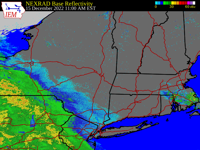 |
| Regional Radar Loop valid 11:00 am December 15 to 8:00 am December 17, 2022 |
Environment
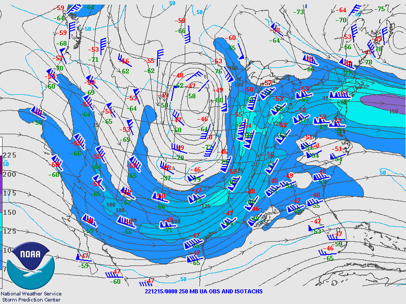
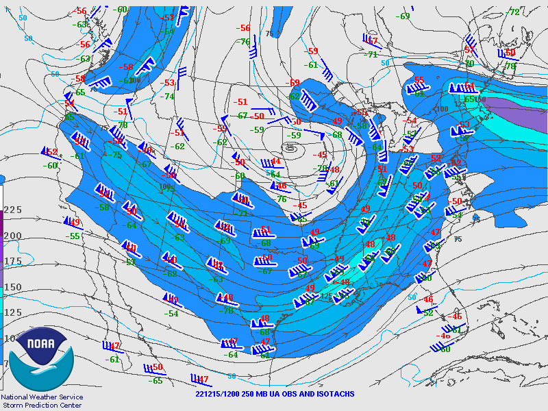
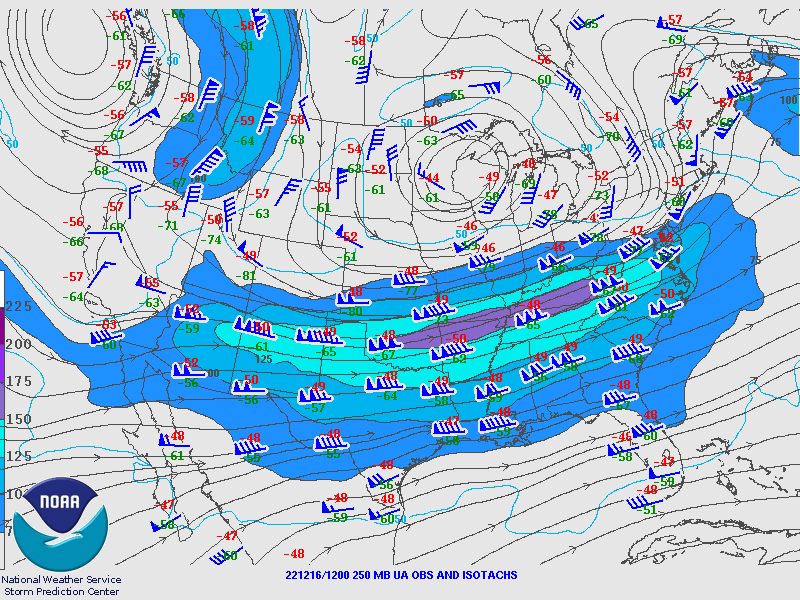
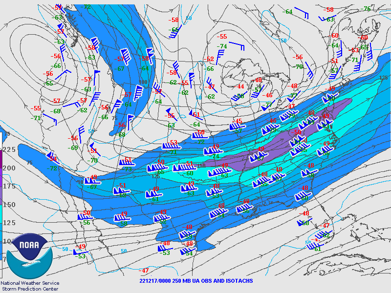
250 hPa Analysis
 |
 |
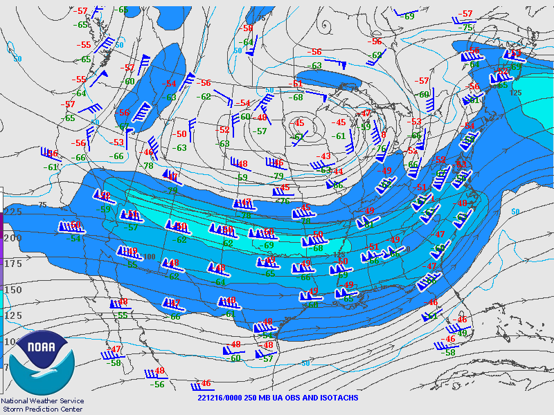 |
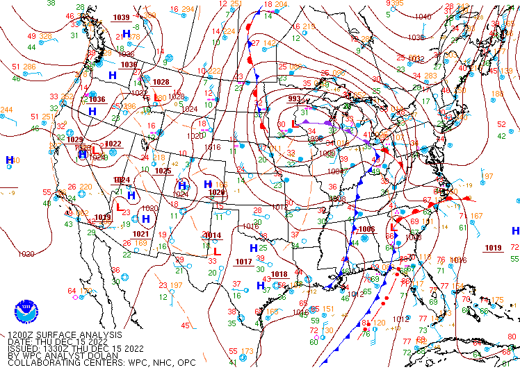
| Valid 00z December 15, 2022 | Valid 12z December 15, 2022 | Valid 00z December 16, 2022 |
 |
 |
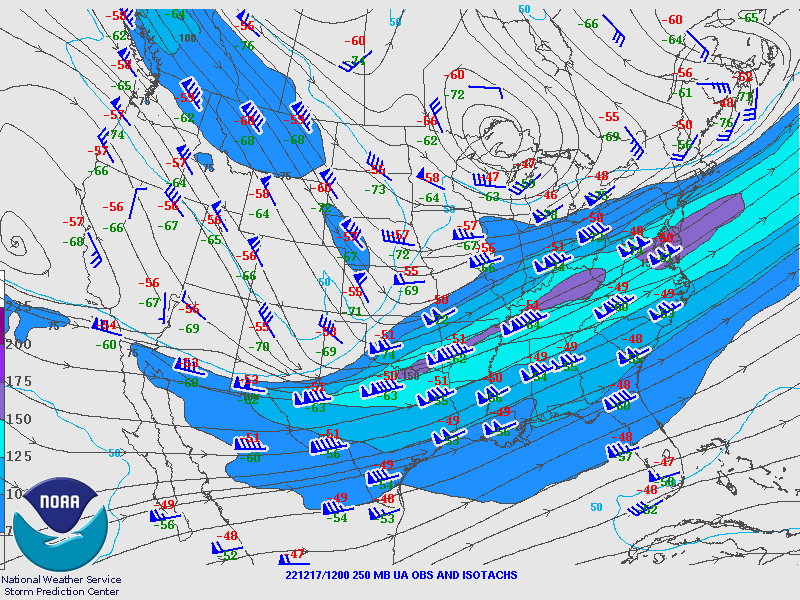 |
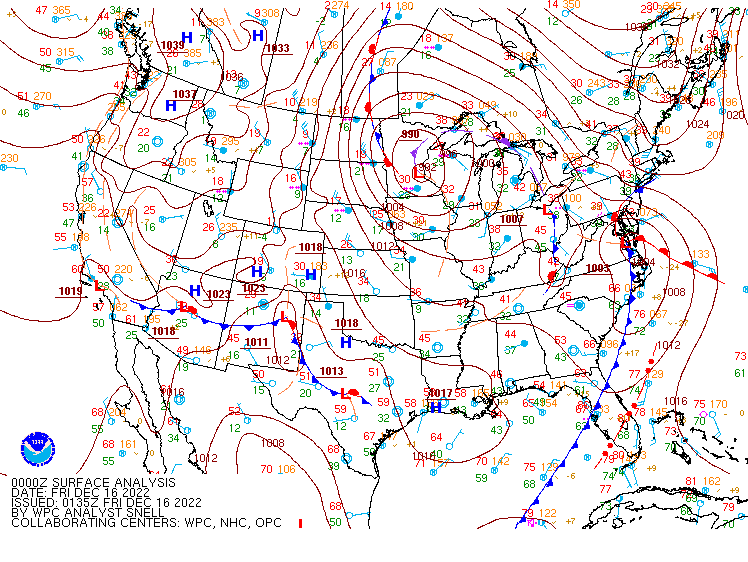
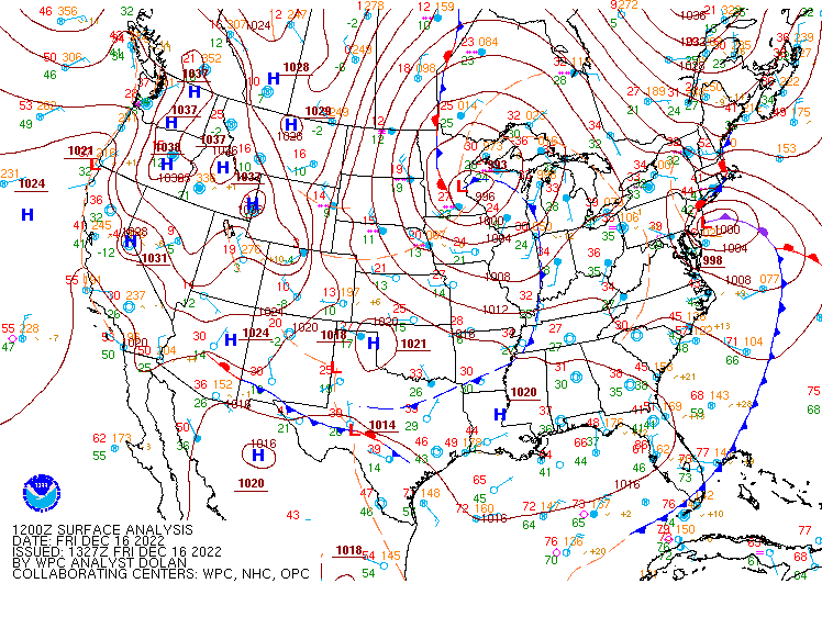
| Valid 12z December 16, 2022 | Valid 00z December 17, 2022 | Valid 12z December 17, 2022 |
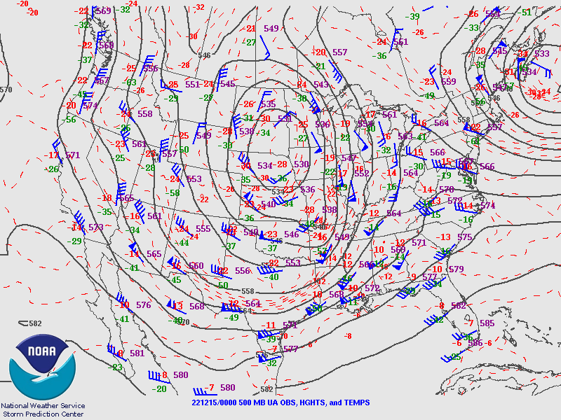
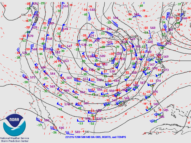
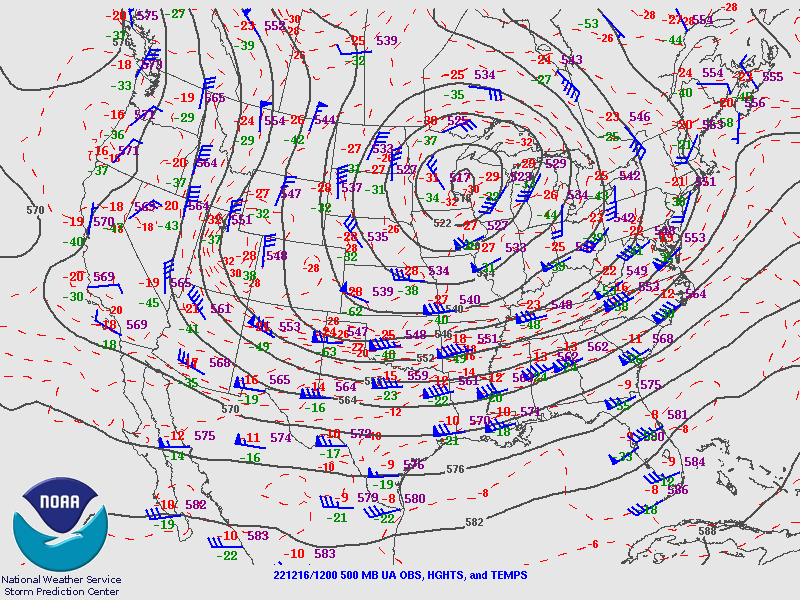
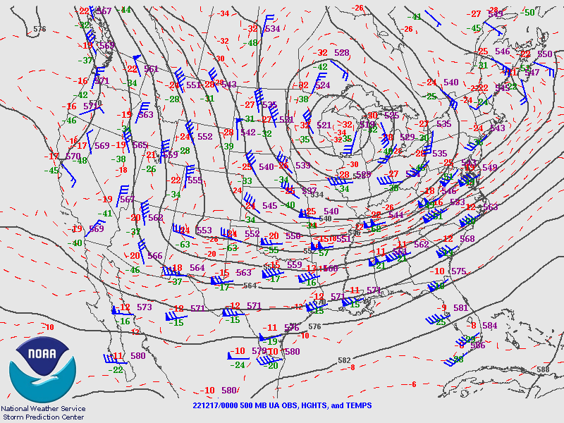
500 hPa Analysis
 |
 |
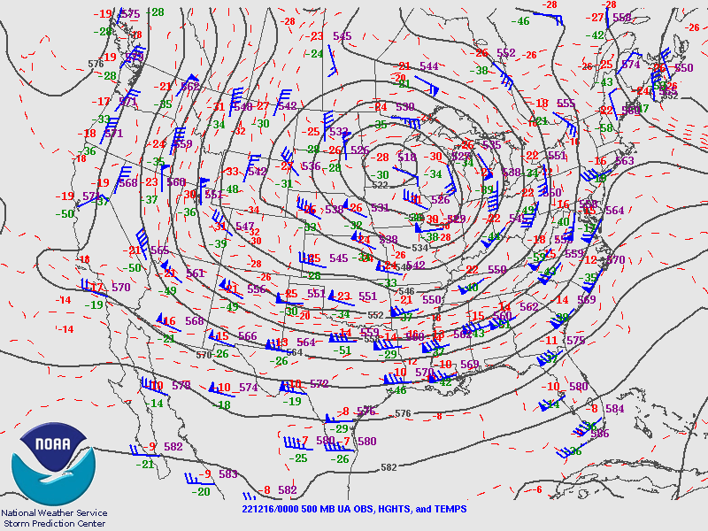 |
| Valid 00z December 15, 2022 | Valid 12z December 15, 2022 | Valid 00z December 16, 2022 |
 |
 |
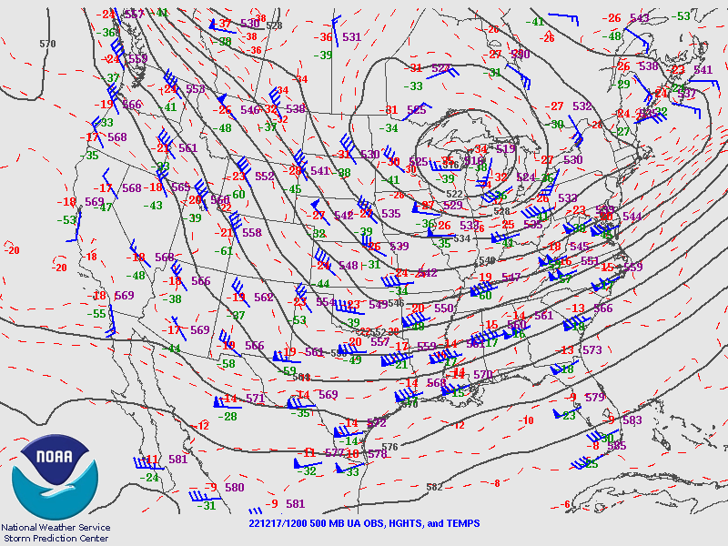 |
| Valid 12z December 16, 2022 | Valid 00z December 17, 2022 | Valid 12z December 17, 2022 |
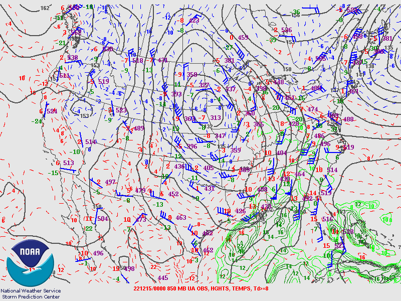
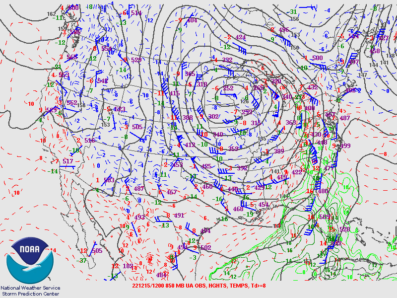
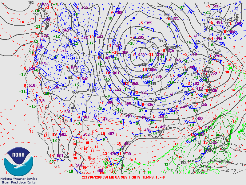
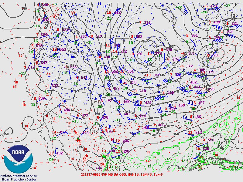
850 hPa Analysis
 |
 |
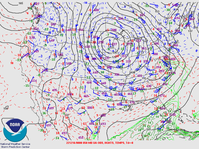 |
| Valid 00z December 15, 2022 | Valid 12z December 15, 2022 | Valid 00z December 16, 2022 |
 |
 |
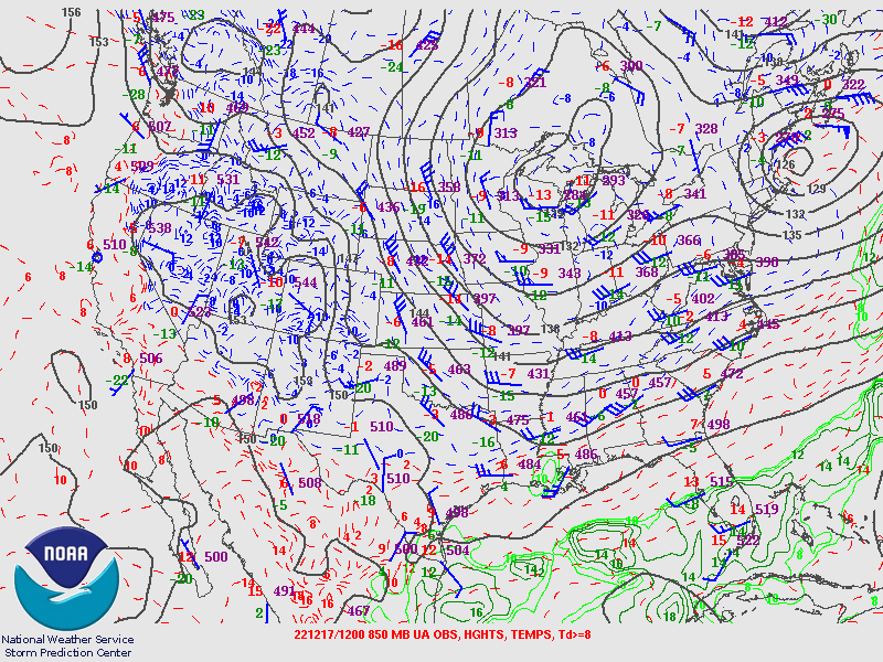 |
| Valid 12z December 16, 2022 | Valid 00z December 17, 2022 | Valid 12z December 17, 2022 |
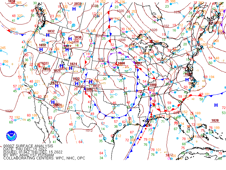
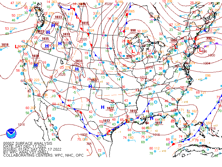
Surface Analysis
 |
 |
 |
| Valid 00z December 15, 2022 | Valid 12z December 15, 2022 | Valid 00z December 16, 2022 |
 |
 |
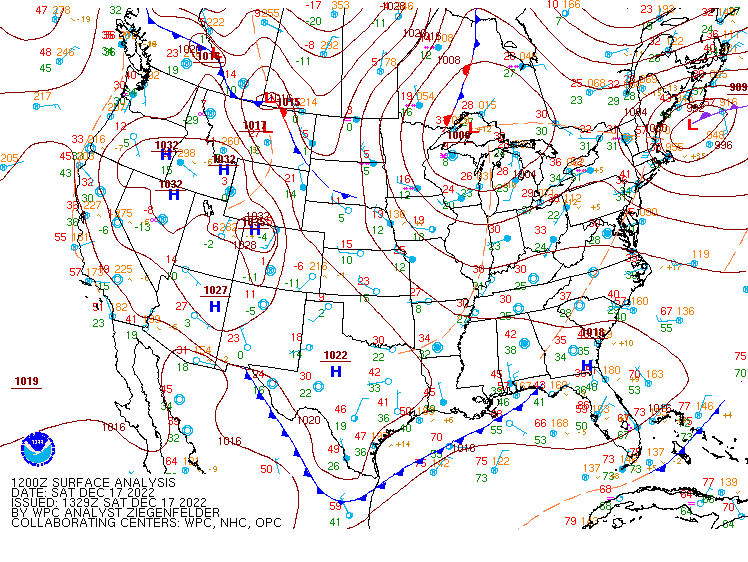 |
| Valid 12z December 16, 2022 | Valid 00z December 17, 2022 | Valid 12z December 17, 2022 |
 |
Media use of NWS Web News Stories is encouraged! Please acknowledge the NWS as the source of any news information accessed from this site. |
|

