Overview
A potent Miller Type B storm system (weakening low pressure to the west over the Great Lakes and strengthening low off the east coast) brought locally strong to damaging wind gusts, rain, and heavy, wet snow to eastern New York and western New England over the period of April 3-5, 2024. The greatest snowfall totals occurred in the Southern Adirondacks, Helderbergs and the higher peaks of the Berkshires and southern Green Mountains where totals ranged from 7 to 12 inches with locally higher totals up to 17 inches. Elsewhere, totals ranging from less than 1 inch to 6 inches were common with the Mid-Hudson Valley and southern Litchfield County generally accumulating the least amount of snow.
This storm also produced strong to locally damaging wind gusts across eastern New York and western New England. While most recorded gusts ranged from about 35 to 50 mph, a few gusts reached 50 and 65 mph. An isolated, maximum gust of 85 mph was recorded in Rensselaer County which lead to the significant damage to a barn on a farm in the town of Petersburgh. A 72 mph wind gust was recorded in Bennington County while a 67 mph wind gust was recorded in northern Berkshire County. These winds resulted in numerous reports of downed trees and wires resulting in some power outages.
Storm total rainfall or liquid equivalent precipitation was mostly between 1 and 3 inches.
High Wind:
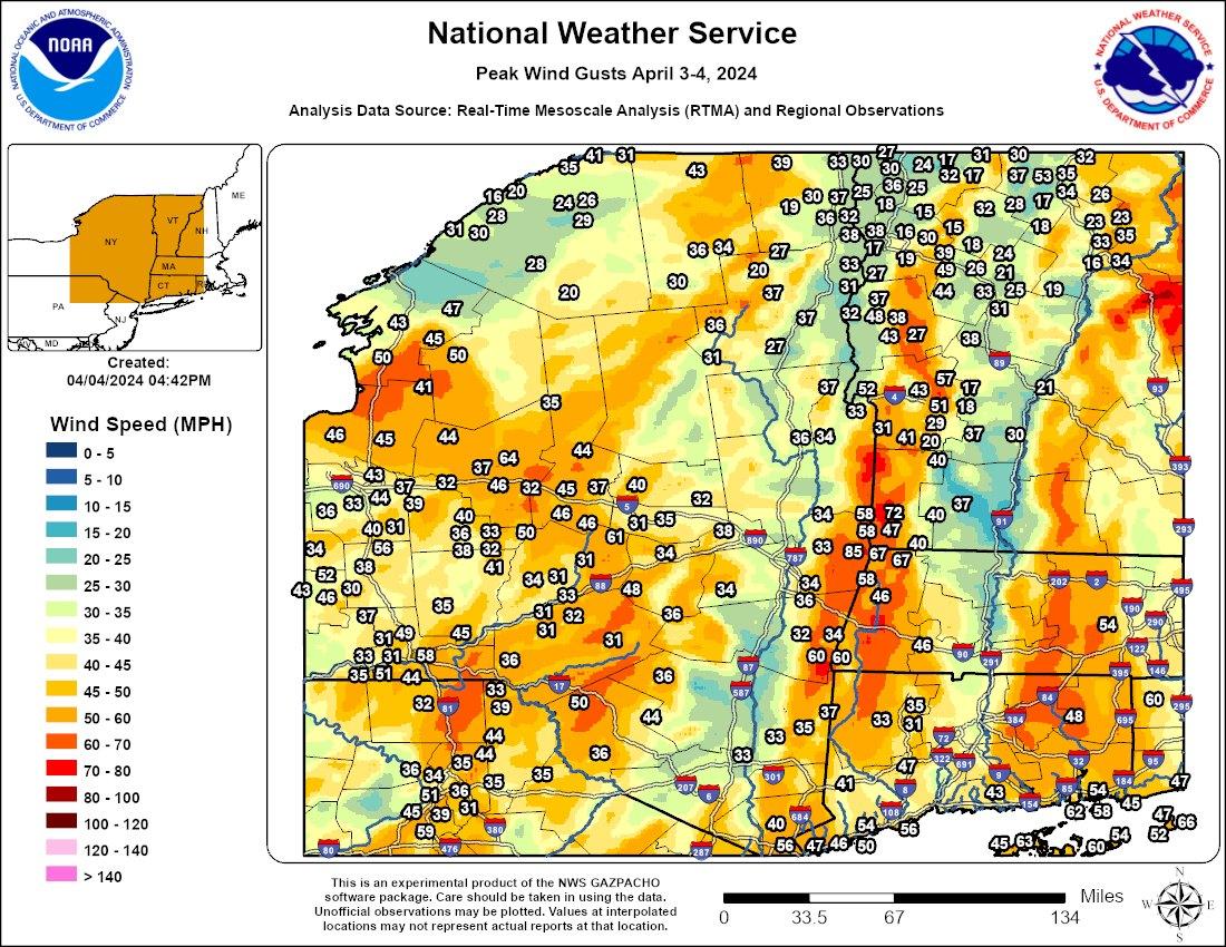 |
| Peak Wind Gusts: April 3-4, 2024 |
Public Information Statement
Spotter Reports
National Weather Service Albany NY
951 AM EDT Thu Apr 04 2024

The following are unofficial observations taken during the past 36
hours for the storm that has been affecting our region. Appreciation
is extended to highway departments, cooperative observers, Skywarn
spotters and media for these reports. This summary also is available
on our home page at weather.gov/albany

***********************PEAK WIND GUST***********************

LOCATION             MAX WIND      TIME/DATE  COMMENTS
                         GUST       MEASURED
                        (mph)

CONNECTICUT

...Litchfield County...
  Torrington               35   445 AM  4/04  CWOP
  Bantam                   33   445 AM  4/04  CWOP
  Plymouth                 31   430 AM  4/04  CWOP

MASSACHUSETTS

...Berkshire County...
  Harriman-and-west-Ai     67   319 PM  4/03  ASOS
  1 ESE Williamstown       67   321 PM  4/03  AWOS
  Pittsfield Municipal     46   453 PM  4/03  ASOS
  East Otis                46   445 AM  4/04  CWOP
  Williamstown             46   915 PM  4/03  CWOP
  Clarksburg               40  1130 AM  4/03  CWOP

NEW YORK

...Albany County...
  Medusa                   34   755 AM  4/03  NYSM

...Columbia County...
  3 NE Copake              60  1010 PM  4/03  NYS Mesonet
  Copake                   60  1130 PM  4/03  NYSM
  Kinderhook               36  1230 AM  4/04  NYSM
  Hillsdale                34  1130 PM  4/03  CWOP
  Claverack                32   330 PM  4/03  CWOP

...Dutchess County...
  Dover Plains             37   800 PM  4/03  NYSM
  Lagrangeville            35   331 PM  4/03  CWOP
  Hudson Valley Region     33   447 PM  4/03  ASOS
  Beacon                   33  1145 AM  4/03  NYSM

...Fulton County...
  Oppenheim                40   735 AM  4/03  NYSM

...Hamilton County...
  Indian Lake              31   215 PM  4/03  NYSM

...Herkimer County...
  Herkimer                 45   105 PM  4/03  NYSM
  Cold Brook               44  1050 PM  4/03  NYSM
  Little Falls             37   115 PM  4/03  CWOP

...Montgomery County...
  Hessville                61  1130 AM  4/03  CWOP
  Sprakers                 35   555 PM  4/03  NYSM
  Johnstown                32   805 AM  4/03  NYSM
  Fort Plain               31   519 PM  4/03  CWOP

...Rensselaer County...
  2 SE Petersburgh         85  1010 PM  4/03  Trained Spotter
  Stephentown              58   310 PM  4/03  NYSM
  Schaghticoke             34   125 AM  4/04  NYSM
  Schodack                 34   410 PM  4/03  NYSM
  Eagle Mills              33   157 PM  4/03  CWOP

...Schenectady County...
  Duanesburg               38   255 AM  4/04  NYSM

...Schoharie County...
  Cobleskill               34   525 PM  4/03  NYSM

...Ulster County...
  Claryville               36   420 PM  4/03  NYSM

...Warren County...
  Hartford                 37   302 AM  4/04  CWOP
  Floyd Bennett Memori     36   528 PM  4/03  ASOS
  Glens Falls              34   550 PM  4/03  NYSM

...Washington County...
  5 S Whitehall            33   630 PM  4/03  NYSM
  Granville                31   335 AM  4/04  CWOP

VERMONT

...Bennington County...
  2 NE Old Bennington      72  1214 AM  4/04  MESOWEST
  Bennington State Air     58   746 PM  4/03  ASOS
  Bennington State Air     58   818 PM  4/03  ASOS
  3 W Woodford State P     47  1044 PM  4/03  MESOWEST
  Rt-9 Searsburg           40   405 AM  4/04  MESOWEST
  4 W Peru VTRANS)         40  1009 PM  4/03  MESOWEST

...Windham County...
  West Dover               37   345 PM  4/03  CWOP
Snow
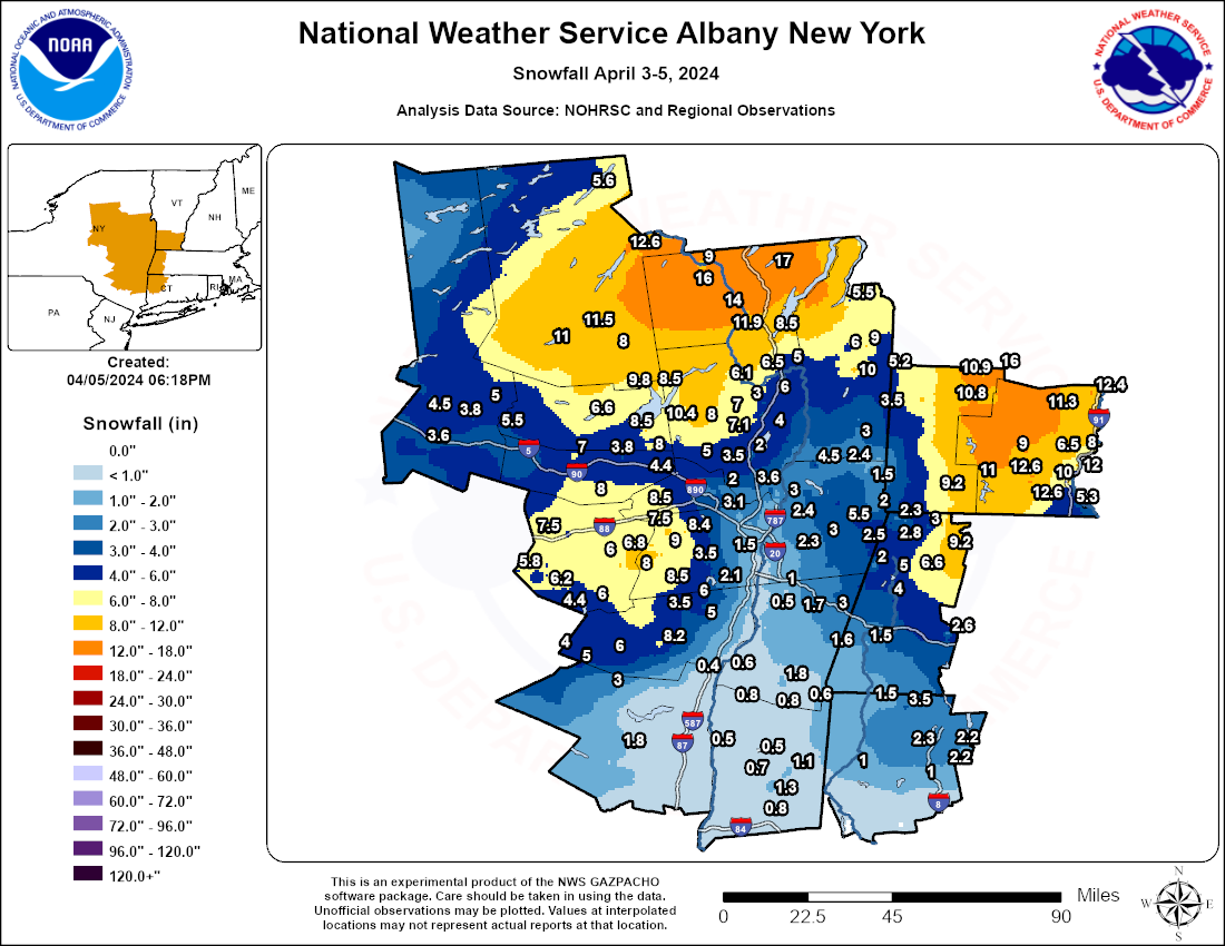 |
| Total Snowfall: April 3-5, 2024 |
Public Information Statement
Spotter Reports
National Weather Service Albany NY
442 PM EDT Fri Apr 05 2024

The following are unofficial observations taken during the past 50
hours for the storm that has been affecting our region. Appreciation
is extended to highway departments, cooperative observers, Skywarn
spotters and media for these reports. This summary also is available
on our home page at weather.gov/albany

********************STORM TOTAL SNOWFALL********************

LOCATION                TOTAL      TIME/DATE  COMMENTS
                     SNOWFALL       MEASURED
                     (inches)

CONNECTICUT

...Litchfield County...
  Norfolk                 3.5  1200 PM  4/04  Co-Op Observer
  Torrington              2.3  1145 AM  4/04  Social Media
  3 SW New Hartford Ce    2.2   700 AM  4/05  CoCoRaHS
  Bakersville             2.2   700 AM  4/05  Co-Op Observer
  4 ESE Canaan            1.5   700 AM  4/05  CoCoRaHS
  2 WNW Warren            1.0   700 AM  4/04  CoCoRaHS
  5 ESE Litchfield        1.0   900 AM  4/04  CoCoRaHS

MASSACHUSETTS

...Berkshire County...
  Savoy                   9.2  1151 PM  4/04  WeatherNet6
  1 NNW Cheshire          6.6   700 AM  4/05  CoCoRaHS
  Lanesborough            5.0  1102 PM  4/04  WeatherNet6
  Pittsfield              4.0   930 AM  4/04  Trained Spotter
  North Adams             3.0  1000 AM  4/04  Trained Spotter
  Williamstown            2.8  1145 AM  4/04  Trained Spotter
  4 SSE Becket            2.6   700 AM  4/04  CoCoRaHS
  2 WNW Williamstown      2.3   600 AM  4/04  CoCoRaHS
  Hancock                 2.0   642 PM  4/04  WeatherNet6
  2 SW Alford             1.6   830 AM  4/04  CoCoRaHS
  3 N Great Barrington    1.5   700 AM  4/04  CoCoRaHS

NEW YORK

...Albany County...
  Knox                    9.0   115 PM  4/04  Social Media
  Berne                   8.5   553 PM  4/04  WeatherNet6
  3 SSW Altamont          8.4   655 AM  4/05  CoCoRaHS
  Rensselaerville         8.0   836 AM  4/04  WeatherNet6
  2 NNW Rensselaervill    7.8   700 AM  4/05  CoCoRaHS
  4 NW Altamont           7.5   950 AM  4/04  Storm total
  West Berne              6.8   915 AM  4/04  Social Media
  Feura Bush              3.5   759 AM  4/04  WeatherNet6
  Albany Intl AP          2.6   400 PM  4/04  ASOS
  4 WNW Colonie           2.3   800 AM  4/04  CoCoRaHS
  Alcove Reservoir        2.1   730 AM  4/04  Co-Op Observer
  2 NW Latham             2.0   700 AM  4/05  CoCoRaHS
  Loudonville             2.0   557 PM  4/04  WeatherNet6
  Albany                  1.5  1050 PM  4/04  WeatherNet6
  1 SW Albany             1.5   700 AM  4/05  CoCoRaHS
  1 SSW Roessleville      1.4   800 AM  4/04  Official NWS Obs
  NWS Albany              1.4   800 AM  4/04  CoCoRaHS
  Wackmans Mobile Home    1.4   655 AM  4/04  Trained Spotter

...Columbia County...
  3 N Austerlitz          3.0  1040 AM  4/04  Meteorologist
  Taghkanic               1.8   846 AM  4/05  WeatherNet6
  1 SW Chatham            1.7   700 AM  4/05  CoCoRaHS
  3 N Valatie             1.0   700 AM  4/04  CoCoRaHS
  N Ancramdale            0.8   700 AM  4/05  CoCoRaHS
  Ancramdale              0.6   700 PM  4/04  WeatherNet6
  1 E Germantown          0.6   700 AM  4/04  CoCoRaHS
  Niverville              0.5   706 PM  4/04  WeatherNet6

...Dutchess County...
  3 NE Lagrangeville      1.3   700 AM  4/04  CoCoRaHS
  3 NE LaGrangeville      1.2   800 AM  4/04  CoCoRaHS
  3 SE Millbrook          1.1   700 AM  4/05  CoCoRaHS
  1 NNE Red Hook          0.8   700 AM  4/04  CoCoRaHS
  3 NE Hopewell Juncti    0.8   600 AM  4/04  CoCoRaHS
  2 S Pleasant Valley     0.7  1200 AM  4/05  CoCoRaHS
  3 NE Millbrook          0.5   600 AM  4/04  CoCoRaHS

...Fulton County...
  1 N Northville          9.8   945 AM  4/04  Social Media
  Broadalbin              8.5  1020 AM  4/04  Social Media
  1 NE Northville         8.5   710 AM  4/05  CoCoRaHS
  Perth                   8.0   945 AM  4/04  WeatherNet6
  Gloversville 7nw        6.6   700 AM  4/05  Co-Op Observer

...Greene County...
  East Jewett             8.2   700 AM  4/04  Trained Spotter
  West Kill               6.0   108 PM  4/04  WeatherNet6
  1 E Greenville          6.0   700 AM  4/05  CoCoRaHS
  Greenville Center       6.0  1221 PM  4/04  WeatherNet6
  3 E Freehold            5.0   530 AM  4/05  CoCoRaHS
  Halcott Center          4.0   934 AM  4/04  WeatherNet6
  Freehold                3.5   547 PM  4/04  WeatherNet6

...Hamilton County...
  Indian Lake            12.6   645 AM  4/05  Co-Op Observer
  2 WSW Lake Pleasant    11.5   655 AM  4/05  CoCoRaHS
  Piseco                 11.0   604 PM  4/04  WeatherNet6
  Wells                   8.0   821 AM  4/04  WeatherNet6
  1 N Long Lake           5.6   800 AM  4/05  CoCoRaHS

...Herkimer County...
  Dolgeville              5.5   300 PM  4/04  Trained Spotter
  2 NW Salisbury Cente    5.0   630 AM  4/05  CoCoRaHS
  3 NE Schuyler           4.5   700 AM  4/05  CoCoRaHS
  2 SSW Salisbury         3.8  1115 AM  4/04  Trained Spotter
  1 WSW Ilion             3.6   700 AM  4/05  CoCoRaHS

...Montgomery County...
  Charleston Four Corn    8.0   120 PM  4/04  Social Media
  5 W Fonda               7.0  1030 AM  4/04  CoCoRaHS
  Amsterdam               4.4   958 AM  4/04  WeatherNet6
  1 NNW Amsterdam         4.4   100 PM  4/04  CoCoRaHS
  Fonda                   3.8   552 PM  4/04  WeatherNet6

...Rensselaer County...
  Berlin                  5.5  1040 AM  4/04  Facebook
  Valley Falls            4.5   948 PM  4/04  WeatherNet6
  Speigletown             3.0   554 PM  4/04  WeatherNet6
  Sand Lake               3.0   610 PM  4/04  WeatherNet6
  Rensselaer              2.5   515 PM  4/04  WeatherNet6
  Buskirk                 2.4   830 AM  4/05  Co-Op Observer
  2 NNE Troy              2.4   800 AM  4/04  CoCoRaHS
  Bon Acre                2.3   500 PM  4/04  CoCoRaHS
  1 WNW Averill Park      2.3   800 AM  4/05  CoCoRaHS
  Petersburg              2.0   630 AM  4/04  WeatherNet6
  1 E Troy                1.9   700 AM  4/05  CoCoRaHS
  Hoosick Falls           1.5   604 PM  4/04  WeatherNet6

...Saratoga County...
  4 WNW Rock City Fall   10.4   855 AM  4/05  CoCoRaHS
  Lake Desolation         9.3   625 PM  4/04  WeatherNet6
  Middle Grove            8.0   930 AM  4/04  Social Media
  6 NNW Milton            7.1   700 AM  4/05  CoCoRaHS
  2 W Greenfield Cente    7.0   900 AM  4/04  CoCoRaHS
  Porter Corners          7.0   819 AM  4/04  Social Media
  Corinth                 6.1  1130 AM  4/04  Public
  Ganesvoort              6.0   749 PM  4/04  WeatherNet6
  3 ESE Ballston Spa      5.2   800 AM  4/05  CoCoRaHS
  Charlton                5.0   607 PM  4/04  WeatherNet6
  Galway                  4.8  1037 PM  4/04  WeatherNet6
  Beacon Hill             4.0  1200 PM  4/04  Public
  Halfmoon                4.0   223 PM  4/04  Social Media
  4 WNW Gansevoort        3.8   815 AM  4/04  CoCoRaHS
  2 S Clifton Park Cen    3.6  1000 AM  4/04  Storm total
  Ballston Spa            3.5   552 PM  4/04  WeatherNet6
  Clifton Park            3.2   721 PM  4/04  WeatherNet6
  Wilton                  3.0  1215 PM  4/04  Trained Spotter
  Saratoga Springs        2.8   224 PM  4/04  WeatherNet6
  Mechanicville           2.6  1144 PM  4/04  WeatherNet6
  Malta                   2.0   135 PM  4/04  WeatherNet6

...Schenectady County...
  Delanson                8.5  1227 PM  4/04  WeatherNet6
  Delanson 2ne            6.0   700 AM  4/05  Co-Op Observer
  Duanesburg              6.0  1237 PM  4/04  WeatherNet6
  Schenectady             4.5   830 AM  4/04  Trained Spotter
  Schenectady-GE Plot     3.1  1025 AM  4/04  Retired NWS Emp.
  Glenville               3.0   553 PM  4/04  WeatherNet6
  1 NW Scotia             2.6   600 AM  4/05  CoCoRaHS
  1 SSW Aqueduct          2.0   600 AM  4/04  NWS Employee

...Schoharie County...
  Richmondville           7.5   854 AM  4/04  WeatherNet6
  Jefferson               6.2  1246 PM  4/04  WeatherNet6
  Gilboa                  6.0   155 PM  4/04  Social Media
  Middleburgh             6.0   748 AM  4/04  WeatherNet6
  Charlotteville          5.8  1047 PM  4/04  WeatherNet6
  Lansing Manor           4.4   830 AM  4/05  Co-Op Observer

...Ulster County...
  Pine Hill               5.0   101 PM  4/04  WeatherNet6
  Phoenicia               3.0   657 PM  4/04  WeatherNet6
  4 N Kerhonkson          1.8   700 AM  4/04  CoCoRaHS
  1 NNE Esopus            0.5   700 AM  4/04  CoCoRaHS
  5 NW Saugerties         0.4   830 AM  4/04  CoCoRaHS

...Warren County...
  2 ENE Brant Lake       17.0   700 AM  4/05  CoCoRaHS
  Bakers Mills           16.0   930 AM  4/04  Facebook
  Warrensburg            14.0  1232 PM  4/04  WeatherNet6
  2 WNW Warrensburg      11.9   800 AM  4/05  CoCoRaHS
  North Creek             9.0   900 AM  4/04  Social Media
  1 N Lake George         8.5   700 AM  4/05  CoCoRaHS
  Queensbury              6.5   703 PM  4/04  WeatherNet6
  Glens Falls             5.0  1050 AM  4/04  Meteorologist

...Washington County...
  Hebron                 10.0   733 AM  4/05  WeatherNet6
  Granville               9.0   815 AM  4/05  WeatherNet6
  10 SW Granville         7.0   748 AM  4/05  CoCoRaHS
  Hartford                6.0  1230 PM  4/04  Social Media
  Whitehall               5.5   530 AM  4/05  Elevation 800 feet
  6 SW Pawlet             5.2   700 AM  4/05  CoCoRaHS
  2 SSE Salem             3.5   600 AM  4/05  CoCoRaHS
  Cambridge               3.0  1115 AM  4/04  Trained Spotter

VERMONT

...Bennington County...
  Landgrove              16.0   811 AM  4/05  WeatherNet6
  1 NNE Landgrove        14.5   700 AM  4/05  CoCoRaHS
  Peru                   10.9   700 AM  4/05  Co-Op Observer
  3 ENE Manchester       10.8   700 AM  4/05  CoCoRaHS
  5 NW Readsboro          9.2   509 PM  4/04  Meteorologist
  5 NNE Stamford          8.7   400 PM  4/04  CoCoRaHS

...Windham County...
  6 W West Brattleboro   12.6   800 AM  4/05  Co-Op Observer
  2 NNE Marlboro         12.6   800 AM  4/05  CoCoRaHS
  1 NNE Rockingham       12.4   700 AM  4/05  CoCoRaHS
  1 NE East Dummerston   12.0   745 AM  4/05  CoCoRaHS
  Athens                 11.3   525 AM  4/05  Social Media
  1 WNW Wilmington       11.0   637 AM  4/05  CoCoRaHS
  Brattleboro            10.0   347 AM  4/04  Social Media
  2 N East Dover          9.0   712 AM  4/05  CoCoRaHS
  1 NE Putney             8.0   800 AM  4/05  CoCoRaHS
  Putney                  6.5  1200 PM  4/04  Trained Spotter
  1 S Brattleboro         5.3   700 AM  4/05  CoCoRaHS
Rain Reports
-RainfallAnalysisPublic1.png) |
| Rainfall/Liquid Equivalent Precipitation: April 3-5, 2024 |
Public Information Statement
Spotter Reports
National Weather Service Albany NY
109 PM EDT Fri Apr 05 2024
The following are unofficial observations taken during the past 73
hours for the storm that has been affecting our region. Appreciation
is extended to highway departments, cooperative observers, Skywarn
spotters and media for these reports. This summary also is available
on our home page at weather.gov/albany
*********STORM TOTAL RAINFALL (AT LEAST 0.16 INCH)**********
LOCATION TOTAL TIME/DATE COMMENTS
RAINFALL MEASURED
(inches)
CONNECTICUT
...Litchfield County...
Bakersville 2.23 900 AM 4/04 Co-Op Observer
3 SW New Hartford Ce 2.18 900 AM 4/04 CoCoRaHS
4 ESE Winsted 2.00 700 AM 4/04 CoCoRaHS
5 ESE Litchfield 1.97 900 AM 4/04 CoCoRaHS
Oxford 1.94 813 AM 4/04 CWOP
THOMASTON 1.92 817 AM 4/04 CWOP
5 SSW New Milford 1.91 800 AM 4/04 CoCoRaHS
2 WNW Warren 1.84 700 AM 4/04 CoCoRaHS
3 N Watertown 1.83 1104 AM 4/04 CoCoRaHS
SE South Kent 1.77 600 AM 4/04 CoCoRaHS
3 WNW New Milford 1.76 700 AM 4/04 CoCoRaHS
Oakville 1.75 755 PM 4/04 CWOP
2 NE Thomaston 1.72 730 AM 4/04 HADS
Plymouth 1.67 815 AM 4/04 CWOP
2 SSW Woodbury Cente 1.66 700 AM 4/04 CoCoRaHS
Watertown 1.58 815 AM 4/04 CWOP
4 ESE Canaan 1.56 700 AM 4/04 CoCoRaHS
3 ENE New Preston 1.41 840 AM 4/04 CoCoRaHS
1 NW Woodbury Center 1.32 815 AM 4/04 HADS
TORRINGTON 1.32 814 AM 4/04 CWOP
Torrington 1.31 755 PM 4/04 CWOP
2 NNE Litchfield 1.27 700 AM 4/04 CoCoRaHS
4 NNE Kent 1.20 825 AM 4/04 AWS
Winsted 1.20 755 PM 4/04 CWOP
3 W Norfolk 1.18 755 PM 4/04 AWS
Bantam 1.16 815 AM 4/04 CWOP
New Hartford 1.16 819 AM 4/04 CWOP
3 NNW Winsted 1.13 800 PM 4/04 AWS
New Milford 1.13 815 AM 4/04 CWOP
Barkhamsted 1.13 755 PM 4/04 CWOP
Colebrook 0.96 815 AM 4/04 CWOP
Falls Village 0.72 815 AM 4/04 HADS
MASSACHUSETTS
...Berkshire County...
Becket 3.00 651 AM 4/04 WeatherNet6
1 ENE Clarksburg 1.51 800 AM 4/04 CoCoRaHS
2 SW Alford 1.44 830 AM 4/04 CoCoRaHS
NEW ASHFORD 1.40 810 AM 4/04 CWOP
3 N Great Barrington 1.34 700 AM 4/04 CoCoRaHS
1 NNW Cheshire 1.11 700 AM 4/04 CoCoRaHS
Great Barrington 1.11 619 PM 4/04 WeatherNet6
Pittsfield Municipal 1.04 154 PM 4/04 ASOS
Pittsfield Airport 1.04 800 AM 4/04 CoCoRaHS
1 N Williamstown 0.91 755 PM 4/04 AWS
Williamstown 0.91 140 PM 4/04 CWOP
2 WNW Williamstown 0.91 600 AM 4/04 CoCoRaHS
Clarksburg 0.78 800 PM 4/04 CWOP
3 WSW Lee 0.78 755 PM 4/04 AWS
1 ESE Williamstown 0.77 752 PM 4/04 AWOS
N Great Barrington 0.74 1159 PM 4/03 CoCoRaHS
Adams 0.53 345 PM 4/03 CWOP
East Otis 0.49 816 AM 4/04 CWOP
Savoy 0.45 619 PM 4/03 WeatherNet6
Monterey 0.40 111 PM 4/03 AWS
Pittsfield 0.36 236 PM 4/03 CWOP
Peru 0.34 745 PM 4/04 CWOP
Lanesborough 0.20 1103 PM 4/03 WeatherNet6
NEW YORK
...Albany County...
4 NW Altamont 2.21 800 AM 4/04 CoCoRaHS
Alcove Reservoir 1.63 730 AM 4/04 Co-Op Observer
Medusa 1.53 825 AM 4/04 NYSM
3 SSW Altamont 1.48 657 AM 4/04 CoCoRaHS
Glenmont 1.36 756 PM 4/04 CWOP
SE Altamont 1.32 700 AM 4/04 CoCoRaHS
Voorheesville 1.30 825 AM 4/04 NYSM
2 W Guilderland 1.27 715 PM 4/04 RAWS
Albany 1.25 759 PM 4/04 CWOP
1 S Delmar 1.21 700 AM 4/04 CoCoRaHS
1 SW Albany 1.14 700 AM 4/04 CoCoRaHS
4 WNW Colonie 1.13 800 AM 4/04 CoCoRaHS
Loudonville 1.05 755 PM 4/04 AWS
Albany Intl Ap 1.01 751 PM 4/04 ASOS
Colonie 0.99 746 PM 4/04 CWOP
4 SSW Voorheesville 0.97 755 PM 4/04 AWS
NWS Albany 0.97 800 AM 4/04 CoCoRaHS
3 SW Glenmont 0.82 700 AM 4/04 CoCoRaHS
Rensselaer 0.72 800 PM 4/04 CWOP
Delmar 0.66 1204 AM 4/04 WeatherNet6
Berne 0.66 800 PM 4/04 AWS
Feura Bush 0.58 727 PM 4/03 WeatherNet6
East Berne 0.57 812 AM 4/04 CWOP
2 NNW Rensselaervill 0.40 700 AM 4/03 CoCoRaHS
Rensselaerville 0.23 710 AM 4/03 WeatherNet6
...Columbia County...
1 E Germantown 2.10 700 AM 4/04 CoCoRaHS
Hudson 1.48 745 PM 4/04 CWOP
Copake 1.31 825 AM 4/04 NYSM
Claverack 1.30 745 PM 4/04 CWOP
Kinderhook 1.23 825 AM 4/04 NYSM
3 N Valatie 1.23 700 AM 4/04 CoCoRaHS
N Ancramdale 1.22 700 AM 4/04 CoCoRaHS
Chatham 1.17 755 PM 4/04 CWOP
3 NE Valatie 1.17 830 AM 4/04 CoCoRaHS
Hillsdale 1.05 745 PM 4/04 CWOP
1 SW Chatham 0.92 700 AM 4/04 CoCoRaHS
1 ESE Ancram 0.64 800 PM 4/04 AWS
...Dutchess County...
INSTITUTE ECO STUDY 3.30 800 PM 4/04 HADS
1 SE Beacon 2.38 700 AM 4/04 CoCoRaHS
2 S Poughkeepsie 2.35 700 AM 4/04 CoCoRaHS
3 NNE Beacon 2.34 748 AM 4/04 RAWS
2 SW Staatsburg 2.33 730 AM 4/04 HADS
2 W Hyde Park 2.29 700 AM 4/04 CoCoRaHS
5 S Poughkeepsie 2.16 900 AM 4/04 CoCoRaHS
Red Hook 2.09 825 AM 4/04 NYSM
1 NNE Red Hook 2.04 700 AM 4/04 CoCoRaHS
3 N Rhinebeck 2.03 700 AM 4/04 CoCoRaHS
Beacon 1.97 825 AM 4/04 NYSM
3 S Tivoli 1.94 730 AM 4/04 HADS
5 SE Rhinebeck 1.88 700 AM 4/04 CoCoRaHS
Wappingers Falls 1.85 817 AM 4/04 CWOP
POUGHKEEPSIE 1.73 815 AM 4/04 CWOP
Manchester Bridge 1.69 445 AM 4/04 Trained Spotter
3 E Poughkeepsie 1.69 500 AM 4/04 CoCoRaHS
Dover Plains 1.68 825 AM 4/04 NYSM
Hudson Valley Region 1.67 753 AM 4/04 ASOS
2 NE Pleasant Valley 1.60 820 AM 4/04 AWS
3 SE Millbrook 1.60 700 AM 4/04 CoCoRaHS
Pleasant Valley 1.60 815 AM 4/04 CWOP
3 NE Millbrook 1.60 600 AM 4/04 CoCoRaHS
3 NE Hopewell Juncti 1.59 600 AM 4/04 CoCoRaHS
STANFORDVILLE 1.57 815 AM 4/04 CWOP
3 NE LaGrangeville 1.55 800 AM 4/04 CoCoRaHS
Stormville 1.52 445 AM 4/04 CWOP
3 NE Lagrangeville 1.52 700 AM 4/04 CoCoRaHS
Salt Point 1.50 815 AM 4/04 CWOP
Fairview 1.42 800 AM 4/04 CWOP
2 E Wingdale 1.42 715 AM 4/04 HADS
3 WNW Pawling 1.32 820 AM 4/04 AWS
2 E Hyde Park 1.26 800 AM 4/04 CoCoRaHS
Lagrangeville 1.12 951 PM 4/03 CWOP
2 S Pleasant Valley 1.10 1200 AM 4/04 CoCoRaHS
...Fulton County...
Oppenheim 1.35 825 AM 4/04 NYSM
1 NE Northville 1.27 800 AM 4/04 CoCoRaHS
Gloversville 7nw 1.16 700 AM 4/04 Co-Op Observer
2 S Broadalbin 1.11 754 PM 4/04 AWS
Perth 0.94 800 PM 4/04 CWOP
...Greene County...
Tannersville 2.60 825 AM 4/04 NYSM
2 N Lexington 2.02 700 AM 4/04 CoCoRaHS
6 SSE Westerlo 1.88 800 AM 4/04 CoCoRaHS
Catskill 1.77 815 AM 4/04 CWOP
3 E Freehold 1.66 500 AM 4/04 CoCoRaHS
EAST DURHAM 1.62 757 PM 4/04 CWOP
1 SSW Acra 1.50 700 AM 4/04 CoCoRaHS
WNW Athens 1.46 620 AM 4/04 CoCoRaHS
Athens 1.37 824 AM 4/04 AWS
Halcott Center 1.33 820 AM 4/04 CWOP
Hunter 1.09 800 PM 4/04 CWOP
1 E Greenville 1.05 700 AM 4/04 CoCoRaHS
Freehold 0.95 745 PM 4/04 CWOP
West Kill 0.74 655 PM 4/03 WeatherNet6
Leeds 0.50 611 PM 4/04 WeatherNet6
...Hamilton County...
2 WSW Lake Pleasant 1.61 655 AM 4/04 CoCoRaHS
Piseco 1.59 755 PM 4/04 NYSM
Indian Lake 1.32 755 PM 4/04 NYSM
2 WNW Hoffmeister 1.26 800 AM 4/04 CoCoRaHS
Wells 1.10 733 AM 4/03 WeatherNet6
Raquette Lake 0.91 755 PM 4/04 NYSM
1 N Long Lake 0.75 700 AM 4/04 CoCoRaHS
6 ENE Piseco 0.38 700 PM 4/04 RAWS
...Herkimer County...
Dolgeville 1.41 745 PM 4/04 CWOP
1 WSW Ilion 1.16 700 AM 4/04 CoCoRaHS
Herkimer 1.11 825 AM 4/04 NYSM
2 NW Salisbury Cente 1.09 515 AM 4/04 CoCoRaHS
3 NE Schuyler 1.06 700 AM 4/04 CoCoRaHS
Cold Brook 0.94 825 AM 4/04 NYSM
Poland 0.91 154 PM 4/04 AWS
Little Falls 0.87 747 PM 4/04 CWOP
West Winfield 0.86 755 PM 4/04 AWS
Old Forge 0.79 755 PM 4/04 NYSM
Big Moose 0.26 745 PM 4/03 CWOP
8 NW Big Moose 0.20 730 PM 4/04 USGS
...Montgomery County...
Sprakers 1.61 825 AM 4/04 NYSM
AMSTERDAM 1.52 755 PM 4/04 CWOP
1 NNW Amsterdam 1.52 100 PM 4/04 CoCoRaHS
SE Fort Plain 1.48 700 AM 4/04 CoCoRaHS
Johnstown 1.48 825 AM 4/04 NYSM
Fort Plain 1.45 756 PM 4/04 CWOP
5 W Fonda 1.30 1030 AM 4/04 CoCoRaHS
Amsterdam 1.18 800 PM 4/04 CWOP
Palatine Bridge 1.18 1257 PM 4/04 WeatherNet6
Hessville 1.17 140 PM 4/04 CWOP
Hagaman 0.92 757 PM 4/04 CWOP
Fonda 0.72 1101 PM 4/03 WeatherNet6
...Rensselaer County...
East Greenbush 1.24 800 PM 4/04 CWOP
Schodack 1.22 825 AM 4/04 NYSM
Castleton 1.17 800 PM 4/04 CWOP
Troy 1.02 755 PM 4/04 CWOP
Stephentown 0.97 825 AM 4/04 NYSM
2 NNE Troy 0.92 800 AM 4/04 CoCoRaHS
Schaghticoke 0.92 825 AM 4/04 NYSM
Brunswick 0.91 800 PM 4/04 CWOP
3 N Troy 0.90 615 AM 4/04 CoCoRaHS
1 E Troy 0.89 700 AM 4/04 CoCoRaHS
1 WNW Averill Park 0.89 800 AM 4/04 CoCoRaHS
Eagle Mills 0.85 757 PM 4/04 CWOP
7 NE Troy 0.78 700 AM 4/04 CoCoRaHS
Buskirk 0.66 845 AM 4/04 Co-Op Observer
Mechanicville 0.63 700 AM 4/04 HADS
1 NW Wyantskill 0.58 755 PM 4/04 AWS
...Saratoga County...
3 ESE Ballston Spa 1.90 845 AM 4/04 CoCoRaHS
Edinburg 1.74 755 PM 4/04 NYSM
4 WNW Rock City Fall 1.35 805 AM 4/04 CoCoRaHS
2 W Greenfield Cente 1.31 900 AM 4/04 CoCoRaHS
Saratoga Springs 1.27 758 PM 4/04 CWOP
Gansevoort 1.18 759 PM 4/04 CWOP
Ballston Spa 1.13 825 AM 4/04 NYSM
6 NNW Milton 1.05 700 AM 4/04 CoCoRaHS
Halfmoon 1.04 800 PM 4/04 CWOP
Mechanicvile 1.04 745 PM 4/04 CWOP
3 NNW Malta 1.02 1000 AM 4/04 CoCoRaHS
3 WSW Mechanicville 1.00 800 AM 4/04 CoCoRaHS
2 W Clifton Park 1.00 800 AM 4/04 CoCoRaHS
Schuylerville 1.00 155 PM 4/04 NYSM
3 S Clifton Park 0.95 600 AM 4/04 CoCoRaHS
Ballston Lake 0.93 800 PM 4/04 CWOP
4 WNW Gansevoort 0.91 815 AM 4/04 CoCoRaHS
1 NW The Saratoga Ba 0.88 738 PM 4/04 RAWS
MECHANICVILLE 0.87 800 PM 4/04 CWOP
Malta 0.75 745 PM 4/04 CWOP
Stillwater 0.61 155 PM 4/04 AWS
Clifton Park 0.60 1124 PM 4/03 WeatherNet6
Lake Desolation 0.44 751 PM 4/03 WeatherNet6
Mechanicville 0.41 743 PM 4/03 WeatherNet6
Galway 0.34 1119 PM 4/03 WeatherNet6
Corinth 0.27 1133 PM 4/03 WeatherNet6
Charlton 0.25 621 PM 4/03 WeatherNet6
Ganesvoort 0.20 654 PM 4/03 WeatherNet6
...Schenectady County...
Duanesburg 1.65 755 PM 4/04 NYSM
SCOTIA 1.48 745 PM 4/04 CWOP
4 NNW Rotterdam Junc 1.31 800 PM 4/04 AWS
1 NW Scotia 1.23 600 AM 4/04 CoCoRaHS
3 SSE Niskayuna 1.04 700 AM 4/04 CoCoRaHS
Niskayuna 0.93 754 PM 4/04 CWOP
2 ENE Schenectady 0.89 700 AM 4/04 CoCoRaHS
Delanson 0.80 645 PM 4/03 WeatherNet6
DELANSON 0.55 757 PM 4/04 CWOP
Glenville 0.48 548 PM 4/03 WeatherNet6
Scotia 0.45 513 PM 4/03 WeatherNet6
Delanson 2ne 0.31 700 AM 4/04 Co-Op Observer
...Schoharie County...
Cobleskill 1.26 825 AM 4/04 NYSM
Lansing Manor 1.20 830 AM 4/04 Co-Op Observer
3 WSW Central Bridge 0.99 755 PM 4/04 AWS
Schoharie 0.98 755 PM 4/04 AWS
Charlotteville 0.80 1123 PM 4/03 WeatherNet6
Middleburgh 0.71 1201 AM 4/04 WeatherNet6
Jefferson 0.60 651 PM 4/03 WeatherNet6
Richmondville 0.55 734 PM 4/03 WeatherNet6
...Ulster County...
East Ashokan 2.77 740 AM 4/04 UCOOP
4 N Kerhonkson 2.67 700 AM 4/04 CoCoRaHS
Catskill Center 2.59 748 AM 4/04 RAWS
Phoenicia 2.55 700 AM 4/04 Co-Op Observer
High Falls 2.53 825 AM 4/04 NYSM
Gardiner 2.50 815 AM 4/04 CWOP
West Shokan 2.50 737 AM 4/04 WeatherNet6
2 NW Highland 2.49 700 AM 4/04 CoCoRaHS
1 ENE Woodstock 2.48 700 AM 4/04 CoCoRaHS
Wallkill 2.47 825 AM 4/04 NYSM
1 NNE Esopus 2.44 700 AM 4/04 CoCoRaHS
SW Highland 2.44 700 AM 4/04 CoCoRaHS
3 NNE Highland 2.43 700 AM 4/04 CoCoRaHS
5 NW Saugerties 2.40 830 AM 4/04 CoCoRaHS
3 N Pine Bush 2.38 700 AM 4/04 CoCoRaHS
NNW Hurley 2.37 700 AM 4/04 CoCoRaHS
2 WSW Hurley 2.37 600 AM 4/04 CoCoRaHS
4 E Wallkill 2.22 700 AM 4/04 CoCoRaHS
Marbletown 2.10 1203 AM 4/04 WeatherNet6
New Paltz 2.08 815 AM 4/04 CWOP
Kerhonkson 1.90 815 AM 4/04 CWOP
Claryville 1.86 825 AM 4/04 NYSM
2 S Hurley 1.70 700 AM 4/04 CoCoRaHS
3 WNW Phoenicia 1.61 800 PM 4/04 AWS
Olivebridge 1.21 717 PM 4/03 WeatherNet6
Kingston 1.03 815 AM 4/04 CWOP
...Warren County...
2 ENE Brant Lake 2.46 830 AM 4/04 CoCoRaHS
Chestertown 1.37 755 PM 4/04 NYSM
2 WNW Warrensburg 1.13 800 AM 4/04 CoCoRaHS
Glen Falls 0.97 756 PM 4/04 CWOP
1 N Lake George 0.95 630 AM 4/04 CoCoRaHS
Glens Falls 0.85 155 PM 4/04 NYSM
Cleverdale 0.77 745 PM 4/04 CWOP
Silver Bay 0.69 745 PM 4/04 CWOP
Queensbury 0.66 755 PM 4/04 CWOP
1 N Lake Luzerne-Had 0.54 755 PM 4/04 AWS
Floyd Bennett Memori 0.47 753 PM 4/04 ASOS
Warrensburg 0.35 948 PM 4/03 WeatherNet6
Hartford 0.24 751 PM 4/04 CWOP
...Washington County...
Whitehall 3.25 108 PM 4/04 WeatherNet6
5 S Whitehall 0.92 755 PM 4/04 NYSM
Cambridge 0.58 800 PM 4/04 CWOP
Salem 0.56 759 PM 4/04 CWOP
Brooklyn 0.49 745 PM 4/04 CWOP
Granville 0.49 755 PM 4/04 CWOP
2 SSE Salem 0.42 600 AM 4/04 CoCoRaHS
10 SW Granville 0.41 748 AM 4/04 CoCoRaHS
VERMONT
...Bennington County...
5 NNE Stamford 1.86 400 PM 4/04 CoCoRaHS
3 ENE Manchester 1.48 700 AM 4/04 CoCoRaHS
1 NNE Landgrove 1.14 715 AM 4/04 CoCoRaHS
Searsburg Reservoir 1.09 700 PM 4/04 MESOWEST
Peru 1.06 700 AM 4/04 Co-Op Observer
Bennington State Air 0.88 754 PM 4/04 ASOS
4 E Woodford State P 0.80 800 AM 4/04 HADS
WNW Shaftsbury 0.57 120 PM 4/04 CoCoRaHS
...Windham County...
6 W West Brattleboro 3.22 800 AM 4/04 Co-Op Observer
2 NNE Marlboro 3.11 800 AM 4/04 CoCoRaHS
Mt Snow Ski Resort I 2.48 700 PM 4/04 MESOWEST
Wilmington 1.87 800 PM 4/04 CWOP
E.Dummerston 1.71 800 PM 4/04 CWOP
1 WNW Wilmington 1.50 544 AM 4/04 CoCoRaHS
SW Saxtons River 1.43 300 PM 4/04 CoCoRaHS
1 S Brattleboro 1.40 700 AM 4/04 CoCoRaHS
1 NE Putney 1.29 800 AM 4/04 CoCoRaHS
2 N East Dover 1.13 720 AM 4/04 CoCoRaHS
6 NW Westminster 0.83 700 AM 4/04 CoCoRaHS
1 NNE Rockingham 0.79 700 AM 4/04 CoCoRaHS
1 NNE West Brattlebo 0.51 800 PM 4/04 AWS
Bellows Falls 0.48 754 PM 4/04 AWS
1 NE East Dummerston 0.42 800 AM 4/04 CoCoRaHS
WEST HALIFAX 0.35 817 AM 4/04 CWOP
Rockingham 0.24 800 PM 4/04 CWOP
Radar
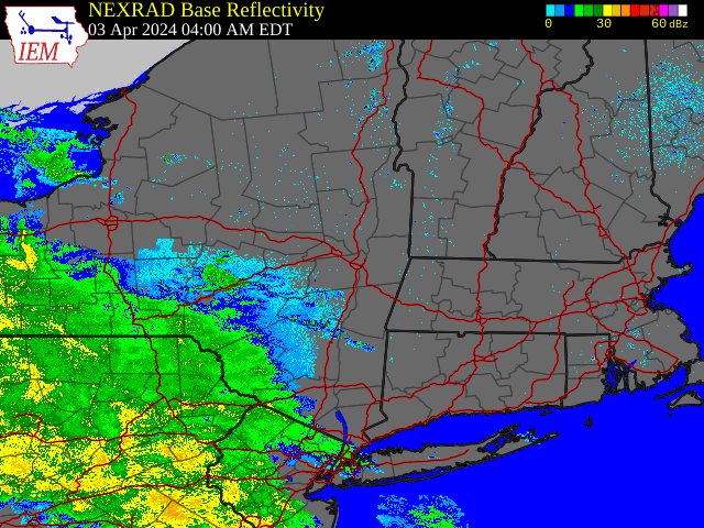 |
| Regional Radar Loop valid 4:00 am April 3 to 1:00 pm April 5, 2024 |
Environment
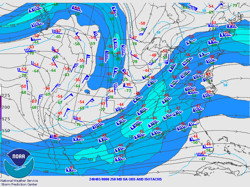
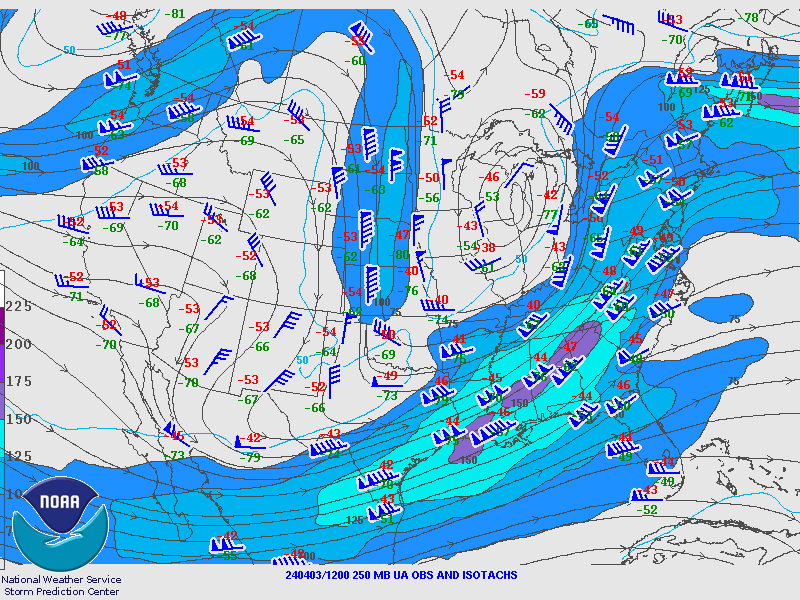
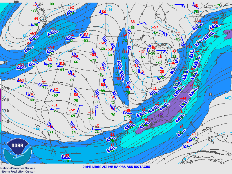
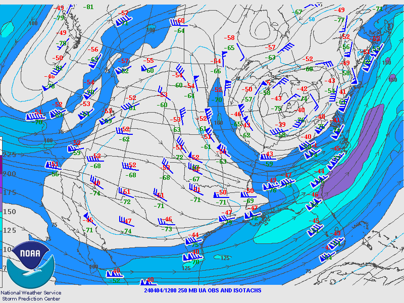
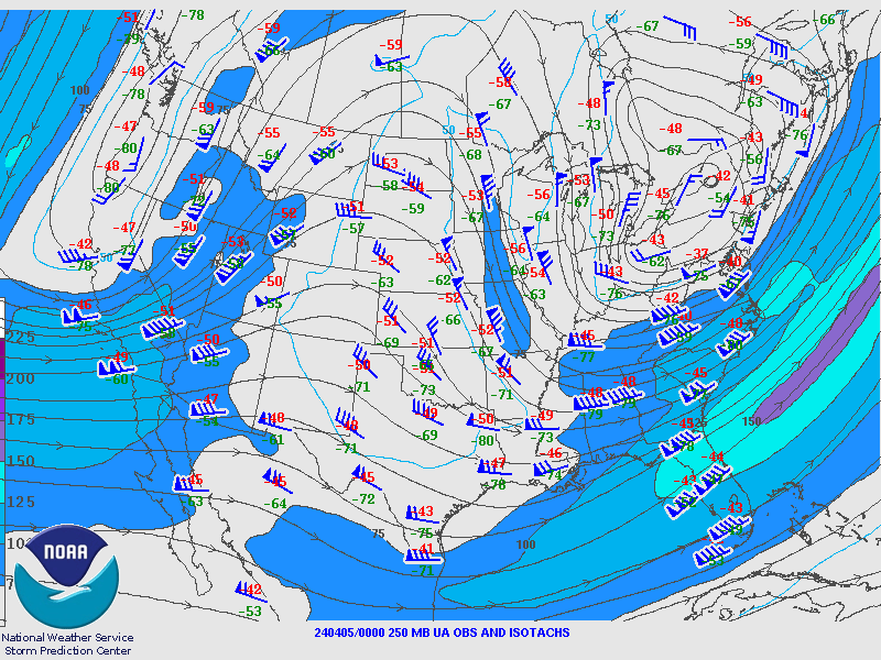
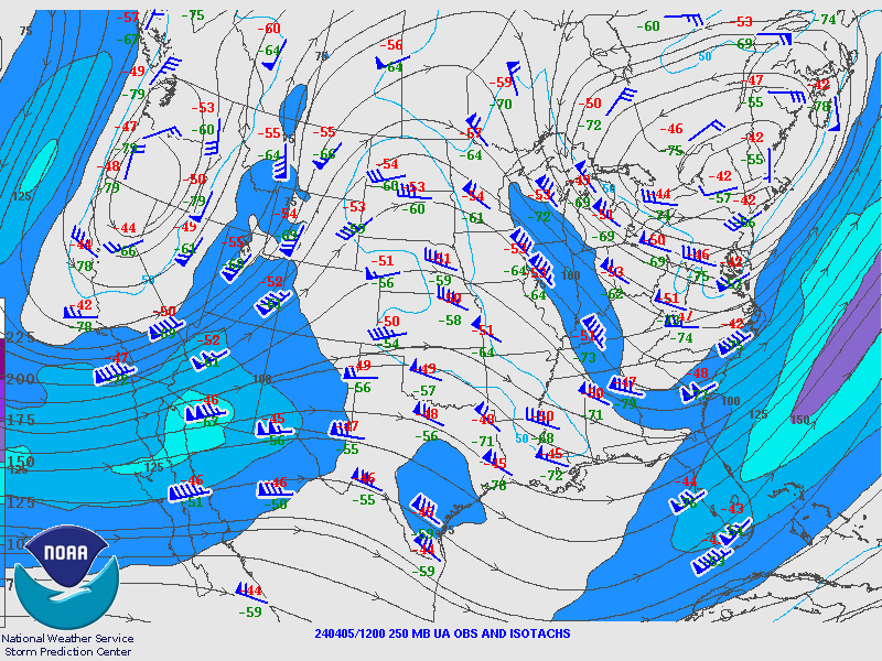
250 hPa Analysis
 |
 |
 |
| Valid 00z April 3, 2024 | Valid 12z April 3, 2024 | Valid 00z April 4, 2024 |
 |
 |
 |
| Valid 12z April 4, 2024 | Valid 00z April 5, 2024 | Valid 12z April 5, 2024 |
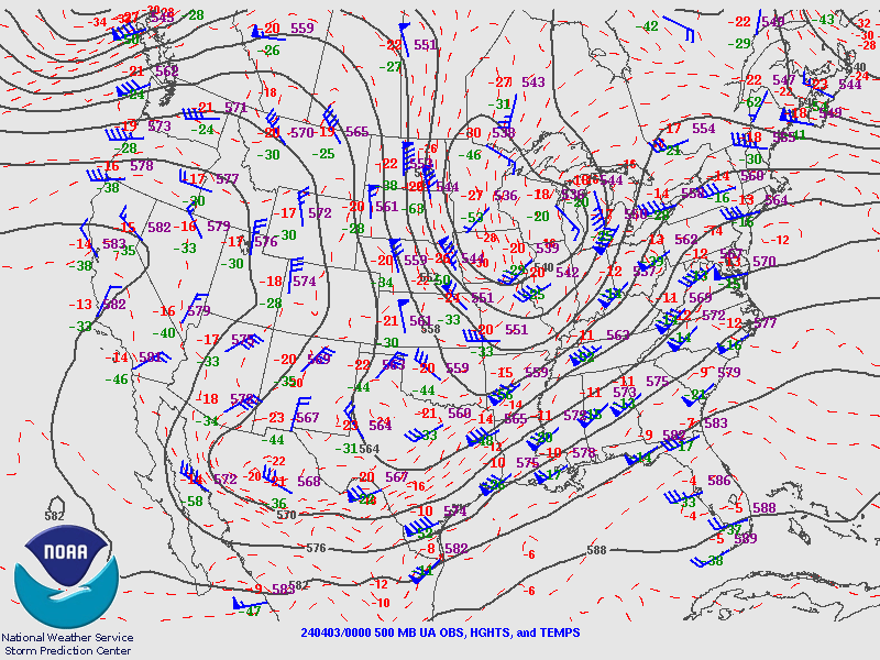
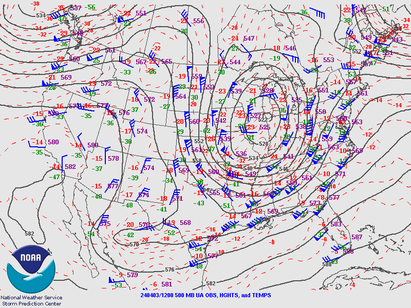
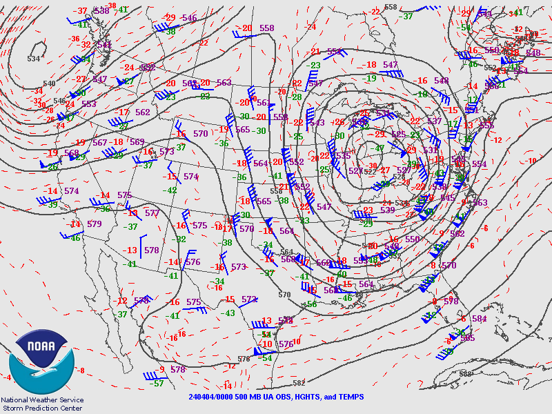
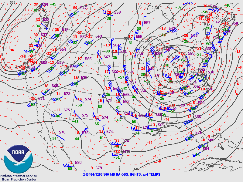
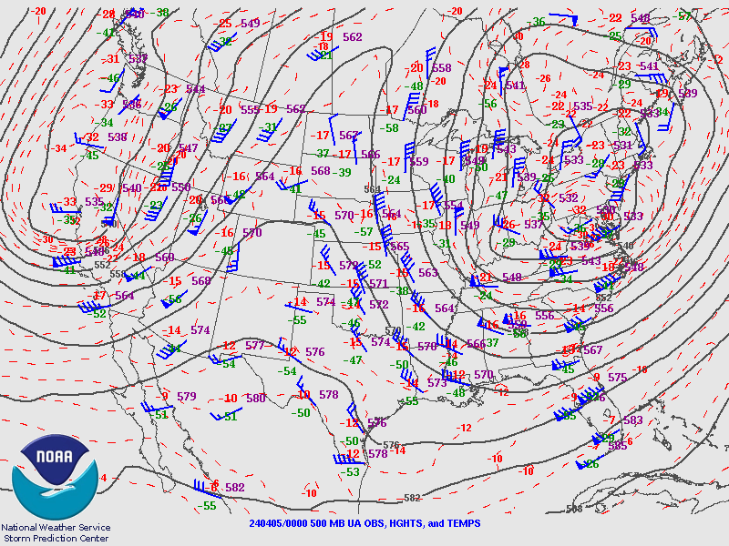
500 hPa Analysis
 |
 |
 |
| Valid 00z April 3, 2024 | Valid 12z April 3, 2024 | Valid 00z April 4, 2024 |
 |
 |
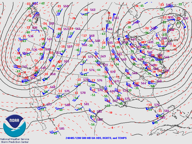 |
| Valid 12z April 4, 2024 | Valid 00z April 5, 2024 | Valid 12z April 5, 2024 |
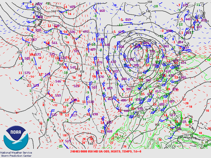
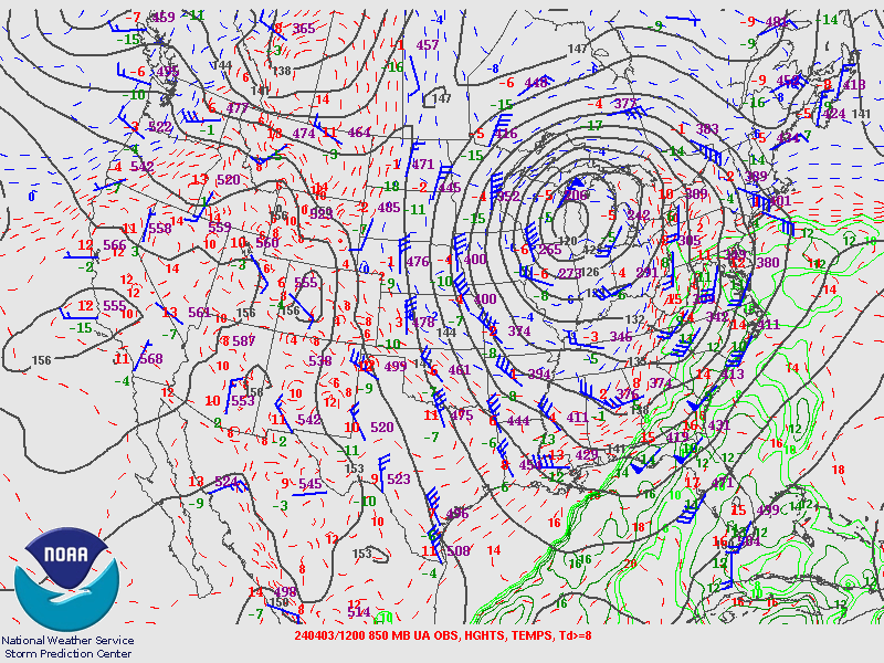
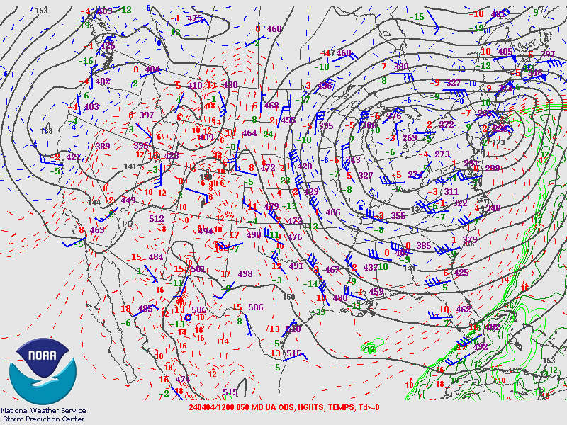
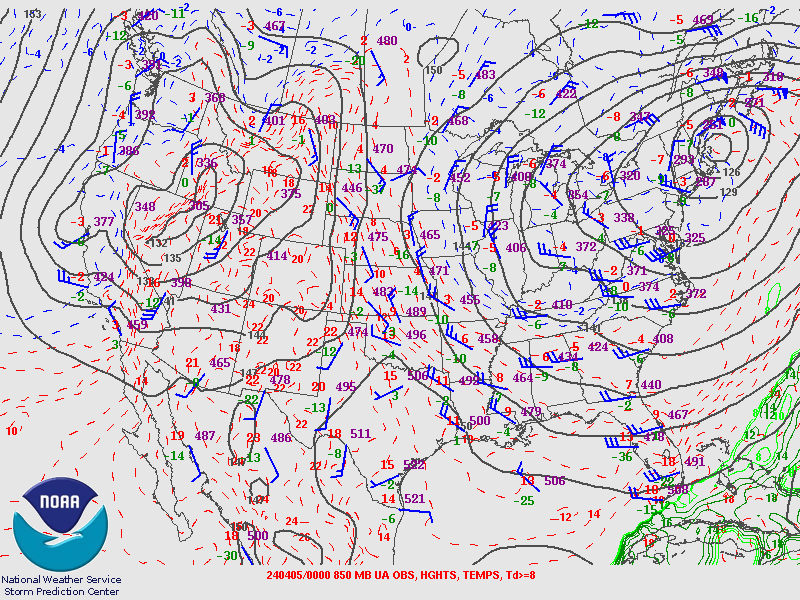
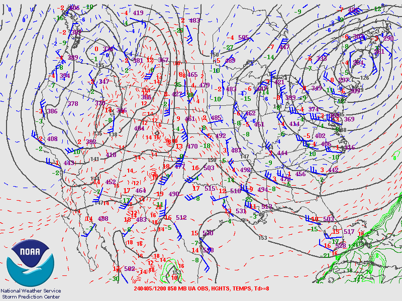
850 hPa Analysis
 |
 |
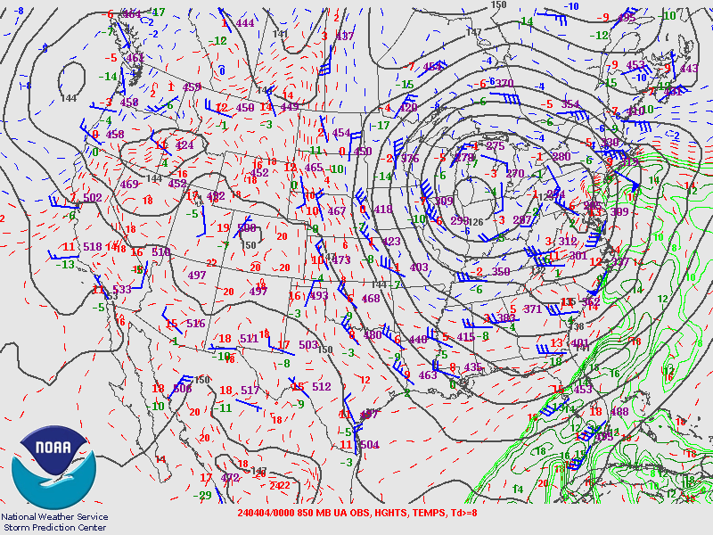 |
| Valid 00z April 3, 2024 | Valid 12z April 3, 2024 | Valid 00z April 4, 2024 |
 |
 |
 |
| Valid 12z April 4, 2024 | Valid 00z April 5, 2024 | Valid 12z April 5, 2024 |
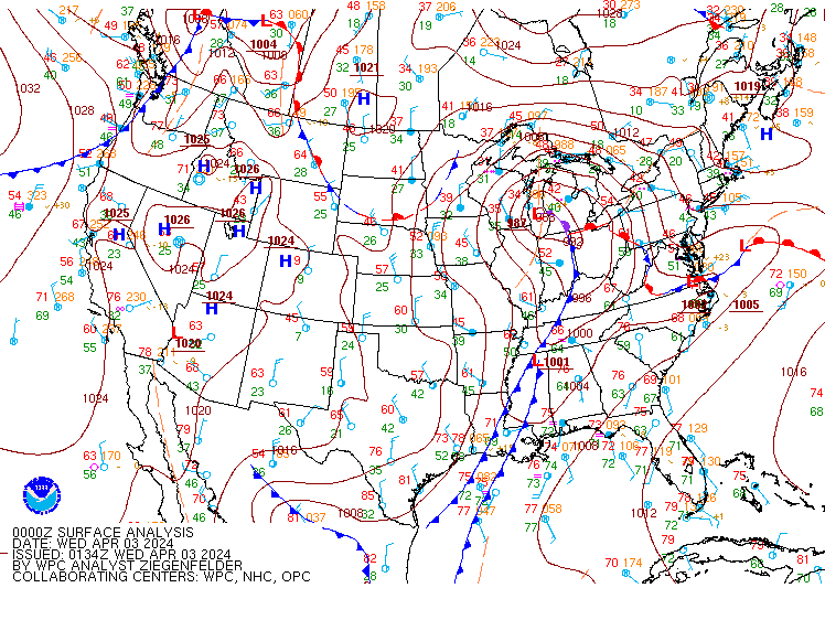
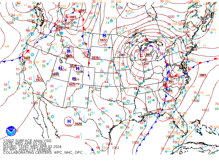
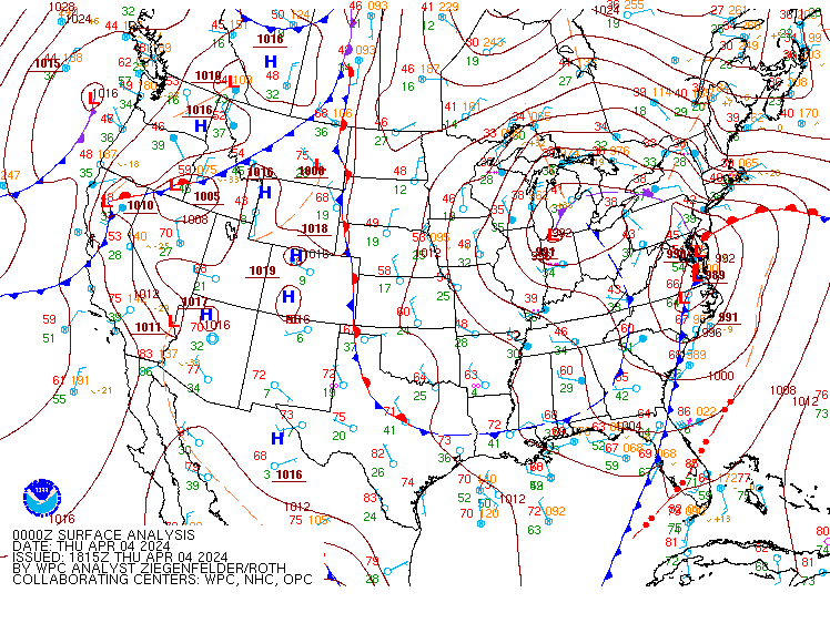
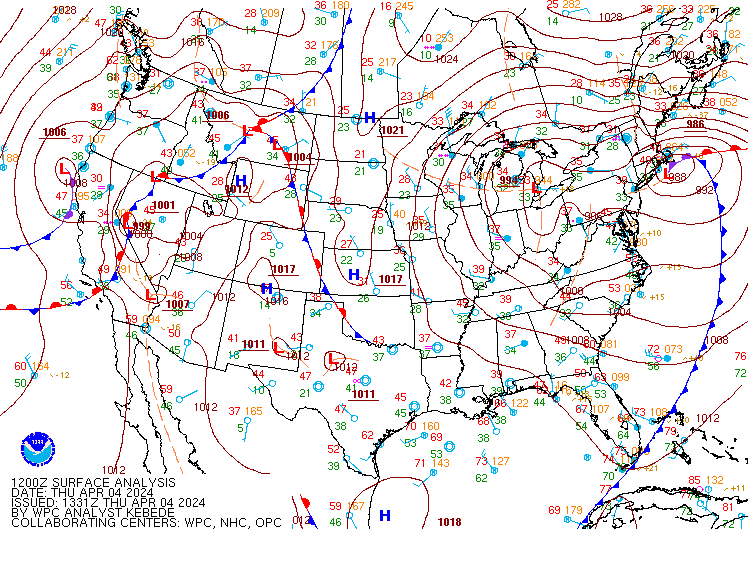
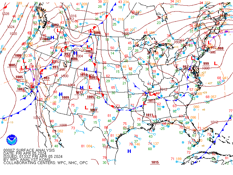
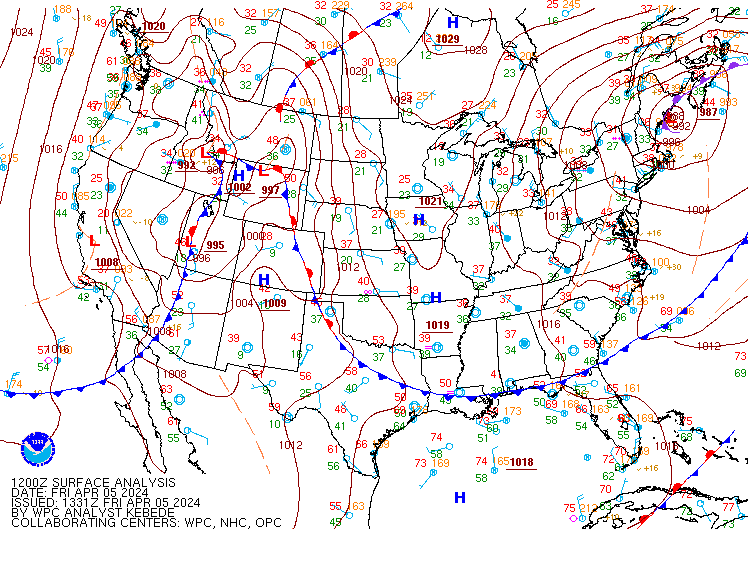
Surface Analysis
 |
 |
 |
| Valid 00z April 3, 2024 | Valid 12z April 3, 2024 | Valid 00z April 4, 2024 |
 |
 |
 |
| Valid 12z April 4, 2024 | Valid 00z April 5, 2024 | Valid 12z April 5, 2024 |
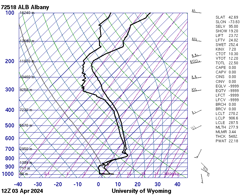
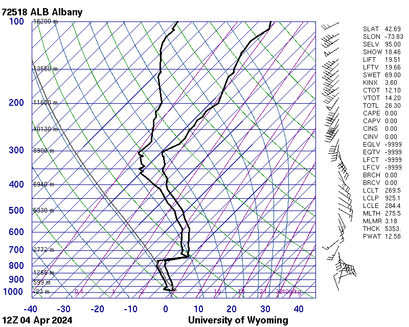
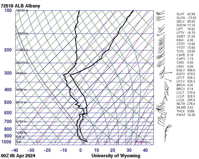
Upper Air Soundings
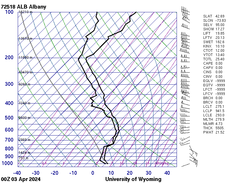 |
 |
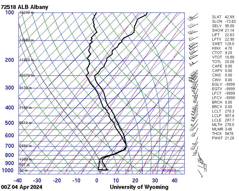 |
| Valid 00z April 3, 2024 (courtesy of University of Wyoming) | Valid 12z April 3, 2024 (courtesy of University of Wyoming) | Valid 00z April 4, 2024 (courtesy of University of Wyoming) |
 |
 |
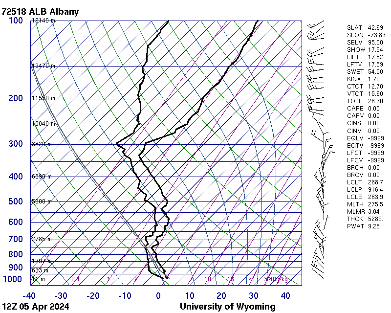 |
| Valid 12z April 4, 2024 (courtesy of University of Wyoming) | Valid 00z April 5, 2024 (courtesy of University of Wyoming) | Valid 12z April 5, 2024 (courtesy of University of Wyoming) |
 |
Media use of NWS Web News Stories is encouraged! Please acknowledge the NWS as the source of any news information accessed from this site. |
|

