
A storm system will track from the southern Plains to the Upper Midwest today. Severe thunderstorms are expected from east Texas into far southeast Iowa and Illinois. A strong tornado and damaging wind potential will exist from central Arkansas into central Missouri. Heavy to excessive rainfall from eastern Texas into the Midwest states may bring new or renewed areas of flooding. Read More >
Wakefield, VA
Weather Forecast Office
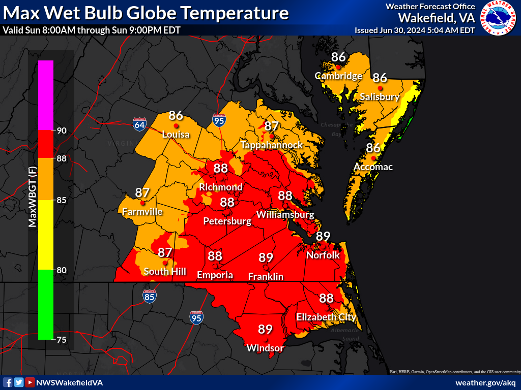
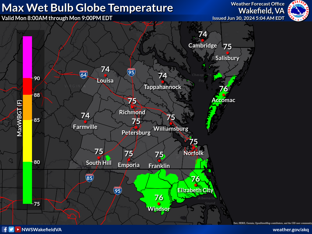
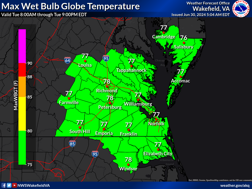
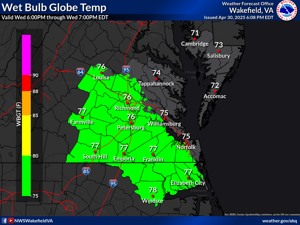
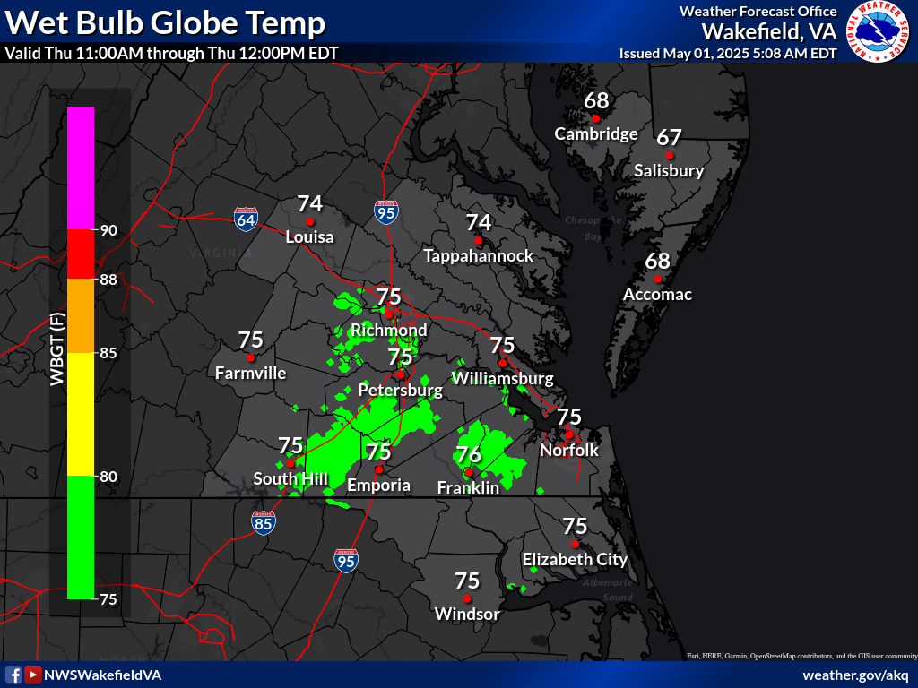
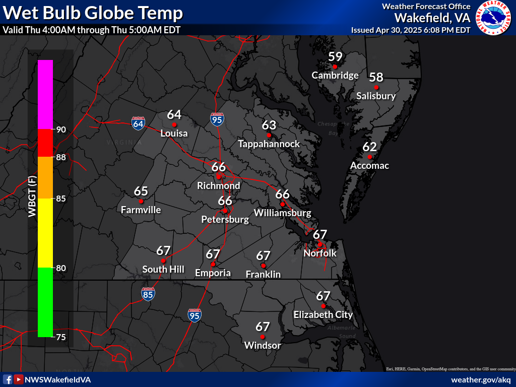
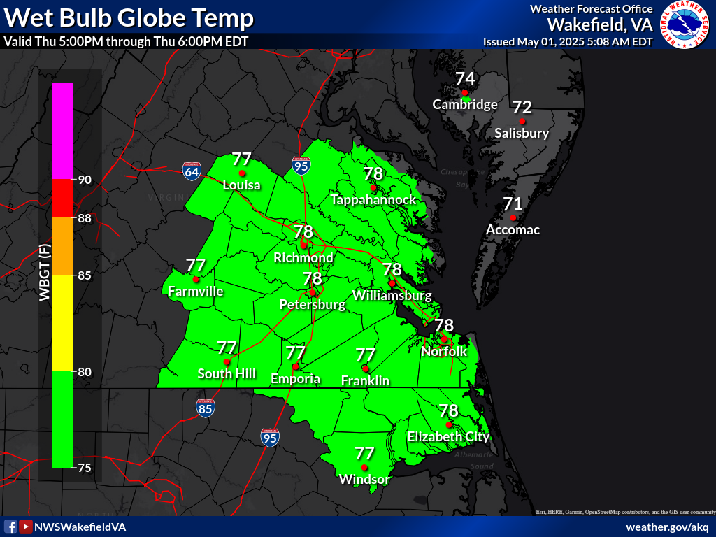
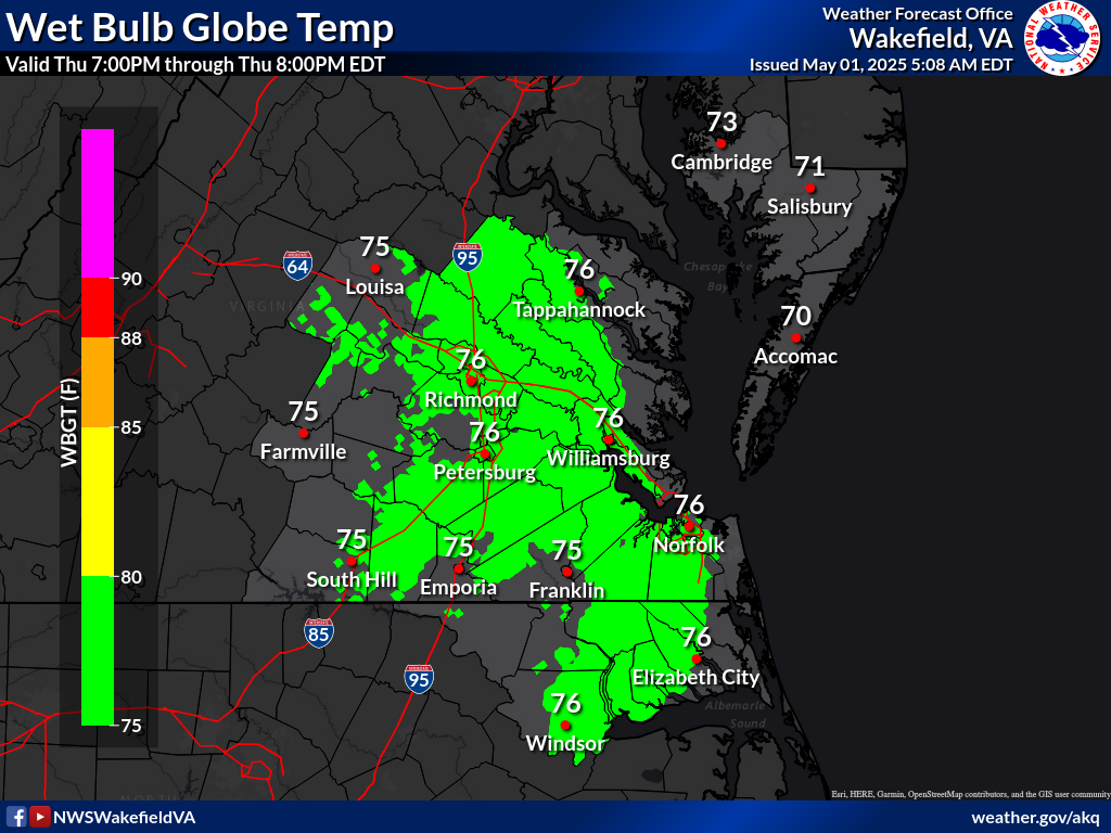
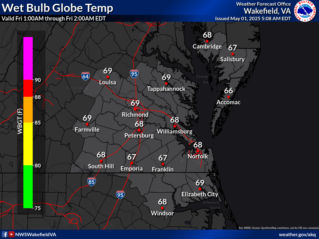
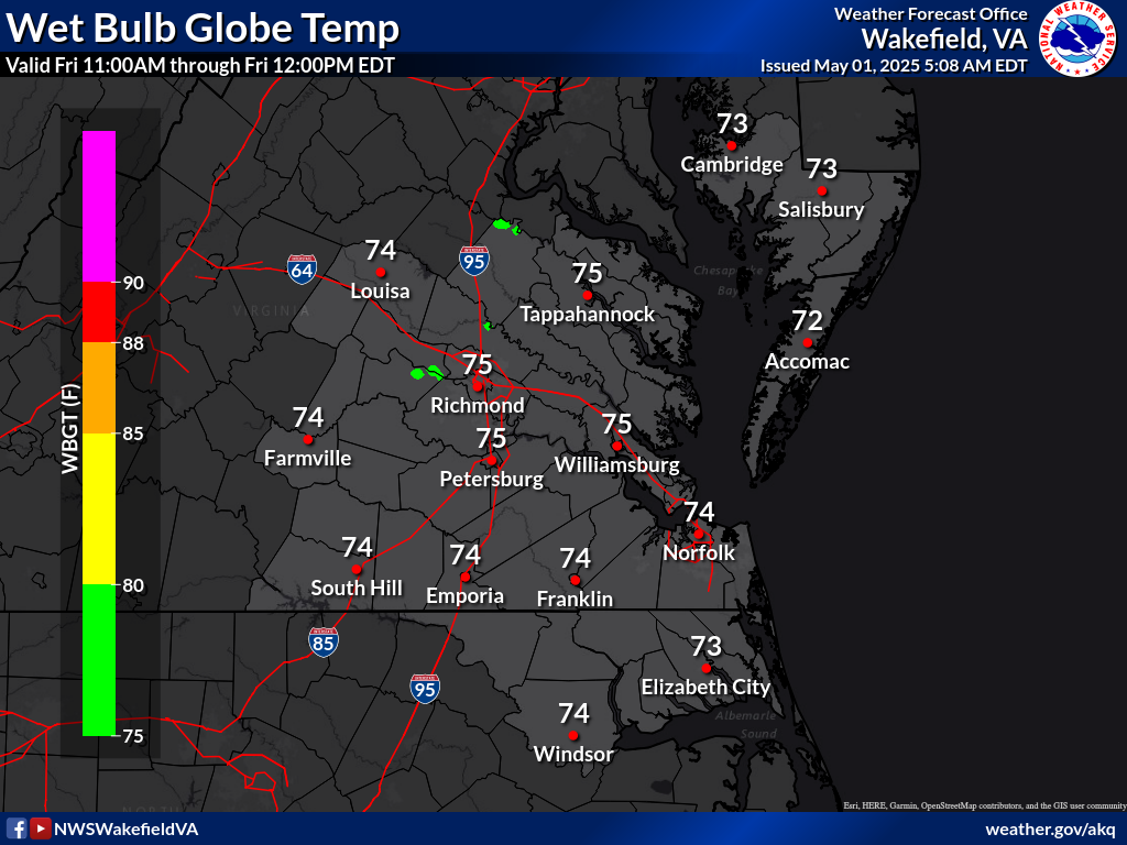
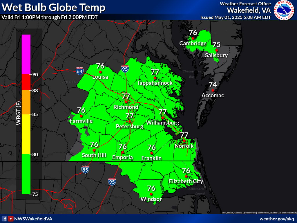
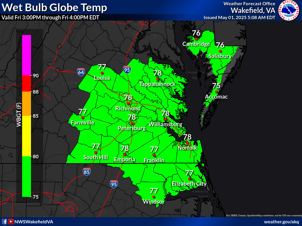
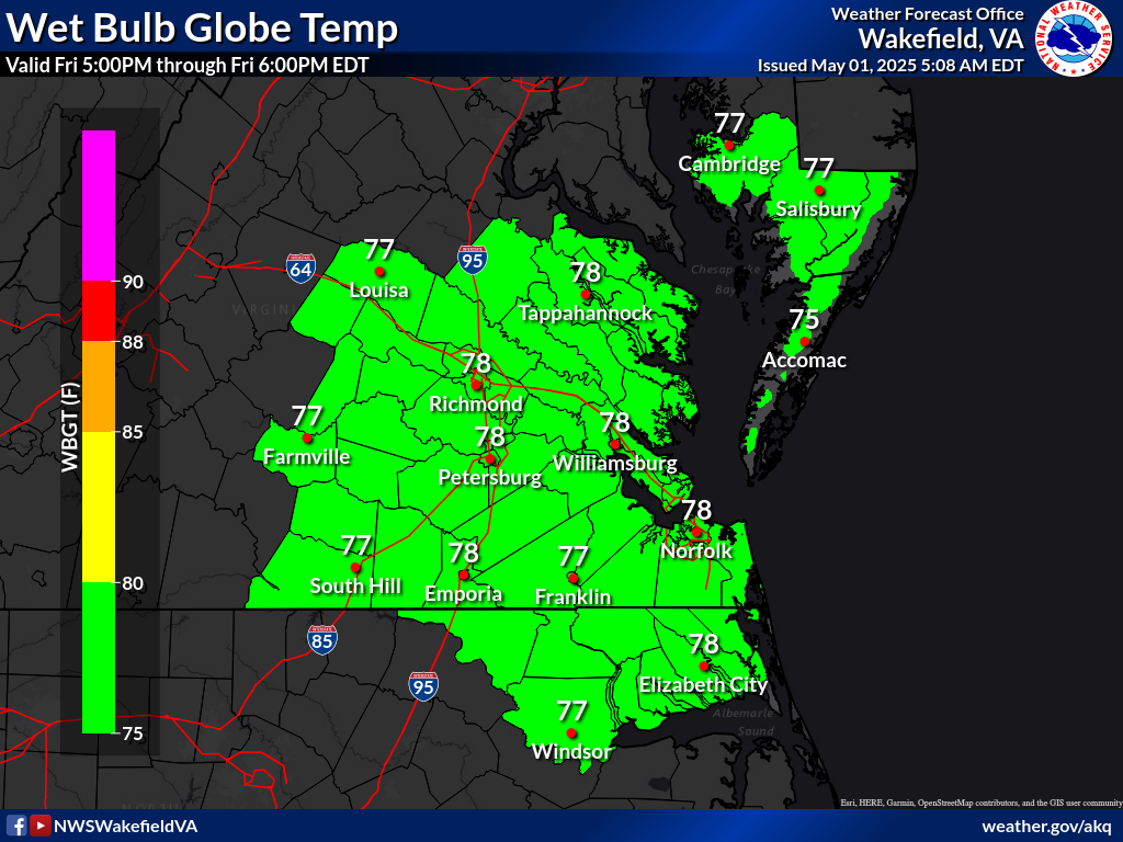
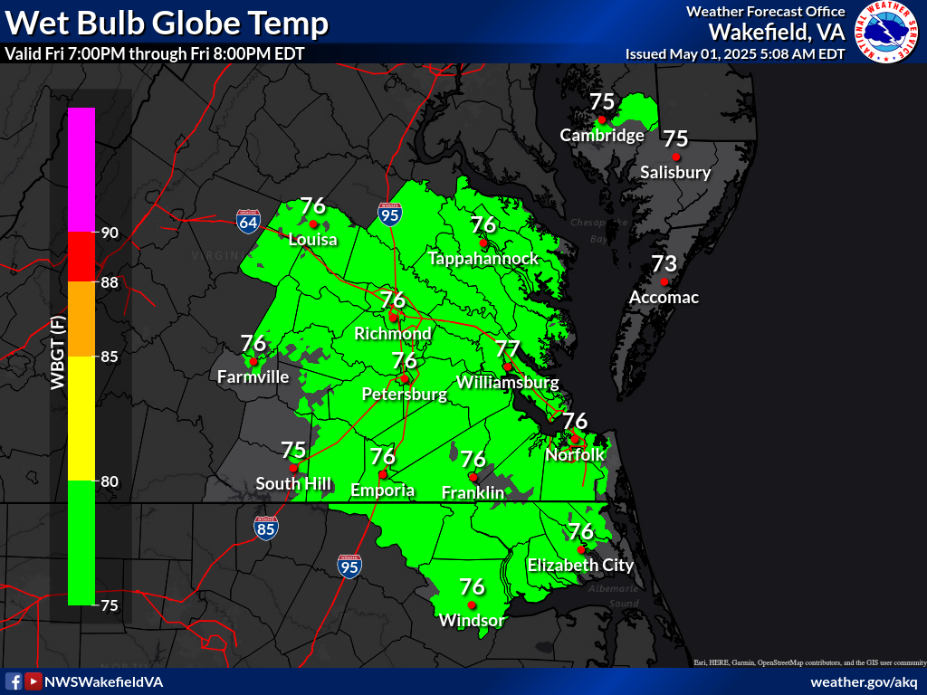
| Max Wet Bulb Globe Day 1 Click Image | Max Wet Bulb Globe Day 2 Click Image | Max Wet Bulb Globe Day 3 Click Image | Wet Bulb Globe Every 2Hrs Day 1 | |||||||||
 |
 |
 |
HR0 | HR2 | HR4 | HR6 | HR8 | HR10 | HR12 | |||
| HR14 | HR16 | HR18 | HR20 | HR22 | HR24 | HR26 | ||||||
| HR28 | HR30 | HR32 | HR34 | HR36 | HR38 | HR40 | ||||||
| HR42 | HR44 | HR46 | HR48 | |||||||||
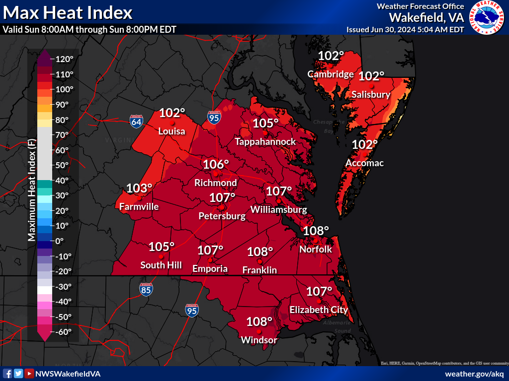
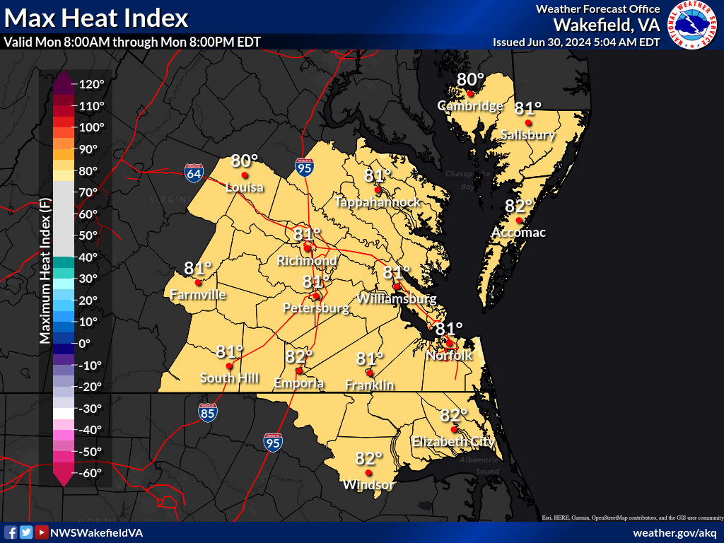
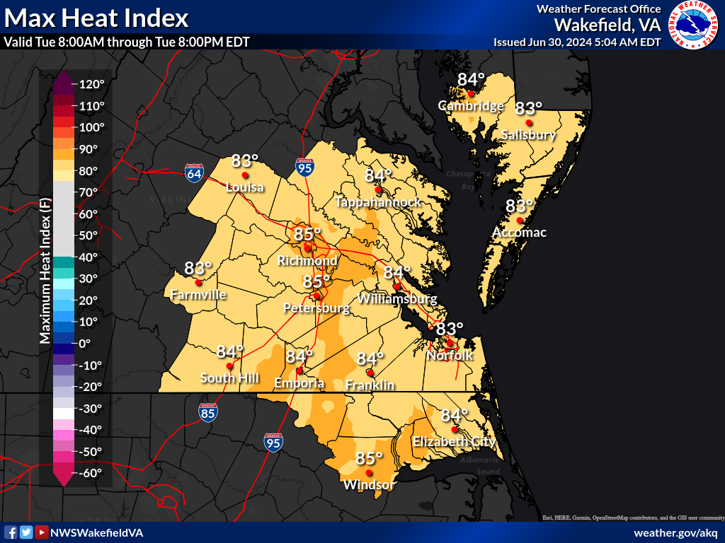
| Max Heat Index Day1 | Max Heat Index Day2 | Max Heat Index Day3 | IMPORTANT LINKS | |||||||||
 |
 |
 |
||||||||||


CURRENT CONDITIONS
MARINE OBSERVATIONS
EARTHQUAKE MONITOR
TIDES NEXT FEW DAYS
LAND OBSERVATIONS HOURLY
RIVER LEVEL SUMMARY
GIS MARINE REPORTS
FORECASTS
Zone Forecast
Marine Forecast
Fire Weather Forecast
Air Quality Forecast
River Level Forecast
Summer Rip Current Forecast
Graphical Rain Totals
Core TEXT Products
RSS/XML
MODEL-DATA
Local WRF Model
Statistical Models
NCEP Models
ENSO
Nearshore Wave Prediction System (NWPS)
Meso Analysis
SAFETY/EDUCATION
Awareness Weeks Messages
CoCoRAHS
SkyWarn
Storm Ready
Weather Ready Nation
Brochures
Safety
WindChill Chart
Heat Index
US Dept of Commerce
National Oceanic and Atmospheric Administration
National Weather Service
Wakefield, VA
10009 General Mahone Highway
Wakefield, VA 23888
757-899-4200
Comments? Questions? Please Contact Us.


 Coastal Flood
 Heat
Heat