Scattered strong to severe thunderstorms will persist over the central to southern High Plains this weekend with a severe weather and flash flooding threat. A late season storm will bring low elevation rain and high elevation snow to portions of California, Nevada and Oregon through the weekend. Winter Weather Advisories are in place for the Sierra for snow totals of 3-6", locally higher. Read More >
Wakefield, VA
Weather Forecast Office
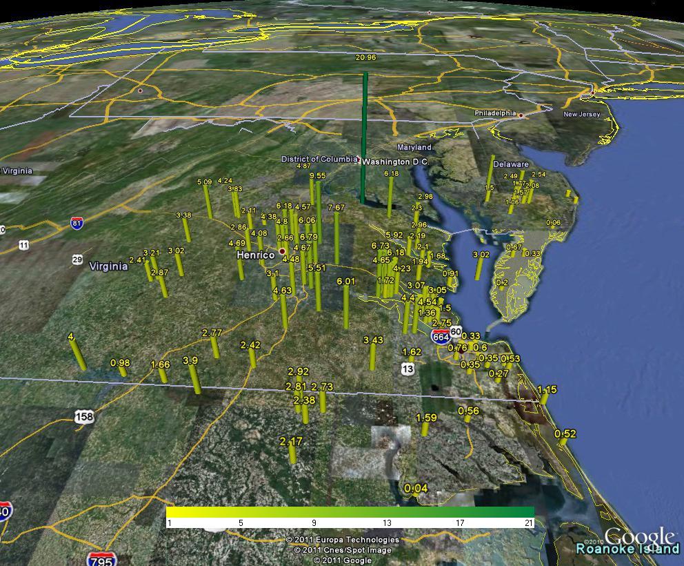
Rainfall Plot for several days for TS Lee.
The remnants of Tropical Storm Lee produced several days of rain over most of Wakefield's forecast area from the 5th to 9th of September. The heaviest rainfall was east of Interstate 95 with widespread 4 to 8 inch totals however amounts dropped off quickly near the coast. Heavy rates of rainfall on Wednesday and Thursday evenings produced flash flooding in some areas. On Thursday, twelve inches fell at Colonial Beach on the Potomac in Westmoreland County. Some roads were washed out in that area where a total of 20 inches fell during the week.
CURRENT CONDITIONS
MARINE OBSERVATIONS
EARTHQUAKE MONITOR
TIDES NEXT FEW DAYS
LAND OBSERVATIONS HOURLY
RIVER LEVEL SUMMARY
GIS MARINE REPORTS
FORECASTS
Zone Forecast
Marine Forecast
Fire Weather Forecast
Air Quality Forecast
River Level Forecast
Summer Rip Current Forecast
Graphical Rain Totals
Core TEXT Products
RSS/XML
MODEL-DATA
Statistical Models
NCEP Models
ENSO
Nearshore Wave Prediction System (NWPS)
Meso Analysis
Local WRF Model
SAFETY/EDUCATION
Awareness Weeks Messages
CoCoRAHS
SkyWarn
Storm Ready
Weather Ready Nation
Brochures
Safety
WindChill Chart
Heat Index
US Dept of Commerce
National Oceanic and Atmospheric Administration
National Weather Service
Wakefield, VA
10009 General Mahone Highway
Wakefield, VA 23888
757-899-4200
Comments? Questions? Please Contact Us.


 Coastal Flood
 Heat
Heat