
Thunderstorms, some severe, may produce heavy to excessive rainfall over portions of the Central/Southern Plains, Mississippi Valley and Southeast. Dry and windy conditions will pose an elevated fire weather risk over parts of western Florida. Read More >
Wakefield, VA
Weather Forecast Office
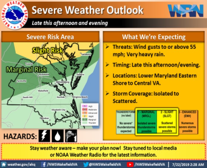
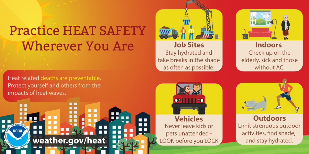
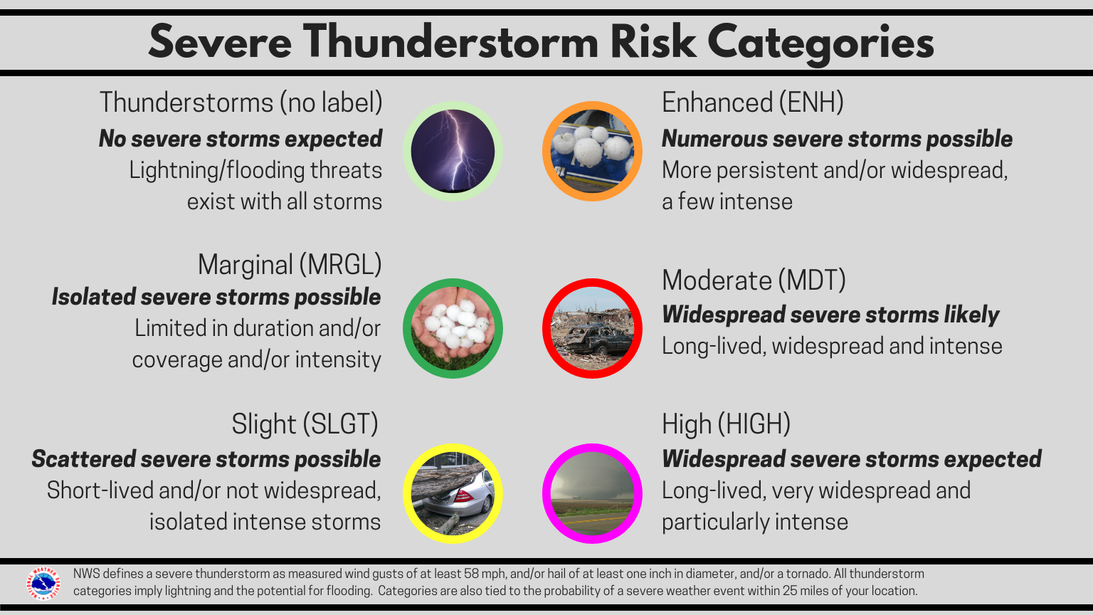
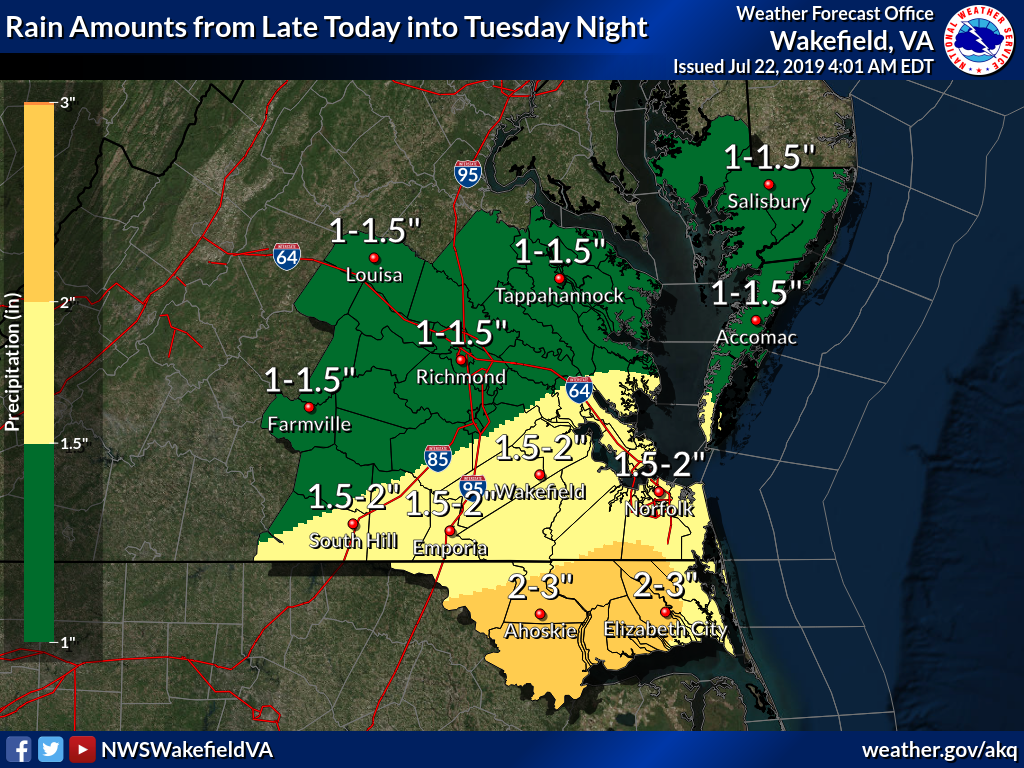
Hot and humid again today! Heat index readings will top out from 100 to 104° over the Piedmont to 104-109° I-95 on East to the coast this afternoon. Practice Heat Safety! Make sure to take plenty of breaks and drink plenty of water to avoid heat exhaustion or heat stroke. And never leave children or pets alone in vehicles for any period of time. Rain chances will increase beginning late today as a cold front crossing the area will bring the heatwave to an end Monday night and Tuesday. Isolated to scattered strong to severe thunderstorms are possible late this afternoon and evening. Locally heavy rain is possible late today into Tuesday night.
.png) |
 |
|
|
CURRENT CONDITIONS
LAND OBSERVATIONS HOURLY
RIVER LEVEL SUMMARY
GIS MARINE REPORTS
MARINE OBSERVATIONS
EARTHQUAKE MONITOR
TIDES NEXT FEW DAYS
FORECASTS
Zone Forecast
Marine Forecast
Fire Weather Forecast
Air Quality Forecast
River Level Forecast
Summer Rip Current Forecast
Graphical Rain Totals
Core TEXT Products
RSS/XML
MODEL-DATA
Nearshore Wave Prediction System (NWPS)
Meso Analysis
Local WRF Model
Statistical Models
NCEP Models
ENSO
SAFETY/EDUCATION
Awareness Weeks Messages
CoCoRAHS
SkyWarn
Storm Ready
Weather Ready Nation
Brochures
Safety
WindChill Chart
Heat Index
US Dept of Commerce
National Oceanic and Atmospheric Administration
National Weather Service
Wakefield, VA
10009 General Mahone Highway
Wakefield, VA 23888
757-899-4200
Comments? Questions? Please Contact Us.


 Coastal Flood
 Heat
Heat