
Thunderstorms, some severe, may produce heavy to excessive rainfall and isolated flooding over portions of the Southern Plains through Saturday. Widespread showers and thunderstorms will spread east into the Great Lakes, Ohio Valley, Mid Atlantic and Northeast. Dry conditions, combined with gusty winds will continue to support an elevated fire weather threat in the Desert Southwest. Read More >
Overview
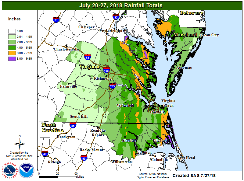
After a relatively quiet first half of July, it became quite active across the area as the large-scale weather pattern shifted. A 500hPa trough slowly dropped southeast as it amplified over the eastern third of the country from 7/19 to 7/21. The first wave of rain moved into eastern VA/MD/NC on the evening of the 20th as a potent shortwave quickly tracked northward along the east side of the trough. The rain lasted into the 21st before ending. While 1 to 4 inches of rain was observed (mainly along and east of Interstate 95), flooding was minor (at most) as the area had been relatively dry during the previous two weeks.
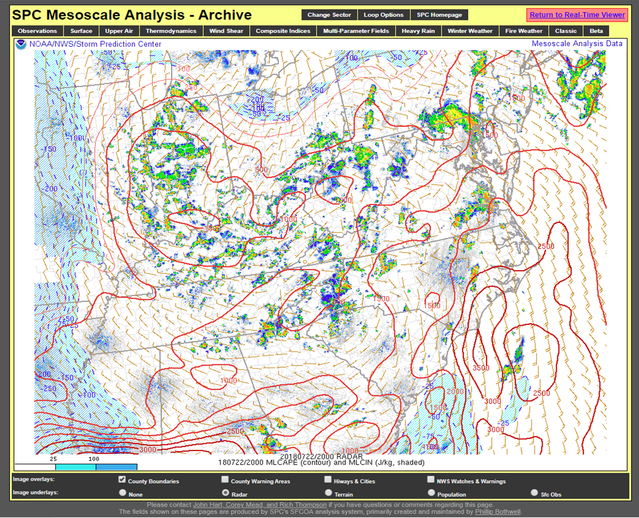
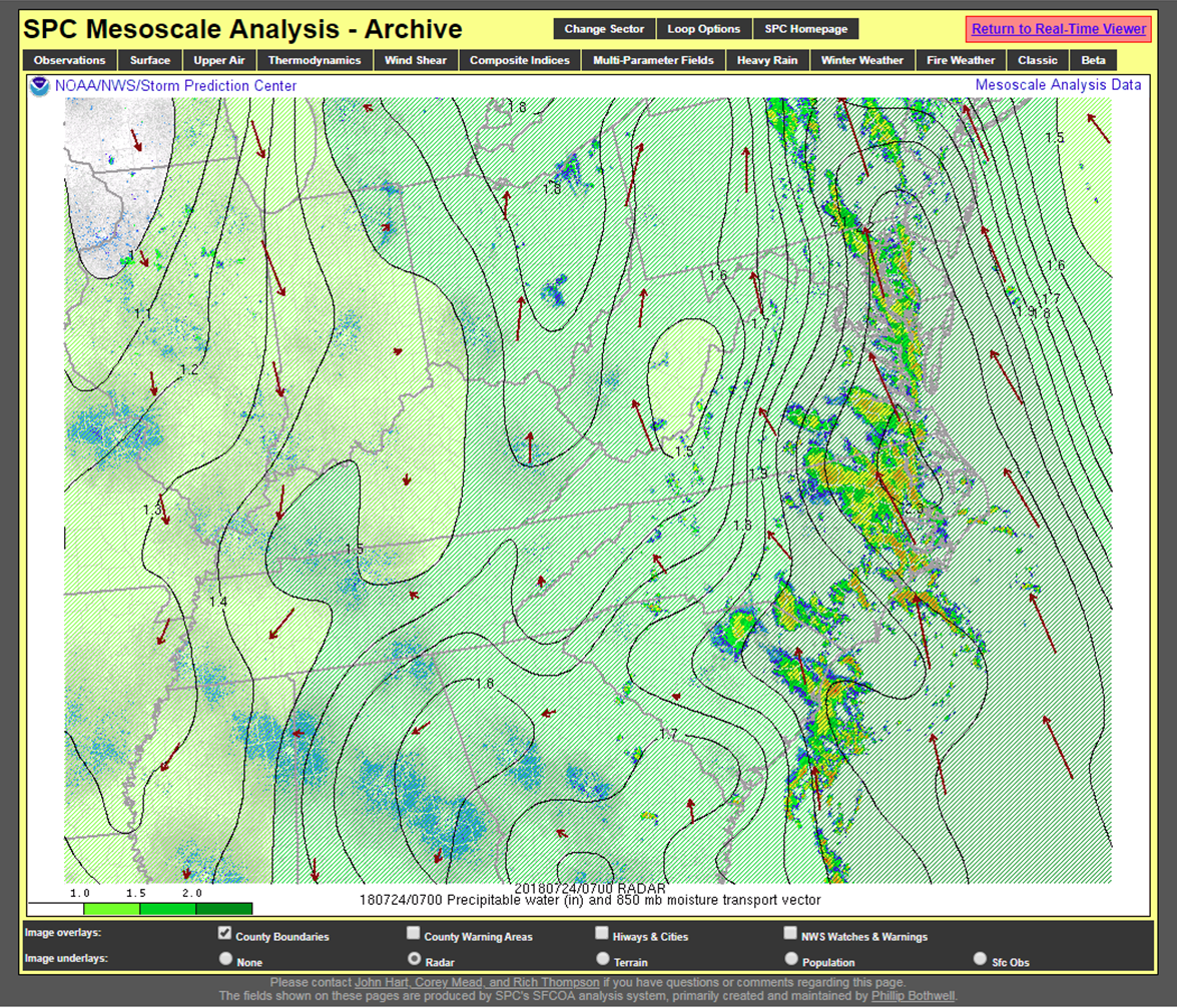
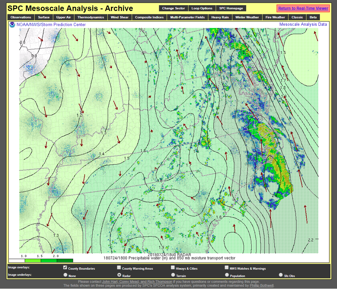
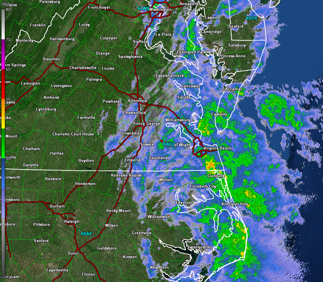
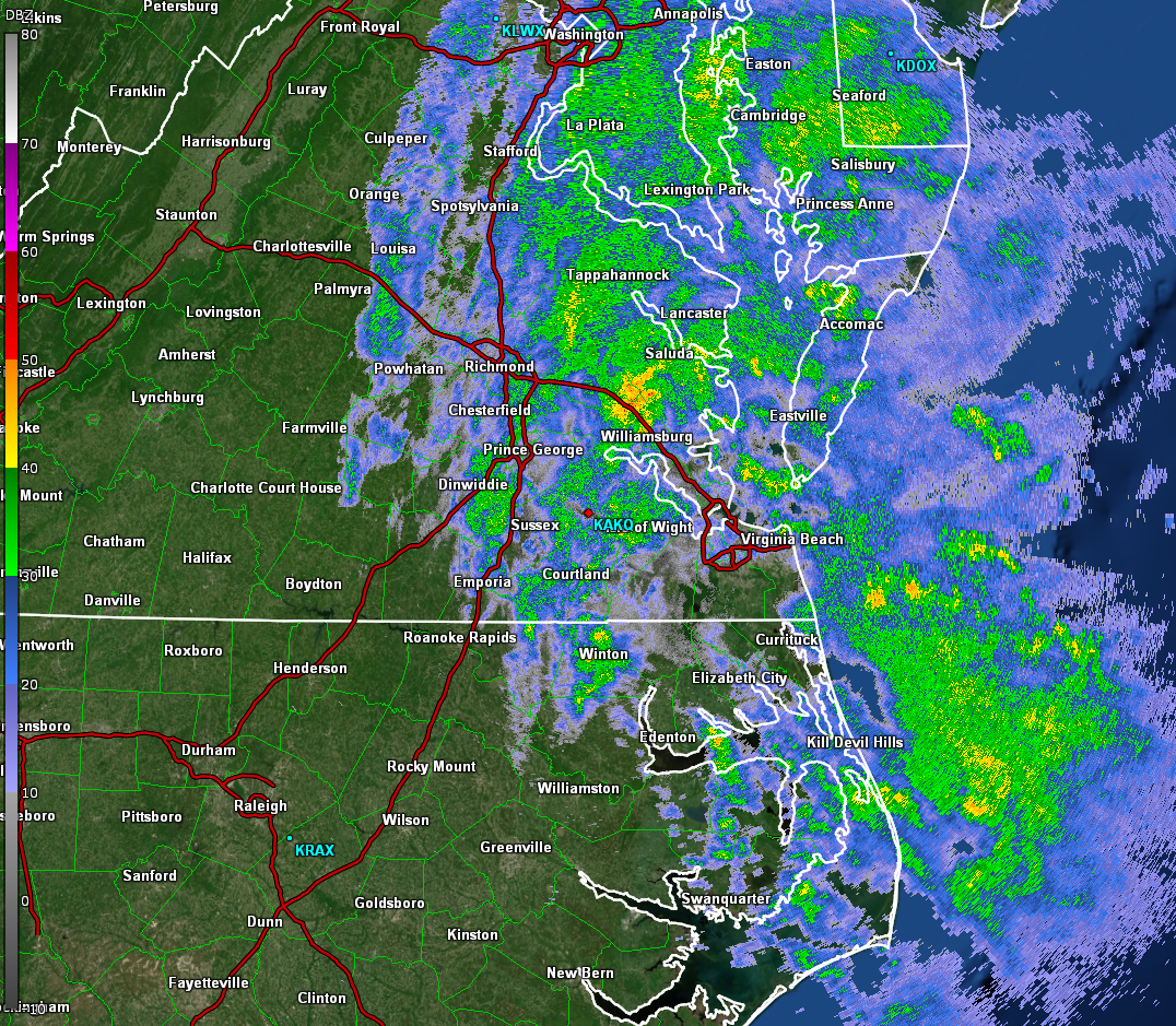
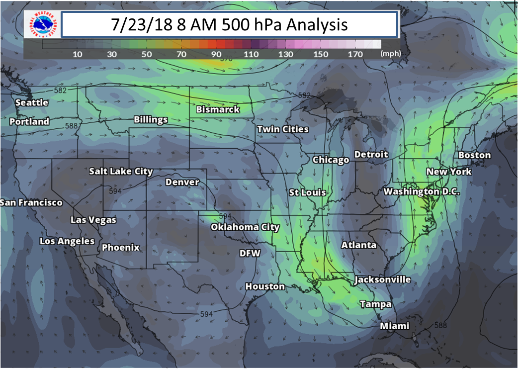
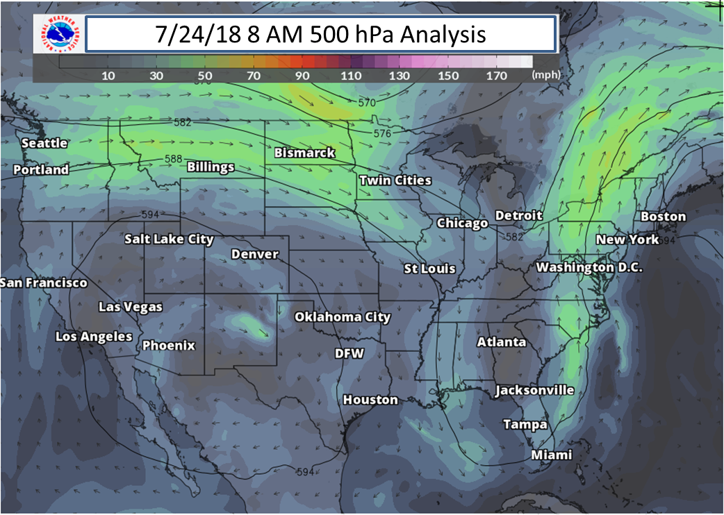
A front set up and was slowly moving northward on July 22nd. With MLCAPE values of 2000-3000 J/kg and 30 to 40 knot mid level flow, a cluster of thunderstorms (which downed a few trees) formed just north of the boundary Sunday afternoon. As they were relatively fast-moving, flooding was kept to a minimum. As the upper level trough amplified (and started to stall) Sunday night-Monday, the flow became (nearly) unidirectional out of the S/SSE on Mon/Tue. This allowed for tropical moisture to stream in from the south. PW values were between 2 and 2.3” throughout the event (~90th Percentile values for late July). Several bands of moderate to heavy rain to streamed northward from Sunday night through Wednesday. The stream of tropical moisture finally shifted offshore late Wednesday as the sfc-500hPa flow slowly veered to the SW.
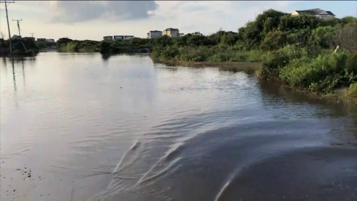
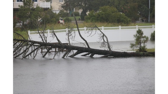
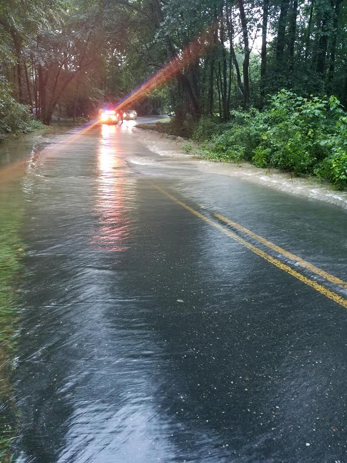
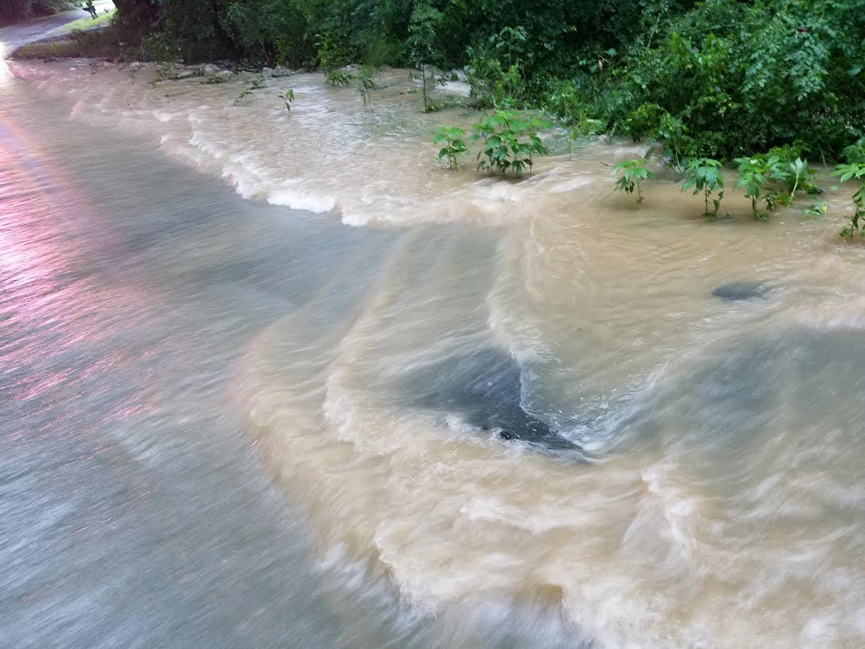
See the attached radar images for a more detailed timeline. While rainfall rates were mainly relatively modest (compared to the 4+"/hour observed at the Richmond ASOS on 6/22), the duration of the rain allowed for flooding to widespread areal flooding to occur over SE VA/NE NC. The Sandbridge, Back Bay, and Pungo sections of Virginia Beach County (in addition to Currituck County) were especially hard hit (where some roads were closed for multiple days). Areal Flood Warnings were in effect for the bulk of the period from Tuesday through Thursday morning for VA Beach/Currituck counties (where the most significant impacts were). Some flooding was observed in other parts of NE NC, the VA Northern Neck, and Dorchester County (MD). See photos for more information.
Radar
Add a written summary if needed.
Radar/Mesoanalysis
 |
 |
 |
 |
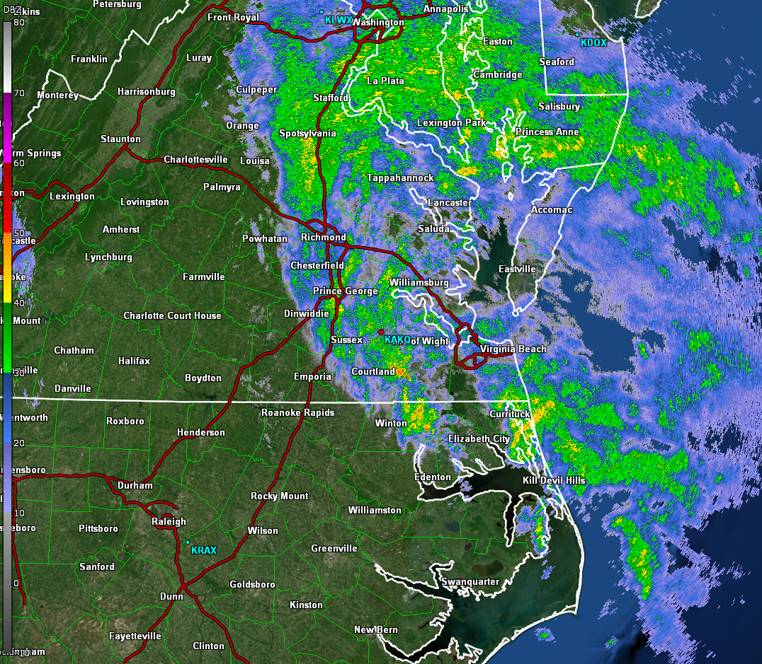
| 2 PM July 22, 2018 Radar/MLCAPE |
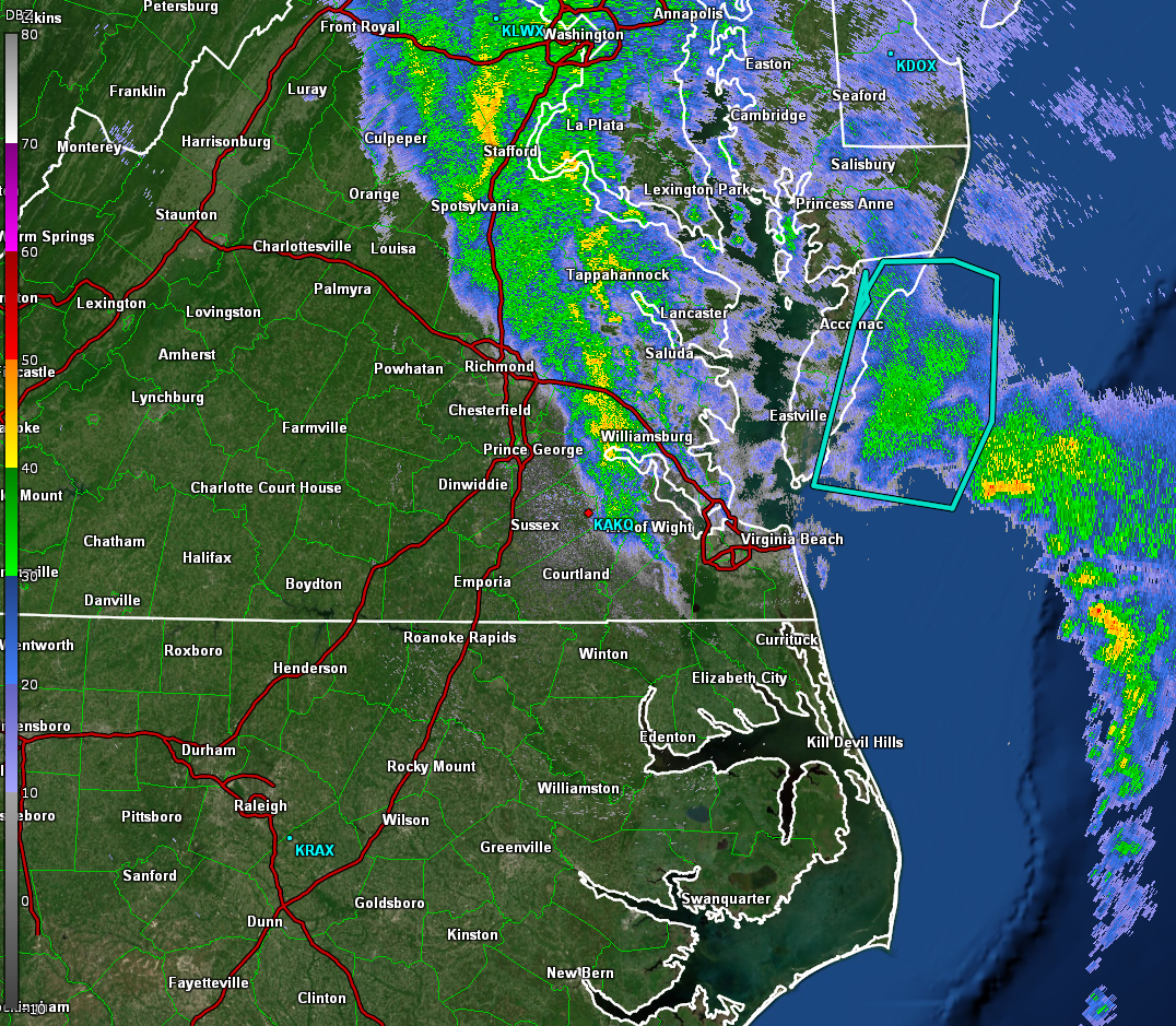
10 PM July 22, 2018 Radar/Precipitable Water |
3 AM July 24, 2018 Radar/Precipitable Water |
2 PM July 24, 2018 Radar/Precipitable Water |
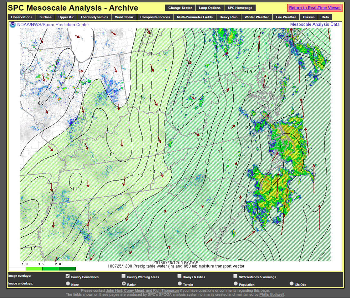 |
| 8 AM July 25, 2018 Radar/Precipitable Water |
Photos & Video:
Header
 |
 |
 |
 |
| Snake in a flooded area of the Pungo section of Virginia Beach (WAVY-TV) |
Flooded road in Sandbridge section of Virginia Beach (The Virginian Pilot) |
Flooding in Swan Beach in Currituck County, North Carolina (WTKR-TV) |
Flooding in Sandbridge neighborhood of Virginia Beach (WAVY-TV) |
 |
 |
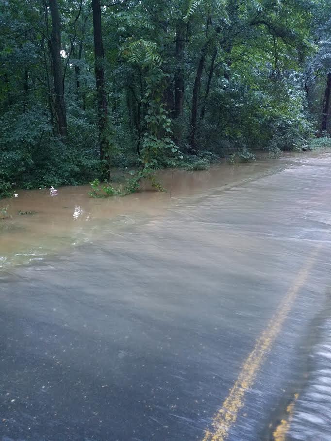 |
| July 25, 2018 Pine Top Road at Kelkris Ct (Dorchester Co., MD Emgcy. Mgmt.) |
July 25, 2018 Pine Top Road at Kelkris Ct (Dorchester Co., MD Emgcy. Mgmt.) |
July 25, 2018 Pine Top Road at Kelkris Ct (Dorchester Co., MD Emgcy. Mgmt.) |
Radar:
Radar Images from the July 21 Coastal Low Pressure System
 |
 |
 |
 |
| 8 AM July 21, 2018 Radar | 11 AM July 21, 2018 Radar | 2 PM July 21, 2018 Radar | 5 PM July 21, 2018 Radar |
Rain Reports
Public Information Statement
National Weather Service Wakefield VA
911 AM EDT Thu Jul 26 2018

...5-DAY STORM TOTAL RAINFALL REPORTS...

These observations are from a variety of data sources, and are unofficial.

Location                     Amount    Time/Date       Provider

...Maryland...

...Somerset County...
2 E Oriole                   4.57 in   0630 AM 07/26   COCORAHS

...North Carolina...

...Camden County...
1 SW Shiloh                  5.08 in   0819 AM 07/26   CWOP

...Currituck County...
Point Harbor                 11.25 in  0700 AM 07/26   COCORAHS

...Perquimans County...
1 SW Burgess                 5.19 in   0700 AM 07/26   COCORAHS
2 WNW Jacocks                4.91 in   0813 AM 07/26   CWOP

...Virginia...

...Caroline County...
2 N Rappahannock Academy     4.46 in   0726 AM 07/26   RAWS
1 SSW Fort A.p. Hill         4.24 in   0733 AM 07/26   RAWS

...City of Virginia Beach County...
1 SSW Back Bay               5.66 in   0816 AM 07/26   CWOP
1 NNW Sigma                  5.46 in   0815 AM 07/26   CWOP

...Essex County...
2 NNE Dunnsville             5.88 in   0818 AM 07/26   CWOP

...Gloucester County...
2 ENE Ark                    4.51 in   0700 AM 07/26   COCORAHS

...Hanover County...
Hewlett                      5.38 in   0700 AM 07/26   COCORAHS

...James City County...
York River State Park        4.61 in   0730 AM 07/26   NERRS
1 WNW Lightfoot              4.54 in   0816 AM 07/26   CWOP

...Mathews County...
Port Haywood                 4.02 in   0700 AM 07/26   COCORAHS

...Middlesex County...
Stampers                     4.78 in   0700 AM 07/26   COCORAHS
1 N Remlik                   4.68 in   0820 AM 07/26   CWOP

...Northumberland County...
2 E Howland                  5.03 in   0654 AM 07/26   COCORAHS

...Richmond County...
1 NNE Kennard                5.56 in   0802 AM 07/26   AWS

...York County...
Skimino                      4.48 in   0700 AM 07/26   COCORAHS
&&

Observations are collected from a variety of sources with varying
equipment and exposures. We thank all volunteer weather observers
for their dedication. Not all data listed are considered official.

$$
Synoptic Environment
500 hPa Analysis:
 |
 |
 |
| 8 AM July 23, 2018 500 hPa Heights and Winds |
8 AM July 24, 2018 500 hPa Heights and Winds |
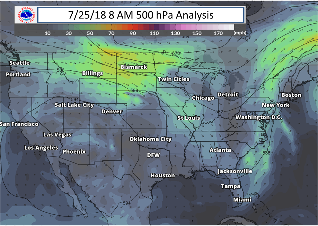
8 AM July 25, 2018 500 hPa Heights and Winds |
700 hPa Analysis:
 |
 |
 |
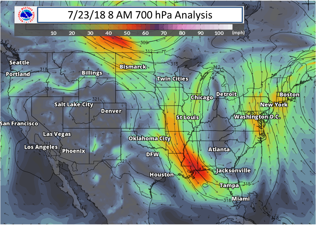
| 8 AM July 23, 2018 700 hPa Heights and Winds |
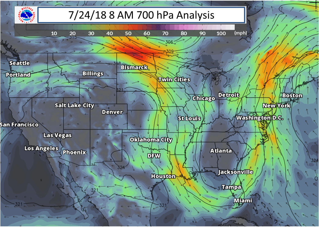
8 AM July 24, 2018 700 hPa Heights and Winds |
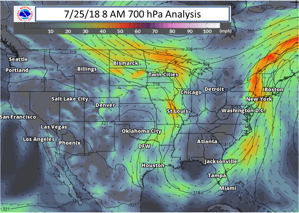
8 AM July 25, 2018 700 hPa Heights and Winds |
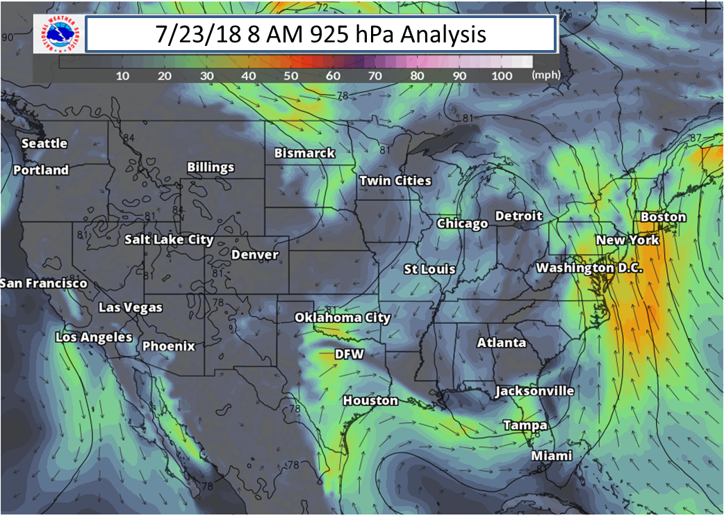
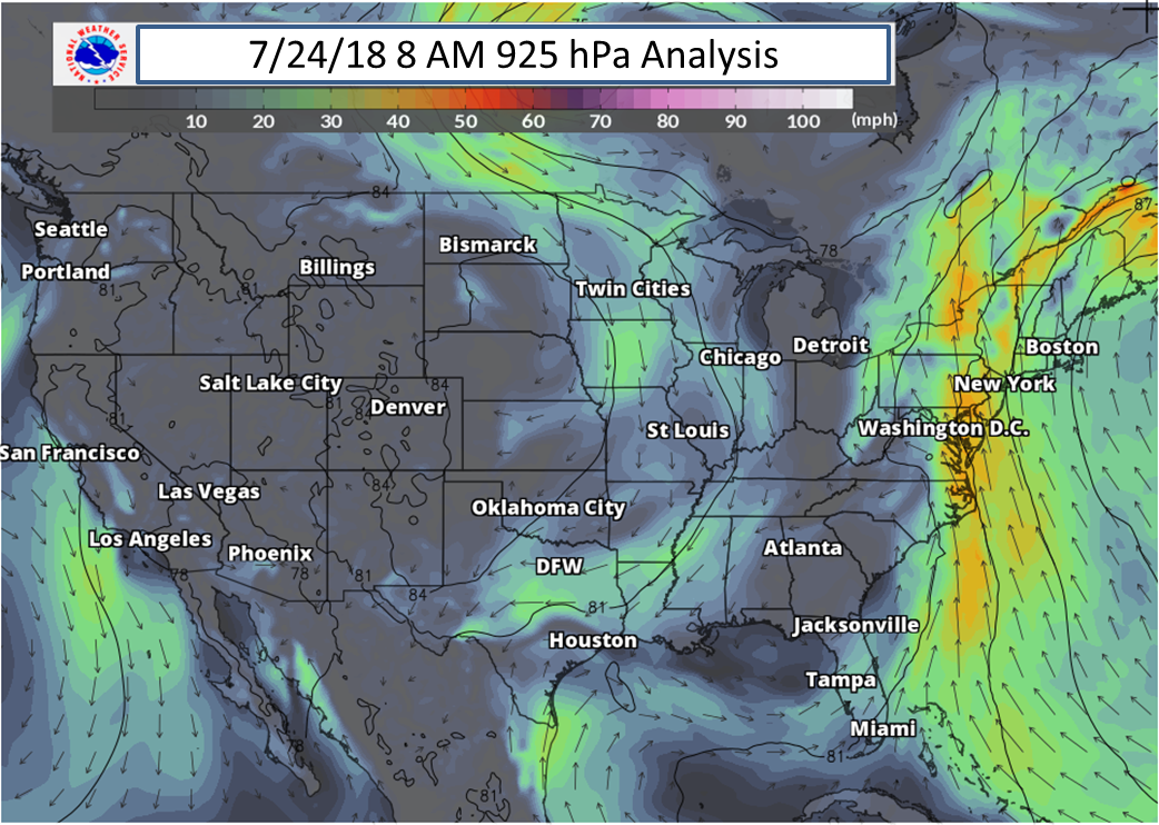
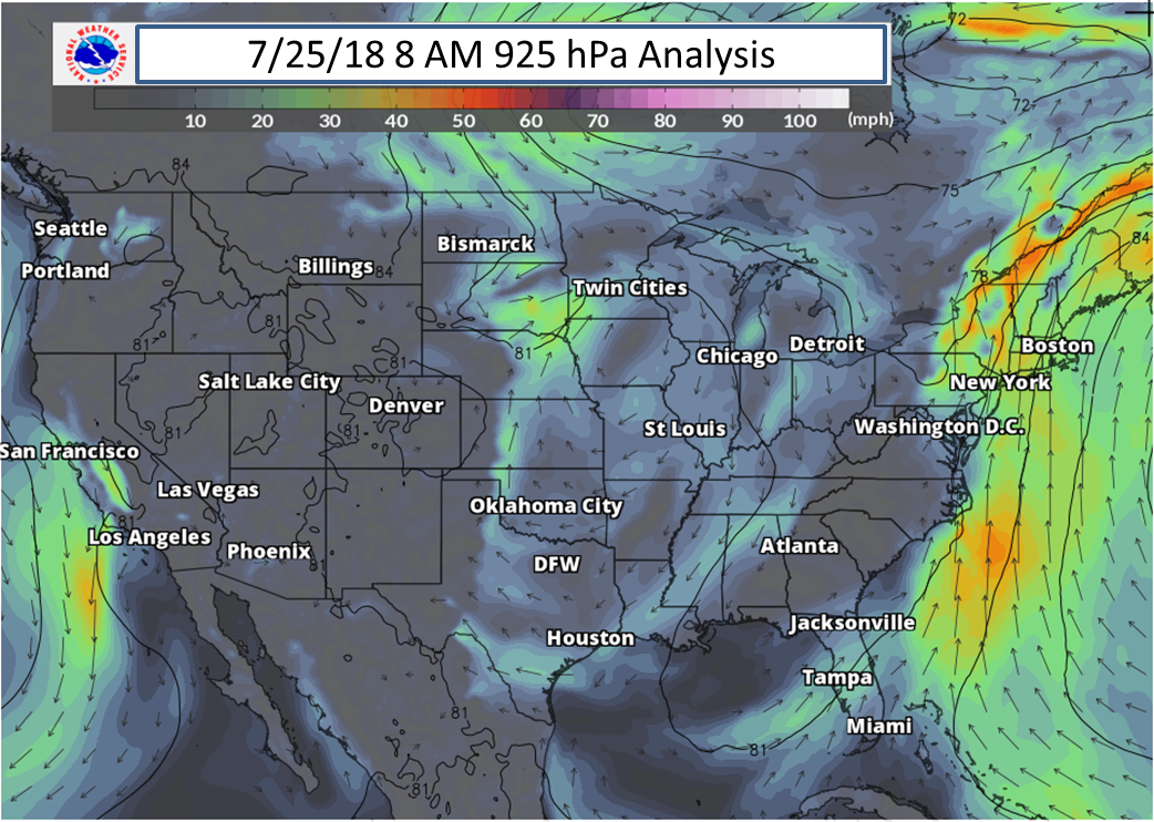
925 hPa Analysis:
 |
 |
 |
| 8 AM July 23, 2018 925 hPa Heights and Winds |
8 AM July 24, 2018 925 hPa Heights and Winds |
8 AM July 25, 2018 925 hPa Heights and Winds |
 |
Media use of NWS Web News Stories is encouraged! Please acknowledge the NWS as the source of any news information accessed from this site. |
|


 Coastal Flood
 Heat
Heat