Overview
A waterspout touched down in the Chesapeake Bay just west of Smith Island just before 7:20 PM on 8/4. The waterspout came ashore and tracked across the western and northern portion of Smith Island as a high-end EF-1 tornado, causing significant damage to a bed and breakfast and several other structures. There were no fatalities, but a resident of a mobile home was injured.
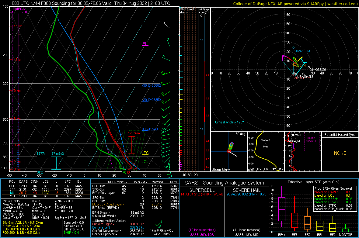
Meteorologically speaking, this was an extremely unusual setup for a tornado with winds in excess of 100 mph to occur. While LCLs were low (temperatures were in the mid-upper 80s with low 80s dew points), several other environmental parameters did not seem favorable for tornadoes. With weak wind fields throughout the atmospheric profile, effective SRH values were no higher than 60 m2/s2. However, there was a decent amount of veering from the surface to 1-2 km AGL (see wind profiler data in Environment section). There was plenty of instability present given the low 80s dew points. While we often look for localized backing in the surface wind field to identify areas that may see enhanced SRH, this was not present in this case (S-SSW winds at Tangier Sound Light right before the tornado hit Smith Island). The cell that went on to produce the tornado split into a left mover and right mover. Perhaps the most unusual aspect of this case is that the right mover quickly dissipated and the left mover not only produced a tornado, but one that was more than just a quick spin-up. In addition, despite the fact that the storm was a left mover, video showed that the tornado had cyclonic rotation. The storm also had a peak rotational velocity of around 10 knots, which made it exceptionally difficult to see on radar. The most likely reason for this is that nearly all of the rotation (and tornado) occurred below the radar beam (~5000 feet AGL from KDOX and out of range from TADW). With classic supercells, there is a deep mesocyclone present with rotation visible with radar that is often above 10000 feet AGL.
Tornadoes:
|
Tornado - Smith Island
Track Map  
|
||||||||||||||||
The Enhanced Fujita (EF) Scale classifies tornadoes into the following categories:
| EF0 Weak 65-85 mph |
EF1 Moderate 86-110 mph |
EF2 Significant 111-135 mph |
EF3 Severe 136-165 mph |
EF4 Extreme 166-200 mph |
EF5 Catastrophic 200+ mph |
 |
|||||
Photos
Selected Photos from Smith Island
 |
 |
 |
| Significant Damage to Bed and Breakfast | Significant Damage to Mobile Home | Significant Damage to Block Building |
Radar
KDOX Radar Loop
 |
| Radar Loop of 0.5° Reflectivity (left) and Storm Relative Velocity (right) from 7:11 to 7:33 PM in ~3 minute increments |
Environment
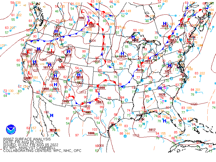
Synoptic summary.
 |
 |
 |
| 18z/2 PM WPC Surface Analysis | 00z/8 PM WPC Surface Analysis | 00z/8 PM 500mb Analysis |
Near-storm environment soundings.
 |
 |
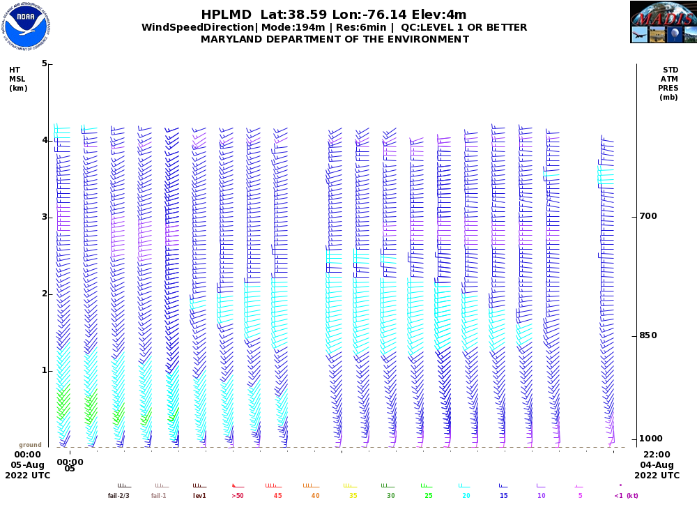 |
| 00z/8 PM KWAL Observed Sounding | 21z/5 PM NAM 3 hr Forecast Sounding for near Smith Island | 22z-00z/6-8 PM Profiler Data from Horn Point (near Cambridge, MD) |
 |
Media use of NWS Web News Stories is encouraged! Please acknowledge the NWS as the source of any news information accessed from this site. |
|


 Coastal Flood
 Heat
Heat