
Scattered strong to severe thunderstorms will persist over the central to southern High Plains this weekend with a severe weather and flash flooding threat. A late season storm will bring low elevation rain and high elevation snow to portions of California, Nevada and Oregon through the weekend. Winter Weather Advisories are in place for the Sierra for snow totals of 3-6", locally higher. Read More >
Overview
Summer like weather prevailed through much of Tuesday (5/4), as temperatures soared to around 90°F by the middle of the afternoon (with dew points in the upper 60s to around 70 degrees). However, as this was happening, the stage was being set for a high end severe wind event across portions of the AKQ CWA. During the morning hours on 5/4, a mid-level shortwave/remnant MCV tracked from the TN Valley ENE to the Appalachians. The cold front (along with the other main synoptic scale features) remained well to our north and west through the duration of the event. The 12z (morning) sounding from Blacksburg, VA (RNK) showed an elevated mixed layer in the 700-500 mb layer (and therefore very steep mid level lapse rates). This is quite rare to see in the Mid-Atlantic. These steep mid-level lapse rates overspread the area during the day. By afternoon, the aforementioned shortwave/remnant MCV tracked from the mountains of SW VA to the central VA Piedmont. This along with weak convergence from lee troughing was enough for convective initiation to occur by 2-3 PM to our west. By this time, the environment was characterized by moderate instability (1000-1500 J/kg of MLCAPE), modest 0-6 km shear, but 50-55 knots of (850-250 mb) shear. This coupled with strong surface heating provided an environment favorable for severe winds. This is exactly what happened as a broken line of thunderstorms tracked from WSW-ENE across the local area. While the severe weather was forecast (especially closer to the event), the clusters of 70-90 mph wind gusts in Louisa/Fluvanna and Lancaster Counties were surprising. In fact, the Louisa County airport manager reported a peak wind gust of 89 MPH as measured by the Louisa AWOS (KLKU). This is unofficially the highest thunderstorm wind gust ever recorded at an ASOS/AWOS in the AKQ CWA since the office opened. It becomes official once entered in Storm Data.Photos
Selected Storm Damage Photos
 |
 |
 |
 |
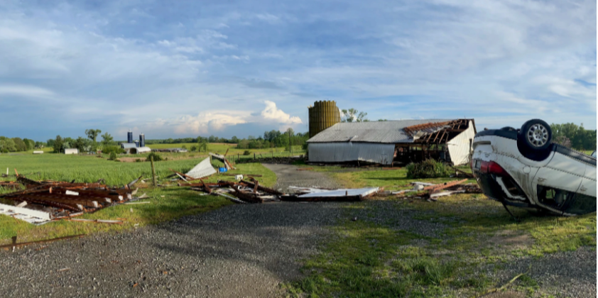
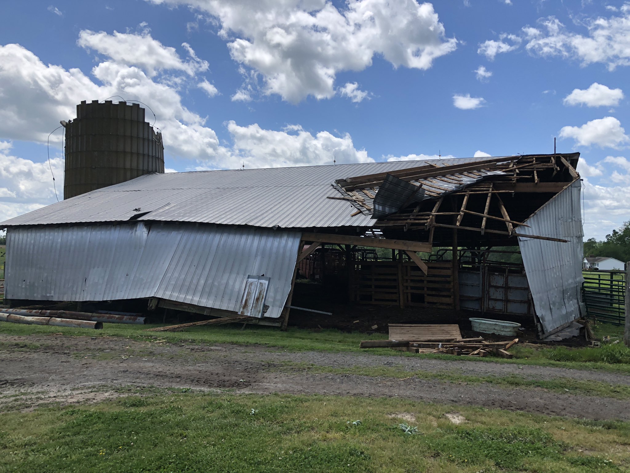
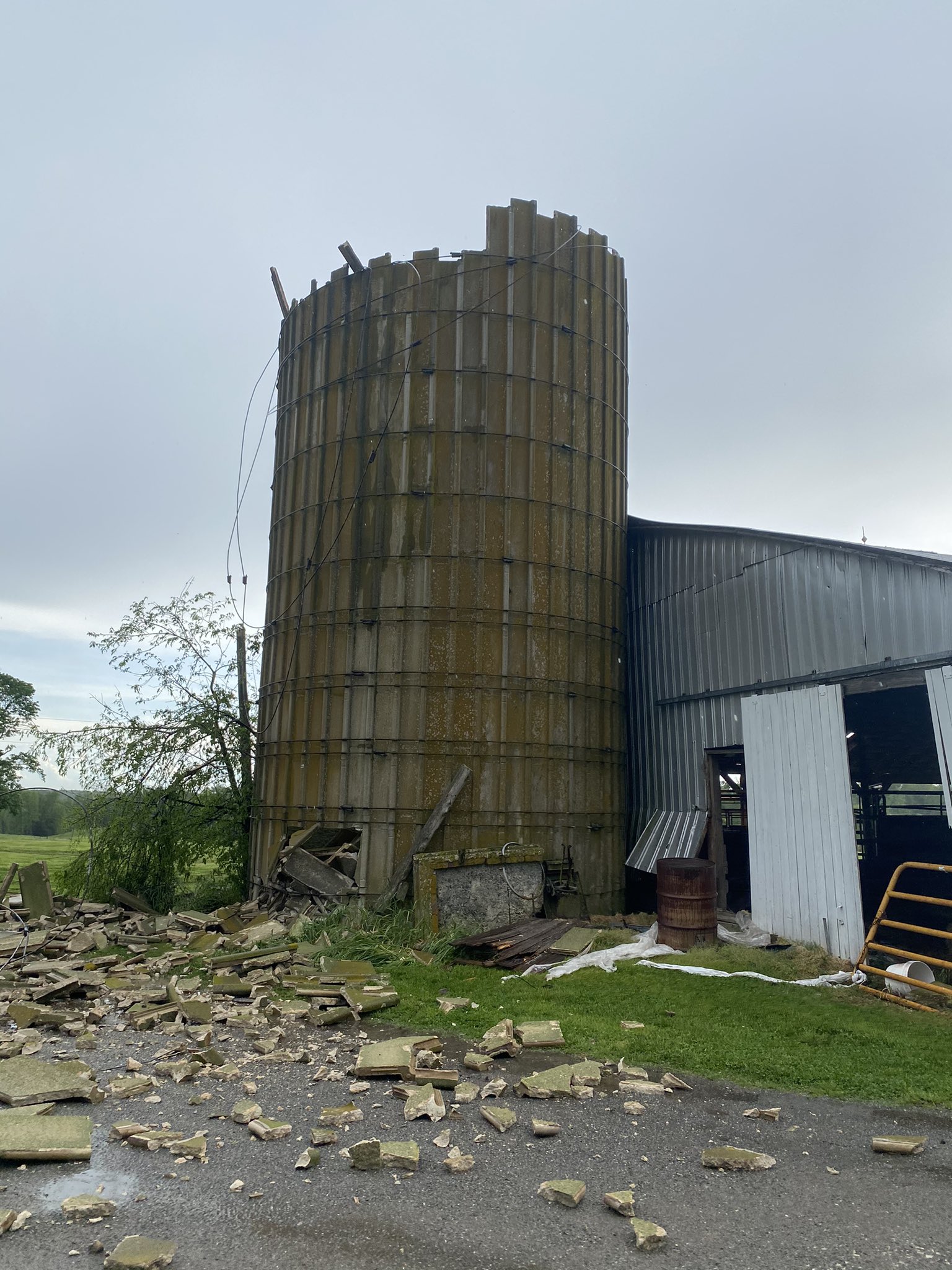
| Storm Damage on Fredericks Hall Rd in Mineral, VA (credit: NBC29) | Storm Damage on Fredericks Hall Rd in Mineral, VA (credit: NBC29) | Storm Damage on Fredericks Hall Rd in Mineral, VA (credit: NBC29) | Planes Overturned at Louisa County Airport (credit: LKU Airport Manager) |
 |
 |
 |
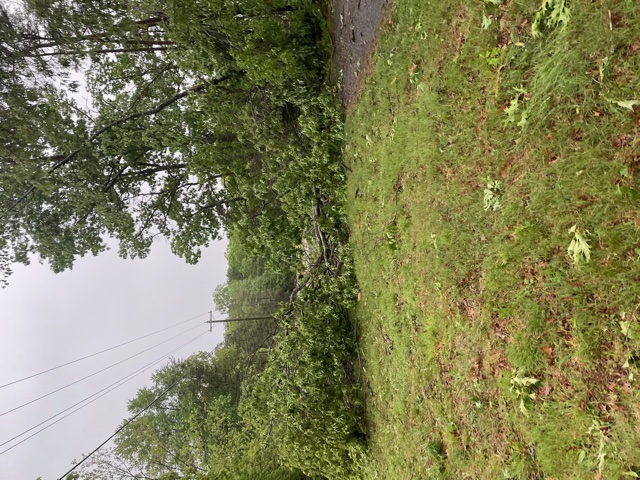 |
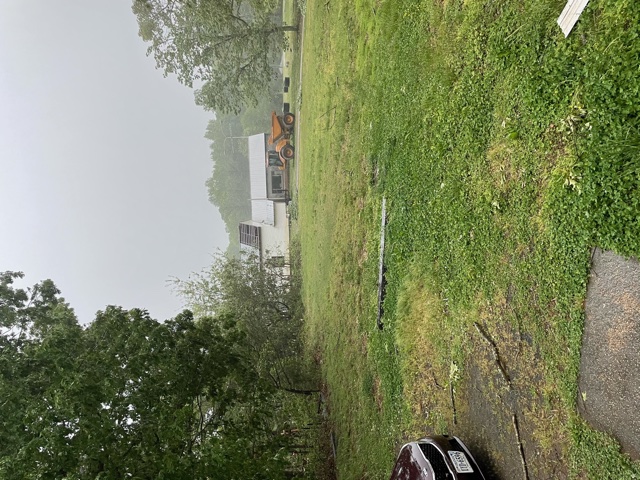
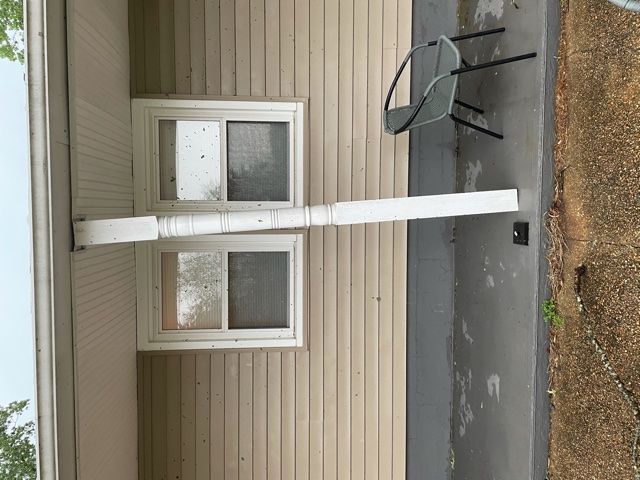
| Damage in Fluvanna County near Scottsville,VA (credit: Courtney Jackson) |
Damage in Fluvanna County near Scottsville,VA (credit: Courtney Jackson) |
Damage in Fluvanna County near Scottsville,VA (credit: Courtney Jackson) |
Damage in Fluvanna County near Scottsville,VA (credit: Courtney Jackson) |
Radar
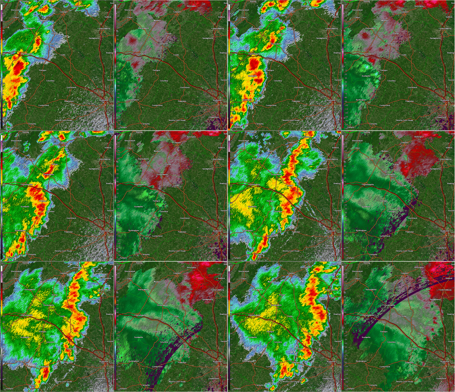
Selected Radar Loops of 0.5° Base Reflectivity/Velocity
 |
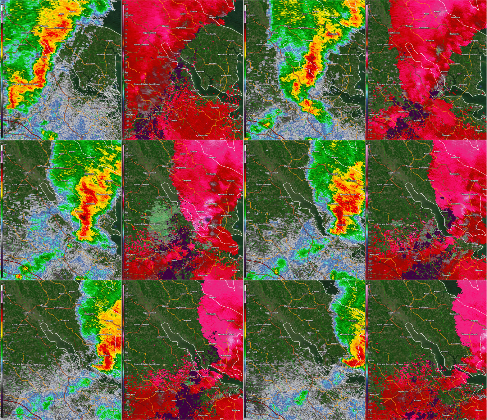 |
| Loop centered on Louisa County from 410 to 515 PM EDT | Loop centered just west of Lancaster County from 640 to 730 PM EDT |
Storm Reports
...National Weather Service concludes straight-line winds caused
the damage across portions of Lancaster County on May 4th...

Severe thunderstorms during the afternoon and evening of May 4th
resulted numerous damage reports across the region. One area of
particularly note-worthy impacts occurred across Lancaster County
along and near the Eastern Branch of the Corrotoman River and
Black Stump Road. The area of damage was roughly 4.5 miles in
length and 1-1.5 miles wide. Winds in this area were estimated at
70-90 mph. After careful review of damage photos and in
consultation with Lancaster County Emergency Management is has
been determined that the damage was a result of straight-line
winds.
----------------------------------------------------------------------------------------------------------
...OTHER LOCAL STORM REPORTS ARE BELOW...
0420 PM     TSTM WND DMG     1 ESE ANTIOCH           37.84N 78.40W
05/04/2021                   FLUVANNA           VA   PUBLIC

            ROOF OFF OF A BARN, PORCH ROOF LIFTED,
            SIDING DAMAGE AND NUMEROUS TREES DOWN.

0427 PM     TSTM WND DMG     1 E LAKE MONTICELLO     37.92N 78.31W
05/04/2021                   FLUVANNA           VA   LAW ENFORCEMENT

            NUMEROUS REPORTS OF TREES DOWN ACROSS ROADS,
            ON HOUSES, AND ON VEHICLES, AND MULTIPLE
            POWER LINES DOWN AROUND LAKE MONTICELLO.
0428 PM     TSTM WND DMG     2 WNW CARYSBROOK        37.83N 78.27W
05/04/2021                   FLUVANNA           VA   911 CALL CENTER

            OVER 50 TREES DOWN ACROSS FLUVANNA.
            WIDESPREAD TREE DAMAGE WITH MANY ROADS
            BLOCKED ACROSS THE COUNTY.
0447 PM     TSTM WND DMG     3 ESE ZION CROSSROADS   37.96N 78.17W
05/04/2021                   LOUISA             VA   PUBLIC

            DOZENS OF TREES DOWN BLOCKING I64 EAST BOUND
            IN WESTERN LOUISA. NUMEROUS TREES DOWN
            BLOCKING ROADS COUNTRYWIDE.
0448 PM     TSTM WND GST     1 ESE LOUISA AIRPORT    38.01N 77.97W
05/04/2021  E89 MPH          LOUISA             VA   AWOS

            CORRECTS PREVIOUS TSTM WND GST REPORT FROM 1
            ESE LOUISA AIRPORT. AIRPORT MANAGER REPORTED
            PEAK WIND OF 77 KT.
0448 PM     TSTM WND DMG     1 ESE LOUISA AIRPORT    38.01N 77.97W
05/03/2021                   LOUISA             VA   AIRPLANE PILOT

            NUMEROUS PLANES OVERTURNED AND SOME
            BUILDINGS DAMAGED AT THE LOUISA COUNTY
            AIRPORT.
0454 PM     TSTM WND DMG     3 ENE MINERAL           38.02N 77.86W
05/04/2021                   LOUISA             VA   PUBLIC

            LARGE TREE FELL AND CRUSHED HOUSE.
0454 PM     TSTM WND DMG     1 WNW FREDERICKS HALL   37.99N 77.83W
05/04/2021                   LOUISA             VA   PUBLIC

            CORRECTS PREVIOUS TORNADO REPORT FROM 1 WNW
            FREDERICKS HALL. CAR FLIPPED OVER. SILO AND
            A BARN DAMAGED. ROOFS ARE DAMAGED.
0455 PM     TSTM WND GST     MINERAL                 38.00N 77.91W
05/04/2021  M73 MPH          LOUISA             VA   MESONET

            CORRECTS PREVIOUS NON-TSTM WND GST REPORT
            FROM MINERAL. MESONET STATION FW1208
            MINERAL.
0500 PM     TSTM WND DMG     BUMPASS                 37.96N 77.74W
05/04/2021                   LOUISA             VA   PUBLIC

            PERGOLA BLOWN INTO AN IN-GROUND POOL.
0520 PM     TSTM WND DMG     2 SSW CORBIN            38.17N 77.41W
05/04/2021                   CAROLINE           VA   PUBLIC

            CHICKEN COOP BLOWN APPROXIMATELY 50 FEET.
            DOG KENNELS WERE BLOWN SEVERAL FEET.
0523 PM     TSTM WND DMG     1 NNW SHORT PUMP        37.66N 77.61W
05/04/2021                   HENRICO            VA   TRAINED SPOTTER

            TREES DOWN NEAR I64. WINDS ESTIMATED 60 MPH.
0525 PM     TSTM WND DMG     1 S VILLBORO            38.12N 77.39W
05/04/2021                   CAROLINE           VA   911 CALL CENTER

            TREES DOWN WIDESPREAD ACROSS CAROLINE
            COUNTY. FREDERICKSBURG HIGHWAY BLOCKED ALONG
            WITH SEVERAL OTHER ROADS.
0535 PM     TSTM WND DMG     1 N ROSLYN HILLS        37.59N 77.57W
05/04/2021                   HENRICO            VA   PUBLIC

            SIDING DAMAGED ON HOME.
0605 PM     TSTM WND DMG     HOMEVILLE               36.95N 77.17W
05/04/2021                   SUSSEX             VA   911 CALL CENTER

            SEVERAL TREES DOWN ACROSS EASTERN SUSSEX
            COUNTY.
0718 PM     TSTM WND DMG     2 WNW KILMARNOCK        37.72N 76.42W
05/04/2021                   LANCASTER          VA   FIRE DEPT/RESCUE

            TREES DOWN ON HOUSES ALONG QUARTERS COVE
            DRIVE.
0719 PM     TSTM WND DMG     2 W KILMARNOCK          37.71N 76.41W
05/04/2021                   LANCASTER          VA   FIRE DEPT/RESCUE

            WIND DAMAGE ALONG BLACK STUMP ROAD.
Environment
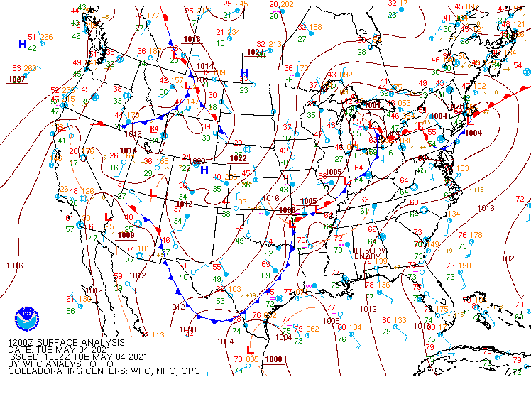
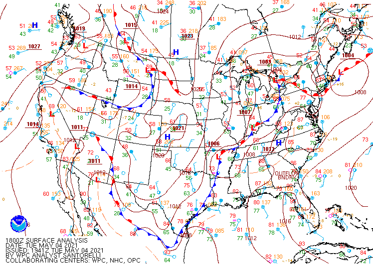
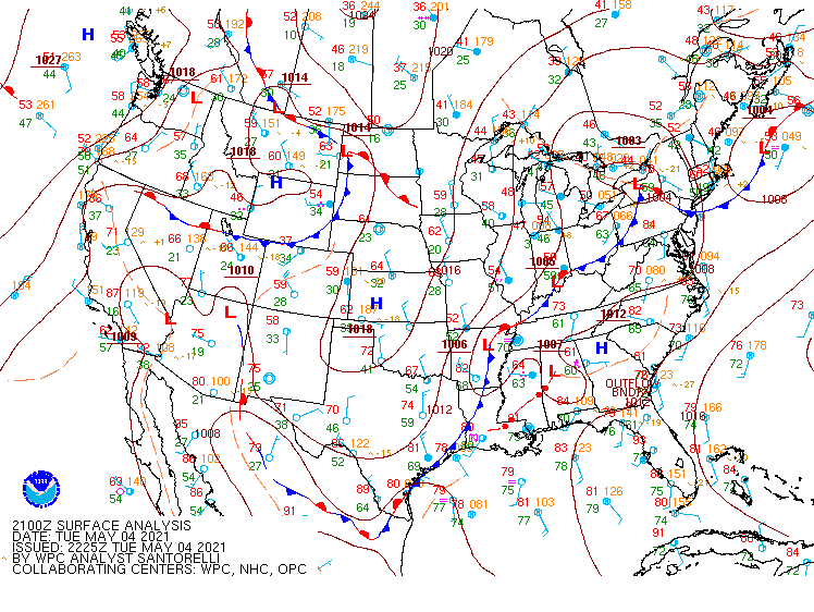
Synoptic Surface Summary from WPC Analysis.
 |
 |
 |
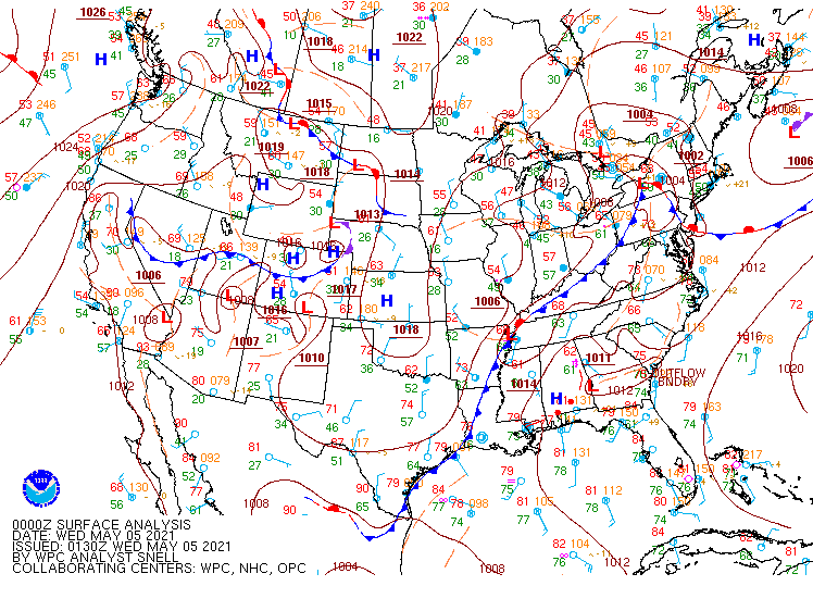 |
| 12z/8 AM EDT | 18z/2 PM EDT | 21z/5 PM EDT | 00z/8 PM EDT |
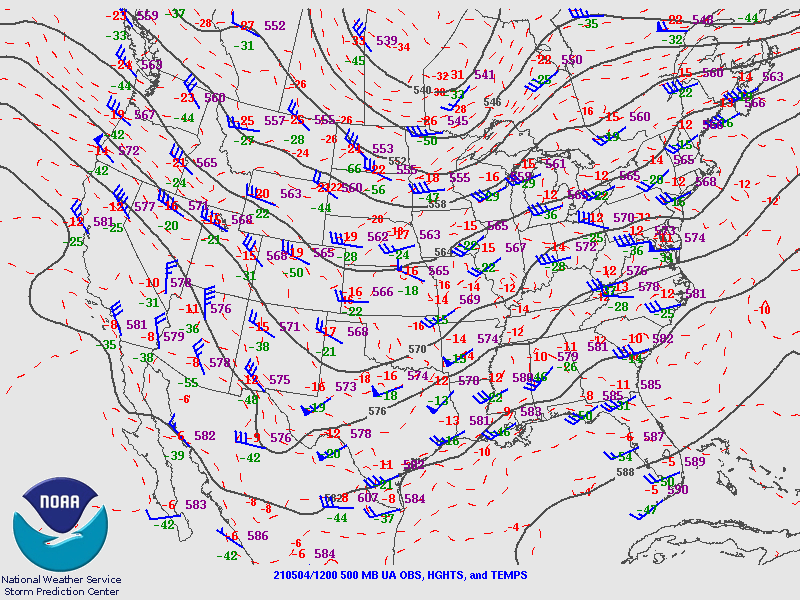
12z/8 AM EDT Upper Level Synoptic Snapshot.
 |
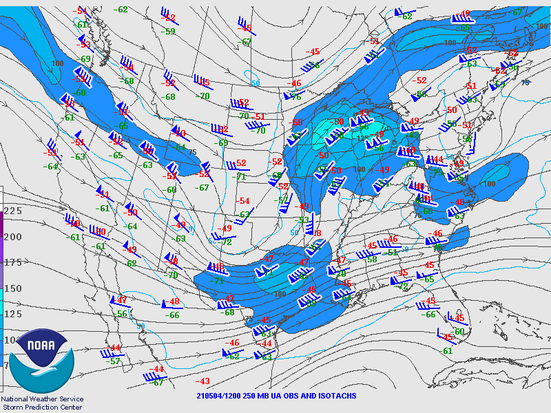 |
| 500 mb Analysis | 250 mb Analysis |
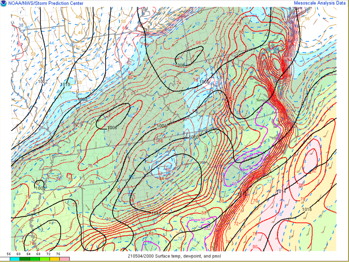
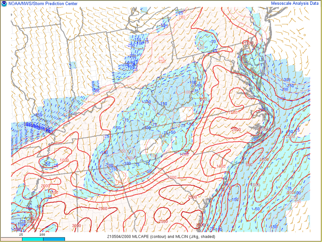
Near Storm Environment Summary.
 |
 |
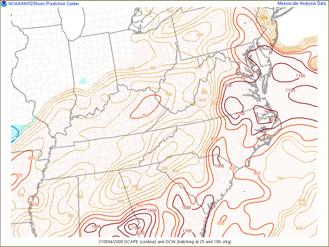 |
| 20z/4 PM T/Td/MSLP/Wind | 20z/4 PM MLCAPE/MLCIN | 20z/4 PM DCAPE |
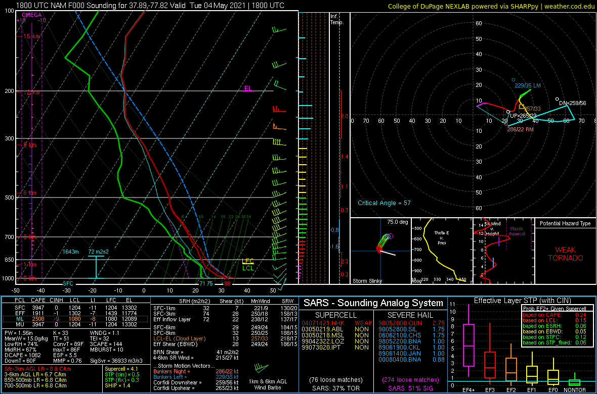
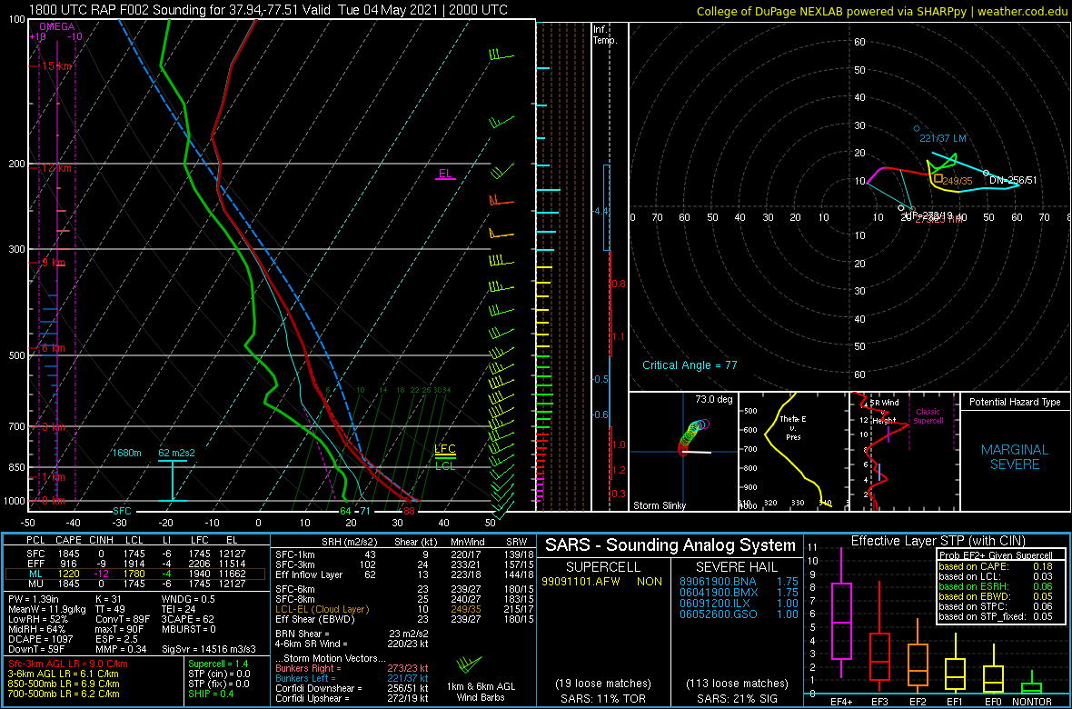
Environmental Sounding data.
 |
 |
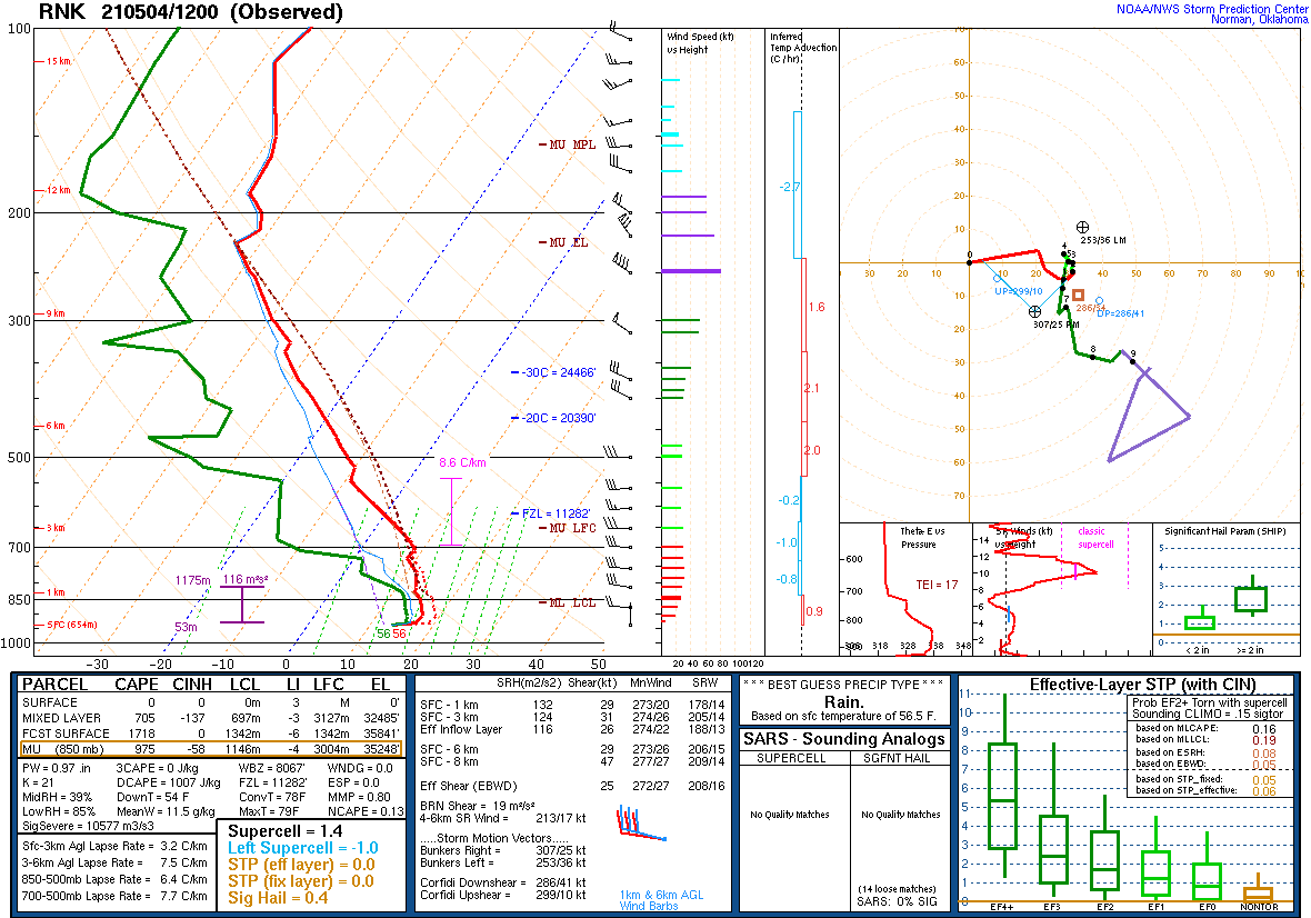 |
| 18z/2 PM RAP Analysis Sounding from Louisa County | 18z/2 PM RAP Analysis Sounding from Caroline County | 12z RNK Sounding...Note the Elevated Mixed Layer (EML) and extremely steep mid-level lapse rates |
 |
Media use of NWS Web News Stories is encouraged! Please acknowledge the NWS as the source of any news information accessed from this site. |
 |