
Dangerous heat will persist over portions of interior California, the Great Basin, and the northern Rockies through Thursday. Heat will gradually spread into the northern Plains today. Across the western Gulf Coast, heavy to excessive rainfall will persist through mid-week. Additionally, the Southwest Monsoon will continue to bring a flash flooding threat to the Four Corners Region this week. Read More >
Overview
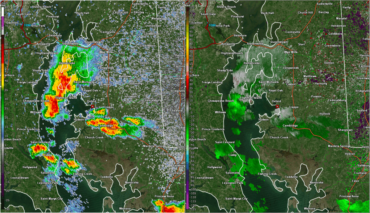
A shortwave trough tracked to the north of the area on July 3. While the main surface features stayed well to our north (as is typical this time of year), a remnant MCV tracking NE out of North Carolina allowed for numerous thunderstorms to develop and track across far SE VA and NE NC during the afternoon and early evening. In addition, scattered convection developed from central VA to MD along and just east of a surface trough. Hot and humid conditions (mid 90s temps with mid 70s dew points) allowed for the storms to produce wind damage. A few 50 knot gusts were even observed with the storms in SE VA and NE NC. The strongest storm of the day intensified as it tracked across the Chesapeake Bay toward the Maryland Eastern Shore (deep-layer flow was slightly stronger here than in areas farther south). A measured 84 mph gust was recorded at Tightman Island, MD (just to the NW of the Wakefield CWA). As the storm crossed into Dorchester County, a truck was overturned on the Choptank River Bridge due to very high winds. In addition, a 50 knot gust was reported just north of Cambridge, MD.
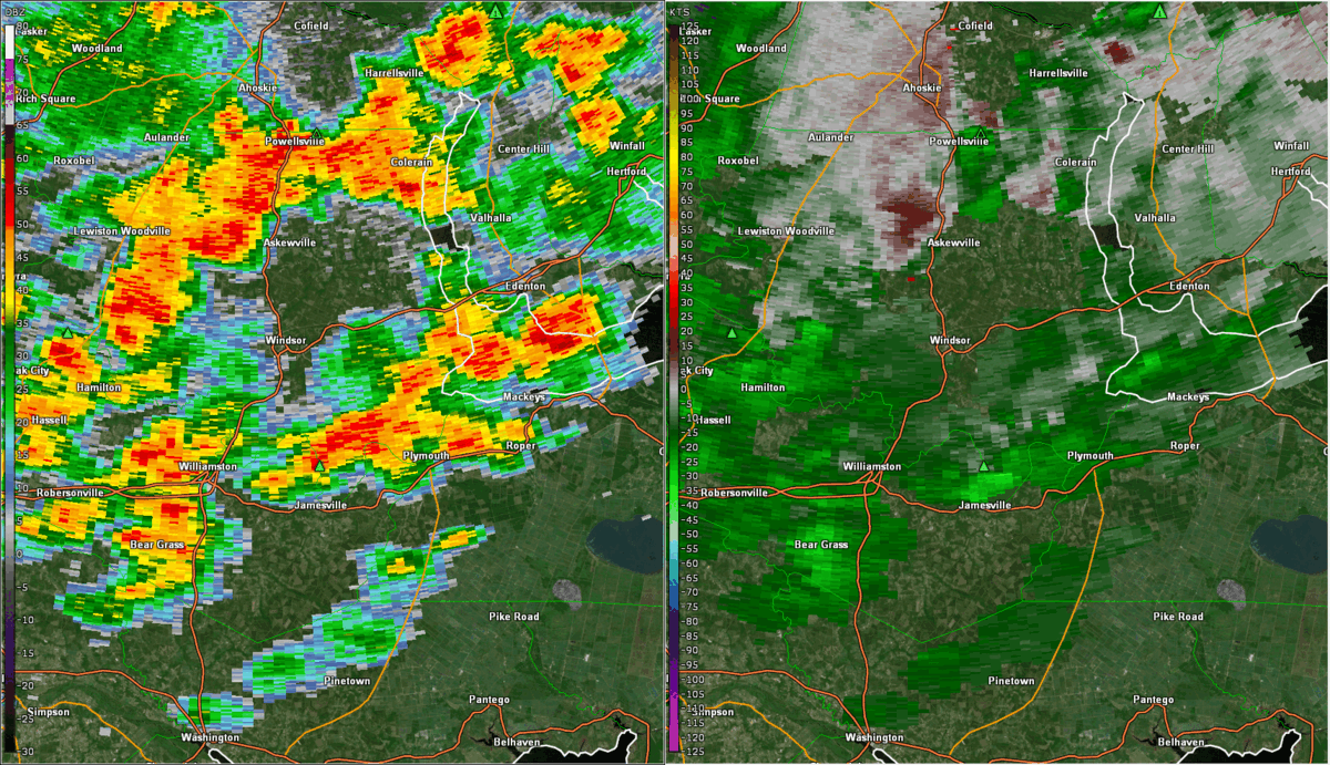
Lastly, a brief high-end EF-0 tornado (max wind speed was estimated at 85 mph) touched down in far southeast Bertie County with the storms in the late afternoon. This was an unusual case where the radar data only indicated brief, weak rotation at the radar level. The strongest part of the circulation was unfortunately very close to the ground (below the radar level).
Tornadoes:
|
Tornado - Just SE of Woodard, NC
Track Map 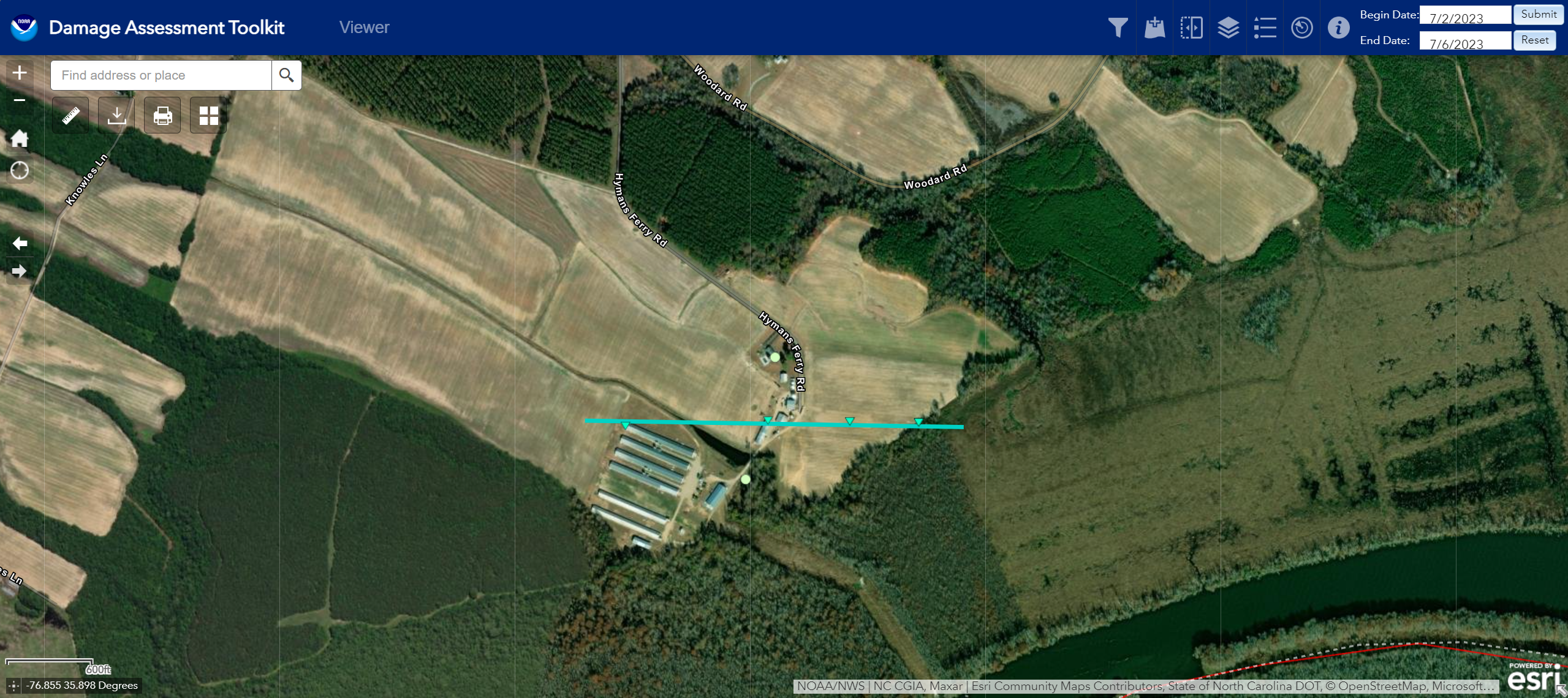 
|
||||||||||||||||
The Enhanced Fujita (EF) Scale classifies tornadoes into the following categories:
| EF0 Weak 65-85 mph |
EF1 Moderate 86-110 mph |
EF2 Significant 111-135 mph |
EF3 Severe 136-165 mph |
EF4 Extreme 166-200 mph |
EF5 Catastrophic 200+ mph |
 |
|||||
Radar and Satellite
Selected Loops
 |
 |
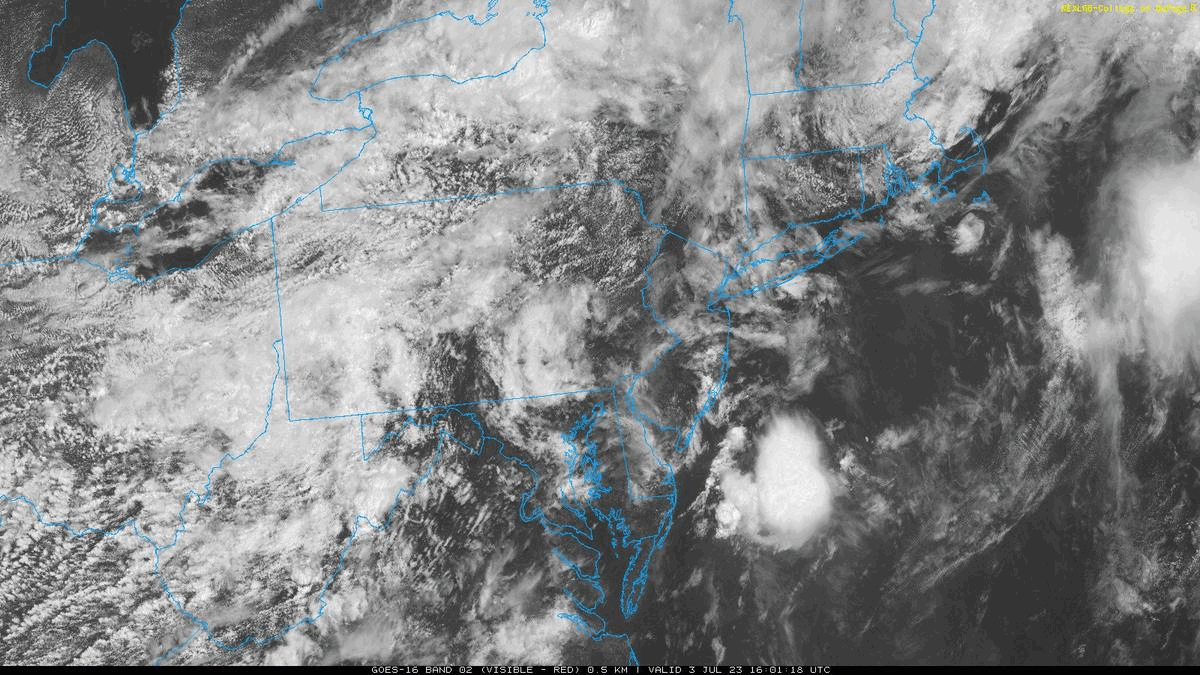 |
| Loop of KAKQ reflectivity and base velocity from 3:21 to 3:44 PM in 2-3 minute increments. Note the messy convective mode and very brief, weak, and transient circulation of the storm that produced the EF-0 tornado in far SE Bertie County. | Loop of KDOX reflectivity and base velocity from 6:40 to 7:35 PM in ~5 minute increments. Note the well defined front and rear inflow notches on the storm that passed through northern Dorchester County. | Visible Satellite Loop from noon-7 PM in 30 minute increments. |
Storm Reports
Insert storm reports here. Copy in PNS or paste map.
Environment
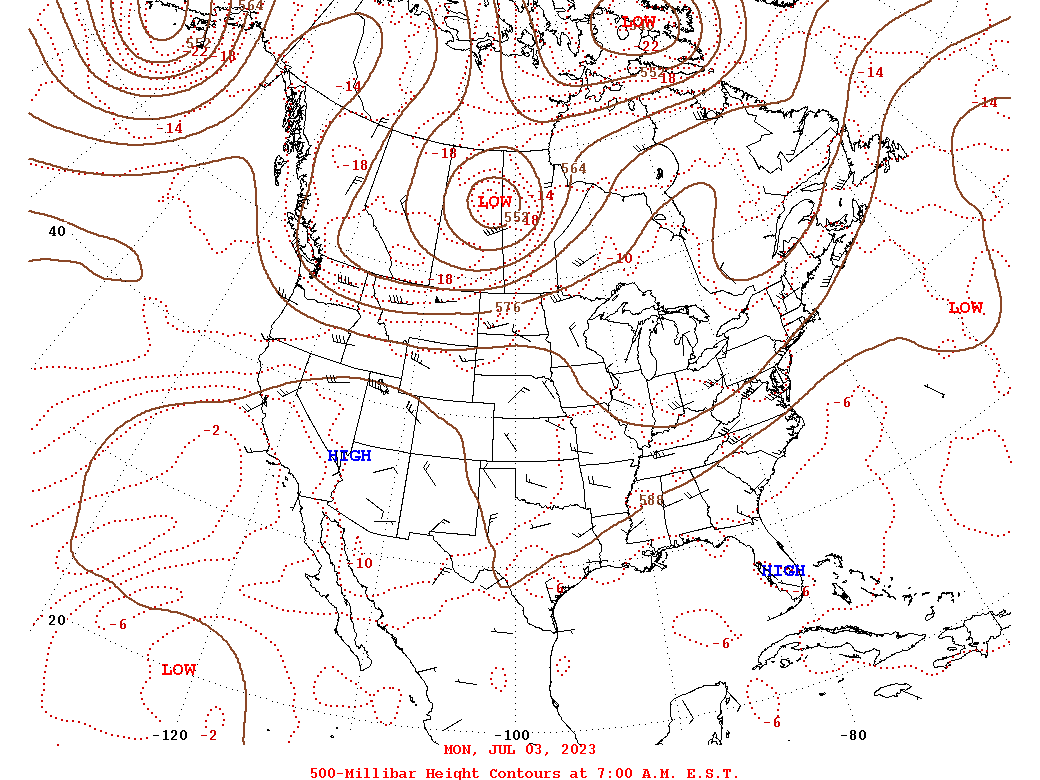
Synoptic summary.
 |
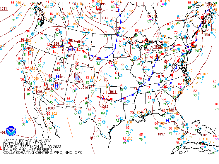 |
| 12z/8 AM 500mb Analysis | Loop of WPC Surface Analysis from 8 AM-8 PM in 3 hour increments |
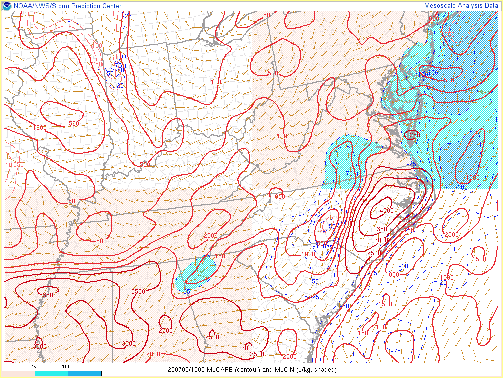
Near-storm environment summary.
 |
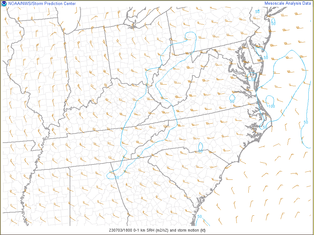 |
| Loop of MLCAPE/MLCIN from 18-23z/2-7 PM | Loop of 0-1km SRH from 18-23z/2-7 PM |
Sounding data.
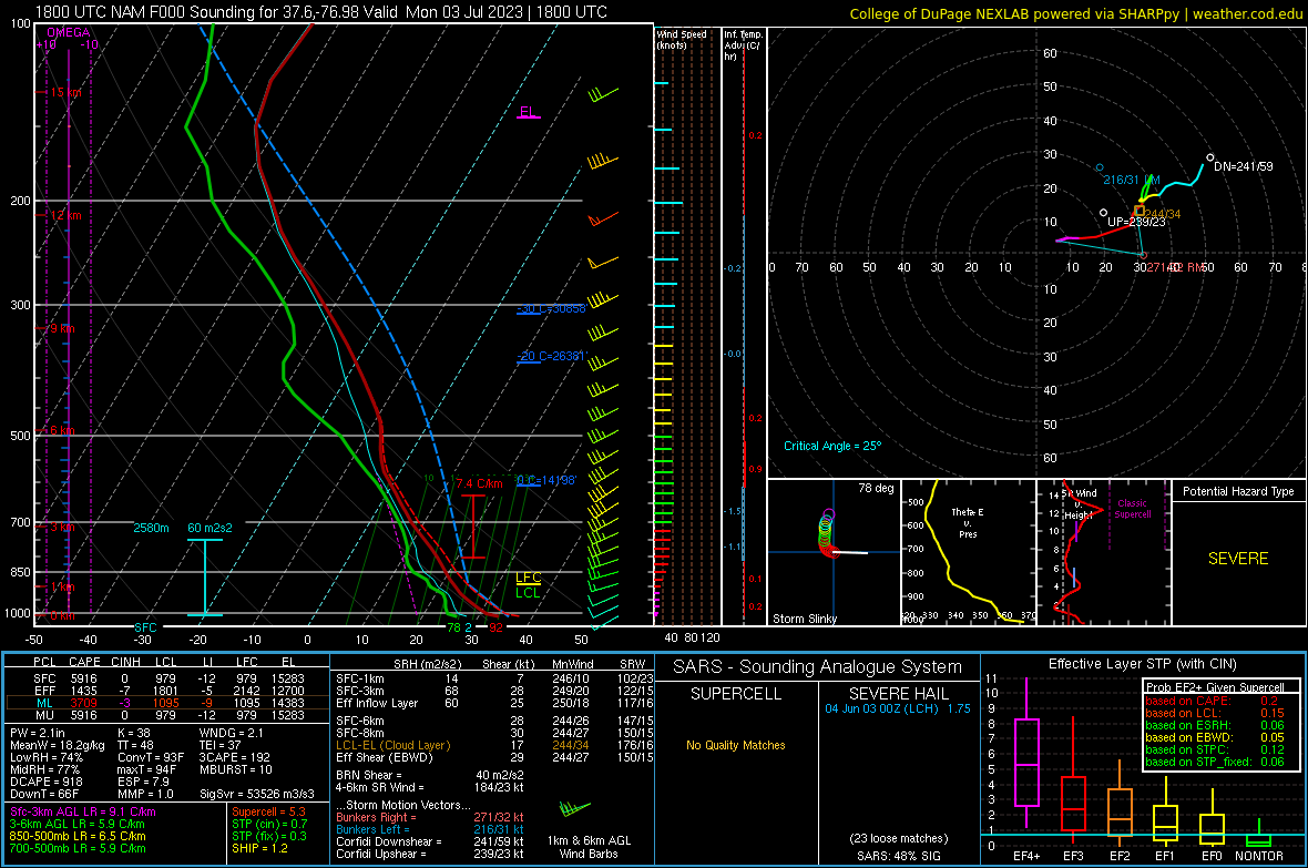 |
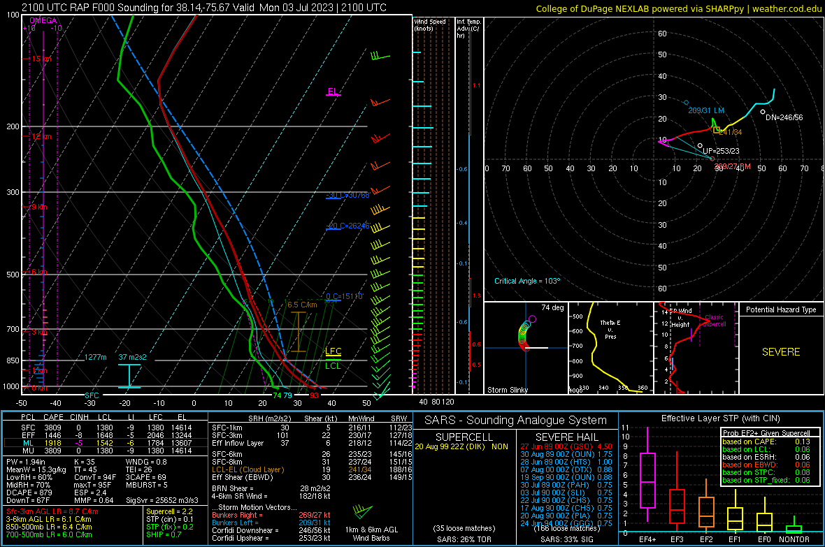 |
| KXSA (Tappahannock, VA) - 18z NAM Analysis Sounding | Lower MD Eastern Shore - 21z RAP Analysis Sounding |
 |
Media use of NWS Web News Stories is encouraged! Please acknowledge the NWS as the source of any news information accessed from this site. |
|


 Coastal Flood
 Heat
Heat