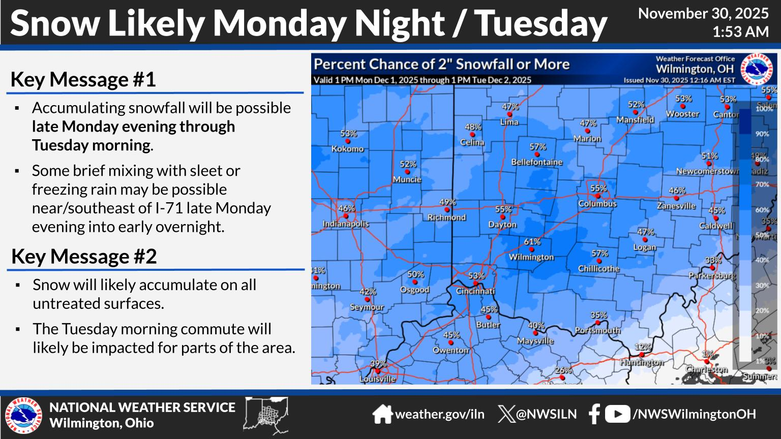
National Weather Service United States Department of Commerce

Rain will overspread the region tonight and continue into the early part of Wednesday. A cold front will move through the area during the afternoon, transitioning the rain to light snow. Lingering snow showers are expected Wednesday evening/night, which could result in some slick spots as air temperatures drop below freezing.
Very breezy conditions will develop tonight, continuing through the daytime Wednesday. The strongest winds, with gusts of 35-45 MPH, are expected Wednesday morning and afternoon. Winds will subside Wednesday evening.
Multiple systems could result in accumulating snowfall late this week, mainly Thursday night into Friday, and again on Saturday. Several inches of accumulating snow will be possible Thursday night into Friday morning. Additionally, a bitterly cold air mass will settle into the region this weekend, with bitterly cold wind chill values likely.