
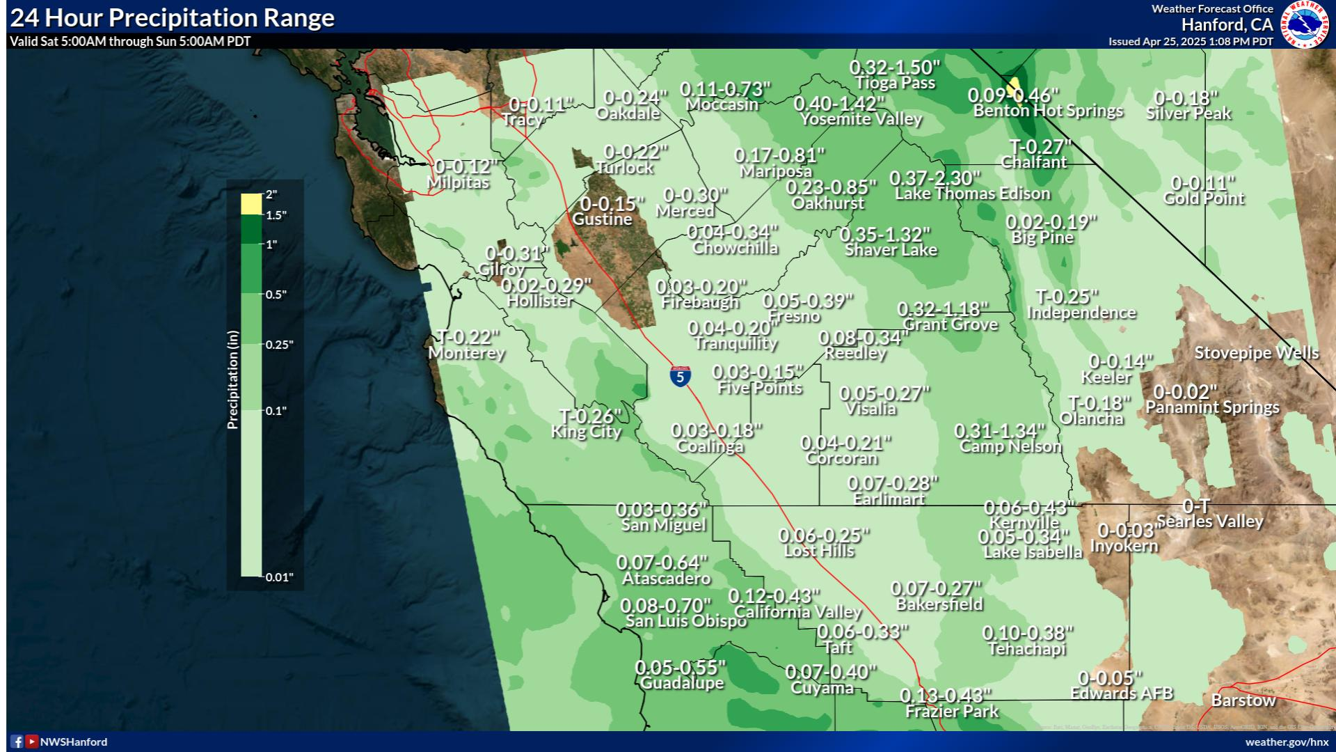
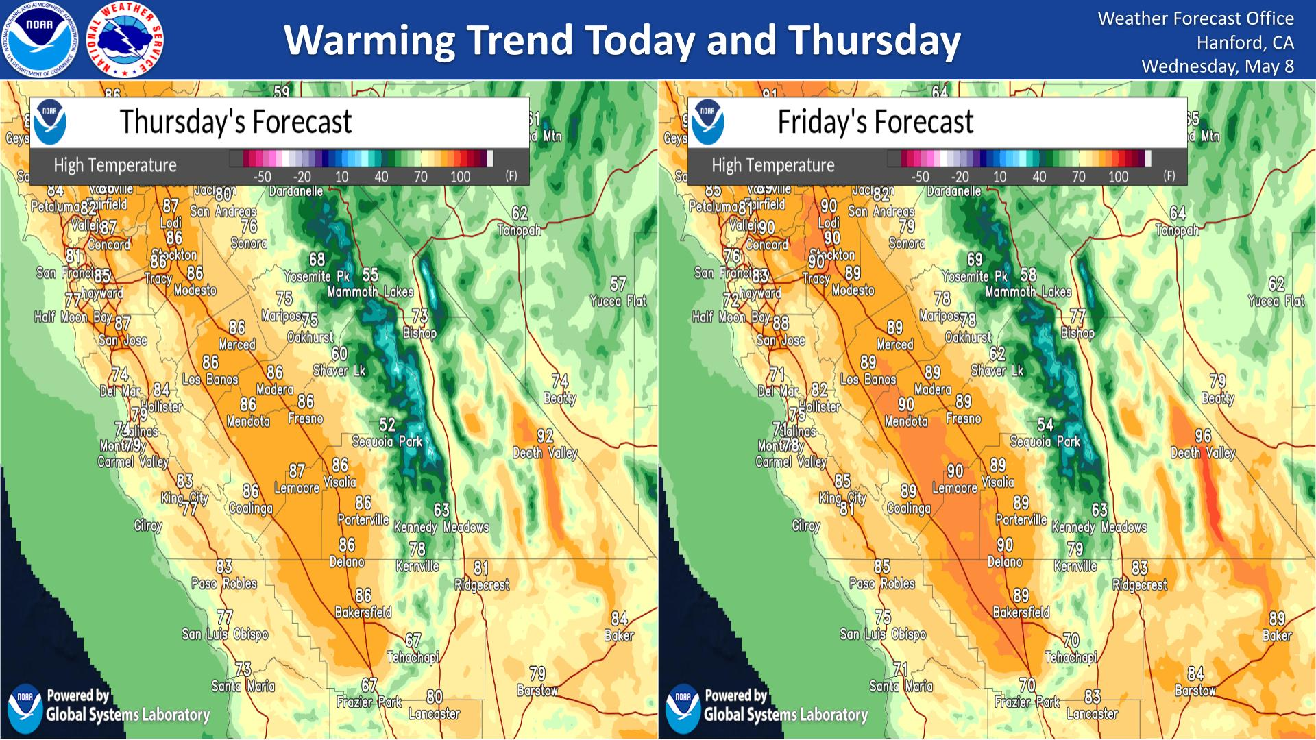
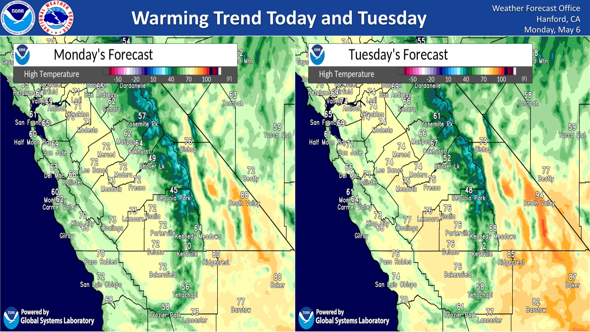
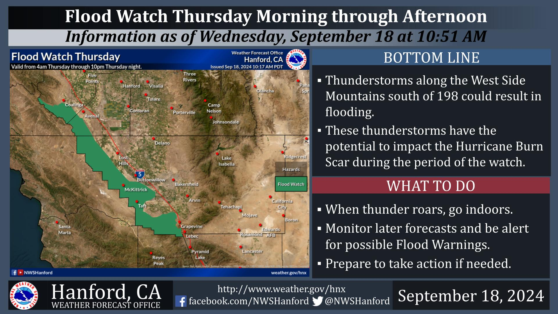
Severe weather and flooding threats will continue for portions of the central U.S. over the next couple of days, with multiple rounds of thunderstorms expected. Dangerous heat will persist across the southern and western U.S. through mid-week. Hot and dry conditions will fuel fire weather concerns for the Intermountain West, where dry thunderstorms may spark additional wildfires. Read More >
Last Map Update: Wed, Jun 24, 2026 at 1:14:22 pm PDT
|
Text Product Selector (Selected product opens in current window)
|
|


 Hanford Radar
 Edwards Radar
 Recent Temperatures
 Satellite
 Weather Map
 Experimental Fog Severity Index
 Social Media
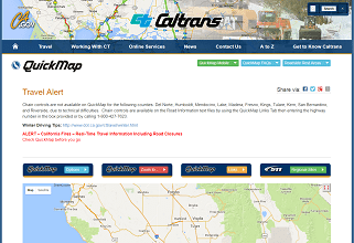 Caltrans QuickMap
 Drought
 Weather Stats