
Severe thunderstorms capable of producing damaging wind gusts, large hail, and a few tornadoes, are likely to develop this afternoon from parts of the lower Ohio Valley into the southern Plains. An Enhanced Risk (Level 3 of 5) outlook has been issued. Further north, widespread rain showers are expected across portions of the Great Lakes and Northeast U.S. Read More >
Last Map Update: Thu, Apr. 18, 2024 at 6:33:23 am CDT
| Latest Text Product Selector (Selected product opens in a new window) | |
 |
 |
 |
 |
 |
 |
| Decision Support | Hazards | Models | Observations | Climate | Hydrology |
 |
 |
 |
 |
 |
 |
| Social Media | Satellite | Fire Weather | Weather Radio | Spotter Training | Text Products |


 Tulsa Radar
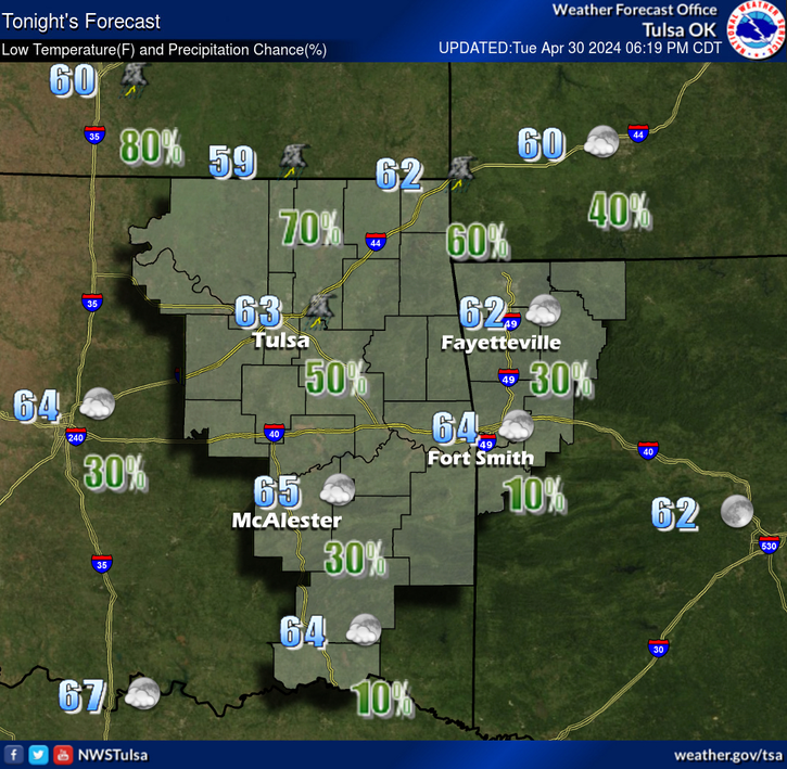
  Weather Map
 Fort Smith Radar
 Follow us on YouTube