An atmospheric river will continue to bring gusty winds, moderate to heavy rainfall, and potential flooding to southern California and the southern Great Basin through Sunday. Periods of heavy snow will continue as well above 7,000 feet over the Sierra Nevada mountains associated with this atmospheric river. Read More >
These images are updated once an hour around the bottom of the hour (+30 min).
Current Weather Hazards
|
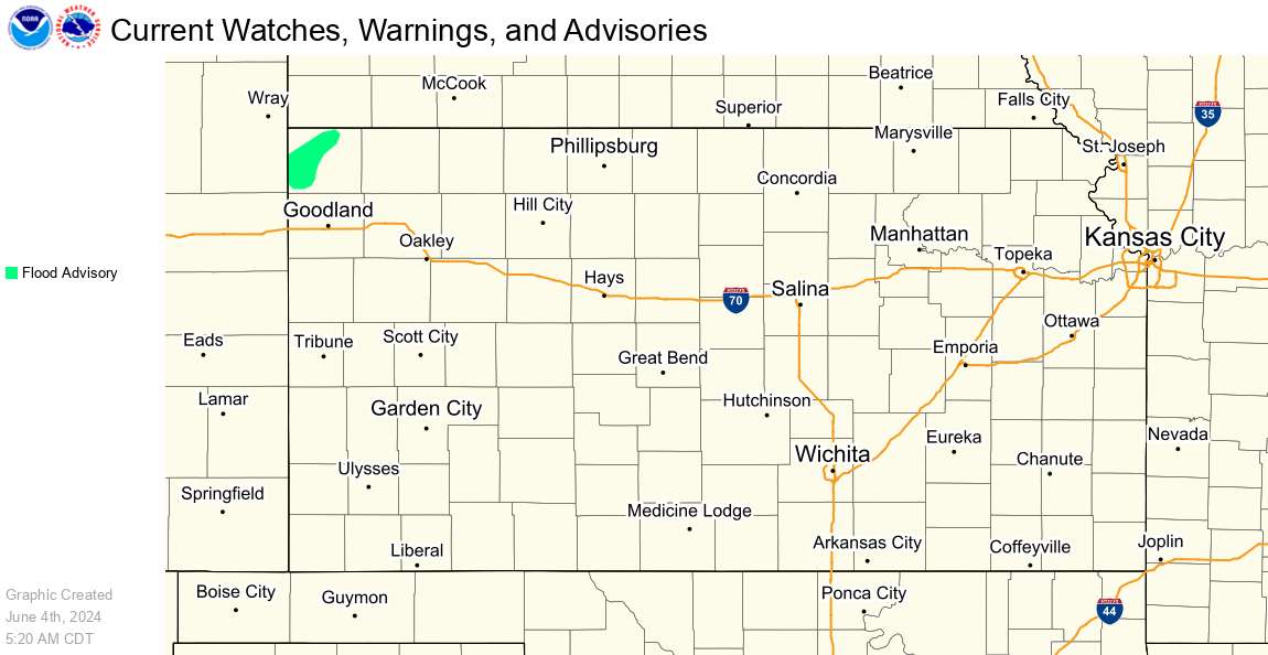
All Current Watches, Warnings, and Advisories |
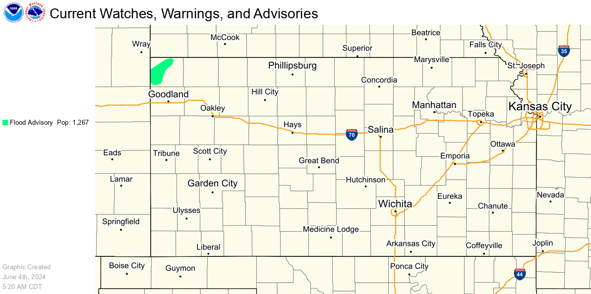
All Current Watches, Warnings, and Advisories w/ Population Stats |
Specific Hazards
|
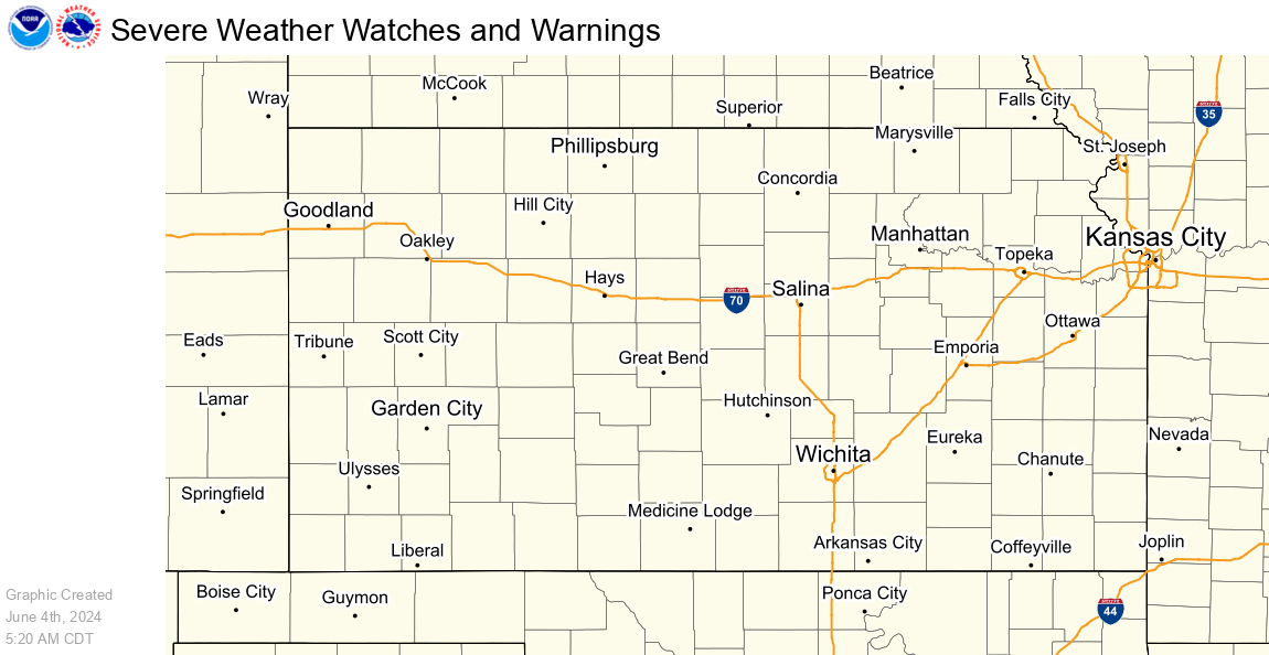
Severe Weather Hazards |
Winter Weather Hazards |
|
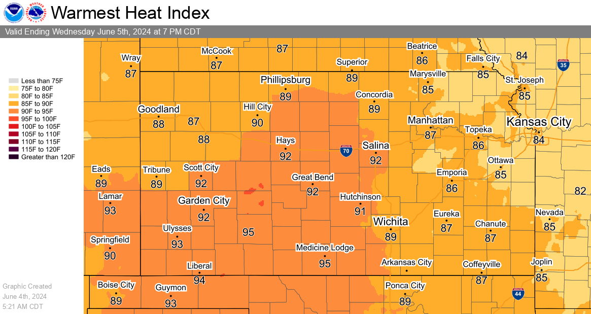
Heat Hazards |
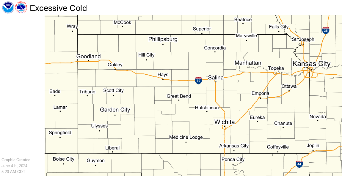
Cold Hazards |
|
Flooding Hazards |
Frost/Freeze Hazards |
|
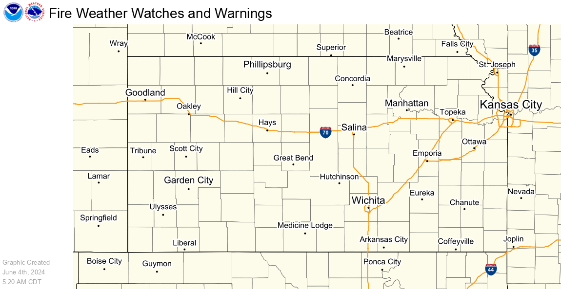
Fire Weather Hazards |
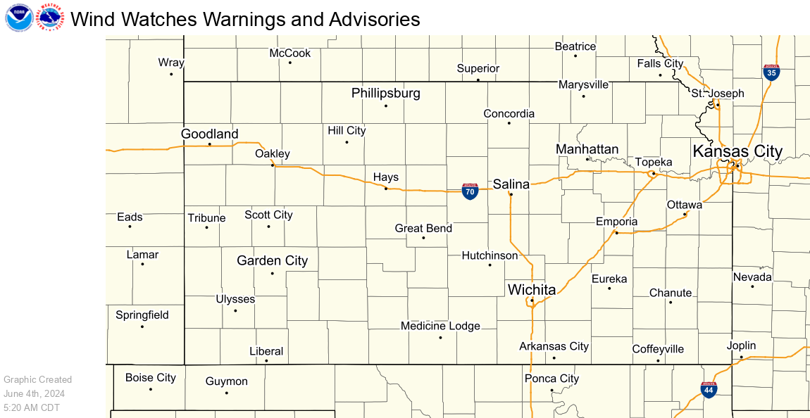
Wind Hazards |
|
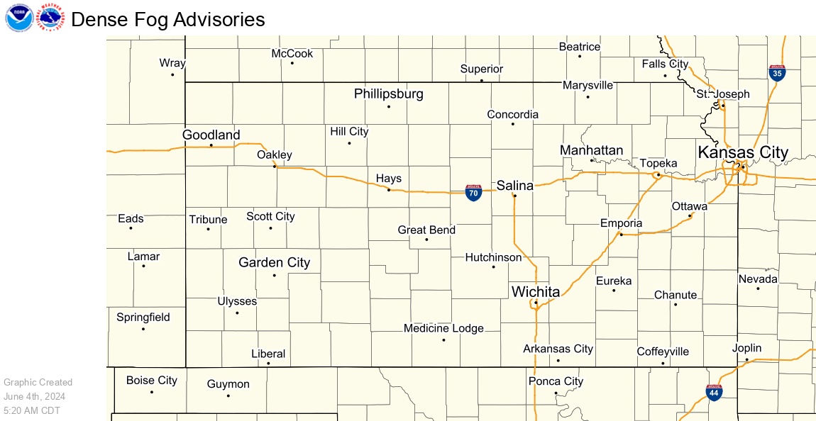
Fog Hazards |
|
Snow, Ice and Wind Chill Graphics
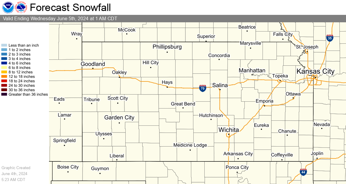
Snowfall
Snowfall accumulation measured in six hourly periods, starting at 12am, 6am, 12pm, and 6pm CST (+1 CDT).
|
12 Hour Snow Accumulation Forecast |
24 Hour Snowfall Accumulation Forecast |
|
48 Hour Snow Accumulation Forecast |
72 Hour Snow Accumulation Forecast |
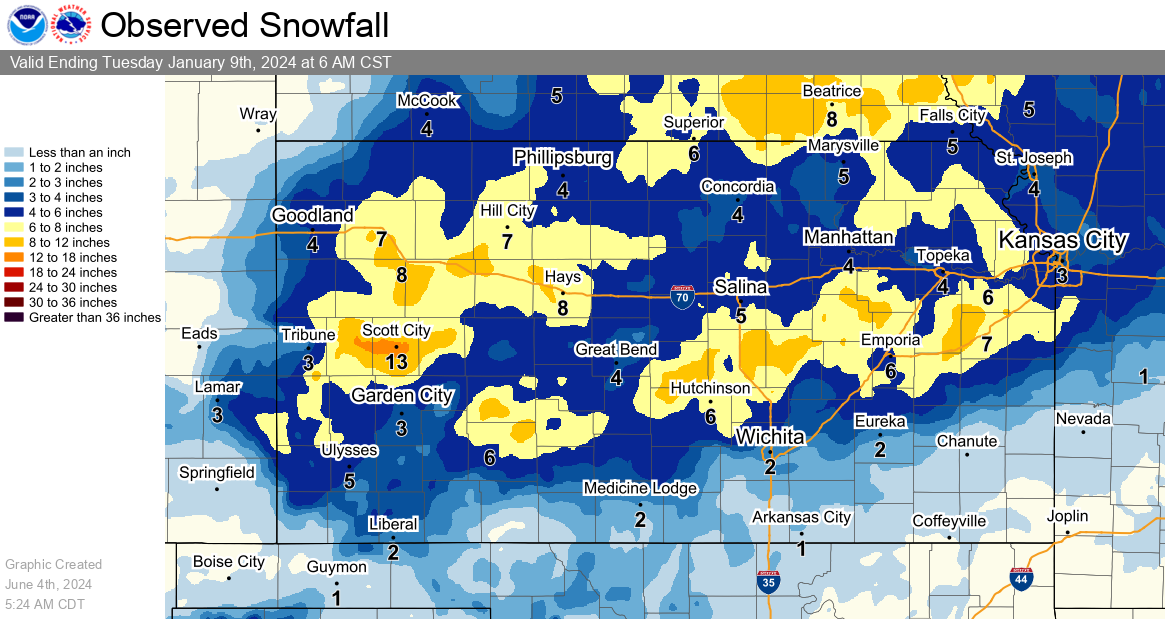
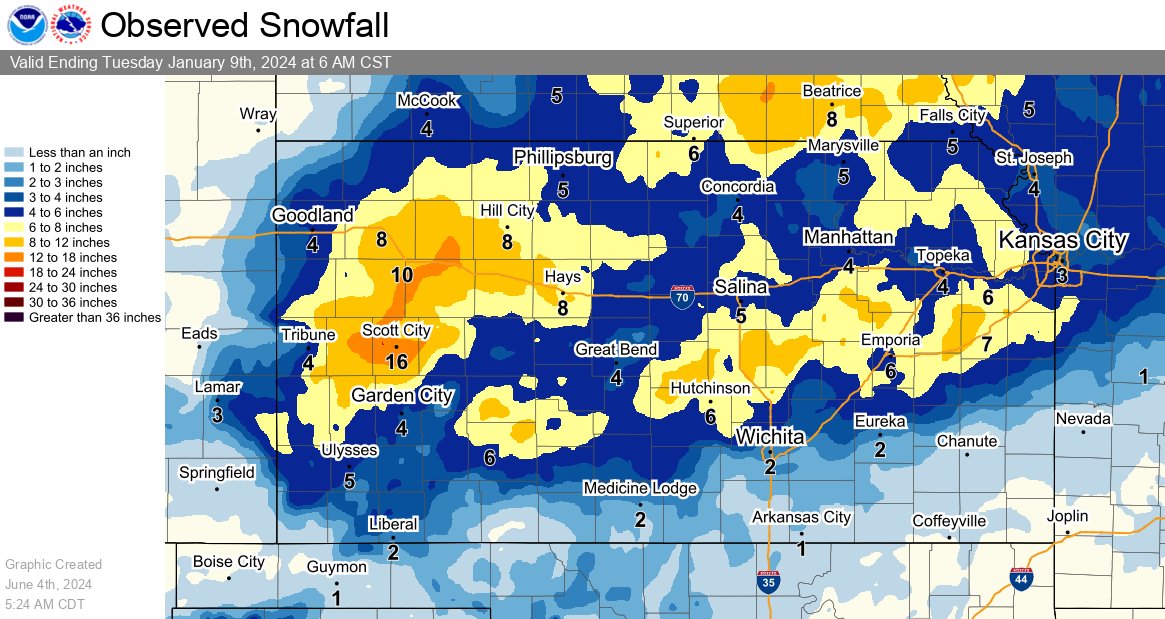
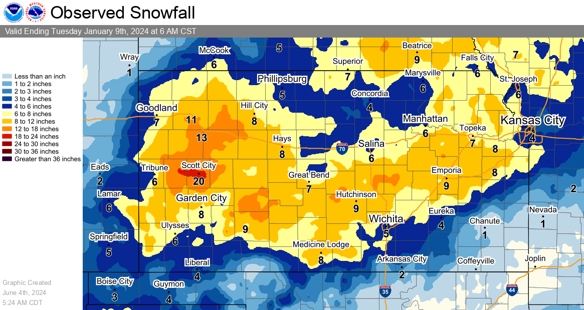
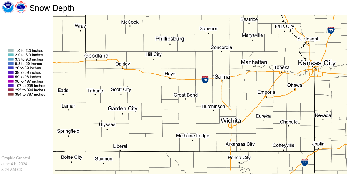
Observed Snowfall/Depth
Observed snowfall graphics are updated once a day at 6am CST (7am CDT). For more frequent updates, visit our Local Snow Reports Page.
An interactive map of the maps below is also available here.
|
Yesterday's Accumulated Snowfall |
Two Day Accumulated Snowfall |
|
Seven Day Accumulated Snowfall |
Current Snow Depth |
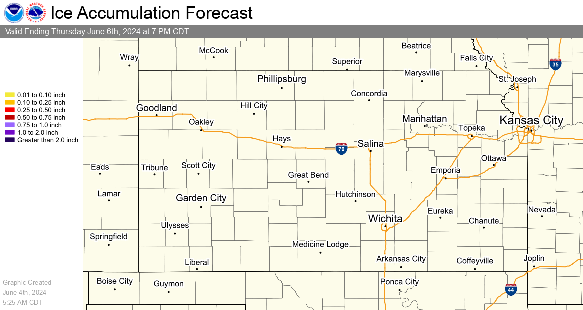
Ice
Ice accumulation measured in six hourly periods, starting at 12am, 6am, 12pm, and 6pm CST (+1 CDT).
|
12 Hour Ice Accumulation Forecast |
24 Hour Ice Accumulation Forecast |
|
48 Hour Ice Accumulation Forecast |
72 Hour Ice Accumulation Forecast |
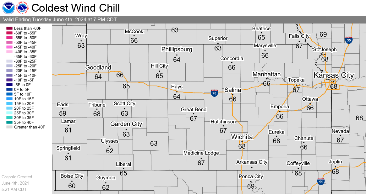
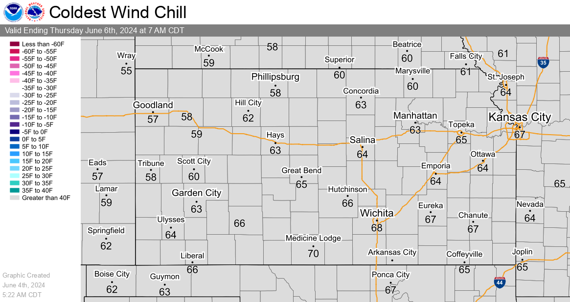
Wind Chill
Severe Weather Graphics
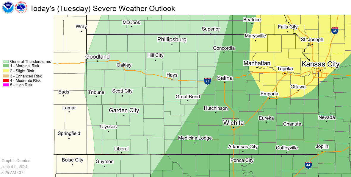
SPC Day 1 Outlook
|
SPC Day 1 Severe Weather Outlook |
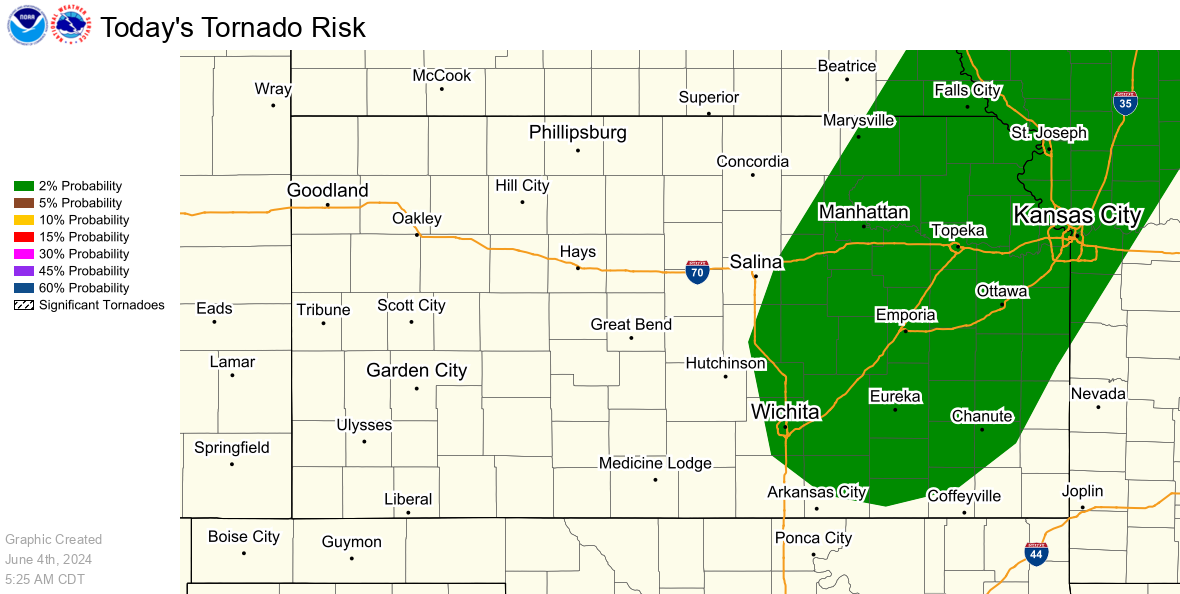
SPC Day 1 Tornado Outlook |
|
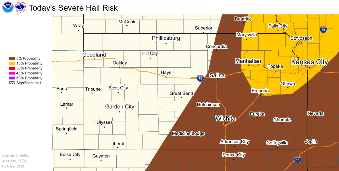
SPC Day 1 Hail Outlook |
SPC Day 1 Wind Outlook |
SPC Day 2 and 3 Outlooks
|
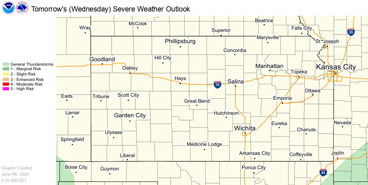
SPC Day 2 Severe Weather Outlook |
SPC Day 3 Severe Weather Outlook |
Precipitation Graphics
Rainfall Forecasts
Precipitation accumulation measured in six hourly periods, starting at 12am, 6am, 12pm, and 6pm CST (+1 CDT).
|
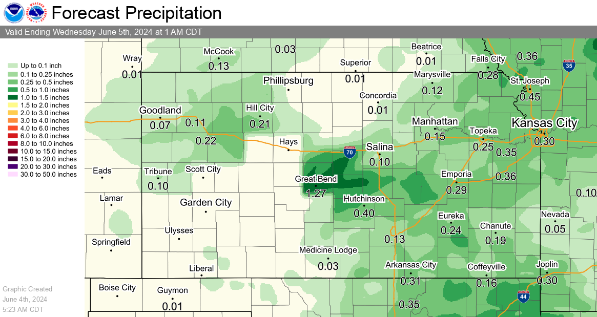
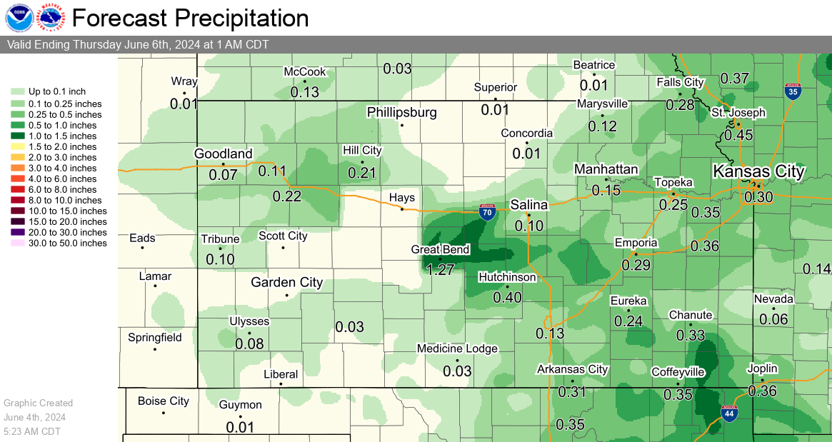
24 Hour Rainfall Forecast |
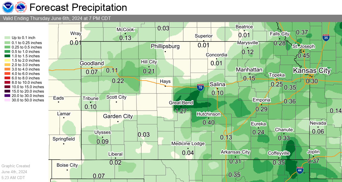
2 Day Rainfall Forecast |
|
3 Day Rainfall Forecast |
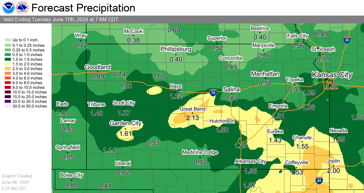
7 Day Rainfall Forecast |
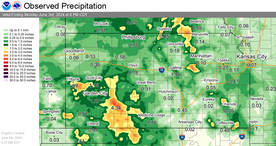
Observed Precipitation
|
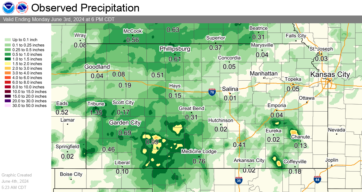
Previous 24 Hours of Precipitation |
Previous 72 Hours of Precipitation |
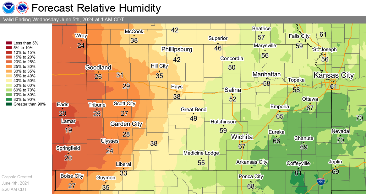
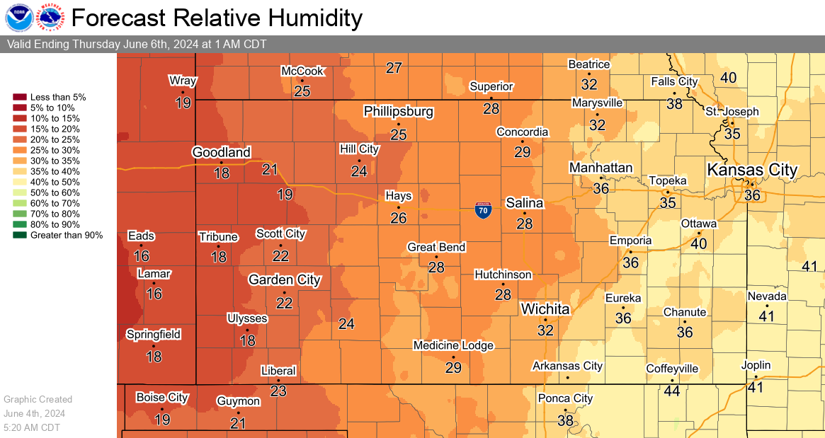
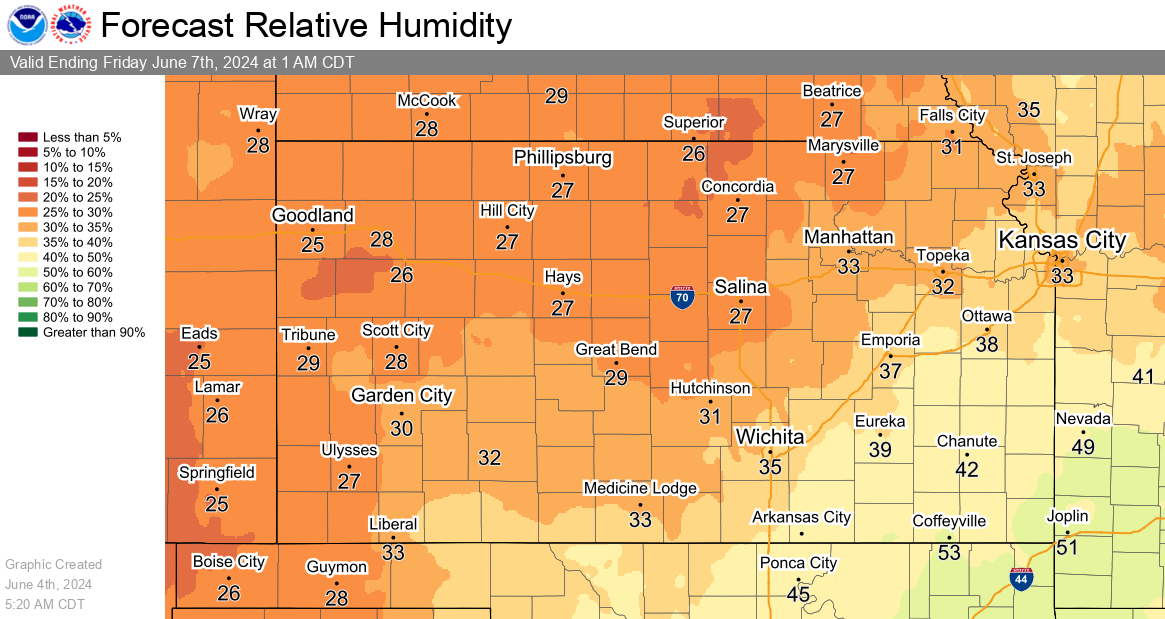
Humidity and Wind Graphics
Minimum Relative Humidity Forecasts
|
Today's Minimum Relative Humidity Forecast |
Tomorrow's Minimum Relative Humidity Forecast |
|
Day 3 Minimum Relative Humidity Forecast |
|
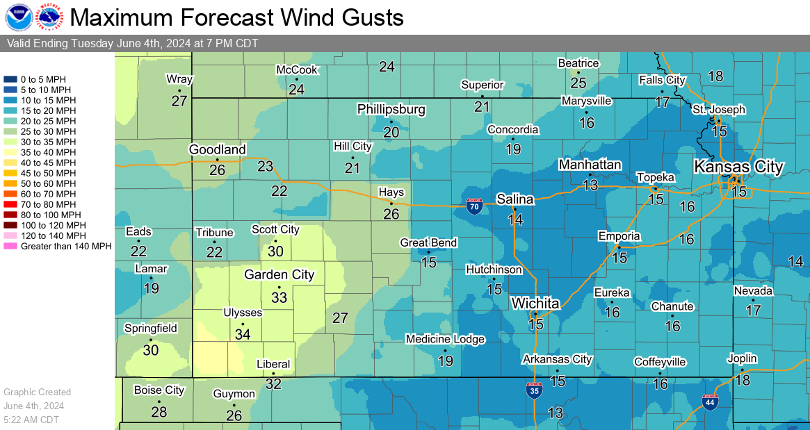
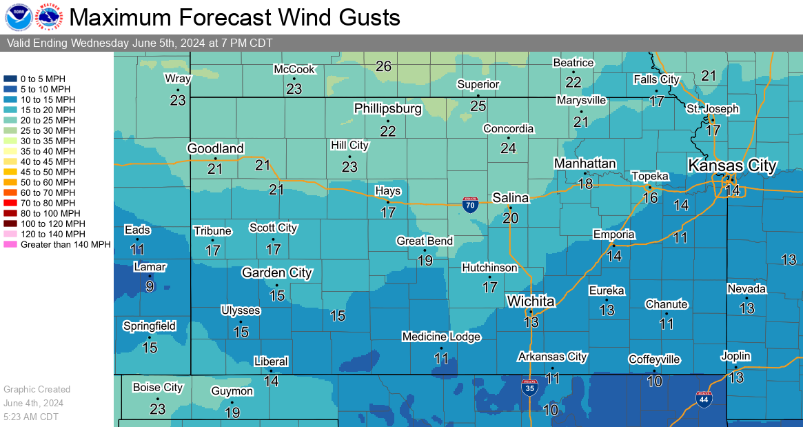
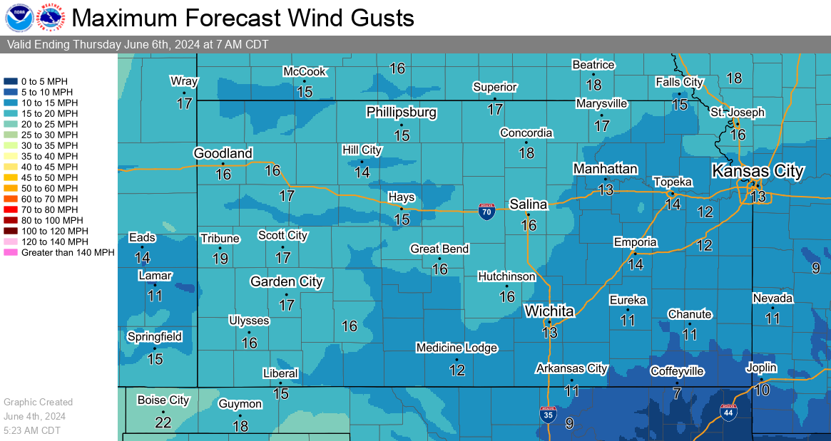
Maximum Wind Gust Forecasts
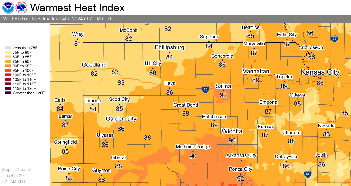
Heat Index Graphics