National Weather Service United States Department of Commerce

Arctic Air Spreads South and East from Rockies Friday through Next Week

Arctic air is plunging across the Rockies and Great Plains and will reach the Deep South and Great Lakes Saturday night, and the Eastern Seaboard by Sunday night, bringing dangerously cold wind chill temperatures. Snow and heavy winds could produce blizzard conditions in the Northern Plains Friday. There is a wintry mix expected in the Midwest/Northeast and rain for the Southeast into Saturday. Read More >

Click a location below for detailed forecast.

Last Map Update: Sat, Jan 18, 2025 at 5:48:30 am EST
Mostly cloudy and mild. Increasing chance of showers and possibly a thunderstorm north this afternoon. Highs in the 70s.
Showers and isolated thunderstorms mainly north and central. Lows in the 60s.
Showers and isolated thunderstorms. Highs in the upper 60s north, and in the 70s central and south.
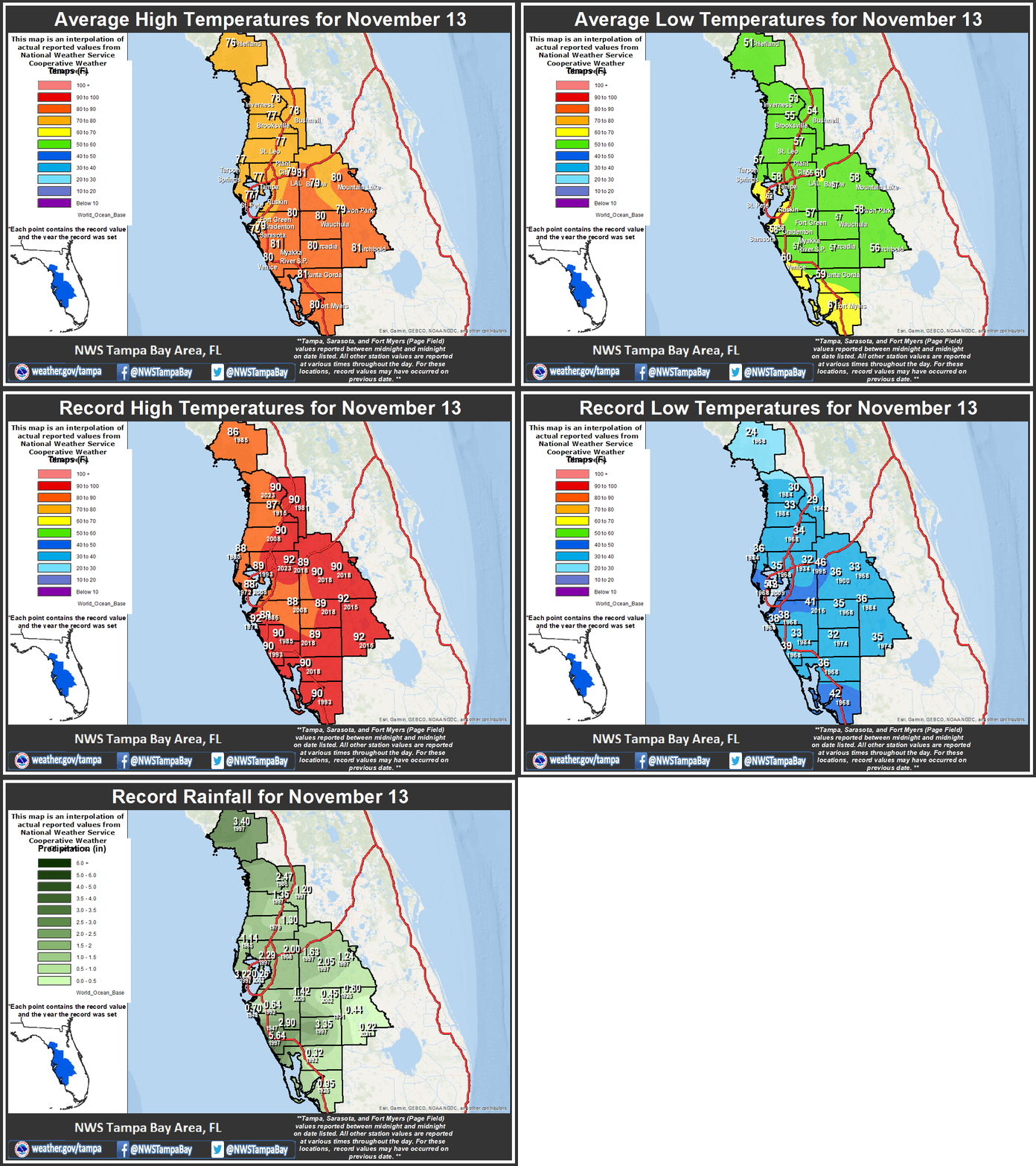
Climate for today, January 18: Long-term average highs and lows. Record highs and lows. Record rainfall.


Text Product Selector 


Radar
Radar
Current Weather
Current Weather
Rivers & Lakes
Rivers & Lakes
Satellite
Satellite
Weather Information Display
Weather Info Display
Forecast Maps
Forecast Maps
Hour by Hour Forecast
Wave Prediction
Weather Hazard Briefing
NOAA PORTS®
Forecaster's Discussion
Tropical Weather
Tropical
Marine Observations and Forecasts
Marine
Beach and Rip Current Forecast
Beach & Surf
Fire Weather
Fire Weather

 
Drought Page
Drought

 
NOAA Weather Radio
NOAA Weather Radio

 
NWS Skywarn Storm Spotter Program
Skywarn

 
Storm Report
Submit Storm Report