
Thunderstorms, some severe, may produce heavy to excessive rainfall over portions of the Central/Southern Plains, Mississippi Valley and Southeast. Dry and windy conditions will pose an elevated fire weather risk over parts of western Florida. Read More >
| Local Discussions, Zones, and other Forecast Products | ||||||||||||||||||||||||||||||||||||||||||||||||||||||
|
||||||||||||||||||||||||||||||||||||||||||||||||||||||
| NWS Glossary of Terms and Contractions | ||||||||||||||||||||||||||||||||||||||||||||||||||||||
| Digital Weather Grids, Local and Regional Scales (for states/locations not listed, select national view) |
||||||||||||||||||||||||||||||||||||||||||||||||||||||
|
||||||||||||||||||||||||||||||||||||||||||||||||||||||
Other Unique Forecast Discussions
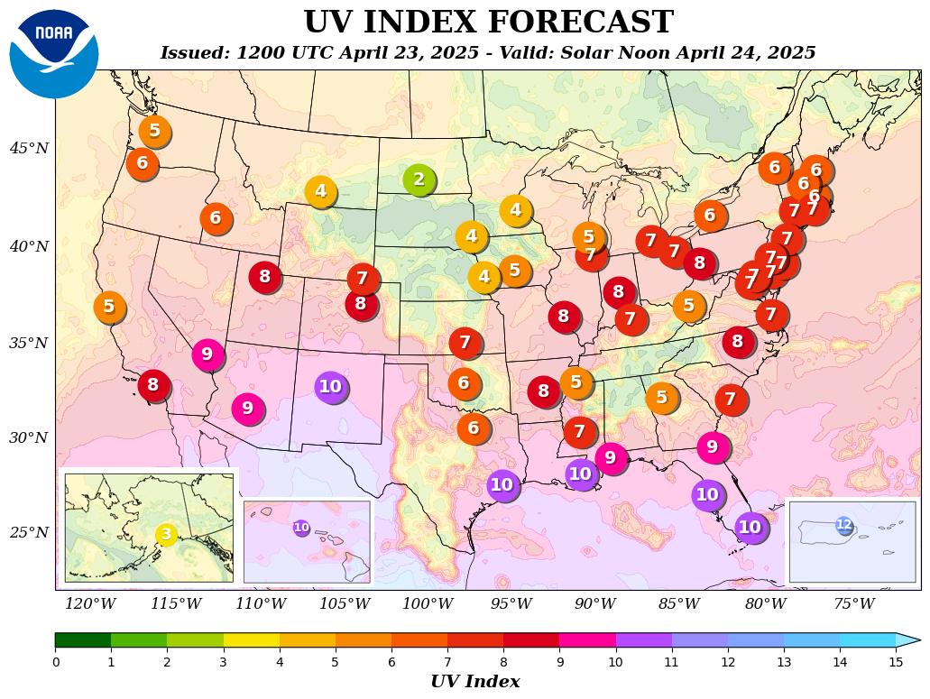
UV Index Forecasts: graphic map. |
||||||||||||||||||||||||||||||||||||||||||||||||||||||

