
Another round of strong to severe storms is possible today as a cold front crosses through the region, with the severe threat diminishing by this evening. The main hazard will be damaging wind, however, we cannot rule out some hail or an isolated tornado. Read More >
Microburst Damage Confirmed by National Weather Survey Team
Wirt County, WV
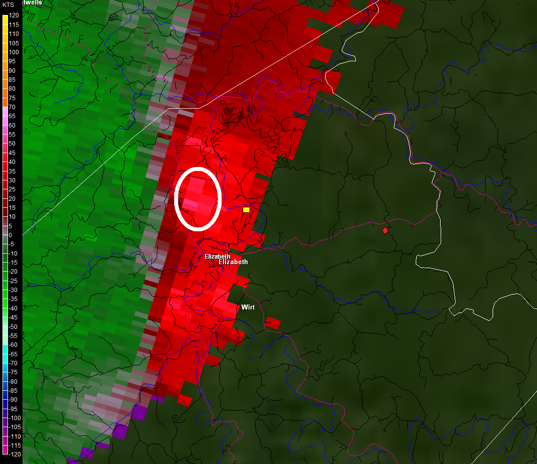
On June 13, 2013, a line of strong thunderstorms crossed the Ohio River into West Virginia just after 11:00 AM EDT. This line of storms can be seen on the radar image below, from 11:07 AM, stretching from near Parkersburg, WV, southeast along the Ohio River. The beginning and end point of the Wirt County microburst have been marked by a yellow square and red diamond respectively, just north and northeast of the Wirt label.
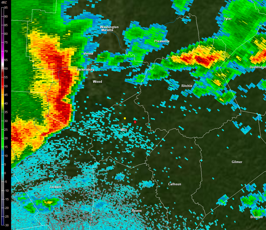
KRLX 0.5° Reflectivity -- June 13, 2013 -- 11:07 AM
The storms quickly moved east, across Wood County and into Wirt County. The three images below show the radar progression of the thunderstorms across the area of the microburst. Again the path of the concentrated microburst damage runs from the yellow square north of Elizabeth to the red diamond to the east.
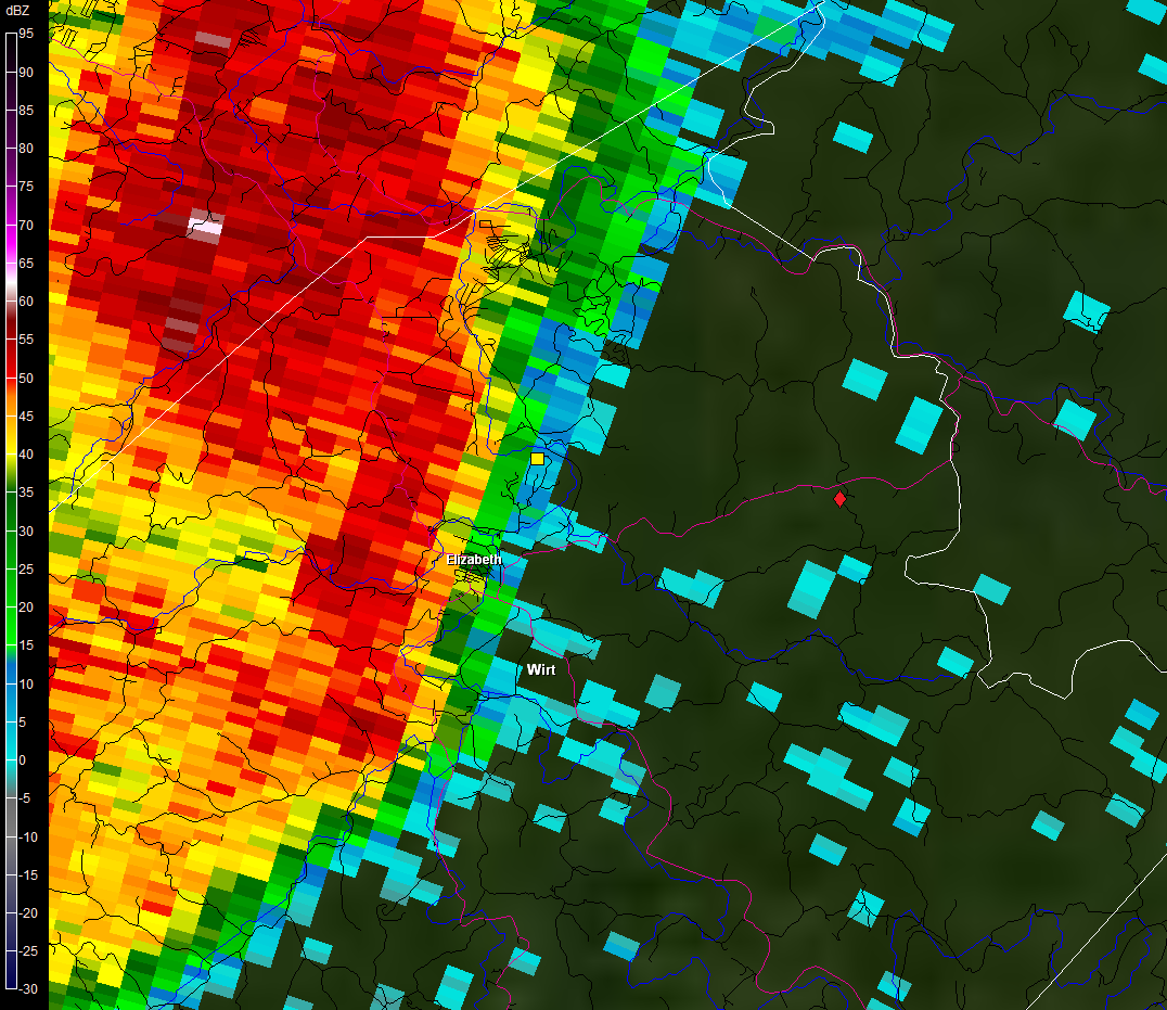
KRLX 0.5° Reflectivity -- June 13, 2013 -- 11:22 AM
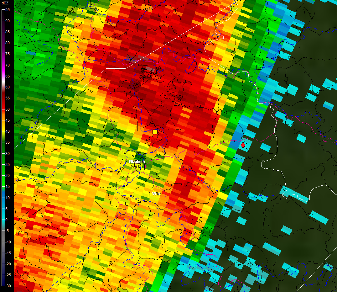
KRLX 0.5° Reflectivity -- June 13, 2013 -- 11:27 AM
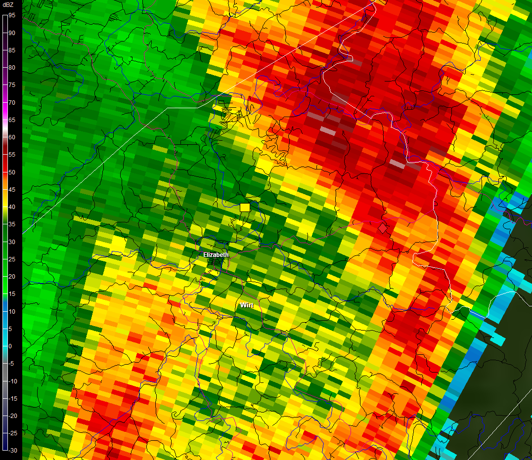
KRLX 0.5° Reflectivity -- June 13, 2013 -- 11:32 AM
Looking at the radar’s doppler velocity (or wind speed) image, there is an area of higher values that passes over the microburst area, however the radar is scanning over 4000 feet above the ground at this point so this is not really a good proxy for estimated surface wind speeds.
KRLX 0.5° Velocity -- June 13, 2013 -- 11:22 AM
Two meteorologists from the National Weather Service in Charleston, along with the Wirt County Emergency Manager, surveyed the damage, plotting damage points to determine the length and width of the microburst. Here is an excerpt from the Public Information Statement about the damage survey:
PUBLIC INFORMATION STATEMENT
NATIONAL WEATHER SERVICE CHARLESTON WV
147 PM EDT SAT JUN 15 2013
...MICROBURST CONFIRMED NEAR ELIZABETH IN WIRT COUNTY
WEST VIRGINIA...
LOCATION...2N TO 6ENE OF ELIZABETH IN WIRT COUNTY WV
DATE...JUNE 13 2013
ESTIMATED TIME...11:25 AM EDT
ESTIMATED MAXIMUM WIND SPEED...75-80 MPH
MAXIMUM PATH WIDTH...400 YARDS
PATH LENGTH...4.8 MILES
BEGINNING LAT/LON...39.085N / 81.381W
ENDING LAT/LON...39.076N / 81.292W
* FATALITIES...0
* INJURIES...0
* THE INFORMATION IN THIS STATEMENT IS PRELIMINARY AND SUBJECT TO
CHANGE PENDING FINAL REVIEW OF THE EVENT AND PUBLICATION IN
NWS STORM DATA.
...SUMMARY...
THE NATIONAL WEATHER SERVICE IN CHARLESTON WV HAS CONFIRMED A
MICROBURST NEAR ELIZABETH IN WIRT COUNTY WEST VIRGINIA ON
JUNE 13 2013.
A LINE OF THUNDERSTORMS MOVING FROM WEST TO EAST AT ABOUT 50
MPH...ENTERED WIRT COUNTY JUST AFTER 11 AM ON THURSDAY JUNE 13.
THE LINE OF STORMS CROSSED THE TOWN OF ELIZABETH AROUND 11:25 AM.
A STORM DAMAGE SURVEY CONDUCTED ON FRIDAY JUNE 14 FOUND A
CONCENTRATED SWATH OF DAMAGE FROM ABOUT 2 MILES NORTH TO ABOUT 6
MILES EAST-NORTHEAST OF ELIZABETH.
NUMEROUS TREES WERE UPROOTED OR SNAPPED...A COUPLE TREES FELL ONTO
HOUSES OR OTHER STRUCTURES. ALSO...THE ROOF OF AN OPEN-ENDED PORCH
WAS FLIPPED ONTO THE HOUSE IT WAS ATTACHED TO.
LITTLE TO NO DAMAGE WAS FOUND IMMEDIATELY TO THE EAST OR WEST OF
THIS SWATH. HOWEVER...SHORTLY AFTER THIS MICROBURST...THE STORM
DEVELOPED A BOWING SEGMENT AND ADDITIONAL DAMAGE WAS REPORTED
ABOUT 50 MILES TO THE EAST ACROSS PORTIONS OF LEWIS AND UPSURE
COUNTIES.
FOR REFERENCE...
A MICROBURST IS A CONVECTIVE DOWNDRAFT WITH AN AFFECTED OUTFLOW
AREA OF LESS THAN 2 1/2 MILES WIDE AND PEAK WINDS LASTING LESS THAN
5 MINUTES. MICROBURSTS MAY INDUCE DANGEROUS HORIZONTAL/VERTICAL
WIND SHEARS...WHICH CAN ADVERSELY AFFECT AIRCRAFT PERFORMANCE AND
CAUSE PROPERTY DAMAGE. STRAIGHT-LINE WINDS ARE GENERALLY ANY WIND
THAT IS NOT ASSOCIATED WITH ROTATION...USED MAINLY TO
DIFFERENTIATE THEM FROM TORNADIC WINDS.
Below is a map showing the damage points found (green circles) and the path of the microburst (green polygon). You may notice a couple damage points outside of the highlighted microburst area. The damage in these areas was not as severe, nor as concentrated, as the microburst area. You may also notice there are no damage points along portions of the microburst track. There was likely damage in these areas as well, however they were not explored during the damage survey. Following the map, are several pictures taken during the damage survey.
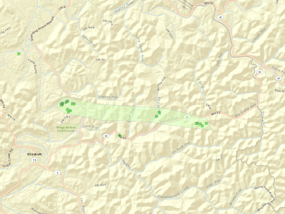
Path of June 13 Microburst in Wirt County
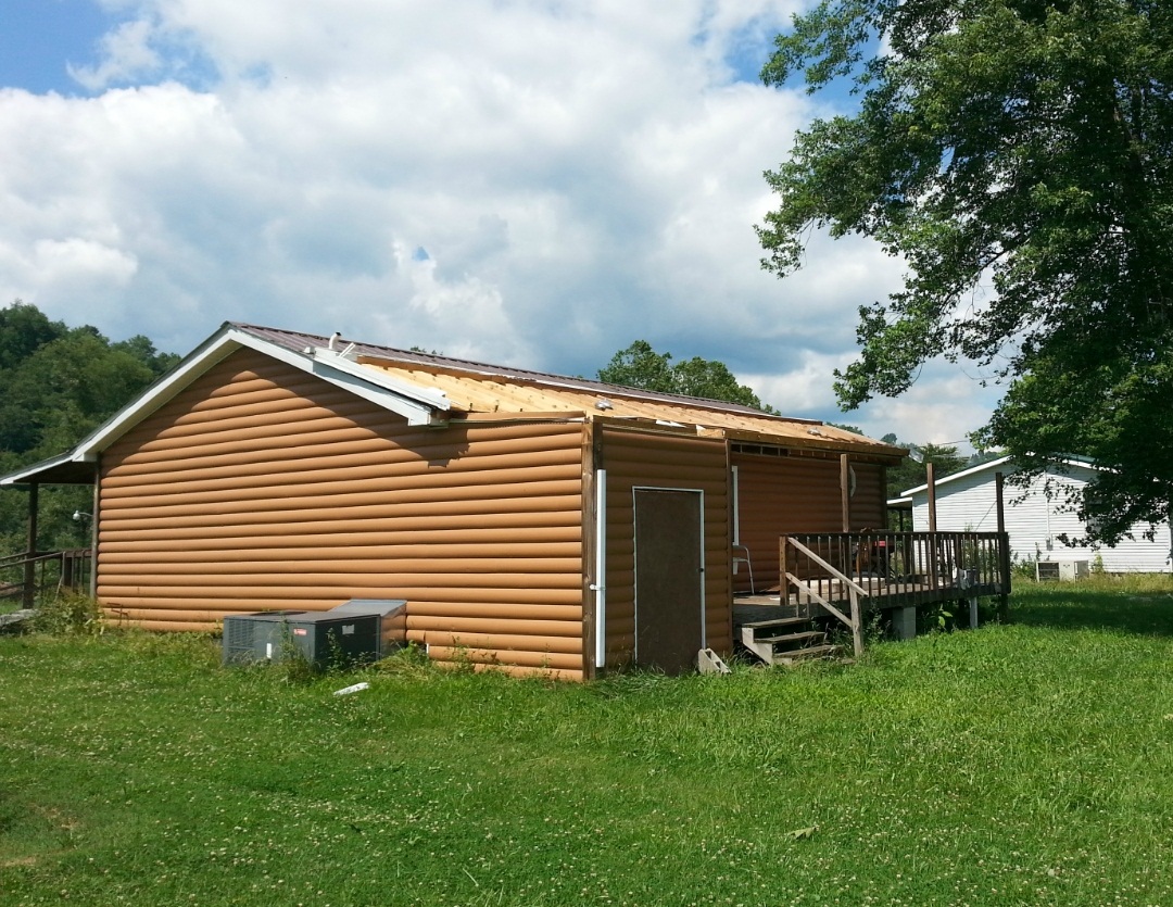
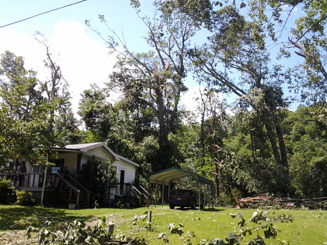
Porch Roof Flipped onto House Near Beginning of Microburst Path
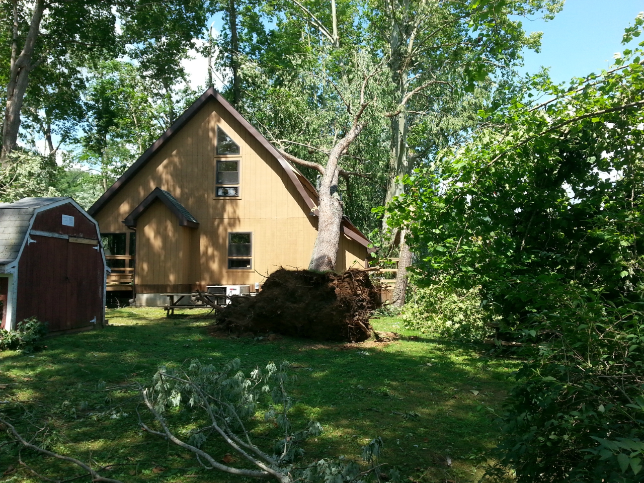
Tree Uprooted onto House Near Beginning of Microburst Path
Large Branches and Limbs Down Near Beginning of Microburst Path
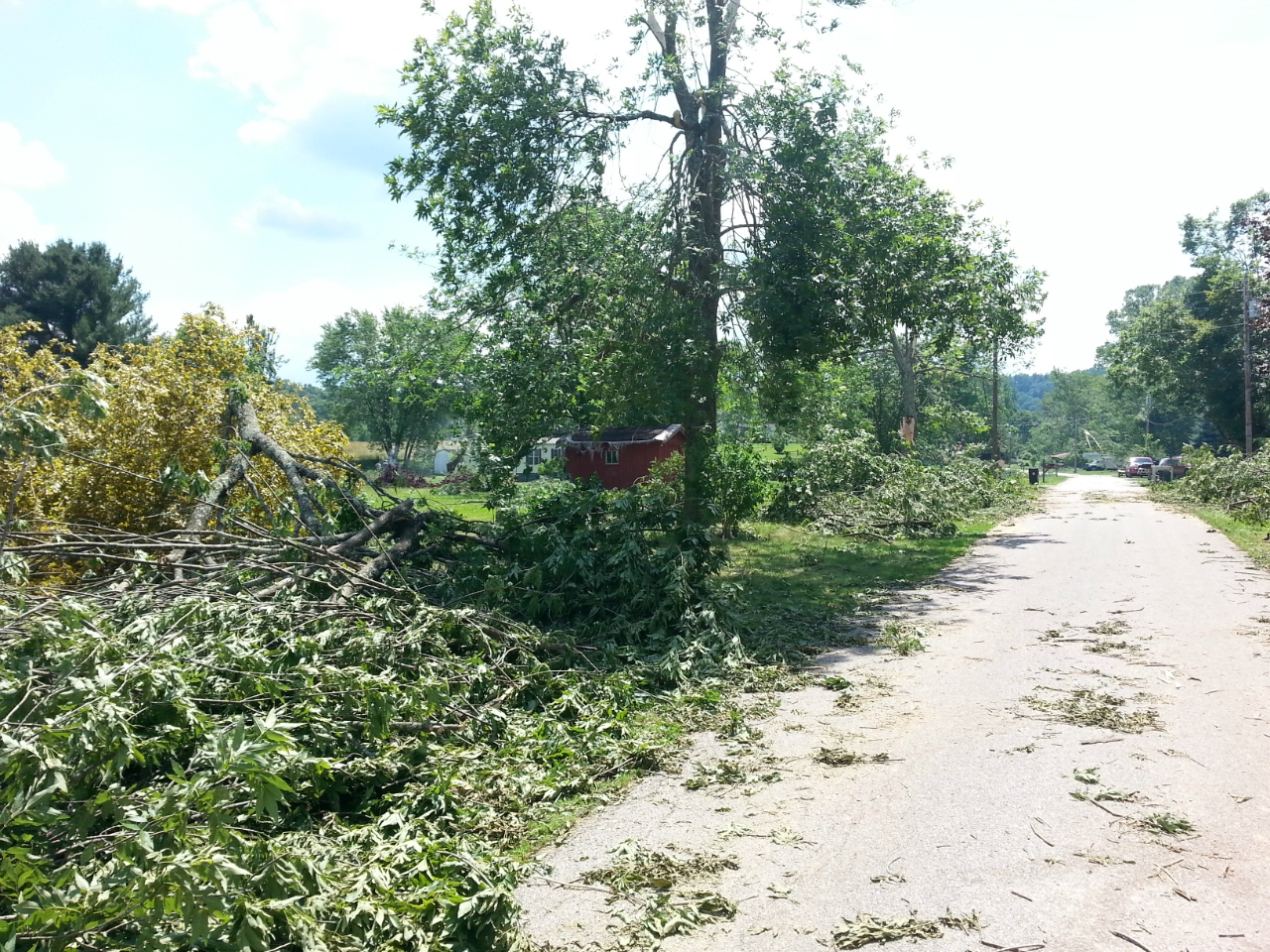
Large Branches and Limbs Down Near Beginning of Microburst Path
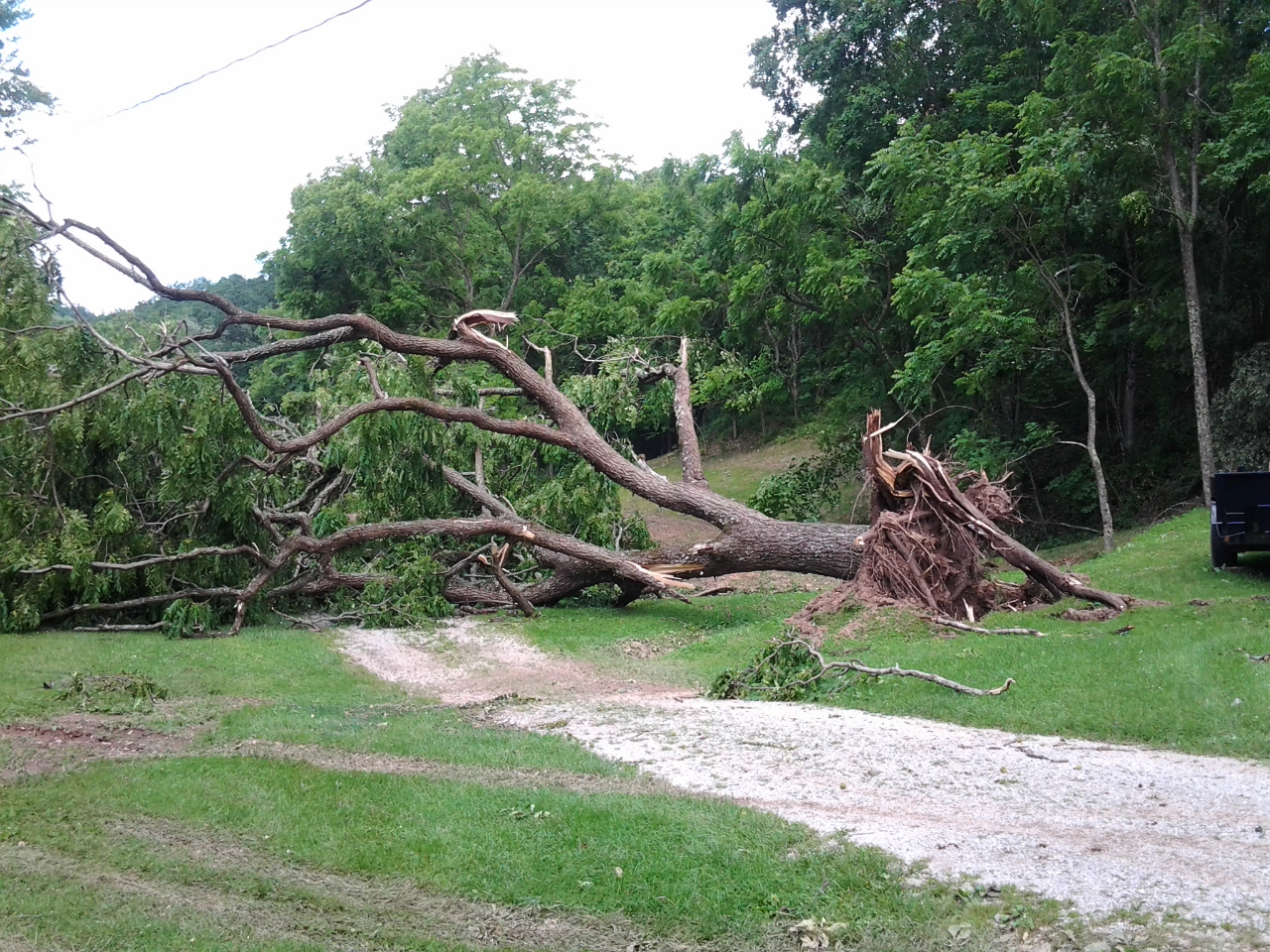
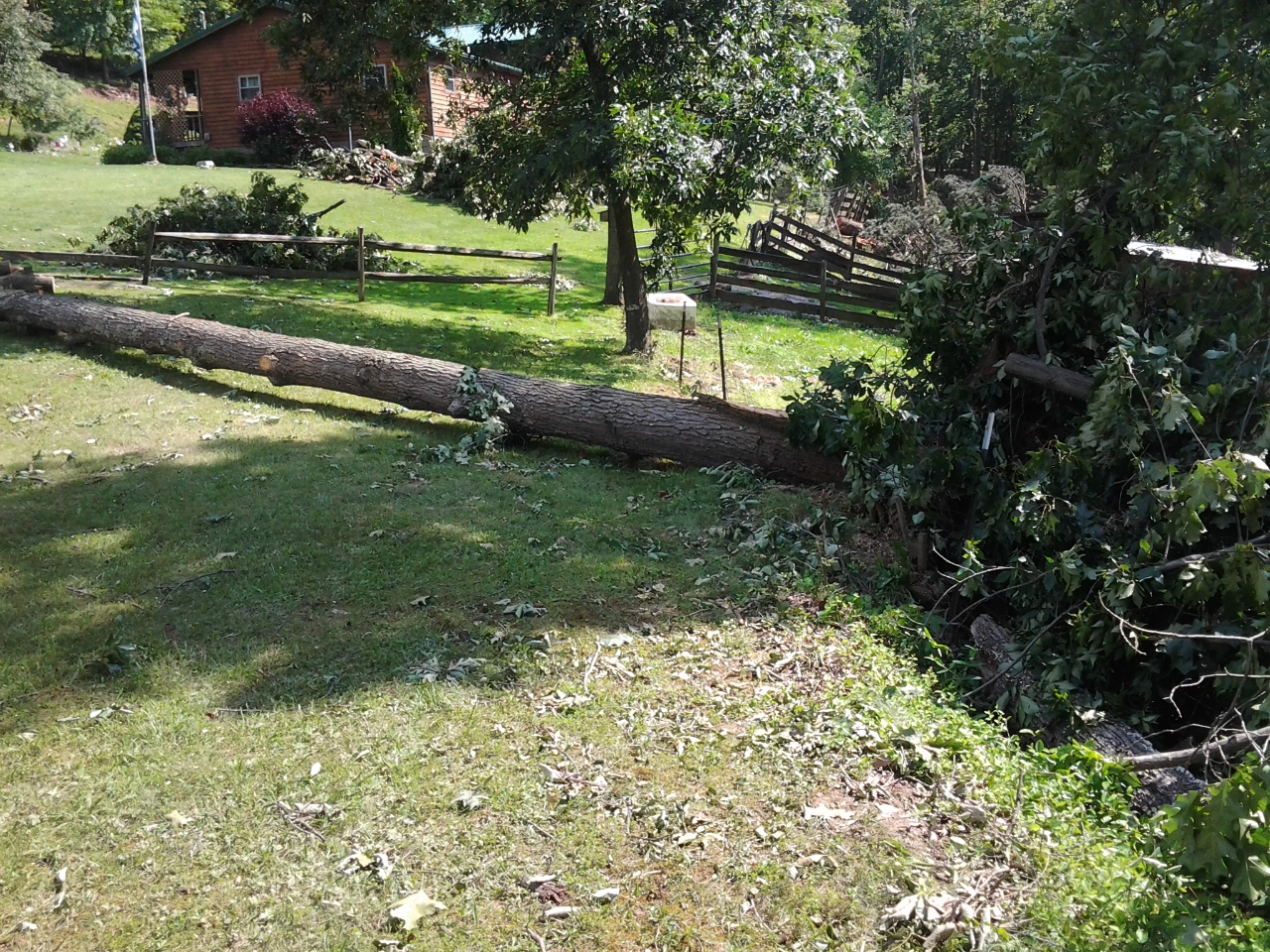
Large Tree Uprooted Along Wilson Fork Near Middle of Microburst Path
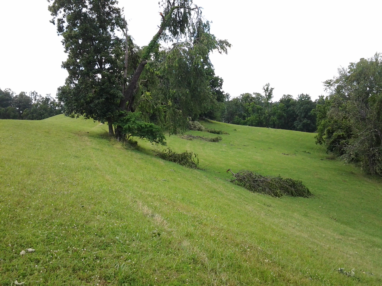
Large Branches Down Near End of Microburst Path
Tree Uprooted and Branches Down Near End of Microburst Path

