
Severe thunderstorms are expected across portions of the Southeast and Carolinas today where a Slight Risk (Level 2 of 5) has been issued. A Slight Risk Excessive Rainfall Outlook (Level 2 of 4) has been issued for part of the northern Gulf Coast today due to the threat of flash, urban, and riverine flooding. Read More >
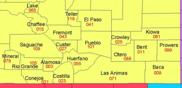
Our area of responsibility covers southeast and south central Colorado. The counties in our area of responsibility are:
The topography of our area is extremely diverse, as you can see from the topographic map below.
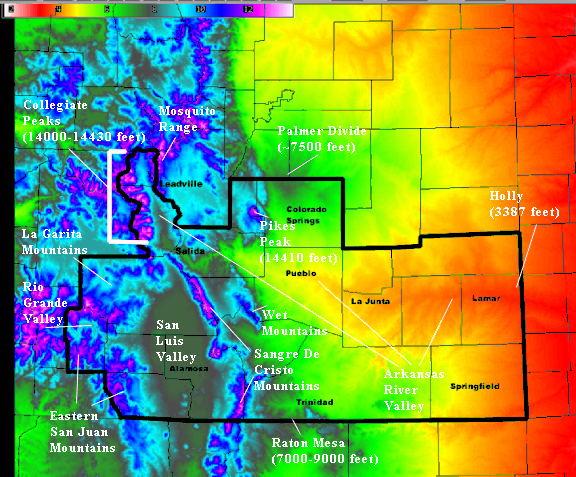 We recently realigned our zones to reflect the topography better. Many of our zone lines are based on an elevation contour. For a more detailed map showing our zones and related elevations, click on the thumbnail below.
Click above map to enlarge Our products are issued either by zone or by county. Zone codes are listed in the above table. County names, and associated FIPS (Federal Information Processing Standard) codes, are pictured below.
|


 Follow us on YouTube