Click image to enlarge 
| National Watches & Warnings | Local Watches & Warnings | Weather Story | SPC Current Activity Chart |
 |
 |
 |
 |
| Display Watch & Warning Map Key: | Situational Awareness Monitoring Links NWS Enhanced Data Display NWS Radar (Experimental Ridge) |
||
Radar
| Northern/Central Rockies Region | Pueblo | Southern Rockies Region | ||||||||||||||||||
|
||||||||||||||||||||
24 Hour Precipitation Ending 6-9 AM Mountain Time
| CoCoRaHS and COOP Observations | |||
| CoCoRaHS Precipitation Reports | |||
Current Observations
| Currrent Conditions Interactive Map: NWS Weather & Hazards Data Viewer | |||
Weather Maps
| National Surface Analysis | Today's Storm Reports |
 |
 |
| Satellite | |
 |
|
Surface Observations (courtesy MesoWest)
CDOT Cameras and Road Conditions (courtesy CDOT)
|
|
|||
| Note: The National Weather Service is not responsible for the content, timeliness or reliability of the webcam images. Images are provided as an aid to evaluate current conditions at various locations across the local area. |
|||
Overview
| Today's Forecast | Tomorrow's Forecast | Day 3 Forecast |
 |
 |
 |
Hazardous Weather Outlook
|
|
|||
Technical Forecast Discussion
|
|
|||
Medium-Range Outlooks
| Day 8 to 14 Temperature Outlook |
Day 8 to 14 Precipitation Outlook |
 |
 |
| Short-Term Severe Weather |
| Mesoscale Discussions | Current Severe Weather Watches |
 |
 |
 |
Severe Weather Outlooks
|
|
|||
Severe Weather Watches
|
|
|||
Storm Prediction Center's Outlooks for Today
| Categorical Outlook |
Tornado Probability Outlook |
Hail Probability Outlook |
Wind Probability Outlook |
 |
 |
 |
 |
| SPC Day 2 Outlook | SPC Day 3 Outlook | |||
| Categorical Outlook |
Probabilistic Outlook |
Categorical Outlook |
Probabilistic Outlook |
|
 |
 |
 |
 |
|
Recent Local Storm Reports
| Today's Reports | Yesterday's Reports |
|
 |
| Note: All storm reports are preliminary and are not considered official until certified in Storm Data. | |
Additional Resources
| Data and Analysis | Preparedness and Safety | ||
| - SPC Mesoanalysis | - Storm Ready | ||
| - Most Recent Storm Reports | - Lightning Safety | ||
| - Severe Weather Preparedness | |||
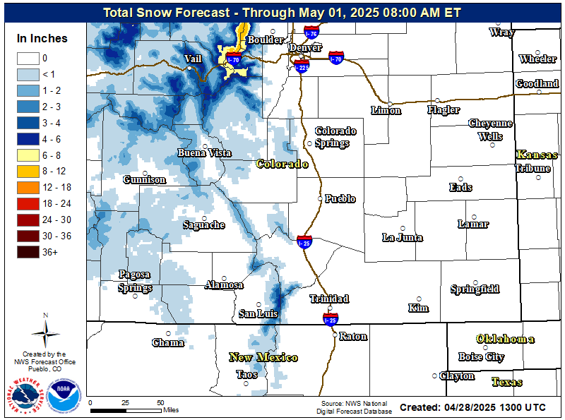
48-72 Hour Total Snowfall Forecast
 |
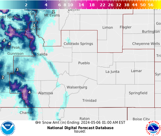
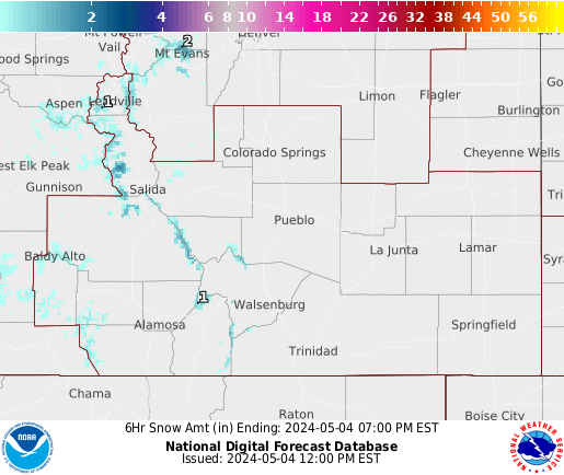
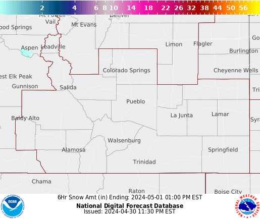
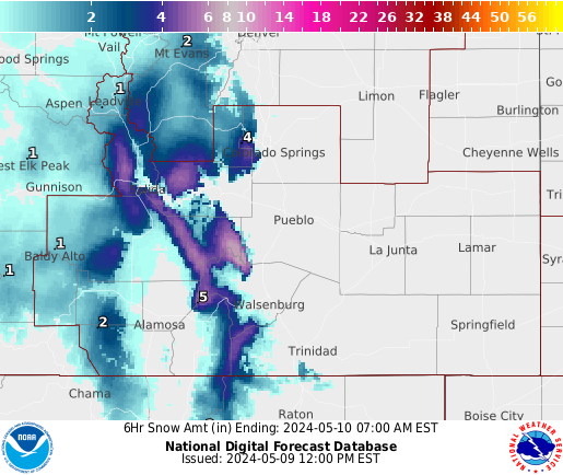
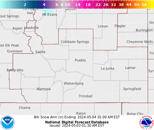
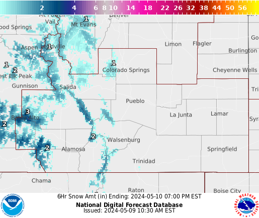
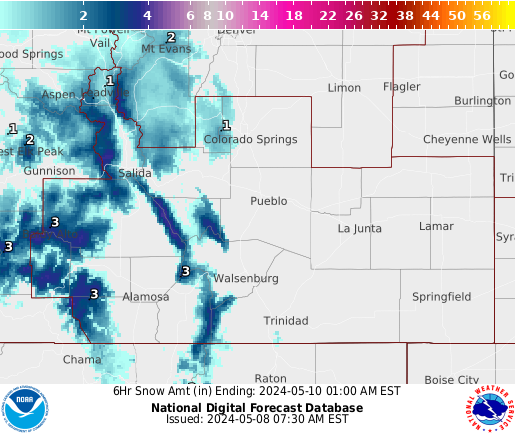
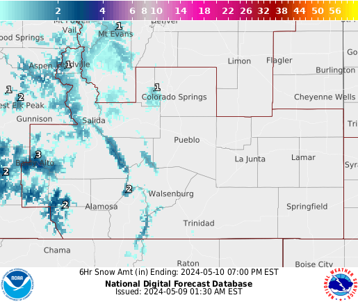
6-Hourly Snowfall Forecasts
| 0-5 Hour | 6-11 Hour | 12-17 Hour | 18-23 Hour |
 |
 |
 |
 |
| 24-29 Hour | 30-35 Hour | 36-41 Hour | 42-47 Hour |
 |
 |
 |
 |
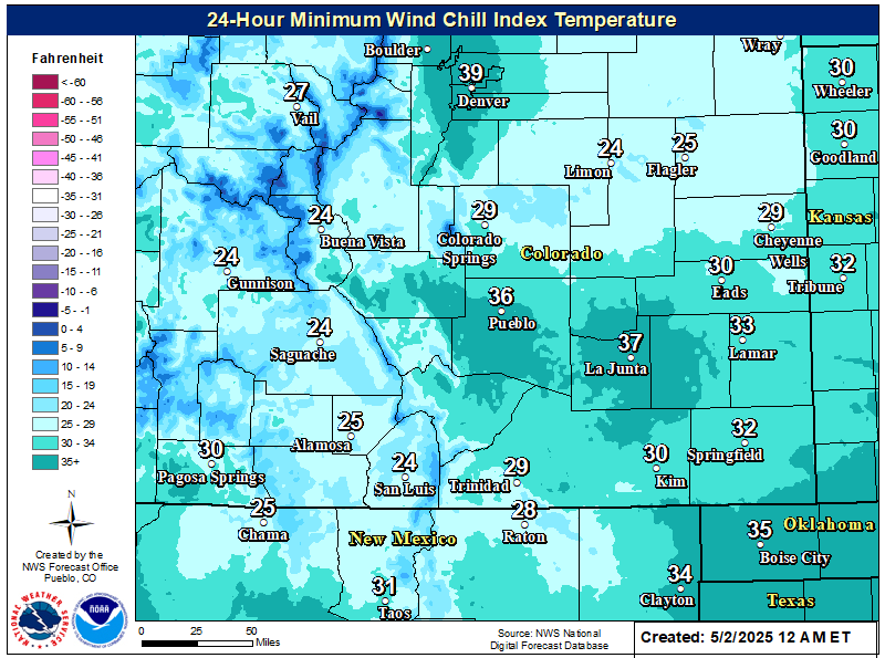
Wind Chill (Apparent Temperature)
Lower Apparent Temperature(Wind Chill) in next 24 Hours
 |
|
|
|||
|
|
|||
National Outlooks
Today
(Discussion)
| Freezing Rain > 1/4 inch | Snow > 4 inches | Heavy Snow > 8 inches | Heavy Snow > 12 inches |
 |
 |
 |
 |
Tomorrow
(Discussion)
| Freezing Rain > 1/4 inch | Snow > 4 inches | Heavy Snow > 8 inches | Heavy Snow > 12 inches |
 |
 |
 |
 |
Day 3
(Discussion)
| Freezing Rain > 1/4 inch | Snow > 4 inches | Heavy Snow > 8 inches | Heavy Snow > 12 inches |
 |
 |
 |
 |
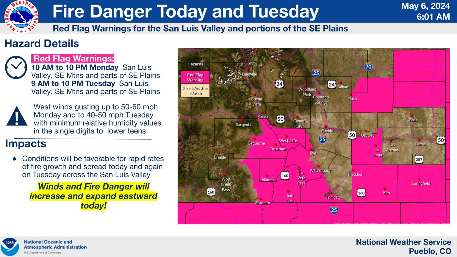
National Fire Weather Outlooks, Watches & Warnings, & Rainfall Forecasts
| Current Fire Weather Watches & Warnings |
 |
 |
Local Fire Weather Watch and/or Red Flag Warning
7-Day Fire Weather Forecast
| Today's Fire Weather Outlook |
Today's Rainfall Forecast |
 |
 |
| Tomorrow's Fire Weather Outlook |
Tomorrow's Rainfall Forecast |
 |
 |
| Day 3 Fire Weather Outlook |
Day 3 Rainfall Forecast |
 |
 |
Additional Resources
| - Spot Forecast Request (Official Use Only) | |||
| - NWS Pueblo Fire Weather Page | |||
| - NWS SPC Fire Weather Analysis Page | |||
| - NWS National Fire Weather Display | |||
| - Active Fire Map | |||
| - National Interagency Fire Center | |||
| - Inciweb | |||
| - 7-Day Signinficany Fire Potential (US) | |||
| - NESDIS/Satellite Services Fire and Smoke Analysis Program's daily Fire Map, Smoke Map, and Interactive GIS Display | |||
South Central and Southeast Colorado River Data
| Upper Arkansas River | Lower Arkansas River | Fountain Creek | Rio Grande | Purgatoire | |||||
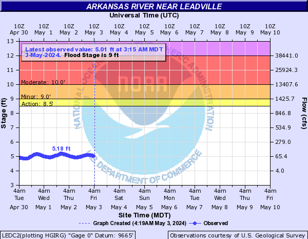 |
LEDC2 - Leadville | 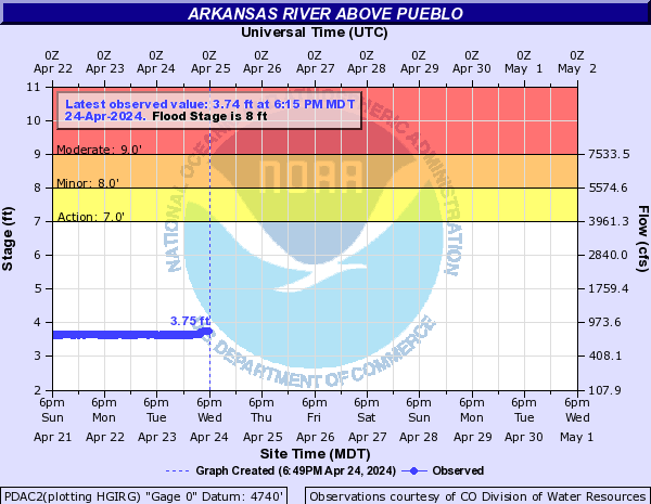 |
PDAC2 - Pueblo Dam |  |
FNEC2 - Colorado Springs | 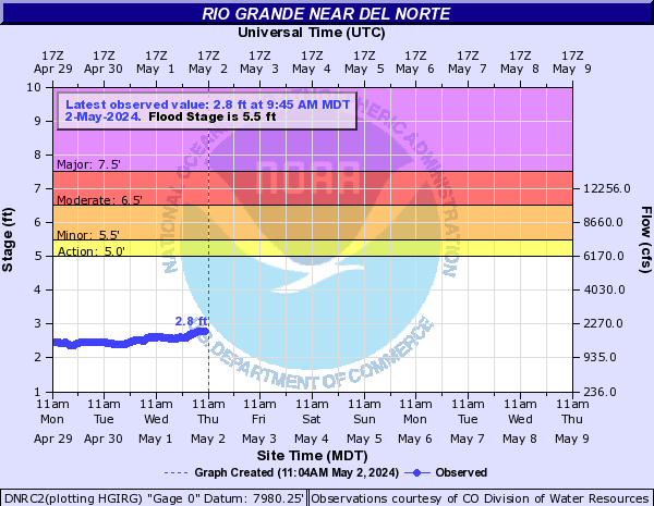 |
DNRC2 - Del Norte | 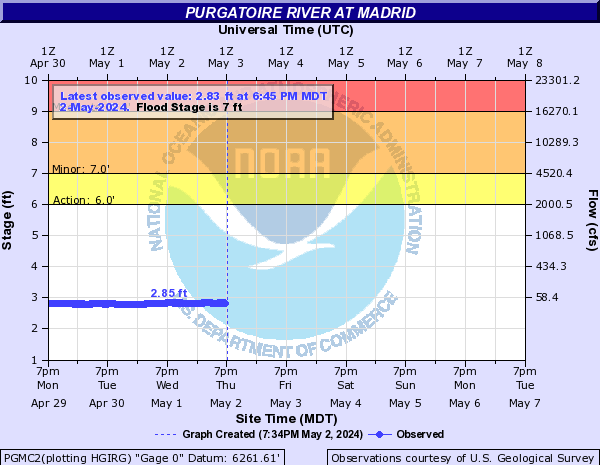 |
PGMC2 - Madrid |
 |
SALC2 - Salida |  |
ADLC2 - Avondale | 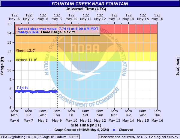 |
FHAC2 - Fountain | 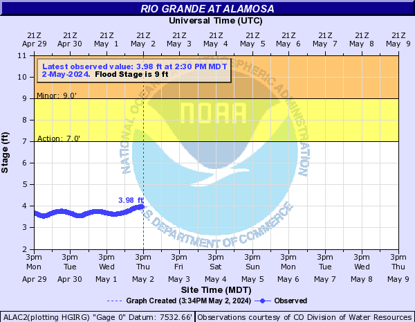 |
ALAC2 - Alamosa |  |
PGRC2 - Trinidad Lake |
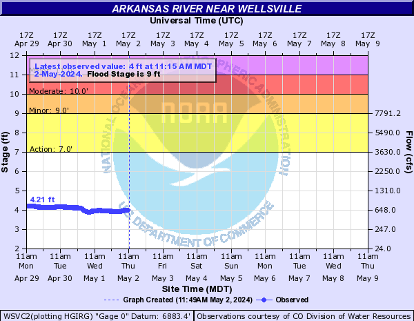 |
WSVC2 - Wellsville | 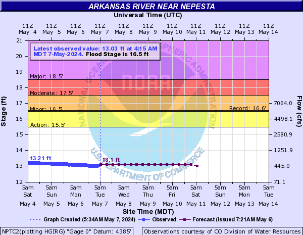 |
NPTC2 - Nepesta |  |
FCHC2 - Pueblo | 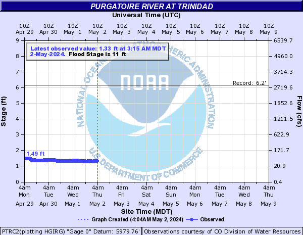 |
PTRC2 - Trinidad | ||
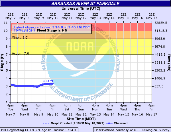 |
PDLC2 - Parkdale |  |
CDMC2 - Catlin Dam |  |
LAPC2 - Las Animas | ||||
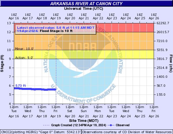 |
CNCC2 - Canon City |  |
ARCC2 - Rocky Ford | ||||||
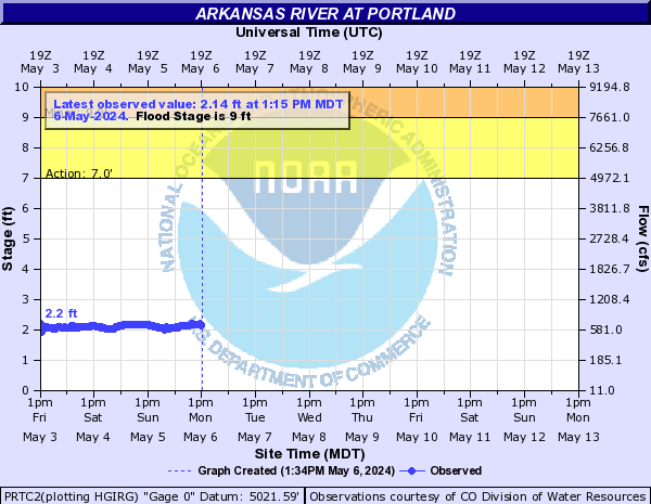 |
PRTC2 - Portland | 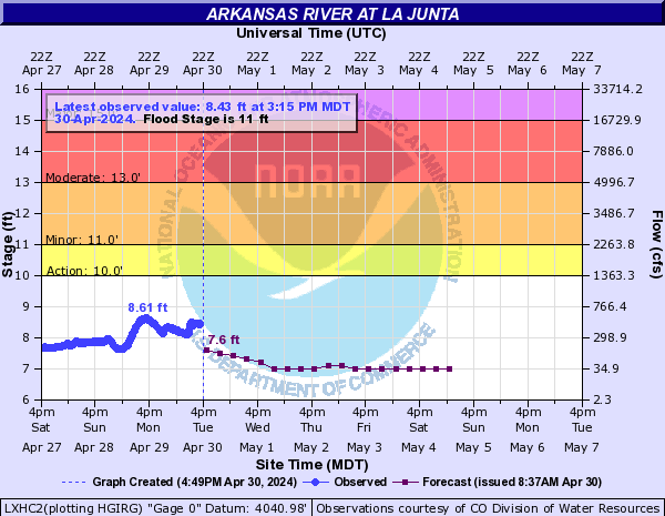 |
LXHC2 - La Junta | ||||||
 |
LMAC2 - Lamar | ||||||||
Hydrology/Snowpack
Snow Data from National Operational Hydrologic Remote Sensing Center(NOHRSC)
| Snow Depth | |
 |
|
| Snow Water Equivalent | |
 |
|
| Snow Water Equivalent 24 Hour Change | |
 |
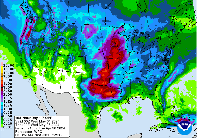
Outlooks and Precipitation Amount Forecasts
 |
 |
|
|
|
|
|
|
|
|
|
|
|
|
 |
 |
 |
|
|
|
||
 |
 |
||
Drought
| Current Drought Status | Drought Outlook |
 |
 |
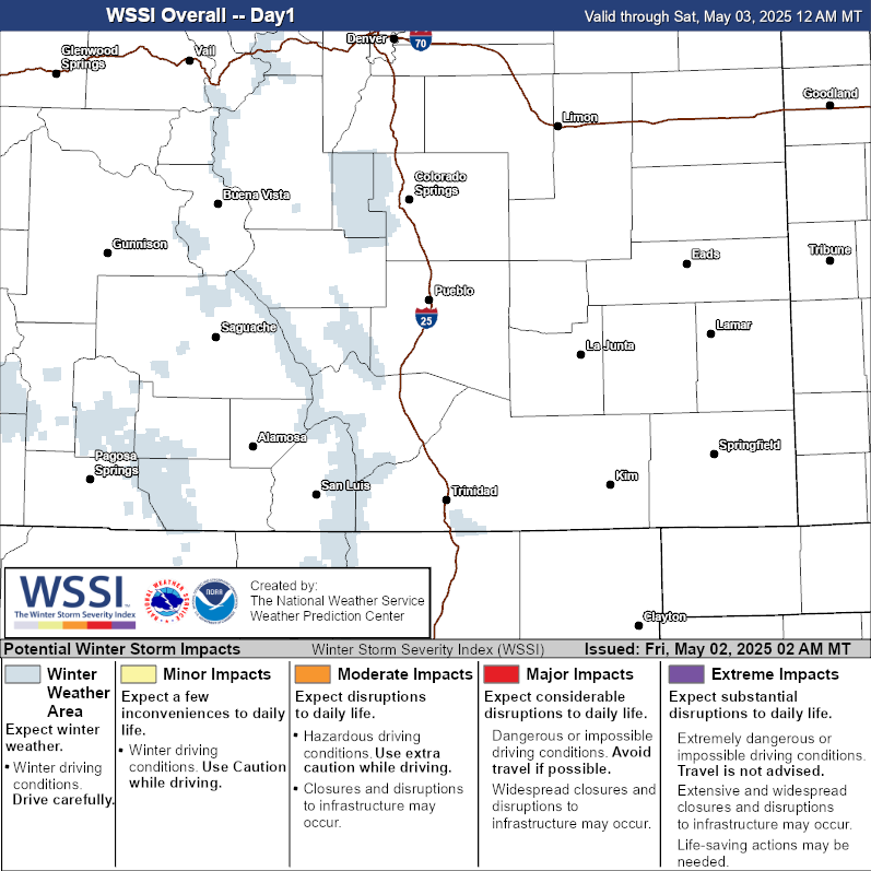
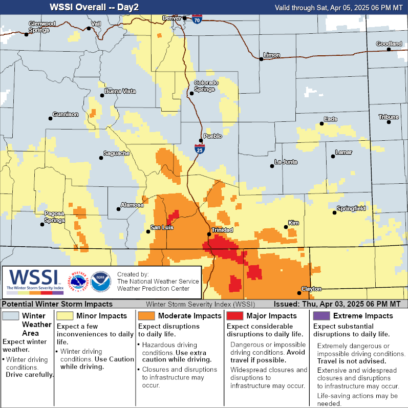
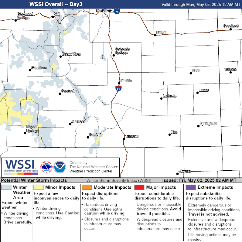
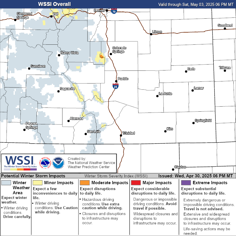
WSSI Overall
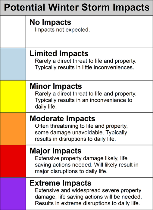
*Please Note* Static images only update at 01, 09, 13, 19 and 21 UTC
| Day 1 Overall | Day 2 Overall |
 |
 |
| Day 3 Overall | Day 1 - 3 Overall |
 |
 |
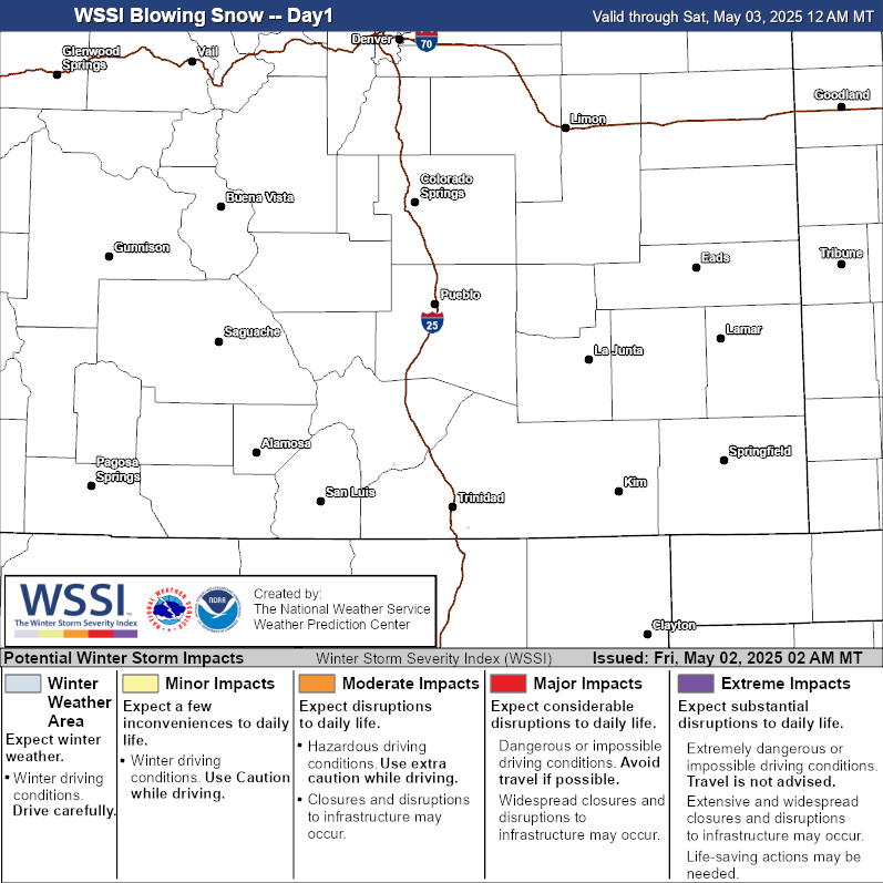
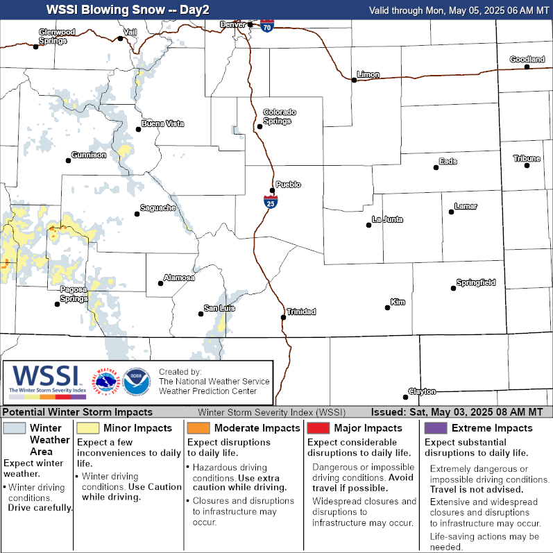
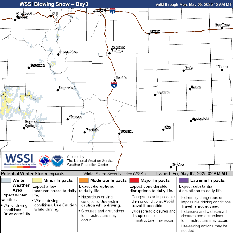
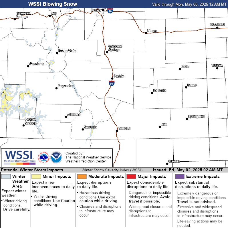
WSSI Blowing Snow
| Day 1 Blowing Snow | Day 2 Blowing Snow |
 |
 |
| Day 3 Blowing Snow | Day 1 - 3 Blowing Snow |
 |
 |
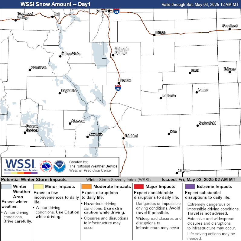
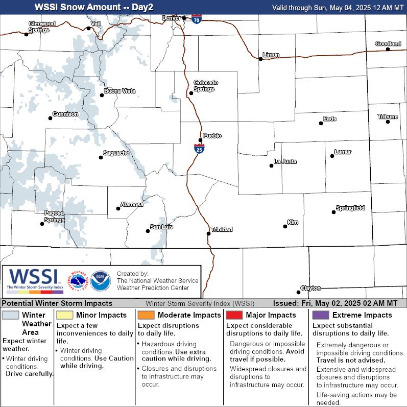
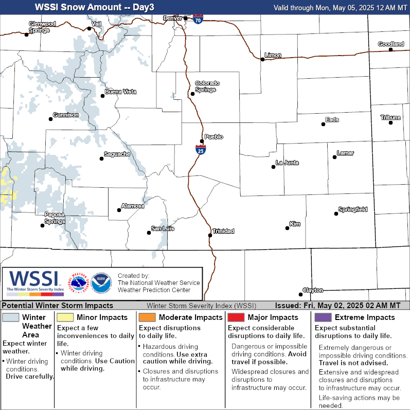
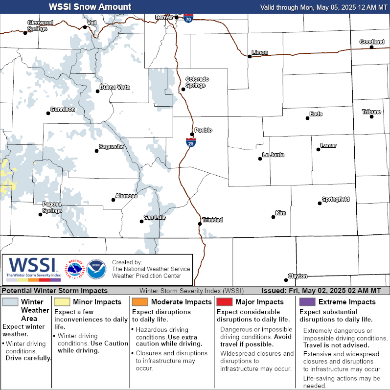
WSSI Snow Amount
| Day 1 Snow Amount | Day 2 Snow Amount |
 |
 |
| Day 3 Snow Amount | Day 1 - 3 Snow Amount |
 |
 |
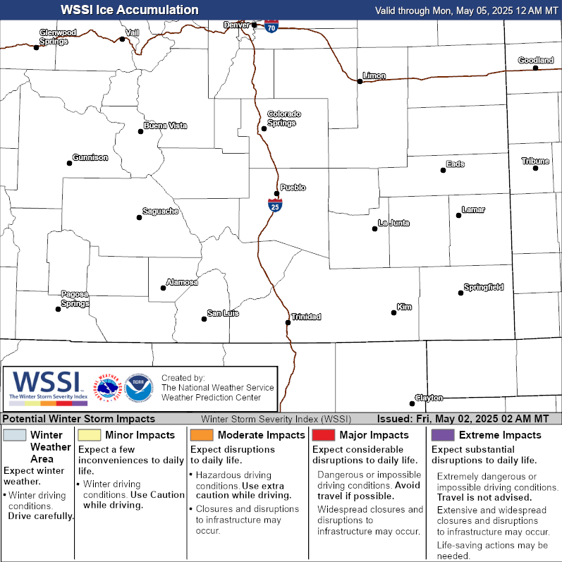
WSSI Ice Accumulation
| Day 1 Ice Accumulation | Day 2 Ice Accumulation |
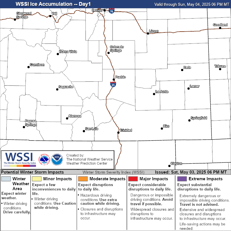 |
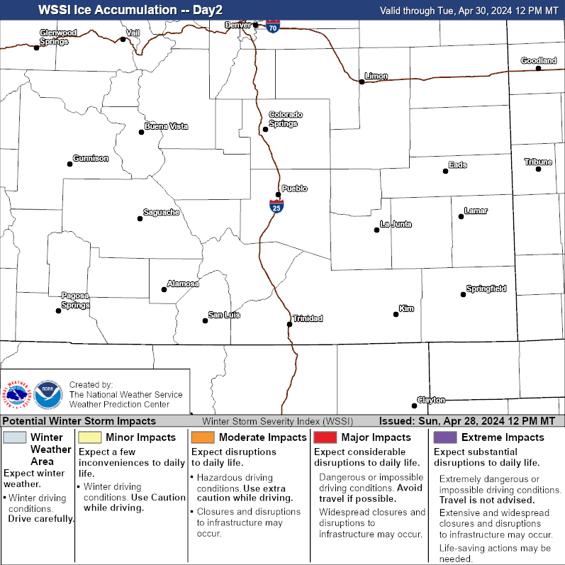 |
| Day 3 Ice Accumulation | Day Ice Accumulation |
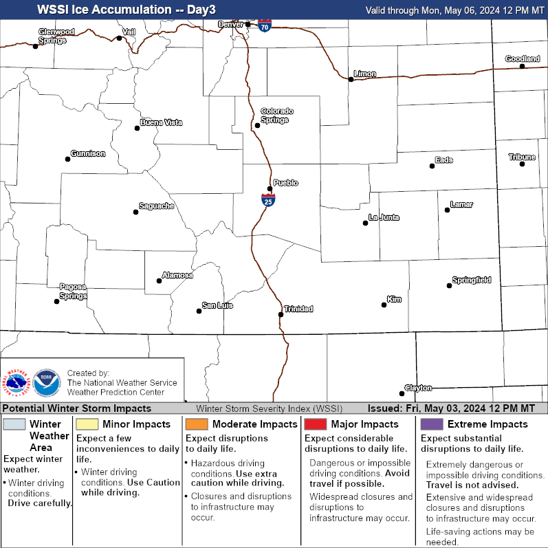 |
 |
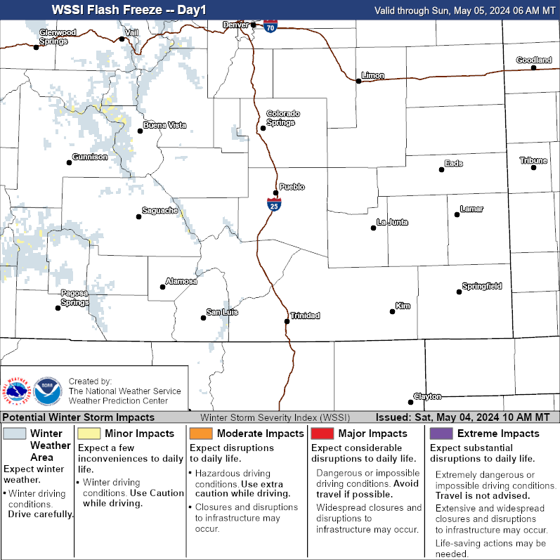
WSSI Flash Freeze
| Day 1 Flash Freeze |
 |
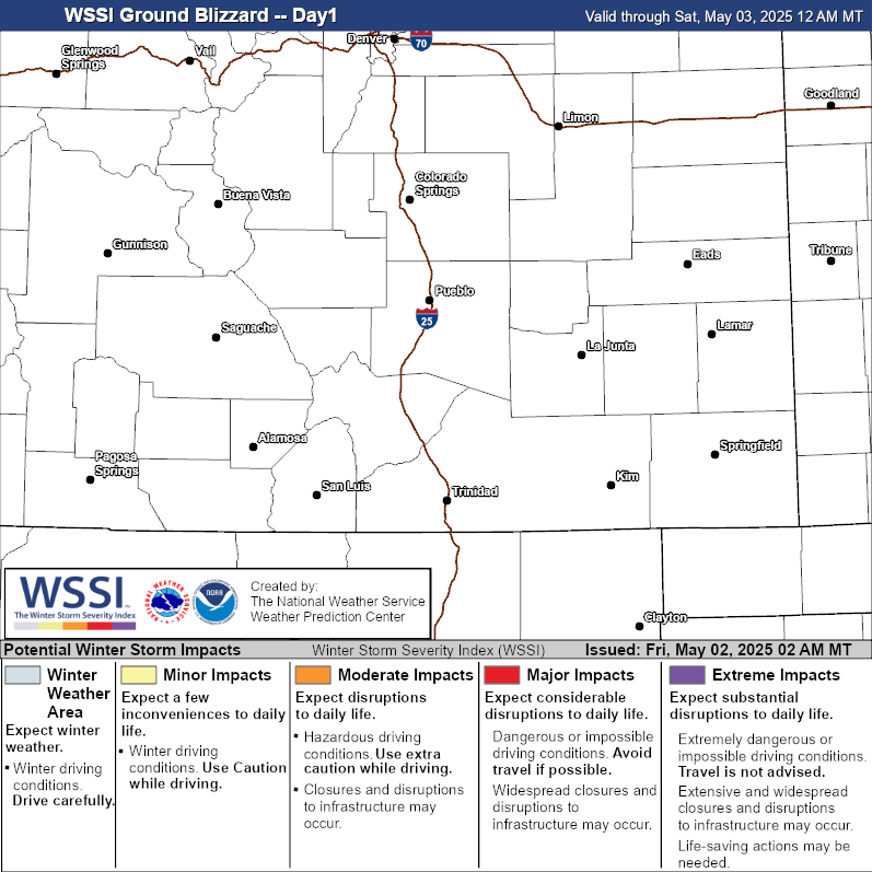
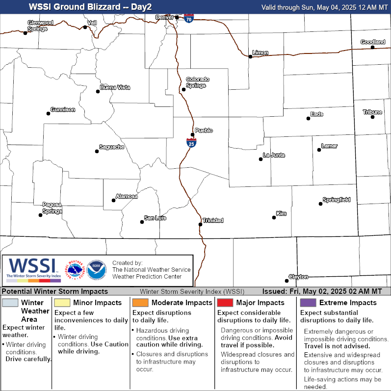
WSSI Ground Blizzard
Media Links
| Day 1 Ground Blizzard | Day 2 Ground Blizzard |
 |
 |

