.JPG)
.png)
.JPG)
.png)
.jpg)
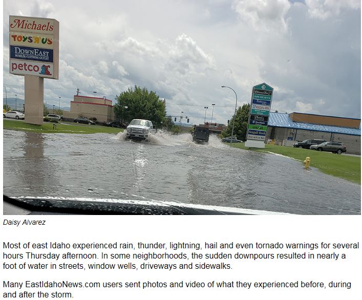
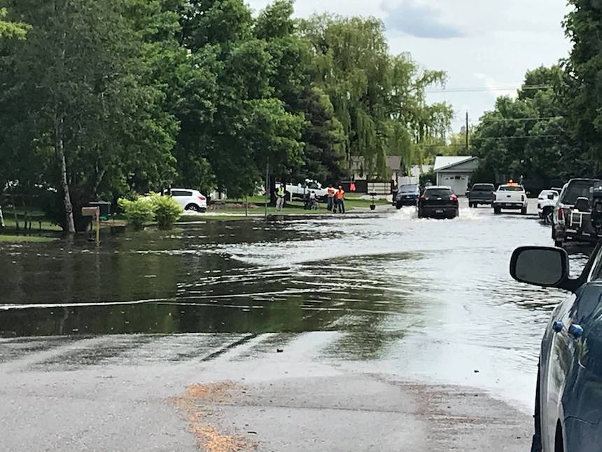
...HIGHEST THUNDERSTORM HAIL REPORTS MAY 31ST...
..TIME...   ...EVENT...      ...CITY LOCATION...     ...LAT.LON...
..DATE...   ....MAG....      ..COUNTY LOCATION..ST.. ...SOURCE....
            ..REMARKS..
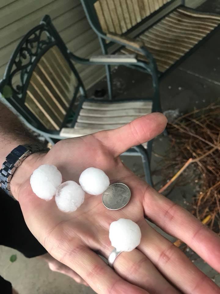
0600 PM     HAIL             20 SW BURLEY            42.33N 114.06W
05/30/2018  M1.25 INCH       CASSIA             ID   SOCIAL MEDIA

            SOCIAL MEDIA PICTURE OF HALF DOLLAR SIZED HAIL 6 MILES
            SOUTH OF MURTAUGH.
1246 PM     HAIL             1 W IDAHO FALLS         43.49N 112.05W
05/31/2018  E0.88 INCH       BONNEVILLE         ID   PUBLIC
1246 PM     HAIL             1 SW AMMON              43.47N 111.98W
05/31/2018  M1.00 INCH       BONNEVILLE         ID   NWS EMPLOYEE
1258 PM     HAIL             2 E UCON                43.59N 111.88W
05/31/2018  M0.75 INCH       BONNEVILLE         ID   TRAINED SPOTTER
0106 PM     HAIL             1 WNW IDAHO FALLS       43.50N 112.05W
05/31/2018  M0.88 INCH       BONNEVILLE         ID   PUBLIC
0110 PM     HAIL             IDAHO FALLS             43.49N 112.03W
05/31/2018  E1.00 INCH       BONNEVILLE         ID   PUBLIC
0145 PM     HAIL             2 WSW RIRIE             43.62N 111.80W
05/31/2018  M1.25 INCH       BONNEVILLE         ID   PUBLIC

            REPORTED FROM EAST IDAHO NEWS.COM SOCIAL
            MEDIA.
0210 PM     HAIL             1 NE CLEMENTSVILLE      43.88N 111.35W
05/31/2018  U1.00 INCH       TETON              ID   PUBLIC

            PUBLIC REPORTS HAIL DAMAGE TO CARS/TRUCKS
            WHILE DRIVING BETWEEN DRIGGS TO REXBURG IN
            THE GREEN CANYON AREA.

Observations are collected from a variety of sources with varying
equipment and exposures. We thank all volunteer weather observers
for their dedication. Not all data listed are considered official.
NWS Damage Survey
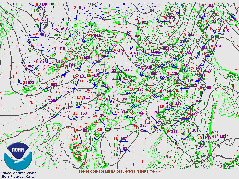
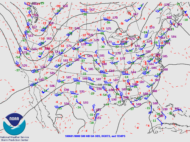
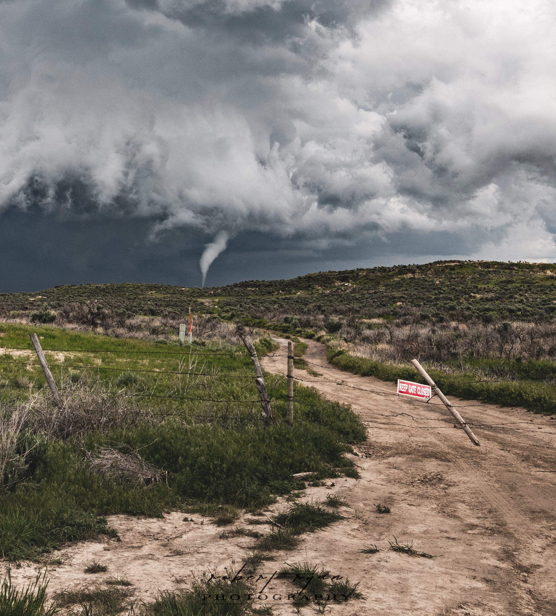
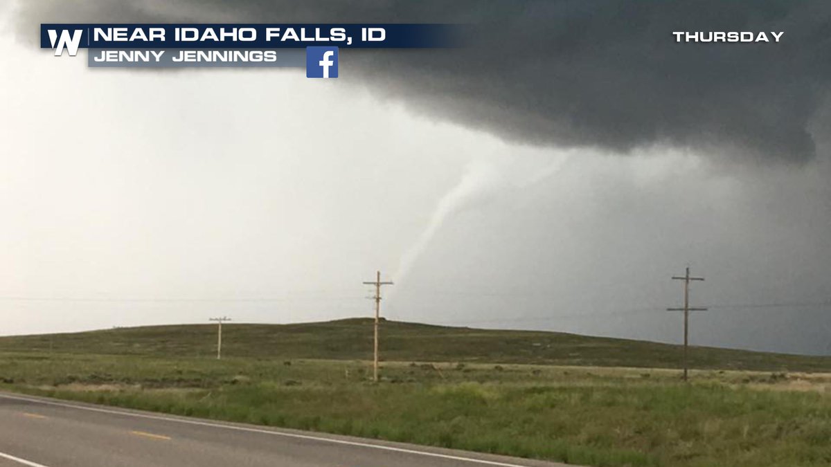
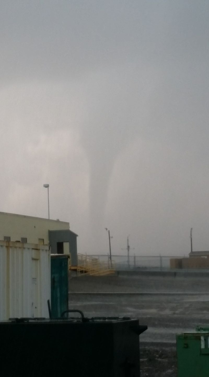
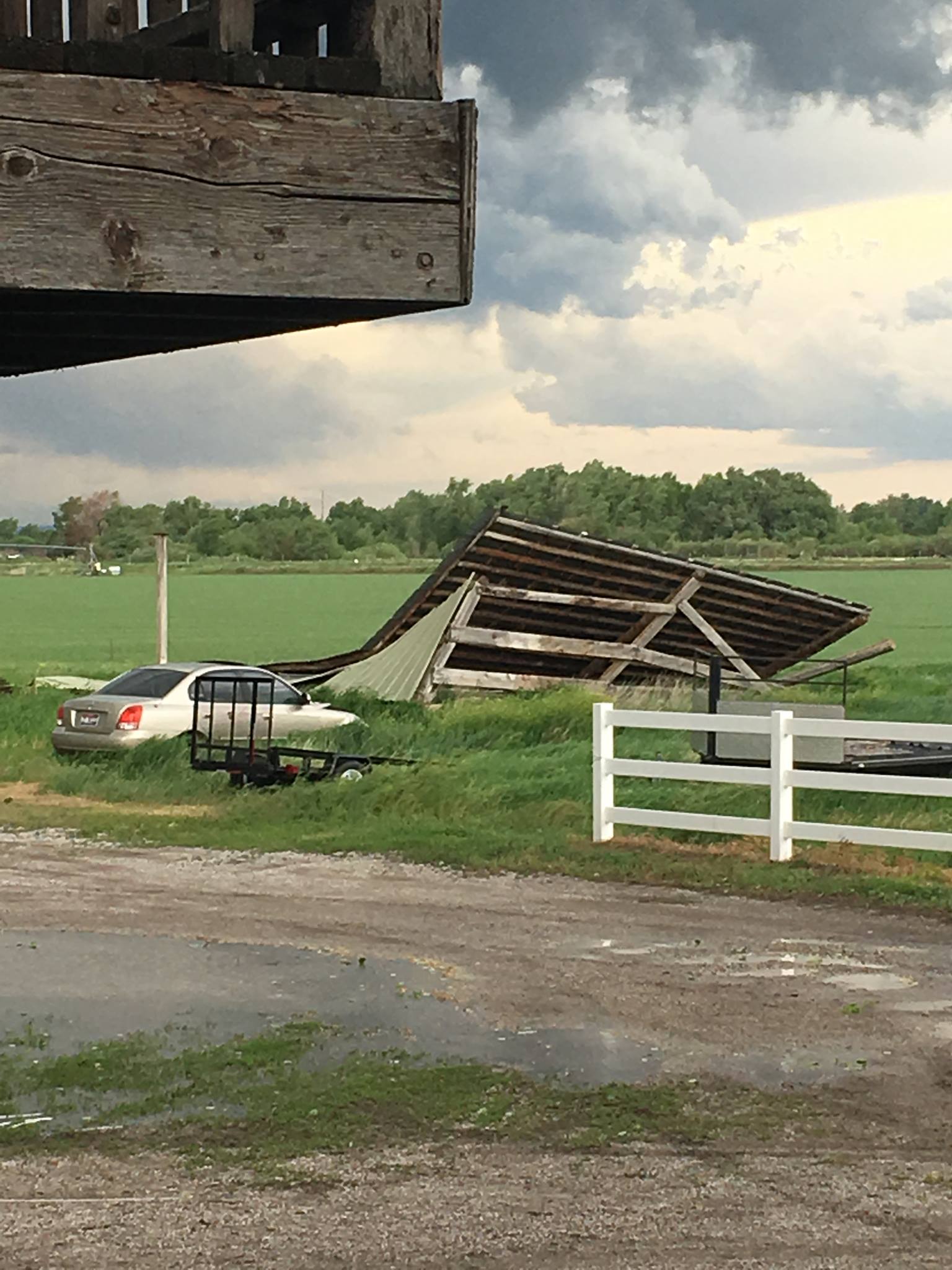
NOUS45 KPIH 030419 CCA
PNSPIH
IDZ017>025-031-032-040415-

Public Information Statement...CORRECTED
National Weather Service Pocatello ID
1019 PM MDT Sat Jun 2 2018

...Preliminary NWS Damage Survey For May 31st, 2018 Tornado
Event...

Based on radar and visual reports, a tornado crossed portions of
the Idaho National Laboratory (INL) around East and Middle Buttes
to the north and east across U-S 20 (including near the MFC
facilities) between 400 and 430 pm MDT. Due to sparseness of
population and terrain, the only damage observed was at mile
marker 277 on U-S 20...at approximately 419pm MDT. At this point,
large sections of 2 snow fences were heavily damaged. Multiple
steel beams were bent and twisted to varying degrees, with
portions of those beams that were below the surface twisted/moved
approximately 1 inch. The horizontal part of these fences, made of
vinyl and steel cable, were ripped apart and strewn for several
yards. Large metal pieces used to hold these together were snapped
and/or thrown several yards away from the fence. Other
indications of tornado damage included a sign snapped off at the
ground, sagebrush that was partially or completely ripped from the
ground and several small size lava rocks tossed an unknown
distance.

Based on this evidence, we are assigning a PRELIMINARY RATING OF
EF-1 (86-110 mph winds) to this portion of the track. Winds were
likely at the high end of this scale, as some of the posts were
almost completely bent over or collapsed. Estimated path width is
between 500-100 yards and estimated length at this point was
240-270 yards. We were unable to other visual evidence to the
southwest and northeast of this point due to terrain and lack of
population. We will continue to investigate this location for
additional damage.

We are also still investigating likely tornado tracks to the
south and southwest of Atomic City and across the southern reaches
of Craters of the Moon National Monument. At this time, the
survey time was unable to locate any conclusive visual evidence of
tornadoes in these areas, again due to limited access and
terrain/vegetation. We will update and finalize our survey
findings in the coming days.
.jpg)
.jpg)
.jpg)