National Weather Service United States Department of Commerce

Back-to-Back Pacific Storms to Impact the West Coast; Heavy Snow in the Central Appalachians

Back-to-back powerful Pacific storm systems to impact the Pacific Northwest and northern California through the end of this week with heavy rain, flooding, strong winds, and higher elevation mountain snow. A strong, long-duration atmospheric river will accompany the Pacific storms, bringing excessive rainfall and flash flooding to southwest Oregon and northwest California through the week. Read More >

Management and Administration
Name Position
Jason Franklin Meteorologist-in-Charge
Robert Deal Science and Operations Officer
Sarah Johnson Warning Coordination Meteorologist
Keith Pugh Electronic Systems Analyst
Joseph Cardin Administrative Support Assistant
Raymond Kruzdlo Senior Service Hydrologist
Lee Robertson Observing Program Leader


Operations Staff
Name Position Program Areas
Paul Fitzsimmons Lead Meteorologist Aviation; Science and Training; Severe Weather
Summer Volunteer Program; Winter Weather: Internet/Intranet;
Vacant Lead Meteorologist  
Ray Martin Lead Meteorologist Storm Data; Coastal Flood; Marine; Frost/Freeze; COOP; Climate
Mike Lee Lead Meteorologist IDSS Management; Skywarn; Tropical Weather
Michael Silva Lead Meteorologist

Aviation; Tropical Weather

Amanda Lee Meteorologist Severe Weather; IDSS Management
Vacant Meteorologist  
Alex Staarmann Meteorologist Climate; COOP/Observing Program; Winter Weather; Remote Sensing;
Social Media; Storm Data; Storm Survey; Summer Volunteer Program; CoCoRaHS
Michael Gorse Meteorologist Aviation; Lightning; Science and Training; Severe Weather
Social Media; Weather Ready Nation/StormReady; Storm Survey
Vacant Meteorologist  
Joe DeSilva Meteorologist Marine; Tropical Weather;
Patrick O'Hara Meteorologist

IT Team; AWIPS; GFE; Lightning

Eric Hoeflich Meteorologist Marine; Storm Data; Coastal Flood; 
Cameron Wunderlin Meteorologist Hydrology; Tropical Weather; Storm Data;


Systems Experts
Name Position Program Areas
Vacant Information Technology Officer AWIPS/GFE/IT; Internet/Intranet; Network
Michael Conrad Electronics Technician ASOS; NOAA Weather Radio; Radar
John Morrill Electronics Technician ASOS; NOAA Weather Radio; Radar
Vacant Electronics Technician ASOS; NOAA Weather Radio; Radar
NWS Philadelphia/Mount Holly County Warning Area


The National Weather Service Mount Holly county warning area (CWA) encompasses eastern and southeastern Pennsylvania (including the Philadelphia metropolitan area), all but far northeast New Jersey, Delaware, and northeastern Maryland.  The Philadelphia/Mount Holly CWA covers the second largest population by NWS forecast office in the country.  Office responsibilities include watch/warning operations; public, aviation, and marine forecasts; climatological record-keeping, and decision support services for our local, state, and federal core partners.

The image below specifies the counties/zones in our CWA.

NWS Philadelphia/Mount Holly Office Information


The NWS Philadelphia/Mount Holly office is located in Burlington County, New Jersey, just east of the New Jersey Turnpike (a little over 20 miles east-northeast of Philadelphia).

Directions to the Office


From the New Jersey Turnpike:  Take Exit 5.  Turn right onto Route 541, Burlington-Mt. Holly Road.  At the second traffic light from the turnpike, use the jughandle and turn right onto Woodlane Road.  Continue on Woodlane Road for three-quarters of a mile.  Our office is on the left-hand side.  

From Interstate 295:  Take Exit 45A, Rancocas-Mt. Holly Road, and drive east toward Mount Holly.  At the third traffic light, turn left onto Irick Road.  At the first traffic light, turn right onto Woodlane Road.  Continue on Woodlane Road for approximately a half mile.  Our office is on the right-hand side, just past the traffic light for the Burlington County Library.


NWS Philadelphia/Mount Holly Office Tours


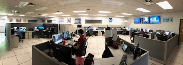
One day each month, the National Weather Service (NWS) in Mount Holly, NJ, will conduct public tours for small groups and/or individuals. The chosen date each month will be based on the availability of staff members to conduct such tours and on favorable weather conditions. On the advertised date, a morning and afternoon tour will be conducted based upon interest. Please be advised that if you request a tour for a very small group, you may be assigned with another group in the same time slot. In case of inclement weather that requires the full attention of the staff, the tour will be cancelled with very short notice. All tours are conducted by a meteorologist who will go through the basics of how the National Weather Service operates and how forecasts are compiled and disseminated to the public. Participants will then be able to tour the operations area where current forecasting is taking place. Photography is permitted. Once a tour slot has been assigned to a small group or individual, an email will be sent from the NWS providing details with directions, parking, and entry into the building. Tours are typically 60 minutes in length. Free parking is available around the building, though spots are limited. Due to the size of the parking lot, we do not have sufficient room for bus parking, unfortunately.

Office Tour Policies

 
  • We will respond to online requests either through email or a telephone call. Tours are available for individuals or small groups (12 people or less). We cannot accommodate more than 12 people due to space and seating constraints.
  • For school or civic groups, tours will be conducted for students and children who are at the middle school level and above (5th grade or higher).
  • During tours, the NWS staff must maintain their duties and operational situational awareness; the staff often spend a considerable amount of time on the phone briefing partners. As such, tour groups must ensure that extraneous noise, conversation, and/or chatter be kept to an absolute minimum while touring the operations area of the facility.
  • Tours are to be conducted between 9:00 AM and 3:00 PM on the designated date.
  • A school or civic group is permitted to schedule just one tour slot per month.
  • Scheduled tours may be cancelled, even at the last minute, due to unforeseen staffing shortages or an unusually heavy workload due to adverse weather. As a result, a contact phone number must be provided when requesting a tour slot. In addition, those assigned a tour are encouraged to call the NWS before traveling to Mount Holly in order to confirm the tour will still be conducted. In the event a tour is cancelled, individuals and/or small groups adversely affected by this action will be given first priority on the next open tour date.
  • All adults are required to carry proper identification (e.g., a driver’s license) into the facility, and everyone participating in the tour will be required to sign in.
 
Virtual Office Tour Video


YouTube Link


   Welcome to the National Weather Service
  Forecast Office in Mount Holly, New Jersey
 
Virtual Office Tour Video


YouTube Link

About Us:

We are one of one hundred and twenty-two forecast offices located throughout the nation, including the U.S. Territory of Guam and the Commonwealth of Puerto Rico.

The National Weather Service (NWS) is a government agency which is part of the National Oceanic and Atmospheric Administration (NOAA), which falls under the United States Department of Commerce (DoC).

The office is staffed 24 hours a day, seven days a week to provide timely and accurate forecasts and warnings.  The office is located twenty-five miles northeast of Philadelphia in suburban southern New Jersey.

Our Mission:
The National Weather Service provides weather, hydrologic, and climate forecasts and warnings for the United States, its territories, adjacent waters and ocean areas, for the protection of life and property and the enhancement of the national economy. NWS data and products form a national information database and infrastructure which can be used by other governmental agencies, the private sector, the public, and the global community.