
An arctic air mass will continue over the Central and Southern U.S. producing widespread, record-breaking cold temperatures through Friday. An atmospheric river will impact the Pacific Northwest states over the weekend with heavy rain and high mountain snow. Read More >
 |
NWS Mt Holly Weather Briefing Page |
 |
.MARINE...
Gales today will mostly diminish to Small Craft Advisory gusts
tonight before totally going sub-advisory on Saturday. Freezing
spray possible mainly this morning, otherwise quiet weather.

Outlook...

Saturday night through Tuesday...No marine headlines expected.

&&
Special Marine Warnings NWS PHI
Special Marine Warning 0004
Special Marine Warning 0003
Special Marine Warning 0002
Special Marine Warning 0001
Special Marine Warnings NWS OKX
Special Marine Warning 0005
Special Marine Warning 0004
Special Marine Warning 0003
Special Marine Warning 0002
Special Marine Warning 0001
Special Marine Warnings NWS LWX
Special Marine Warning 0005
Special Marine Warning 0004
Special Marine Warning 0003
Special Marine Warning 0002
Special Marine Warning 0001
Special Marine Warnings NWS AKQ
Special Marine Warning 0002
Special Marine Warning 0001
Marine Weather Statements NWS PHI
FZUS71 KPHI 162151
MWSPHI

Marine Weather Statement
National Weather Service Mount Holly NJ
451 PM EST Sun Feb 16 2025

ANZ430-450>452-162245-
451 PM EST Sun Feb 16 2025

...SHOWERS WITH A FRONT APPROACHING THE WATERS...

A Marine Weather Statement has been issued for the following areas...
  Coastal waters from Little Egg Inlet to Great Egg Inlet NJ out 20
  nm...
  Coastal waters from Manasquan Inlet to Little Egg Inlet NJ out 20
  nm...
  Coastal waters from Sandy Hook to Manasquan Inlet NJ out 20 nm...
  Delaware Bay waters north of East Point NJ to Slaughter Beach
  DE...

At 448 PM EST, Doppler radar indicated a front with showers, capable
of producing winds to around 50 knots. This front was located along
a line extending from 52 nm west of South Amboy to 6 nm east of
Stony Point, moving east at 50 knots.

PRECAUTIONARY/PREPAREDNESS ACTIONS...

Mariners can expect gusty winds to around 50 knots and locally
higher waves. Boaters should seek safe harbor immediately until
these storms pass.

&&

LAT...LON 4044 7399 4035 7414 4027 7405 3996 7425
      3970 7426 3960 7439 3960 7459 3947 7450
      3938 7463 3938 7464 3944 7465 3948 7469
      3947 7478 3932 7483 3943 7501 3952 7537
      3961 7535 3974 7547 3968 7562

$$

RCM
Marine Weather Statements NWS OKX
FZUS71 KOKX 162305
MWSOKX

Marine Weather Statement
National Weather Service New York NY
605 PM EST Sun Feb 16 2025

ANZ345-350-353-355-170000-
605 PM EST Sun Feb 16 2025

...A STRONG SHOWERS OVER THE WATERS...

The areas affected include...

  Sandy Hook NJ to Fire Island Inlet NY out 20 NM...
  Fire Island Inlet to Moriches Inlet NY out 20 NM...
  Moriches Inlet to Montauk Point NY out 20 NM...
  Long Island South Shore Bays...

At 602 PM EST, Doppler radar indicated a strong thunderstorm,
capable of producing winds to around  knots. This thunderstorm was
located near Fire Island Inlet, moving east at 45 knots.

PRECAUTIONARY/PREPAREDNESS ACTIONS...

Mariners can expect gusty winds to around 40 knots, locally higher
waves, and lightning strikes. Boaters should seek safe harbor
immediately until this storm passes.

&&

LAT...LON 4063 7352 4077 7287 4076 7286 4078 7283
      4088 7236 4061 7227 4038 7340

$$

JP
Marine Weather Statements NWS LWX
FZUS71 KLWX 202249
MWSLWX

Marine Weather Statement
National Weather Service Baltimore MD/Washington DC
549 PM EST Thu Feb 20 2025

ANZ530>543-211100-
Chesapeake Bay north of Pooles Island MD-
Chesapeake Bay from Pooles Island to Sandy Point MD-
Chesapeake Bay from Sandy Point to North Beach MD-
Chesapeake Bay from North Beach to Drum Point MD-
Chesapeake Bay from Drum Point MD to Smith Point VA-
Tidal Potomac from Key Bridge to Indian Head MD-
Tidal Potomac from Indian Head to Cobb Island MD-
Tidal Potomac from Cobb Island MD to Smith Point VA-
Patapsco River including Baltimore Harbor-
Chester River to Queenstown MD-Eastern Bay-
Choptank River to Cambridge MD and the Little Choptank River-
Patuxent River to Broomes Island MD-
Tangier Sound and the inland waters surrounding Bloodsworth
Island-
549 PM EST Thu Feb 20 2025

...BLOWOUT TIDES CONTINUE TONIGHT, PARTICULARLY AROUND TIMES OF
LOW TIDE...

Tidal anomalies continue to fall as northwesterly flow increases
behind a cold front. A blustery northwesterly wind will help drop
water levels to around 1 to 1.5 feet below mean lower low water
across the tidal Potomac, as well as western shores of the
Chesapeake Bay. Anomalies remain low through Friday given the
persistent northwesterly winds.

Mariners should check navigation charts and be careful not to
ground your vessel, particularly when boating away from the main
channel.

$$

BELAK
Marine Weather Statements NWS AKQ
FZUS71 KAKQ 010226
MWSAKQ

MARINE WEATHER STATEMENT
National Weather Service WAKEFIELD VA
926 PM EST Fri Jan 31 2025

ANZ632-634-638-010500-
Chesapeake Bay from New Point Comfort to Little Creek VA-
Chesapeake Bay from Little Creek VA to Cape Henry VA including
the Chesapeake Bay Bridge Tunnel-
James River from James River Bridge to Hampton Roads Bridge-
Tunnel-
926 PM EST Fri Jan 31 2025

...GUSTY WINDS IN THE LOWER BAY AND LOWER JAMES RIVER THIS
EVENING...

Marine weather observations across the lower Chesapeake Bay and
James River are reporting occasional southerly wind gusts between
20 and 25 knots this evening. These gusty winds may persist for
the next few hours, before tapering off some around midnight.
However, a period of more widespread elevated winds are likely
later Saturday morning along and behind a cold front and a Small
Craft Advisory goes into effect starting at 7 AM Saturday morning.

Boaters, especially those in small crafts, should utilize caution
if on the water this evening and be alert for sudden higher gusts
and waves.


$$
Marine Weather Message NWS PHI
WHUS71 KPHI 210603
MWWPHI

URGENT - MARINE WEATHER MESSAGE
National Weather Service Mount Holly NJ
103 AM EST Fri Feb 21 2025

ANZ430-431-212300-
/O.CON.KPHI.GL.W.0010.000000T0000Z-250221T2300Z/
Delaware Bay waters north of East Point NJ to Slaughter Beach DE-
Delaware Bay waters south of East Point NJ to Slaughter Beach DE-
103 AM EST Fri Feb 21 2025

...GALE WARNING REMAINS IN EFFECT UNTIL 6 PM EST THIS EVENING...

* WHAT...Northwest winds 15 to 25 kt with gusts up to 35 kt and
  rough waters.

* WHERE...Delaware Bay waters north of East Point NJ to
  Slaughter Beach DE and Delaware Bay waters south of East Point
  NJ to Slaughter Beach DE.

* WHEN...Until 6 PM EST this evening.

* IMPACTS...Strong winds will cause hazardous seas which could
  capsize or damage vessels and reduce visibility.

PRECAUTIONARY/PREPAREDNESS ACTIONS...

Mariners should alter plans to avoid these hazardous conditions.
Remain in port, seek safe harbor, alter course, and/or secure the
vessel for hazardous conditions.

&&

$$

ANZ452>455-212300-
/O.CON.KPHI.GL.W.0010.000000T0000Z-250221T2300Z/
Coastal waters from Little Egg Inlet to Great Egg Inlet NJ out
20 nm-
Coastal waters from Great Egg Inlet to Cape May NJ out 20 nm-
Coastal waters from Cape May NJ to Cape Henlopen DE out 20 nm-
Coastal waters from Cape Henlopen to Fenwick Island DE out 20 nm-
103 AM EST Fri Feb 21 2025

...GALE WARNING REMAINS IN EFFECT UNTIL 6 PM EST THIS EVENING...

* WHAT...Northwest winds 20 to 30 kt with gusts up to 35 kt and
  seas 3 to 6 ft.

* WHERE...Coastal waters from Little Egg Inlet to Great Egg
  Inlet NJ out 20 nm, Coastal waters from Great Egg Inlet to
  Cape May NJ out 20 nm, Coastal waters from Cape May NJ to Cape
  Henlopen DE out 20 nm and Coastal waters from Cape Henlopen to
  Fenwick Island DE out 20 nm.

* WHEN...Until 6 PM EST this evening.

* IMPACTS...Strong winds will cause hazardous seas which could
  capsize or damage vessels and reduce visibility.

PRECAUTIONARY/PREPAREDNESS ACTIONS...

Mariners should alter plans to avoid these hazardous conditions.
Remain in port, seek safe harbor, alter course, and/or secure the
vessel for hazardous conditions.

&&

$$

ANZ450-451-212300-
/O.CON.KPHI.GL.W.0010.000000T0000Z-250221T2300Z/
Coastal waters from Sandy Hook to Manasquan Inlet NJ out 20 nm-
Coastal waters from Manasquan Inlet to Little Egg Inlet NJ out
20 nm-
103 AM EST Fri Feb 21 2025

...GALE WARNING REMAINS IN EFFECT UNTIL 6 PM EST THIS EVENING...

* WHAT...Northwest winds 20 to 30 kt with gusts up to 35 kt and
  seas 3 to 6 ft.

* WHERE...Coastal waters from Sandy Hook to Manasquan Inlet NJ
  out 20 nm and Coastal waters from Manasquan Inlet to Little
  Egg Inlet NJ out 20 nm.

* WHEN...Until 6 PM EST this evening.

* IMPACTS...Strong winds will cause hazardous seas which could
  capsize or damage vessels and reduce visibility.

PRECAUTIONARY/PREPAREDNESS ACTIONS...

Mariners should alter plans to avoid these hazardous conditions.
Remain in port, seek safe harbor, alter course, and/or secure the
vessel for hazardous conditions.

&&

$$
Marine Weather Message NWS OKX
WHUS71 KOKX 210801
MWWOKX

URGENT - MARINE WEATHER MESSAGE
National Weather Service New York NY
301 AM EST Fri Feb 21 2025

ANZ332-350-212115-
/O.EXT.KOKX.SC.Y.0022.000000T0000Z-250222T0900Z/
Long Island Sound East of the Mouth of the Connecticut River-
Moriches Inlet NY to Montauk Point NY out 20 nm-
301 AM EST Fri Feb 21 2025

...SMALL CRAFT ADVISORY NOW IN EFFECT UNTIL 4 AM EST SATURDAY...

* WHAT...Northwest winds 15 to 25 kt with gusts up to 30 kt and
  seas 4 to 7 feet.

* WHERE...Long Island Sound east of Orient Point and the
  Connecticut River, and Moriches Inlet NY to Montauk Point NY
  out 20 nm.

* WHEN...Until 4 AM EST Saturday.

* IMPACTS...Conditions will be hazardous to small craft.

PRECAUTIONARY/PREPAREDNESS ACTIONS...

Inexperienced mariners, especially those operating smaller
vessels, should avoid navigating in hazardous conditions.

&&

$$

ANZ331-353-355-212115-
/O.EXT.KOKX.SC.Y.0022.000000T0000Z-250222T0600Z/
Long Island Sound East of New Haven CT/Port Jefferson NY to the
Mouth of the Connecticut River-
Fire Island Inlet NY to Moriches Inlet NY out 20 nm-
Sandy Hook NJ to Fire Island Inlet NY out 20 nm-
301 AM EST Fri Feb 21 2025

...SMALL CRAFT ADVISORY NOW IN EFFECT UNTIL 1 AM EST SATURDAY...

* WHAT...Northwest winds 15 to 25 kt with gusts up to 30 kt and
  seas 3 to 5 feet.

* WHERE...Sandy Hook NJ to Moriches Inlet NY out 20 nm, and Long
  Island Sound East of New Haven CT/Port Jefferson NY to the
  Mouth of the Connecticut River.

* WHEN...Until 1 AM EST Saturday.

* IMPACTS...Conditions will be hazardous to small craft.

PRECAUTIONARY/PREPAREDNESS ACTIONS...

Inexperienced mariners, especially those operating smaller
vessels, should avoid navigating in hazardous conditions.

&&

$$

ANZ335-338-340-345-212115-
/O.EXT.KOKX.SC.Y.0022.000000T0000Z-250222T0300Z/
Long Island Sound West of New Haven CT/Port Jefferson NY-
New York Harbor-Peconic and Gardiners Bays-
South Shore Bays from Jones Inlet through Shinnecock Bay-
301 AM EST Fri Feb 21 2025

...SMALL CRAFT ADVISORY NOW IN EFFECT UNTIL 10 PM EST THIS
EVENING...

* WHAT...Northwest winds 15 to 20 kt with gusts up to 30 kt and
  seas 1 to 3 feet.

* WHERE...The south shore and eastern bays of Long Island, Long
  Island Sound West of New Haven CT/Port Jefferson NY, and New
  York Harbor.

* WHEN...Until 10 PM EST this evening.

* IMPACTS...Conditions will be hazardous to small craft.

PRECAUTIONARY/PREPAREDNESS ACTIONS...

Inexperienced mariners, especially those operating smaller
vessels, should avoid navigating in hazardous conditions.

&&

$$

For more details, see the Coastal Waters Forecast from
National Weather Service New York NY, or visit
https://www.weather.gov/okx/marine
Marine Weather Message NWS LWX
WHUS71 KLWX 210908
MWWLWX

URGENT - MARINE WEATHER MESSAGE
National Weather Service Baltimore MD/Washington DC
408 AM EST Fri Feb 21 2025

ANZ530>534-537-539>541-543-211715-
/O.EXT.KLWX.GL.W.0008.000000T0000Z-250221T1700Z/
/O.NEW.KLWX.SC.Y.0036.250221T1700Z-250222T0600Z/
Chesapeake Bay north of Pooles Island MD-
Chesapeake Bay from Pooles Island to Sandy Point MD-
Chesapeake Bay from Sandy Point to North Beach MD-
Chesapeake Bay from North Beach to Drum Point MD-
Chesapeake Bay from Drum Point MD to Smith Point VA-
Tidal Potomac from Cobb Island MD to Smith Point VA-
Chester River to Queenstown MD-Eastern Bay-
Choptank River to Cambridge MD and the Little Choptank River-
Tangier Sound and the inland waters surrounding Bloodsworth
Island-
408 AM EST Fri Feb 21 2025

...GALE WARNING NOW IN EFFECT UNTIL NOON EST TODAY...
...SMALL CRAFT ADVISORY IN EFFECT FROM NOON TODAY TO 1 AM EST
SATURDAY...

* WHAT...For the Gale Warning, northwest winds 15 to 25 kt with
  gusts up to 40 kt and waves 2 to 4 ft. For the Small Craft
  Advisory, northwest winds 10 to 20 kt with gusts up to 30 kt and
  waves 2 to 4 ft expected.

* WHERE...Chesapeake Bay main channel north of Smith Point VA,
  Tidal Potomac from Cobb Island MD to Smith Point VA, Chester
  River to Queenstown MD, Eastern Bay, Choptank River to
  Cambridge MD and the Little Choptank River, and Tangier Sound
  and the inland waters surrounding Bloodsworth Island.

* WHEN...For the Gale Warning, until noon EST today. For the
  Small Craft Advisory, from noon today to 1 AM EST Saturday.

* IMPACTS...Strong winds will cause hazardous waves which could
  capsize or damage vessels.

PRECAUTIONARY/PREPAREDNESS ACTIONS...

Mariners should alter plans to avoid these hazardous conditions.
Remain in port, seek safe harbor, alter course, and/or secure the
vessel for hazardous conditions.

&&

$$

ANZ535-536-538-542-211715-
/O.EXT.KLWX.SC.Y.0035.000000T0000Z-250222T0000Z/
Tidal Potomac from Key Bridge to Indian Head MD-
Tidal Potomac from Indian Head to Cobb Island MD-
Patapsco River including Baltimore Harbor-
Patuxent River to Broomes Island MD-
408 AM EST Fri Feb 21 2025

...SMALL CRAFT ADVISORY NOW IN EFFECT UNTIL 7 PM EST THIS
EVENING...

* WHAT...Northwest winds 10 to 20 kt with gusts up to 30 kt.

* WHERE...Tidal Potomac River from Key Bridge to Cobb Island MD,
  Patapsco River including Baltimore Harbor, and Patuxent River
  to Broomes Island MD.

* WHEN...Until 7 PM EST this evening.

* IMPACTS...Conditions will be hazardous to small craft.

PRECAUTIONARY/PREPAREDNESS ACTIONS...

Inexperienced mariners, especially those operating smaller
vessels, should avoid navigating in hazardous conditions.

&&

$$
Marine Weather Message NWS AKQ
WHUS71 KAKQ 211152
MWWAKQ

URGENT - MARINE WEATHER MESSAGE
National Weather Service Wakefield VA
652 AM EST Fri Feb 21 2025

ANZ631-632-634-212000-
/O.CAN.KAKQ.GL.W.0008.000000T0000Z-250221T1500Z/
/O.EXB.KAKQ.SC.Y.0030.000000T0000Z-250222T0600Z/
/O.CON.KAKQ.UP.Y.0002.000000T0000Z-250221T1500Z/
Chesapeake Bay from Windmill Point to New Point Comfort VA-
Chesapeake Bay from New Point Comfort to Little Creek VA-
Chesapeake Bay from Little Creek VA to Cape Henry VA including
the Chesapeake Bay Bridge Tunnel-
652 AM EST Fri Feb 21 2025

...SMALL CRAFT ADVISORY IN EFFECT UNTIL 1 AM EST SATURDAY...
...FREEZING SPRAY ADVISORY REMAINS IN EFFECT UNTIL 10 AM EST THIS
MORNING...
...GALE WARNING IS CANCELLED...

* WHAT...For the Small Craft Advisory, northwest winds 15 to 25
  kt with gusts up to 30 kt and waves 2 to 4 ft. For the
  Freezing Spray Advisory, moderate accumulation of freezing
  spray.

* WHERE...Chesapeake Bay from Windmill Point to New Point
  Comfort VA, Chesapeake Bay from New Point Comfort to Little
  Creek VA and Chesapeake Bay from Little Creek VA to Cape Henry
  VA including the Chesapeake Bay Bridge Tunnel.

* WHEN...For the Small Craft Advisory, until 1 AM EST Saturday.
  For the Freezing Spray Advisory, until 10 AM EST this morning.

* IMPACTS...Operating a vessel in freezing spray is hazardous.
  Freezing spray may render mechanical and electronic components
  inoperative. Ice accretion on decks and superstructures may
  result in some loss of stability. Conditions will be hazardous
  to small craft.

PRECAUTIONARY/PREPAREDNESS ACTIONS...

Mariners should prepare for ice accumulation on their vessel and
consider altering plans to avoid or mitigate these hazardous
conditions.

Inexperienced mariners, especially those operating smaller
vessels, should avoid navigating in hazardous conditions.

&&

$$

ANZ654-656-212000-
/O.CAN.KAKQ.GL.W.0008.000000T0000Z-250221T1500Z/
/O.EXB.KAKQ.SC.Y.0030.000000T0000Z-250222T0600Z/
/O.CON.KAKQ.UP.Y.0002.000000T0000Z-250221T1500Z/
Coastal waters from Parramore Island to Cape Charles Light VA out
20 nm-Coastal Waters from Cape Charles Light to Virginia-
North Carolina border out to 20 nm-
652 AM EST Fri Feb 21 2025

...SMALL CRAFT ADVISORY IN EFFECT UNTIL 1 AM EST SATURDAY...
...FREEZING SPRAY ADVISORY REMAINS IN EFFECT UNTIL 10 AM EST THIS
MORNING...
...GALE WARNING IS CANCELLED...

* WHAT...For the Small Craft Advisory, northwest winds 15 to 25
  kt with gusts up to 30 kt and seas 4 to 6 ft. For the Freezing
  Spray Advisory, moderate accumulation of freezing spray.

* WHERE...Coastal waters from Parramore Island to Cape Charles
  Light VA out 20 nm and Coastal Waters from Cape Charles Light
  to Virginia-North Carolina border out to 20 nm.

* WHEN...For the Small Craft Advisory, until 1 AM EST Saturday.
  For the Freezing Spray Advisory, until 10 AM EST this morning.

* IMPACTS...Operating a vessel in freezing spray is hazardous.
  Freezing spray may render mechanical and electronic components
  inoperative. Ice accretion on decks and superstructures may
  result in some loss of stability. Conditions will be hazardous
  to small craft.

PRECAUTIONARY/PREPAREDNESS ACTIONS...

Mariners should prepare for ice accumulation on their vessel and
consider altering plans to avoid or mitigate these hazardous
conditions.

Inexperienced mariners, especially those operating smaller
vessels, should avoid navigating in hazardous conditions.

&&

$$

ANZ658-212000-
/O.CAN.KAKQ.GL.W.0009.000000T0000Z-250221T1500Z/
/O.NEW.KAKQ.SC.Y.0032.250221T1152Z-250222T0600Z/
/O.CON.KAKQ.UP.Y.0002.000000T0000Z-250221T1500Z/
Coastal waters from NC VA border to Currituck Beach Light NC out
20 nm-
652 AM EST Fri Feb 21 2025

...SMALL CRAFT ADVISORY IN EFFECT UNTIL 1 AM EST SATURDAY...
...FREEZING SPRAY ADVISORY REMAINS IN EFFECT UNTIL 10 AM EST THIS
MORNING...
...GALE WARNING IS CANCELLED...

* WHAT...For the Small Craft Advisory, northwest winds 15 to 25
  kt with gusts up to 30 kt and seas 4 to 6 ft. For the Freezing
  Spray Advisory, moderate accumulation of freezing spray.

* WHERE...Coastal waters from NC VA border to Currituck Beach
  Light NC out 20 nm.

* WHEN...For the Small Craft Advisory, until 1 AM EST Saturday.
  For the Freezing Spray Advisory, until 10 AM EST this morning.

* IMPACTS...Operating a vessel in freezing spray is hazardous.
  Freezing spray may render mechanical and electronic components
  inoperative. Ice accretion on decks and superstructures may
  result in some loss of stability. Conditions will be hazardous
  to small craft.

PRECAUTIONARY/PREPAREDNESS ACTIONS...

Mariners should prepare for ice accumulation on their vessel and
consider altering plans to avoid or mitigate these hazardous
conditions.

Inexperienced mariners, especially those operating smaller
vessels, should avoid navigating in hazardous conditions.

&&

$$

ANZ630-211500-
/O.CON.KAKQ.GL.W.0008.000000T0000Z-250221T1500Z/
/O.CON.KAKQ.UP.Y.0002.000000T0000Z-250221T1500Z/
Chesapeake Bay from Smith Point to Windmill Point VA-
652 AM EST Fri Feb 21 2025

...GALE WARNING REMAINS IN EFFECT UNTIL 10 AM EST THIS MORNING...
...FREEZING SPRAY ADVISORY REMAINS IN EFFECT UNTIL 10 AM EST THIS
MORNING...

* WHAT...For the Gale Warning, northwest winds 20 to 25 kt with
  gusts up to 35 kt and waves 3 to 4 ft. For the Freezing Spray
  Advisory, moderate accumulation of freezing spray.

* WHERE...Chesapeake Bay from Smith Point to Windmill Point VA.

* WHEN...Until 10 AM EST this morning.

* IMPACTS...Operating a vessel in freezing spray is hazardous.
  Freezing spray may render mechanical and electronic components
  inoperative. Ice accretion on decks and superstructures may
  result in some loss of stability. Strong winds will cause
  hazardous waves which could capsize or damage vessels and
  reduce visibility.

PRECAUTIONARY/PREPAREDNESS ACTIONS...

Mariners should prepare for ice accumulation on their vessel and
consider altering plans to avoid or mitigate these hazardous
conditions.

Mariners should alter plans to avoid these hazardous conditions.
Remain in port, seek safe harbor, alter course, and/or secure the
vessel for hazardous conditions.

&&

$$

ANZ650-652-211500-
/O.CON.KAKQ.GL.W.0008.000000T0000Z-250221T1500Z/
/O.CON.KAKQ.UP.Y.0002.000000T0000Z-250221T1500Z/
Coastal waters from Fenwick Island DE to Chincoteague VA out
20 nm-
Coastal waters from Chincoteague to Parramore Island VA out 20 nm-
652 AM EST Fri Feb 21 2025

...GALE WARNING REMAINS IN EFFECT UNTIL 10 AM EST THIS MORNING...
...FREEZING SPRAY ADVISORY REMAINS IN EFFECT UNTIL 10 AM EST THIS
MORNING...

* WHAT...For the Gale Warning, northwest winds 20 to 25 kt with
  gusts up to 35 kt and seas 4 to 6 ft. For the Freezing Spray
  Advisory, moderate accumulation of freezing spray.

* WHERE...Coastal waters from Fenwick Island DE to Chincoteague
  VA out 20 nm and Coastal waters from Chincoteague to Parramore
  Island VA out 20 nm.

* WHEN...Until 10 AM EST this morning.

* IMPACTS...Operating a vessel in freezing spray is hazardous.
  Freezing spray may render mechanical and electronic components
  inoperative. Ice accretion on decks and superstructures may
  result in some loss of stability. Strong winds will cause
  hazardous seas which could capsize or damage vessels and
  reduce visibility.

PRECAUTIONARY/PREPAREDNESS ACTIONS...

Mariners should prepare for ice accumulation on their vessel and
consider altering plans to avoid or mitigate these hazardous
conditions.

Mariners should alter plans to avoid these hazardous conditions.
Remain in port, seek safe harbor, alter course, and/or secure the
vessel for hazardous conditions.

&&

$$

ANZ633-211800-
/O.CON.KAKQ.SC.Y.0029.000000T0000Z-250221T1800Z/
/O.CON.KAKQ.UP.Y.0002.000000T0000Z-250221T1500Z/
Currituck Sound-
652 AM EST Fri Feb 21 2025

...SMALL CRAFT ADVISORY REMAINS IN EFFECT UNTIL 1 PM EST THIS
AFTERNOON...
...FREEZING SPRAY ADVISORY REMAINS IN EFFECT UNTIL 10 AM EST THIS
MORNING...

* WHAT...For the Small Craft Advisory, northwest winds 15 to 20
  kt with gusts up to 25 kt and waves 1 to 2 ft. For the
  Freezing Spray Advisory, moderate accumulation of freezing
  spray.

* WHERE...Currituck Sound.

* WHEN...For the Small Craft Advisory, until 1 PM EST this
  afternoon. For the Freezing Spray Advisory, until 10 AM EST
  this morning.

* IMPACTS...Operating a vessel in freezing spray is hazardous.
  Freezing spray may render mechanical and electronic components
  inoperative. Ice accretion on decks and superstructures may
  result in some loss of stability. Conditions will be hazardous
  to small craft.

PRECAUTIONARY/PREPAREDNESS ACTIONS...

Mariners should prepare for ice accumulation on their vessel and
consider altering plans to avoid or mitigate these hazardous
conditions.

Inexperienced mariners, especially those operating smaller
vessels, should avoid navigating in hazardous conditions.

&&

$$

ANZ635>637-211800-
/O.CON.KAKQ.SC.Y.0030.000000T0000Z-250221T1800Z/
/O.CON.KAKQ.UP.Y.0002.000000T0000Z-250221T1500Z/
Rappahannock River from Urbanna to Windmill Point-York River-
James River from Jamestown to the James River Bridge-
652 AM EST Fri Feb 21 2025

...SMALL CRAFT ADVISORY REMAINS IN EFFECT UNTIL 1 PM EST THIS
AFTERNOON...
...FREEZING SPRAY ADVISORY REMAINS IN EFFECT UNTIL 10 AM EST THIS
MORNING...

* WHAT...For the Small Craft Advisory, northwest winds 15 to 20
  kt with gusts up to 25 kt and waves 1 to 2 ft. For the Freezing
  Spray Advisory, moderate accumulation of freezing spray.

* WHERE...Rappahannock River from Urbanna to Windmill Point,
  York River and James River from Jamestown to the James River
  Bridge.

* WHEN...For the Small Craft Advisory, until 1 PM EST this
  afternoon. For the Freezing Spray Advisory, until 10 AM EST
  this morning.

* IMPACTS...Operating a vessel in freezing spray is hazardous.
  Freezing spray may render mechanical and electronic components
  inoperative. Ice accretion on decks and superstructures may
  result in some loss of stability. Conditions will be hazardous
  to small craft.

PRECAUTIONARY/PREPAREDNESS ACTIONS...

Mariners should prepare for ice accumulation on their vessel and
consider altering plans to avoid or mitigate these hazardous
conditions.

Inexperienced mariners, especially those operating smaller
vessels, should avoid navigating in hazardous conditions.

&&

$$

ANZ638-211800-
/O.CON.KAKQ.SC.Y.0029.000000T0000Z-250221T1800Z/
/O.CON.KAKQ.UP.Y.0002.000000T0000Z-250221T1500Z/
James River from James River Bridge to Hampton Roads Bridge-
Tunnel-
652 AM EST Fri Feb 21 2025

...SMALL CRAFT ADVISORY REMAINS IN EFFECT UNTIL 1 PM EST THIS
AFTERNOON...
...FREEZING SPRAY ADVISORY REMAINS IN EFFECT UNTIL 10 AM EST THIS
MORNING...

* WHAT...For the Small Craft Advisory, northwest winds 15 to 20 kt
  with gusts up to 25 kt and waves around 2 ft. For the Freezing
  Spray Advisory, moderate accumulation of freezing spray.

* WHERE...James River from James River Bridge to Hampton Roads
  Bridge-Tunnel.

* WHEN...For the Small Craft Advisory, until 1 PM EST this
  afternoon. For the Freezing Spray Advisory, until 10 AM EST
  this morning.

* IMPACTS...Operating a vessel in freezing spray is hazardous.
  Freezing spray may render mechanical and electronic components
  inoperative. Ice accretion on decks and superstructures may
  result in some loss of stability. Conditions will be hazardous
  to small craft.

PRECAUTIONARY/PREPAREDNESS ACTIONS...

Mariners should prepare for ice accumulation on their vessel and
consider altering plans to avoid or mitigate these hazardous
conditions.

Inexperienced mariners, especially those operating smaller
vessels, should avoid navigating in hazardous conditions.

&&

$$
Latest Coastal Waters Forecast Issued for the NJ/DE coasts and Delaware Bay
FZUS51 KPHI 211205
CWFPHI

Coastal Waters Forecast for New Jersey and Delaware
National Weather Service Mount Holly NJ
702 AM EST Fri Feb 21 2025

Sandy Hook NJ to Fenwick Island DE to 20 NM offshore and Delaware
Bay

ANZ400-220100-
702 AM EST Fri Feb 21 2025

.SYNOPSIS FOR THE COASTAL WATERS FROM SANDY HOOK NJ TO FENWICK
ISLAND DE AND FOR DELAWARE BAY...
High pressure builds into the region today, remaining in
control through the weekend. The pattern turns more unsettled
next week, though no significant systems appear to be on the
horizon.

$$

ANZ450-220100-
Coastal waters from Sandy Hook to Manasquan Inlet NJ out 20 nm-
702 AM EST Fri Feb 21 2025

...GALE WARNING IN EFFECT UNTIL 6 PM EST THIS EVENING...

.TODAY...NW winds 20 to 25 kt with gusts up to 35 kt. Seas 4 to
6 ft. Wave Detail: NW 5 ft at 5 seconds and SE 2 ft at 9 seconds.
A chance of light freezing spray this morning.
.TONIGHT...NW winds 20 to 25 kt, diminishing to 15 to 20 kt after
midnight. Gusts up to 35 kt. Seas 3 to 5 ft. Wave Detail: NW 5 ft
at 5 seconds and SE 1 foot at 9 seconds. A chance of light
freezing spray.
.SAT...NW winds 10 to 15 kt, becoming W in the afternoon. Seas
2 to 3 ft. Wave Detail: NW 3 ft at 4 seconds and E 1 foot at
8 seconds.
.SAT NIGHT...SW winds 10 to 15 kt with gusts up to 20 kt. Seas
around 2 ft. Wave Detail: SW 2 ft at 3 seconds.
.SUN...W winds 10 to 15 kt, diminishing to 5 to 10 kt in the
afternoon. Seas around 2 ft. Wave Detail: W 2 ft at 4 seconds.
.SUN NIGHT...W winds 5 to 10 kt. Seas around 2 ft. Wave Detail: W
2 ft at 5 seconds.
.MON...SW winds 5 to 10 kt, becoming S 10 to 15 kt in the
afternoon. Seas 1 foot or less, then around 2 ft in the
afternoon.
.MON NIGHT...SW winds 10 to 15 kt. Seas 2 to 3 ft.
.TUE...S winds 5 to 10 kt. Seas 2 to 3 ft.
.TUE NIGHT...SW winds 5 to 10 kt, becoming W after midnight. Seas
2 to 3 ft.

$$

ANZ451-220100-
Coastal waters from Manasquan Inlet to Little Egg Inlet NJ out
20 nm-
702 AM EST Fri Feb 21 2025

...GALE WARNING IN EFFECT UNTIL 6 PM EST THIS EVENING...

.TODAY...NW winds 20 to 25 kt with gusts up to 35 kt. Seas 4 to
6 ft. Wave Detail: N 5 ft at 5 seconds and SE 2 ft at 9 seconds.
A chance of light freezing spray this morning.
.TONIGHT...NW winds 20 to 25 kt, diminishing to 15 to 20 kt after
midnight. Seas 3 to 5 ft. Wave Detail: NW 4 ft at 5 seconds and
SE 1 foot at 9 seconds. A chance of light freezing spray.
.SAT...NW winds 10 to 15 kt, becoming W in the afternoon. Seas
2 to 3 ft. Wave Detail: NW 3 ft at 4 seconds and E 1 foot at
9 seconds.
.SAT NIGHT...SW winds 10 to 15 kt with gusts up to 20 kt. Seas
2 to 3 ft. Wave Detail: SW 2 ft at 4 seconds and N 1 foot at
4 seconds.
.SUN...W winds 10 to 15 kt, diminishing to 5 to 10 kt in the
afternoon. Seas 2 to 3 ft. Wave Detail: SW 2 ft at 5 seconds.
.SUN NIGHT...SW winds 5 to 10 kt. Seas around 2 ft. Wave Detail:
SW 2 ft at 5 seconds.
.MON...SW winds 5 to 10 kt, becoming S 10 to 15 kt in the
afternoon. Seas around 2 ft.
.MON NIGHT...SW winds 10 to 15 kt. Seas 2 to 3 ft.
.TUE...S winds around 10 kt. Seas 2 to 3 ft.
.TUE NIGHT...SW winds 5 to 10 kt, becoming W after midnight. Seas
2 to 3 ft.

$$

ANZ452-220100-
Coastal waters from Little Egg Inlet to Great Egg Inlet NJ out
20 nm-
702 AM EST Fri Feb 21 2025

...GALE WARNING IN EFFECT UNTIL 6 PM EST THIS EVENING...

.TODAY...NW winds 20 to 25 kt with gusts up to 35 kt. Seas 4 to
6 ft. Wave Detail: N 5 ft at 5 seconds and SE 2 ft at 9 seconds.
A chance of light freezing spray this morning.
.TONIGHT...NW winds 20 to 25 kt, diminishing to 15 to 20 kt after
midnight. Seas 3 to 5 ft. Wave Detail: N 4 ft at 5 seconds and SE
1 foot at 9 seconds. A chance of light freezing spray after
midnight.
.SAT...NW winds 10 to 15 kt, becoming W in the afternoon. Seas
2 to 3 ft. Wave Detail: NW 2 ft at 3 seconds and NE 2 ft at
6 seconds.
.SAT NIGHT...SW winds 10 to 15 kt with gusts up to 20 kt. Seas
2 to 3 ft. Wave Detail: SW 3 ft at 4 seconds and NE 1 foot at
5 seconds.
.SUN...W winds 10 to 15 kt. Seas 2 to 3 ft. Wave Detail: SW 2 ft
at 5 seconds.
.SUN NIGHT...SW winds 5 to 10 kt. Seas around 2 ft in the
evening, then 1 foot or less. Wave Detail: SW 2 ft at 5 seconds,
becoming SW 1 foot at 4 seconds.
.MON...SW winds 5 to 10 kt, becoming S 10 to 15 kt in the
afternoon. Seas around 2 ft.
.MON NIGHT...SW winds 10 to 15 kt. Seas 2 to 3 ft.
.TUE...SW winds around 10 kt. Seas 2 to 3 ft.
.TUE NIGHT...SW winds 5 to 10 kt, becoming W after midnight. Seas
2 to 3 ft.

$$

ANZ453-220100-
Coastal waters from Great Egg Inlet to Cape May NJ out 20 nm-
702 AM EST Fri Feb 21 2025

...GALE WARNING IN EFFECT UNTIL 6 PM EST THIS EVENING...

.TODAY...NW winds 20 to 25 kt with gusts up to 35 kt. Seas 4 to
6 ft. Wave Detail: N 5 ft at 5 seconds and SE 2 ft at 9 seconds.
A chance of light freezing spray this morning.
.TONIGHT...NW winds 20 to 25 kt, diminishing to 15 to 20 kt after
midnight. Seas 3 to 5 ft. Wave Detail: N 4 ft at 5 seconds and SE
1 foot at 9 seconds.
.SAT...NW winds 10 to 15 kt with gusts up to 20 kt, becoming W in
the afternoon. Seas 2 to 3 ft. Wave Detail: NW 2 ft at 3 seconds
and NE 2 ft at 6 seconds.
.SAT NIGHT...SW winds 10 to 15 kt with gusts up to 20 kt. Seas
2 to 3 ft. Wave Detail: SW 2 ft at 3 seconds and NE 1 foot at
6 seconds.
.SUN...W winds 5 to 10 kt. Seas 2 to 3 ft. Wave Detail: SW 2 ft
at 5 seconds.
.SUN NIGHT...SW winds 5 to 10 kt. Seas around 2 ft in the
evening, then 1 foot or less. Wave Detail: SW 1 foot at
4 seconds.
.MON...S winds 5 to 10 kt, increasing to 10 to 15 kt in the
afternoon. Seas 1 foot or less, then around 2 ft in the
afternoon.
.MON NIGHT...SW winds 10 to 15 kt. Seas 2 to 3 ft.
.TUE...SW winds around 10 kt. Seas 2 to 3 ft.
.TUE NIGHT...SW winds 5 to 10 kt, becoming W after midnight. Seas
2 to 3 ft.

$$

ANZ454-220100-
Coastal waters from Cape May NJ to Cape Henlopen DE out 20 nm-
702 AM EST Fri Feb 21 2025

...GALE WARNING IN EFFECT UNTIL 6 PM EST THIS EVENING...

.TODAY...NW winds 20 to 25 kt with gusts up to 35 kt. Seas 4 to
6 ft. Wave Detail: N 5 ft at 5 seconds and SE 2 ft at 9 seconds.
A chance of light freezing spray this morning.
.TONIGHT...NW winds 20 to 25 kt, diminishing to 15 to 20 kt after
midnight. Seas 3 to 5 ft. Wave Detail: N 5 ft at 5 seconds and SE
1 foot at 9 seconds.
.SAT...NW winds 10 to 15 kt with gusts up to 20 kt, becoming W
5 to 10 kt in the afternoon. Seas 2 to 3 ft. Wave Detail: N 2 ft
at 5 seconds and E 1 foot at 9 seconds.
.SAT NIGHT...SW winds 10 to 15 kt with gusts up to 20 kt. Seas
2 to 3 ft. Wave Detail: SW 2 ft at 3 seconds and NE 1 foot at
6 seconds.
.SUN...W winds 5 to 10 kt. Seas around 2 ft. Wave Detail: W 2 ft
at 4 seconds.
.SUN NIGHT...SW winds around 5 kt. Seas 1 foot or less. Wave
Detail: W 1 foot at 4 seconds.
.MON...S winds 5 to 10 kt, increasing to 10 to 15 kt in the
afternoon. Seas 1 foot or less, then around 2 ft in the
afternoon.
.MON NIGHT...SW winds 10 to 15 kt. Seas 2 to 3 ft.
.TUE...S winds around 10 kt. Seas 2 to 3 ft.
.TUE NIGHT...SW winds around 10 kt, becoming W after midnight.
Seas 2 to 3 ft.

$$

ANZ455-220100-
Coastal waters from Cape Henlopen to Fenwick Island DE out 20 nm-
702 AM EST Fri Feb 21 2025

...GALE WARNING IN EFFECT UNTIL 6 PM EST THIS EVENING...

.TODAY...NW winds 20 to 25 kt with gusts up to 35 kt. Seas 4 to
6 ft. Wave Detail: NW 5 ft at 5 seconds and SE 2 ft at 9 seconds.
A chance of light freezing spray this morning.
.TONIGHT...NW winds 20 to 25 kt, diminishing to 15 to 20 kt after
midnight. Seas 3 to 5 ft. Wave Detail: N 5 ft at 5 seconds and SE
1 foot at 9 seconds.
.SAT...NW winds 10 to 15 kt with gusts up to 20 kt, becoming W
5 to 10 kt in the afternoon. Seas 2 to 4 ft. Wave Detail: N 3 ft
at 6 seconds.
.SAT NIGHT...SW winds 10 to 15 kt. Seas 2 to 3 ft. Wave Detail:
SW 2 ft at 3 seconds and NE 1 foot at 6 seconds.
.SUN...W winds 5 to 10 kt. Seas around 2 ft. Wave Detail: W 2 ft
at 4 seconds and NE 1 foot at 5 seconds.
.SUN NIGHT...SW winds around 5 kt. Seas 1 foot or less. Wave
Detail: SW 1 foot at 4 seconds.
.MON...S winds 5 to 10 kt, increasing to 10 to 15 kt in the
afternoon. Seas 1 foot or less, then around 2 ft in the
afternoon.
.MON NIGHT...SW winds 10 to 15 kt. Seas 2 to 3 ft.
.TUE...S winds around 10 kt. Seas 2 to 3 ft.
.TUE NIGHT...SW winds around 10 kt, becoming W after midnight.
Seas 2 to 3 ft.

$$

ANZ431-220100-
Delaware Bay waters south of East Point NJ to Slaughter Beach DE-
702 AM EST Fri Feb 21 2025

...GALE WARNING IN EFFECT UNTIL 6 PM EST THIS EVENING...

.TODAY...NW winds 20 to 25 kt with gusts up to 30 kt. Seas 2 to
4 ft. Wave Detail: NW 3 ft at 4 seconds and SE 1 foot at
9 seconds. A chance of light freezing spray this morning.
.TONIGHT...NW winds 15 to 20 kt, diminishing to 10 to 15 kt after
midnight. Seas 2 to 3 ft. Wave Detail: NW 3 ft at 4 seconds and
SE 1 foot at 9 seconds.
.SAT...NW winds around 10 kt, becoming W in the afternoon. Seas
around 2 ft in the morning, then 1 foot or less. Wave Detail: NW
2 ft at 4 seconds, becoming W 1 foot at 3 seconds.
.SAT NIGHT...SW winds 5 to 10 kt. Seas 1 foot or less. Wave
Detail: SW 1 foot at 2 seconds.
.SUN...W winds 5 to 10 kt. Seas 1 foot or less. Wave Detail: W
1 foot at 3 seconds.
.SUN NIGHT...SW winds around 5 kt. Seas 1 foot or less. Wave
Detail: W 1 foot at 3 seconds.
.MON...S winds 5 to 10 kt. Seas 1 foot or less.
.MON NIGHT...S winds around 10 kt. Seas 1 foot or less.
.TUE...S winds 5 to 10 kt. Seas 1 foot or less.
.TUE NIGHT...SW winds 5 to 10 kt, becoming W after midnight. Seas
1 foot or less, then around 2 ft after midnight.

$$

ANZ430-220100-
Delaware Bay waters north of East Point NJ to Slaughter Beach DE-
702 AM EST Fri Feb 21 2025

...GALE WARNING IN EFFECT UNTIL 6 PM EST THIS EVENING...

.TODAY...NW winds 15 to 20 kt with gusts up to 30 kt. Seas 2 to
3 ft. Wave Detail: NW 3 ft at 4 seconds. A chance of light
freezing spray this morning.
.TONIGHT...NW winds 15 to 20 kt, diminishing to 10 to 15 kt after
midnight. Seas 2 to 3 ft. Wave Detail: NW 3 ft at 4 seconds.
.SAT...NW winds 5 to 10 kt, becoming W in the afternoon. Seas
around 2 ft in the morning, then 1 foot or less. Wave Detail: NW
1 foot at 3 seconds, becoming W 1 foot at 2 seconds.
.SAT NIGHT...SW winds 5 to 10 kt. Seas 1 foot or less. Wave
Detail: SW 1 foot at 2 seconds.
.SUN...W winds 5 to 10 kt. Seas 1 foot or less. Wave Detail: W
1 foot at 3 seconds.
.SUN NIGHT...SW winds around 5 kt. Seas 1 foot or less.
.MON...S winds around 5 kt, increasing to around 10 kt in the
afternoon. Seas 1 foot or less.
.MON NIGHT...S winds 5 to 10 kt. Seas 1 foot or less.
.TUE...S winds 5 to 10 kt. Seas 1 foot or less.
.TUE NIGHT...SW winds around 5 kt, becoming W after midnight.
Seas 1 foot or less.

$$
Latest Coastal Waters Forecast Issued for Long Island waters and New York Harbor
FZUS51 KOKX 210938
CWFOKX

Coastal Waters Forecast
National Weather Service New York NY
438 AM EST Fri Feb 21 2025

Montauk Point NY to Sandy Hook NJ out 20 nm offshore, including
Long Island Sound, the Long Island Bays, and New York Harbor

ANZ300-211045-
438 AM EST Fri Feb 21 2025

.Synopsis for the Long Island and Connecticut coastal waters...
High pressure builds Friday into the weekend. High pressure
moves offshore Sunday night into Monday. Low pressure impacts
the region Monday night through A low passes to the north Monday
night into Tuesday night.

$$

ANZ350-211045-
Moriches Inlet NY to Montauk Point NY out 20 nm-
438 AM EST Fri Feb 21 2025

...SMALL CRAFT ADVISORY IN EFFECT THROUGH LATE TONIGHT...

.TODAY...NW winds 20 to 25 kt with gusts up to 30 kt. Seas 4 to
6 ft, occasionally to 8 ft. Wave Detail: W 4 ft at 6 seconds and
S 3 ft at 9 seconds. Chance of light freezing spray this morning.
.TONIGHT...NW winds 20 to 25 kt, diminishing to 15 to 20 kt after
midnight. Seas 4 to 6 ft, occasionally to 8 ft. Wave Detail: W
4 ft at 5 seconds and SE 2 ft at 9 seconds. Chance of light
freezing spray.
.SAT...NW winds 10 to 15 kt with gusts up to 20 kt, becoming W in
the afternoon. Seas 2 to 4 ft, occasionally to 5 ft. Wave Detail:
NW 3 ft at 4 seconds and SE 1 ft at 9 seconds. Chance of light
freezing spray in the morning.
.SAT NIGHT...W winds 15 to 20 kt. Seas 2 to 4 ft, occasionally to
5 ft. Wave Detail: SW 3 ft at 4 seconds and SE 1 ft at 9 seconds.
.SUN...W winds 10 to 15 kt with gusts up to 20 kt. Seas 2 to
4 ft, occasionally to 5 ft. Wave Detail: SW 3 ft at 5 seconds and
E 1 ft at 8 seconds.
.SUN NIGHT...W winds 5 to 10 kt. Seas 2 to 3 ft. Wave Detail: SW
3 ft at 5 seconds.
.MON...S winds 10 to 15 kt. Seas around 2 ft.
.MON NIGHT...S winds 10 to 15 kt. Seas 2 to 3 ft.
.TUE...SW winds around 10 kt. Seas 3 to 4 ft, occasionally to
5 ft.
.TUE NIGHT...W winds around 10 kt. Seas 3 to 4 ft, occasionally
to 5 ft.

$$

ANZ353-211045-
Fire Island Inlet NY to Moriches Inlet NY out 20 nm-
438 AM EST Fri Feb 21 2025

...SMALL CRAFT ADVISORY IN EFFECT THROUGH LATE TONIGHT...

.TODAY...NW winds 20 to 25 kt with gusts up to 30 kt. Seas 4 to
6 ft, occasionally to 8 ft. Wave Detail: NW 5 ft at 5 seconds and
SE 2 ft at 9 seconds. Chance of light freezing spray this
morning.
.TONIGHT...NW winds 20 to 25 kt, diminishing to 15 to 20 kt after
midnight. Seas 4 to 6 ft, occasionally to 8 ft. Wave Detail: NW
5 ft at 5 seconds and SE 2 ft at 9 seconds. Chance of light
freezing spray.
.SAT...W winds 10 to 15 kt. Seas 2 to 3 ft. Wave Detail: W 3 ft
at 4 seconds and SE 1 ft at 9 seconds. Chance of light freezing
spray in the morning.
.SAT NIGHT...W winds 15 to 20 kt. Seas 2 to 3 ft. Wave Detail: SW
3 ft at 4 seconds and SE 1 ft at 9 seconds.
.SUN...W winds 10 to 15 kt with gusts up to 20 kt. Seas 2 to
3 ft. Wave Detail: SW 2 ft at 5 seconds and E 1 ft at 9 seconds.
.SUN NIGHT...W winds 5 to 10 kt. Seas around 2 ft. Wave Detail:
SW 2 ft at 4 seconds and SE 1 ft at 9 seconds.
.MON...S winds 10 to 15 kt. Seas around 2 ft.
.MON NIGHT...SW winds 10 to 15 kt. Seas 2 to 3 ft.
.TUE...SW winds around 10 kt. Seas 3 to 4 ft, occasionally to
5 ft.
.TUE NIGHT...W winds around 10 kt. Seas 3 to 4 ft, occasionally
to 5 ft.

$$

ANZ355-211045-
Sandy Hook NJ to Fire Island Inlet NY out 20 nm-
438 AM EST Fri Feb 21 2025

...SMALL CRAFT ADVISORY IN EFFECT THROUGH LATE TONIGHT...

.TODAY...NW winds 20 to 25 kt with gusts up to 30 kt. Seas 4 to
6 ft, occasionally to 8 ft. Wave Detail: NW 5 ft at 5 seconds and
SE 2 ft at 9 seconds. Chance of light freezing spray this
morning.
.TONIGHT...NW winds 20 to 25 kt, diminishing to 15 to 20 kt after
midnight. Seas 3 to 5 ft, occasionally to 6 ft. Wave Detail: NW
5 ft at 5 seconds and SE 1 ft at 9 seconds. Chance of light
freezing spray.
.SAT...NW winds 10 to 15 kt with gusts up to 20 kt, becoming W in
the afternoon. Seas 2 to 3 ft. Wave Detail: NW 3 ft at 4 seconds
and SE 1 ft at 9 seconds. Chance of light freezing spray in the
morning.
.SAT NIGHT...W winds 10 to 15 kt with gusts up to 20 kt. Seas
2 to 3 ft. Wave Detail: SW 2 ft at 4 seconds and SE 1 ft at
8 seconds.
.SUN...W winds 10 to 15 kt. Seas around 2 ft. Wave Detail: SW
2 ft at 4 seconds and SE 1 ft at 9 seconds.
.SUN NIGHT...W winds 5 to 10 kt. Seas around 2 ft. Wave Detail:
SW 1 ft at 4 seconds and SE 1 ft at 9 seconds.
.MON...S winds 10 to 15 kt. Seas around 2 ft.
.MON NIGHT...SW winds 10 to 15 kt. Seas 2 to 3 ft.
.TUE...SW winds 5 to 10 kt. Seas 2 to 3 ft.
.TUE NIGHT...W winds around 10 kt. Seas 3 to 4 ft, occasionally
to 5 ft.

$$

ANZ332-211045-
Long Island Sound East of the Mouth of the Connecticut River-
438 AM EST Fri Feb 21 2025

...SMALL CRAFT ADVISORY IN EFFECT THROUGH LATE TONIGHT...

.TODAY...NW winds 15 to 20 kt with gusts up to 30 kt. Seas 2 to
3 ft. Wave Detail: NW 3 ft at 4 seconds and SE 1 ft at 9 seconds.
Chance of light freezing spray this morning.
.TONIGHT...NW winds 15 to 20 kt with gusts up to 25 kt. Seas 2 to
3 ft. Wave Detail: NW 3 ft at 4 seconds and E 1 ft at 9 seconds.
Chance of light freezing spray.
.SAT...W winds 10 to 15 kt. Seas around 2 ft in the morning, then
1 ft or less. Wave Detail: W 2 ft at 3 seconds, becoming W 1 ft
at 3 seconds.
.SAT NIGHT...W winds 10 to 15 kt. Seas 1 ft or less. Wave Detail:
W 1 ft at 3 seconds.
.SUN...W winds 5 to 10 kt. Seas 1 ft or less. Wave Detail: W 1 ft
at 3 seconds.
.SUN NIGHT...W winds 5 to 10 kt, diminishing to around 5 kt after
midnight. Seas 1 ft or less. Wave Detail: W 1 ft at 3 seconds.
.MON...S winds 5 to 10 kt. Seas 1 ft or less.
.MON NIGHT...S winds around 10 kt. Seas 1 ft or less.
.TUE...SW winds 5 to 10 kt. Seas around 2 ft.
.TUE NIGHT...W winds 5 to 10 kt. Seas around 2 ft.

$$

ANZ331-211045-
Long Island Sound East of New Haven CT/Port Jefferson NY to the
Mouth of the Connecticut River-
438 AM EST Fri Feb 21 2025

...SMALL CRAFT ADVISORY IN EFFECT THROUGH LATE TONIGHT...

.TODAY...NW winds 15 to 20 kt, increasing to 20 to 25 kt late.
Seas 2 to 4 ft, occasionally to 5 ft. Wave Detail: NW 3 ft at
4 seconds. Chance of light freezing spray this morning.
.TONIGHT...NW winds 15 to 20 kt, diminishing to 10 to 15 kt after
midnight. Seas 2 to 4 ft, occasionally to 5 ft. Wave Detail: NW
3 ft at 4 seconds. Chance of light freezing spray.
.SAT...W winds around 10 kt. Seas around 2 ft in the morning,
then 1 ft or less. Wave Detail: W 1 ft at 3 seconds.
.SAT NIGHT...SW winds around 10 kt. Seas 1 ft or less. Wave
Detail: W 1 ft at 3 seconds.
.SUN...W winds 5 to 10 kt. Seas 1 ft or less. Wave Detail: W 1 ft
at 3 seconds.
.SUN NIGHT...SW winds around 5 kt. Seas 1 ft or less. Wave
Detail: W 1 ft at 3 seconds.
.MON...S winds 5 to 10 kt. Seas 1 ft or less.
.MON NIGHT...S winds 5 to 10 kt. Seas 1 ft or less.
.TUE...SW winds 5 to 10 kt. Seas 1 ft or less.
.TUE NIGHT...W winds 5 to 10 kt. Seas 1 ft or less.

$$

ANZ335-211045-
Long Island Sound West of New Haven CT/Port Jefferson NY-
438 AM EST Fri Feb 21 2025

...SMALL CRAFT ADVISORY IN EFFECT THROUGH THIS EVENING...

.TODAY...NW winds 15 to 20 kt with gusts up to 25 kt. Seas 2 to
3 ft. Wave Detail: NW 2 ft at 3 seconds.
.TONIGHT...NW winds 15 to 20 kt, diminishing to 10 to 15 kt after
midnight. Seas 2 to 3 ft, subsiding to 1 to 2 ft after midnight.
Wave Detail: NW 2 ft at 3 seconds, becoming NW 1 ft at 2 seconds.
.SAT...W winds 5 to 10 kt. Seas 1 ft or less. Wave Detail: W 1 ft
at 2 seconds.
.SAT NIGHT...SW winds around 10 kt. Seas 1 ft or less. Wave
Detail: SW 1 ft at 2 seconds.
.SUN...W winds 5 to 10 kt. Seas 1 ft or less. Wave Detail: W 1 ft
at 2 seconds.
.SUN NIGHT...W winds 5 to 10 kt, becoming SW after midnight. Seas
1 ft or less.
.MON...S winds 5 to 10 kt. Seas 1 ft or less.
.MON NIGHT...S winds 5 to 10 kt. Seas 1 ft or less.
.TUE...SW winds 5 to 10 kt. Seas 1 ft or less.
.TUE NIGHT...W winds 5 to 10 kt. Seas 1 ft or less.

$$

ANZ338-211045-
New York Harbor-
438 AM EST Fri Feb 21 2025

...SMALL CRAFT ADVISORY IN EFFECT THROUGH THIS EVENING...

.TODAY...NW winds 15 to 20 kt, increasing to 20 to 25 kt late
this morning and afternoon. Waves 2 to 3 ft. Wave Detail: NW 2 ft
at 2 seconds.
.TONIGHT...NW winds 20 to 25 kt, diminishing to 10 to 15 kt after
midnight. Waves around 2 ft. Wave Detail: NW 2 ft at 2 seconds.
.SAT...W winds 5 to 10 kt. Waves 1 ft or less. Wave Detail: W
1 ft at 2 seconds.
.SAT NIGHT...SW winds 5 to 10 kt. Waves 1 ft or less.
.SUN...W winds 5 to 10 kt. Waves 1 ft or less.
.SUN NIGHT...W winds 5 to 10 kt. Waves 1 ft or less.
.MON...S winds 5 to 10 kt. Waves 1 ft or less.
.MON NIGHT...SW winds 5 to 10 kt. Waves 1 ft or less.
.TUE...SW winds 5 to 10 kt. Waves 1 ft or less.
.TUE NIGHT...W winds 5 to 10 kt. Waves 1 to 2 ft.

$$

ANZ340-211045-
Peconic and Gardiners Bays-
438 AM EST Fri Feb 21 2025

...SMALL CRAFT ADVISORY IN EFFECT THROUGH THIS EVENING...

.TODAY...NW winds 15 to 20 kt with gusts up to 30 kt. Waves
around 2 ft.
.TONIGHT...NW winds 15 to 20 kt, diminishing to 10 to 15 kt after
midnight. Waves around 2 ft.
.SAT...W winds 10 to 15 kt. Waves 1 ft or less.
.SAT NIGHT...W winds around 10 kt. Waves 1 ft or less.
.SUN...W winds 5 to 10 kt. Waves 1 ft or less.
.SUN NIGHT...W winds around 5 kt. Waves 1 ft or less.
.MON...S winds 5 to 10 kt. Waves 1 ft or less.
.MON NIGHT...S winds 5 to 10 kt. Waves 1 ft or less.
.TUE...SW winds 5 to 10 kt. Waves 1 ft or less.
.TUE NIGHT...W winds 5 to 10 kt. Waves 1 ft or less.

$$

ANZ345-211045-
South Shore Bays from Jones Inlet through Shinnecock Bay-
438 AM EST Fri Feb 21 2025

...SMALL CRAFT ADVISORY IN EFFECT THROUGH THIS EVENING...

.TODAY...NW winds 15 to 20 kt with gusts up to 25 kt. Waves 1 ft
or less.
.TONIGHT...NW winds 15 to 20 kt, diminishing to 10 to 15 kt after
midnight. Waves 1 ft or less.
.SAT...NW winds 5 to 10 kt with gusts up to 20 kt, becoming W in
the afternoon. Waves 1 ft or less.
.SAT NIGHT...SW winds 10 to 15 kt. Waves 1 ft or less.
.SUN...W winds 5 to 10 kt. Waves 1 ft or less.
.SUN NIGHT...W winds 5 to 10 kt. Waves 1 ft or less.
.MON...S winds 5 to 10 kt. Waves 1 ft or less.
.MON NIGHT...SW winds 5 to 10 kt. Waves 1 ft or less.
.TUE...SW winds 5 to 10 kt. Waves 1 ft or less.
.TUE NIGHT...W winds 5 to 10 kt. Waves 1 ft or less.

$$
Latest Coastal Waters Forecast Issued for the tidal Potomac River and upper portions of Chesapeake Bay
FZUS51 KLWX 211134
CWFLWX

Coastal Waters Forecast
National Weather Service Baltimore MD/Washington DC
634 AM EST Fri Feb 21 2025

Tidal Potomac River and Maryland portion of Chesapeake Bay.

Forecasts of wave heights do not include effects of wind direction
relative to tidal currents. Expect higher waves when winds are
blowing against the tidal flow.  Waves flat where waters are iced over.

ANZ500-212100-
634 AM EST Fri Feb 21 2025

.SYNOPSIS FOR THE TIDAL POTOMAC AND MD PORTION OF THE CHESAPEAKE BAY...

Low pressure off the Carolinas will exit out to sea later today.
Arctic high pressure over the Great Plains is expected to push
toward the east over the next couple of days before settling off to
the south by the end of the weekend. A weak frontal system
approaches from the west early next week. Small Craft Advisories may
 be needed through Friday night.

$$

ANZ535-212100-
Tidal Potomac from Key Bridge to Indian Head-
634 AM EST Fri Feb 21 2025

...SMALL CRAFT ADVISORY IN EFFECT THROUGH THIS EVENING...

.TODAY...NW winds 15 to 20 kt with gusts to 30 kt. Waves 1 ft.
.TONIGHT...NW winds 10 to 15 kt with gusts to 20 kt... diminishing
to 5 kt late. Waves 1 ft.
.SAT...W winds 5 to 10 kt...becoming SW late. Waves 1 ft.
.SAT NIGHT...SW winds 5 kt. Waves less than 1 ft.
.SUN...W winds around 5 kt. Waves 1 ft.
.SUN NIGHT...S winds around 5 kt. Waves 1 ft or less.
.MON...S winds 5 to 10 kt. Waves 1 ft.
.TUE...W winds 5 to 10 kt. Waves 1 ft. A chance of rain in the
afternoon.

$$

ANZ536-212100-
Tidal Potomac from Indian Head to Cobb Island-
634 AM EST Fri Feb 21 2025

...SMALL CRAFT ADVISORY IN EFFECT THROUGH THIS EVENING...

.TODAY...NW winds 15 to 20 kt with gusts to 30 kt. Waves 2 ft.
.TONIGHT...NW winds 10 to 15 kt. Gusts up to 20 kt until early
morning. Waves 1 ft.
.SAT...W winds 5 to 10 kt...becoming SW late. Waves 1 ft.
.SAT NIGHT...SW winds 5 to 10 kt. Waves 1 ft.
.SUN...W winds around 5 kt. Waves 1 ft.
.SUN NIGHT...S winds around 5 kt. Waves 1 ft.
.MON...SW winds 5 to 10 kt. Waves 1 ft.
.TUE...W winds 5 to 10 kt. Waves 1 ft. A chance of rain in the
afternoon.

$$

ANZ537-212100-
Tidal Potomac from Cobb Island to Smith Point-
634 AM EST Fri Feb 21 2025

...GALE WARNING IN EFFECT UNTIL NOON EST TODAY...
...SMALL CRAFT ADVISORY IN EFFECT FROM NOON EST TODAY THROUGH LATE
TONIGHT...

.TODAY...NW winds 20 kt. Gusts up to 35 kt... diminishing to 25 kt
late. Waves 3 ft.
.TONIGHT...NW winds 10 to 15 kt with gusts to 20 kt. Waves 2 to
3 ft.
.SAT...NW winds 5 to 10 kt...becoming SW late. Waves 1 ft.
.SAT NIGHT...SW winds 5 to 10 kt. Waves 1 ft.
.SUN...SW winds around 5 kt. Waves 1 ft or less.
.SUN NIGHT...S winds 5 kt. Waves flat.
.MON...S winds 5 to 10 kt. Waves 1 ft.
.TUE...SW winds 5 to 10 kt. Waves 1 ft.

$$

ANZ530-212100-
Chesapeake Bay north of Pooles Island-
634 AM EST Fri Feb 21 2025

...GALE WARNING IN EFFECT UNTIL NOON EST TODAY...
...SMALL CRAFT ADVISORY IN EFFECT FROM NOON EST TODAY THROUGH LATE
TONIGHT...

.TODAY...NW winds 20 kt with gusts to 30 kt. Waves 2 ft. Light
freezing spray this morning.
.TONIGHT...NW winds 10 to 15 kt. Gusts up to 25 kt in the evening.
Waves 1 to 2 ft.
.SAT...W winds 5 to 10 kt. Waves 1 ft.
.SAT NIGHT...SW winds 5 to 10 kt. Waves 1 ft.
.SUN...W winds around 5 kt. Waves 1 ft.
.SUN NIGHT...SW winds around 5 kt. Waves 1 ft or less.
.MON...S winds 5 to 10 kt. Waves 1 ft.
.TUE...W winds 5 to 10 kt. Waves 1 ft. A chance of rain in the
afternoon.

$$

ANZ531-212100-
Chesapeake Bay from Pooles Island to Sandy Point-
634 AM EST Fri Feb 21 2025

...GALE WARNING IN EFFECT UNTIL NOON EST TODAY...
...SMALL CRAFT ADVISORY IN EFFECT FROM NOON EST TODAY THROUGH LATE
TONIGHT...

.TODAY...NW winds 20 kt with gusts to 35 kt. Waves 3 ft. Light
freezing spray this morning.
.TONIGHT...NW winds 15 to 20 kt with gusts to 25 kt... diminishing
to 10 kt late. Waves 2 to 3 ft.
.SAT...W winds 5 to 10 kt...becoming SW late. Waves 1 ft.
.SAT NIGHT...SW winds 5 to 10 kt. Waves 1 ft.
.SUN...W winds 5 kt. Waves less than 1 ft.
.SUN NIGHT...SW winds around 5 kt. Waves flat.
.MON...S winds 5 to 10 kt. Waves 1 ft.
.TUE...W winds 5 to 10 kt. Waves 1 ft. A chance of rain in the
afternoon.

$$

ANZ538-212100-
Patapsco River including Baltimore Harbor-
634 AM EST Fri Feb 21 2025

...SMALL CRAFT ADVISORY IN EFFECT THROUGH THIS EVENING...

.TODAY...NW winds 15 to 20 kt with gusts to 30 kt. Waves 2 ft.
.TONIGHT...NW winds 10 to 15 kt with gusts to 20 kt. Waves 1 ft.
.SAT...W winds 5 kt. Waves less than 1 ft.
.SAT NIGHT...SW winds 5 kt. Waves less than 1 ft.
.SUN...W winds around 5 kt. Waves flat.
.SUN NIGHT...SW winds around 5 kt. Waves flat.
.MON...S winds around 5 kt. Waves 1 ft or less.
.TUE...W winds 5 kt. Waves less than 1 ft. A chance of rain in the
afternoon.

$$

ANZ539-212100-
Chester River to Queenstown MD-
634 AM EST Fri Feb 21 2025

...GALE WARNING IN EFFECT UNTIL NOON EST TODAY...
...SMALL CRAFT ADVISORY IN EFFECT FROM NOON EST TODAY THROUGH LATE
TONIGHT...

.TODAY...NW winds 20 kt with gusts to 35 kt. Waves 3 ft. Light
freezing spray this morning.
.TONIGHT...NW winds 15 to 20 kt with gusts to 25 kt... diminishing
to 10 kt late. Waves 2 to 3 ft.
.SAT...W winds 5 to 10 kt...becoming SW late. Waves 1 ft.
.SAT NIGHT...SW winds 5 to 10 kt. Waves 1 ft.
.SUN...W winds 5 kt. Waves less than 1 ft.
.SUN NIGHT...S winds around 5 kt. Waves flat.
.MON...S winds 5 to 10 kt. Waves 1 ft or less.
.TUE...SW winds 5 to 10 kt. Waves 1 ft. A chance of rain in the
afternoon.

$$

ANZ532-212100-
Chesapeake Bay from Sandy Point to North Beach-
634 AM EST Fri Feb 21 2025

...GALE WARNING IN EFFECT UNTIL NOON EST TODAY...
...SMALL CRAFT ADVISORY IN EFFECT FROM NOON EST TODAY THROUGH LATE
TONIGHT...

.TODAY...NW winds 20 to 25 kt with gusts to 35 kt. Waves 3 ft. Light
freezing spray this morning.
.TONIGHT...NW winds 15 to 20 kt. Gusts up to 25 kt until early
morning. Waves 2 to 3 ft.
.SAT...W winds 5 to 10 kt...becoming SW late. Waves 1 ft.
.SAT NIGHT...SW winds 5 to 10 kt. Waves 1 ft.
.SUN...W winds 5 kt. Waves less than 1 ft.
.SUN NIGHT...S winds around 5 kt. Waves flat.
.MON...S winds 5 to 10 kt. Waves 1 ft.
.TUE...SW winds 5 to 10 kt. Waves 1 ft. A chance of rain in the
afternoon.

$$

ANZ540-212100-
Eastern Bay-
634 AM EST Fri Feb 21 2025

...GALE WARNING IN EFFECT UNTIL NOON EST TODAY...
...SMALL CRAFT ADVISORY IN EFFECT FROM NOON EST TODAY THROUGH LATE
TONIGHT...

.TODAY...NW winds 20 kt with gusts to 35 kt. Waves 2 to 3 ft. Light
freezing spray this morning.
.TONIGHT...NW winds 10 to 15 kt. Gusts up to 25 kt until early
morning. Waves 1 to 2 ft.
.SAT...W winds 5 to 10 kt...becoming SW late. Waves 1 ft.
.SAT NIGHT...SW winds 5 to 10 kt. Waves 1 ft.
.SUN...W winds 5 kt. Waves less than 1 ft.
.SUN NIGHT...S winds around 5 kt. Waves flat.
.MON...S winds 5 to 10 kt. Waves 1 ft.
.TUE...SW winds 5 to 10 kt. Waves 1 ft. A chance of rain in the
afternoon.

$$

ANZ533-212100-
Chesapeake Bay from North Beach to Drum Point-
634 AM EST Fri Feb 21 2025

...GALE WARNING IN EFFECT UNTIL NOON EST TODAY...
...SMALL CRAFT ADVISORY IN EFFECT FROM NOON EST TODAY THROUGH LATE
TONIGHT...

.TODAY...NW winds 20 to 25 kt with gusts to 35 kt. Waves 4 ft. Light
freezing spray this morning.
.TONIGHT...NW winds 15 to 20 kt with gusts to 25 kt. Waves 2 to
3 ft.
.SAT...W winds 5 to 10 kt...becoming S late. Waves 1 to 2 ft.
.SAT NIGHT...SW winds 5 to 10 kt. Waves 1 ft.
.SUN...SW winds 5 kt. Waves less than 1 ft.
.SUN NIGHT...S winds 5 kt. Waves flat.
.MON...S winds 5 to 10 kt. Waves 1 ft.
.TUE...SW winds 5 to 10 kt. Waves 1 ft.

$$

ANZ541-212100-
Choptank River to Cambridge MD and the Little Choptank River-
634 AM EST Fri Feb 21 2025

...GALE WARNING IN EFFECT UNTIL NOON EST TODAY...
...SMALL CRAFT ADVISORY IN EFFECT FROM NOON EST TODAY THROUGH LATE
TONIGHT...

.TODAY...NW winds 20 to 25 kt with gusts to 35 kt. Waves 2 ft...
except around 3 ft near the mouth of the Choptank. Light freezing
spray this morning.
.TONIGHT...NW winds 15 to 20 kt with gusts to 25 kt. Waves 2 ft.
.SAT...NW winds 5 to 10 kt...becoming SW late. Waves 1 ft.
.SAT NIGHT...SW winds 5 to 10 kt. Waves 1 ft.
.SUN...W winds 5 kt. Waves less than 1 ft.
.SUN NIGHT...S winds 5 kt. Waves flat.
.MON...S winds 5 to 10 kt. Waves 1 ft.
.TUE...SW winds 5 to 10 kt. Waves 1 ft.

$$

ANZ542-212100-
Patuxent River to Broomes Island MD-
634 AM EST Fri Feb 21 2025

...SMALL CRAFT ADVISORY IN EFFECT THROUGH THIS EVENING...

.TODAY...NW winds 15 to 20 kt with gusts to 30 kt. Waves 1 ft.
.TONIGHT...NW winds 10 to 15 kt with gusts to 20 kt. Waves 1 ft.
.SAT...W winds 5 to 10 kt...becoming SW late. Waves 1 ft.
.SAT NIGHT...SW winds 5 to 10 kt. Waves 1 ft.
.SUN...SW winds 5 kt. Waves less than 1 ft.
.SUN NIGHT...S winds 5 kt. Waves less than 1 ft.
.MON...S winds 5 to 10 kt. Waves 1 ft.
.TUE...SW winds 5 to 10 kt. Waves 1 ft.

$$

ANZ534-212100-
Chesapeake Bay from Drum Point to Smith Point-
634 AM EST Fri Feb 21 2025

...GALE WARNING IN EFFECT UNTIL NOON EST TODAY...
...SMALL CRAFT ADVISORY IN EFFECT FROM NOON EST TODAY THROUGH LATE
TONIGHT...

.TODAY...NW winds 20 to 25 kt. Gusts up to 40 kt... diminishing to
25 kt late. Waves 4 ft. Light freezing spray this morning.
.TONIGHT...NW winds 15 to 20 kt with gusts to 25 kt. Waves 3 ft.
.SAT...NW winds 10 to 15 kt...becoming SW 5 to 10 kt in the
afternoon. Waves 1 to 2 ft.
.SAT NIGHT...SW winds 10 to 15 kt. Waves 2 ft.
.SUN...SW winds 5 to 10 kt. Waves 1 ft.
.SUN NIGHT...S winds 5 kt. Waves less than 1 ft.
.MON...S winds 5 to 10 kt. Waves 1 to 2 ft.
.TUE...SW winds 5 to 10 kt. Waves 1 ft.

$$

ANZ543-212100-
Tangier Sound and the inland waters surrounding Bloodsworth Island-
634 AM EST Fri Feb 21 2025

...GALE WARNING IN EFFECT UNTIL NOON EST TODAY...
...SMALL CRAFT ADVISORY IN EFFECT FROM NOON EST TODAY THROUGH LATE
TONIGHT...

.TODAY...NW winds 20 to 25 kt. Gusts up to 35 kt... diminishing to
25 kt late. Waves 2 to 3 ft. Light freezing spray this morning.
.TONIGHT...NW winds 15 to 20 kt with gusts to 25 kt. Waves 2 ft.
.SAT...NW winds 10 to 15 kt...becoming SW 5 to 10 kt in the
afternoon. Waves 1 ft.
.SAT NIGHT...SW winds 10 to 15 kt. Waves 1 ft.
.SUN...SW winds 5 to 10 kt. Waves 1 ft or less.
.SUN NIGHT...S winds 5 kt. Waves less than 1 ft.
.MON...S winds 5 to 10 kt. Waves 1 ft.
.TUE...SW winds 5 to 10 kt. Waves 1 ft.

$$
Latest Coastal Waters Forecast Issued for lower portions of Chesapeake Bay and the coastal waters of MD, VA, and northeast NC
FZUS51 KAKQ 211158
CWFAKQ

Coastal Waters Forecast for Virginia
National Weather Service Wakefield VA
658 AM EST Fri Feb 21 2025

Virginia Portion of the Chesapeake Bay, Currituck Sound and
Atlantic Coastal Waters from Fenwick Island DE to Currituck Beach
Light NC out 20 nautical miles

ANZ600-220015-
658 AM EST Fri Feb 21 2025

.Synopsis for Fenwick Island DE to Currituck Beach Light NC out 20
nautical miles including Virginia portion of the Chesapeake Bay,
Currituck Sound and portions of the James, York, and Rappahannock
Rivers...

Strong low pressure system deepens as it accelerates away from the
area this morning. Meanwhile, Arctic high pressure builds to the
west through this afternoon. Elevated winds and seas are expected
through this morning, before gradually diminishing this afternoon
into tonight. High pressure builds across the waters, bringing
improving conditions for the weekend and early next week.

$$

ANZ630-220015-
Chesapeake Bay from Smith Point to Windmill Point VA-
658 AM EST Fri Feb 21 2025

...GALE WARNING IN EFFECT UNTIL 10 AM EST THIS MORNING...
...FREEZING SPRAY ADVISORY IN EFFECT UNTIL 10 AM EST THIS
MORNING...

.TODAY...NW winds 25 to 30 kt with gusts to 35 kt, diminishing to
15 to 20 kt with gusts to 25 kt this afternoon. Waves 3 to 4 ft.
Light freezing spray this morning.
.TONIGHT...NW winds 15 to 20 kt with gusts up to 25 kt. Waves
2 to 3 ft.
.SAT...NW winds 10 to 15 kt, becoming SW 5 to 10 kt in the
afternoon. Waves 1 to 2 ft.
.SAT NIGHT...SW winds 10 kt. Waves 1 to 2 ft.
.SUN...W winds 5 to 10 kt, becoming SW in the afternoon. Waves
1 foot.
.SUN NIGHT...S winds 5 kt. Waves 1 foot.
.MON...S winds 5 to 10 kt. Waves 1 foot.
.MON NIGHT...S winds 10 to 15 kt. Waves 1 to 2 ft.
.TUE...SW winds 10 kt. Waves 1 to 2 ft.
.TUE NIGHT...SW winds 10 kt, becoming W. Waves 1 to 2 ft.

$$

ANZ631-220015-
Chesapeake Bay from Windmill Point to New Point Comfort VA-
658 AM EST Fri Feb 21 2025

...SMALL CRAFT ADVISORY IN EFFECT THROUGH LATE TONIGHT...
...FREEZING SPRAY ADVISORY IN EFFECT UNTIL 10 AM EST THIS
MORNING...

.TODAY...NW winds 20 to 25 kt with gusts to 30 kt, diminishing to
15 to 20 kt this afternoon. Waves 3 to 4 ft. Light freezing spray
this morning.
.TONIGHT...NW winds 15 to 20 kt with gusts up to 25 kt. Waves
2 to 3 ft.
.SAT...N winds 10 to 15 kt, becoming SW 5 to 10 kt in the
afternoon. Waves 2 to 3 ft, subsiding to 1 foot in the afternoon.
.SAT NIGHT...SW winds 10 kt. Waves 1 to 2 ft.
.SUN...W winds 5 to 10 kt, becoming S in the afternoon. Waves
1 foot.
.SUN NIGHT...S winds 5 kt. Waves 1 foot.
.MON...S winds 5 to 10 kt. Waves 1 to 2 ft.
.MON NIGHT...S winds 10 kt. Waves 1 to 2 ft.
.TUE...SW winds 10 kt. Waves around 2 ft.
.TUE NIGHT...SW winds 10 kt, becoming W. Waves 1 to 2 ft.

$$

ANZ632-220015-
Chesapeake Bay from New Point Comfort to Little Creek VA-
658 AM EST Fri Feb 21 2025

...SMALL CRAFT ADVISORY IN EFFECT THROUGH LATE TONIGHT...
...FREEZING SPRAY ADVISORY IN EFFECT UNTIL 10 AM EST THIS
MORNING...

.TODAY...NW winds 20 to 25 kt with gusts to 30 kt, diminishing to
15 to 20 kt late this morning and afternoon. Waves 3 to 4 ft.
Light freezing spray this morning.
.TONIGHT...NW winds 15 to 20 kt with gusts up to 25 kt. Waves
2 to 3 ft.
.SAT...N winds 10 to 15 kt, becoming SW 5 to 10 kt in the
afternoon. Waves 2 to 3 ft, subsiding to 1 foot in the afternoon.
.SAT NIGHT...SW winds 5 to 10 kt. Waves 1 to 2 ft.
.SUN...W winds 5 to 10 kt, becoming SW in the afternoon. Waves
1 foot.
.SUN NIGHT...S winds 5 kt. Waves 1 foot.
.MON...SW winds 5 kt, becoming S in the afternoon. Waves 1 to
2 ft.
.MON NIGHT...SW winds 10 kt. Waves around 2 ft.
.TUE...SW winds 10 kt. Waves around 2 ft.
.TUE NIGHT...SW winds 10 kt, becoming W. Waves 1 to 2 ft.

$$

ANZ634-220015-
Chesapeake Bay from Little Creek VA to Cape Henry VA including
the Chesapeake Bay Bridge Tunnel-
658 AM EST Fri Feb 21 2025

...SMALL CRAFT ADVISORY IN EFFECT THROUGH LATE TONIGHT...
...FREEZING SPRAY ADVISORY IN EFFECT UNTIL 10 AM EST THIS
MORNING...

.TODAY...NW winds 20 to 25 kt, diminishing to 15 to 20 kt this
afternoon. Waves 3 to 4 ft, occasionally to 5 ft. Wave Detail: NW
4 ft at 5 seconds and SE 1 foot at 9 seconds. Light freezing
spray this morning.
.TONIGHT...NW winds 15 to 20 kt with gusts up to 25 kt. Waves
around 3 ft. Wave Detail: NW 3 ft at 5 seconds and SE 1 foot at
9 seconds.
.SAT...N winds 10 to 15 kt, becoming SW 5 kt in the afternoon.
Waves 2 to 3 ft. Wave Detail: N 2 ft at 4 seconds.
.SAT NIGHT...SW winds 10 kt. Waves 1 to 2 ft. Wave Detail: NW
1 foot at 4 seconds.
.SUN...W winds 5 to 10 kt, becoming SW in the afternoon. Waves
1 to 2 ft. Wave Detail: W 1 foot at 3 seconds.
.SUN NIGHT...S winds 5 kt. Waves 1 to 2 ft.
.MON...SW winds 5 kt, becoming S in the afternoon. Waves 1 to
2 ft.
.MON NIGHT...SW winds 10 kt. Waves around 2 ft.
.TUE...SW winds 10 kt. Waves around 2 ft.
.TUE NIGHT...SW winds 10 kt, becoming W. Waves around 2 ft.

$$

ANZ650-220015-
Coastal waters from Fenwick Island DE to Chincoteague VA out
20 nm-
658 AM EST Fri Feb 21 2025

...GALE WARNING IN EFFECT UNTIL 10 AM EST THIS MORNING...
...FREEZING SPRAY ADVISORY IN EFFECT UNTIL 10 AM EST THIS
MORNING...

.TODAY...NW winds 20 to 25 kt with gusts up to 35 kt. Seas 5 to 6
ft, occasionally to 8 ft, subsiding to 4 to 5 ft, occasionally to
6 ft this afternoon. Wave Detail: NW 5 ft at 5 seconds and SE 2
ft at 9 seconds. Light freezing spray this morning.
.TONIGHT...NW winds 15 to 20 kt with gusts up to 25 kt. Seas 4 to
5 ft, occasionally to 6 ft. Wave Detail: NW 4 ft at 5 seconds and
SE 1 foot at 9 seconds.
.SAT...NW winds 10 to 15 kt, becoming W 5 to 10 kt in the
afternoon. Seas 3 to 4 ft, occasionally to 5 ft, subsiding to 2 ft
in the afternoon. Wave Detail: N 3 ft at 5 seconds, becoming W 2
ft at 2 seconds and NE 2 ft at 6 seconds.
.SAT NIGHT...SW winds 10 to 15 kt with gusts up to 20 kt. Seas
2 to 3 ft. Wave Detail: SW 2 ft at 3 seconds and NE 1 foot at
6 seconds.
.SUN...W winds 5 to 10 kt, becoming SW in the afternoon. Seas
2 to 3 ft. Wave Detail: SW 2 ft at 4 seconds and SE 1 foot at
10 seconds.
.SUN NIGHT...SW winds 5 to 10 kt. Seas around 2 ft.
.MON...S winds 5 to 10 kt. Seas around 2 ft.
.MON NIGHT...SW winds 10 to 15 kt with gusts up to 20 kt. Seas
2 to 3 ft.
.TUE...SW winds 10 to 15 kt. Seas 2 to 3 ft.
.TUE NIGHT...SW winds 10 kt, becoming W. Seas 2 to 3 ft.

$$

ANZ652-220015-
Coastal waters from Chincoteague to Parramore Island VA out 20 nm-
658 AM EST Fri Feb 21 2025

...GALE WARNING IN EFFECT UNTIL 10 AM EST THIS MORNING...
...FREEZING SPRAY ADVISORY IN EFFECT UNTIL 10 AM EST THIS
MORNING...

.TODAY...NW winds 20 to 25 kt with gusts up to 35 kt. Seas 4 to
5 ft, occasionally to 6 ft. Wave Detail: N 5 ft at 5 seconds and
SE 2 ft at 9 seconds. Light freezing spray this morning.
.TONIGHT...NW winds 15 to 20 kt with gusts up to 25 kt. Seas 4 to
5 ft, occasionally to 6 ft. Wave Detail: N 3 ft at 5 seconds and
SE 1 foot at 8 seconds.
.SAT...NW winds 10 to 15 kt, becoming W 5 to 10 kt in the
afternoon. Seas 2 to 3 ft. Wave Detail: N 2 ft at 4 seconds.
.SAT NIGHT...SW winds 10 to 15 kt with gusts up to 20 kt. Seas
2 to 3 ft. Wave Detail: SW 2 ft at 3 seconds and NE 2 ft at
6 seconds.
.SUN...W winds 5 to 10 kt, becoming SW in the afternoon. Seas
around 2 ft. Wave Detail: SW 2 ft at 4 seconds and NE 1 foot at
5 seconds.
.SUN NIGHT...S winds 5 kt. Seas around 2 ft.
.MON...S winds 5 to 10 kt. Seas around 2 ft.
.MON NIGHT...SW winds 10 to 15 kt with gusts up to 20 kt. Seas
around 2 ft.
.TUE...SW winds 10 kt. Seas around 2 ft.
.TUE NIGHT...SW winds 10 kt, becoming W. Seas around 2 ft.

$$

ANZ654-220015-
Coastal waters from Parramore Island to Cape Charles Light VA out
20 nm-
658 AM EST Fri Feb 21 2025

...SMALL CRAFT ADVISORY IN EFFECT THROUGH LATE TONIGHT...
...FREEZING SPRAY ADVISORY IN EFFECT UNTIL 10 AM EST THIS
MORNING...

.TODAY...NW winds 20 to 25 kt. Seas 4 to 5 ft, occasionally to
6 ft. Wave Detail: NW 5 ft at 4 seconds and SE 2 ft at 9 seconds.
Light freezing spray this morning.
.TONIGHT...NW winds 15 to 20 kt with gusts up to 25 kt. Seas 4 to
5 ft, occasionally to 6 ft, subsiding to 3 to 4 ft, occasionally
to 5 ft. Wave Detail: N 3 ft at 5 seconds and SE 1 foot at 8
seconds.
.SAT...N winds 10 to 15 kt, becoming W 5 kt in the afternoon.
Seas 2 to 3 ft. Wave Detail: N 3 ft at 5 seconds.
.SAT NIGHT...SW winds 10 to 15 kt. Seas around 2 ft. Wave Detail:
SW 2 ft at 3 seconds and NE 2 ft at 6 seconds.
.SUN...W winds 5 to 10 kt, becoming SW in the afternoon. Seas
around 2 ft. Wave Detail: SW 2 ft at 3 seconds and NE 1 foot at
6 seconds.
.SUN NIGHT...S winds 5 kt. Seas around 2 ft.
.MON...S winds 5 to 10 kt. Seas around 2 ft.
.MON NIGHT...SW winds 10 to 15 kt. Seas around 2 ft.
.TUE...SW winds 10 kt. Seas around 2 ft.
.TUE NIGHT...SW winds 10 to 15 kt, becoming W. Seas around 2 ft.

$$

ANZ656-220015-
Coastal Waters from Cape Charles Light to Virginia-
North Carolina border out to 20 nm-
658 AM EST Fri Feb 21 2025

...SMALL CRAFT ADVISORY IN EFFECT THROUGH LATE TONIGHT...
...FREEZING SPRAY ADVISORY IN EFFECT UNTIL 10 AM EST THIS
MORNING...

.TODAY...NW winds 20 to 25 kt, diminishing to 15 to 20 kt late
this afternoon. Seas 4 to 5 ft, occasionally to 6 ft. Wave Detail:
N 5 ft at 6 seconds and SE 2 ft at 9 seconds. Light freezing spray
this morning.
.TONIGHT...NW winds 15 to 20 kt with gusts up to 25 kt. Seas 4 to
5 ft, occasionally to 6 ft, subsiding to 3 to 4 ft, occasionally
to 5 ft. Wave Detail: N 3 ft at 6 seconds and SE 1 foot at 9
seconds.
.SAT...N winds 10 to 15 kt, becoming W 5 kt in the afternoon.
Seas 3 to 4 ft, occasionally to 5 ft, subsiding to 2 ft in the
afternoon. Wave Detail: N 3 ft at 5 seconds, becoming N 2 ft at 5
seconds.
.SAT NIGHT...SW winds 5 to 10 kt. Seas around 2 ft. Wave Detail:
N 2 ft at 5 seconds and SE 1 foot at 8 seconds.
.SUN...SW winds 5 to 10 kt. Seas around 2 ft. Wave Detail: W
1 foot at 2 seconds and NE 1 foot at 6 seconds.
.SUN NIGHT...S winds 5 kt. Seas around 2 ft.
.MON...SW winds 5 to 10 kt. Seas around 2 ft.
.MON NIGHT...SW winds 10 to 15 kt. Seas around 2 ft.
.TUE...SW winds 10 kt. Seas around 2 ft.
.TUE NIGHT...SW winds 10 kt, becoming W. Seas 2 to 3 ft.

$$

ANZ658-220015-
Coastal waters from NC VA border to Currituck Beach Light NC out
20 nm-
658 AM EST Fri Feb 21 2025

...SMALL CRAFT ADVISORY IN EFFECT THROUGH LATE TONIGHT...
...FREEZING SPRAY ADVISORY IN EFFECT UNTIL 10 AM EST THIS
MORNING...

.TODAY...NW winds 20 to 25 kt, diminishing to 15 to 20 kt this
afternoon. Seas 4 to 5 ft, occasionally to 6 ft. Wave Detail: N
6 ft at 6 seconds and SE 2 ft at 9 seconds. Light freezing spray
this morning.
.TONIGHT...NW winds 15 to 20 kt with gusts up to 25 kt. Seas 4 to
5 ft, occasionally to 6 ft, subsiding to 3 to 4 ft, occasionally
to 5 ft. Wave Detail: N 3 ft at 6 seconds and SE 1 foot at 9
seconds.
.SAT...N winds 10 to 15 kt, becoming W 5 kt in the afternoon.
Seas 3 to 4 ft, occasionally to 5 ft. Wave Detail: N 3 ft at 6
seconds.
.SAT NIGHT...SW winds 5 to 10 kt. Seas around 2 ft. Wave Detail:
N 2 ft at 5 seconds.
.SUN...SW winds 5 to 10 kt. Seas around 2 ft. Wave Detail: NE
2 ft at 6 seconds and W 1 foot at 2 seconds.
.SUN NIGHT...S winds 5 kt, becoming SW. Seas around 2 ft.
.MON...SW winds 5 to 10 kt. Seas around 2 ft.
.MON NIGHT...SW winds 5 to 10 kt. Seas around 2 ft.
.TUE...SW winds 10 kt. Seas around 2 ft.
.TUE NIGHT...SW winds 10 kt, becoming W. Seas 2 to 3 ft.

$$

ANZ633-220015-
Currituck Sound-
658 AM EST Fri Feb 21 2025

...SMALL CRAFT ADVISORY IN EFFECT UNTIL 1 PM EST THIS AFTERNOON...
...FREEZING SPRAY ADVISORY IN EFFECT UNTIL 10 AM EST THIS
MORNING...

.TODAY...NW winds 15 to 20 kt, diminishing to 10 to 15 kt this
afternoon. Waves around 2 ft, subsiding to 1 to 2 ft this
afternoon. Light freezing spray this morning.
.TONIGHT...NW winds 10 to 15 kt. Waves 1 to 2 ft.
.SAT...N winds 5 to 10 kt, becoming W in the afternoon. Waves
around 1 foot.
.SAT NIGHT...SW winds 5 to 10 kt. Waves around 1 foot.
.SUN...SW winds 5 to 10 kt. Waves around 1 foot.
.SUN NIGHT...S winds 5 kt, becoming SW. Waves 1 foot or less and
light chop.
.MON...SW winds 5 kt. Waves 1 foot or less and light chop.
.MON NIGHT...SW winds 5 to 10 kt. Waves around 1 foot.
.TUE...SW winds 10 kt. Waves around 1 foot.
.TUE NIGHT...SW winds 5 to 10 kt, becoming W. Waves around 1
foot.

$$

ANZ635-220015-
Rappahannock River from Urbanna to Windmill Point-
658 AM EST Fri Feb 21 2025

...SMALL CRAFT ADVISORY IN EFFECT UNTIL 1 PM EST THIS AFTERNOON...
...FREEZING SPRAY ADVISORY IN EFFECT UNTIL 10 AM EST THIS
MORNING...

.TODAY...NW winds 15 to 20 kt, diminishing to 10 to 15 kt this
afternoon. Waves around 2 ft, subsiding to 1 to 2 ft this
afternoon. Light freezing spray this morning.
.TONIGHT...NW winds 10 to 15 kt. Waves 1 to 2 ft.
.SAT...NW winds 5 to 10 kt, becoming SW in the afternoon. Waves
around 1 foot.
.SAT NIGHT...SW winds 5 to 10 kt. Waves around 1 foot.
.SUN...W winds 5 kt, becoming SW in the afternoon. Waves 1 foot
or less and light chop.
.SUN NIGHT...S winds 5 kt. Waves 1 foot or less and light chop.
.MON...SW winds 5 kt, becoming S 5 to 10 kt in the afternoon.
Waves 1 foot or less and light chop, building to around 1 foot in
the afternoon.
.MON NIGHT...SW winds 10 kt. Waves around 1 foot.
.TUE...SW winds 10 kt. Waves around 1 foot.
.TUE NIGHT...SW winds 5 to 10 kt, becoming W. Waves around 1
foot.

$$

ANZ636-220015-
York River-
658 AM EST Fri Feb 21 2025

...SMALL CRAFT ADVISORY IN EFFECT UNTIL 1 PM EST THIS AFTERNOON...
...FREEZING SPRAY ADVISORY IN EFFECT UNTIL 10 AM EST THIS
MORNING...

.TODAY...NW winds 15 to 20 kt, diminishing to 10 to 15 kt this
afternoon. Waves around 2 ft, subsiding to 1 to 2 ft this
afternoon. Light freezing spray this morning.
.TONIGHT...NW winds 10 to 15 kt. Waves around 1 foot.
.SAT...N winds 5 to 10 kt, becoming SW in the afternoon. Waves
around 1 foot.
.SAT NIGHT...SW winds 5 to 10 kt. Waves around 1 foot.
.SUN...SW winds 5 kt. Waves 1 foot or less and light chop.
.SUN NIGHT...S winds 5 kt. Waves 1 foot or less and light chop.
.MON...SW winds 5 kt, increasing to 10 kt in the afternoon. Waves
1 foot or less and light chop, building to around 1 foot in the
afternoon.
.MON NIGHT...SW winds 5 to 10 kt. Waves around 1 foot.
.TUE...SW winds 10 kt. Waves around 1 foot.
.TUE NIGHT...SW winds 5 to 10 kt, becoming W. Waves around 1
foot.

$$

ANZ637-220015-
James River from Jamestown to the James River Bridge-
658 AM EST Fri Feb 21 2025

...SMALL CRAFT ADVISORY IN EFFECT UNTIL 1 PM EST THIS AFTERNOON...
...FREEZING SPRAY ADVISORY IN EFFECT UNTIL 10 AM EST THIS
MORNING...

.TODAY...NW winds 15 to 20 kt, diminishing to 10 to 15 kt this
afternoon. Waves around 2 ft, subsiding to 1 to 2 ft this
afternoon.
.TONIGHT...N winds 5 to 10 kt. Waves around 1 foot.
.SAT...N winds 5 to 10 kt, becoming SW in the afternoon. Waves
around 1 foot.
.SAT NIGHT...SW winds 5 kt. Waves 1 foot or less and light chop.
.SUN...SW winds 5 kt. Waves 1 foot or less and light chop.
.SUN NIGHT...S winds 5 kt. Waves 1 foot or less and light chop.
.MON...SW winds 5 kt, increasing to 10 kt in the afternoon. Waves
1 foot or less and light chop, building to around 1 foot in the
afternoon.
.MON NIGHT...SW winds 5 to 10 kt. Waves around 1 foot.
.TUE...SW winds 10 kt. Waves around 1 foot.
.TUE NIGHT...SW winds 5 to 10 kt, becoming W. Waves around 1
foot.

$$

ANZ638-220015-
James River from James River Bridge to Hampton Roads Bridge-
Tunnel-
658 AM EST Fri Feb 21 2025

...SMALL CRAFT ADVISORY IN EFFECT UNTIL 1 PM EST THIS AFTERNOON...
...FREEZING SPRAY ADVISORY IN EFFECT UNTIL 10 AM EST THIS
MORNING...

.TODAY...NW winds 15 to 20 kt, diminishing to 10 to 15 kt this
afternoon. Waves around 2 ft. Light freezing spray this morning.
.TONIGHT...NW winds 10 kt. Waves 1 to 2 ft.
.SAT...N winds 5 to 10 kt, becoming SW in the afternoon. Waves
1 to 2 ft.
.SAT NIGHT...SW winds 5 to 10 kt. Waves 1 to 2 ft.
.SUN...SW winds 5 to 10 kt. Waves 1 to 2 ft.
.SUN NIGHT...S winds 5 kt. Waves 1 foot.
.MON...SW winds 5 kt, becoming S in the afternoon. Waves 1 foot.
.MON NIGHT...SW winds 10 kt. Waves 1 foot.
.TUE...SW winds 10 kt. Waves 1 foot.
.TUE NIGHT...SW winds 10 kt, becoming W. Waves 1 foot.

$$
Latest Surf Zone Forecast Issued for the NJ/DE coasts
FZUS51 KPHI 292039
SRFPHI

Surf Zone Forecast for New Jersey and Delaware
National Weather Service Mount Holly NJ
439 PM EDT Sun Sep 29 2024

NJZ014-300815-
Eastern Monmouth-
Including the beaches of Sandy Hook
439 PM EDT Sun Sep 29 2024

...HIGH RIP CURRENT RISK IN EFFECT UNTIL 8 PM EDT THIS EVENING...

.MONDAY...
Rip Current Risk............Moderate.
Surf Height.................2 to 3 feet.
Thunderstorm Potential**....None.
UV Index**..................Moderate.
Water Temperature...........In the upper 60s.
Weather.....................Mostly cloudy until 3 PM, then partly
                            sunny.
High Temperature............In the upper 60s.
Winds.......................Northeast winds around 15 mph.
Tides...
   Belmar...................High at 06:25 AM EDT.
                            Low at 12:18 PM EDT.
Sunrise.....................6:50 AM.
Sunset......................6:42 PM.

.END OF FORECAST SEASON ON TUESDAY OCTOBER 1ST...

&&

Rip Current Risk Category
* Low Risk - The risk for rip currents is low, however,
life-threatening rip currents often occur in the vicinity of groins,
jetties, reefs, and piers.
* Moderate Risk - Life-threatening rip currents are possible in the
surf zone.
* High Risk - Life-threatening rip currents are likely in the surf
zone.

** For thunderstorm, waterspout, and UV definitions see:
https://www.weather.gov/beach/phi

$$

NJZ026-300815-
Coastal Ocean-
Including the beaches of Long Beach Island
439 PM EDT Sun Sep 29 2024

...HIGH RIP CURRENT RISK IN EFFECT UNTIL 8 PM EDT THIS EVENING...

.MONDAY...
Rip Current Risk............Moderate.
Surf Height.................2 to 3 feet.
Thunderstorm Potential**....None.
UV Index**..................Moderate.
Water Temperature...........In the mid 60s.
Weather.....................Mostly cloudy.
High Temperature............Around 70.
Winds.......................Northeast winds around 15 mph.
Tides...
   Barnegat Inlet...........High at 06:51 AM EDT.
                            Low at 12:59 PM EDT.
Sunrise.....................6:51 AM.
Sunset......................6:43 PM.

.END OF FORECAST SEASON ON TUESDAY OCTOBER 1ST...

&&

Rip Current Risk Category
* Low Risk - The risk for rip currents is low, however,
life-threatening rip currents often occur in the vicinity of groins,
jetties, reefs, and piers.
* Moderate Risk - Life-threatening rip currents are possible in the
surf zone.
* High Risk - Life-threatening rip currents are likely in the surf
zone.

** For thunderstorm, waterspout, and UV definitions see:
https://www.weather.gov/beach/phi

$$

NJZ025-300815-
Coastal Atlantic-
Including the beaches of Atlantic City
439 PM EDT Sun Sep 29 2024

...HIGH RIP CURRENT RISK IN EFFECT UNTIL 8 PM EDT THIS EVENING...

.MONDAY...
Rip Current Risk............Low.
Surf Height.................2 to 3 feet.
Thunderstorm Potential**....None.
UV Index**..................Moderate.
Water Temperature...........In the lower 60s.
Weather.....................Mostly cloudy. A slight chance of rain.
High Temperature............In the lower 70s.
Winds.......................Northeast winds 15 to 20 mph.
Tides...
   Atlantic City............High at 06:43 AM EDT.
                            Low at 12:42 PM EDT.
Sunrise.....................6:52 AM.
Sunset......................6:44 PM.

.END OF FORECAST SEASON ON TUESDAY OCTOBER 1ST...

&&

Rip Current Risk Category
* Low Risk - The risk for rip currents is low, however,
life-threatening rip currents often occur in the vicinity of groins,
jetties, reefs, and piers.
* Moderate Risk - Life-threatening rip currents are possible in the
surf zone.
* High Risk - Life-threatening rip currents are likely in the surf
zone.

** For thunderstorm, waterspout, and UV definitions see:
https://www.weather.gov/beach/phi

$$

NJZ024-300815-
Atlantic Coastal Cape May-
Including the beaches of Ocean City
439 PM EDT Sun Sep 29 2024

...HIGH RIP CURRENT RISK IN EFFECT UNTIL 8 PM EDT THIS EVENING...

.MONDAY...
Rip Current Risk............Low.
Surf Height.................2 to 3 feet.
Thunderstorm Potential**....None.
UV Index**..................Moderate.
Water Temperature...........In the upper 60s.
Weather.....................Mostly cloudy. A slight chance of rain.
High Temperature............In the lower 70s.
Winds.......................Northeast winds 15 to 20 mph.
Tides...
   Cape May.................High at 07:17 AM EDT.
                            Low at 01:03 PM EDT.
Sunrise.....................6:53 AM.
Sunset......................6:46 PM.

.END OF FORECAST SEASON ON TUESDAY OCTOBER 1ST...

&&

Rip Current Risk Category
* Low Risk - The risk for rip currents is low, however,
life-threatening rip currents often occur in the vicinity of groins,
jetties, reefs, and piers.
* Moderate Risk - Life-threatening rip currents are possible in the
surf zone.
* High Risk - Life-threatening rip currents are likely in the surf
zone.

** For thunderstorm, waterspout, and UV definitions see:
https://www.weather.gov/beach/phi

$$

DEZ004-300815-
Delaware Beaches-
Including the beaches of Rehoboth Beach
439 PM EDT Sun Sep 29 2024

.MONDAY...
Rip Current Risk............Moderate.
Surf Height.................2 to 3 feet.
Thunderstorm Potential**....None.
UV Index**..................Moderate.
Water Temperature...........In the lower 70s.
Weather.....................Mostly cloudy. A chance of rain.
High Temperature............In the lower 70s.
Winds.......................Northeast winds 15 to 20 mph.
Tides...
   Rehoboth Beach...........High at 06:52 AM EDT.
                            Low at 12:57 PM EDT.
Sunrise.....................6:55 AM.
Sunset......................6:47 PM.

.END OF FORECAST SEASON ON TUESDAY OCTOBER 1ST...

&&

Rip Current Risk Category
* Low Risk - The risk for rip currents is low, however,
life-threatening rip currents often occur in the vicinity of groins,
jetties, reefs, and piers.
* Moderate Risk - Life-threatening rip currents are possible in the
surf zone.
* High Risk - Life-threatening rip currents are likely in the surf
zone.

** For thunderstorm, waterspout, and UV definitions see:
https://www.weather.gov/beach/phi


$$
Latest Surf Zone Forecast Issued for Long Island waters and New York Harbor
FZUS51 KOKX 291330
SRFOKX

Surf Zone Forecast for New York
National Weather Service New York NY
930 AM EDT Sun Sep 29 2024

NYZ075-292015-
Kings (Brooklyn)-
Including the beaches of Coney Island Beach and Manhattan Beach
930 AM EDT Sun Sep 29 2024

...HIGH RIP CURRENT RISK IN EFFECT UNTIL 6 PM EDT THIS EVENING...

.REST OF TODAY...
Rip Current Risk............High.
Surf Height.................Around 3 feet.
Thunderstorm Potential......None.
UV Index**..................Low.
Surf Temperature............Upper 60s.
Weather.....................Cloudy. A chance of rain.
High Temperature............Upper 60s.
Winds.......................East around 15 mph.
Tides...
   Coney Island.............Low at 12:03 PM.
Sunrise.....................6:49 AM.
Sunset......................6:44 PM.
Remarks.....................Forecasts resume in 2025 before Memorial
                            Day weekend on Thursday May 22, 2025.

&&

Rip Current Risk Categories:

* Low Risk - Implies that wind and wave conditions do not support an
enhanced rip current risk. However, life-threatening rip currents are
always possible in the vicinity of groins, jetties, reefs, and piers.

* Moderate Risk - Life-threatening rip currents are possible in the
surf zone. Anyone planning to enter the surf should check with local
beach patrols first. Be sure to swim within sight of a life guard,
and never alone or at night.

* High Risk - Life-threatening rip currents are likely for all people
entering the surf zone. Anyone visiting the beaches should stay out
of the surf.

If you enter the surf zone, always have a flotation device with you
and swim near a lifeguard. If caught in a rip current, relax and
float, and do not swim against the current. If able, swim in a
direction following the shoreline. If unable to escape, face the
shore and yell or wave for help.

For UV Index definitions plus more on rip current and beach safety,
see: https://www.weather.gov/beach/okx

$$

NYZ178-292015-
Southern Queens-
Including the beaches of Jacob Riis Park and Rockaway Beach
930 AM EDT Sun Sep 29 2024

...HIGH RIP CURRENT RISK IN EFFECT UNTIL 6 PM EDT THIS EVENING...

.REST OF TODAY...
Rip Current Risk............High.
Surf Height.................Around 3 feet.
Thunderstorm Potential......None.
UV Index**..................Low.
Surf Temperature............Upper 60s.
Weather.....................Cloudy. A chance of rain.
High Temperature............Upper 60s.
Winds.......................East 15 to 20 mph.
Tides...
   East Rockaway Inlet......Low at 12:05 PM.
Sunrise.....................6:49 AM.
Sunset......................6:43 PM.
Remarks.....................Forecasts resume in 2025 before Memorial
                            Day weekend on Thursday May 22, 2025.

&&

Rip Current Risk Categories:

* Low Risk - Implies that wind and wave conditions do not support an
enhanced rip current risk. However, life-threatening rip currents are
always possible in the vicinity of groins, jetties, reefs, and piers.

* Moderate Risk - Life-threatening rip currents are possible in the
surf zone. Anyone planning to enter the surf should check with local
beach patrols first. Be sure to swim within sight of a life guard,
and never alone or at night.

* High Risk - Life-threatening rip currents are likely for all people
entering the surf zone. Anyone visiting the beaches should stay out
of the surf.

If you enter the surf zone, always have a flotation device with you
and swim near a lifeguard. If caught in a rip current, relax and
float, and do not swim against the current. If able, swim in a
direction following the shoreline. If unable to escape, face the
shore and yell or wave for help.

For UV Index definitions plus more on rip current and beach safety,
see: https://www.weather.gov/beach/okx

$$

NYZ179-292015-
Southern Nassau-
Including the beaches of Atlantic Beach, Long Beach, Lido Beach,
and Jones Beach
930 AM EDT Sun Sep 29 2024

...HIGH RIP CURRENT RISK IN EFFECT UNTIL 6 PM EDT THIS EVENING...

.REST OF TODAY...
Rip Current Risk............High.
Surf Height.................Around 3 feet.
Thunderstorm Potential......None.
UV Index**..................Low.
Surf Temperature............Upper 60s.
Weather.....................Cloudy. A chance of rain.
High Temperature............Upper 60s.
Winds.......................East 15 to 20 mph.
Tides...
   Jones Inlet..............Low at 11:55 AM.
Sunrise.....................6:48 AM.
Sunset......................6:42 PM.
Remarks.....................Forecasts resume in 2025 before Memorial
                            Day weekend on Thursday May 22, 2025.

.TUESDAY...Mostly cloudy. A slight chance of showers. Highs in the
upper 60s. East winds around 15 mph.
.WEDNESDAY...Partly sunny. Highs in the upper 60s. Northeast winds
around 10 mph.
.THURSDAY...Sunny. Highs around 70. Northeast winds around 10 mph.

&&

Rip Current Risk Categories:

* Low Risk - Implies that wind and wave conditions do not support an
enhanced rip current risk. However, life-threatening rip currents are
always possible in the vicinity of groins, jetties, reefs, and piers.

* Moderate Risk - Life-threatening rip currents are possible in the
surf zone. Anyone planning to enter the surf should check with local
beach patrols first. Be sure to swim within sight of a life guard,
and never alone or at night.

* High Risk - Life-threatening rip currents are likely for all people
entering the surf zone. Anyone visiting the beaches should stay out
of the surf.

If you enter the surf zone, always have a flotation device with you
and swim near a lifeguard. If caught in a rip current, relax and
float, and do not swim against the current. If able, swim in a
direction following the shoreline. If unable to escape, face the
shore and yell or wave for help.

For UV Index definitions plus more on rip current and beach safety,
see: https://www.weather.gov/beach/okx

$$

NYZ080-292015-
Southwestern Suffolk-
Including the beaches of Gilgo State Park and Robert Moses State Park
930 AM EDT Sun Sep 29 2024

...HIGH RIP CURRENT RISK IN EFFECT UNTIL 6 PM EDT THIS EVENING...

.REST OF TODAY...
Rip Current Risk............High.
Surf Height.................Around 3 feet.
Thunderstorm Potential......None.
UV Index**..................Low.
Surf Temperature............Upper 60s.
Weather.....................Cloudy. A chance of rain.
High Temperature............Mid 60s.
Winds.......................East around 20 mph.
Tides...
   Fire Island Inlet........Low at 11:53 AM.
                            High at 5:54 PM.
Sunrise.....................6:47 AM.
Sunset......................6:41 PM.
Remarks.....................Forecasts resume in 2025 before Memorial
                            Day weekend on Thursday May 22, 2025.

&&

Rip Current Risk Categories:

* Low Risk - Implies that wind and wave conditions do not support an
enhanced rip current risk. However, life-threatening rip currents are
always possible in the vicinity of groins, jetties, reefs, and piers.

* Moderate Risk - Life-threatening rip currents are possible in the
surf zone. Anyone planning to enter the surf should check with local
beach patrols first. Be sure to swim within sight of a life guard,
and never alone or at night.

* High Risk - Life-threatening rip currents are likely for all people
entering the surf zone. Anyone visiting the beaches should stay out
of the surf.

If you enter the surf zone, always have a flotation device with you
and swim near a lifeguard. If caught in a rip current, relax and
float, and do not swim against the current. If able, swim in a
direction following the shoreline. If unable to escape, face the
shore and yell or wave for help.

For UV Index definitions plus more on rip current and beach safety,
see: https://www.weather.gov/beach/okx

$$

NYZ081-292015-
Southeastern Suffolk-
Including the beaches of Smith Point, Cupsogue Beach,
Hither Hills State Park, and Ditch Plains
930 AM EDT Sun Sep 29 2024

...HIGH RIP CURRENT RISK IN EFFECT UNTIL 6 PM EDT THIS EVENING...

.REST OF TODAY...
Rip Current Risk............High.
Surf Height.................Around 4 feet.
Thunderstorm Potential......None.
UV Index**..................Low.
Surf Temperature............Mid 60s.
Weather.....................Mostly cloudy. A chance of rain.
High Temperature............Upper 60s.
Winds.......................East around 15 mph.
Tides...
   Shinnecock Inlet.........Low at 12:07 PM.
Sunrise.....................6:42 AM.
Sunset......................6:36 PM.
Remarks.....................Forecasts resume in 2025 before Memorial
                            Day weekend on Thursday May 22, 2025.

&&

Rip Current Risk Categories:

* Low Risk - Implies that wind and wave conditions do not support an
enhanced rip current risk. However, life-threatening rip currents are
always possible in the vicinity of groins, jetties, reefs, and piers.

* Moderate Risk - Life-threatening rip currents are possible in the
surf zone. Anyone planning to enter the surf should check with local
beach patrols first. Be sure to swim within sight of a life guard,
and never alone or at night.

* High Risk - Life-threatening rip currents are likely for all people
entering the surf zone. Anyone visiting the beaches should stay out
of the surf.

If you enter the surf zone, always have a flotation device with you
and swim near a lifeguard. If caught in a rip current, relax and
float, and do not swim against the current. If able, swim in a
direction following the shoreline. If unable to escape, face the
shore and yell or wave for help.

For UV Index definitions plus more on rip current and beach safety,
see: https://www.weather.gov/beach/okx


$$
Latest Surf Zone Forecast Issued for the coastal waters of MD, VA, and northeast NC
FZUS51 KAKQ 292001
SRFAKQ

Surf Zone Forecast for Virginia
National Weather Service Wakefield VA
401 PM EDT Sun Sep 29 2024

MDZ025-300815-
Maryland Beaches-
Including the beaches of Ocean City Beaches and Assateague
401 PM EDT Sun Sep 29 2024

...MODERATE RIP CURRENT RISK IN EFFECT THROUGH MONDAY EVENING...

.MONDAY...
Rip Current Risk*...........Moderate.
Surf Height.................3 to 5 feet.
UV Index**..................Moderate.
Water Temperature...........Mid 70s.
Weather.....................Mostly cloudy. A chance of showers.
High Temperature............In the lower 70s.
Winds.......................Northeast winds 15 to 20 mph.
Tides...
   Ocean City Fishing Pier..High at 06:37 AM EDT.
                            Low at 12:49 PM EDT.
Remarks.....................None.

.TUESDAY...
Rip Current Risk*...........High.
Surf Height.................2 to 5 feet.
Weather.....................Mostly cloudy. A chance of showers and
                            a slight chance of thunderstorms.
High Temperature............In the lower 70s.
Winds.......................Northeast winds around 20 mph.
Tides...
   Ocean City Fishing Pier..High at 07:13 AM EDT.
                            Low at 01:28 PM EDT.
Remarks.....................None.

.EXTENDED...
.WEDNESDAY...Surf height 2 to 5 feet. Mostly sunny. Highs around 70.
Northeast winds around 15 mph.
.THURSDAY...Surf height 2 to 4 feet. Sunny. Highs in the lower 70s.
Northeast winds around 10 mph.
.FRIDAY...Surf height 2 to 3 feet. Mostly sunny. Highs in the lower
70s. Southeast winds around 5 mph.
.REMARKS FOR EXTENDED...Surf Heights greater than 4 feet typically
result in dangerous breaking waves in the surf zone and potentially
a Moderate to High Rip Risk.

&&

Rip Current Risk Category
* Low Risk - The risk for rip currents is low, however,
life-threatening rip currents often occur in the vicinity of groins,
jetties, reefs, and piers.
* Moderate Risk - Life-threatening rip currents are possible in the
surf zone.
* High Risk - Life-threatening rip currents are likely in the surf
zone.

** The beach forecast graphic can be found at weather.gov/beach/akq.

$$

VAZ099-100-300815-
Accomack-Northampton-
Including the beaches of Chincoteague, Wallops Island,
and Barrier Islands Between Cape Charles and Parramore
401 PM EDT Sun Sep 29 2024

...MODERATE RIP CURRENT RISK IN EFFECT THROUGH MONDAY EVENING...

.MONDAY...
Rip Current Risk*...........Moderate.
Surf Height.................2 to 3 feet.
UV Index**..................Moderate.
Water Temperature...........Mid 70s.
Weather.....................Mostly cloudy. A chance of showers.
High Temperature............In the mid 70s.
Winds.......................Northeast winds 15 to 20 mph.
Tides...
   Wachapreague.............High at 07:22 AM EDT.
                            Low at 01:29 PM EDT.
Remarks.....................None.

.TUESDAY...
Rip Current Risk*...........High.
Surf Height.................2 to 4 feet.
Weather.....................Mostly cloudy. A chance of showers and
                            a slight chance of thunderstorms.
High Temperature............In the lower 70s.
Winds.......................Northeast winds around 20 mph.
Tides...
   Wachapreague.............High at 08:05 AM EDT.
                            Low at 02:15 PM EDT.
Remarks.....................None.

.EXTENDED...
.WEDNESDAY...Surf height 3 to 5 feet. Mostly sunny. Highs in the
lower 70s. Northeast winds around 15 mph.
.THURSDAY...Surf height 3 to 4 feet. Sunny. Highs in the lower 70s.
Northeast winds around 10 mph.
.FRIDAY...Surf height 2 to 3 feet. Sunny. Highs in the lower 70s.
East winds around 10 mph.
.REMARKS FOR EXTENDED...Surf Heights greater than 4 feet typically
result in dangerous breaking waves in the surf zone and potentially
a Moderate to High Rip Risk.

&&

Rip Current Risk Category
* Low Risk - The risk for rip currents is low, however,
life-threatening rip currents often occur in the vicinity of groins,
jetties, reefs, and piers.
* Moderate Risk - Life-threatening rip currents are possible in the
surf zone.
* High Risk - Life-threatening rip currents are likely in the surf
zone.

** The beach forecast graphic can be found at weather.gov/beach/akq.

$$

VAZ098-300815-
Virginia Beach-
Including the beaches of Virginia Beach and Sandbridge
401 PM EDT Sun Sep 29 2024

...MODERATE RIP CURRENT RISK IN EFFECT THROUGH MONDAY EVENING...

.MONDAY...
Rip Current Risk*...........Moderate.
Surf Height.................2 to 3 feet.
UV Index**..................Moderate.
Water Temperature...........Mid 70s.
Weather.....................Partly sunny. A chance of showers and a
                            slight chance of thunderstorms.
High Temperature............In the upper 70s.
Winds.......................Northeast winds around 10 mph.
Tides...
   Virginia Beach...........High at 07:06 AM EDT.
                            Low at 01:13 PM EDT.
Remarks.....................None.

.TUESDAY...
Rip Current Risk*...........High.
Surf Height.................2 to 4 feet.
Weather.....................Mostly cloudy. A chance of showers and
                            thunderstorms.
High Temperature............In the mid 70s.
Winds.......................Northeast winds 10 to 15 mph.
Tides...
   Virginia Beach...........High at 07:42 AM EDT.
                            Low at 01:50 PM EDT.
Remarks.....................None.

.EXTENDED...
.WEDNESDAY...Surf height 3 to 5 feet. Mostly sunny. Highs in the
lower 70s. North winds around 15 mph.
.THURSDAY...Surf height 3 to 4 feet. Sunny. Highs in the lower 70s.
Northeast winds around 10 mph.
.FRIDAY...Surf height 2 to 3 feet. Mostly sunny. Highs in the lower
70s. East winds around 5 mph.
.REMARKS FOR EXTENDED...Surf Heights greater than 4 feet typically
result in dangerous breaking waves in the surf zone and potentially
a Moderate to High Rip Risk.

&&

Rip Current Risk Category
* Low Risk - The risk for rip currents is low, however,
life-threatening rip currents often occur in the vicinity of groins,
jetties, reefs, and piers.
* Moderate Risk - Life-threatening rip currents are possible in the
surf zone.
* High Risk - Life-threatening rip currents are likely in the surf
zone.

** The beach forecast graphic can be found at weather.gov/beach/akq.

$$

NCZ102-300815-
Outer Banks Currituck-
Including the beaches of Currituck County Beaches
401 PM EDT Sun Sep 29 2024

...MODERATE RIP CURRENT RISK IN EFFECT THROUGH MONDAY EVENING...

.MONDAY...
Rip Current Risk*...........Moderate.
Surf Height.................2 to 3 feet.
UV Index**..................Moderate.
Water Temperature...........Mid 70s.
Weather.....................Partly sunny. A chance of showers.
High Temperature............In the upper 70s.
Winds.......................Northeast winds around 10 mph.
Tides...
   Duck.....................High at 06:51 AM EDT.
                            Low at 12:57 PM EDT.
Remarks.....................None.

.TUESDAY...
Rip Current Risk*...........High.
Surf Height.................2 to 5 feet.
Weather.....................Partly sunny. A chance of showers and
                            thunderstorms.
High Temperature............In the upper 70s.
Winds.......................Northeast winds around 10 mph.
Tides...
   Duck.....................High at 07:27 AM EDT.
                            Low at 01:34 PM EDT.
Remarks.....................None.

.EXTENDED...
.WEDNESDAY...Surf height 3 to 6 feet. Mostly sunny. Highs in the
lower 70s. North winds around 15 mph.
.THURSDAY...Surf height 3 to 5 feet. Sunny. Highs in the lower 70s.
Northeast winds around 10 mph.
.FRIDAY...Surf height 2 to 3 feet. Mostly sunny. Highs in the lower
70s. East winds around 5 mph.
.REMARKS FOR EXTENDED...Surf Heights greater than 4 feet typically
result in dangerous breaking waves in the surf zone and potentially
a Moderate to High Rip Risk.

&&

Rip Current Risk Category
* Low Risk - The risk for rip currents is low, however,
life-threatening rip currents often occur in the vicinity of groins,
jetties, reefs, and piers.
* Moderate Risk - Life-threatening rip currents are possible in the
surf zone.
* High Risk - Life-threatening rip currents are likely in the surf
zone.

** The beach forecast graphic can be found at weather.gov/beach/akq.


$$
Latest Offshore Waters Forecast for New England
FZNT21 KWBC 210853
OFFNT1

Offshore Waters Forecast
NWS Ocean Prediction Center Washington DC
353 AM EST Fri Feb 21 2025

New England continental shelf and slope waters from 25 nm
offshore to the Hague Line, except to 1000 fm south of New
England.

Seas given as significant wave height, which is the average
height of the highest 1/3 of the waves. Individual waves may be
more than twice the significant wave height.

Locally higher winds and seas can be expected in and near tstms.

ANZ898-212000-
353 AM EST Fri Feb 21 2025

.SYNOPSIS FOR NEW ENGLAND WATERS...An intensifying low pressure
will continue to move well E into the N Atlantic today and tonight.
A series of low pressure troughs or secondary cold fronts will
cross the waters today into Sat. High pressure will build E to
the mid-Atlantic coast Sat, and will pass S and SE of the area
Sat night and Sun. A weak cold front will move E across the
waters Sun into Sun night. High pressure will pass across the
area Sun night as a warm front approaches from the S. A weak low
pressure system will lift NE along the front on Mon into Mon
night but remain SE of the waters. Weak high pressure will
briefly fill across the waters Tue before another cold front
approaches late Tue, then moves offshore Tue night.

$$

ANZ800-212000-
Gulf of Maine to the Hague Line-
353 AM EST Fri Feb 21 2025

.TODAY...N to NW winds 20 to 30 kt. Seas 5 to 9 ft. Light
freezing spray early.
.TONIGHT...NW winds 20 to 30 kt. Seas 4 to 8 ft. Light freezing
spray.
.SAT...NW winds 15 to 25 kt, becoming W 10 to 20 kt. Seas 4 to
7 ft. Light freezing spray.
.SAT NIGHT...W winds 15 to 25 kt. Seas 3 to 6 ft.
.SUN...W winds 10 to 20 kt. Seas 4 to 7 ft.
.SUN NIGHT...W winds 5 to 15 kt, becoming W to SW. Seas 3 to
6 ft.
.MON...S to SW winds less than 10 kt, becoming S. Seas 3 to
4 ft.
.MON NIGHT...S winds 10 to 20 kt. Seas 3 to 5 ft.
.TUE...S to SW winds 15 to 20 kt. Seas 3 to 5 ft.
.TUE NIGHT...SW winds 10 to 15 kt, becoming W. Seas 3 to 5 ft.

$$

ANZ805-212000-
Georges Bank between Cape Cod and 68W north of 1000 FM-
353 AM EST Fri Feb 21 2025

.TODAY...NW winds 20 to 30 kt. Seas 6 to 10 ft. Scattered snow
showers.
.TONIGHT...NW winds 15 to 25 kt. Seas 6 to 10 ft.
.SAT...W to NW winds 10 to 20 kt. Seas 4 to 8 ft. Light freezing
spray early.
.SAT NIGHT...W winds 15 to 20 kt. Seas 3 to 6 ft.
.SUN...W winds 15 to 20 kt. Seas 3 to 6 ft.
.SUN NIGHT...W winds 10 to 20 kt, diminishing to 5 to 15 kt.
Seas 3 to 5 ft.
.MON...SW winds 5 to 10 kt, becoming S 5 to 15 kt. Seas 3 to
4 ft.
.MON NIGHT...S winds 10 to 20 kt. Seas 3 to 4 ft.
.TUE...S winds 10 to 20 kt, becoming SW 15 to 20 kt. Seas 3 to
5 ft.
.TUE NIGHT...SW winds 10 to 15 kt, becoming W. Seas 3 to 5 ft.

$$

ANZ900-212000-
Georges Bank between 68W and the Hague Line-
353 AM EST Fri Feb 21 2025

.TODAY...NW winds 25 to 30 kt. Seas 6 to 11 ft. Scattered snow
showers.
.TONIGHT...NW winds 20 to 25 kt. Seas 6 to 11 ft.
.SAT...NW winds 15 to 20 kt, becoming W 10 to 20 kt. Seas 4 to
8 ft.
.SAT NIGHT...W winds 10 to 20 kt. Seas 4 to 6 ft.
.SUN...W winds 15 to 20 kt. Seas 5 to 7 ft.
.SUN NIGHT...W winds 10 to 20 kt, diminishing to 5 to 15 kt.
Seas 3 to 6 ft.
.MON...S to SW winds 5 to 10 kt, becoming S 5 to 15 kt. Seas
3 to 4 ft.
.MON NIGHT...S winds 5 to 15 kt. Seas 3 to 4 ft.
.TUE...S winds 10 to 20 kt. Seas 4 to 5 ft.
.TUE NIGHT...S to SW winds 15 to 20 kt, becoming SW 10 to 15 kt.
Seas 5 to 6 ft.

$$

ANZ810-212000-
South of New England between the Great South Channel and Montauk
Point to 1000 FM-
353 AM EST Fri Feb 21 2025

.TODAY...NW winds 20 to 30 kt. Seas 6 to 11 ft. Light freezing
spray early.
.TONIGHT...NW winds 20 to 30 kt. Seas 6 to 10 ft. Light freezing
spray.
.SAT...NW winds 15 to 20 kt, becoming W 10 to 15 kt. Seas 5 to
8 ft. Light freezing spray early.
.SAT NIGHT...W winds 15 to 20 kt. Seas 3 to 5 ft.
.SUN...W winds 15 to 20 kt. Seas 4 to 5 ft.
.SUN NIGHT...W winds 10 to 15 kt, diminishing to 5 to 10 kt.
Seas 3 to 5 ft.
.MON...SW winds 5 to 10 kt, becoming S 5 to 15 kt. Seas 3 to
4 ft.
.MON NIGHT...S winds 5 to 15 kt, increasing to 10 to 20 kt. Seas
3 to 4 ft.
.TUE...SW winds 10 to 15 kt. Seas 4 to 5 ft.
.TUE NIGHT...SW winds 10 to 15 kt, becoming W. Seas 4 to 5 ft.

$$

ANZ815-212000-
South of Long Island between Montauk Point and Sandy Hook to
1000 FM-
353 AM EST Fri Feb 21 2025

.TODAY...NW winds 25 to 30 kt. Seas 6 to 10 ft. Light freezing
spray early.
.TONIGHT...NW winds 20 to 30 kt. Seas 5 to 9 ft. Light freezing
spray.
.SAT...NW winds 10 to 20 kt, becoming W 10 to 15 kt. Seas 3 to
6 ft. Light freezing spray early.
.SAT NIGHT...W winds 15 to 20 kt. Seas 3 to 5 ft.
.SUN...W winds 10 to 20 kt. Seas 3 to 5 ft.
.SUN NIGHT...W winds 10 to 15 kt, diminishing to 5 to 10 kt.
Seas 3 to 4 ft.
.MON...SW winds 5 to 10 kt, becoming S 5 to 15 kt. Seas 3 to
4 ft.
.MON NIGHT...S winds 10 to 20 kt, becoming SW 15 to 20 kt. Seas
3 to 4 ft.
.TUE...SW winds 10 to 15 kt, increasing to 15 to 20 kt. Seas
3 to 4 ft.
.TUE NIGHT...W to SW winds 15 to 20 kt. Seas 3 to 4 ft.

$$

.Forecaster Connelly. Ocean Prediction Center.
Latest Offshore Waters Forecast for the Mid-Atlantic
FZNT22 KWBC 210904
OFFNT2

Offshore Waters Forecast
NWS Ocean Prediction Center Washington DC
404 AM EST Fri Feb 21 2025

West central North Atlantic continental shelf and slope waters
beyond 20 nm to 250 nm offshore, including south of Georges Bank
from 1000 fm to 250 nm offshore.

Seas given as significant wave height, which is the average
height of the highest 1/3 of the waves. Individual waves may be
more than twice the significant wave height.

Locally higher winds and seas can be expected in and near tstms.

ANZ899-211945-
404 AM EST Fri Feb 21 2025

.SYNOPSIS FOR MID ATLC WATERS...Strong low pressure will clear
well NE of the area today. A series of low pressure troughs or
secondary cold fronts will move across the waters Fri and Fri
night. High pressure will build to the coast Sat, settle offshore
Sat night, then shift E of the area Sun. A weak cold front will
move slowly across the area Sun into Mon. A weak area of low
pressure will develop along the front over the southern waters
late Sun, then lift NE along the front Sun night into Mon. The
low and associated front will move E of the waters Mon night.
High pressure will briefly fill across the waters Tue before a
cold front approaches the coast and moves offshore Tue night.

$$

ANZ820-211945-
Hudson Canyon to Baltimore Canyon to 1000 FM-
404 AM EST Fri Feb 21 2025

.TODAY...NW winds 25 to 30 kt. Seas 6 to 11 ft. Light freezing
spray early.
.TONIGHT...NW winds 20 to 30 kt. Seas 5 to 9 ft. Light freezing
spray.
.SAT...NW winds 10 to 20 kt, becoming W 5 to 15 kt. Seas 3 to
6 ft.
.SAT NIGHT...W winds 10 to 20 kt. Seas 3 to 4 ft.
.SUN...W winds 5 to 15 kt. Seas 3 to 4 ft.
.SUN NIGHT...W winds 5 to 15 kt, becoming W to SW. Seas 3 to
4 ft.
.MON...S winds less than 10 kt, increasing to 10 to 15 kt. Seas
2 ft or less.
.MON NIGHT...S winds 10 to 20 kt, becoming SW 10 to 15 kt. Seas
3 to 4 ft.
.TUE...SW winds 10 to 15 kt, increasing to 15 to 20 kt. Seas
3 to 4 ft.
.TUE NIGHT...W to SW winds 15 to 20 kt. Seas 3 to 4 ft.

$$

ANZ915-211945-
Between 1000FM and 38.5 N west of 69 W-
404 AM EST Fri Feb 21 2025

...GALE WARNING...

.TODAY...NW winds 25 to 35 kt, becoming 25 to 30 kt. Seas 8 to
13 ft.
.TONIGHT...NW winds 20 to 30 kt. Seas 6 to 11 ft.
.SAT...W to NW winds 10 to 20 kt. Seas 4 to 8 ft.
.SAT NIGHT...W winds 10 to 20 kt. Seas 3 to 6 ft.
.SUN...W winds 10 to 20 kt. Seas 3 to 5 ft.
.SUN NIGHT...W winds 10 to 20 kt, diminishing to 5 to 15 kt.
Seas 3 to 5 ft.
.MON...W to SW winds less than 10 kt. Seas 3 to 4 ft.
.MON NIGHT...S to SW winds 5 to 15 kt. Seas 3 to 5 ft.
.TUE...SW winds 10 to 15 kt, becoming 10 to 20 kt. Seas 3 to
5 ft.
.TUE NIGHT...W to SW winds 10 to 20 kt. Seas 4 to 6 ft.

$$

ANZ920-211945-
Baltimore Canyon to 69W east of 1000 FM and south of 38.5N to
250 NM offshore-
404 AM EST Fri Feb 21 2025

...GALE WARNING...

.TODAY...NW winds 35 to 45 kt. Seas 10 to 17 ft. Scattered snow
showers.
.TONIGHT...NW winds 25 to 35 kt, diminishing to 20 to 30 kt.
Seas 8 to 14 ft.
.SAT...NW winds 15 to 25 kt. Seas 6 to 10 ft.
.SAT NIGHT...W winds 10 to 15 kt, increasing to 15 to 20 kt.
Seas 4 to 7 ft.
.SUN...W winds 10 to 20 kt. Seas 3 to 5 ft.
.SUN NIGHT...W winds 10 to 20 kt, diminishing to 5 to 15 kt.
Seas 3 to 5 ft.
.MON...Variable winds less than 5 kt, becoming W to SW. Seas
4 to 7 ft.
.MON NIGHT...SW winds 5 to 15 kt, increasing to 10 to 20 kt.
Seas 4 to 7 ft.
.TUE...SW winds 15 to 25 kt. Seas 4 to 7 ft.
.TUE NIGHT...W to SW winds 15 to 25 kt. Seas 4 to 7 ft.

$$

ANZ905-211945-
East of 69W to the Hague Line between 1000 FM and 39N-
404 AM EST Fri Feb 21 2025

...GALE WARNING...

.TODAY...W to NW winds 25 to 35 kt. Seas 8 to 14 ft. Scattered
snow showers early.
.TONIGHT...NW winds 20 to 30 kt. Seas 8 to 13 ft.
.SAT...NW winds 15 to 25 kt. Seas 6 to 10 ft.
.SAT NIGHT...W to NW winds 15 to 20 kt. Seas 5 to 8 ft.
.SUN...W winds 15 to 20 kt. Seas 5 to 6 ft.
.SUN NIGHT...W winds 10 to 20 kt. Seas 4 to 6 ft.
.MON...W to SW winds 5 to 10 kt, becoming S. Seas 3 to 5 ft.
.MON NIGHT...S winds 5 to 10 kt, becoming SW 10 to 15 kt. Seas
3 to 6 ft.
.TUE...S to SW winds 10 to 20 kt. Seas 4 to 7 ft.
.TUE NIGHT...W to SW winds 15 to 20 kt. Seas 5 to 7 ft.

$$

ANZ910-211945-
East of 69W and south of 39N to 250 NM offshore-
404 AM EST Fri Feb 21 2025

...GALE WARNING...

.TODAY...NW winds 30 to 40 kt. Seas 11 to 17 ft. Scattered snow
showers.
.TONIGHT...NW winds 25 to 35 kt, becoming 25 to 30 kt. Seas 9 to
16 ft. Isolated showers.
.SAT...NW winds 15 to 25 kt. Seas 7 to 12 ft.
.SAT NIGHT...W to NW winds 10 to 20 kt, becoming W 10 to 15 kt.
Seas 4 to 8 ft.
.SUN...W winds 15 to 20 kt. Seas 4 to 6 ft.
.SUN NIGHT...W winds 15 to 20 kt, diminishing to 5 to 15 kt.
Seas 4 to 6 ft.
.MON...Variable winds less than 10 kt. Seas 5 to 8 ft.
.MON NIGHT...SW winds 5 to 15 kt, increasing to 10 to 20 kt.
Seas 5 to 8 ft.
.TUE...SW winds 15 to 25 kt. Seas 5 to 7 ft.
.TUE NIGHT...SW winds 15 to 25 kt, becoming W. Seas 5 to 8 ft.

$$

ANZ825-211945-
Baltimore Canyon to Cape Charles Light to 100 NM offshore-
404 AM EST Fri Feb 21 2025

...GALE WARNING...

.TODAY...NW winds 30 to 35 kt, diminishing to 20 to 30 kt. Seas
6 to 11 ft.
.TONIGHT...NW winds 15 to 25 kt. Seas 4 to 8 ft.
.SAT...NW winds 10 to 15 kt, becoming W to NW 5 to 10 kt. Seas
3 to 6 ft.
.SAT NIGHT...SW winds 10 to 20 kt, becoming 10 to 15 kt. Seas
3 to 4 ft.
.SUN...W winds 5 to 15 kt, diminishing to less than 10 kt. Seas
3 to 4 ft.
.SUN NIGHT...Variable winds less than 10 kt. Seas 2 ft or less.
.MON...S to SW winds less than 10 kt, becoming S. Seas 2 ft or
less.
.MON NIGHT...S winds 10 to 15 kt, becoming SW. Seas 3 to 4 ft.
.TUE...SW winds 10 to 15 kt, increasing to 15 to 20 kt. Seas
3 to 4 ft.
.TUE NIGHT...W to SW winds 15 to 20 kt, becoming W to NW. Seas
3 to 4 ft.

$$

ANZ828-211945-
Cape Charles Light to Currituck Beach Light to 100 NM offshore-
404 AM EST Fri Feb 21 2025

...GALE WARNING...

.TODAY...NW winds 30 to 40 kt, diminishing to 20 to 30 kt. Seas
7 to 13 ft.
.TONIGHT...NW winds 20 to 30 kt. Seas 6 to 10 ft.
.SAT...N winds 10 to 20 kt, becoming NW 5 to 10 kt. Seas 4 to
7 ft.
.SAT NIGHT...W to SW winds 5 to 15 kt. Seas 3 to 5 ft.
.SUN...W winds less than 10 kt. Seas 3 to 4 ft.
.SUN NIGHT...Variable winds less than 10 kt. Seas 3 to 4 ft.
.MON...Variable winds less than 5 kt, becoming S to SW 5 to
15 kt. Seas 3 to 4 ft.
.MON NIGHT...S to SW winds 10 to 15 kt, becoming SW 10 to 20 kt.
Seas 3 to 4 ft.
.TUE...W to SW winds 15 to 25 kt. Seas 3 to 4 ft.
.TUE NIGHT...W to SW winds 15 to 25 kt, becoming W to NW. Seas
3 to 5 ft.

$$

ANZ925-211945-
Baltimore Canyon to Hatteras Canyon between 100 NM and 250 NM
offshore-
404 AM EST Fri Feb 21 2025

...GALE WARNING...

.TODAY...NW winds 35 to 45 kt. Seas 9 to 16 ft. Isolated
showers.
.TONIGHT...NW winds 20 to 30 kt. Seas 8 to 13 ft.
.SAT...NW winds 15 to 20 kt, diminishing to 5 to 15 kt. Seas
6 to 10 ft.
.SAT NIGHT...W winds 5 to 15 kt, increasing to 10 to 20 kt. Seas
3 to 6 ft.
.SUN...W winds 10 to 20 kt, diminishing to 5 to 15 kt. Seas 3 to
5 ft.
.SUN NIGHT...W to SW winds 5 to 15 kt, becoming S to SW 10 to
20 kt. Seas 3 to 6 ft.
.MON...S to SW winds 10 to 20 kt, becoming W to SW 5 to 15 kt.
Seas 4 to 7 ft.
.MON NIGHT...SW winds 5 to 15 kt, increasing to 10 to 20 kt.
Seas 3 to 6 ft.
.TUE...SW winds 15 to 25 kt. Seas 3 to 6 ft.
.TUE NIGHT...W to SW winds 20 to 30 kt. Seas 3 to 6 ft.

$$

ANZ830-211945-
Currituck Beach Light to Cape Hatteras to 100 NM offshore-
404 AM EST Fri Feb 21 2025

...GALE WARNING...

.TODAY...NW winds 30 to 40 kt, diminishing to 20 to 30 kt. Seas
7 to 13 ft.
.TONIGHT...NW winds 20 to 30 kt. Seas 6 to 10 ft.
.SAT...N winds 10 to 20 kt, becoming N to NW 5 to 10 kt. Seas
4 to 7 ft.
.SAT NIGHT...W winds 5 to 10 kt, increasing to 10 to 15 kt. Seas
3 to 5 ft.
.SUN...W to NW winds 5 to 15 kt, becoming W 5 to 10 kt. Seas
3 to 4 ft.
.SUN NIGHT...Variable winds less than 5 kt, becoming N to NW.
Seas 3 to 4 ft.
.MON...W to NW winds less than 5 kt, becoming W to SW. Seas 3 to
4 ft.
.MON NIGHT...SW winds 10 to 15 kt, becoming W to SW 10 to 20 kt.
Seas 3 to 4 ft.
.TUE...W to SW winds 15 to 25 kt. Seas 3 to 5 ft.
.TUE NIGHT...W to NW winds 15 to 25 kt. Seas 3 to 5 ft.

$$

ANZ833-211945-
Cape Hatteras to Cape Fear to 100 NM Offshore.-
404 AM EST Fri Feb 21 2025

...GALE WARNING...

.TODAY...N to NW winds 25 to 35 kt, diminishing to 20 to 30 kt.
Seas 7 to 12 ft.
.TONIGHT...NW winds 15 to 25 kt, becoming N 10 to 20 kt. Seas
5 to 9 ft.
.SAT...N winds 10 to 20 kt, becoming variable less than 10 kt.
Seas 4 to 7 ft.
.SAT NIGHT...W to SW winds less than 10 kt, becoming W. Seas
3 to 4 ft.
.SUN...W to NW winds less than 10 kt, becoming variable. Seas
3 to 4 ft.
.SUN NIGHT...Variable winds less than 10 kt, becoming NW. Seas
3 to 4 ft.
.MON...W to NW winds less than 10 kt, becoming W to SW. Seas
3 to 4 ft.
.MON NIGHT...S to SW winds 5 to 15 kt, becoming W to SW. Seas
3 to 4 ft.
.TUE...W winds 15 to 25 kt. Seas 3 to 5 ft.
.TUE NIGHT...W to NW winds 15 to 25 kt. Seas 3 to 5 ft.

$$

ANZ930-211945-
Hatteras Canyon to Cape Fear between 100 NM and 250 NM offshore-
404 AM EST Fri Feb 21 2025

...GALE WARNING...

.TODAY...NW winds 30 to 40 kt, diminishing to 20 to 30 kt. Seas
8 to 14 ft.
.TONIGHT...NW winds 20 to 30 kt. Seas 7 to 12 ft.
.SAT...N to NW winds 10 to 20 kt, diminishing to 5 to 15 kt.
Seas 5 to 9 ft.
.SAT NIGHT...W winds less than 10 kt, becoming W to SW. Seas
3 to 6 ft.
.SUN...SW winds less than 10 kt, becoming S to SW. Seas 3 to
4 ft.
.SUN NIGHT...S to SW winds 10 to 20 kt. Seas 3 to 6 ft.
.MON...W to SW winds 10 to 20 kt, becoming SW 5 to 15 kt. Seas
4 to 7 ft.
.MON NIGHT...S to SW winds 5 to 15 kt, increasing to 10 to
20 kt. Seas 3 to 5 ft.
.TUE...SW winds 15 to 25 kt. Seas 4 to 5 ft.
.TUE NIGHT...W to SW winds 15 to 25 kt. Seas 4 to 6 ft.

$$

ANZ835-211945-
Cape Fear to 31N to 1000 FM-
404 AM EST Fri Feb 21 2025

.TODAY...N winds 20 to 30 kt. Seas 6 to 11 ft.
.TONIGHT...N winds 10 to 20 kt, becoming N to NE 10 to 15 kt.
Seas 5 to 8 ft.
.SAT...E to NE winds 5 to 10 kt, becoming variable. Seas 3 to
6 ft.
.SAT NIGHT...Variable winds 5 to 15 kt, diminishing to less than
10 kt. Seas 3 to 4 ft. Scattered showers.
.SUN...N to NW winds 5 to 15 kt, diminishing to less than 10 kt.
Seas 3 to 4 ft.
.SUN NIGHT...Variable winds less than 10 kt, becoming W. Seas
3 to 4 ft.
.MON...W to NW winds less than 10 kt, becoming variable. Seas
3 to 4 ft.
.MON NIGHT...Variable winds less than 10 kt, becoming W to NW.
Seas 3 to 4 ft.
.TUE...W winds 15 to 25 kt. Seas 3 to 4 ft.
.TUE NIGHT...W to NW winds 15 to 25 kt. Seas 3 to 5 ft.

$$

ANZ935-211945-
Cape Fear to 31N east of 1000 FM to 250 NM offshore-
404 AM EST Fri Feb 21 2025

.TODAY...N to NW winds 20 to 30 kt. Seas 7 to 12 ft.
.TONIGHT...N winds 10 to 20 kt. Seas 6 to 10 ft.
.SAT...N to NE winds 5 to 15 kt, becoming variable. Seas 4 to
8 ft.
.SAT NIGHT...Variable winds less than 10 kt, becoming S to SE.
Seas 3 to 6 ft.
.SUN...SE winds less than 10 kt, becoming S. Seas 3 to 5 ft.
.SUN NIGHT...S to SW winds 10 to 20 kt. Seas 3 to 6 ft.
.MON...W to SW winds 5 to 15 kt, becoming variable. Seas 3 to
5 ft.
.MON NIGHT...S to SE winds less than 10 kt. Seas 3 to 5 ft.
.TUE...W to SW winds 10 to 20 kt. Seas 4 to 5 ft.
.TUE NIGHT...W winds 15 to 25 kt. Seas 4 to 5 ft.

$$

.Forecaster Connelly. Ocean Prediction Center.
|
|
|||||||||
|
||||||||||
|
||||||||
|
||||||||||
|
||||||||||
|
|||||||
Experimental Beach Forecast Page
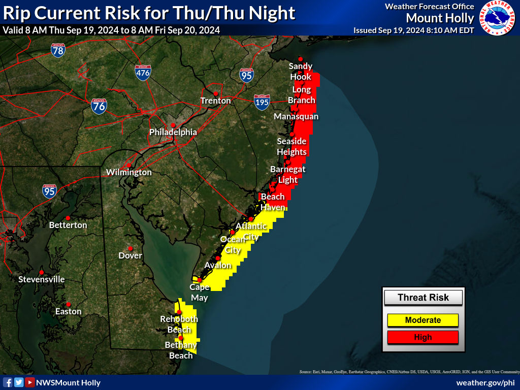
|
||||||||


New Jersey Coastal Waters Model Run
These models forecasts are produced by WFO Mount Holly, NJ, using the NWPS wave models and the Real Time Ocean Forecast System.
NWPS accounts for the following physics:
In here you will see 3-hourly forecast outputs for significant wave height, peak wave direction, peak wave period, and significant swell height (heights in feet and periods in seconds). Our local version of NWPS also uses input from WAVEWATCH III for boundary conditions. NOTE: Significant Swell Height output from NWPS is the average height of the highest 1/3 of the group of waves with periods of 10 secs or longer. |
|
|


 Coastal Flood
 Marine Forecasts
 Text Products
 Climate Information
 Skywarn
 Submit Storm Report
 Weather Event Archives
 Forecast Discussion
 Emergency Managers
 Briefing Page