
Back-to-back powerful Pacific storm systems to impact the Pacific Northwest and northern California through the end of this week with heavy rain, flooding, strong winds, and higher elevation mountain snow. A strong, long-duration atmospheric river will accompany the Pacific storms, bringing excessive rainfall and flash flooding to southwest Oregon and northwest California through the week. Read More >
The most deadly tornado to ever strike within the borders of the state of Oklahoma occurred on Wednesday, April 9, 1947 in the city of Woodward. The Woodward tornadic storm began in the Texas Panhandle during the afternoon of April 9, 1947, and produced at least six tornadoes along a 220 mile path that stretched from White Deer, TX (northeast of Amarillo) to St. Leo, KS (west of Wichita).
The tornado that would strike Woodward began near Canadian, TX. Moving northeast, it continued on the ground continuously for about 100 miles, ending in Woods County, Oklahoma, west of Alva. The tornado was massive, up to 1.8 miles wide, and traveled at forward speeds of about 50 miles per hour. It first struck Glazier and Higgins in the Texas Panhandle, devastating both towns and producing at least 69 fatalities in Texas before crossing into Oklahoma. In Ellis County, Oklahoma, the tornado did not strike any towns, passing to the southeast of Shattuck, Gage, and Fargo. Even though no towns were struck, nearly 60 farms and ranches were destroyed and 8 people were killed with 42 more injured. Moving into Woodward County, one death was reported near Tangier.
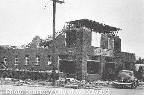
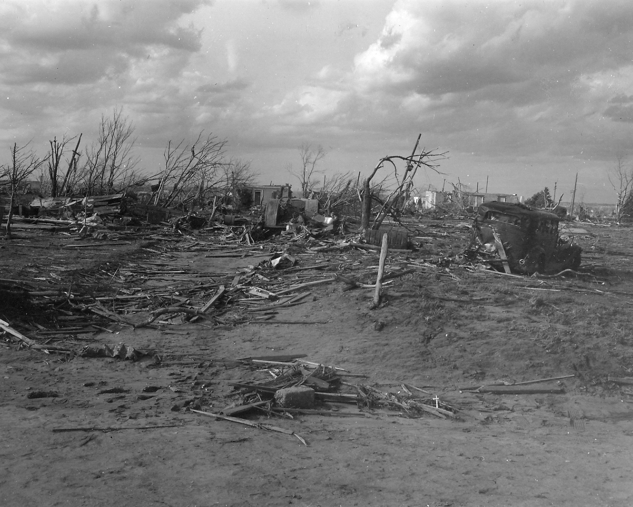
The violent tornado (F5 on the Fujita Scale) unleashed its worst destruction on Woodward, striking the city without warning at 8:42 pm. Over 100 city blocks on the west and north sides of the city were destroyed with lesser damage in the southeast portion of the town. Confusion and fires reigned in the aftermath with over 1000 homes and businesses destroyed, at least 107 people killed in and around Woodward, and nearly 1000 additional injuries. Normal communications between Woodward and the outside world were not restored for some time and there was great uncertainty as to victim status. In fact, the bodies of three children were never identified, and one child who survived the tornado was lost and never reunited with her family. Help for Woodward came from many places, including units from as far away as Oklahoma City and Wichita. Beyond Woodward, the tornado lost some intensity, but still destroyed 36 homes and injured 30 people in Woods County before ending.
In all, at least 116 lives were lost in Oklahoma on that fateful night. Never before or since has a tornado been so costly to human life in the Sooner State. Because of the Woodward tornado and other devastating tornadoes in the late 1940's and early 1950's, and because of new technologies available after World War II, the Weather Bureau (now the National Weather Service) began a tornado watch and warning program in 1953. During the last five decades, the warning system composed of the National Weather Service, local civil preparedness agencies, and the media has continued to mature and provide better and better information to citizens to help them protect themselves from tornadoes. Because of the strengths of the warning system, tornado death tolls in Oklahoma, and nationwide, have dropped considerably with each passing decade and, hopefully, will continue to decrease."
Now with Doppler radar coverage of Woodward from Norman, Dodge City, and an Air Force AFB NEXRAD located northwest of Enid in Alfalfa County...Woodward is better protected than it ever has been. Doppler radar technology has dramatically improved the warning process...and it is probable that a storm like the Woodward tornado of 1947 would be warned on well in advance by the National Weather Service.
- Donald W. Burgess, formerly with the National Severe Storms Laboratory (NSSL)
Note: The original summary for the April 9, 1947 Woodward tornado was based upon a four-day investigation of the tornado damage in the Texas Panhandle and northwestern Oklahoma by three U.S. Weather Bureau (USWB) meteorologists. These meteorologists were: Vernon W. Schaad, MIC (Meteorologist in Charge) at the USWB office at Fort Worth, TX; J. R. Lloyd, MIC at the USWB office in Kansas City, MO; and Henry C. Winburn, MIC at the USWB office in Amarillo, TX. This narrative was part of the monthly climate summary for Oklahoma for April 1947 and has been repoduced below.
Based upon their investigation and initial research, the Woodward tornado was originally thought to have a path length of 221 miles through the Texas Panhandle, northwestern Oklahoma, and southern Kansas. However, independent research conducted by both Don Burgess of the NSSL and Tom Grazulis of the Tornado Project indicated that it may have been the second tornado in a series of at least 6 tornadoes.
This tornado was considered to be the longest, widest, and most destructive ever to have occurred in this section of the country. The tornado ripped through three states in a 221 mile long path, leaving in its wake 169 killed, 980 injured, and a property damage of about $9,700,000.
The tornado originated about 5:42 p. m. CST, April 9, 1947, 1-2 miles SE of White Deer, Texas. The storm moved northeastward, passing 5 mi. NW of Pampa at 6:05 p. m., 3 mi. NW of Canadian, through Glazier about 7:22 p. m., and through Higgins, about 7:45 p. m. It entered Ellis Co., Oklahoma, about 8:00. p. m., following a path which took it 4 mi. SE of Shattuck, 4 mi. NW of Arnett, 3 mi SE of Gage at 8:13 p, m., and 2 miles SE of Fargo. Moving into Woodward Co., the storm struck Woodward at 8:43 p. m. From Woodward the tornado continued its northeastward course through Woodward and Woods Counties, finally leaving Oklahoma about 10:00 p. m., not far from Hardtner, Kansas. Between 10:00 p.m. and 11:00 p. m., CST, the tornado passed through Barber Co., Kansas, and into Kingman Co., where it dissipated after causing some damage at St. Leo, 6 miles north of Nashville, Kansas. The rate of forward movement, 42 mi. per hr. The width of the path was 250 yds. near White Deer, 1.5 mi. at Higgins, 1.8 mi. at Woodward, and 1.0 mi. from Woods Co. to the point of dissipation.
The area affected by the tornado, during the period prior to the onset of the storm, was in the apex of the warm sector of a low pressure system centered in southern Colorado at 6:30 p.m. CST, April 9; the center moving to near Wichita by 12:30 a. m., April 10. On the 6:30 p. m. map, a cold front was indicated as extending SSW from the center along the western edge of the Texas Panhandle. By midnight the front had moved eastward, and was indicated as a cold front aloft through central Kansas, through Enid, Okla., just west of Fort Sill, and to a point south of Big Spring, Texas. Southerly, gusty surface winds, 30-40 mph, with low clouds were noted in the area. Winds aloft at Amarillo at 4:00 p. m. were southerly from 53 to 61 mph at levels from 4 to 7 thousand feet MSL.
Few reports were received from persons actually observing the tornado cloud due to fog, low clouds, and darkness. Observers saw the tornado as it formed near White Deer, and the Weather Bureau observer at Pampa noted the cloud when it was north of his station. The roar of the tornado as it passed 3-5 mi. to the south could be heard at the Gage station. Near Gage the funnel shaped cloud was seen during lightning flashes. The tornado caused marked dips in the barograph traces at both Pampa and Gage. The cooperative observer at Arnett, 4 mi. to the south at the storm path, heard the tornado roaring but was unable to see it because of the low clouds. Observers at Woodward reported hearing the tornado, comparing its sound to the roar of a fast freight or express train.
Loss of 1ife totaled 169; 101 being killed in Oklahoma and 68 in Texas. According to the American Red Cross 95 persons lost their lives at Woodward and 6 in Ellis Co. In Glazier, 17 were killed and in Higgins 51. 782 injured were counted in Oklahoma and 198 in Texas. The Red Cross reported a total of 626 houses destroyed and 920 damaged as follows: Oklahoma, Woodward Co., 430 destroyed, 650 damaged; Ellis Co., 52 destroyed, 133 damaged; Woods Co., 25 destroyed, 20 damaged; Texas: Lipscomb Co., 83 destroyed, 116 damaged; Hemphill Co., 36 destroyed and 1 damaged.
The tornado struck Woodward in the early part of the night, when numerous families or members of families were away from home. Many returned to find their homes completely destroyed or badly damaged. Some families, like that of the local Weather Observer, escaped injury by taking refuge in their storm cellars. Miraculous escapes were many, while in other cases most if not all members of the family were either killed or injured. Confusion among separated families was rampant. Weather conditions added to the misery or the homeless and the task of relief workers as temperatures dropped into the 30s and 40s and cold rain changed to snow on the 12th and l3th.
Total property damage for the three States was estimated at $9,700,000. Losses to property were principally to buildings, although many livestock, fences, telegraph wires, automobiles, and farm machinery were destroyed. Damage estimates by County Agents in Oklahoma were: Woodward Co., $6,608,750; Ellis Co., 1,264,000; and Woods Co., $150,000; making the total loss in Oklahoma around 8,022,750. Total property damage was estimated at $1,505,000 in Texas, and $200,000 in Kansas.
Fires broke out in a number of places, and were difficult to control due to loss of water supply and lack of help. Persons were mostly concerned with taking care of the dead and injured. A downpour of rain for about 15 minutes shortly after the storm moved on helped suppress the fires at Woodward. The tornado destroyed the equipment for the local weather station, but the amount of rainfall was estimated by the observer at 0.50 inch. Rain and snow on the 12-13th added to damage of property remaining unprotected.
In Woodward over a hundred city blocks were demolished. Practically all of Higgins and Glazier were destroyed. For the entire storm between 4,000 and 4,000 buildings of all kinds, including homes, were either destroyed or damaged.
Weather Bureau Officials, Messrs. Lloyd, Schaad, and Winburn, who investigated the tornado, indicated that the path of the tornado at Woodward measured 1.8 mi. wide, one of the widest tornado paths of record. Measurements of the distance from the right hand edge of the tornado, where structural damage began, to the center of the core of the tornado was 1.1 mi. From the center of the core to the left hand edge of the zone of destruction was determined at 0.7 mi. On the extreme right hand edge of the zone of destruction the debris lay almost parallel to the path of the tornado. Moving in toward the center of the core, directly across the path of the tornado, the angle at which the debris lay gradually shifted, as the forward ends of trees, boards, etc., were inclined more to the left. At the right hand edge of the core the debris lay due north-south; and in the core itself, the debris was in a tangled masa with the bulk of it at right angles or nearly right angles to the path. (M.O.A.)
Records taken from the Storm Prediction Center archive data, "Storm Data", and data from the National Weather Service office in Norman. Data modified as described in NOAA Tech Memo NWS SR-209 (Speheger, D., 2001: "Corrections to the Historic Tornado Database").
Tornado F-scale ratings prior to 1950 are referenced from Significant Tornadoes, 1680-1991. by T. P. Grazulis.
| # | Date | Time (CST) |
Path Length (miles) |
Path Width (yards) |
F-Scale | Killed | Injured | County | Path |
|---|---|---|---|---|---|---|---|---|---|
| 1 | 06/09/1941 | 0700 | 3 | 250 | 0 | 3 | Woodward | Woodward | |
|
Woodward was struck by a tornado at 7:00 am CST. The storm moved across a section of the city from northwest to southeast and caused considerable damage to many homes mid other property. The path of destruction was about 250 yards wide and about 3 miles long. No one was killed, but three persons were injured. Crop loss in the vicinity of Woodward was estimated at $35,000, while the total of other property damage was estimated at $65,000. |
|||||||||
| 2 | 04/09/1947 | 1952 | 221 | 3200 | F5 | 169 (101) |
980 (782) |
Ellis/ Woodward/ Woods | .5 SE White Deer TX - 5 NW Pampa TX - Glazier TX - Higgins TX - 4 SE Shattuck - 4 NW Arnett - 3 SE Gage - 2 SE Fargo - Woodward - near Hartner KS - St. Leo KS |
|
Please see the summaries through the main summary tab and the original summary tab. |
|||||||||
| 3 | 05/15/1949 | 2130 | 4 | 67 | 0 | 0 | Woodward | Near Woodward | |
|
A small tornado occurred near Woodward during the evening of May 15, 1947. |
|||||||||
| 4 | 05/20/1949 | 67 | 0 | Woodward | 2.5 E Woodward | ||||
|
A tornado touched east of Woodward and part of an outbreak of more than 20 tornadoes that occurred in Oklahoma during the after and evening ours of May 20, 1947 and the early morning hours of May 21, 1947. |
|||||||||
| 5 | 04/28/1953 | 1500 | 0.1 | 25 | F0 | 0 | 0 | Woodward | 5 N Woodward |
|
A small tornado was reported five miles north of Woodward moving over open ranch land. No damage was reported |
|||||||||
| 6 | 05/03/1960 | 1930 | 0.5 | 100 | F1 | 0 | 0 | Woodward | 6 SE Woodward |
|
A small, but well-developed tornado was observed moving through open country 6 miles southeast of Woodward. No damage was reported. |
|||||||||
| 7 | 05/09/1979 | 2030 | 0.3 | 15 | F1 | 0 | 1 | Woodward | 4 W Woodward |
|
A tornado picked up a mobile home and dropped it upside down 4 miles west of Woodward. One woman was injured when she was thrown through a window. Golfball size hail was also reported at Fort Supply Lake. |
|||||||||
| 8 | 04/20/1985 | 2201 | 15 | 100 | F0 | 0 | 0 | Woodward | 4 N Sharon- S of Woodward |
|
A tornado set down 3 1/2 miles north of Sharon and moved intermittently in a north-northwesterly direction for 15.3 miles. One barn, several outbuildings and a grain bin were destroyed. Many other buildings were damaged and many trees and power poles were downed. Damage was estimated at $20,000. |
|||||||||
| 9 | 05/26/1991 | 1753 | 2 | 75 | F1 | 0 | 0 | Woodward | 3 E- 5 E Woodward |
|
Thunderstorms developed across northwestern Oklahoma during the late afternoon hours and quickly became severe. During the night, the storms spread to north-central and northeastern Oklahoma. Three tornadoes were produced in the vicinity of Woodward from the same parent thunderstorm. The first tornado (Fl) developed 2.5 miles east of Woodward and moved east along a 2-mile path causing minor damage. |
|||||||||
| 10 | 05/26/1991 | 1758 | 13 | 1000 | F3 | 0 | 0 | Woodward | 3 E- 13 E Woodward |
|
The second tornado (F3) of this event was the longest and most destructive it developed less than 0.5 mile south of the first tornado and moved almost due east along a: 9.5-mile long path, sometimes in excess of 0.5 mile in width. Even though it moved through mostly farm country, it did cause areas of F3 damage 8 miles east of Woodward along the North Canadian River. In total, three mobile homes were destroyed, one had minor damage; six barns or large outbuilding were destroyed, four were damaged; at least five small sheds or outbuildings were destroyed; ten homes damaged (mostly minor); and in addition damage was done to 36 power poles, fences, and trees along the path. |
|||||||||
| 11 | 05/26/1991 | 1759 | 1.0 | 50 | F1 | 0 | 0 | Woodward | 4 ESE Woodward |
|
The third tornado (Fl) developed about 0.5 mile south of the second tornado and moved southeast along a 1-rmle path length doing damage consistent with a Fl tornado. It was described as rope-like in appearance. |
|||||||||
| 12 | 04/09/1992 | 1615 | 0.5 | 60 | F0 | 0 | 0 | Woodward | 9 NNW Woodward |
|
A weak tornado associated with thunderstorm outflow (also known as a landspout) occurred 9 miles north-northwest of Woodward. |
|||||||||
| 13 | 04/09/1992 | 1615 | 0.3 | 25 | F1 | 0 | 0 | Woodward | 10 N Woodward |
|
A weak tornado associated with thunderstorm outflow (also known as a landspout) occurred 10 miles north of Woodward. |
|||||||||
| 14 | 04/09/1992 | 1620 | 0.1 | 30 | F0 | 0 | 0 | Woodward | 7 NNW Woodward |
|
A weak tornado associated with thunderstorm outflow (also known as a landspout) occurred 7 miles north-northwest of Woodward. |
|||||||||
| 15 | 04/30/1993 | 2158 | 0.1 | 20 | F0 | 0 | 0 | Woodward | 7 N Woodward |
|
A brief, small tornado touched down 7 miles north of Woodward, OK. No damage was reported. |
|||||||||
| 16 | 04/30/1993 | 2215 | 0.1 | 20 | F0 | 0 | 0 | Woodward | 4 N Woodward |
|
A brief, small tornado touched down 4 miles north of Woodward, OK. No damage was reported. |
|||||||||
| 17 | 06/05/2001 | 1834 | 0.1 | 25 | F0 | 0 | 0 | Woodward | 5 SSW Woodward |
|
This brief tornado was observed by a storm chaser causing no damage in a field in southwest Woodward County. |
|||||||||
| 18 | 04/09/2012 | 1723 | 0.1 | 30 | EF0 | 0 | 0 | Woodward | 3 SSW Woodward |
|
A number of storm chasers reported a tornado approximately 3 miles south-southwest of Woodward. No known damage occurred and the location is estimated. |
|||||||||
| 19 | 04/09/2012 | 1735 | 0.2 | 100 | EF1 | 0 | 0 | Woodward | 5 S Woodward |
|
A tornado was observed by spotters and storm chasers south of Woodward. A camper was rolled over, trees were uprooted and light damage occurred to a building. |
|||||||||
| 20 | 04/14/2012-04/15/2012 | 2342-0026 | 34 | 400 | EF3 | 6 | 29 | Ellis/ Woodward | 2 SSW Arnett - Woodward - 4 N Woodward |
|
The tornado developed approximately just south of Arnett (Ellis County) at 11:42 pm CST on April 14, 2012 and moved northeast. Only minor damage, downed trees and power poles/lines, was seen as the tornado moved over mainly rural portions of Woodward County, southwest of the city of Woodward. At approximately 12:12 am CST on April 15, 2012, the tornado struck two mobile homes 5 miles southwest of Woodward. The damage here was determined to be EF-2 in intensity, and also resulted in 3 fatalities. The heaviest damage, rated EF-3, was reported as the tornado entered the southwest sides of Woodward around 12:18 am CST. Several homes and businesses were heavily damaged as the tornado continued northeast. Several more mobile homes were destroyed by the tornado on the north side of Woodward, and resulted in 3 additional fatalities. The tornado finally exited the city of Woodward at approximately 12:23 am CST, eventually dissipating approximately 4 miles north of Woodward at 12:27 am CST. |
|||||||||
| 21 | 05/23/2016 | 1925 | 2.7 | 400 | EF0 | 0 | 0 | Woodward | 5.5 - 6.5 NNW Woodward |
|
A tornado was observed north-northwest of Woodward by multiple spotters and storm chasers. Two outbuildings were damaged, but otherwise meandered over open ranchland. Although the tornado was observed to have become rather wide, both the damage produced and preliminary data from the University of Massachusetts X-Pol mobile Doppler radar operated by Purdue University researchers indicate that the tornado likely only produced EF0 wind speeds. Based on the circulation track derived from the UMass X-Pol radar, the total path length was approximately 2.7 miles along a meandering path. |
|||||||||
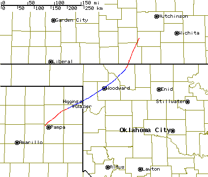
Map showing the Woodward tornado track. The blue area is what is now considered to be the track of the Woodward tornado. The red tracks were originally reported to be from the Woodward tornado also, but are now thought to be other tornadoes in a family of 5 or 6 tornadoes.
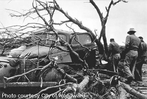
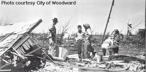
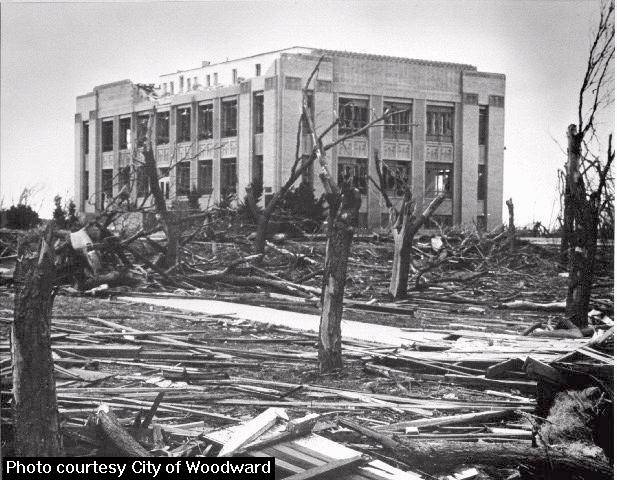
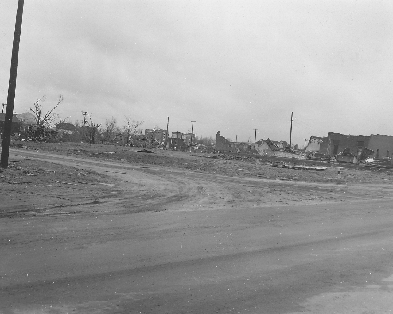
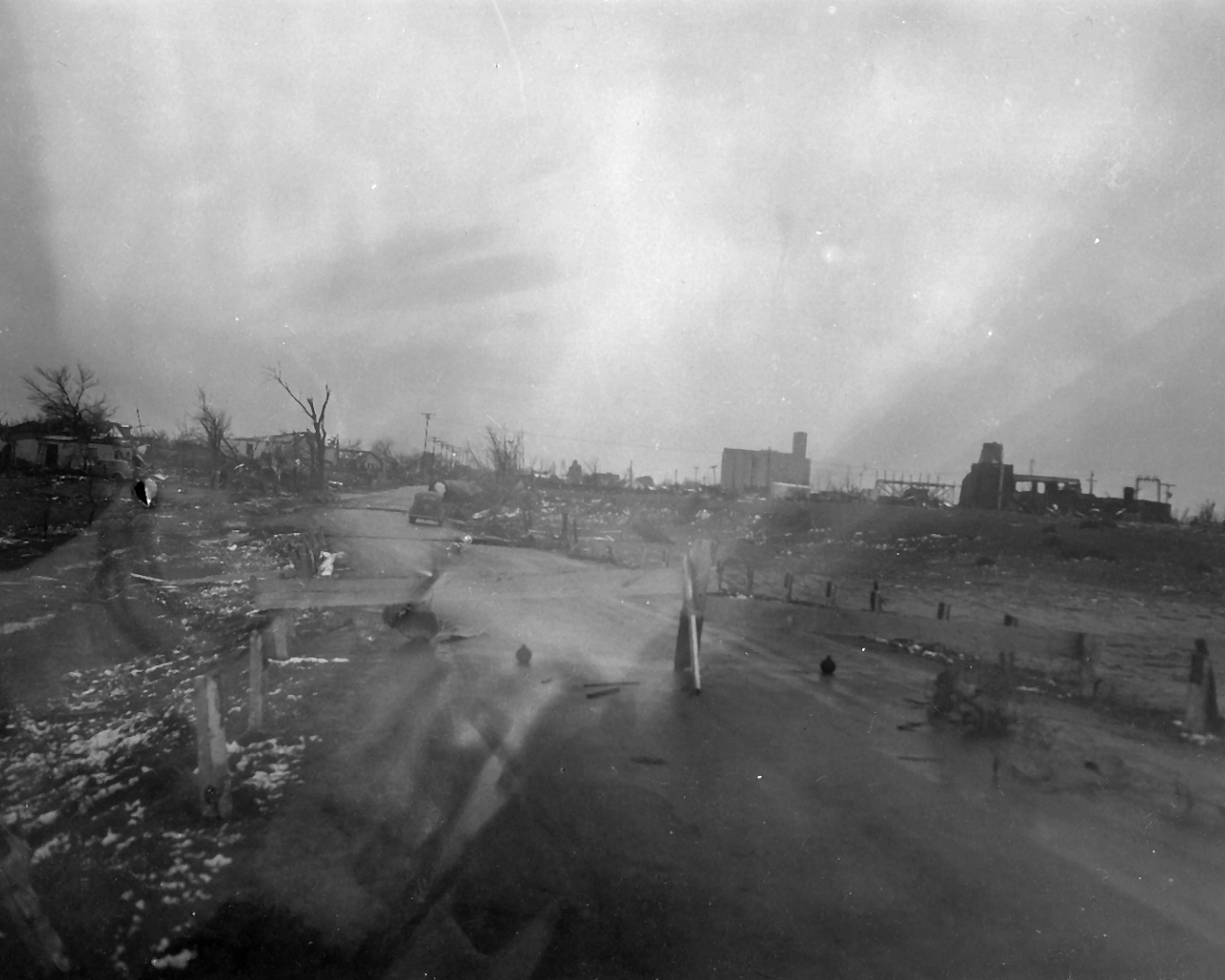
All photographs below were presented to the National Weather Service in Norman by the City of Woodward.
 |
 |
 |
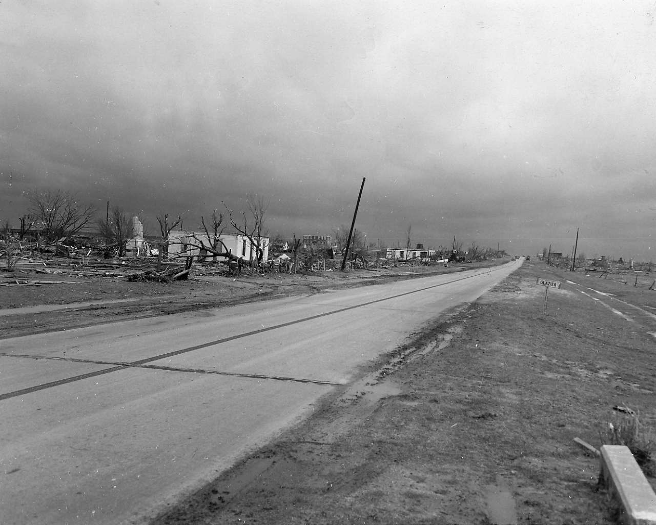
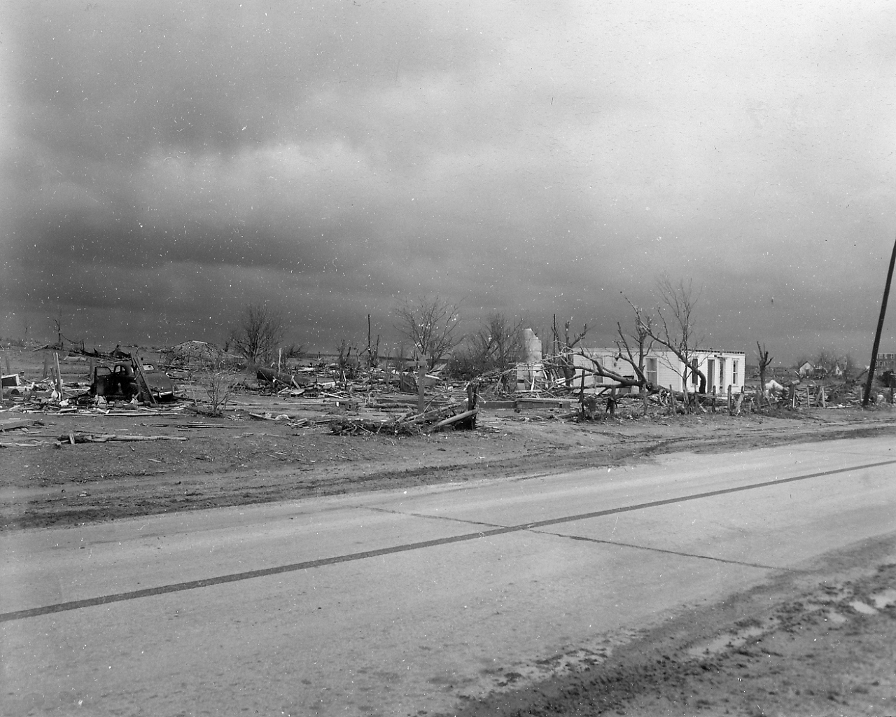
Note: The following 48 photos were taken on or around April 15, 1947 by Vernon W. Schaad, MIC (Meteorologist in Charge) at the U.S. Weather Bureau's office at Fort Worth, TX. Mr. Schaad spent four days investigating the tornado damage in the Texas Panhandle and northwestern Oklahoma with two other USWB meteorologists. The other meteorologists were J. R. Lloyd, MIC at the USWB office in Kansas City, MO and Henry C. Winburn, MIC at the USWB office in Amarillo, TX.
 |
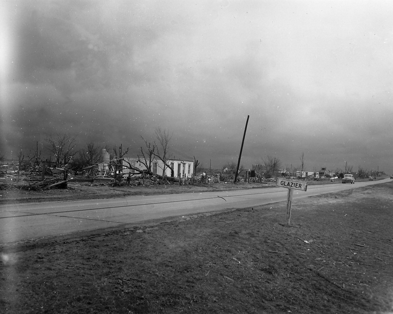 |
| Photo 1: Looking north with three buildings left in in Glazier, Texas. The small building to the right is a temporary building constructed after the storm. | Photo 2: Looking north at damage to trees in Glazier, Texas. |
 |
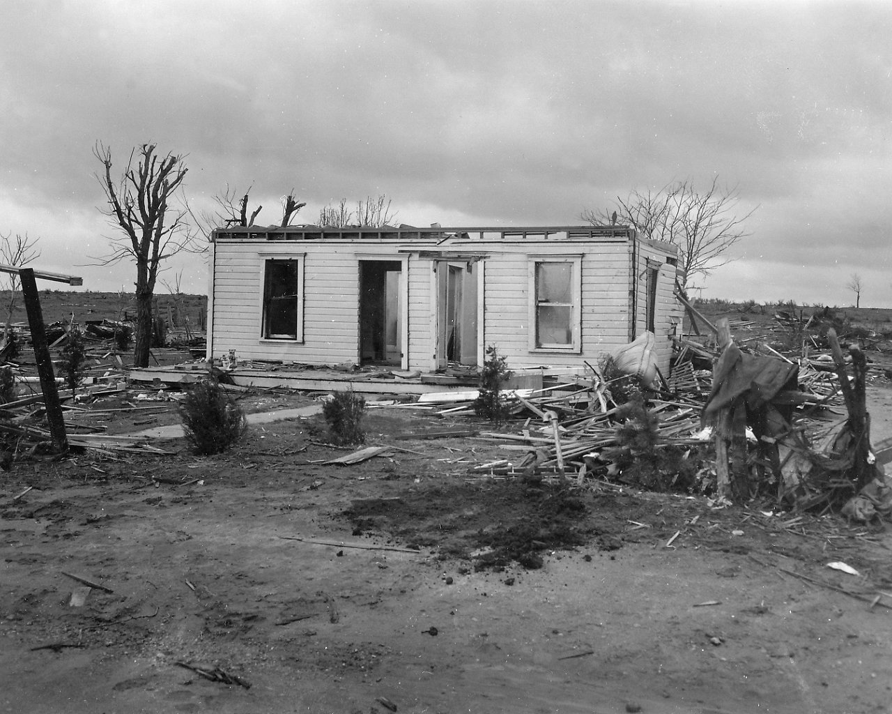 |
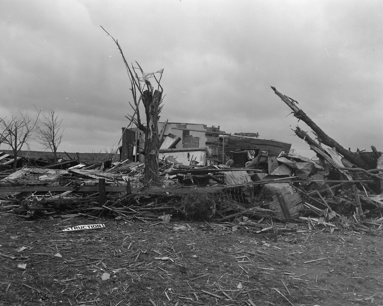
| Photo 3: Looking north at the south edge of Glazier, Texas. | Photo 4: Representative damage that occurred to the three houses remaining in Glazier, Texas. |
 |
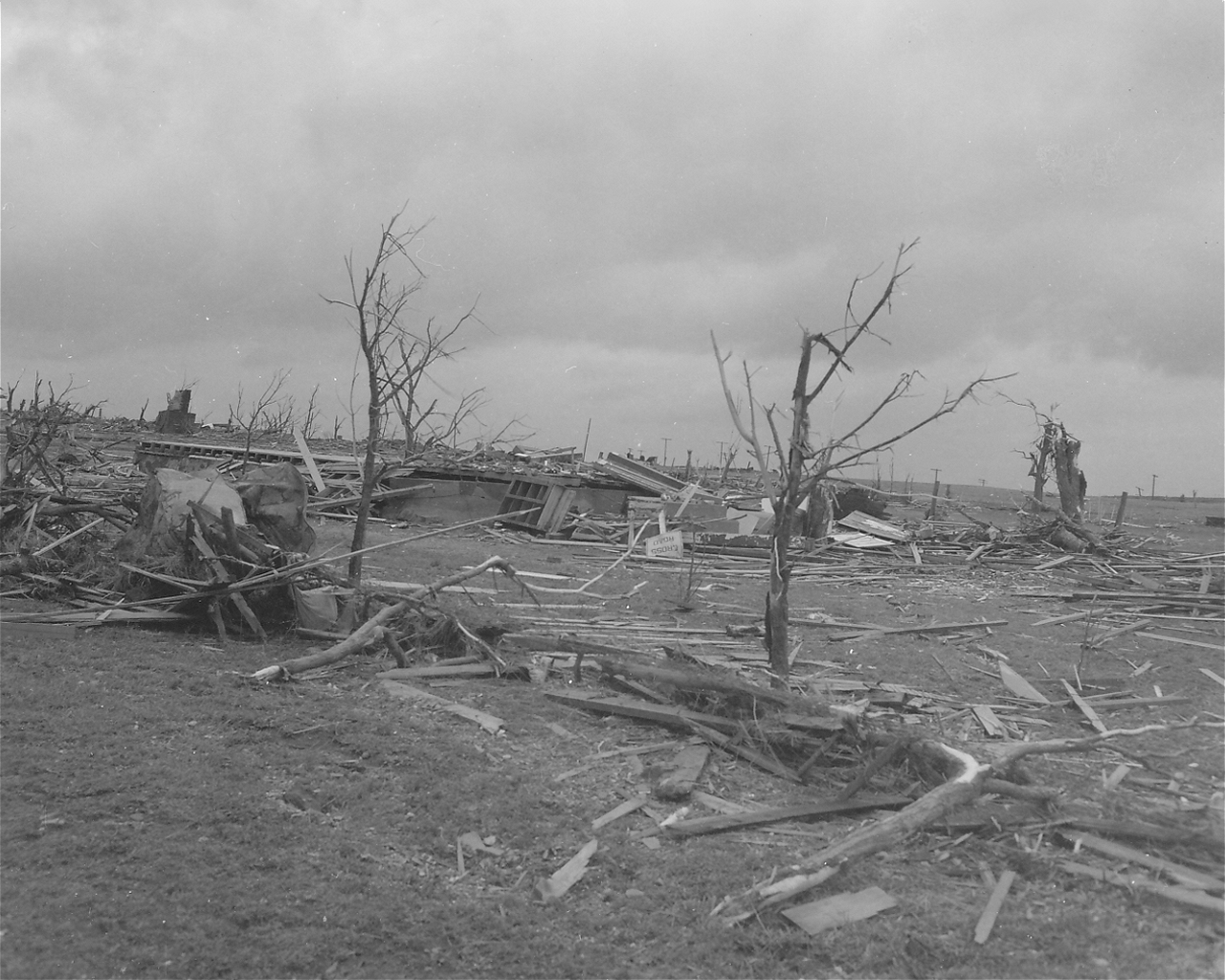 |
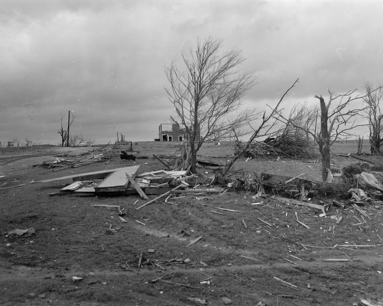
| Photo 5: View of total destruction in Glazier, Texas. | Photo 6: View of total destruction in Glazier, Texas. |
 |
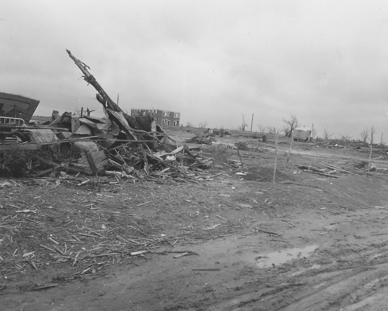 |
| Photo 7: View of damage to a two-story building in Glazier, Texas. | Photo 8: View of shredded debris in Glazier, Texas can be seen in the foreground of the photo. |
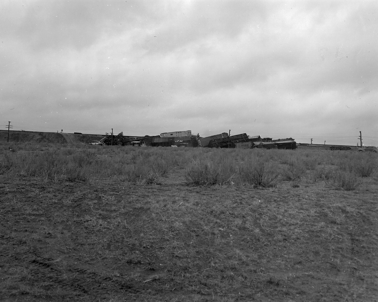 |
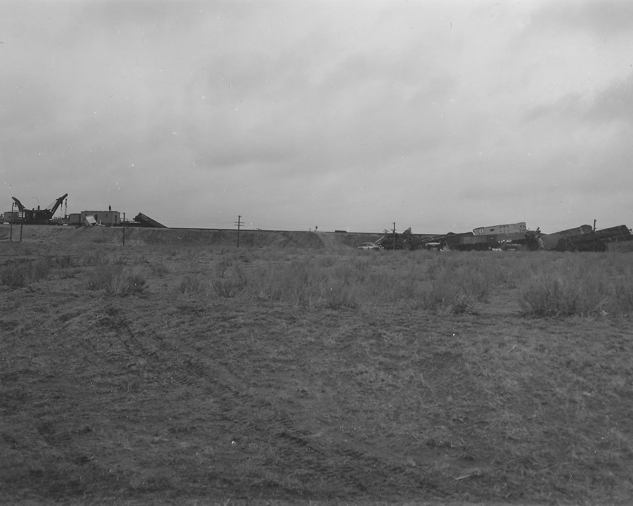 |
| Photo 9: View of a train wreck along the Santa Fe Railroad at Higgins, Texas. Two freight trains collided due to a breakdown of the centralized traffic control system due to the storm. | Photo 10: View of the train wreck and railroad track at Higgins, Texas. A railroad crew is at work clearing debris from the track in the left center of the photo. |
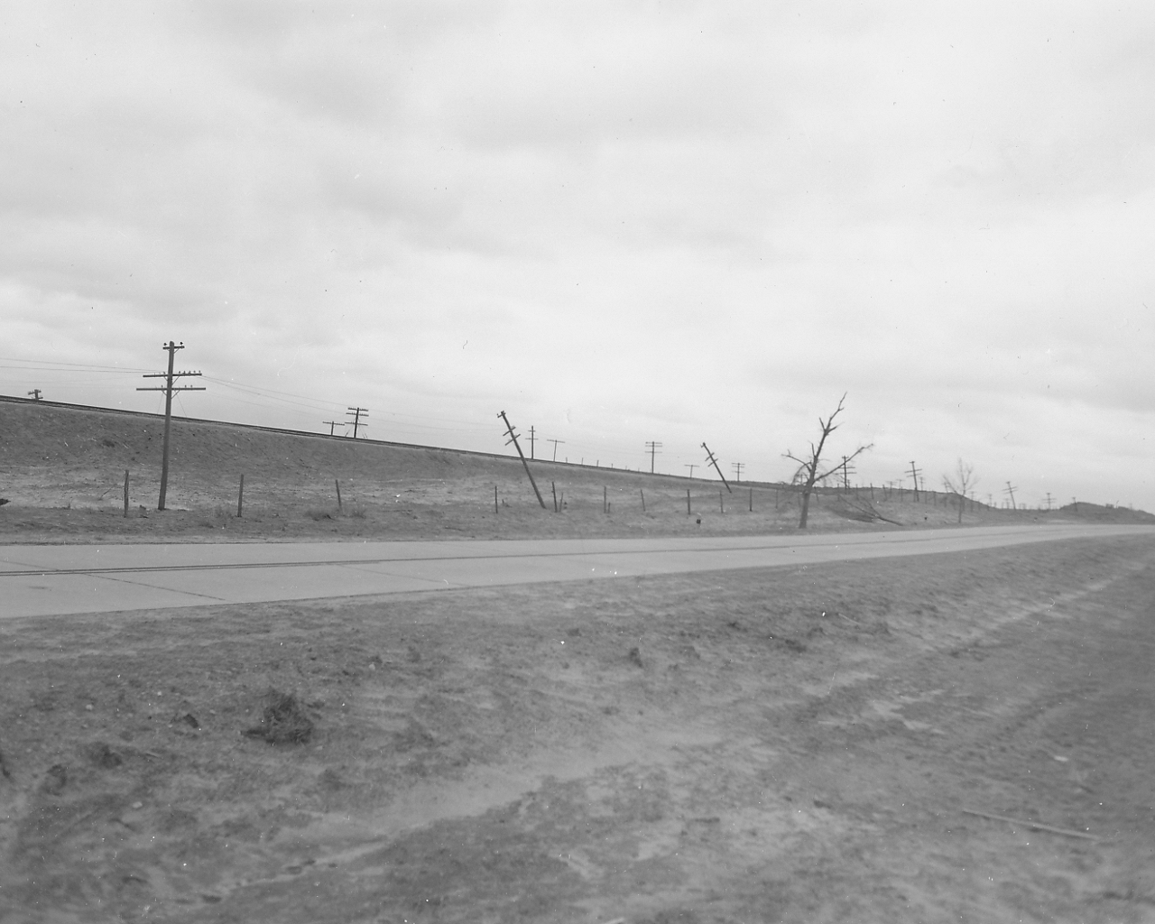 |
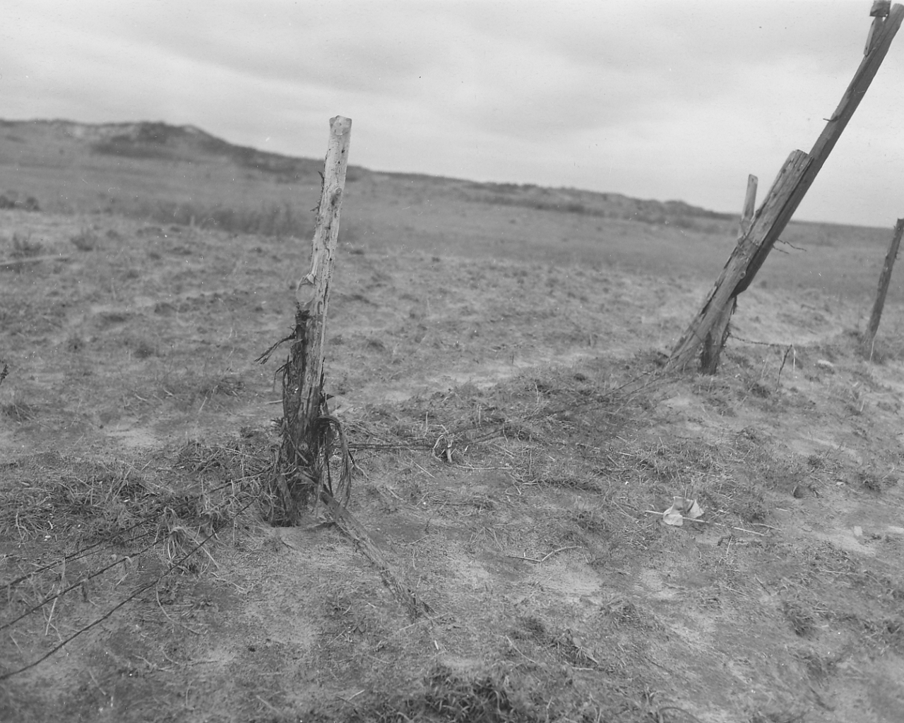 |
| Photo 11: View of damage along the highway between Glazier and Higgins, Texas. The tornado traveled along the highway between Glazier and Higgins. | Photo 12: View of fences broken down and bark shredded from fence posts in an area between Glazier and Higgins, Texas. |
 |
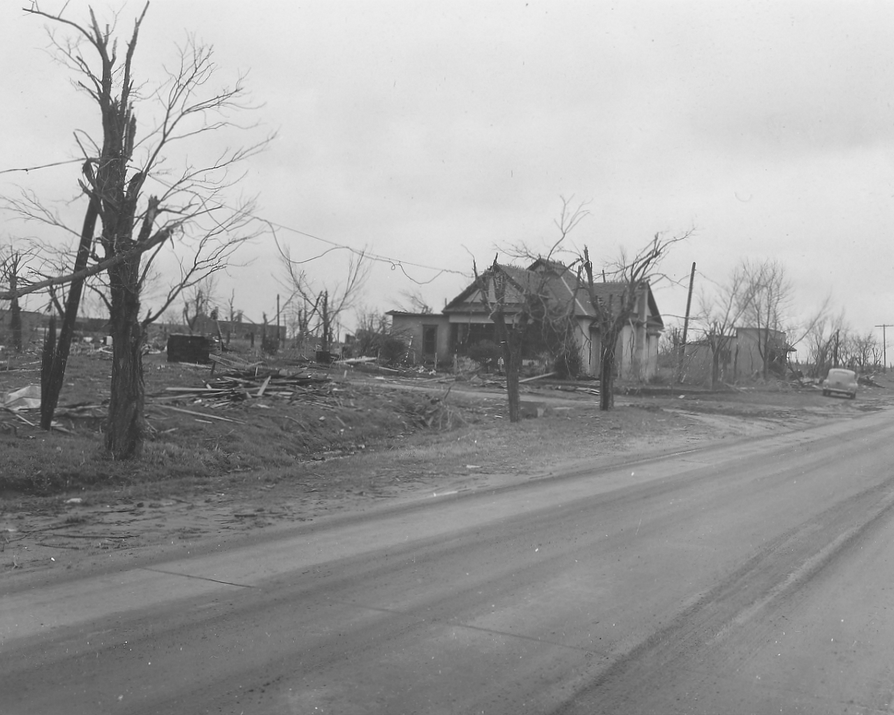 |
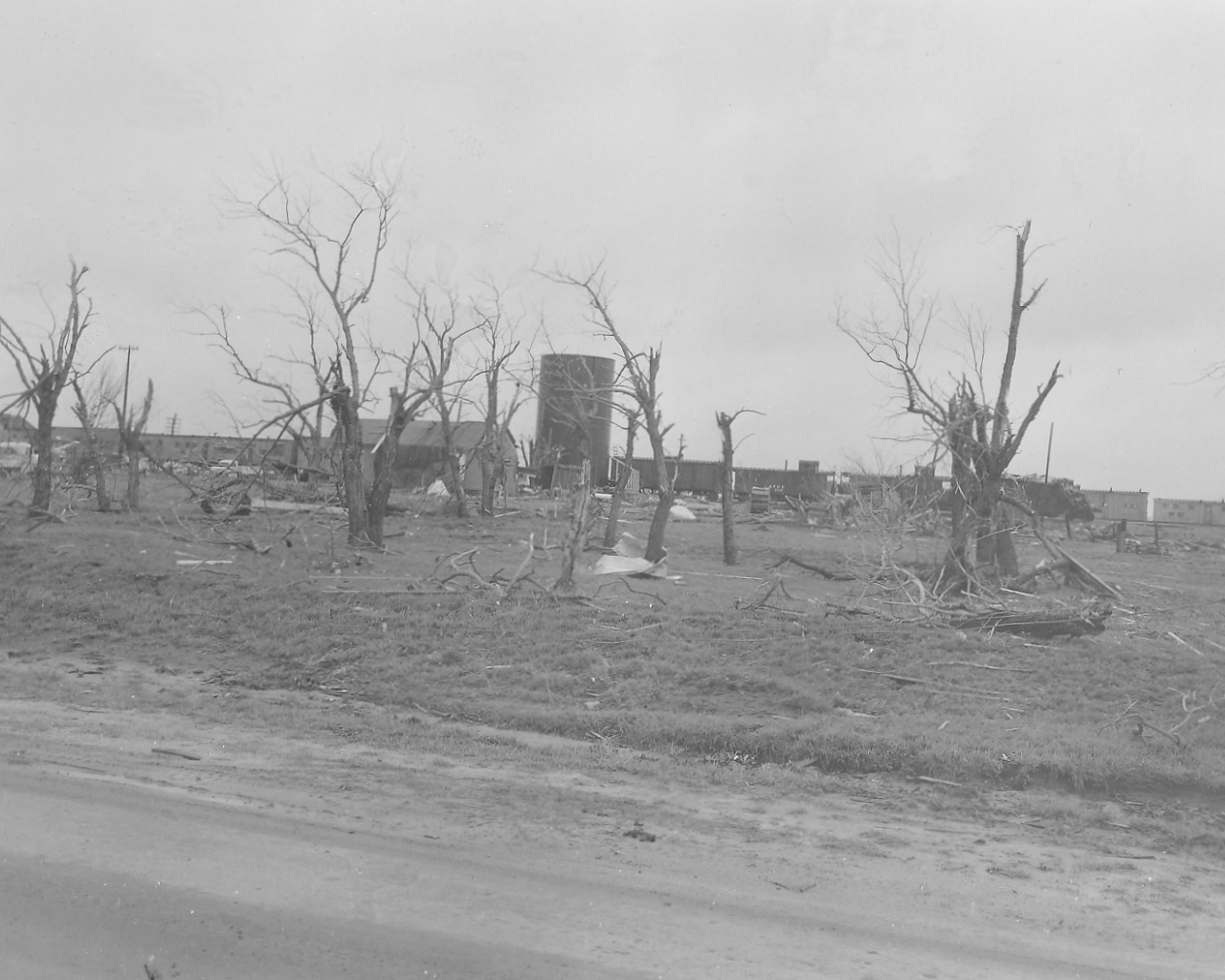
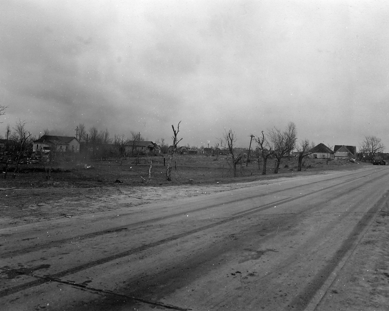
| Photo 13: View of damage of the south edge of Higgins, Texas along the south edge of the of tornado damage path. | Photo 14: View looking to the north at a damaged telephone cable in Higgins, Texas. |
 |
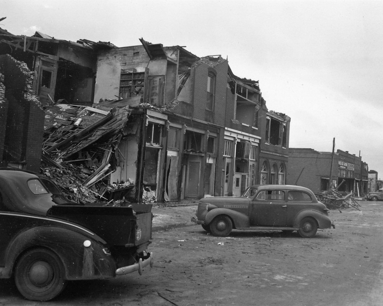 |
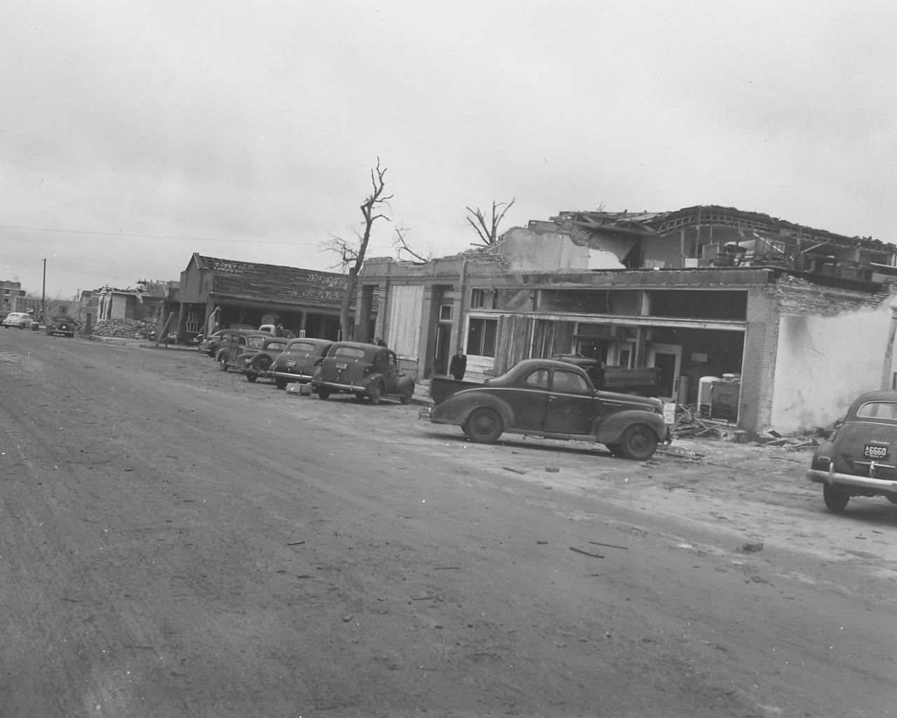
| Photo 15: View of the north edge of the tornado damage path in Higgins, Texas. Tree damage occurred and some buildings remained standing within the tornado damage path. | Photo 16: View of the damaged business section in Higgins, Texas. |
 |
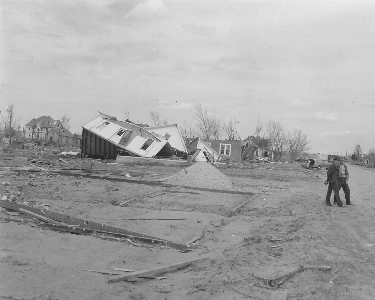 |
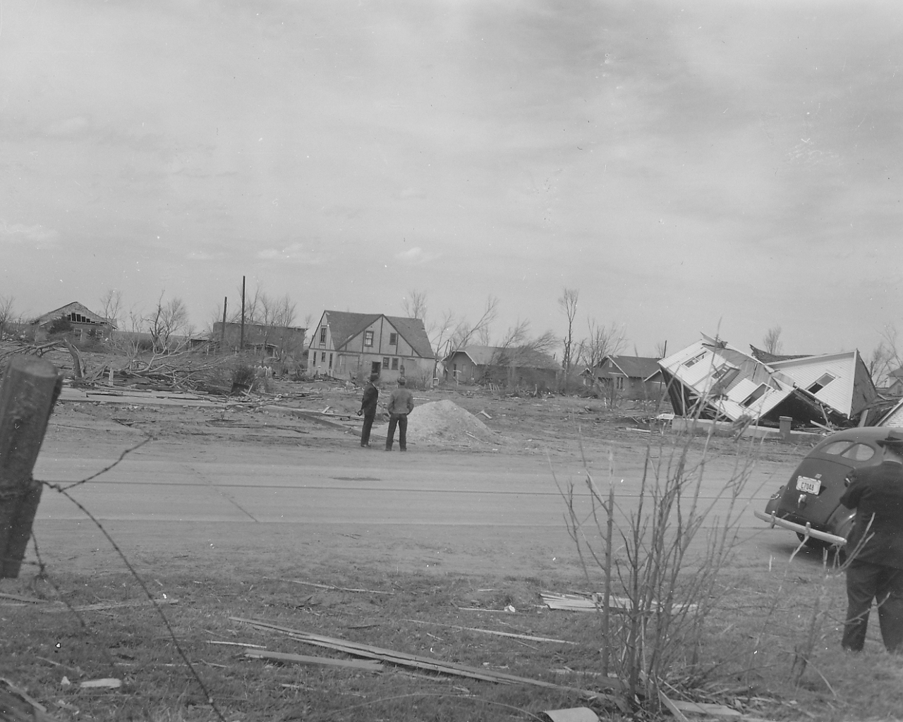
| Photo 17: View of the damaged business section in Higgins, Texas. This damage was along the south side of the street across from the area shown in the previous photo. | Photo 18: View of a collapsed two-story house in Higgins, Texas. An unroofed stucco house can be seen in the background. The concrete forms in the foreground were for a projected filling station. Residents of the frame house took refuge in a ditch during the storm and were unhurt. Residents of stucco house were in a cellar during the storm. |
 |
|
| Photo 19: Another view of the collapsed two-story frame house in Higgins, Texas. Note the strong cross braced construction of the wall of the house. The left center of the photo shows the foundation from which a building was completely removed by the tornado. |
 |
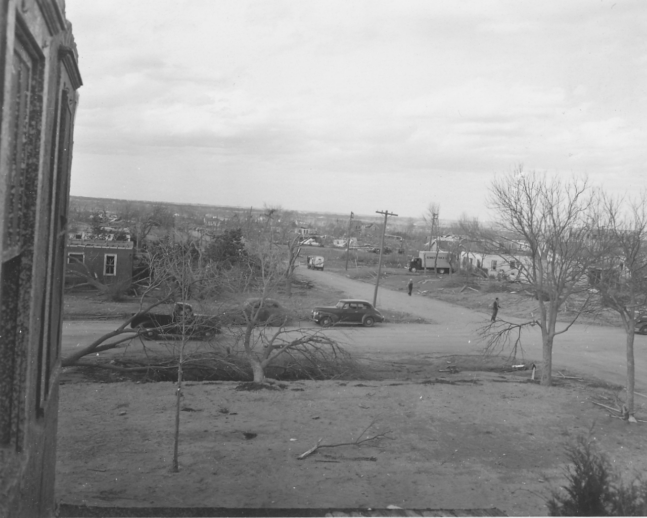 |
| Photo 20: View looking at wreckage of brick and steel construction within the tornado damage path in Woodward, Oklahoma. | Photo 21: View looking north at damage along the right edge of the tornado path in Woodward, Oklahoma. The photo was taken from the second floor of a damaged house. |
 |
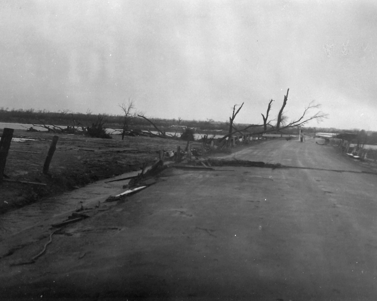 |
| Photo 22: View looking south at damage in Woodward, Oklahoma. The photo was taken from a highway bridge. Note the brick and steel construction of the structure in the right portion of the photo. | Photo 23: View of the north end of 8th Street in Woodward, Oklahoma. The bridge is blown out and debris lies to the left of it. The path of the tornado extended one-half mile beyond the North Canadian River which runs along the north side of Woodward. |
 |
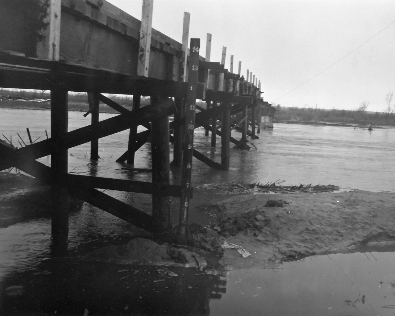 |
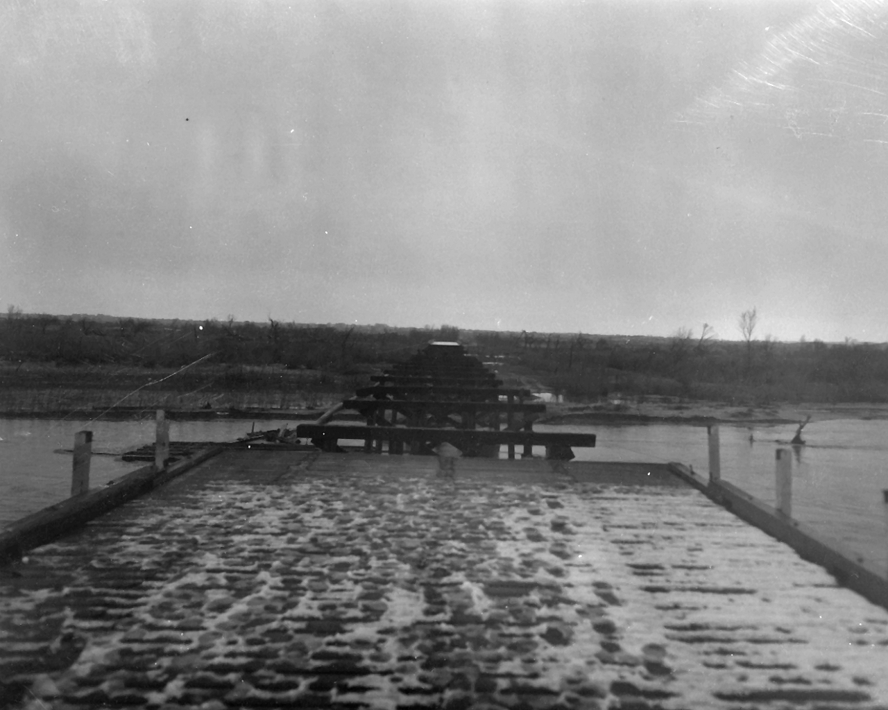
| Photo 24: View looking north at a damaged bridge over the North Canadian River on the north side of Woodward, Oklahoma. | Photo 25: View looking north-northwest at the U.S. Army Corps of Engineers river gage on the damaged highway bridge. The staff gage was used to stage river stage readings for the North Canadian River. |
 |
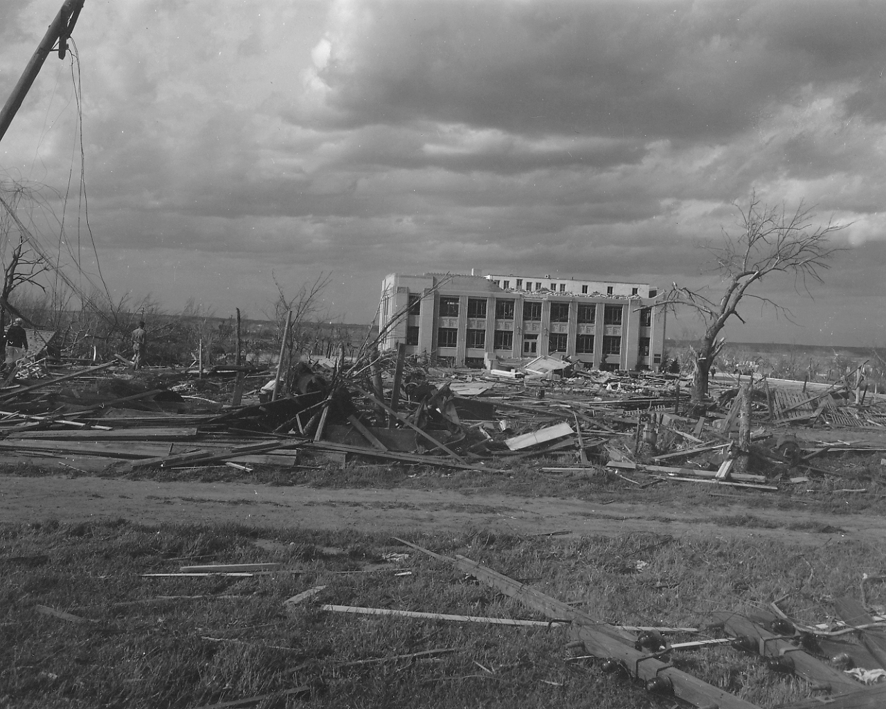 |
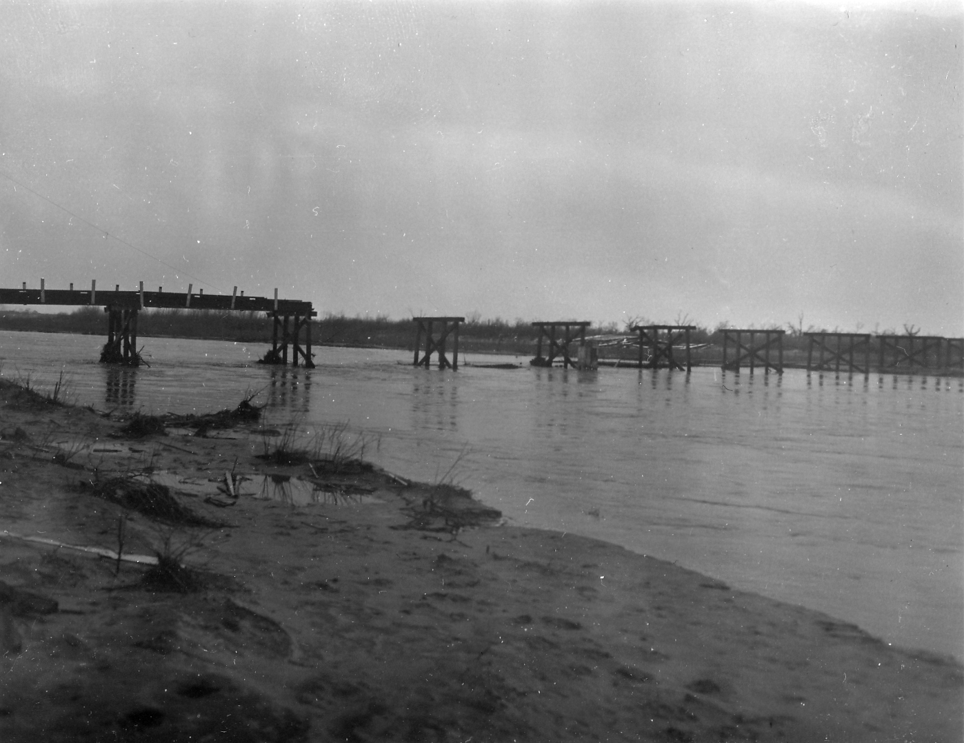
| Photo 26: Side view looking northwest at the damaged highway bridge just north of Woodward, Oklahoma. | Photo 27: View of the damaged Woodward County Courthouse building in Woodward. Some of the stone facing on the building had been torn loose. |
 |
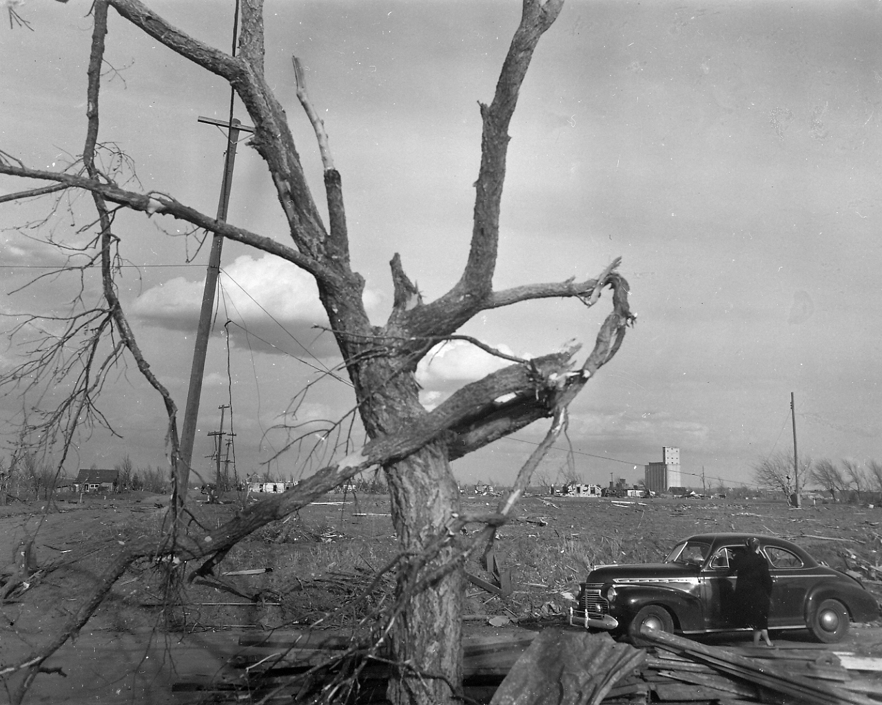 |
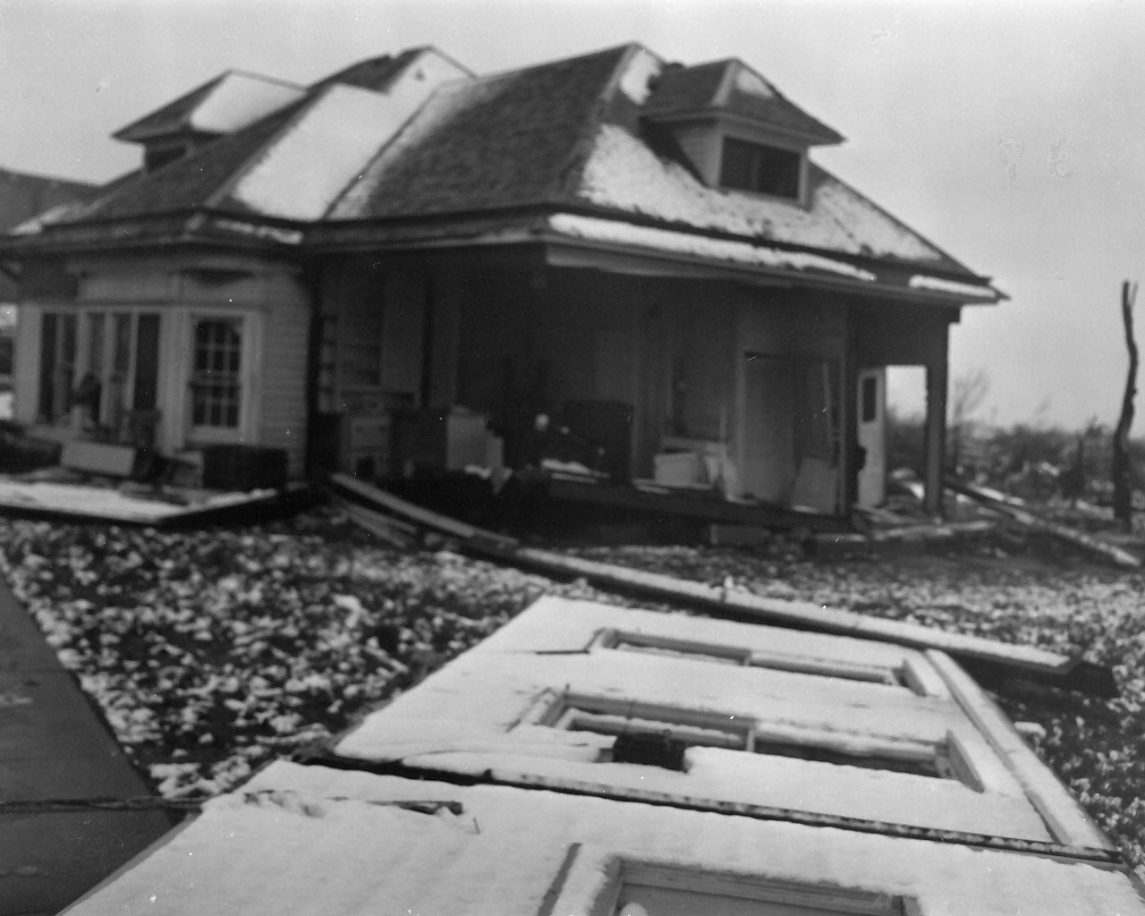
| Photo 28: View looking southwest at damage to a dwelling in Woodward. The north and east sides of the structure had been blown out. | Photo 29: View looking east at tree damage in Woodward, Oklahoma. |
 |
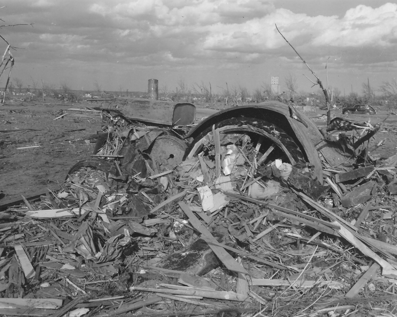 |
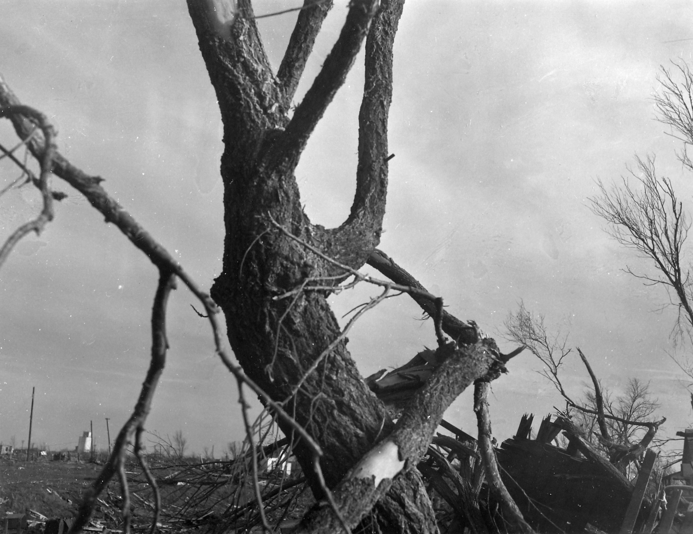
| Photo 30: View looking south at tree damage in Woodward. A section of shingle was had been driven into a tree branch on the right side of the tree. | Photo 31: View of damage on the right-hand (east) side of the tornado path in Woodward. A tractor had the left edge of its radiator "chewed away" and debris had been driven into the mechanism. |
 |
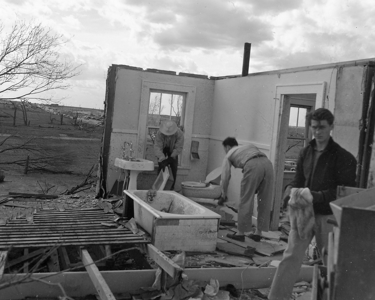 |
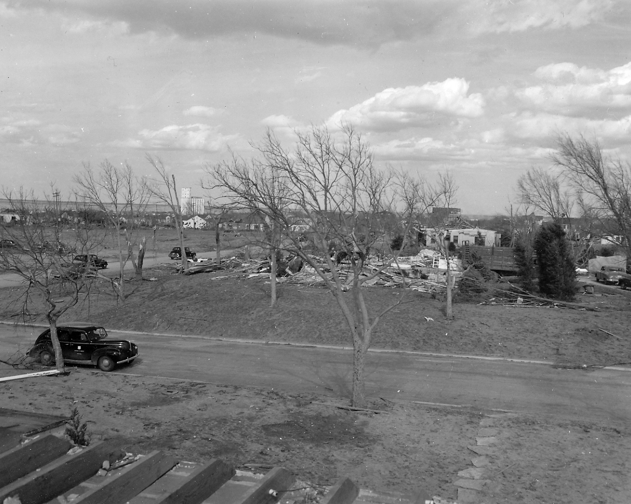
| Photo 32: View looking northeast at the edge of damage in Woodward, Oklahoma. | Photo 33: View of damage to the southwest corner of a two-story dwelling. |
 |
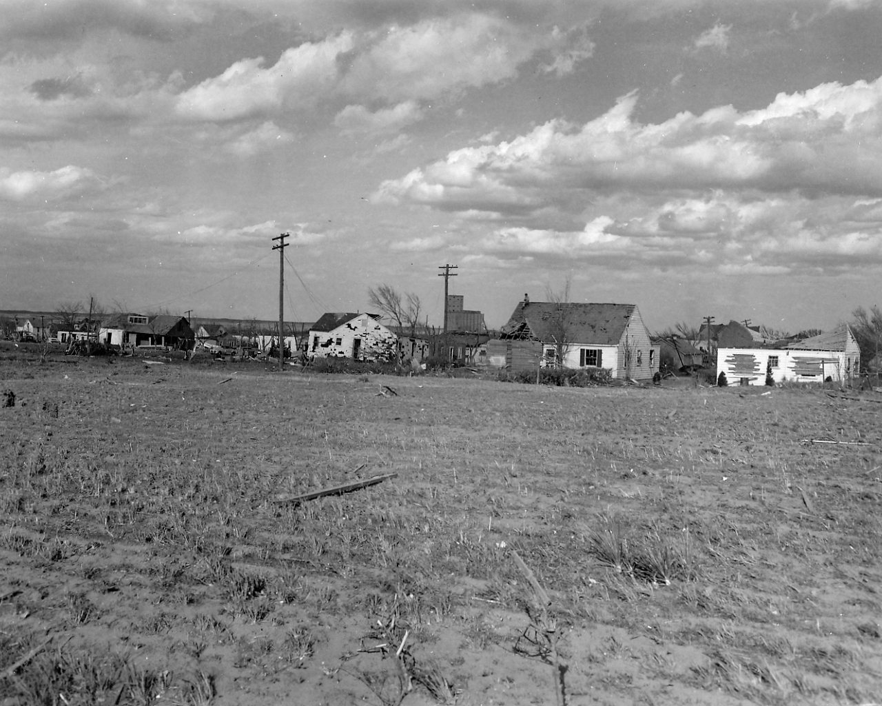 |
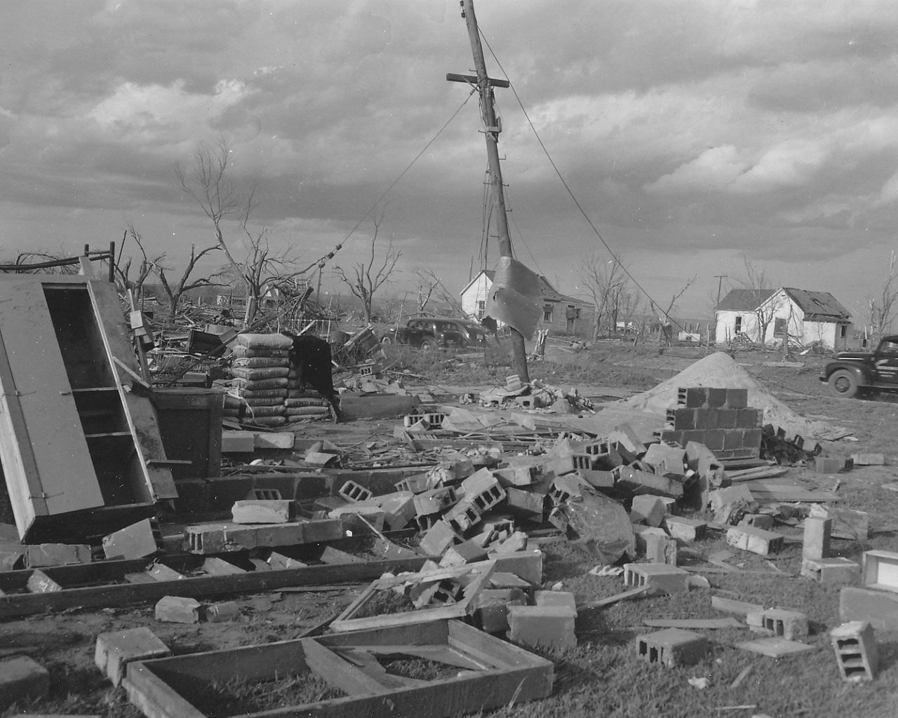
| Photo 34: View of the remains of a concrete block store and corrugated metal roofing wrapped around pole in Woodward. | Photo 35: View of the right-hand (east) edge of the tornado damage path. Damage occurred to the windows and siding was torn from houses in Woodward. |
 |
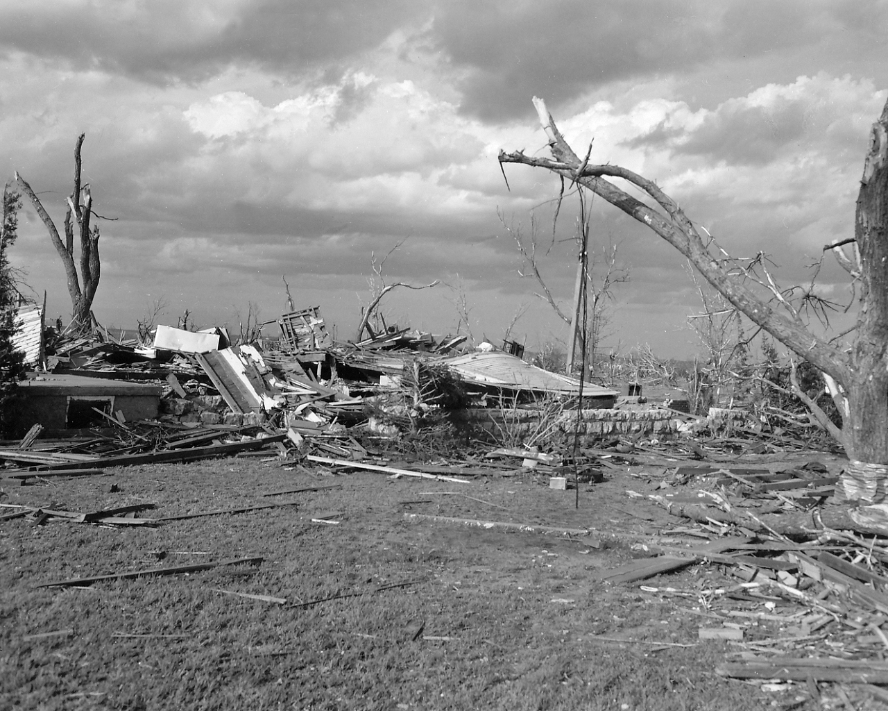 |
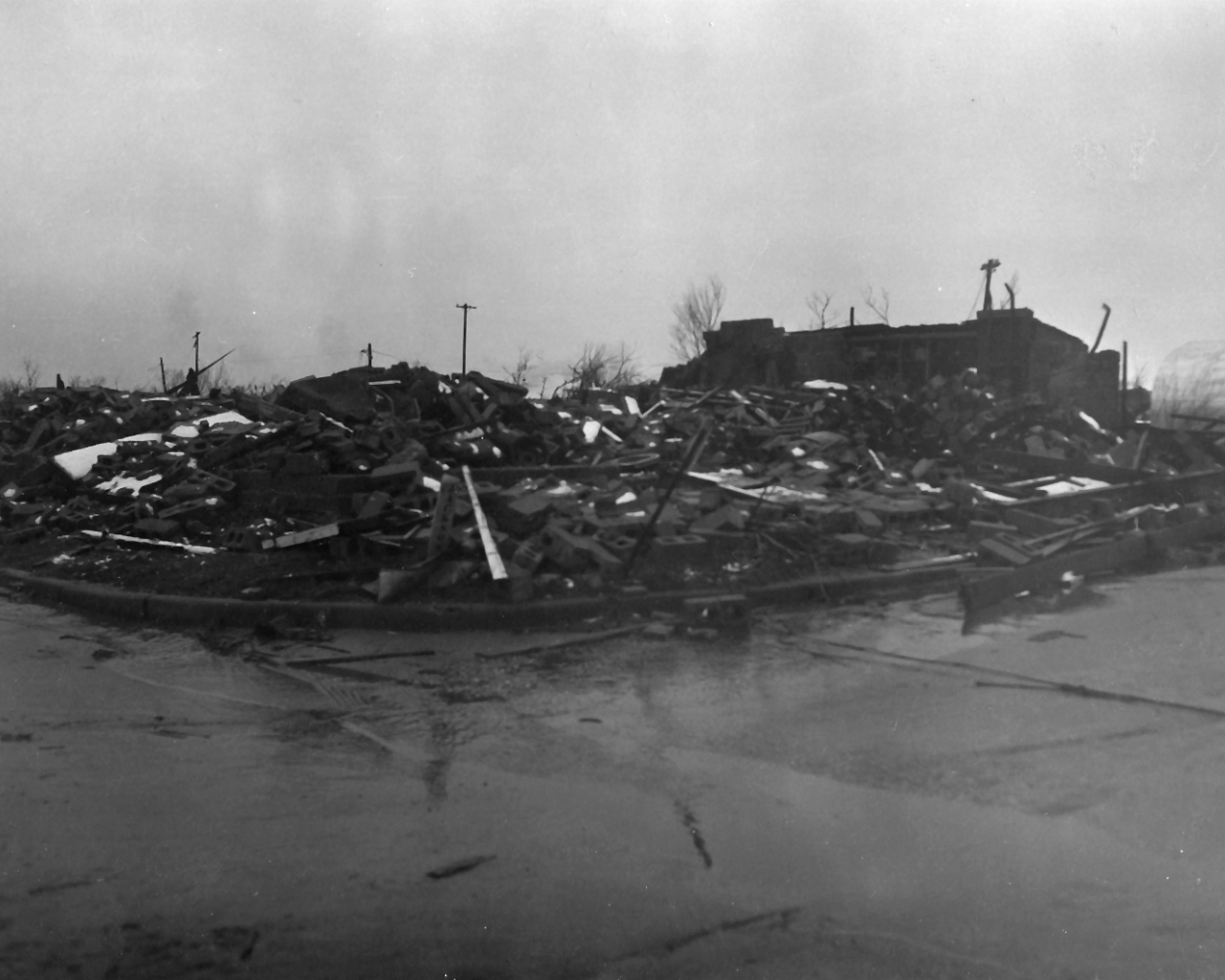
| Photo 36: View of a demolished concrete block battery shop within the center of the tornado damage path in Woodward. | Photo 37: View of demolished frame house within the center of the tornado damage path in Woodward. |
 |
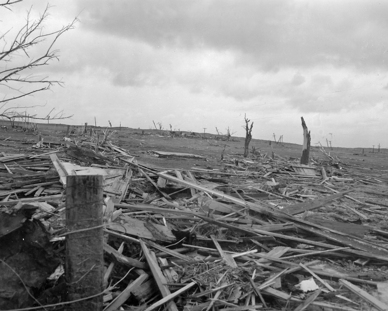 |
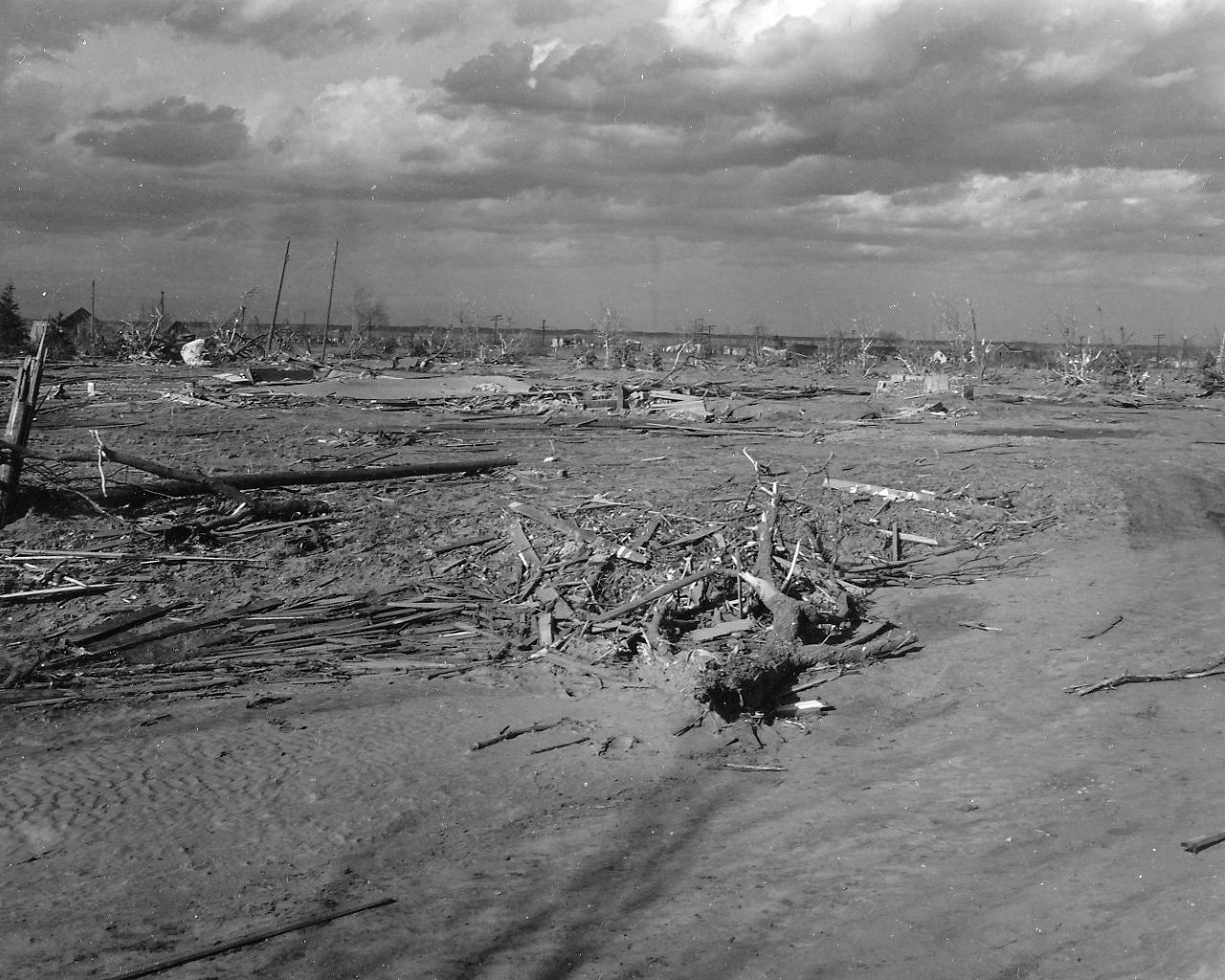
| Photo 38: View of the right-hand (east) edge of total destruction within the tornado damage path in Woodward.v | Photo 39: View of total destruction with trees torn off at their tops in Woodward. |
 |
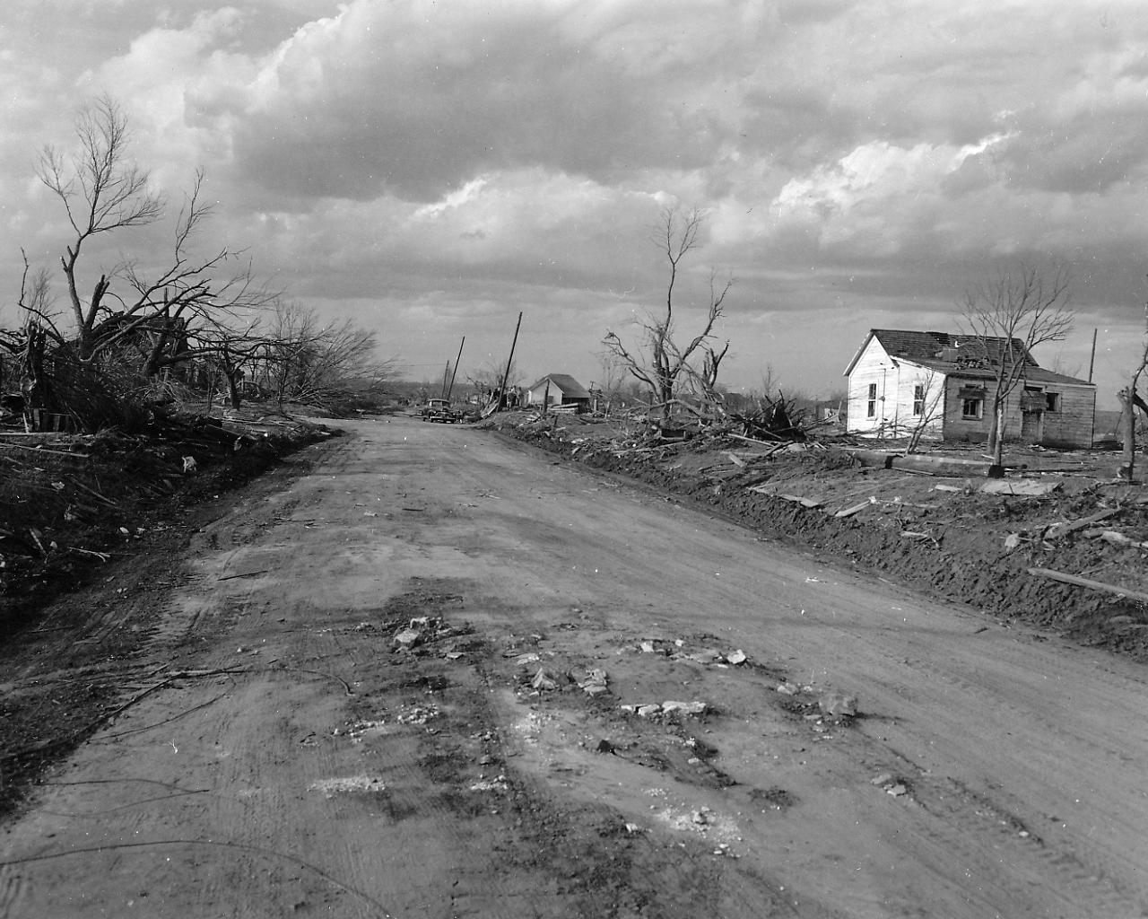 |
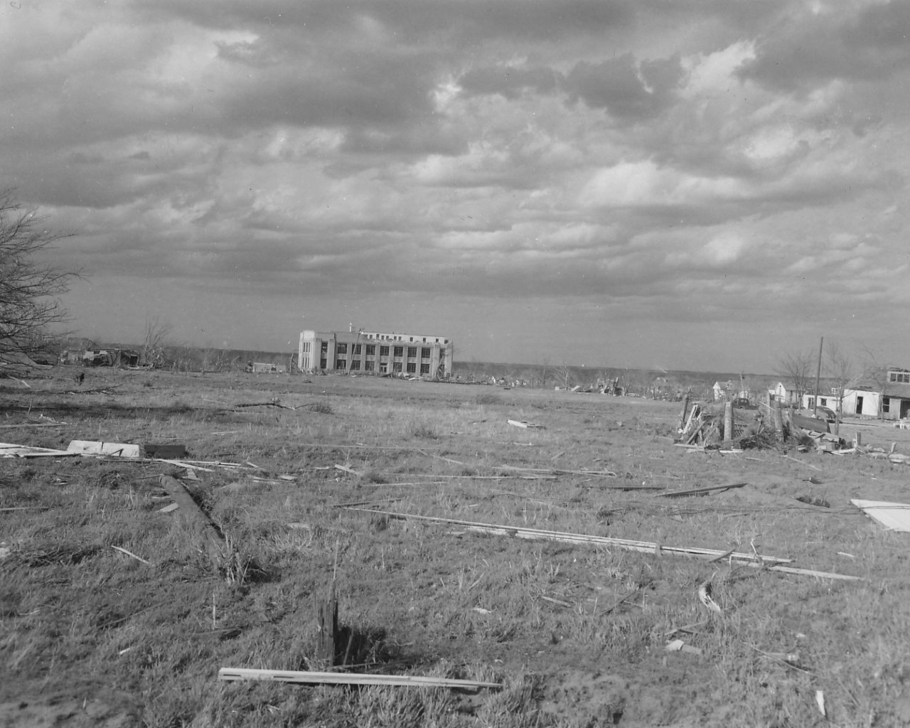
| Photo 40: View of the damaged Woodward County Courthouse and debris in a park area in Woodward. | Photo 41: View of tree and house damage along the right-hand edge of tornado damage path in Woodward. Inner walls of a house were pierced with splinters, but the outside walls of the house were left undamaged. Debris was apparently drawn into house through the "funnel effect" by windows. |
 |
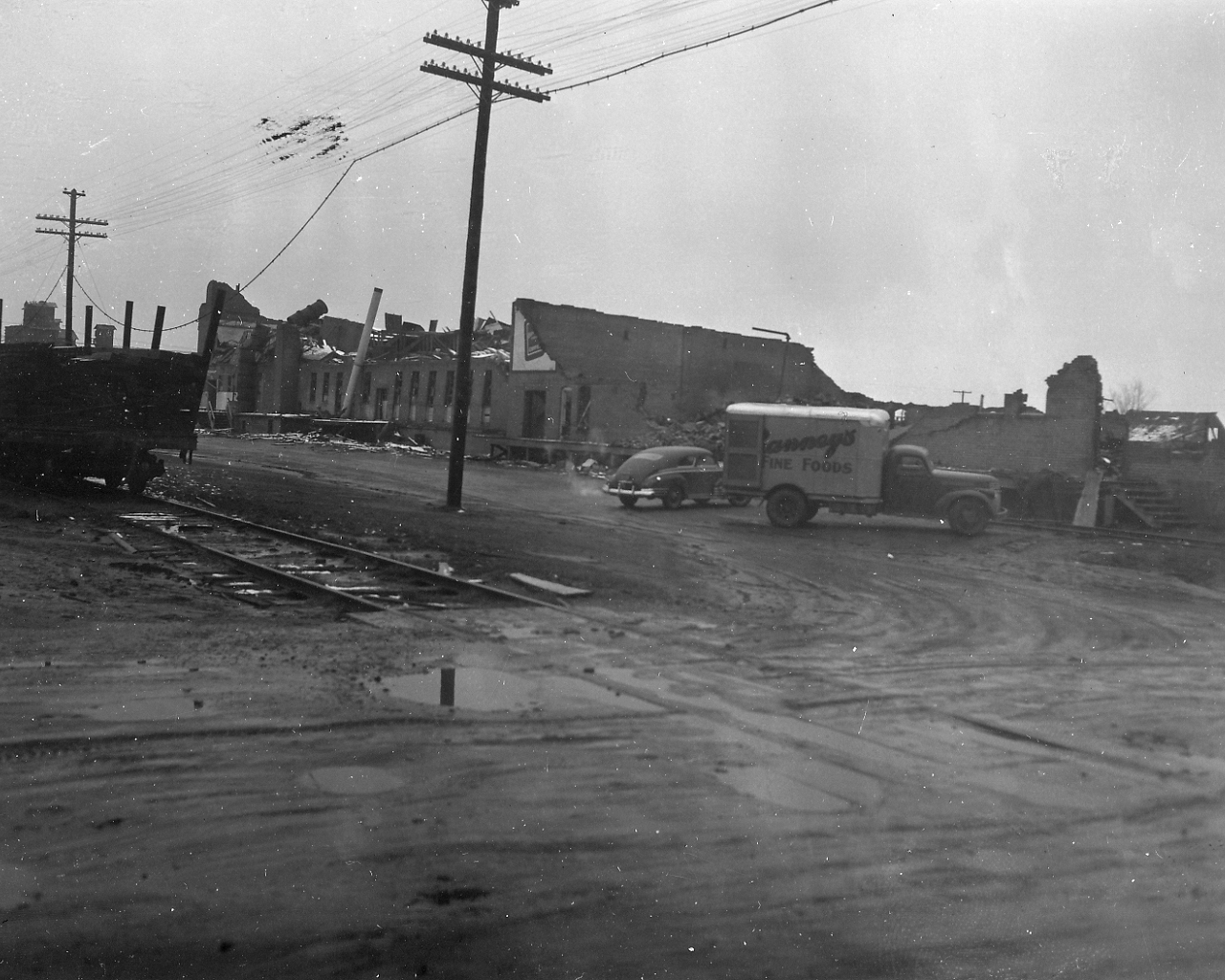 |
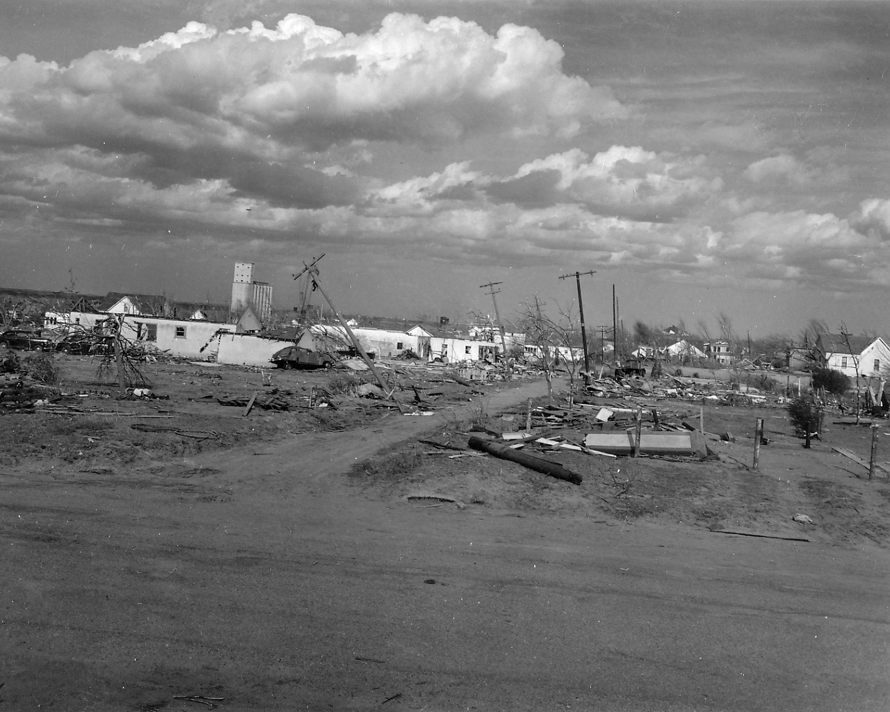
| Photo 42: View of the downtown area of Woodward within the right-hand (east) edge of the tornado damage path. The slanted trees and poles show the effects of the tornadic winds. | Photo 43: View of damage to a wholesale grocery warehouse in Woodward. Note the debris hanging in the utility wires. |
 |
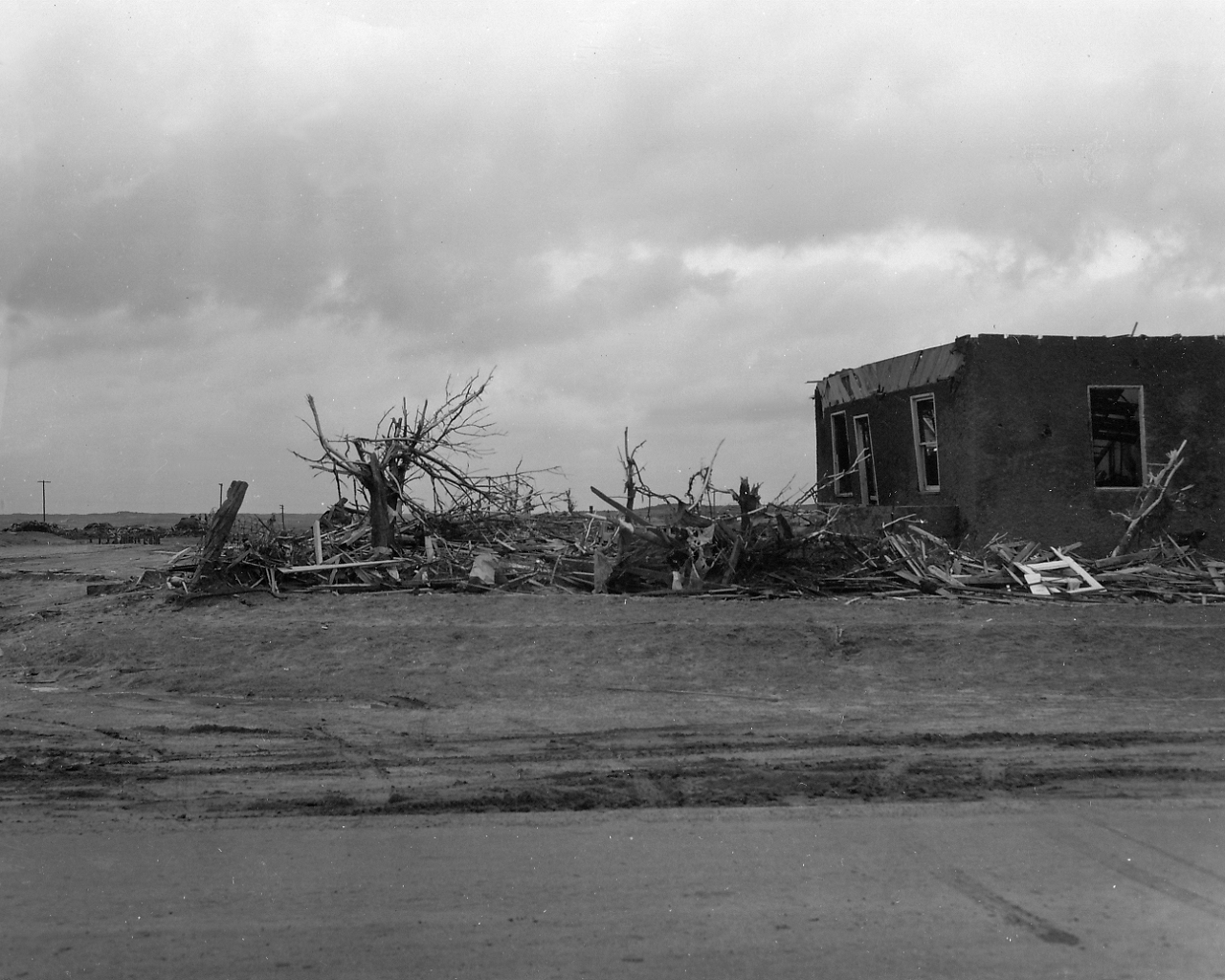 |
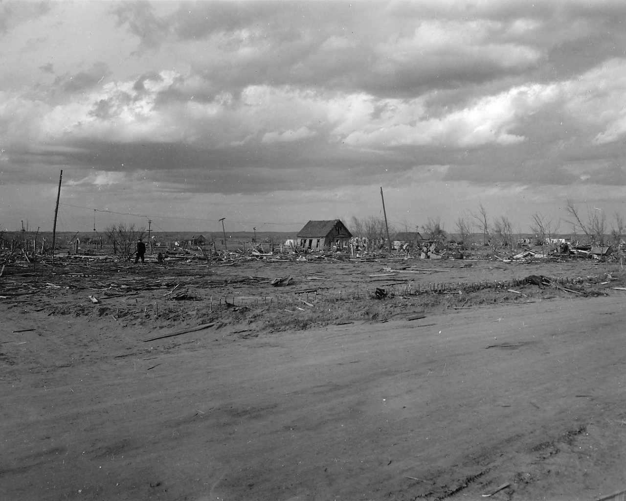
| Photo 44: View of a few buildings intact within the center of tornado damage path in Woodward. | Photo 45: View of heavy tree damage with a building still standing within the center of the tornado damage path in Woodward. |
 |
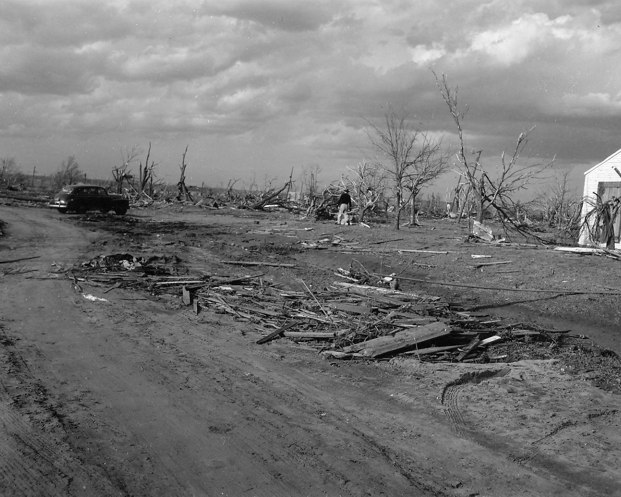 |
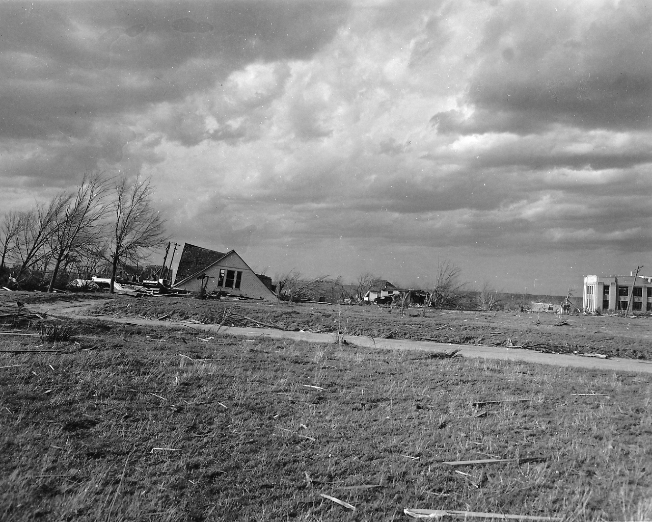
| Photo 46: View of collapsed buildings within the left side of the tornado damage path in Woodward. Note the slanted trees. | Photo 47: View of severe tree damage in Woodward. |
 |
|
| Photo 48: View looking north at two ridges of debris at the left-hand (west) edge of the tornado damage path in Woodward. |