National Weather Service United States Department of Commerce

Extreme Heat and Tropical Storm Bertha Impacts

Dangerous heat will expand from the Gulf Coast into the Southern Plains and Desert Southwest through week's end. Additional extreme heat impacting the Pacific Northwest will shift to the northern Plains by the weekend. Tropical Storm Bertha is expected to continue to impact portions of the northwestern Gulf Coast from south central Louisiana to the upper Texas coast today. Read More >

A significant surge of monsoon moisture will bring scattered to widespread showers and thunderstorms to Western Montana and North Central Idaho from Tuesday through Thursday. These are expected to be wet, bringing a potential for heavy rain and localized flash flooding, especially on Wednesday and Thursday. The main threats during the afternoon and evening hours will include frequent lightning, gusty and erratic winds, heavy rain, and small hail. To prepare, ensure you have a reliable way to receive weather warnings, such as a NOAA Weather Radio or a trusted weather app on your phone. If you are recreating outdoors, be prepared to alter your plans by getting off the water and away from mountain peaks before storms arrive. Finally, take a moment to secure loose patio furniture or outdoor decor, as high winds can easily blow these items around. Stay weather aware this week and visit weather.gov/mso for the latest updates. Temperatures are expected to rise into the 90s and just above 100 degrees in the lower elevations of Idaho. To mitigate the risks associated with these hot temperatures, individuals should stay hydrated, limit strenuous outdoor activities during peak afternoon heating, and spend time in air-conditioned or shaded environments.
We are highlighting the potential for strong to severe thunderstorms today between 1 PM and 10 PM. This primarily impacts north-central Idaho and extends as far east as the I-90 corridor. These cells are expected to track from the west-southwest to the east-northeast. While not everyone will see a severe storm, the environment is favorable for those that do develop to be impactful. Expected Hazards: Damaging wind gusts up to 60 mph Hail up to 1 inch in diameter Frequent lightning Please ensure you have multiple reliable ways to receive weather warnings this afternoon. If you hear thunder, you are close enough to be struck by lightning—move indoors immediately.
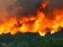
Hot, dry, and breezy conditions are moving into Western Montana and North Central Idaho this Friday and will stick around through the weekend. 🌡️🌬️ With mid-afternoon wind gusts reaching 20-30+ mph, low humidity, and warm temps, we are looking at an Elevated Fire Weather Risk. What you need to know: 🔥 Fire Safety: Please do your part. Extinguish campfires completely and do not start new ones. ⛵ Boaters: Headed to the lake? Expect choppy conditions and difficulties for small crafts. Stay safe, be fire-aware, and keep an eye on weather.gov/mso for the latest updates!


Text Product Selector (Selected product opens in current window)