Overview
|
 Confirmed Tornado Tracks Over East Central Florida |
Tornadoes:
|
Tornado - Rural Okeechobee County, Near Dixie Ranch Acres
Track Map 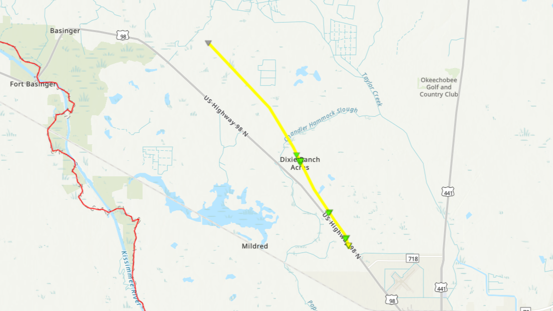 
|
||||||||||||||||
|
Tornado - Along I-95 near Port St Lucie
Track Map 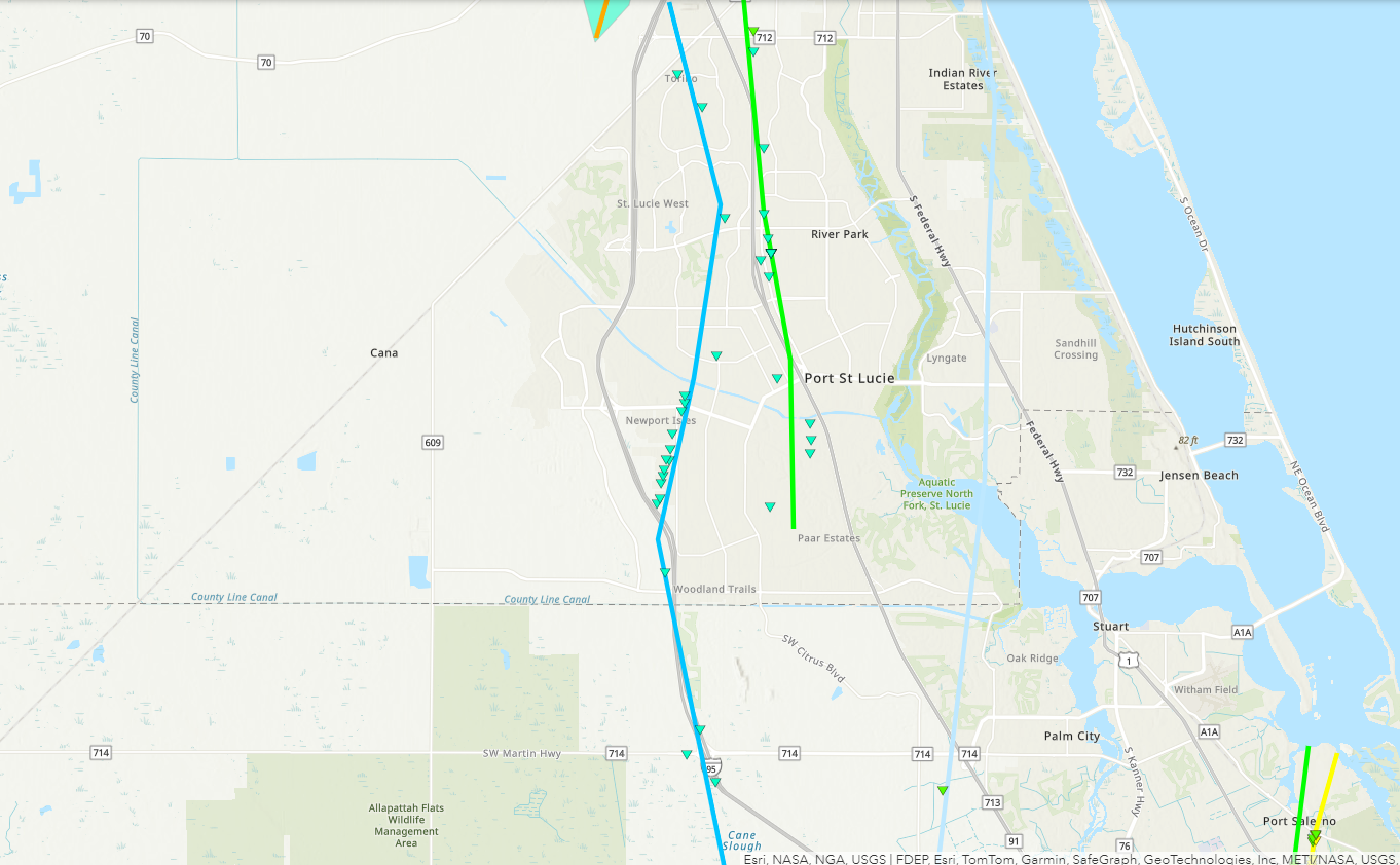
|
||||||||||||||||
|
Tornado - Rural NE Okeechobee County
Track Map 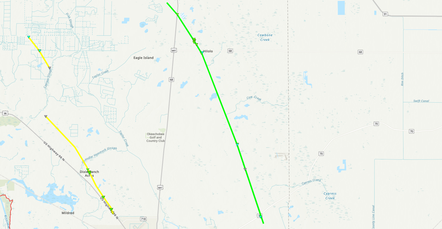
|
||||||||||||||||
|
Tornado - Rural Okeechobee County, Near C & M Rucks Dairy
Track Map 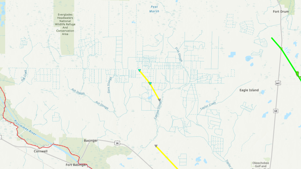
|
||||||||||||||||
|
Tornado - Port St Lucie to Fort Pierce
Track Map 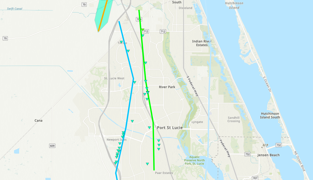
|
||||||||||||||||
|
Tornado - St. Lucie Indrio Road
Track Map 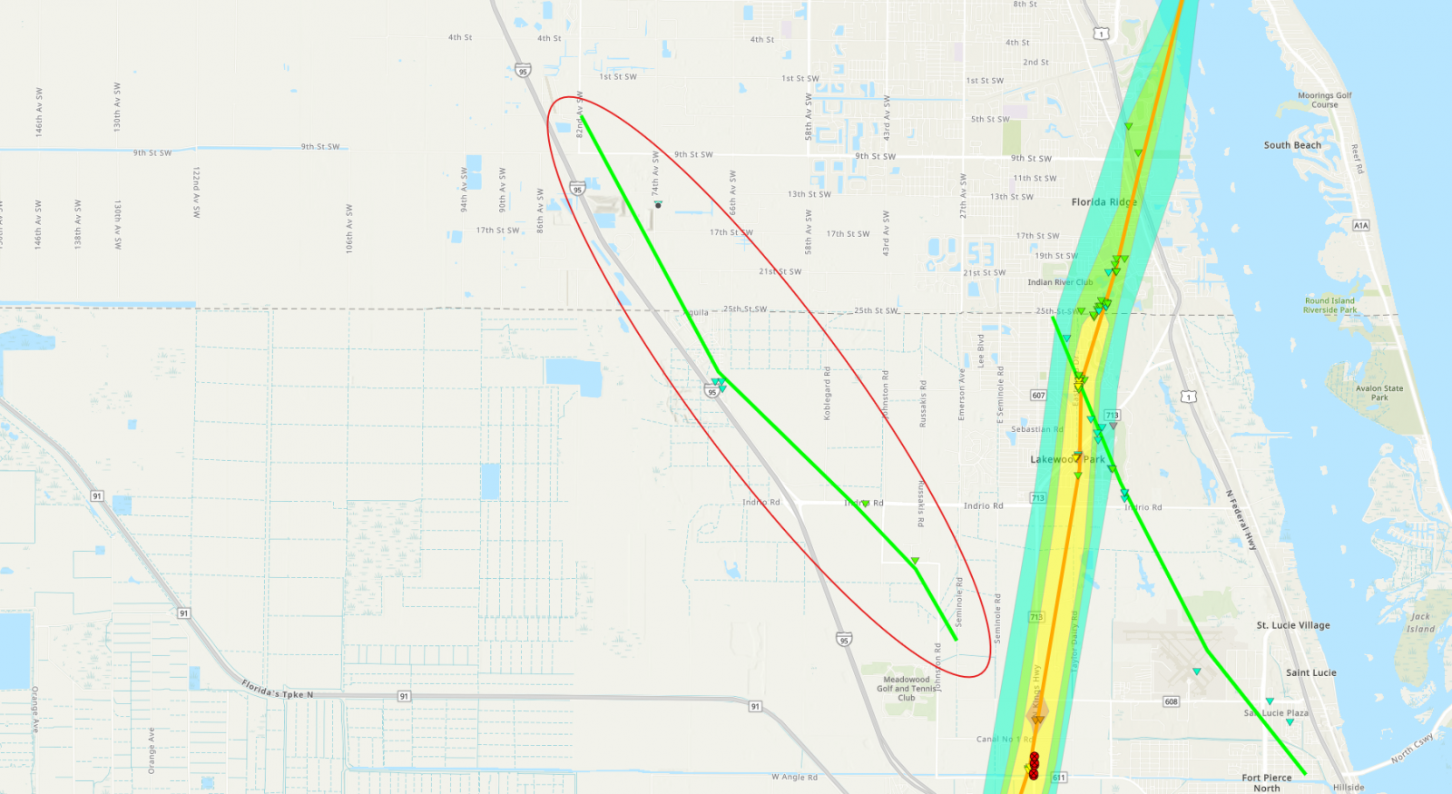
|
||||||||||||||||
|
Tornado - East to North of Holopaw
Track Map 
|
||||||||||||||||
|
Tornado - First Downtown Vero Beach
Track Map 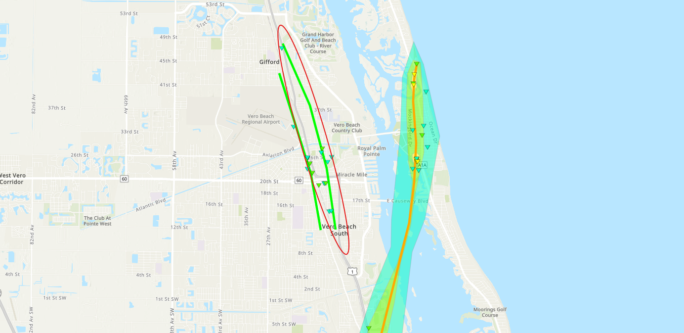
|
||||||||||||||||
|
Tornado - First Stuart Tornado
Track Map 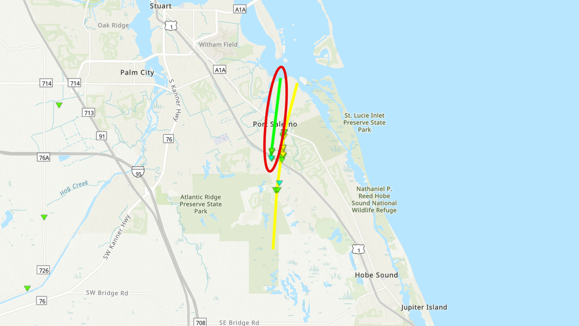
|
||||||||||||||||
|
Tornado - Second Downtown Vero Beach Indian River County
Track Map 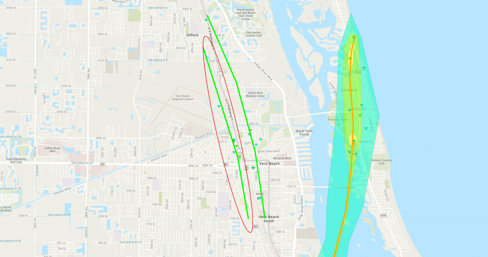
|
||||||||||||||||
|
Tornado - Fort Pierce
Track Map 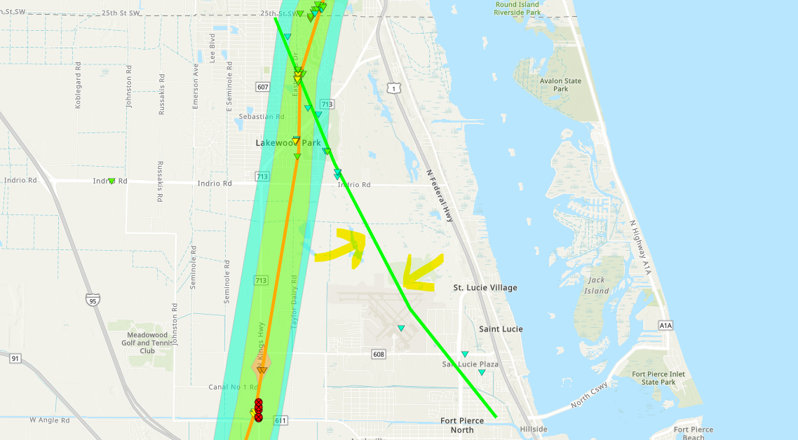
|
||||||||||||||||
|
Tornado - Fort Pierce, Spanish Lakes, and Vero Beach Area
Track Map 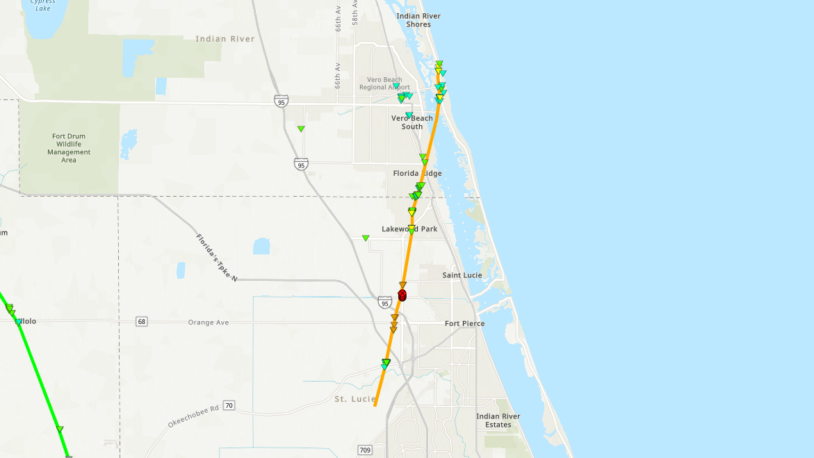
|
||||||||||||||||
|
Tornado - Palm City and Port St. Lucie
Track Map 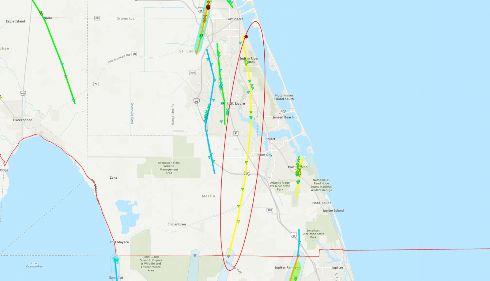
|
||||||||||||||||
|
Tornado - Southeast Martin County
Track Map 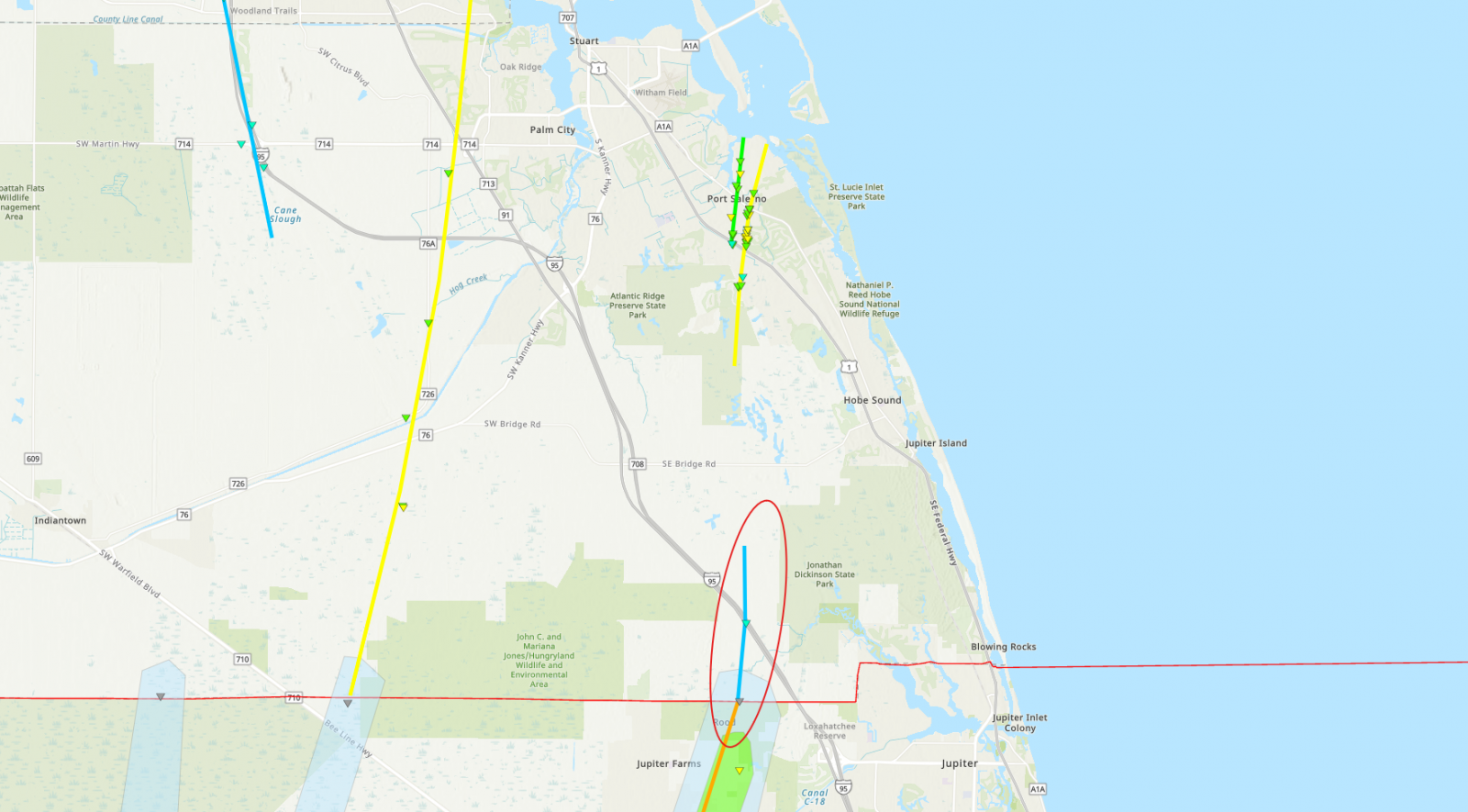
|
||||||||||||||||
|
Tornado - Second Stuart Tornado
Track Map 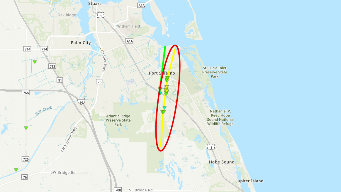
|
||||||||||||||||
|
Tornado - Cocoa Beach Tornado
Track Map 
|
||||||||||||||||
The Enhanced Fujita (EF) Scale classifies tornadoes into the following categories:
| EF0 Weak 65-85 mph |
EF1 Moderate 86-110 mph |
EF2 Significant 111-135 mph |
EF3 Severe 136-165 mph |
EF4 Extreme 166-200 mph |
EF5 Catastrophic 200+ mph |
 |
|||||
Flooding
Extensive flooding occurred over portions of East Central Florida due to Hurricane Milton. Additional information will be added to this tab soon.
Radar/Photos
 |
| Hurricane Milton Total Rainfall |
Photos & Video
Photos will be added soon.
Radar
Archived radar images will be added soon.
Storm Surge
Additional information regarding coastal surge will be added soon.
 |
Media use of NWS Web News Stories is encouraged! Please acknowledge the NWS as the source of any news information accessed from this site. |
|

